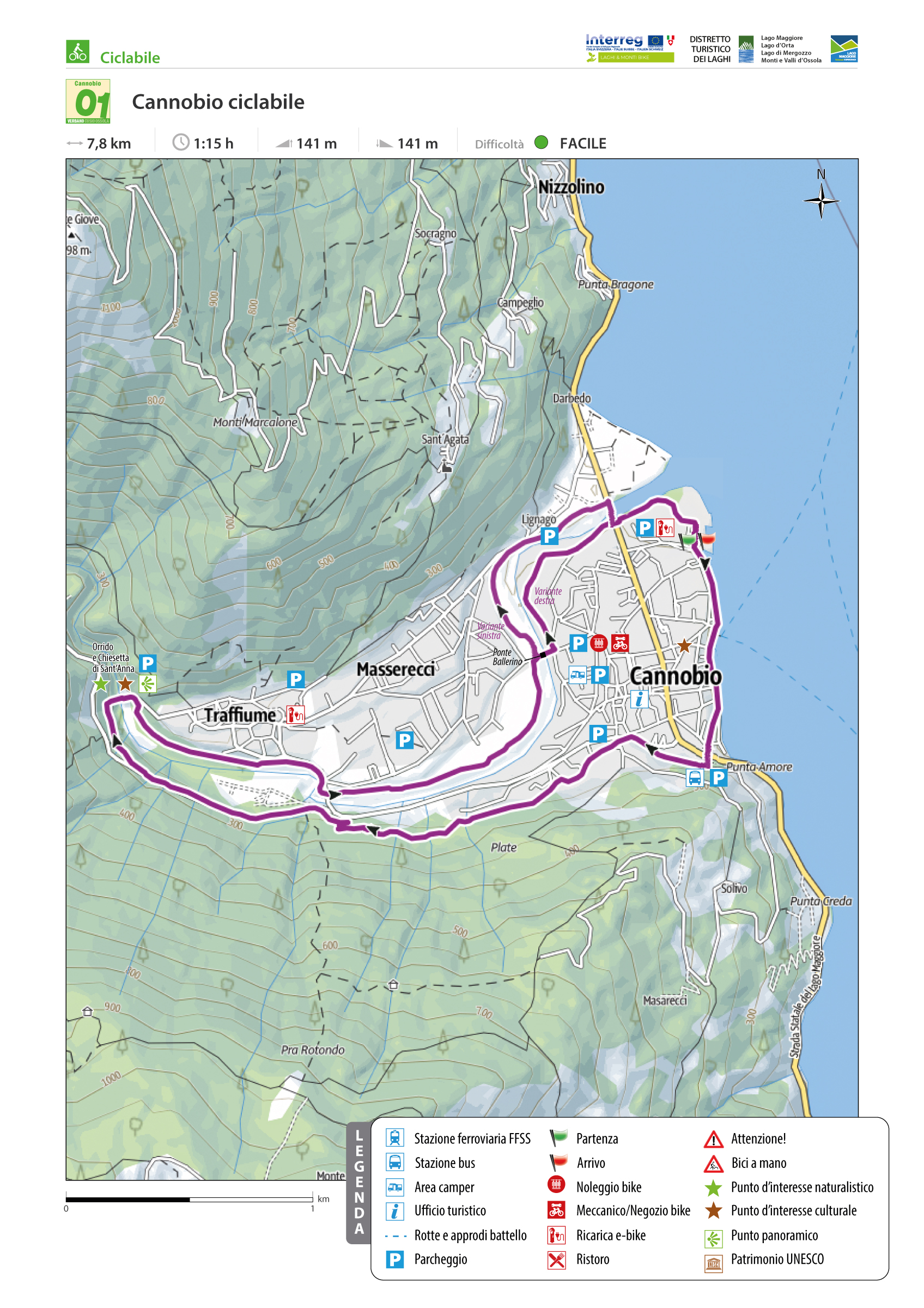
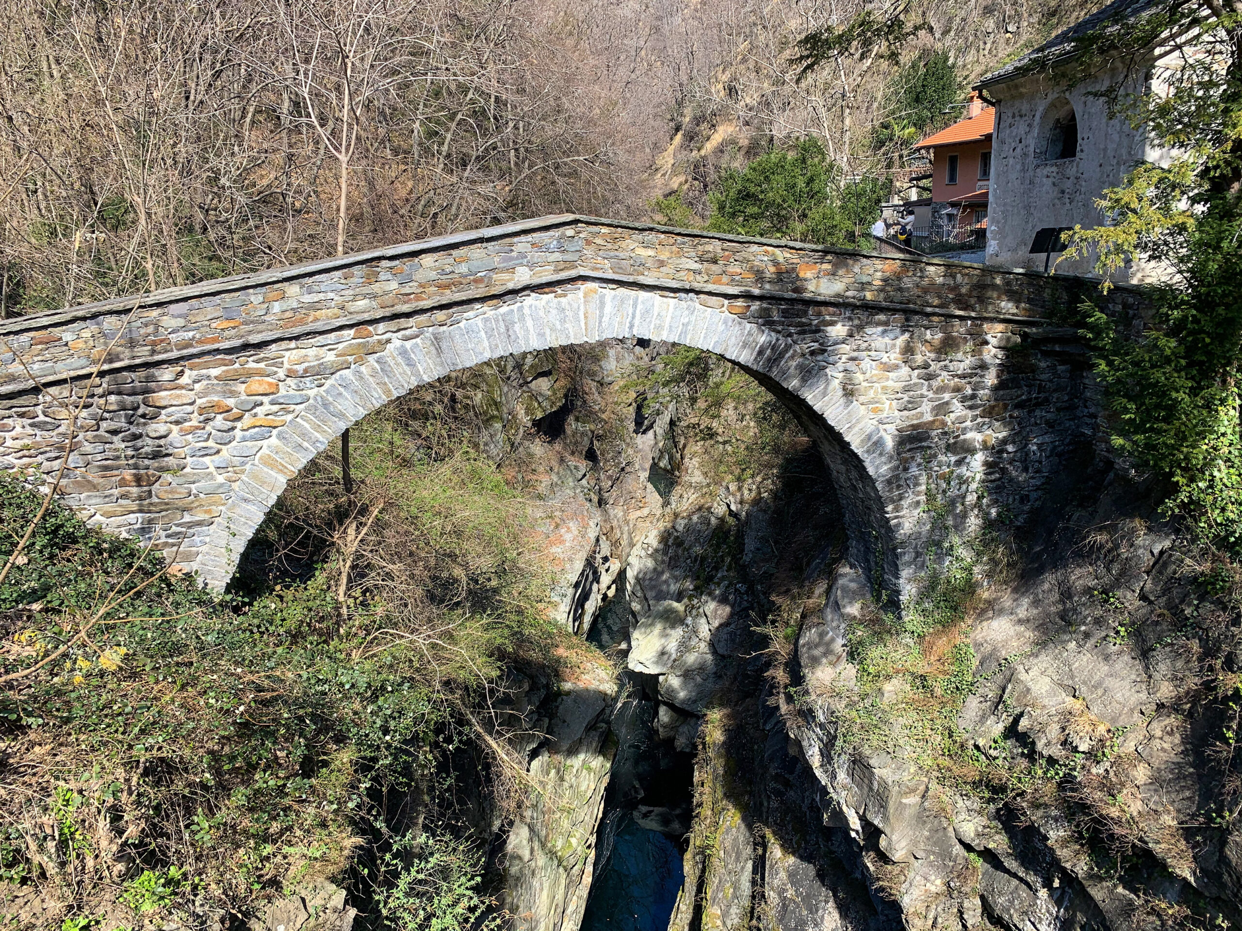
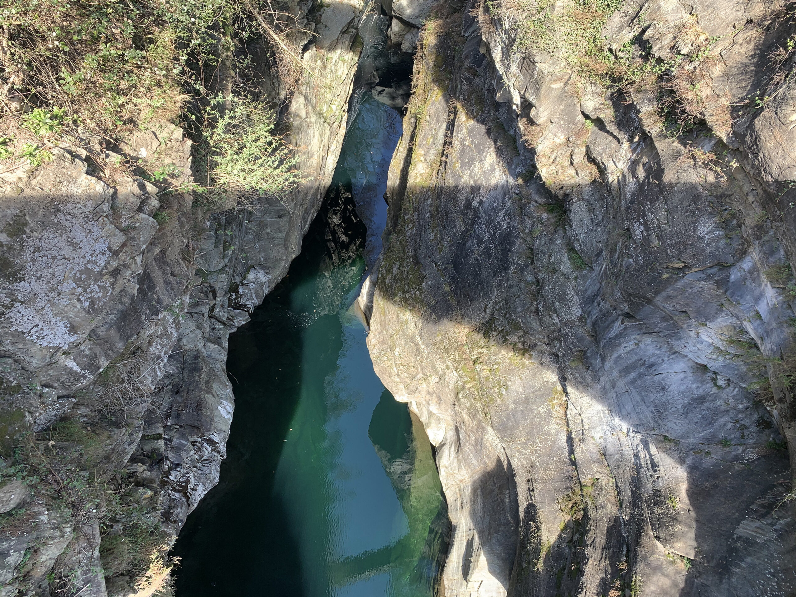
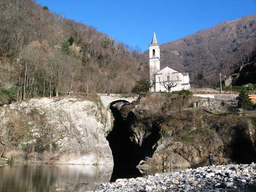
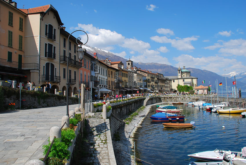
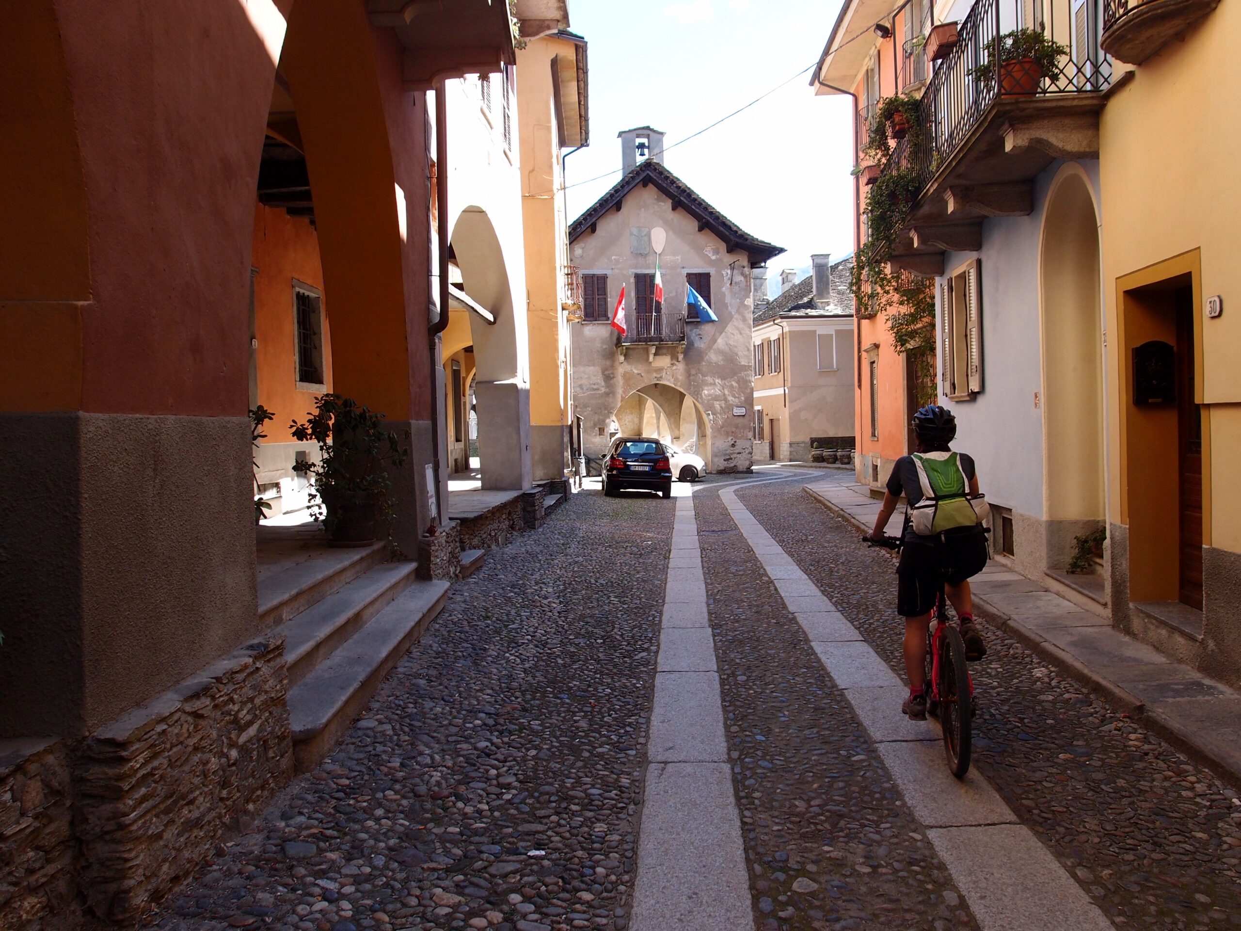
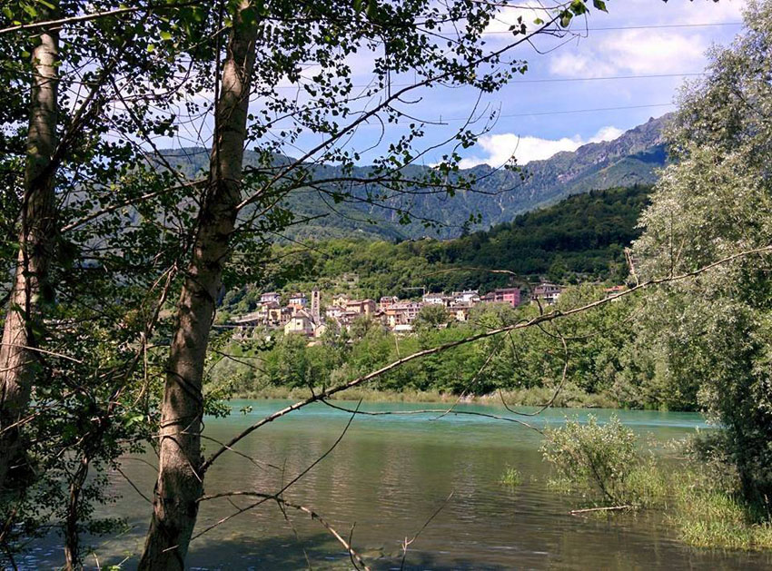
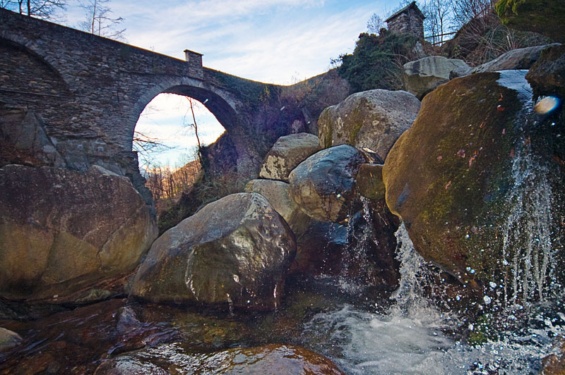
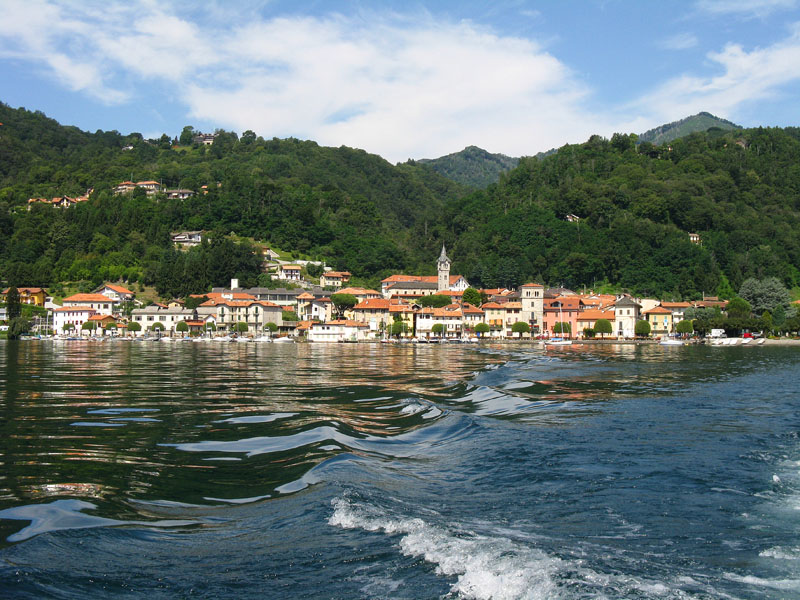
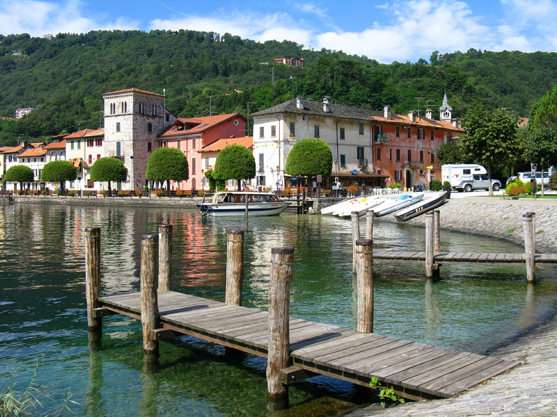
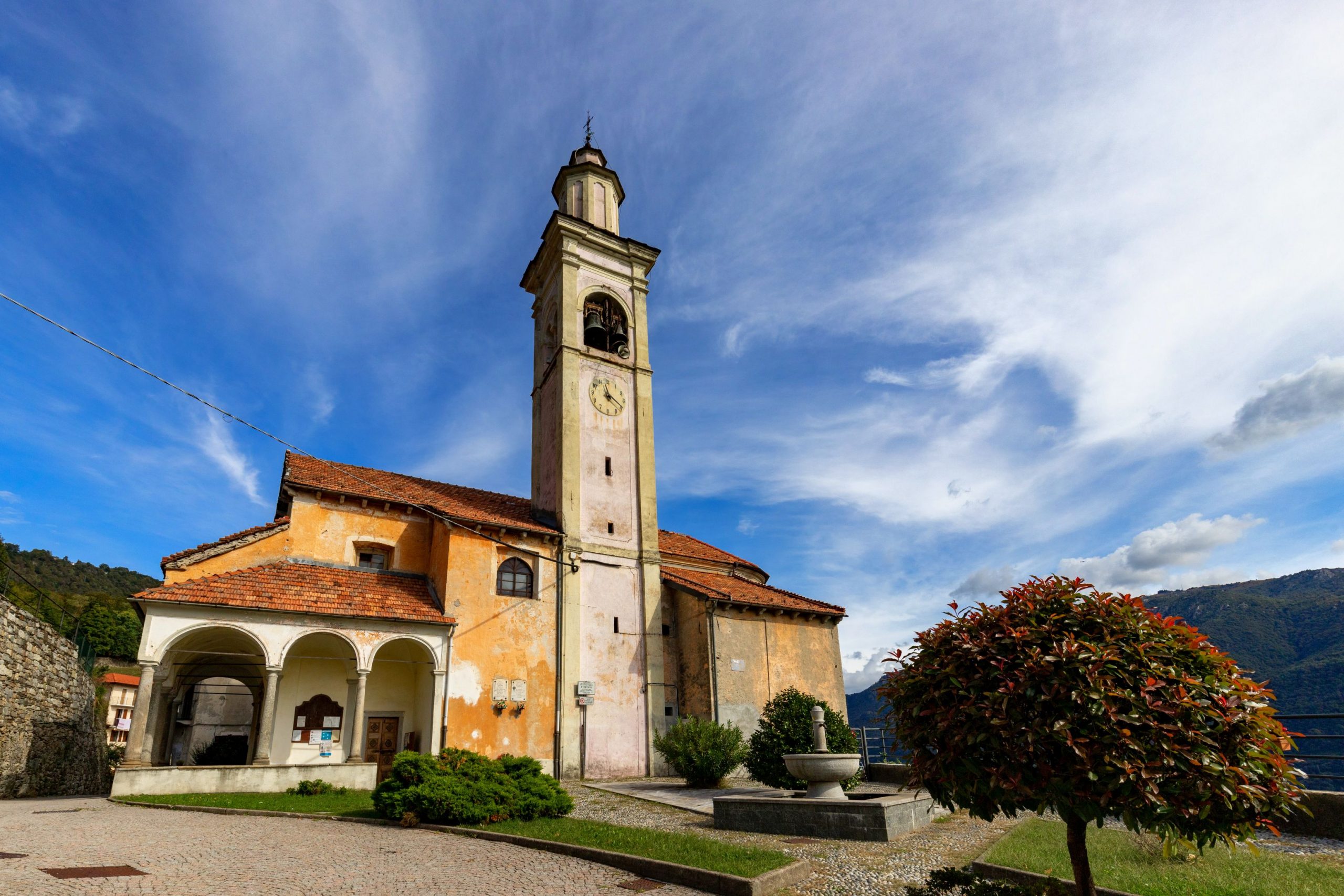
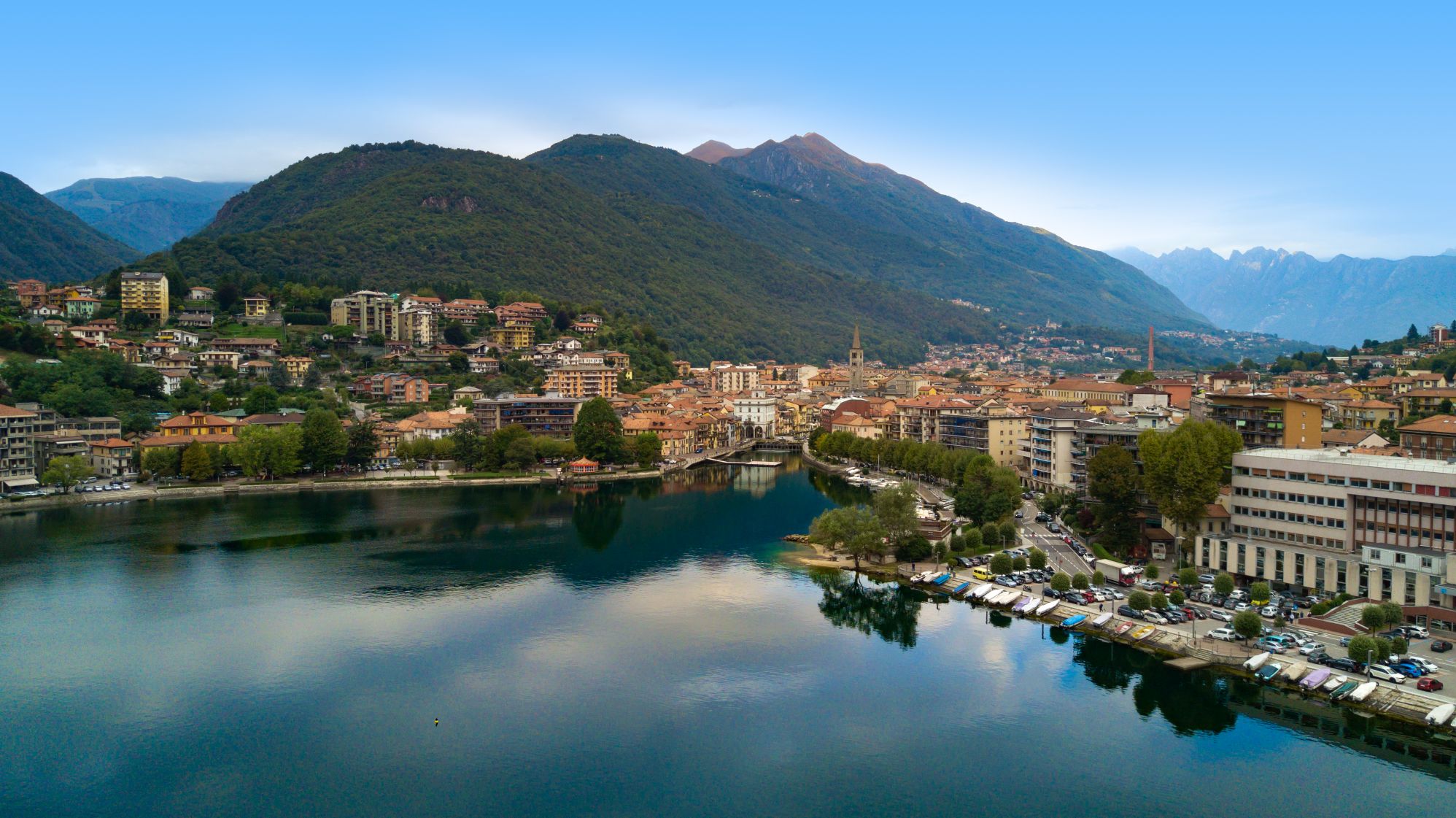
CANNOBIO AND ST. ANNA GORGE
Lago Maggiore
Route description
Cannobio‘s “bike way,” along with other measures designed and implemented with a bikefriendly perspective, has enabled the town of Verbania to receive the coveted “yellow flag” as a bike-friendly municipality from FIAB (Italian Federation for Environment and Bicycle).
In doing so, the last Italian town close to Canton Ticino, dear to San Carlo Borromeo, intended to offer its many guests a bicycle route to learn more about its territory.
Inspired by European directives encouraging routes along waterways, Cannobio has developed its bicycle path between Lake Maggiore and the Cannobino Stream, offering users numerous insights into history, culture, and the environment.
Back to the list of routes
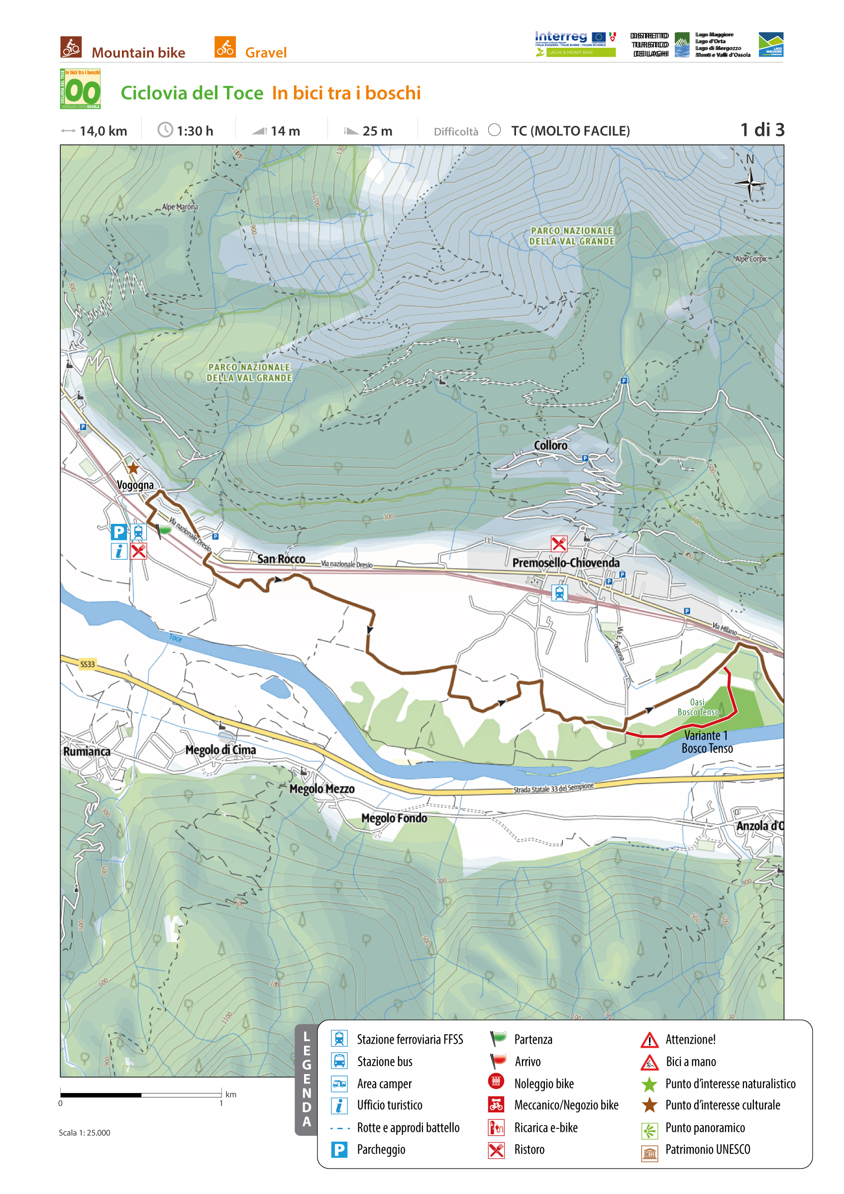
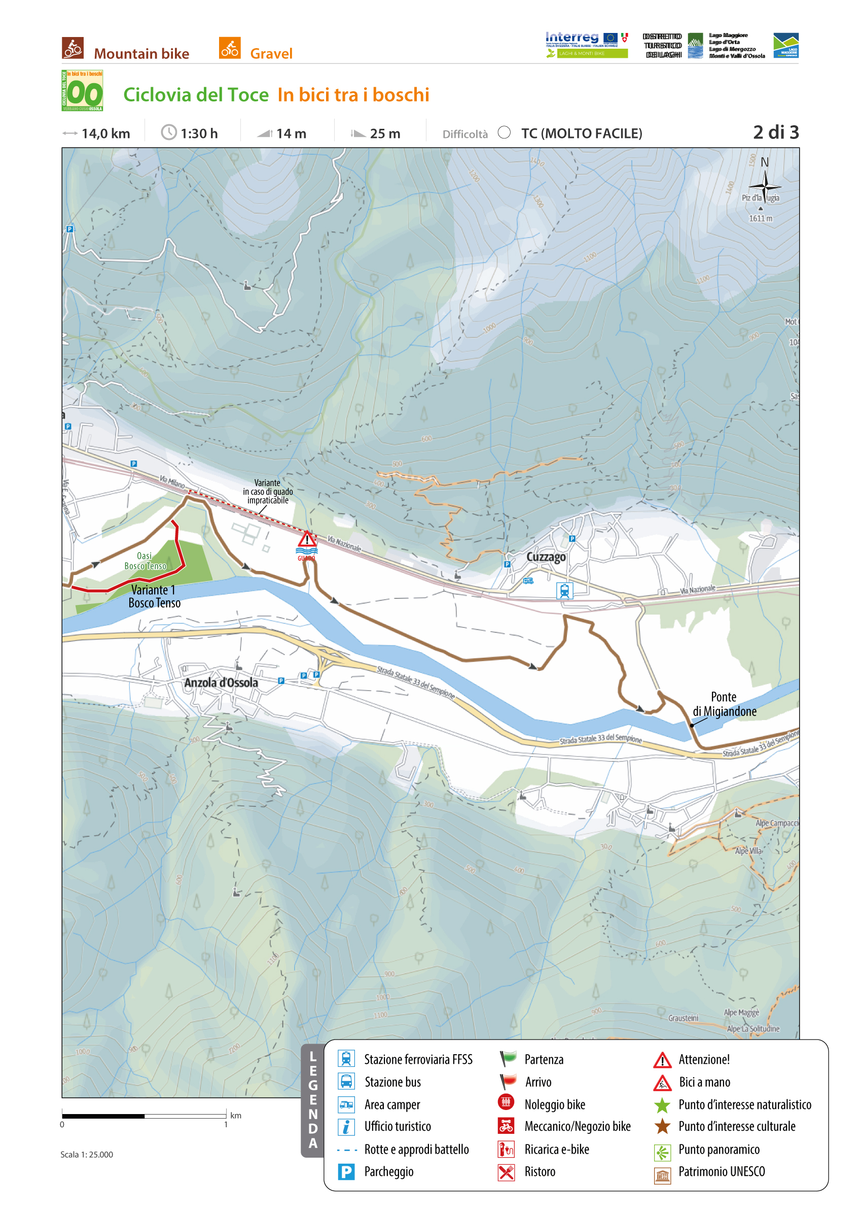
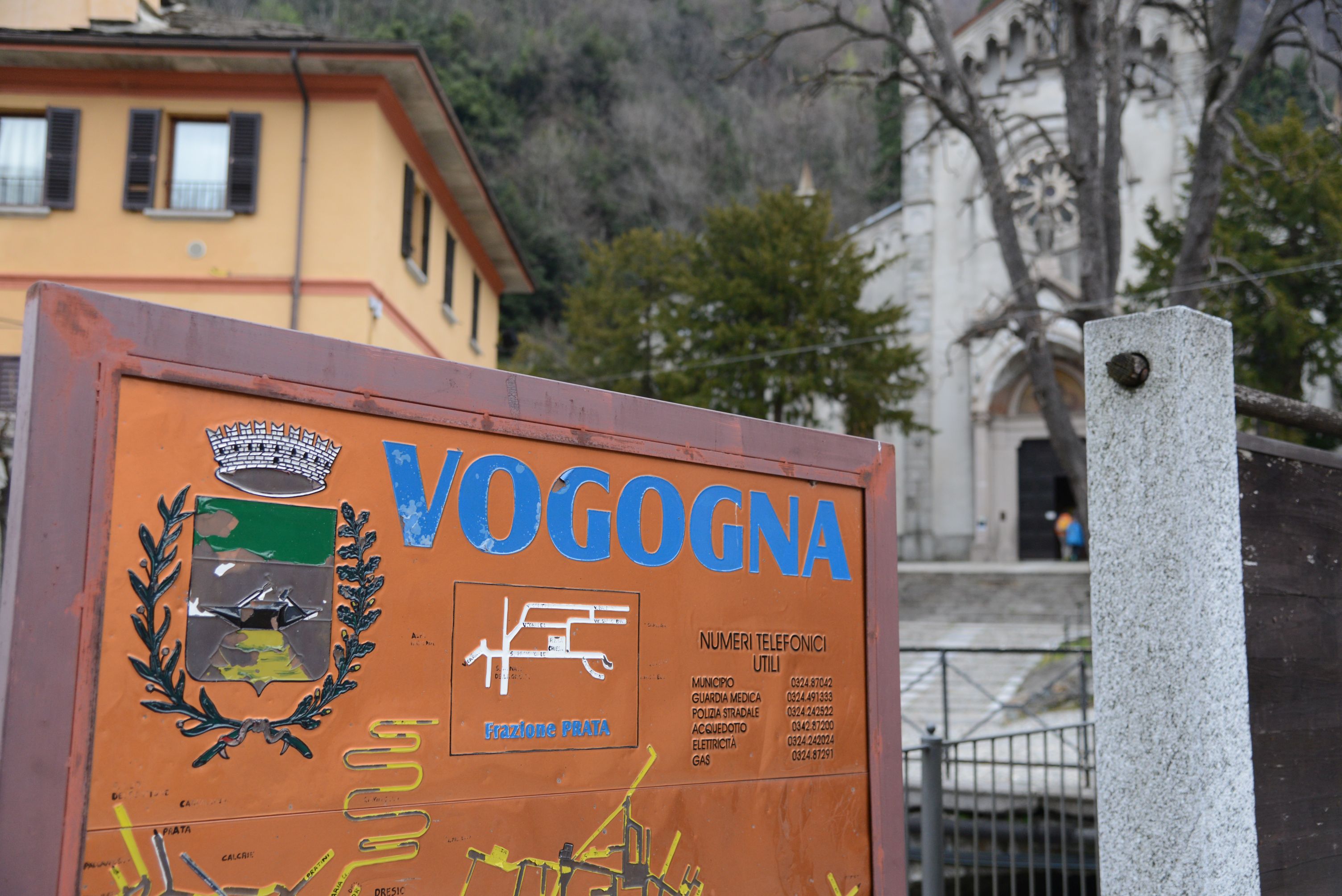
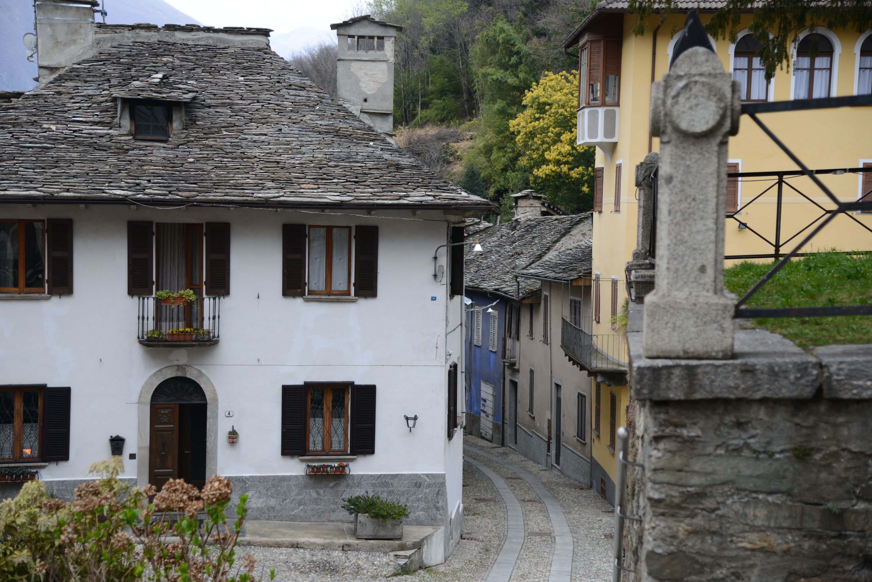
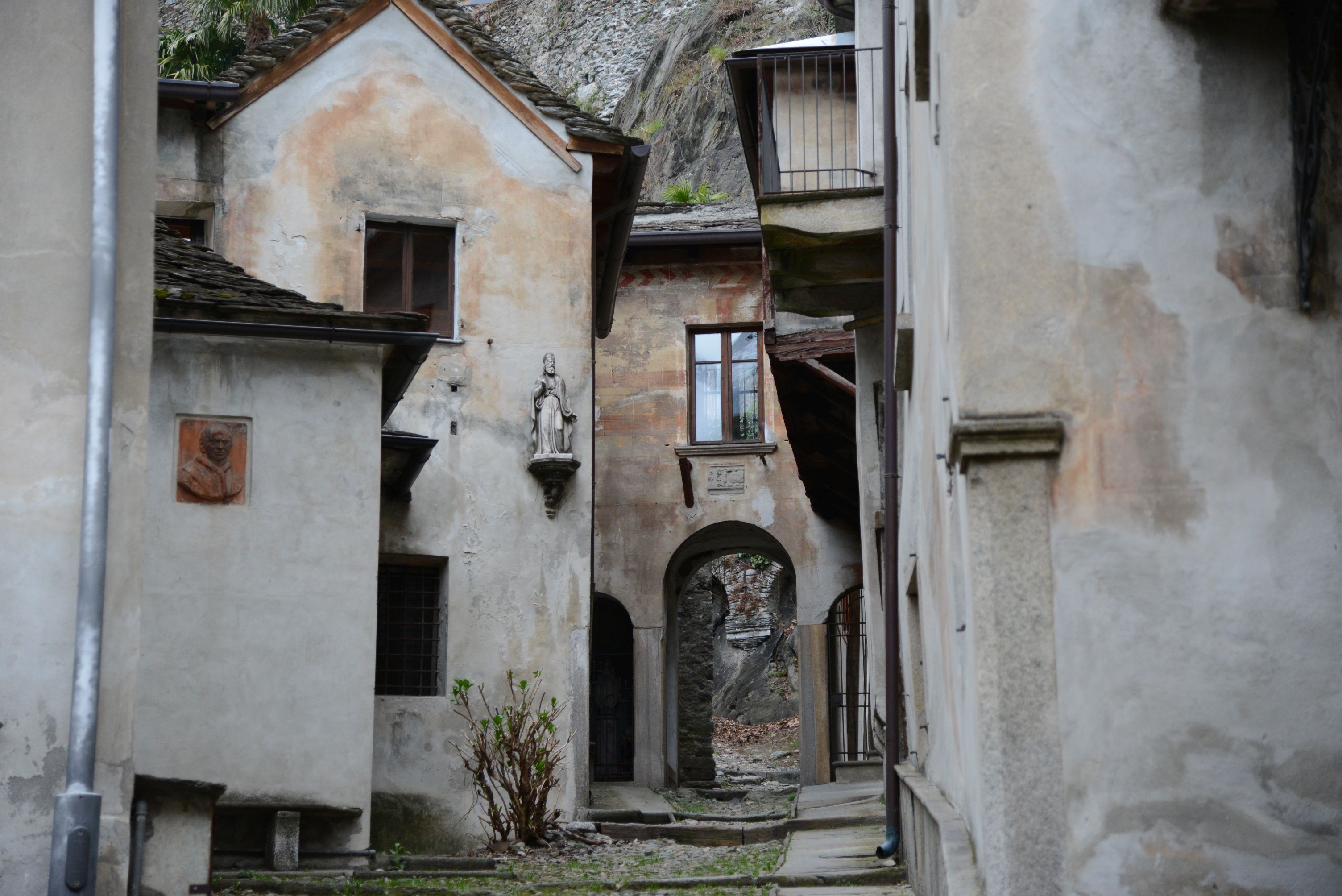
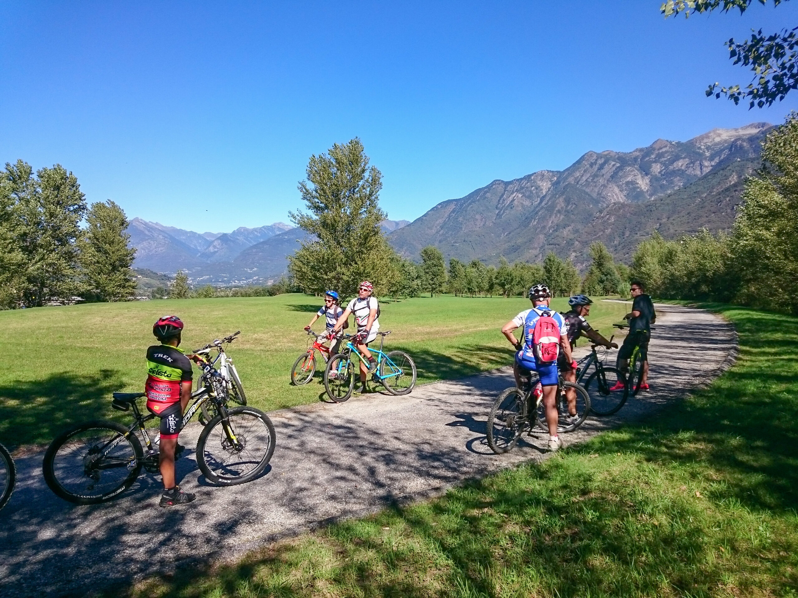
The route starts from Vogogna
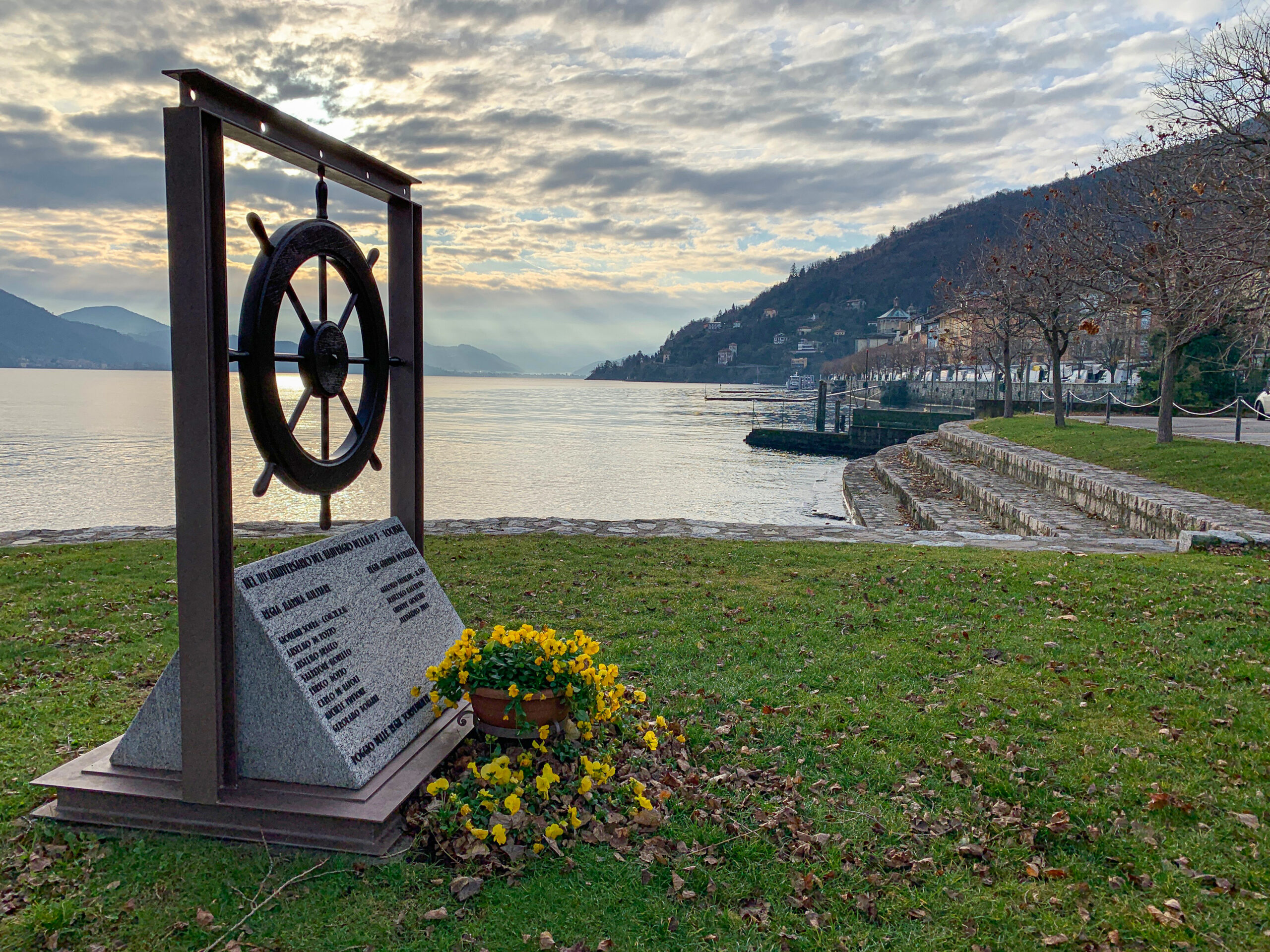
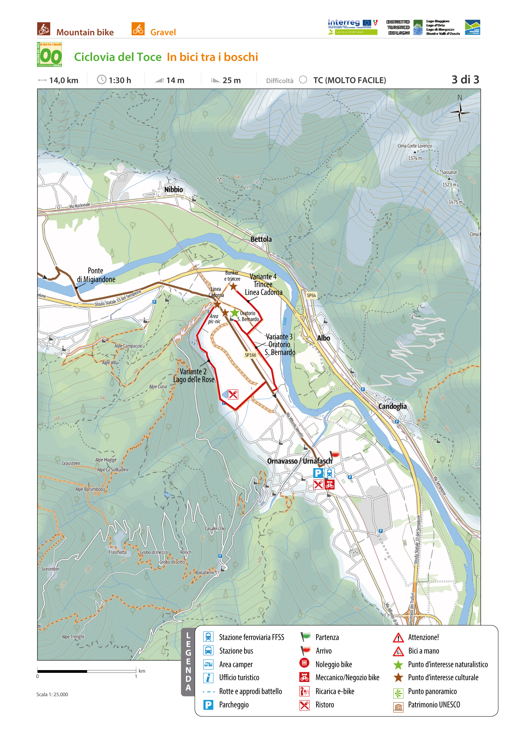
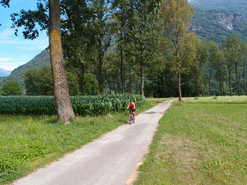
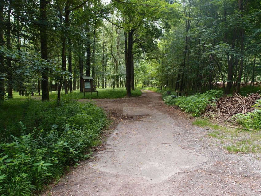
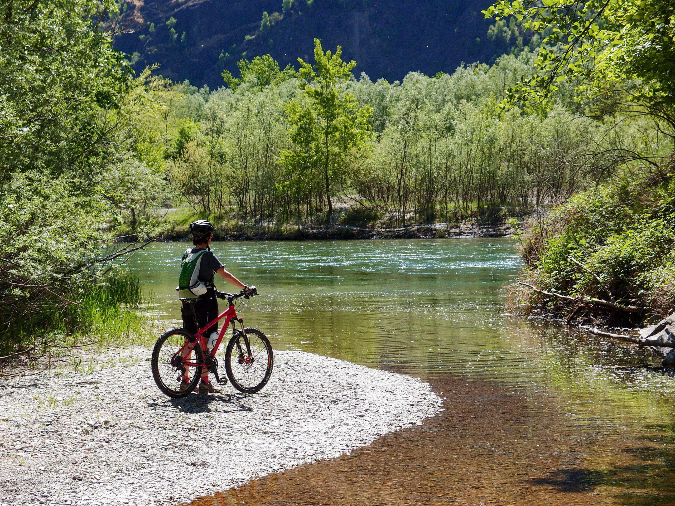
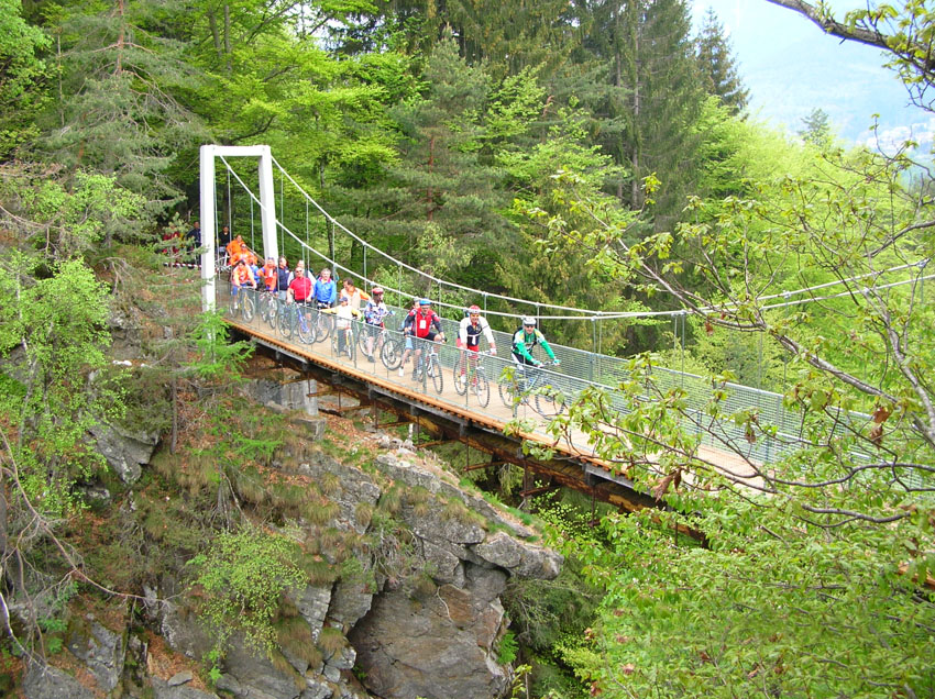
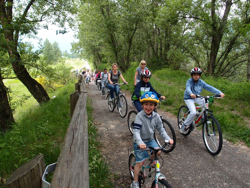
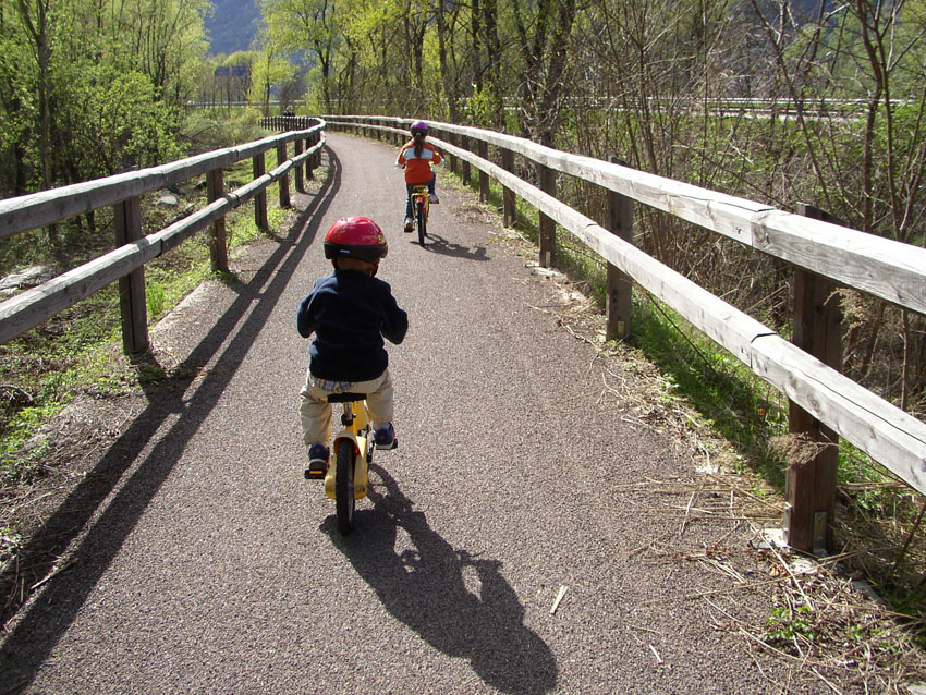
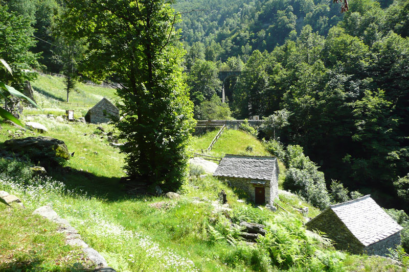
TOCE CYCLE PATH, CYCLING THROUGHT THE WOODS
Piana del Toce
Route description
The route starts from Vogogna and takes you to Ornavasso passing through the central part of the Toce river valley amid cultivated fields and woods of the plain. You cross Bosco Tenso (Tenso Woods). The area is important for its abundant and varied bird life including both resident and migratory species. The reserve has a series of information boards that describe the animal species present in the area.
Back to the list of routes
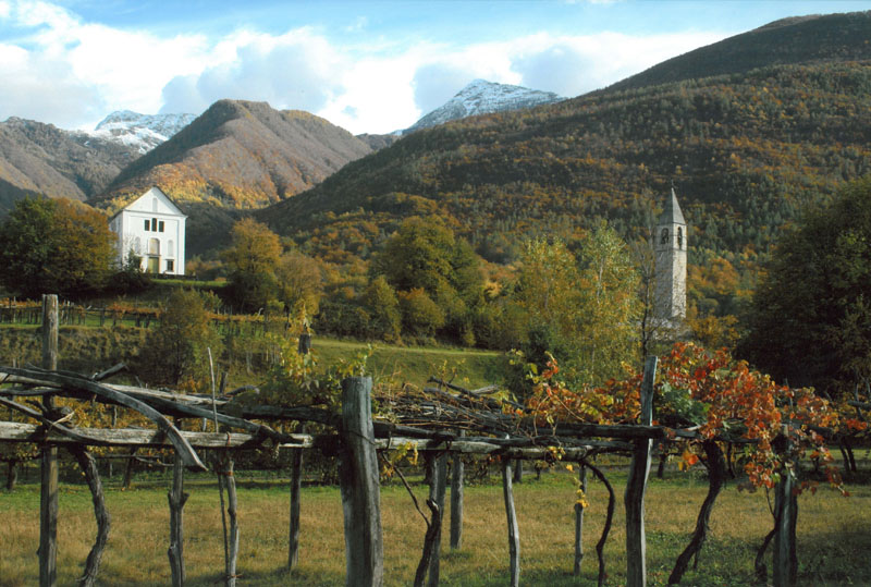
a corridor between Ossola and Ticino
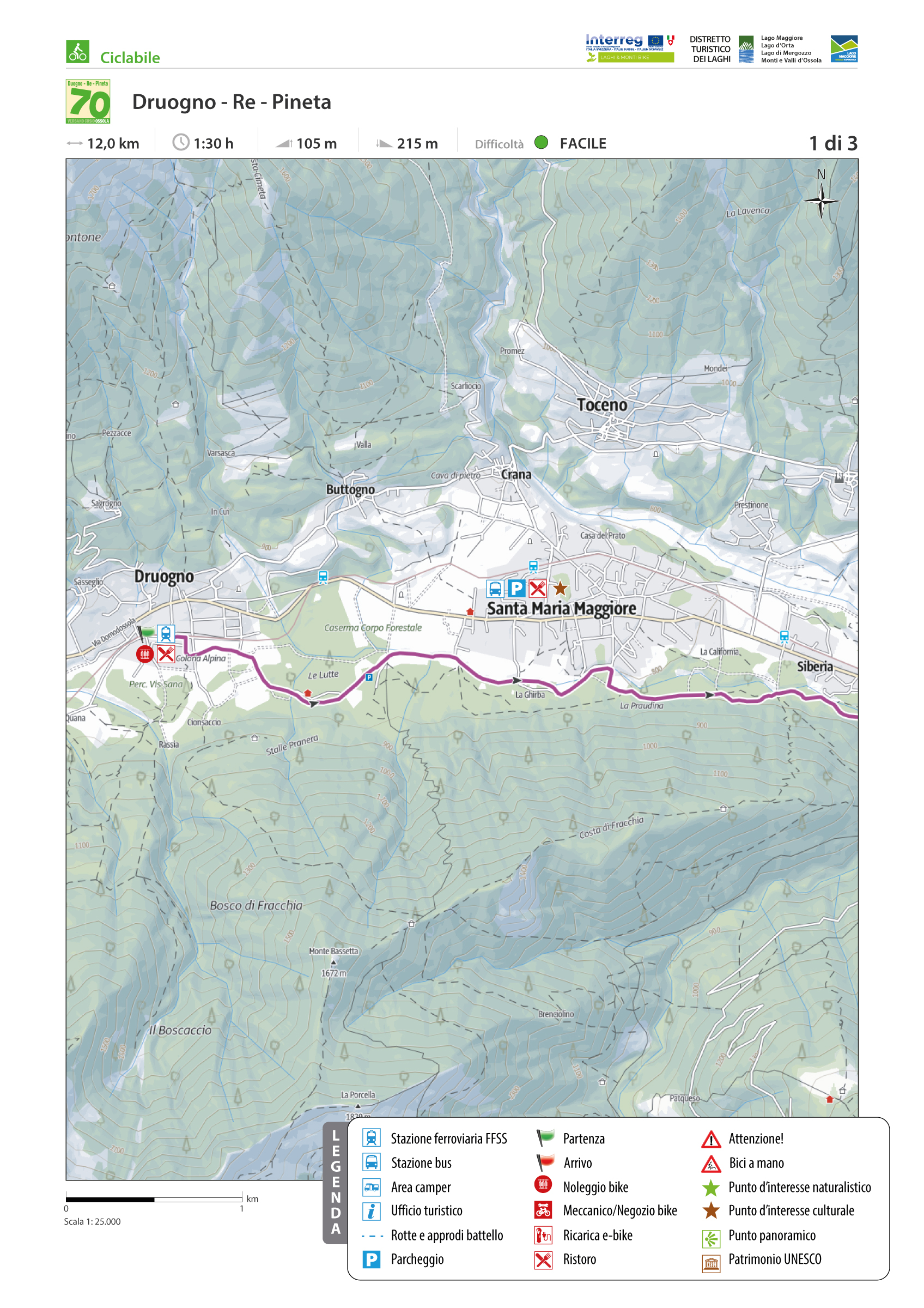
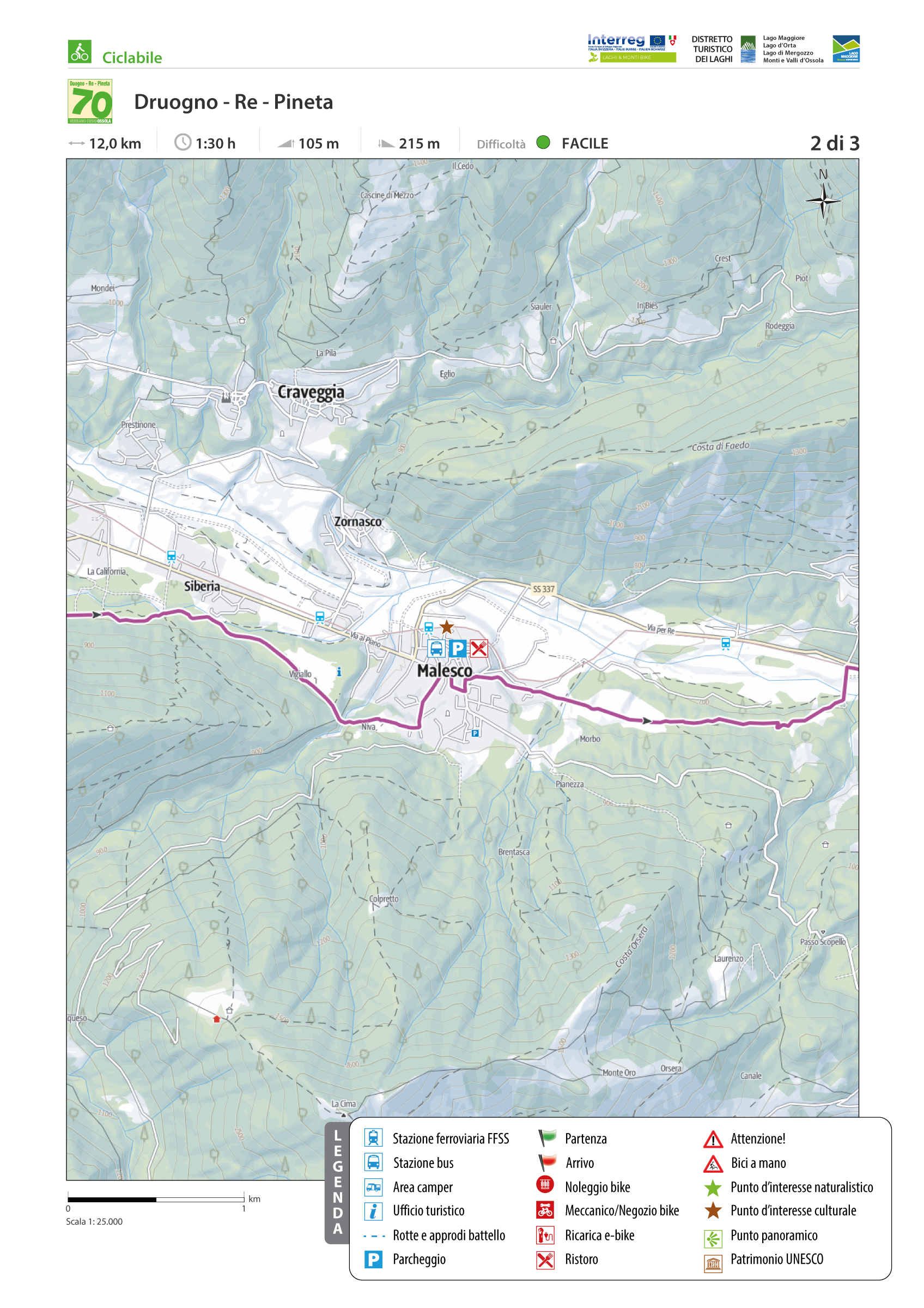
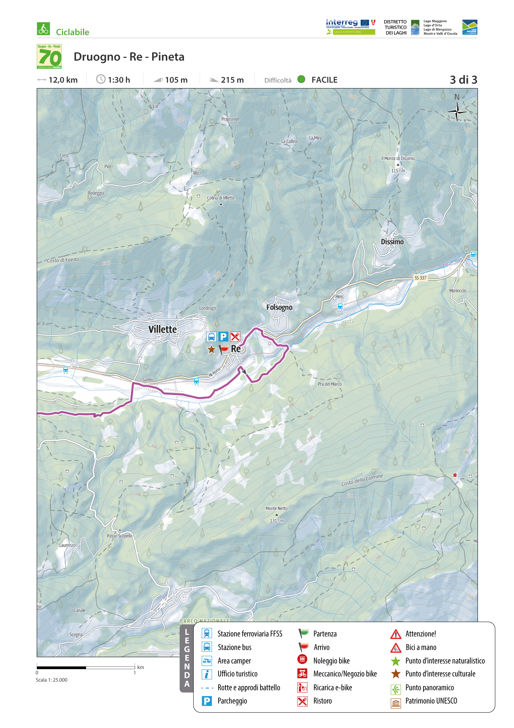
VIGEZZO BIKE LAND: CYCLE ROUTE DRUOGNO – RE “PINETA”
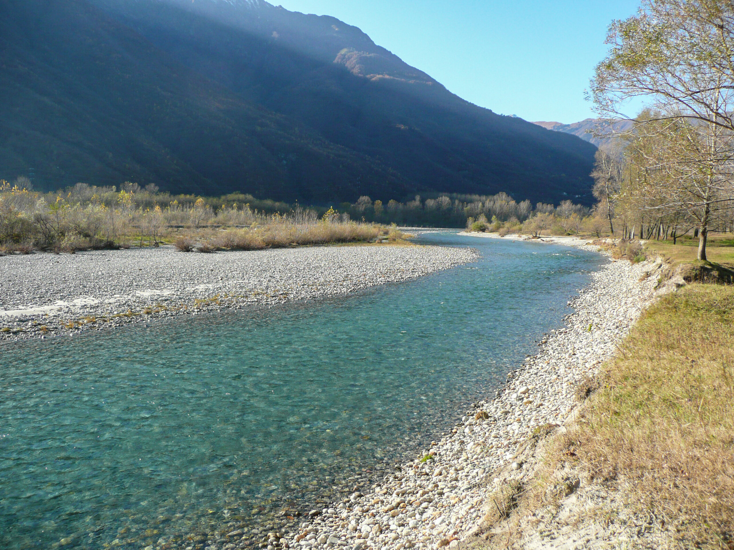
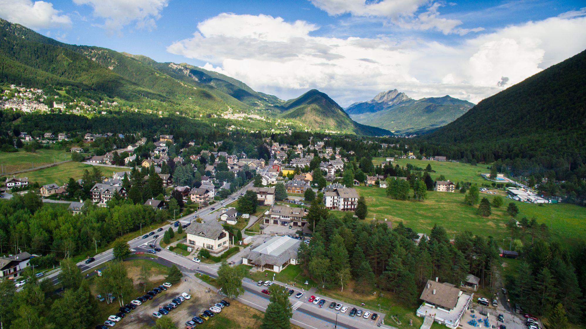
Valle Vigezzo
Route description
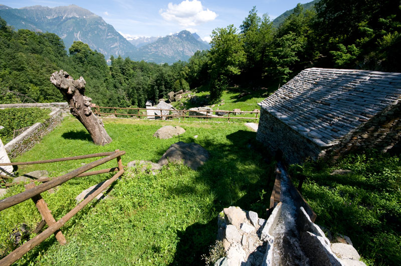
The Vigezzo Valley is a unique valley among those of the Ossola. It is a corridor between the Ossola and the Ticino, has neither beginning nor end, and is a vast plateau 800 m above sea level covered with forests. The valley tells the legend of chimney sweeps and an artistic tradition of large brushes that has earned Vigezzo the nickname “Valley of Painters”.
The valley has 15 marked bicycle and pedestrian routes, some of which use bicycle paths and some of which use agricultural tracks or existing roads. The the main route is No. 1, the Druogno—Re “Pineta” route.
This bicycle route par excellence in the Vigezzo Valley has an almost continuous dedicated bicycle path, except for a short section on a low-traffic secondary road before the Santa Maria Maggiore sports field and in crossing the village of Malesco.
Back to the list of routes
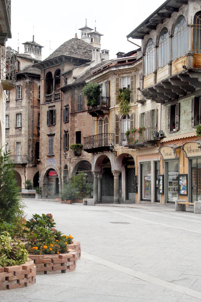
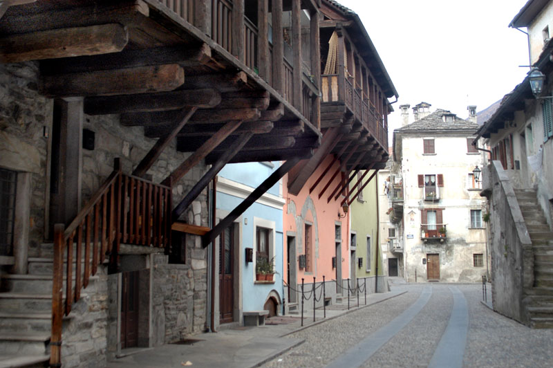
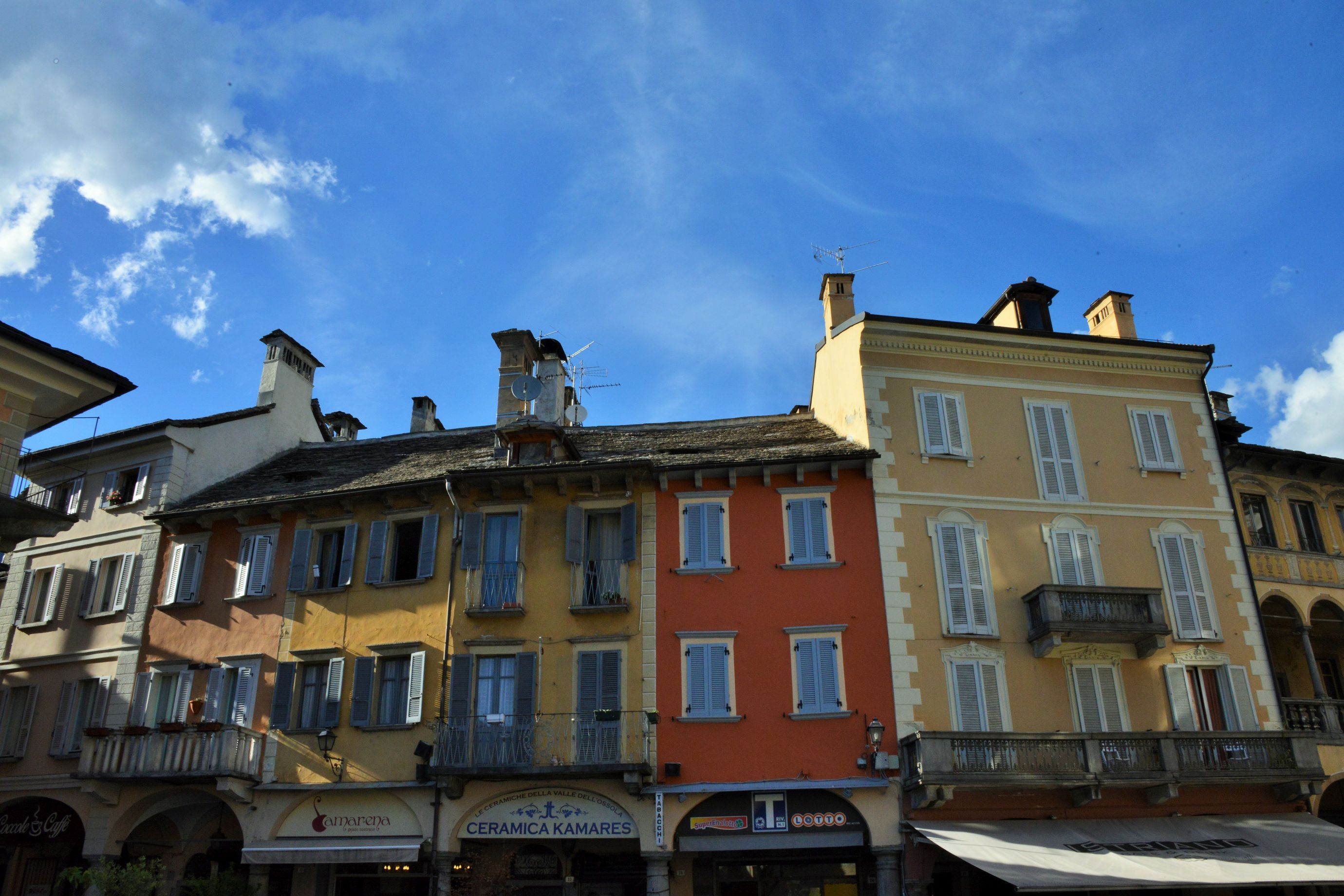
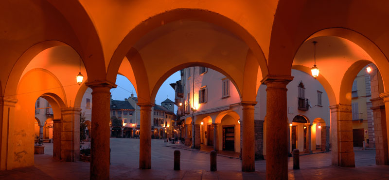
THE ROUTE STARTS FROM DOMODOSSOLA
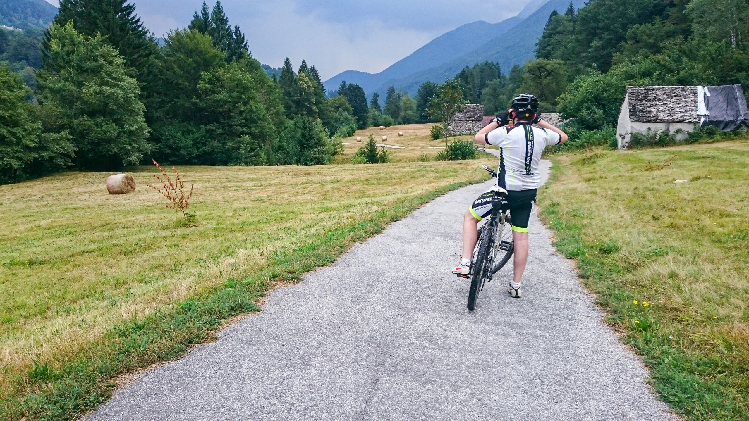
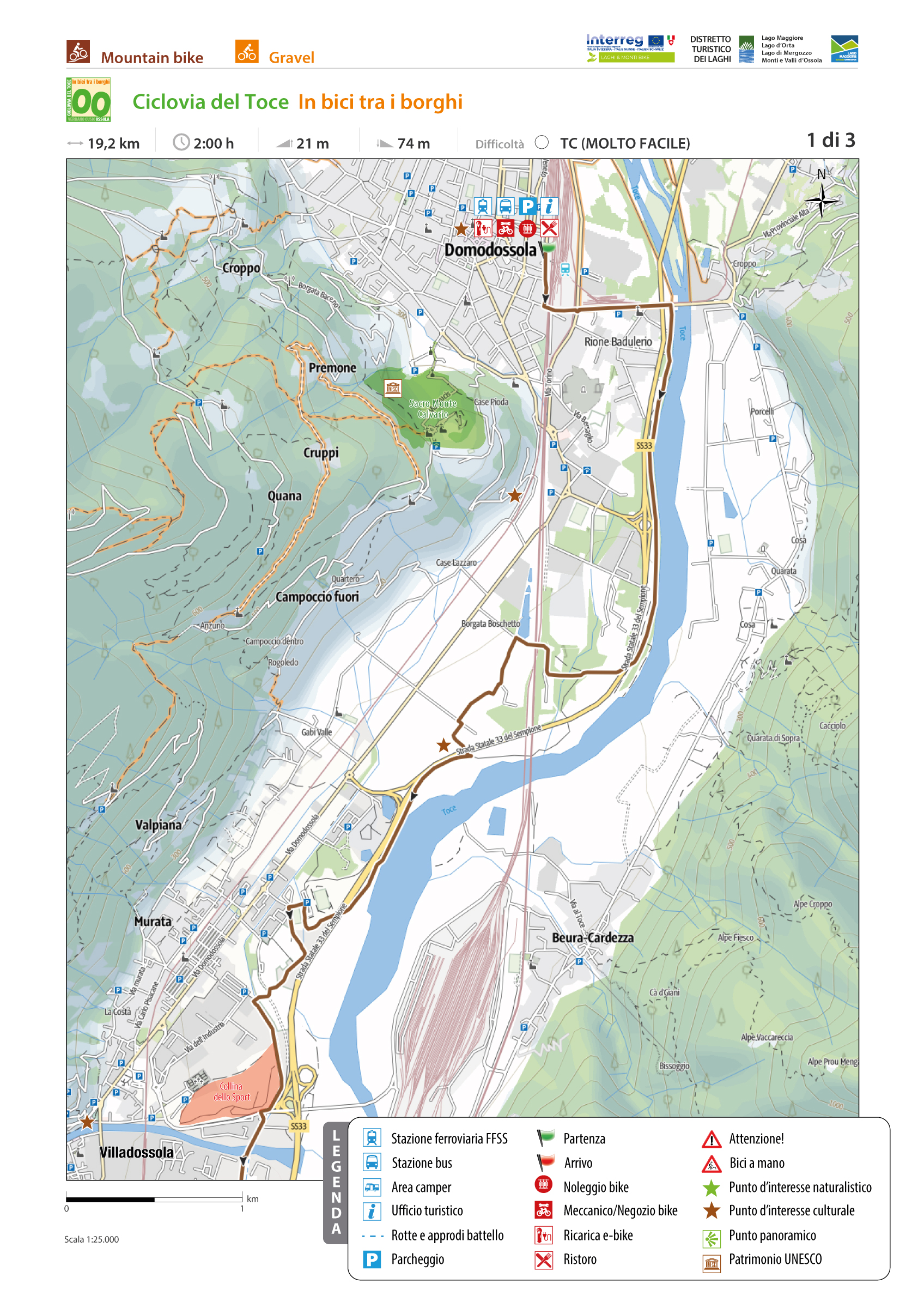
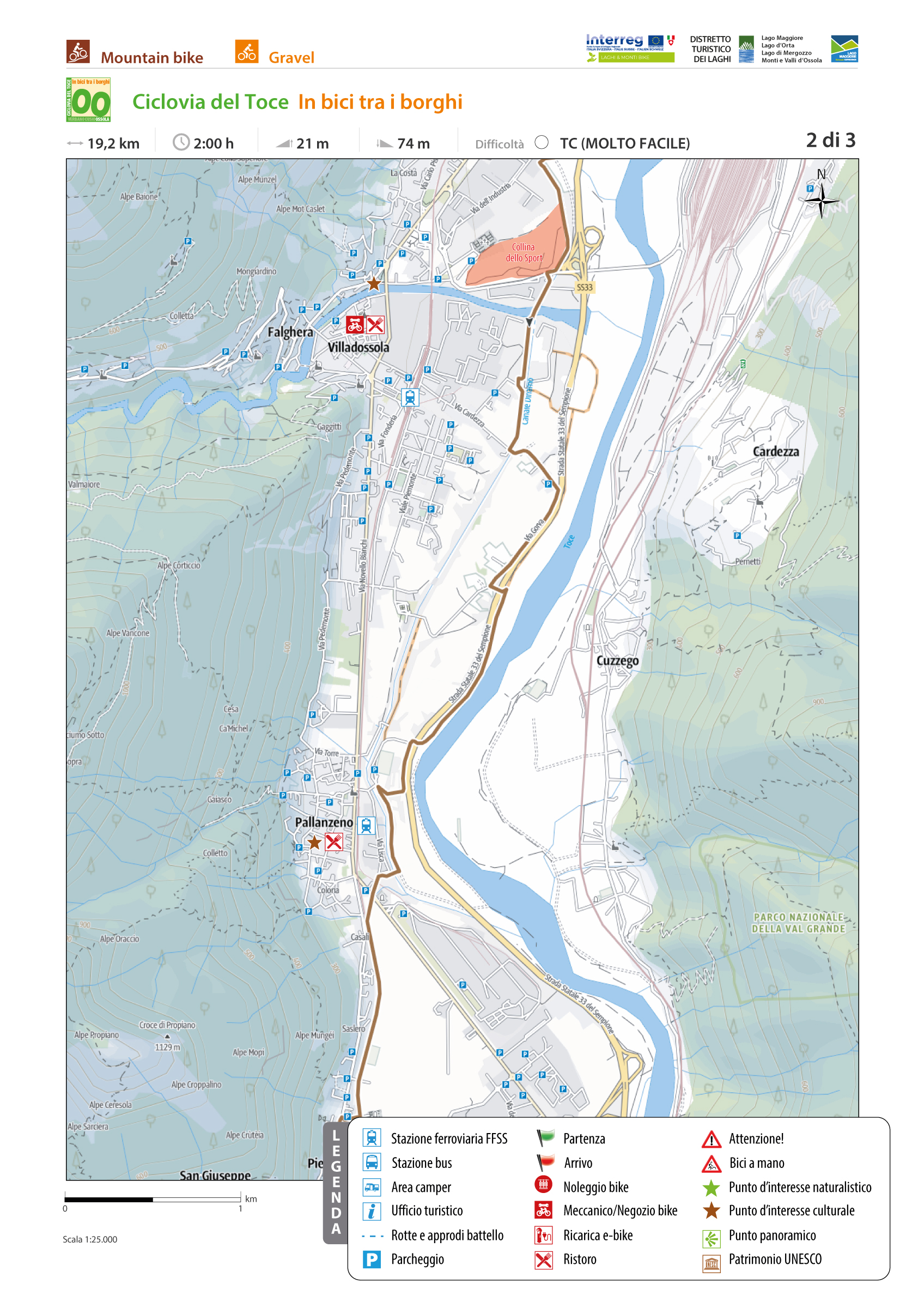
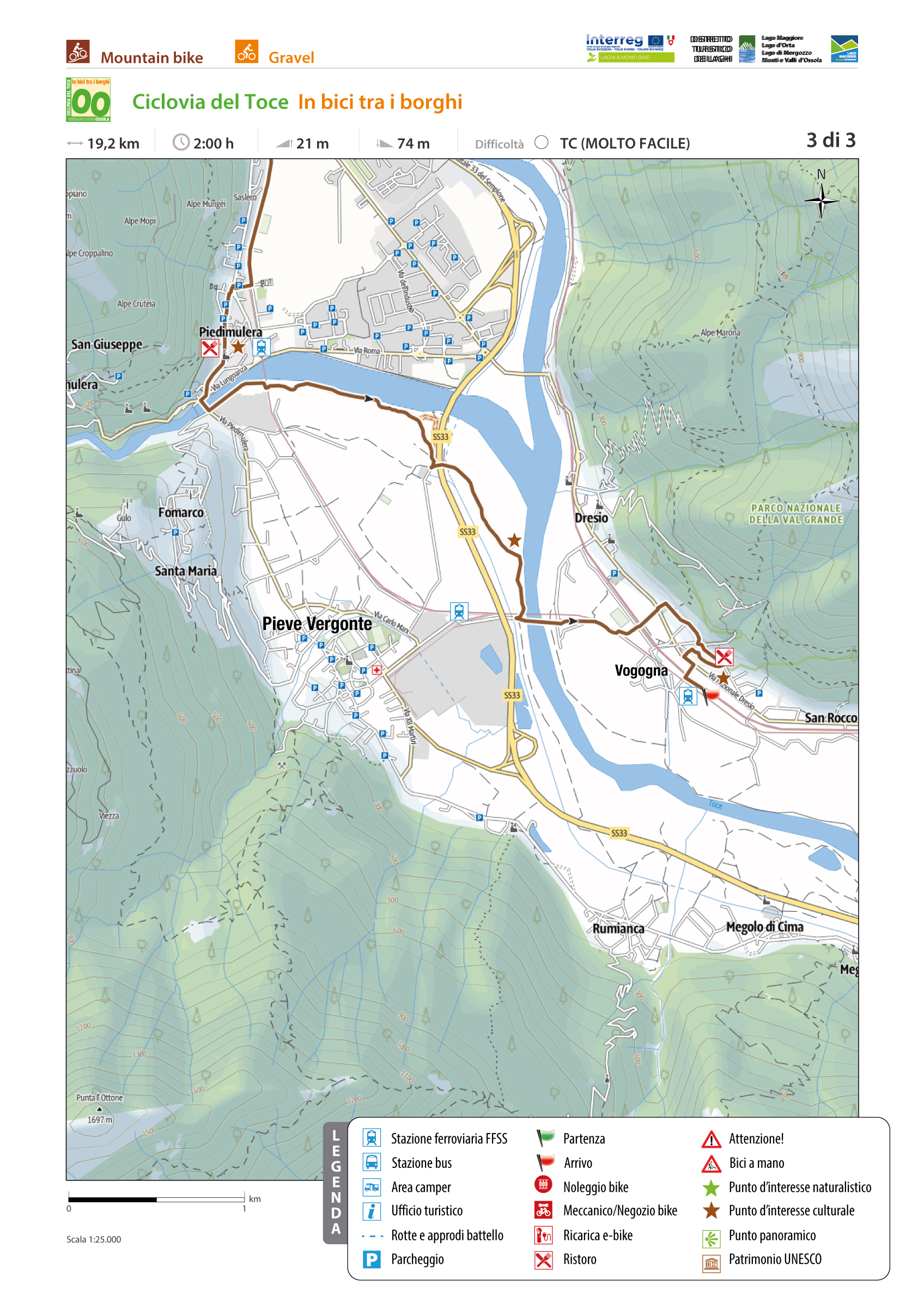
CYCLE PATH OF TOCE, CYCLING AROUND THE VILLAGES
Domodossola e dintorni
Route description
The route starts from Domodossola, the ancient capital of the Upper Ossola, the fulcrum of a borderland, a crossroads of cultures and trade. The historic core of Domodossola, a cultural jewel of absolute prominence nationally and beyond, has undergone a major architectural redevelopment in recent years. The “Borgo della Cultura” project aimed to draw a new image of the entire old town by redeveloping its most important buildings and evaluating the medieval wall system that protected and jealously guarded it over the centuries.
The endpoint of this thematic itinerary is the village of Vogogna, capital of the Lower Ossola, included in the list of 217 “Most Beautiful Villages in Italy” (www.borghitalia.it), with an architectural layout of the medieval village dating back to the 14th century. Vogogna has also been awarded the Orange Flag by the Italian Touring Club (www.bandierearancioni.it).
Back to the list of routes
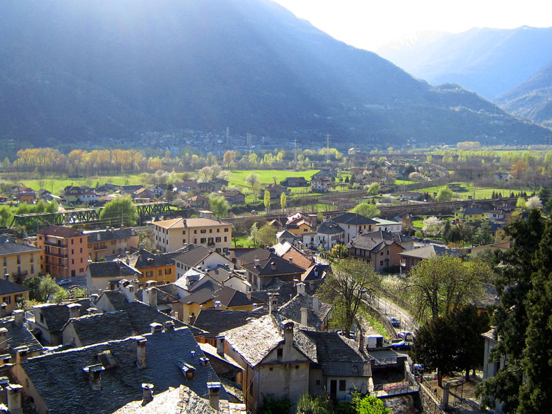
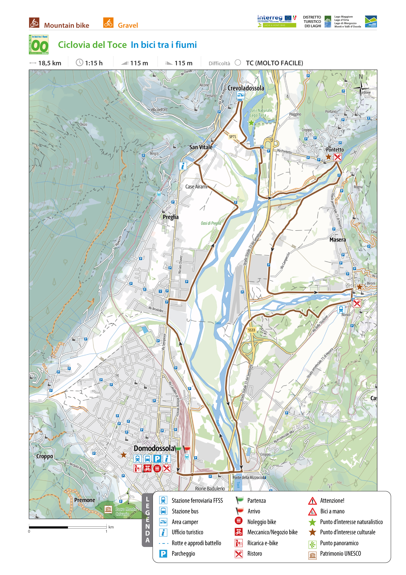
ROUND TRIP STARTING FROM DOMODOSSOLA
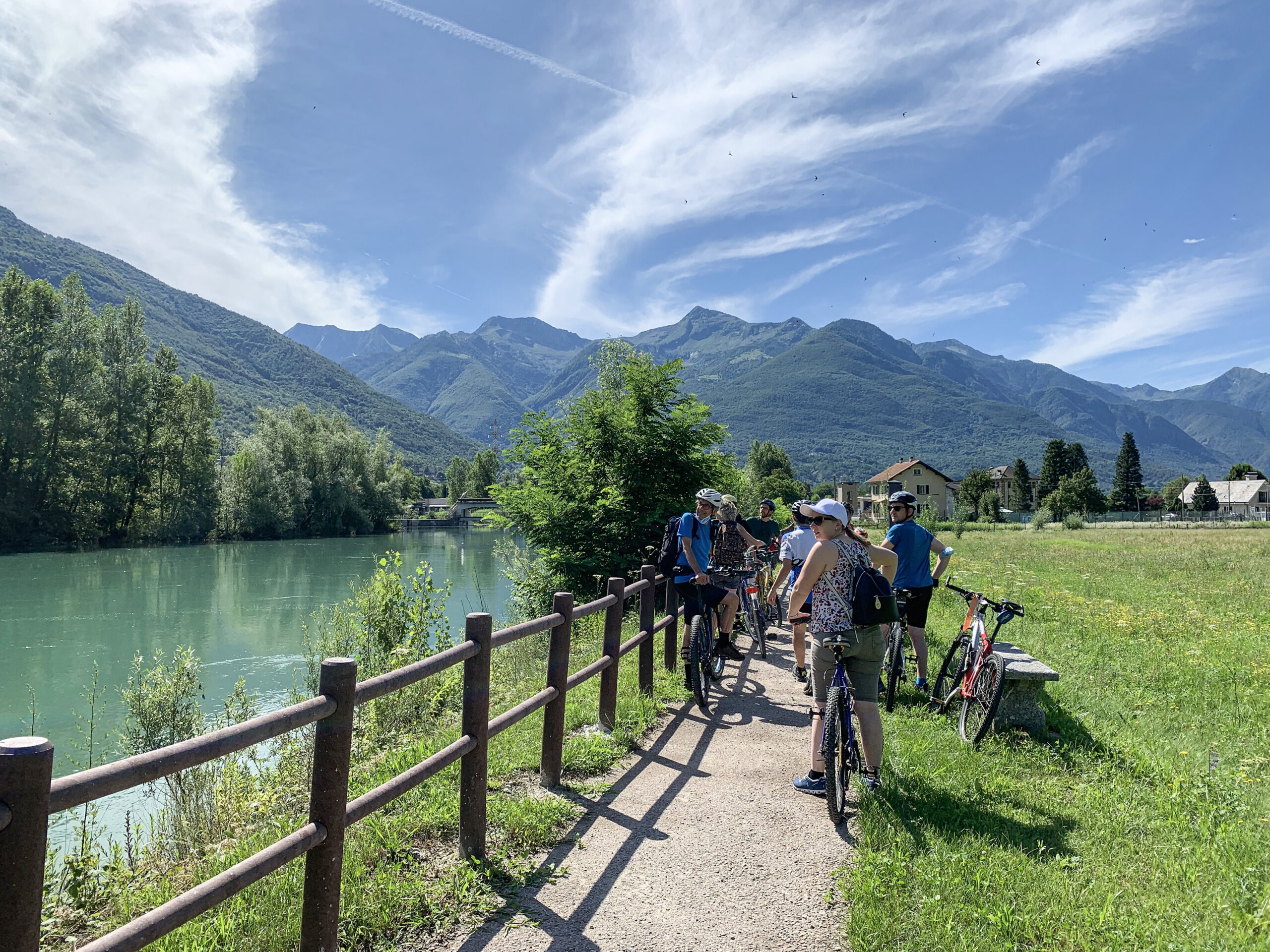
TOCE CYCLE PATH, CYCLING ALONG THE RIVERSIDES
Domodossola e dintorni
Route description
This is a round trip starting from the railway station of Domodossola that takes you in the clockwise direction all around the flatland of Domodossola, Crevalodossola, Montecrestese, Masera and Trontano. The route takes its name because it passes five rivers: Toce, Bogna, Diveria, Isorno and Melezzo.
Back to the list of routes
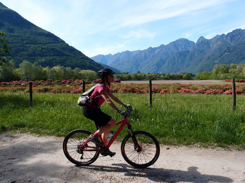
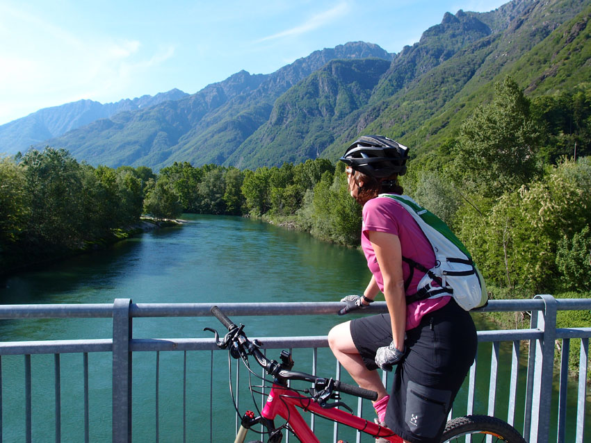
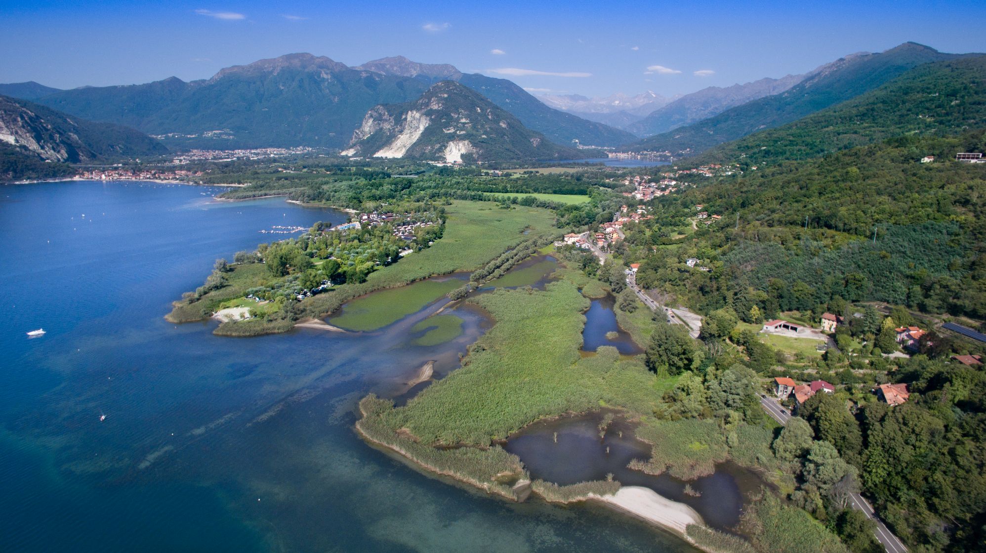
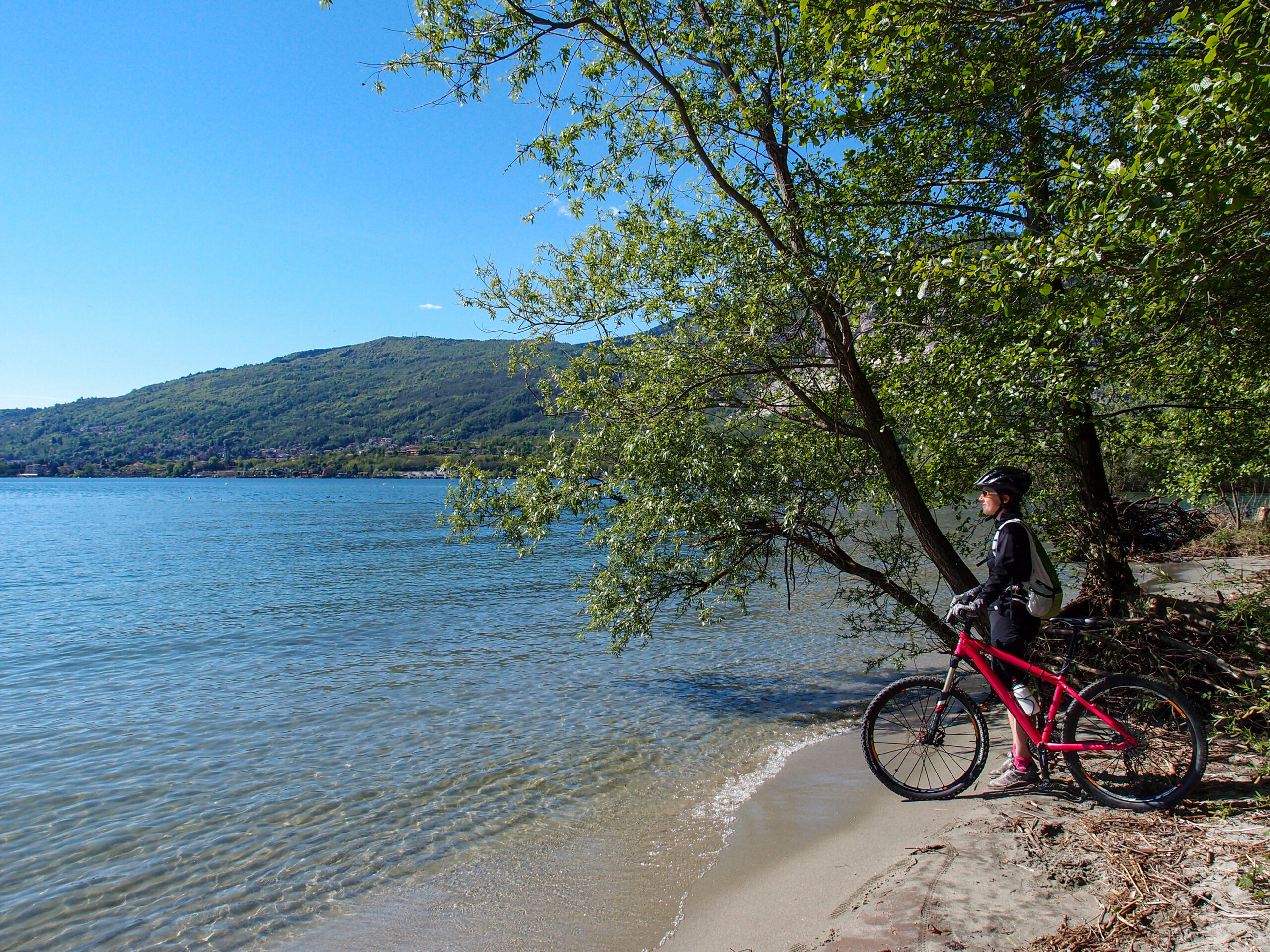
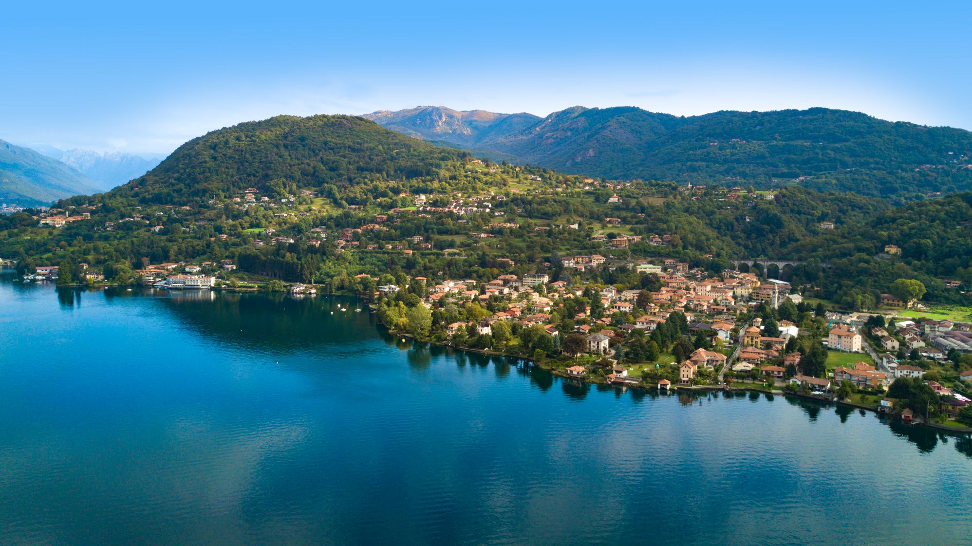
THE ROUTE STARTS AT ORNAVASSO AND REACHES THE CANEBRAKE OF FONDOTOCE
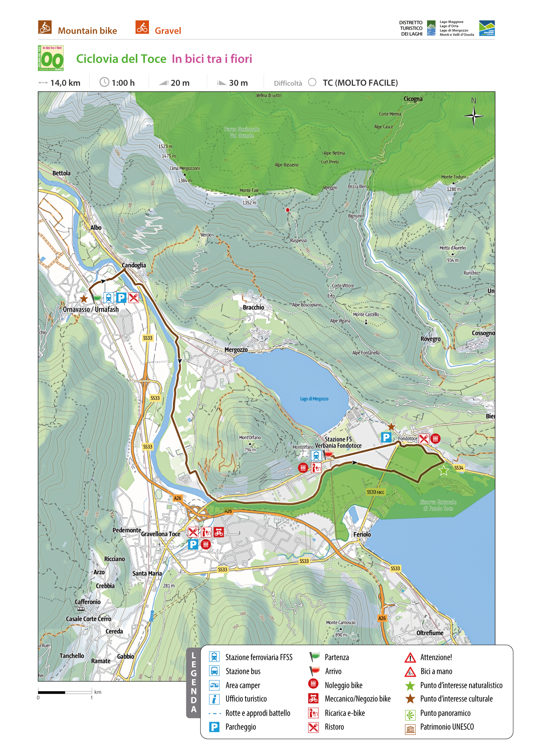
TOCE CYCLE PATH, CYCLING THROUGH THE FLOWERS
Lago Maggiore
Route description
CYCLEWAY
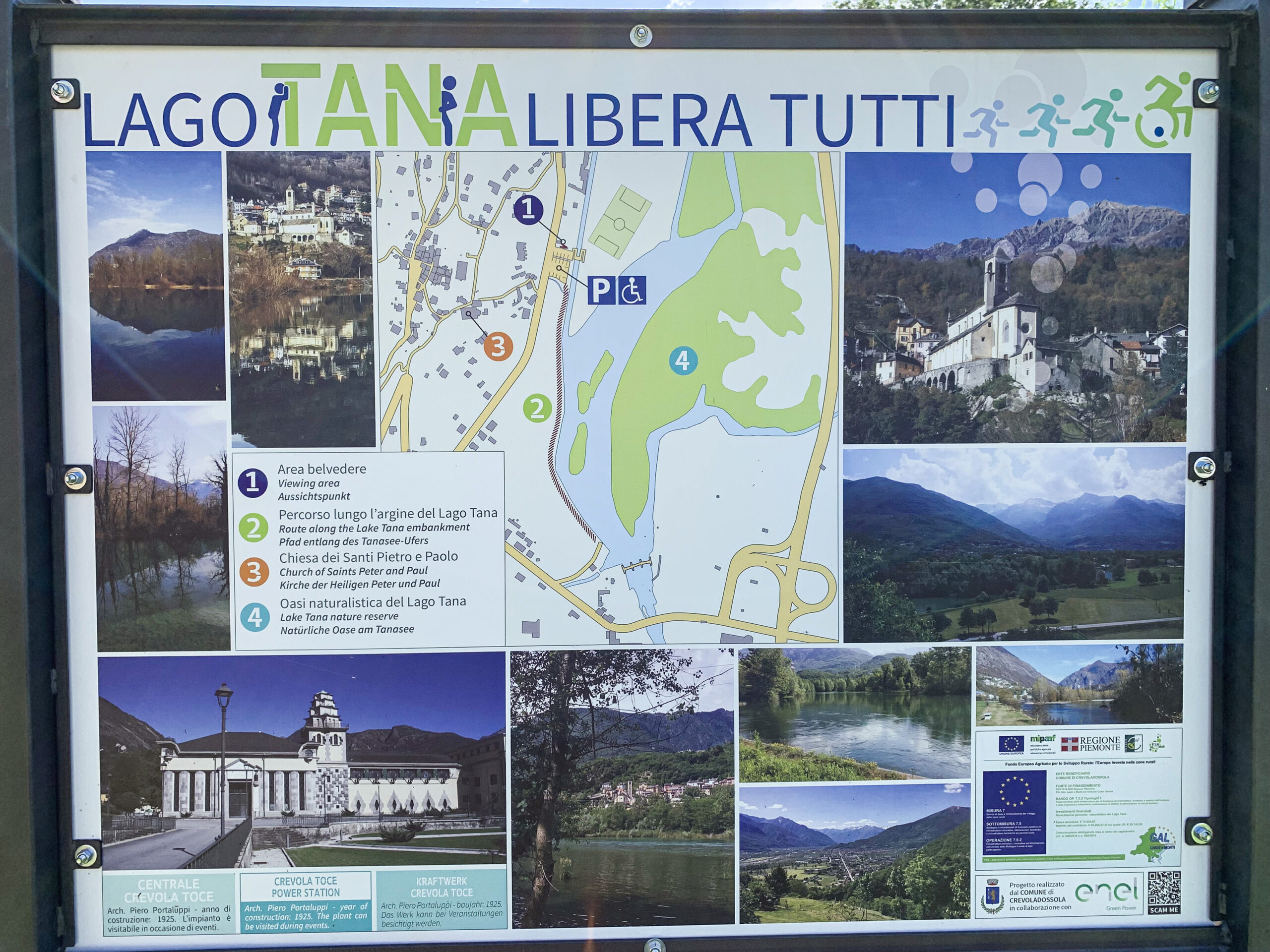
The route starts at Ornavasso and reaches the canebrake of Fondotoce and the railway station of Verbania Pallanza passing through the production areas of “Flowers Typical of Lake Maggiore”. Between April and May, in the blooming period, azaleas, rhododendrons and camellias display their infinite shades and tints of colours.
Back to the list of routes
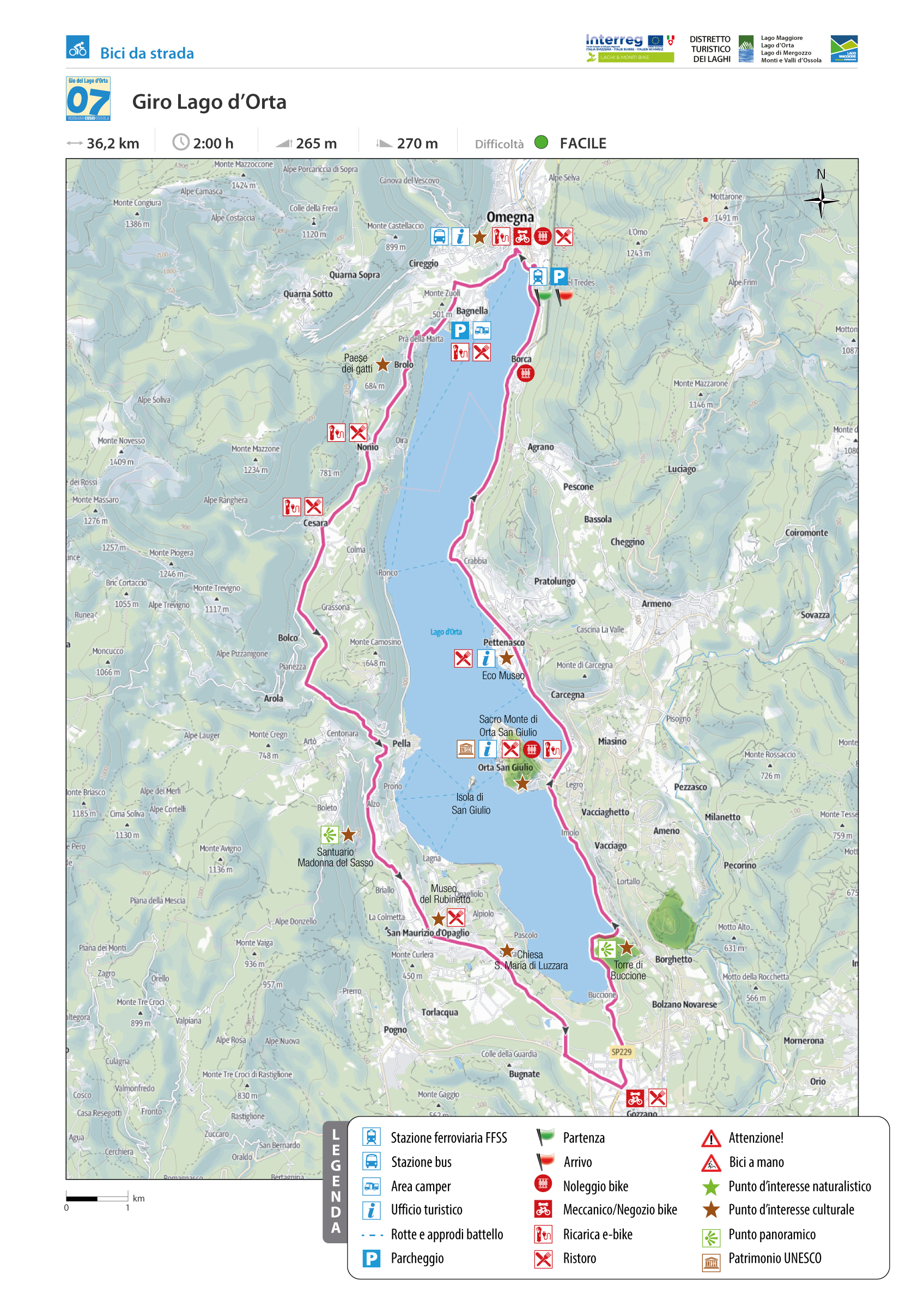
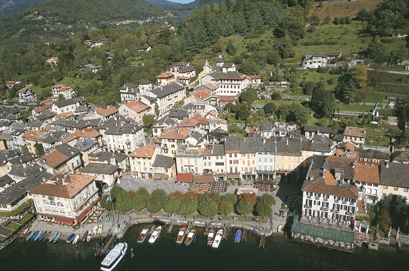
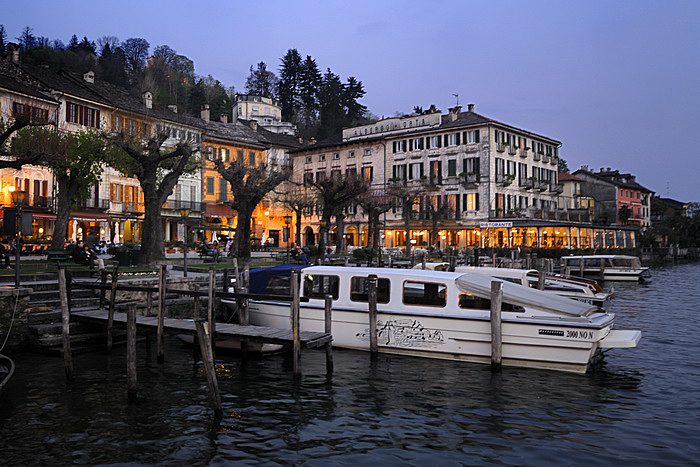
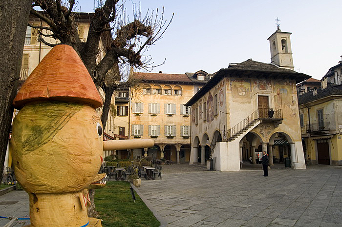
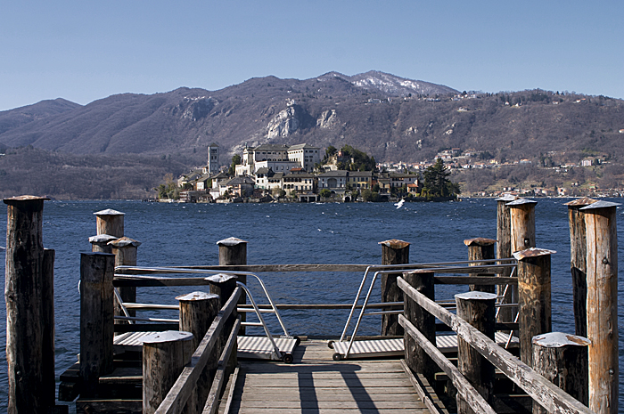
BIKE TOURING STARTING FROM OMEGNA
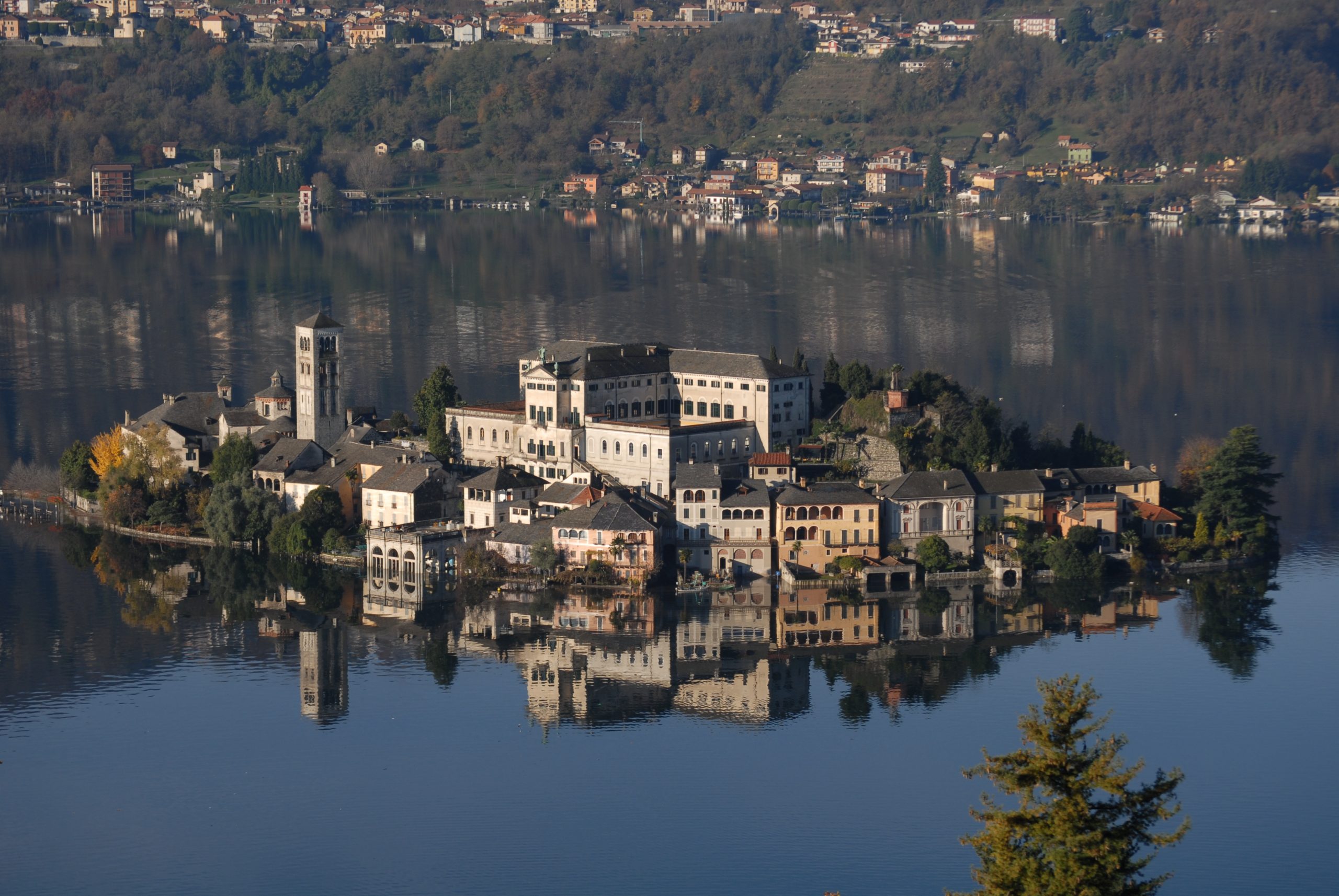
TOUR OF ORTA LAKE
Lago d’Orta
Route description
Cult tour around the Lake Orta and the Isle of San Giulio
It is a very well-known and popular ride, especially among foreign guests.
The reasons for its success are diverse, from lake to island, from tower to sanctuary…along an arterial road with low road traffic.
Back to the list of routes
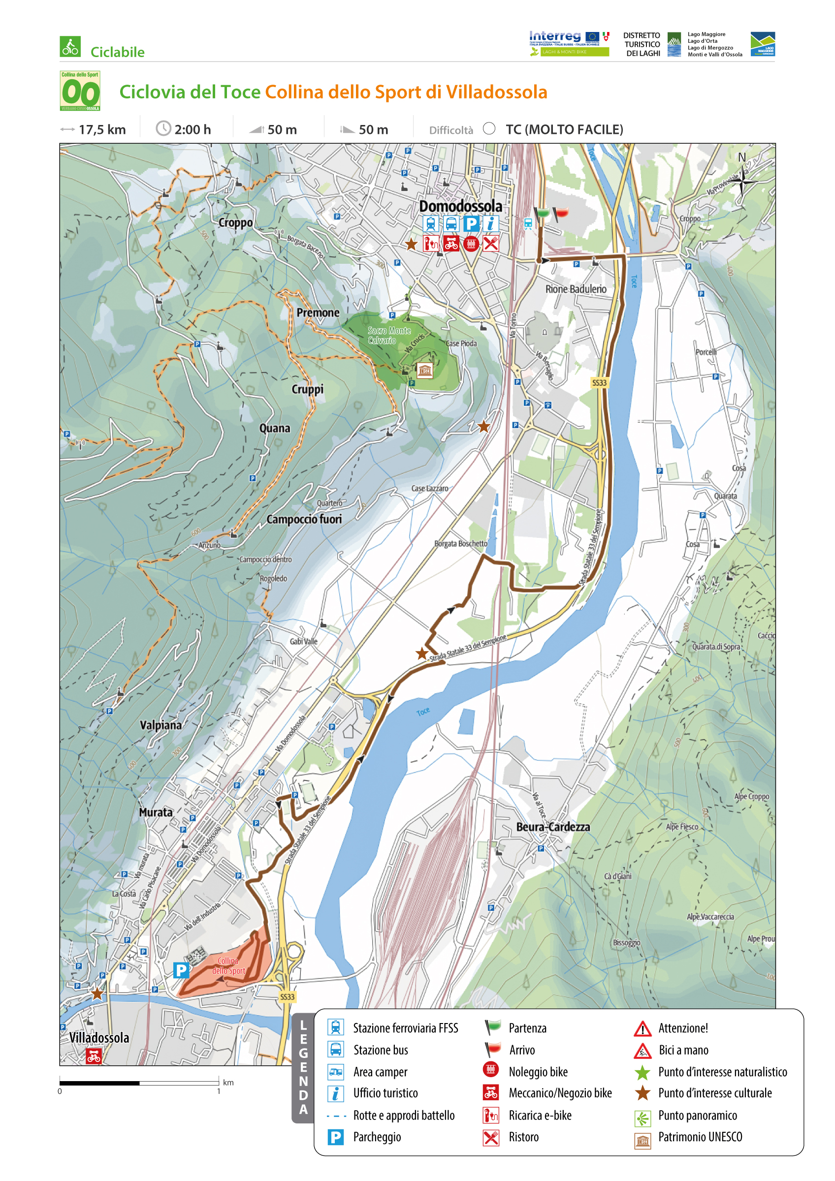
TOCE CYCLEWAY: VILLADOSSOLA SPORTS HILL
Domodossola e dintorni
Route description
This route runs along the first section of the Ciclovia del Toce and is characterized almost entirely by dedicated bike lanes. The route starts in Domodossola and reaches the Collina dello Sport in Villadossola.
Back to the list of routes
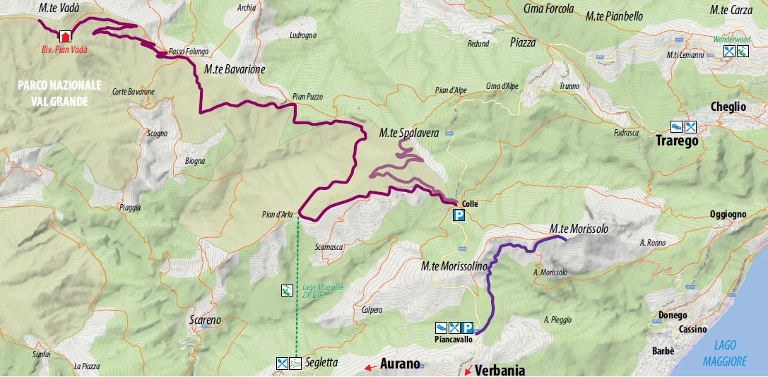
From Piancavallo to the Tunnels of Monte Morissolo
HISTORIC MOUNTAIN ROADS: LINEA CADORNA
Alto Verbano
Route description
The Cadorna Line is the defence system that was built near the Swiss border during World War I at the behest of General Luigi Cadorna, the then Chief of Staff of the Italian Army, who feared a German-Austrian invasion through neutral Switzerland.
The immense defence structure, built between the summer of 1915 and the spring of 1918, stretched from Ossola to Verbano and into Lombardy, becoming a dense network of military roads and mule tracks, trenches, artillery positions, lookout posts, camp hospitals and logistical facilities, barracks and outposts.
The work was carried out by local bricklayers and stonemasons and women also played a fundamental role in the construction of the defence line, particularly in transporting material and supplies to the work sites.
The Cadorna Line was never used for war purposes and today this military road is a historical heritage site that allows the community to learn about a historical moment of the 20th century.
It is also a natural heritage of trails for trekking and mountain-biking enthusiasts, offering routes that can be travelled almost all year round (be careful in the event of recent snowfall).
HIGHLIGHTS AND TOUR DETAILS
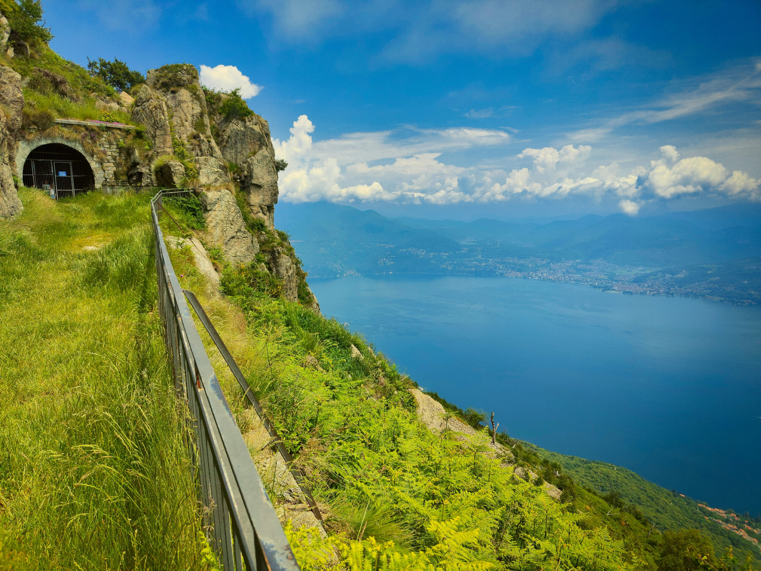
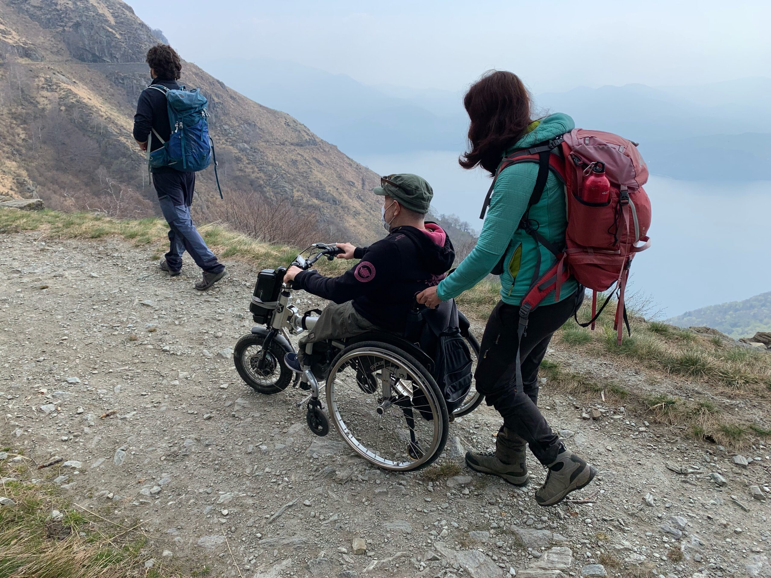
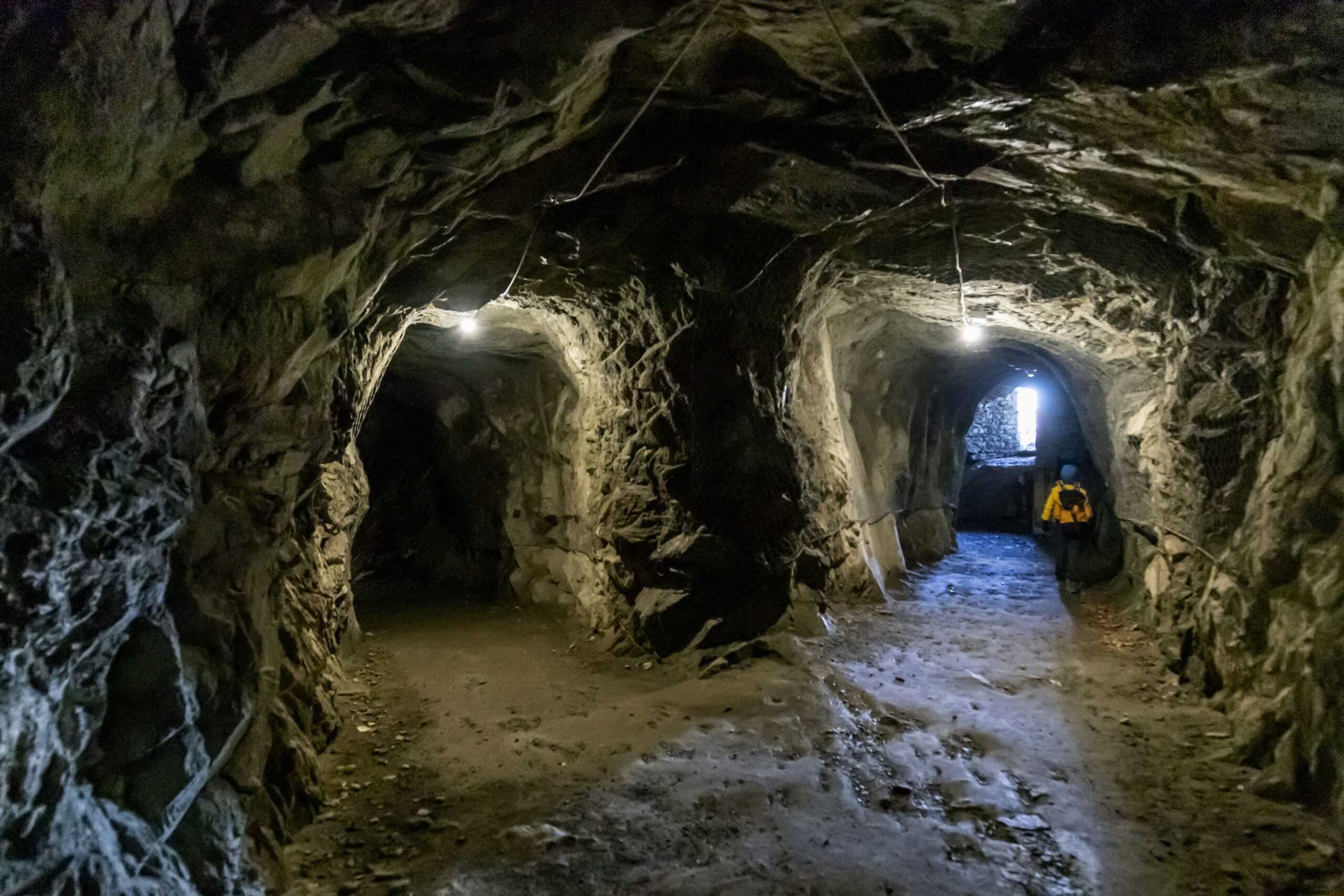
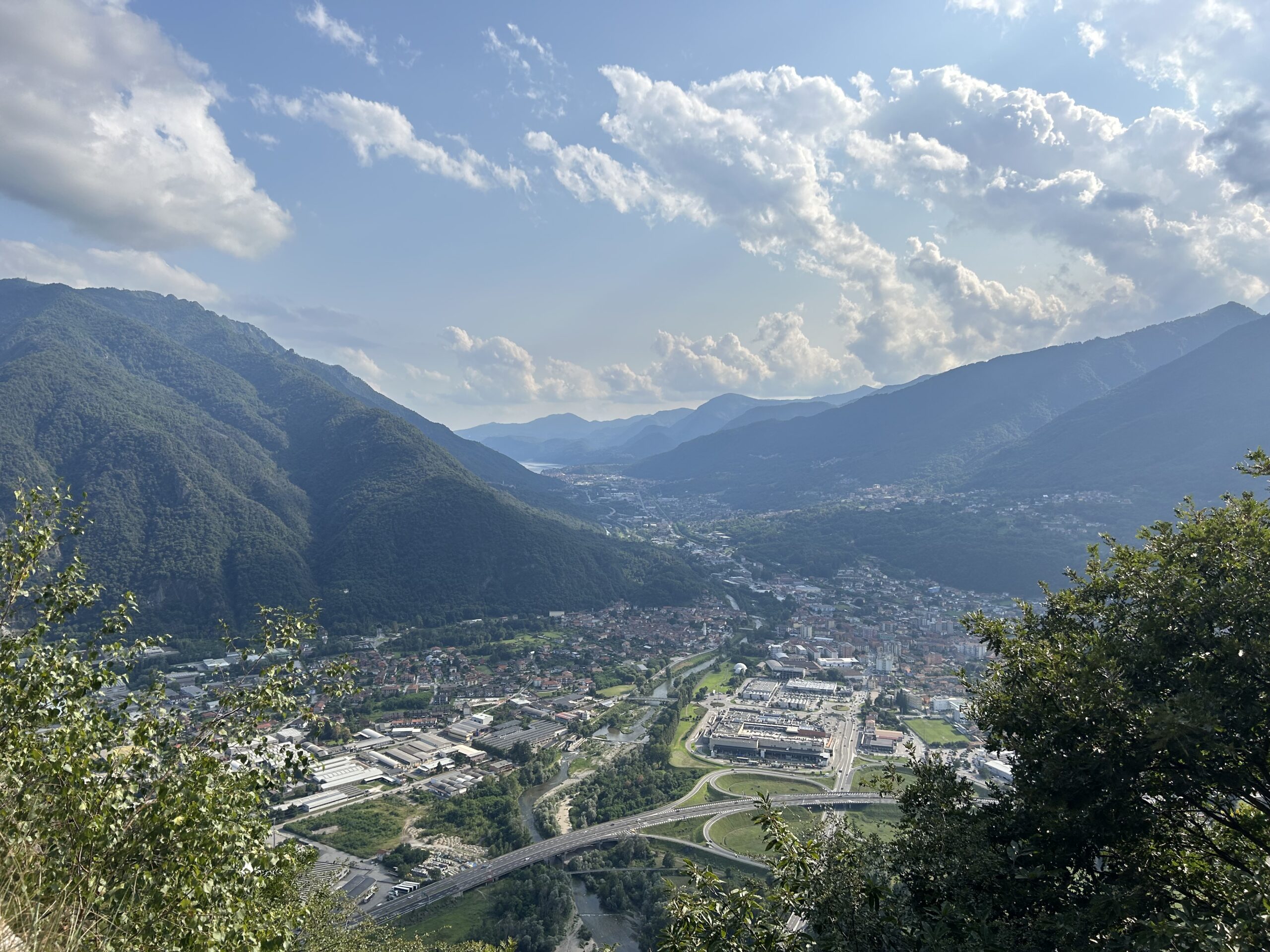
The section of the Cadorna Line between Piancavallo and Morissolo begins in Piancavallo (1247 m asl) in Alto Verbano, following the road to Colle. After passing the Auxological Hospital, you take the dirt road to the right, following the signs for the Monte Morissolo tunnels. After passing a barrier, the flat route begins on the wide military road that crosses a picturesque beech wood. As you exit the wood, you are struck by the breathtaking view of Upper Lake Maggiore. In just under half an hour on foot you reach the tunnels carved into the live rock and the cave posts of Monte Morissolo.
Trail suitable for people using motorised wheelchairs suitable for uneven terrain or manual but equipped wheelchairs. The use of wheelchair attachment with an accompanying person is recommended.
POINT OF INTERESTS
Scenic view of Upper Lake Maggiore.
Tunnels and cave posts.
Other trekking routes depart from here to Cima di Morissolo and Monte Morissolino.
A few kilometres away, it is possible to reach the Lake Maggiore Zipline, the 1850 m long steel cable which allows you to try the experience of an adrenaline-packed flight of 1 and a half minutes at over 120 km/hr (www.lagomaggiorezipline.it – possibility to rent e-bikes at Alpe Segletta – Aurano).
Fun is assured at Wonderwood Adventure Park and a breathtaking view from the Big Bench of the Lake at Monte Carza (Trarego Viggiona) www.wonderwood.it .
Back to the list of routes
From Pra’ Michelaccio to Cima Montorfano
HISTORIC MOUNTAIN ROADS: LINEA CADORNA, MERGOZZO
Lago Maggiore
Route description
The Cadorna Line is the defence system that was built near the Swiss border during World War I at the behest of General Luigi Cadorna, the then Chief of Staff of the Italian Army, who feared a German-Austrian invasion through neutral Switzerland.
The immense defence structure, built between the summer of 1915 and the spring of 1918, stretched from Ossola to Verbano and into Lombardy, becoming a dense network of military roads and mule tracks, trenches, artillery positions, lookout posts, camp hospitals and logistical facilities, barracks and outposts.
The work was carried out by local bricklayers and stonemasons and women also played a fundamental role in the construction of the defence line, particularly in transporting material and supplies to the work sites.
The Cadorna Line was never used for war purposes and today this military road is a historical heritage site that allows the community to learn about a historical moment of the 20th century.
It is also a natural heritage of trails for trekking and mountain-biking enthusiasts, offering routes that can be travelled almost all year round (be careful in the event of recent snowfall).
Highlights and tour details
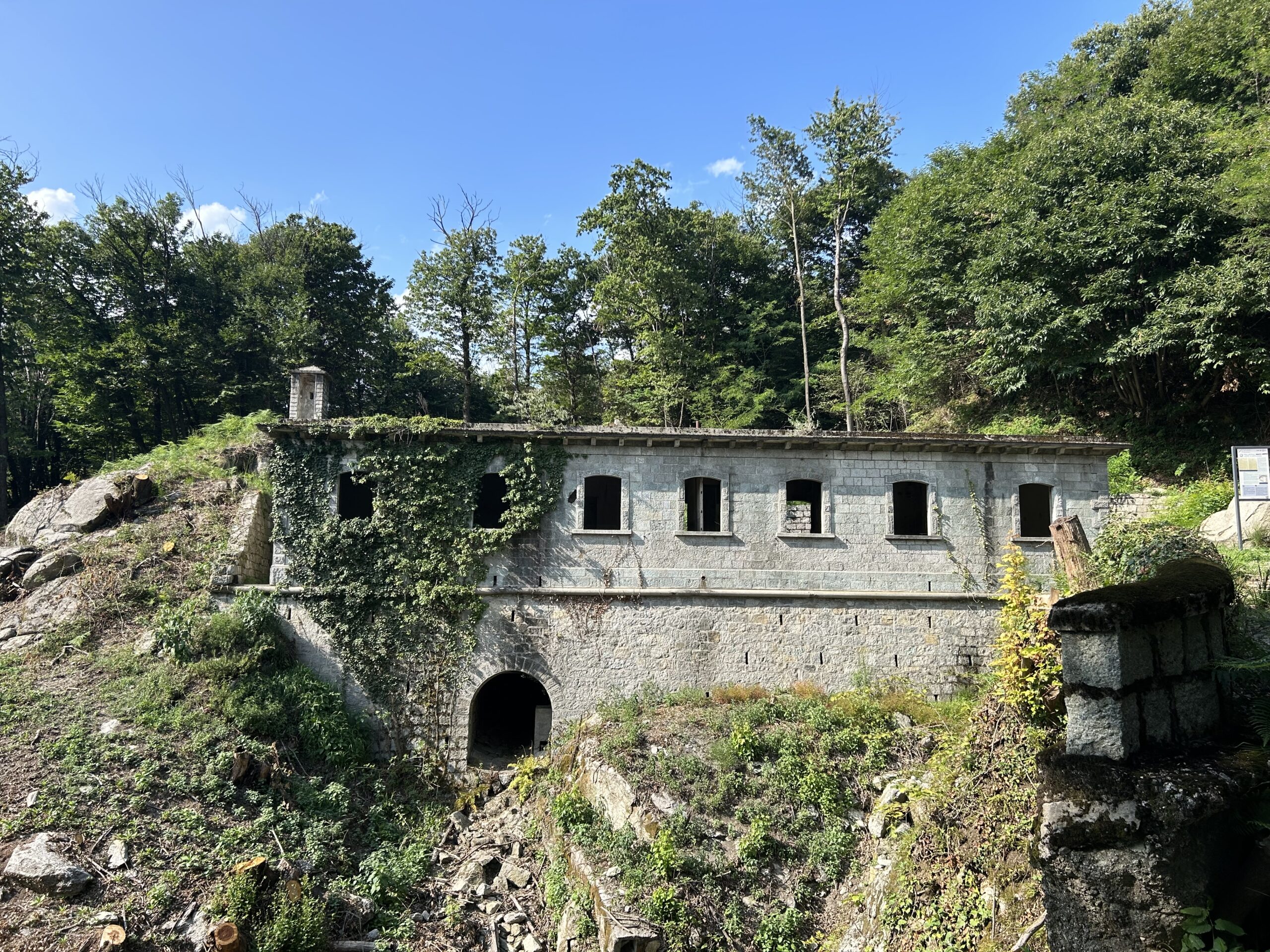
Because of its isolated position, Mont’Orfano or Montorfano was considered an important strategic place from which to dominate the entire surrounding area, from Lake Maggiore to Lake Orta to Bassa Ossola.
Various military constructions were built on the slopes of the mount that are still visible and can be reached thanks to Strada Cadorna, a 4 km long and 4 metre wide dirt road.
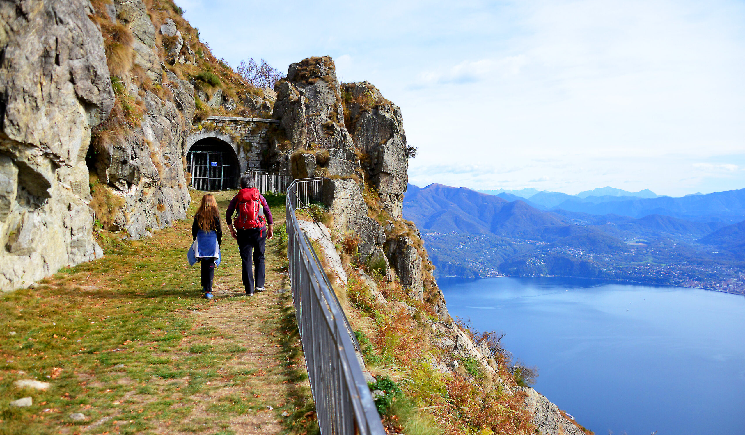
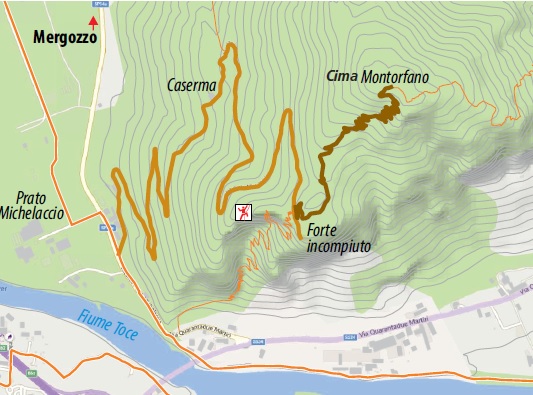
The route along this section of the Cadorna Line begins in Mergozzo, in the hamlet of Pra’ Michelaccio (204 m asl), following the signs for the military fortifications.
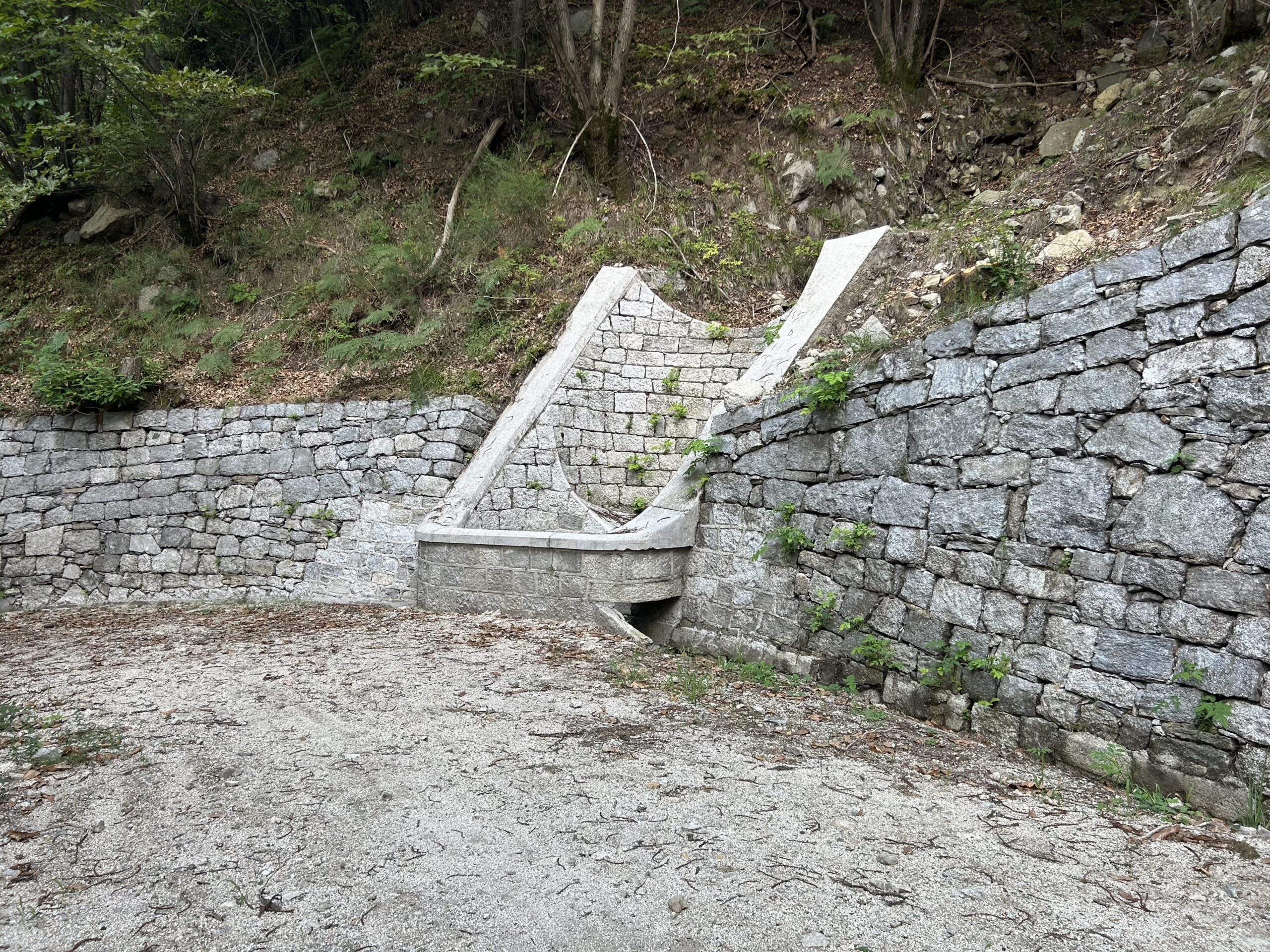
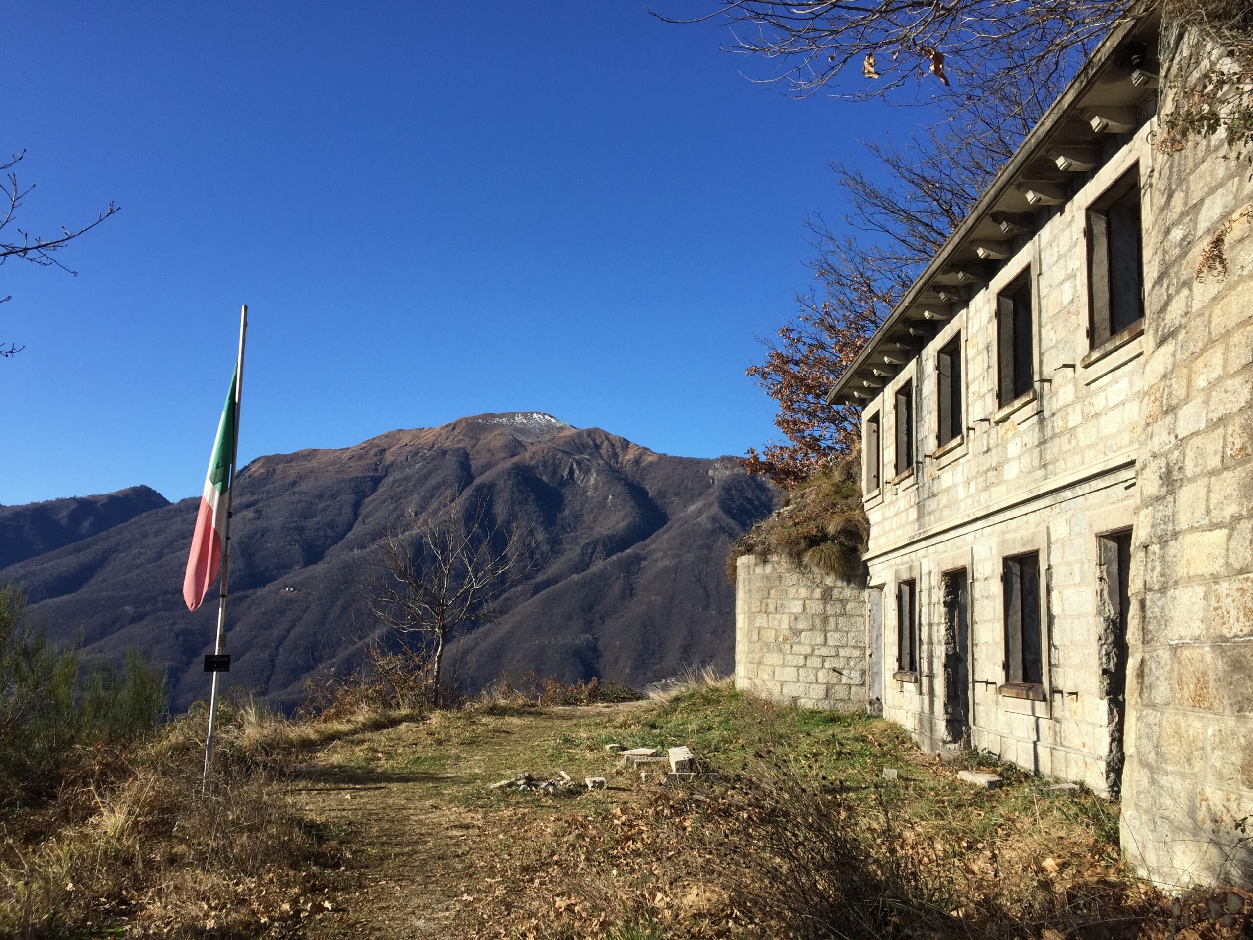
The military road, asphalted only in the first short section, becomes a beautiful dirt road that climbs steadily for 4 km, with beautiful stone hairpin bends leading to the first “Casermetta” (small barracks). Continuing with a succession of beautiful military artefacts (retaining walls and water channels), the road reaches the second Casermetta and the “Polveriera” (magazine). The panoramic view from up here is truly stunning.
From the Polveriera you can continue as far as Cima del Montorfano (794 m asl – about 2 km). The dirt road becomes a mule track that later becomes a grassy path and in about 45 minutes reaches other military works (shelters and barracks), whose construction involved the use of local natural resources including granite extracted from the nearby Cava Verde quarry at the foot of Montorfano.
Points of interest
Panoramic views over Lake Maggiore, Lake Orta, Mergozzo and Bassa Ossola.
Remarkably beautiful military artefacts.
Suitable for the whole family is the Sentiero Azzurro, a beautiful paved path that connects the village of Mergozzo to one of Montorfano, from which there is a panoramic view over Lake Mergozzo and Lake Maggiore.
For adrenaline seekers, along the Strada Cadorna is the access to the Via Ferrata Montorfano, a route with Tibetan bridges and exposed passages (Difficult level; a route to be followed only with suitable equipment).
(https://www.comune.mergozzo.vb.it/it-it/vivere-il-comune/cosa-vedere/fer… )
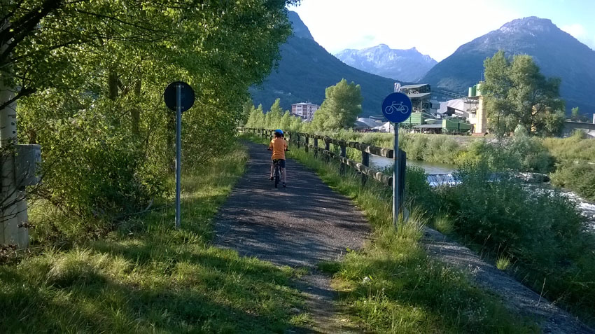
From Pra’ Michelaccio, along the banks of the River Toce, the homonymous Ciclovia del Toce (Toce Cycle Route) passes, which from Alta Val Formazza continues to Lake Maggiore.
For lovers of local history, the Montorfano Granite Ecomuseum and the Archaeological Civic Museum with a display of artefacts from Prehistoric to Medieval times can also be visited in the village of Mergozzo. www.ecomuseogranitomontorfano.it
(Progetto è promosso dalla legge regionale 19 maggio 2021 n. 9, “Interventi per la valorizzazione delle strade storiche di montagna di interesse turistico” che riconosce e valorizza le strade storiche di montagna di interesse turistico al fine di favorire lo sviluppo del turismo all’aria aperta)
Back to the list of routes
Da Pra’ Michelaccio alla Cima Montorfano
VIE STORICHE DI MONTAGNA: LA LINEA CADORNA
Lago Maggiore
Route description
La Linea Cadorna è il sistema difensivo che venne costruito vicino alla frontiera svizzera durante la Prima Guerra Mondiale per volere del Generale Luigi Cadorna, l’allora Capo di Stato Maggiore dell’Esercito, il quale temeva un’invasione austro-tedesca, attraverso la neutrale Svizzera.
L’immensa struttura difensiva, costruita tra l’estate del 1915 e la primavera del 1918, si estendeva dall’Ossola al Verbano fino alla Lombardia, divenendo un fitto reticolo di strade e mulattiere militari, trincee, postazioni d’artiglieria, luoghi di avvistamento, ospedaletti e strutture logistiche, casermette e punti di avvistamento.
I lavori furono eseguiti da muratori e scalpellini locali ed anche le donne ebbero un ruolo fondamentale nella realizzazione della linea difensiva, in particolare nel trasporto di materiale e rifornimento nei cantieri.
La Linea Cadorna non venne mai utilizzata per scopi bellici ed oggigiorno questa strada militare è un patrimonio storico che permette alla comunità di conoscere un momento di storia del Novecento.
E’ però anche un patrimonio naturalistico di sentieri per gli amanti di trekking e della mountain-bike offrendo percorsi percorribili quasi tutto l’anno (prestare attenzione in caso di recenti nevicate).
DESCRIZIONE DEL PERCORSO
Il Mont’Orfano o Montorfano, grazie alla sua posizione isolata, venne considerato un importante luogo strategico da cui dominare a 360° il territorio circostante, dal Lago Maggiore al Lago d’Orta alla Bassa Ossola.
Alle pendici del monte vennero realizzate varie costruzioni militari ancora visibili e raggiungibili grazie alla strada Cadorna, un percorso sterrato camionabile lungo 4 km e largo ben 4 metri.
Il percorso in questo tratto di Linea Cadorna inizia a Mergozzo, nella Loc. Pra’ Michelaccio (204 m slm), seguendo le indicazioni per le fortificazioni militari.
La strada militare, asfaltata solo nel primo breve tratto, diventa una bella sterrata che sale per 4 km con pendenza costante e con bei tornanti in pietra che conducono alla prima Casermetta. Proseguendo con un susseguirsi di manufatti militari di notevole bellezza (muri di contenimento e canali idraulici), la strada giunge alla seconda Caserma e alla Polveriera. La vista panoramica che si ha da quassù è davvero suggestiva.
Dalla Polveriera si può proseguire fino alla Cima del Montorfano (794 m slm – circa 2 km). La sterrata lascia posto ad una mulattiera che poi diventa sentiero erboso ed in circa 45 minuti raggiunge altre opere militari (ricoveri e baraccamenti), la cui edificazione ha visto l’impiego di risorse naturali locali tra cui il granito estratto dalla vicina Cava Verde, ai piedi del Montorfano.
Attenzione: La strada in alcuni punti è priva di protezioni. Prestare attenzione in caso di recenti nevicate.
PUNTI D’INTERESSE
Vista panoramica sul Lago Maggiore, Lago d’Orta, di Mergozzo e Bassa Ossola.
Manufatti militari di notevole bellezza.
Adatto a tutta la famiglia è il Sentiero Azzurro, un bellissimo percorso lastricato che collega il paese di Mergozzo all’abitato di Montorfano, da cui si ha una vista panoramica su Lago di Mergozzo e Lago Maggiore.
Per chi cerca adrenalina, lungo la Strada Cadorna, si incontra invece l’accesso alla Via Ferrata Montorfano, percorso con ponti tibetani e passaggi esposti (livello Difficile; via da percorrere solo muniti di idonea attrezzatura).
(https://www.comune.mergozzo.vb.it/it-it/vivere-il-comune/cosa-vedere/fer… )
Da Pra’ Michelaccio, lungo le rive del fiume Toce, passa l’omonima Ciclovia del Toce che proveniente dall’Alta Val Formazza, prosegue sino al Lago Maggiore. https://lagomaggiorexperience.it/percorso/ciclovia-del-toce-in-bici-tra-…
Per gli amanti di storia locale, a Mergozzo paese, si possono inoltre visitate l’Ecomuseo del Granito di Montorfano e il Museo Civico Archeologico con l’esposizione di reperti dalla Preistoria all’Età Medievale. www.ecomuseogranitomontorfano.it
(Progetto è promosso dalla legge regionale 19 maggio 2021 n. 9, “Interventi per la valorizzazione delle strade storiche di montagna di interesse turistico” che riconosce e valorizza le strade storiche di montagna di interesse turistico al fine di favorire lo sviluppo del turismo all’aria aperta)
Back to the list of routes

