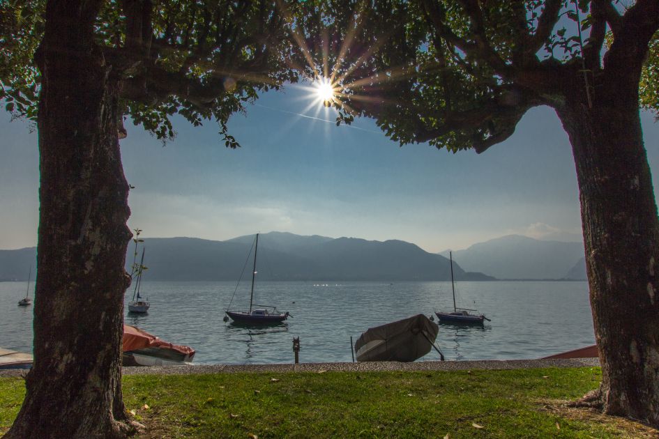
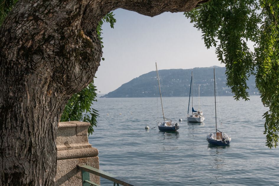
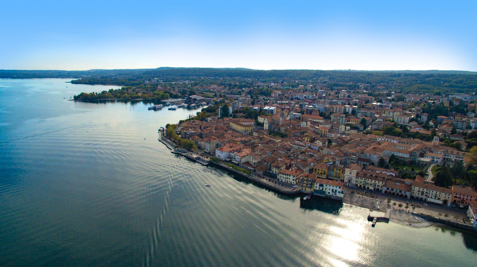
From Arona to Suna
Along Lake Maggiore, from San Carlone to the Borromeo Gulf
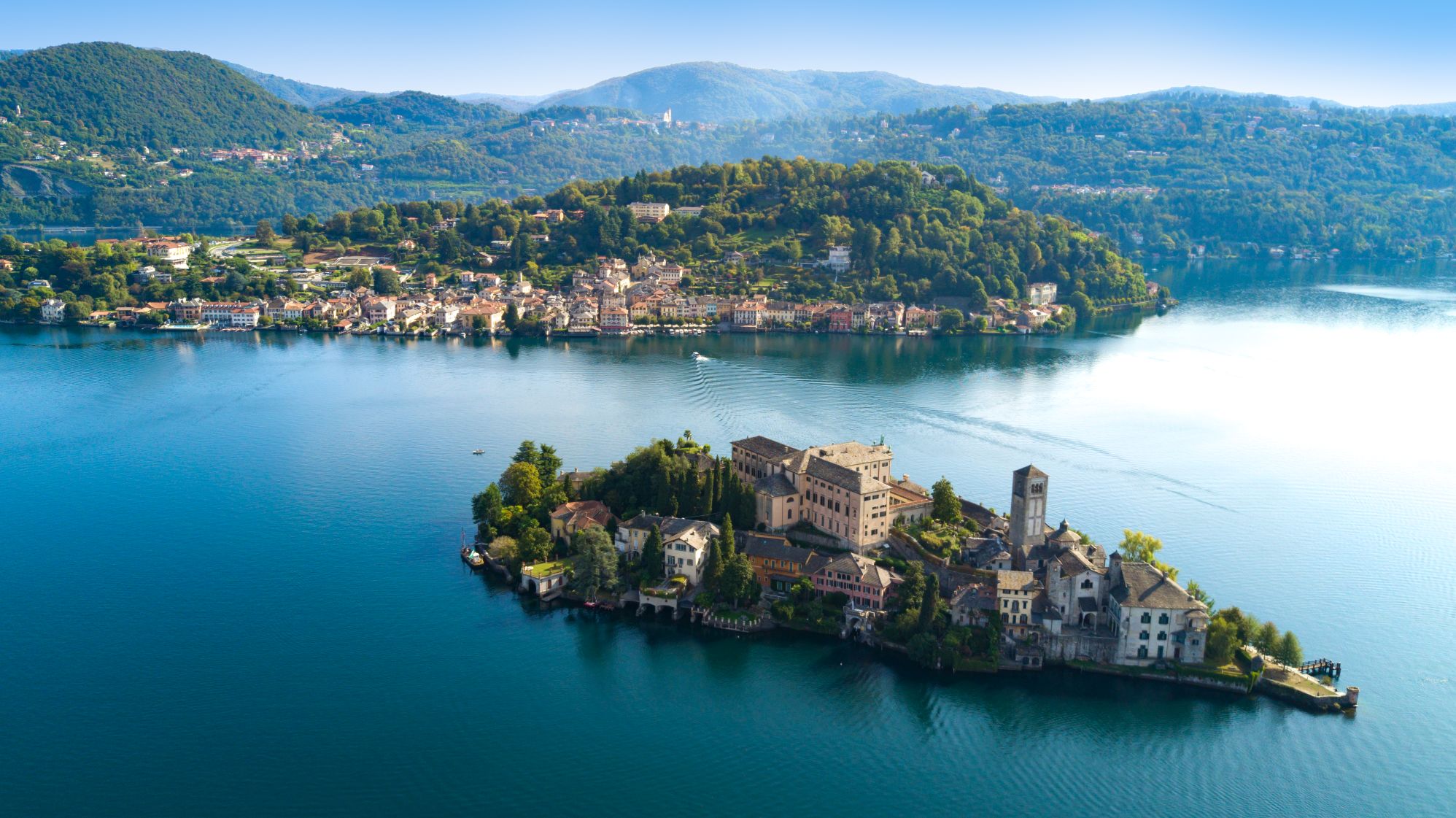
Lago Maggiore
Route description
Itinerary Description
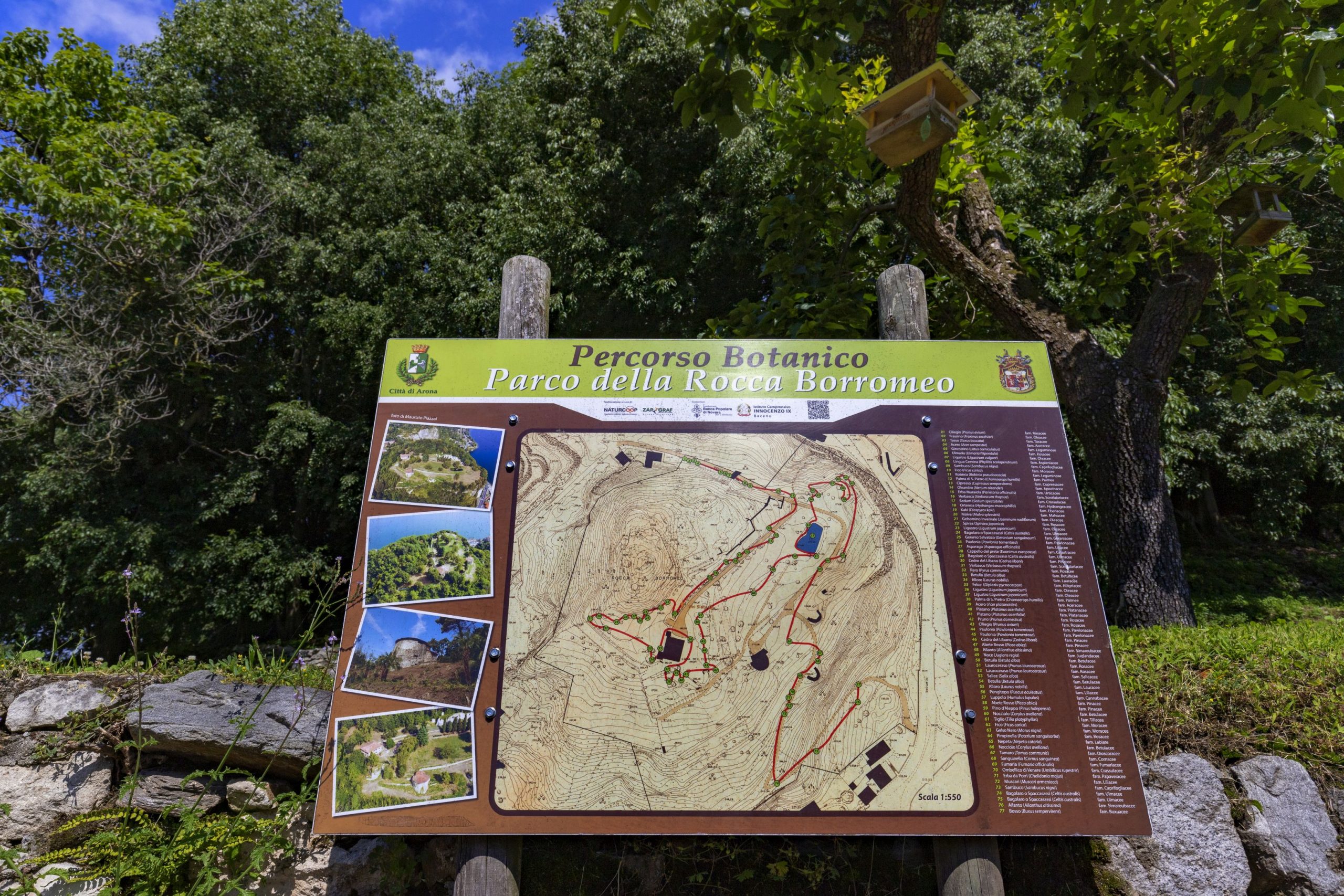
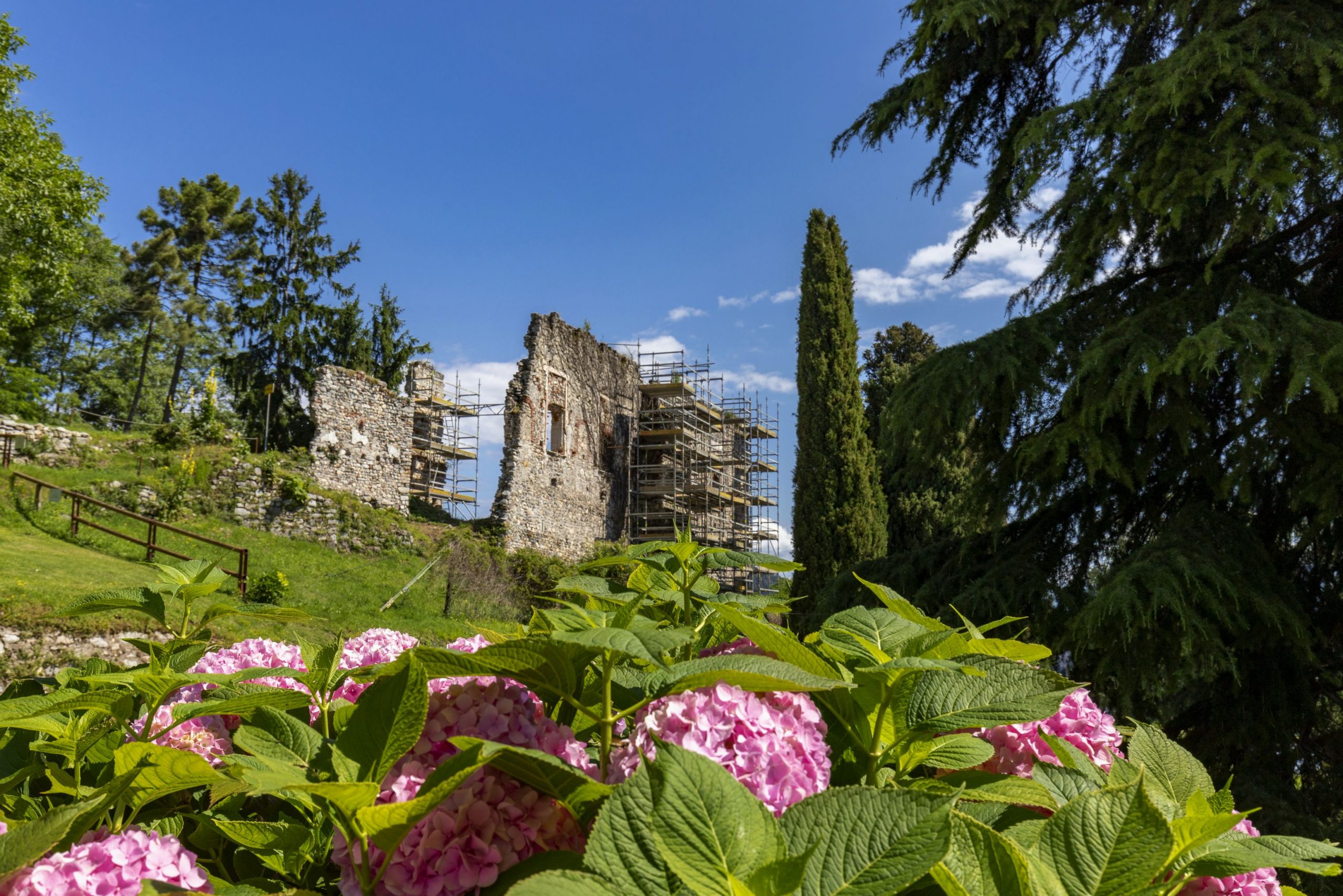
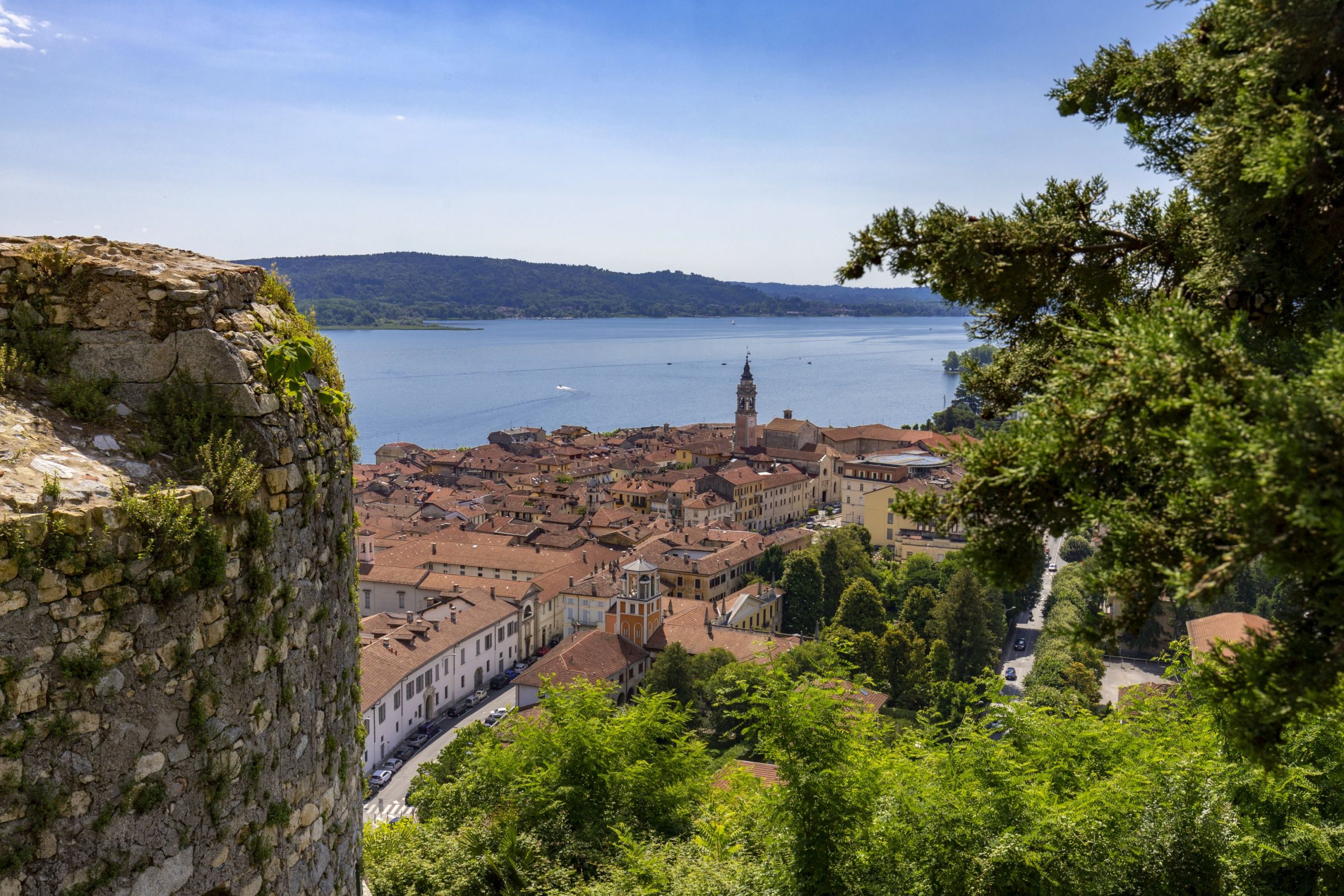
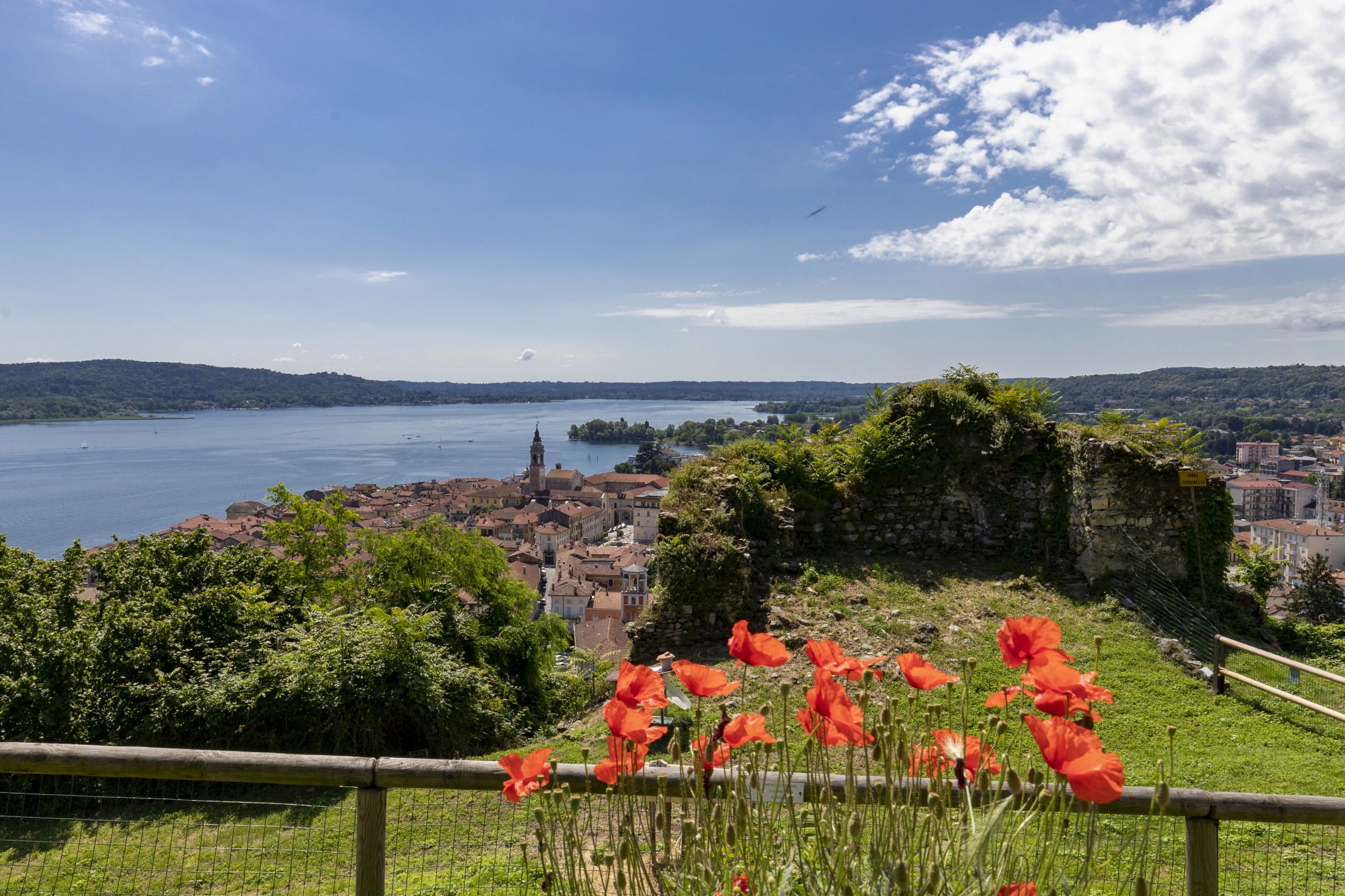
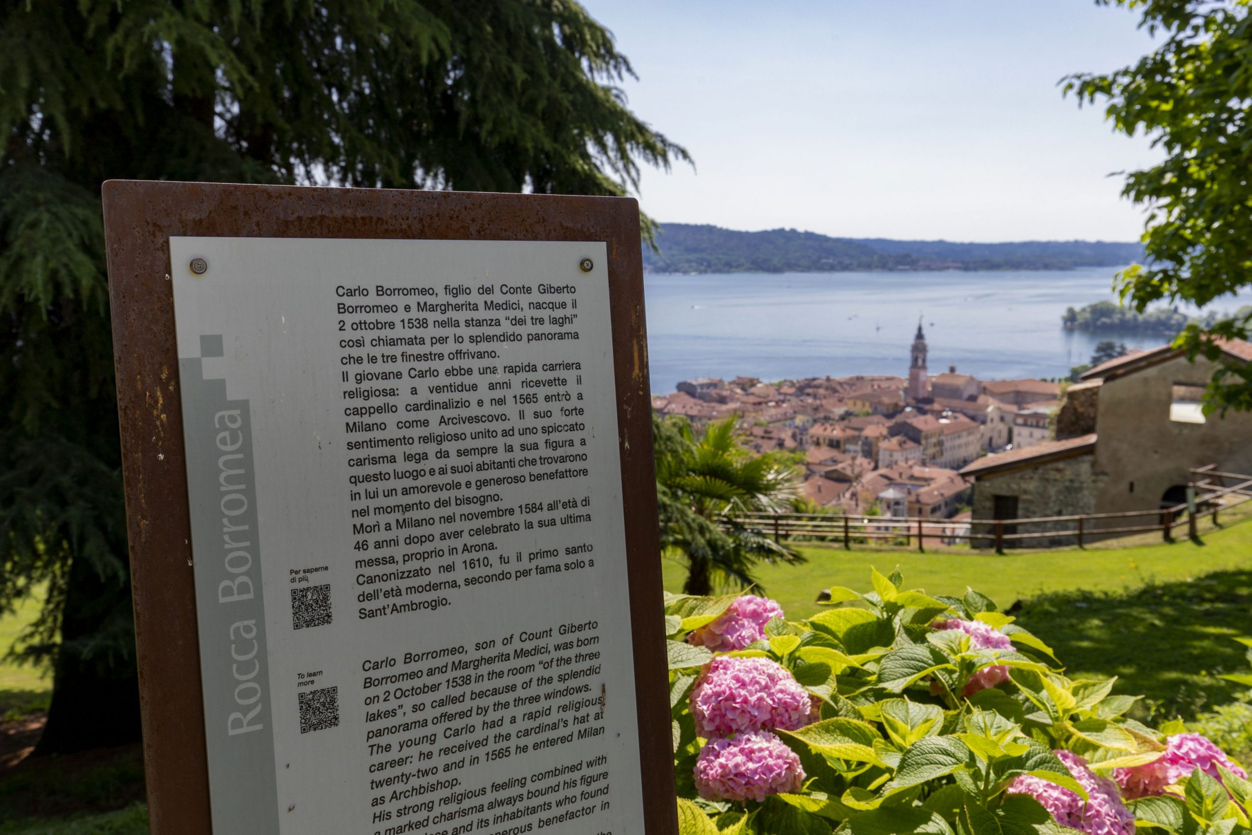
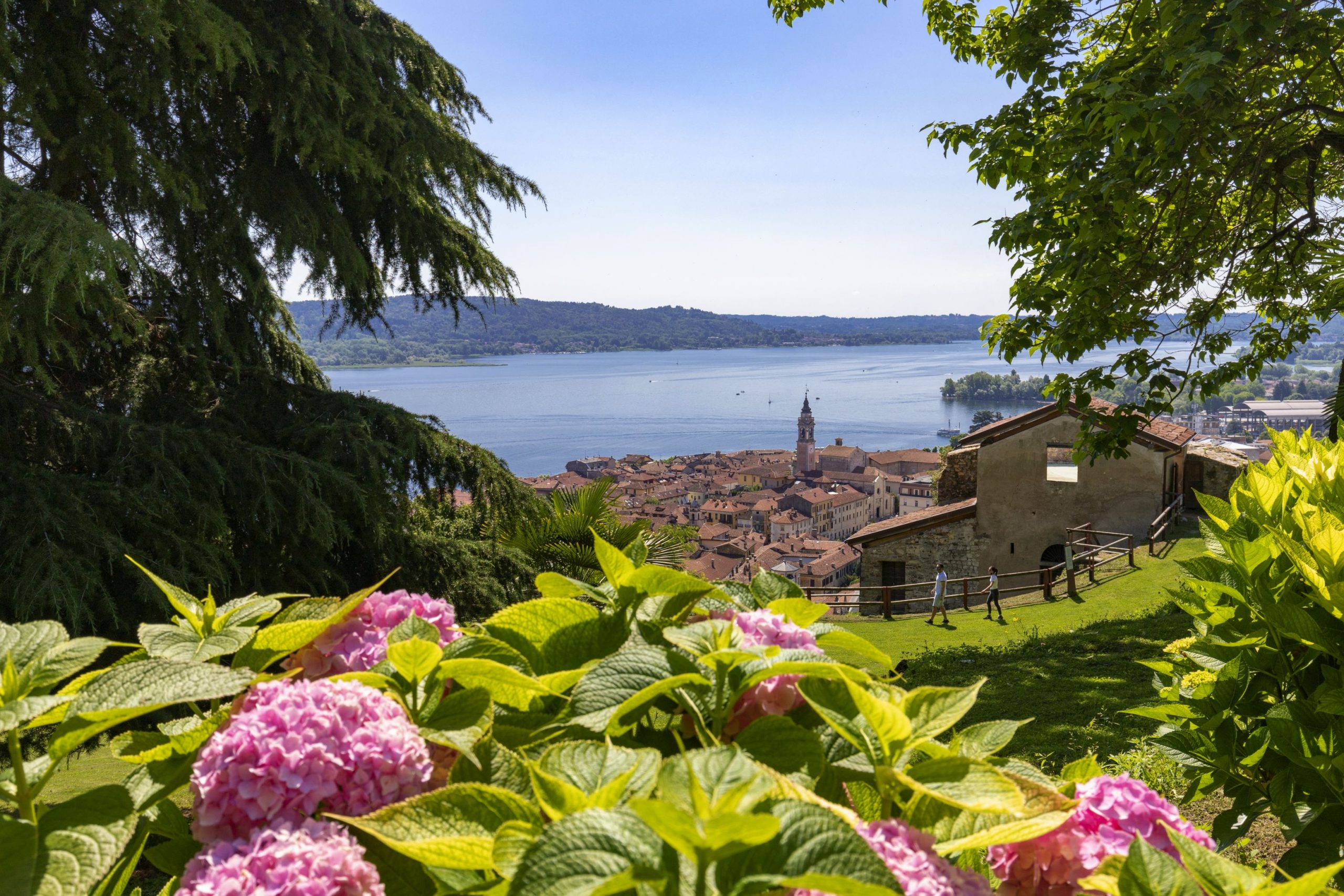
Before embarking on this journey, it is worth a visit to the centre of Arona, with the churches and the Archaeological and Mineralogical Museum, and its immediate surroundings: in particular the Rocca Borromea and the Sacro Monte di San Carlo, which although it has this name, it is not included in the group of UNESCO Sacro Monte sites.
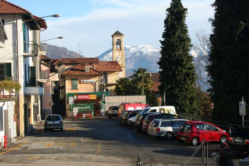
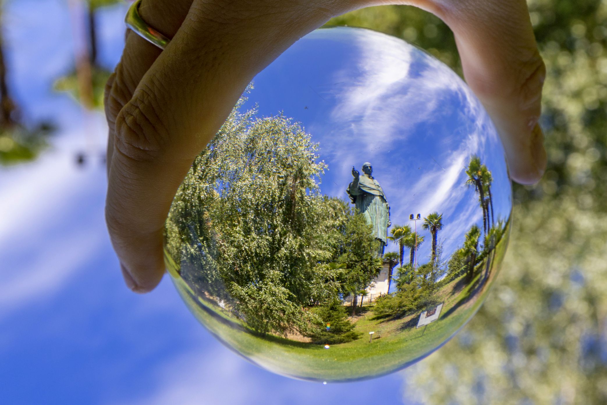
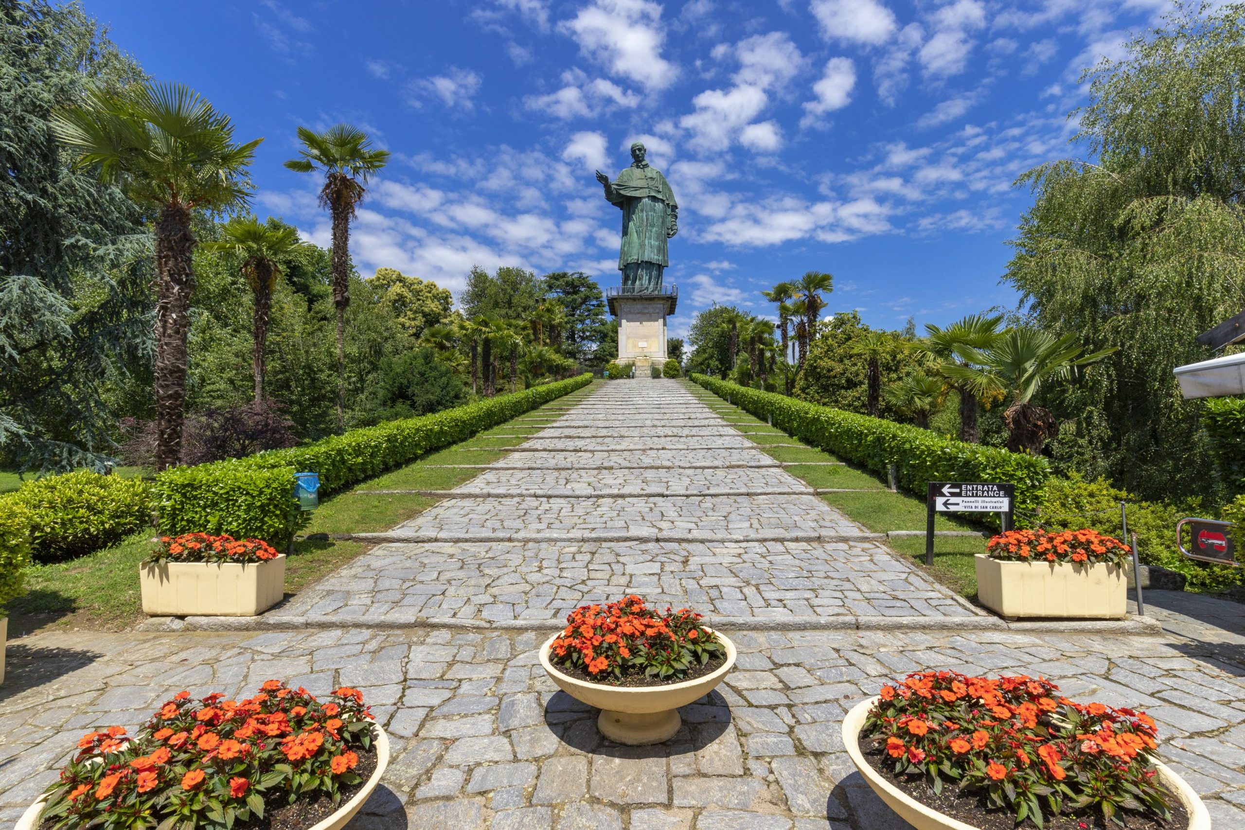
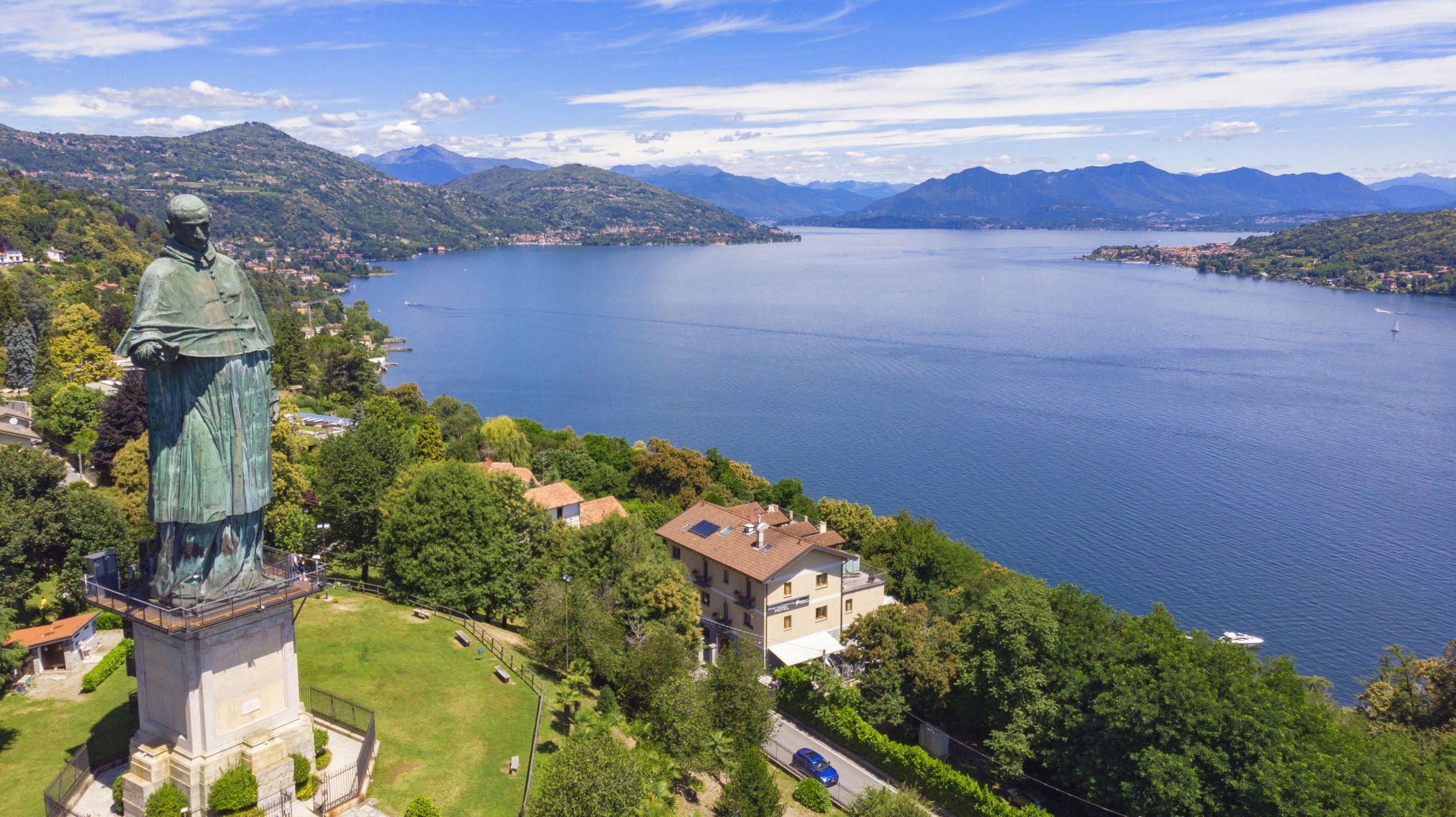
From the colossal statue of San Carlo, more commonly known as “San Carlone”, we leave in the direction of Dagnente, and then to Meina, walking mostly on paved roads that pass through residential areas. We must pay particular attention to road traffic, because most of these roads do not have sidewalks or spaces for pedestrian transit.
In Meina, it may be worth a deviation from the centre to visit the Museum of Meina, housed in the historic Villa Faraggiana
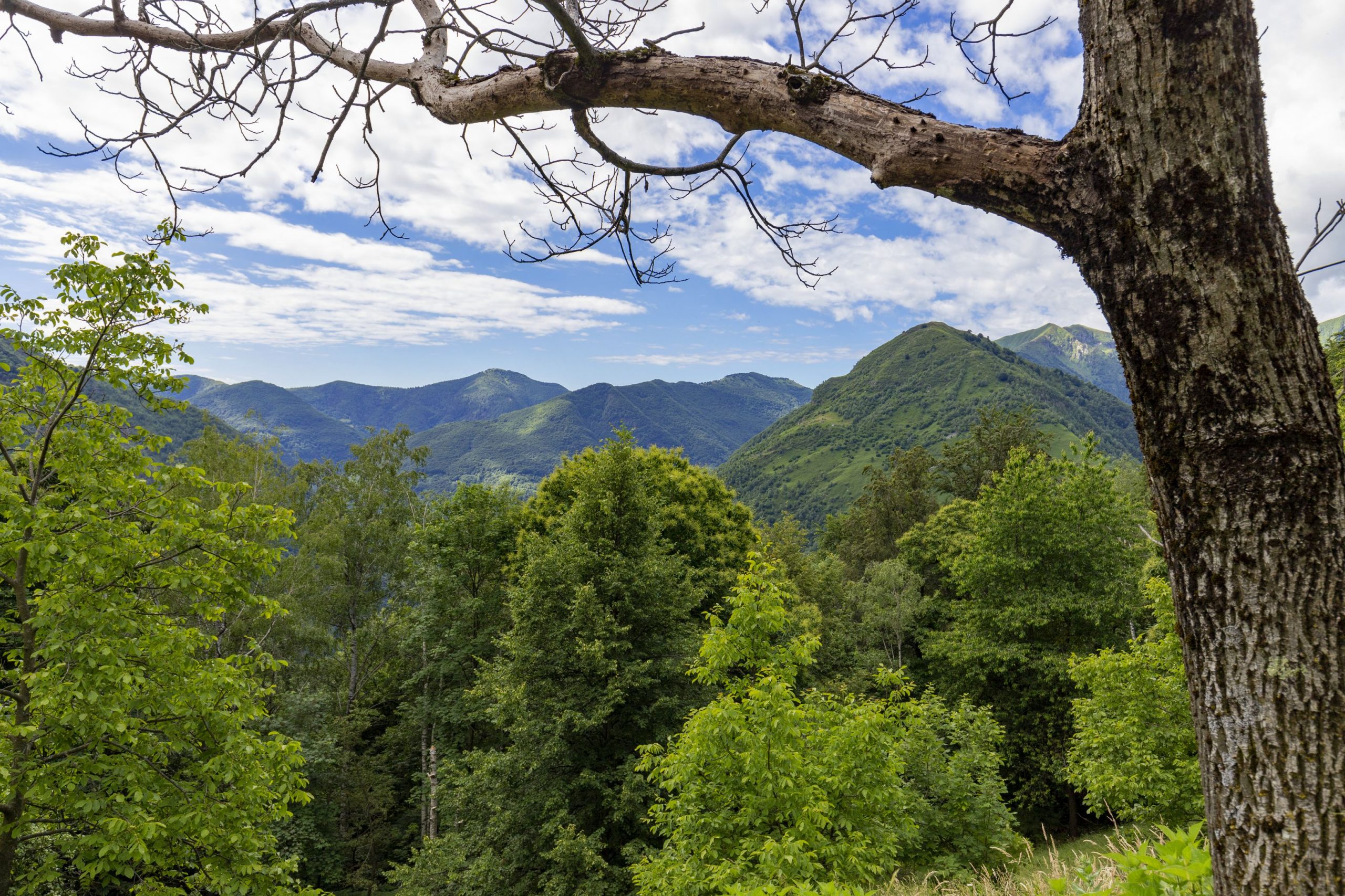
By alternating woodlands with short glimpses of the lake, we quickly come to Lesa, where the trail gains a bit of elevation, and begins to offer hikers a wider scenic view, alternating with historical villas built in the nineteenth century. And here also, we recommend a deviation to visit to the Manzoni Museum.
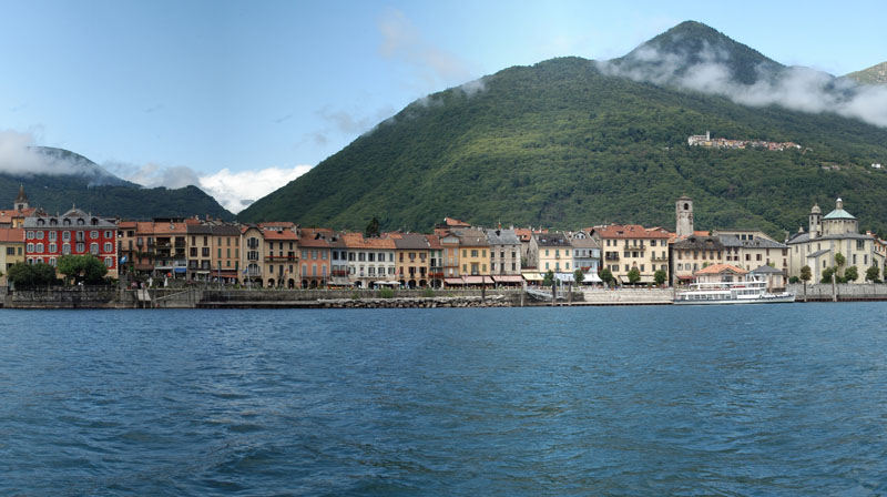
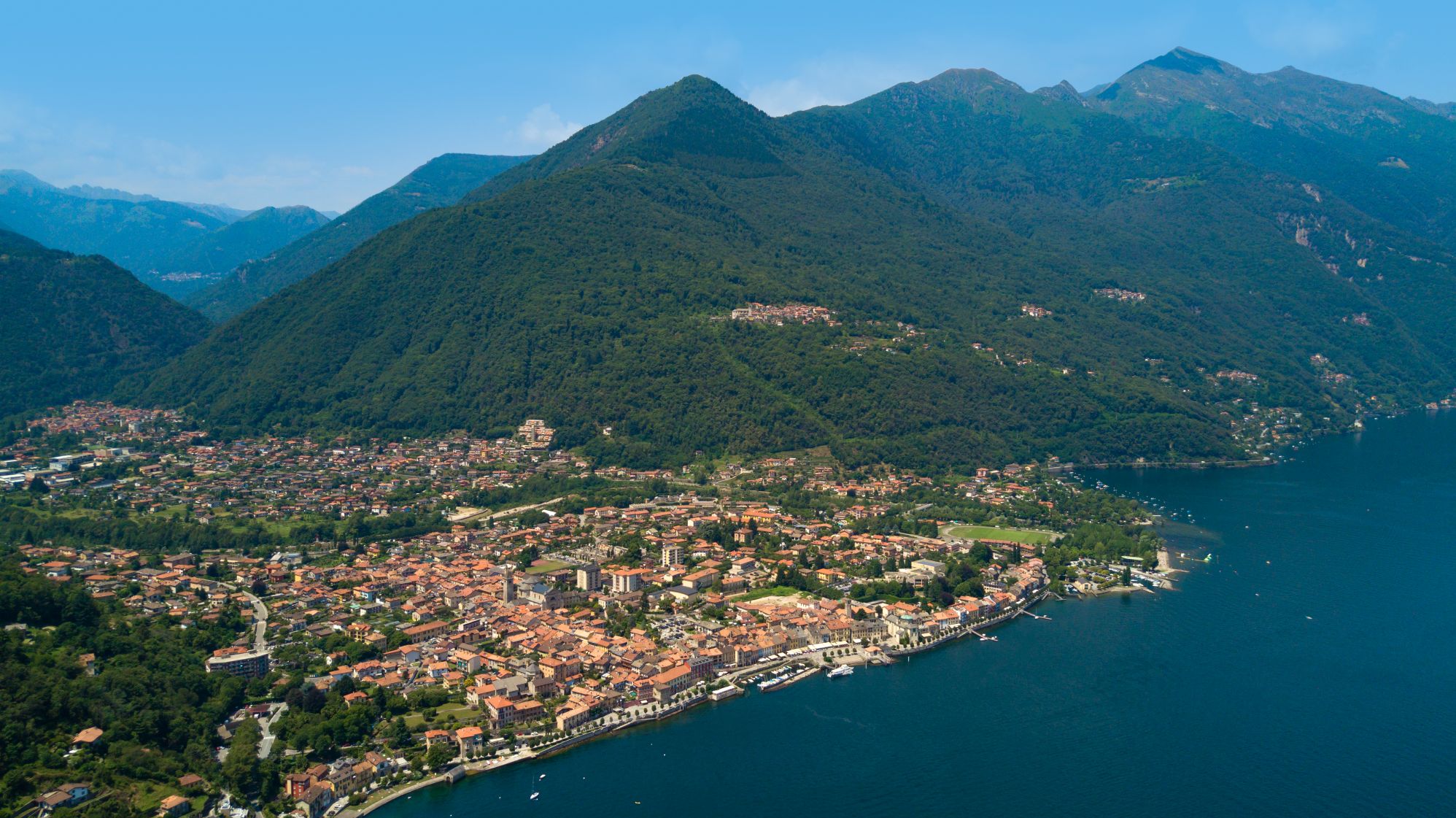
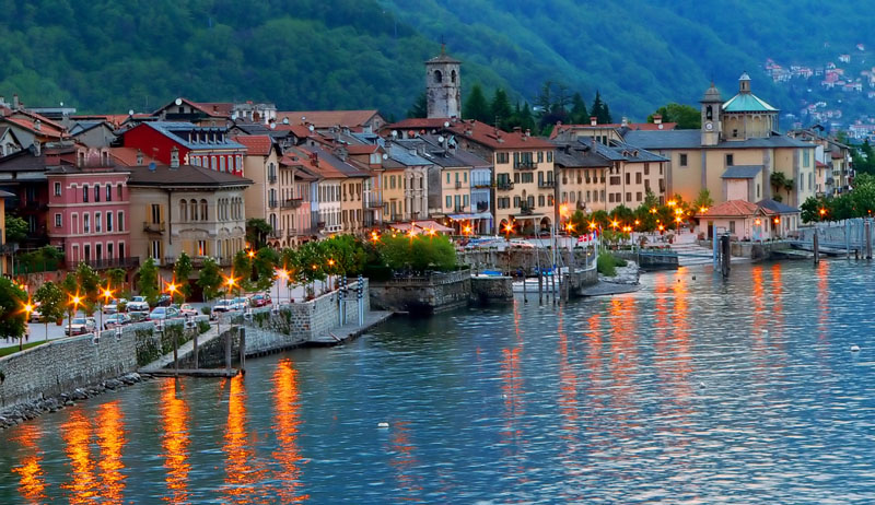
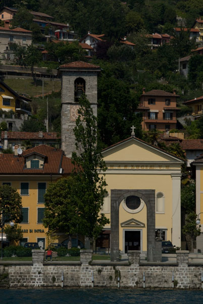
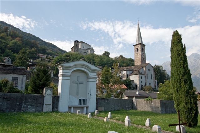
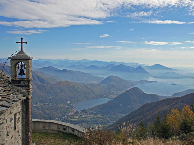
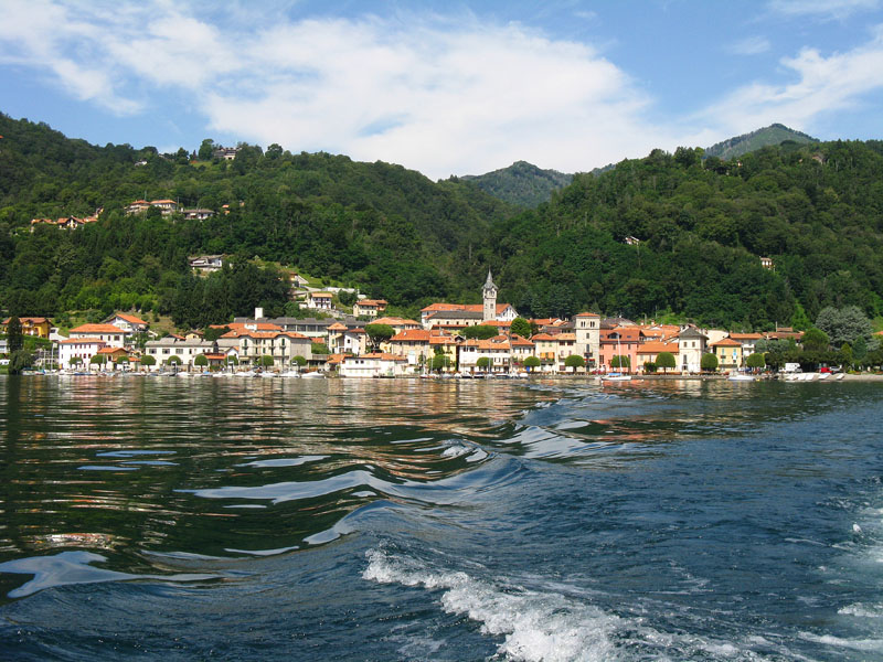
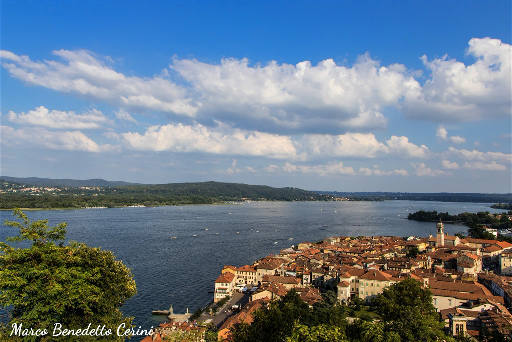
The trail continues through residential areas and some agricultural areas, until it reaches Belgirate, with the majestic Old Church or the Church of Santa Maria, dating back to the ninth century. From here, we see a wide panorama of the lower Verbano.
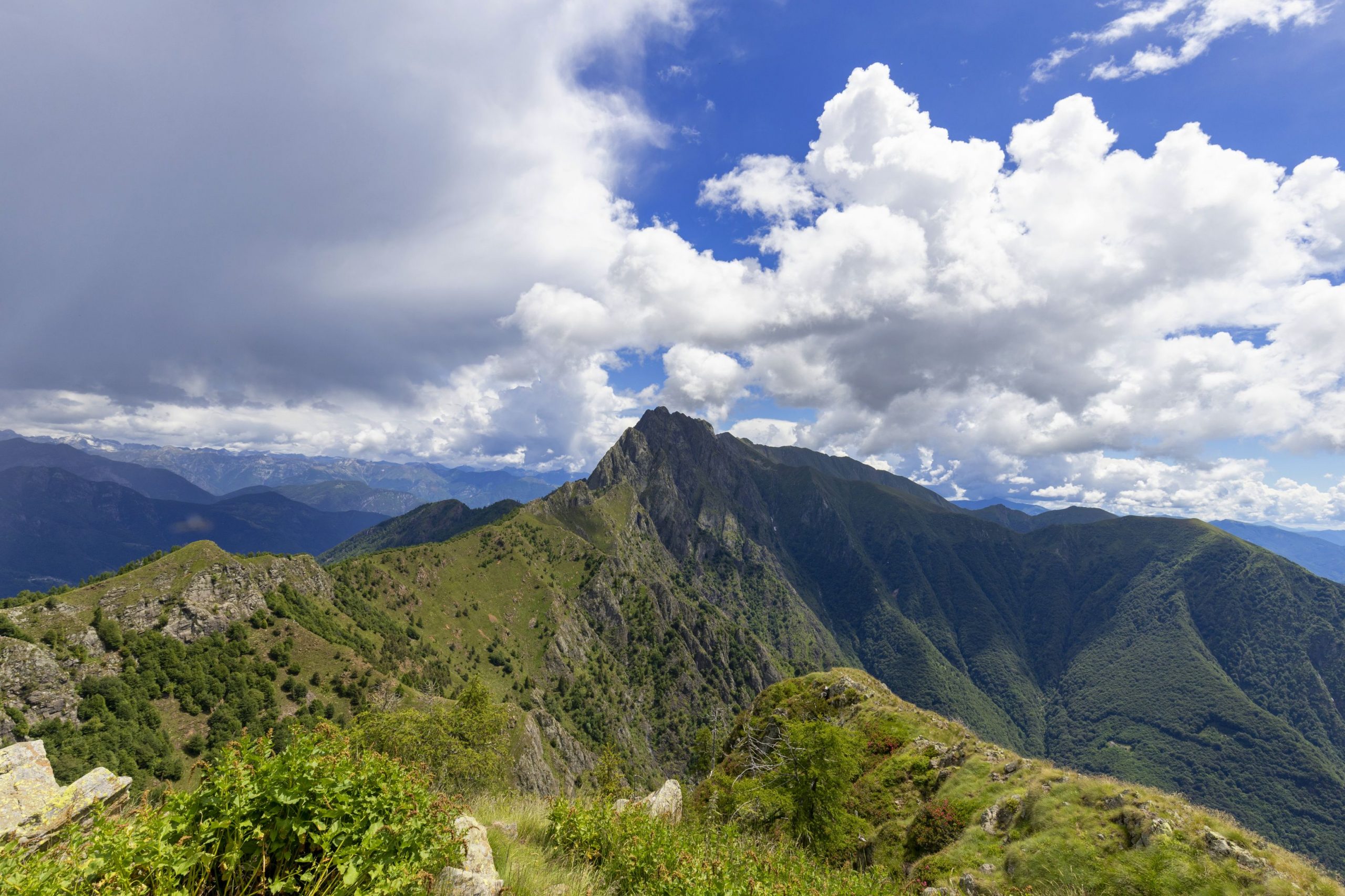
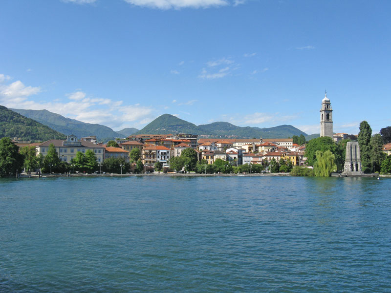
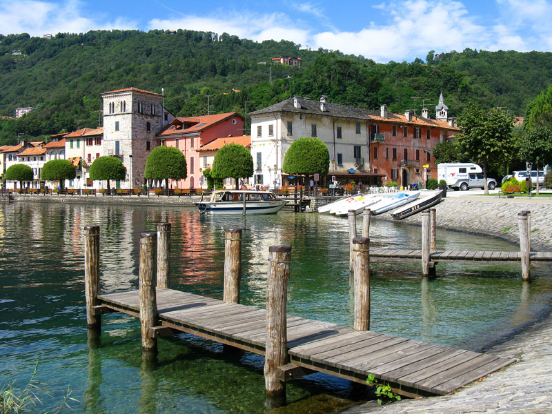
Quickly, we climb in elevation to then continue high above the lake to Stresa and its surrounding villages. At the limit of a glade, we come to the small oratory of St. Paul, near which a few coins from the Roman imperial age were found in addition to a rock with holes in it, evidence that the area was populated in ancient times. The mule track continues up to Magognino, and then descends to the small cemetery where the Church of Sant’Albino is located, another medieval structure, with a small characteristic bell tower not unlike other parish churches of that time.
Now, the trail begins to descend slightly, always on paths and mule tracks, toward Passera and then Stresa, passing behind Villa Pallavicino, which houses a botanical park with local fauna that we can visit.
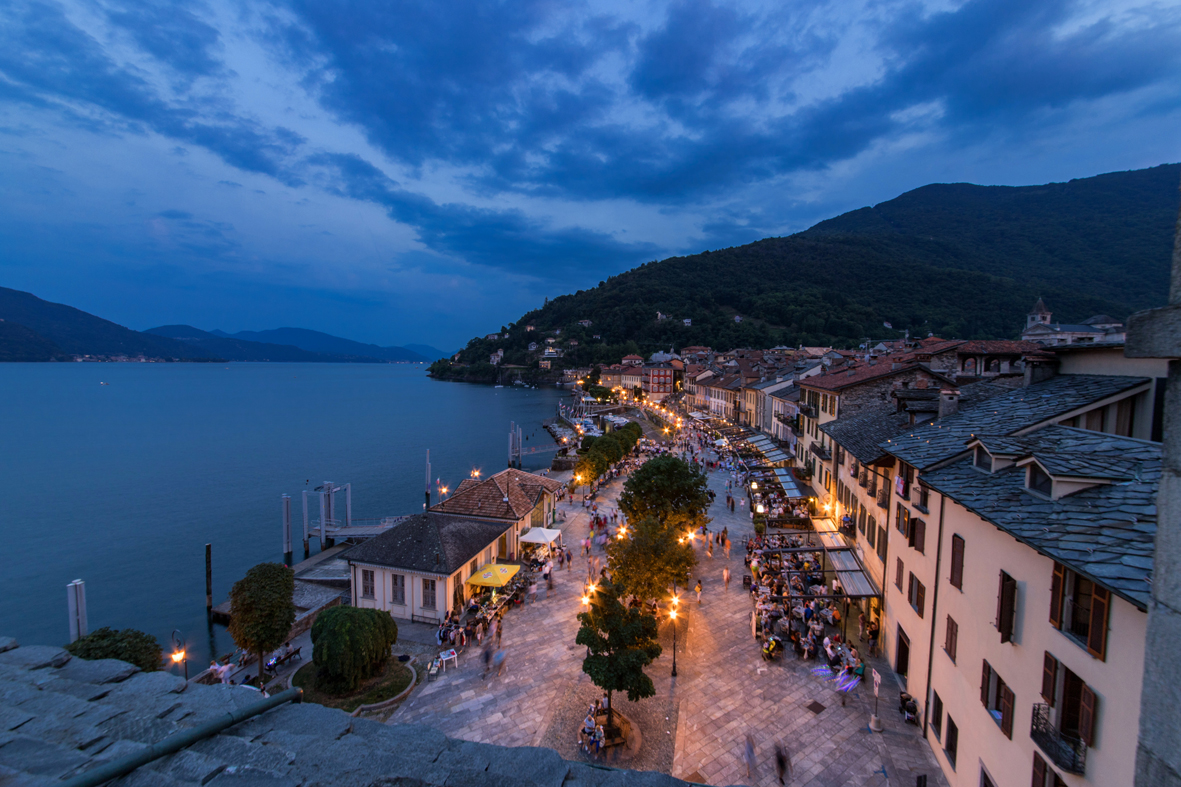
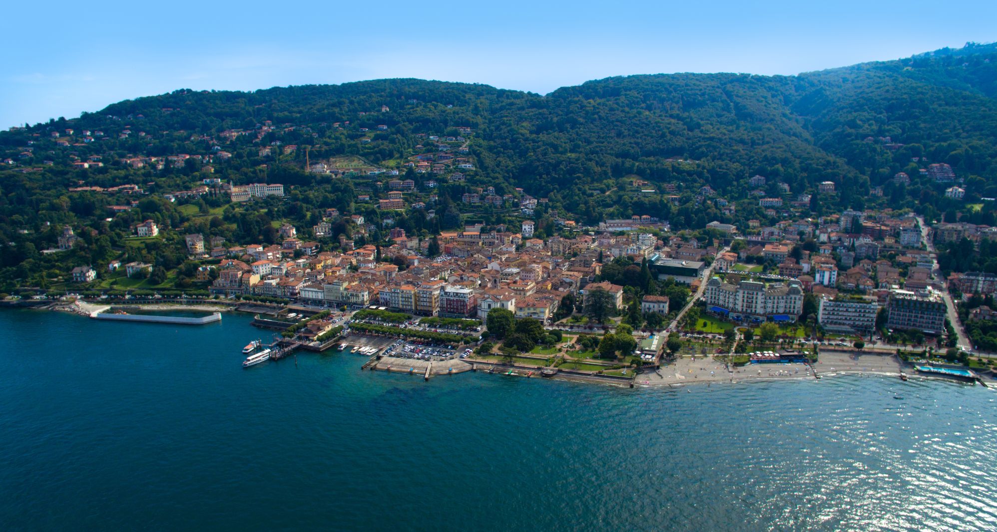
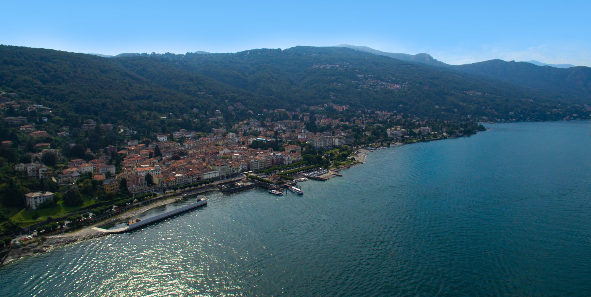
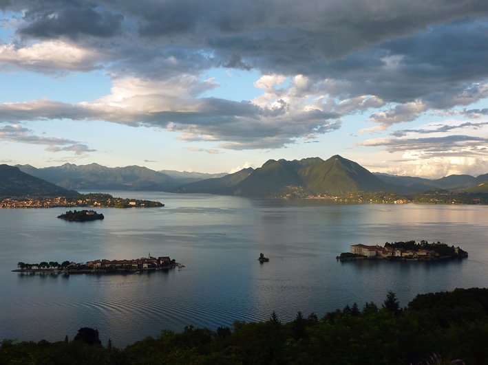
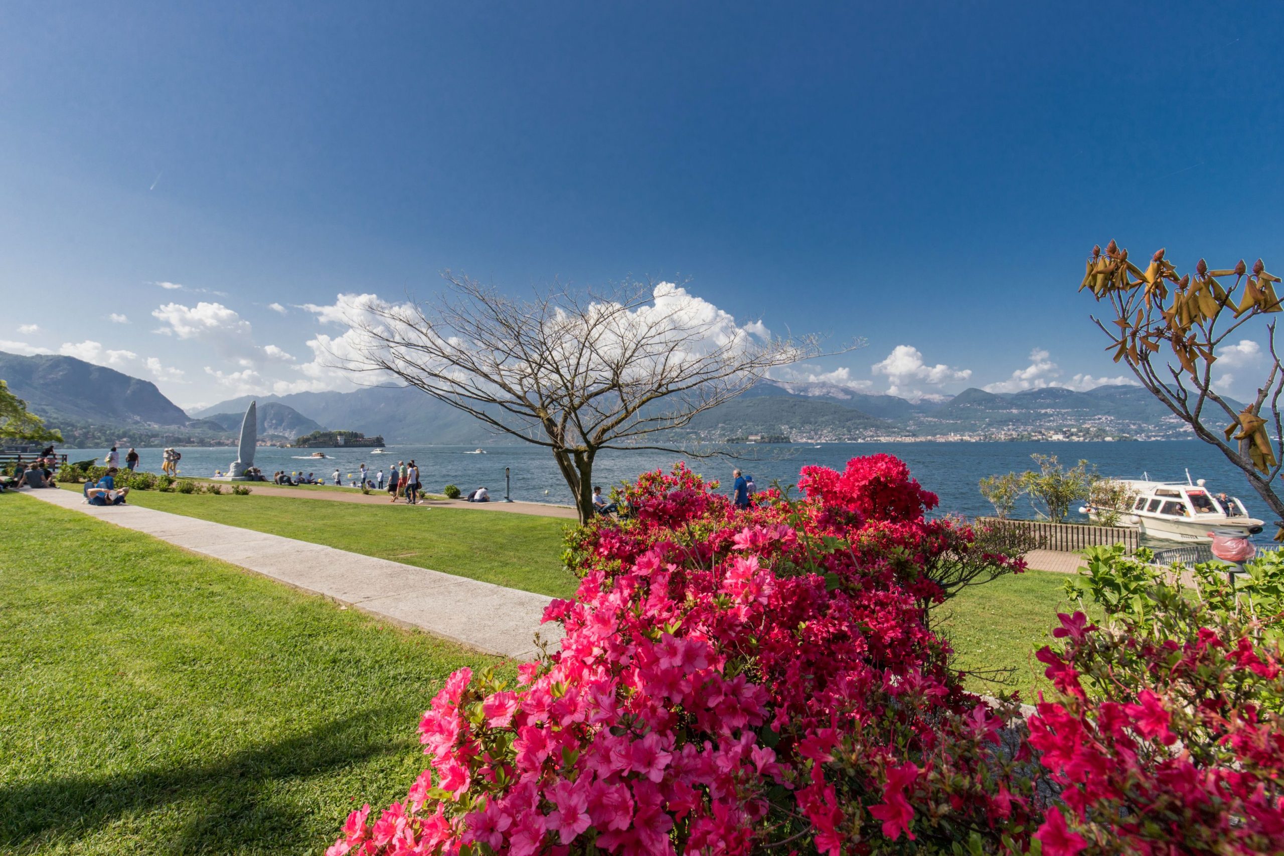
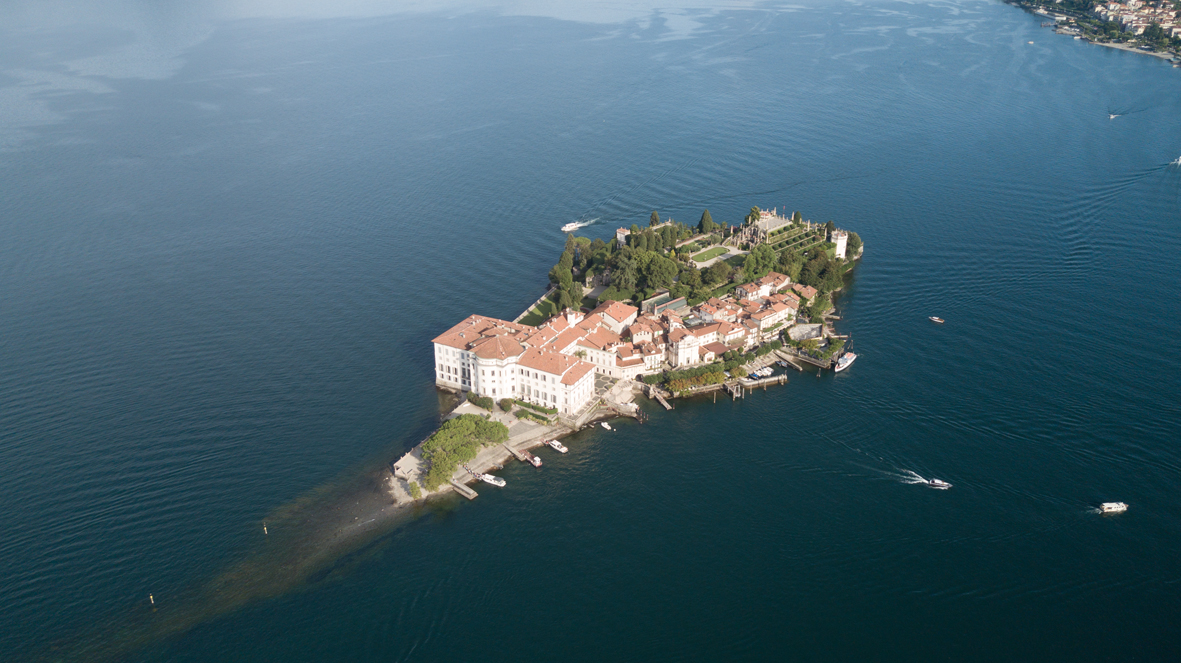
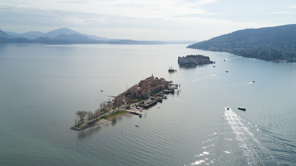
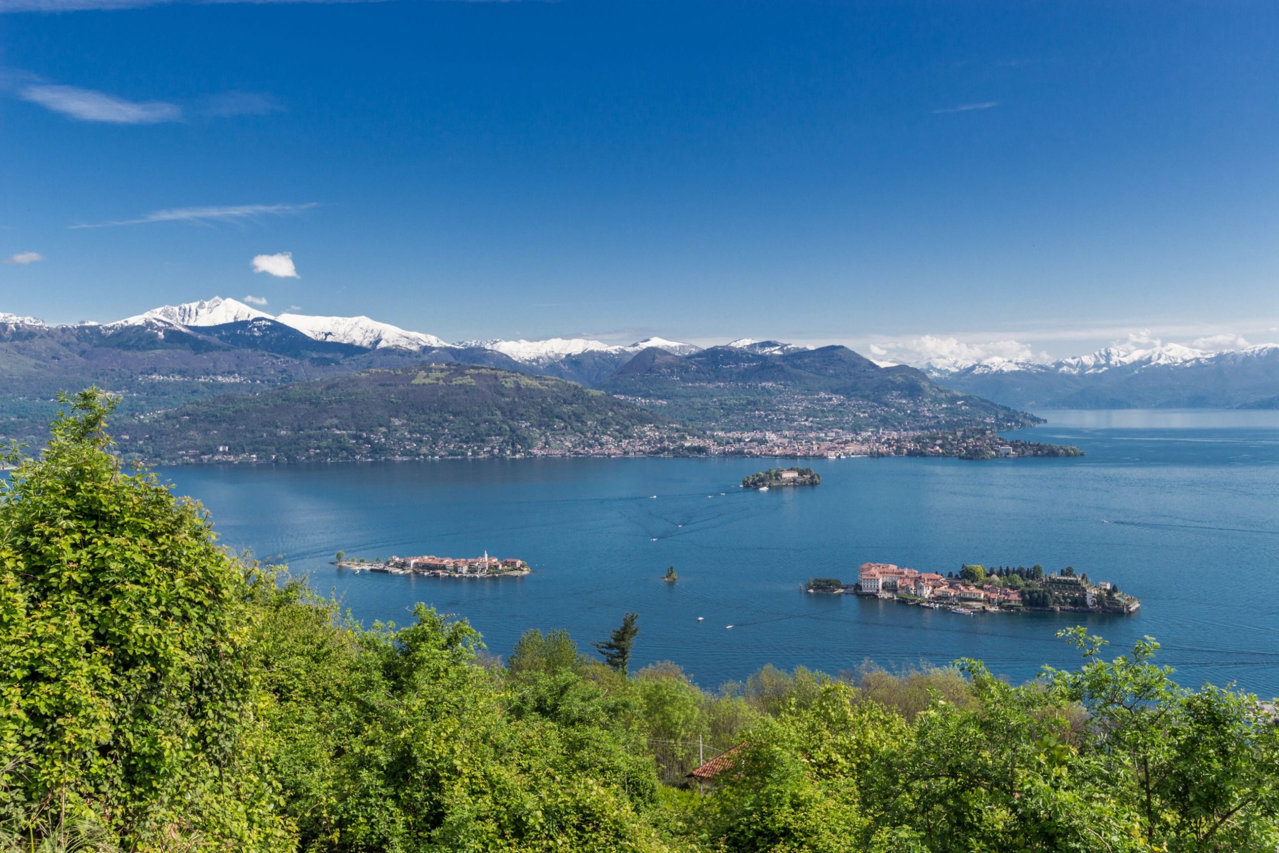
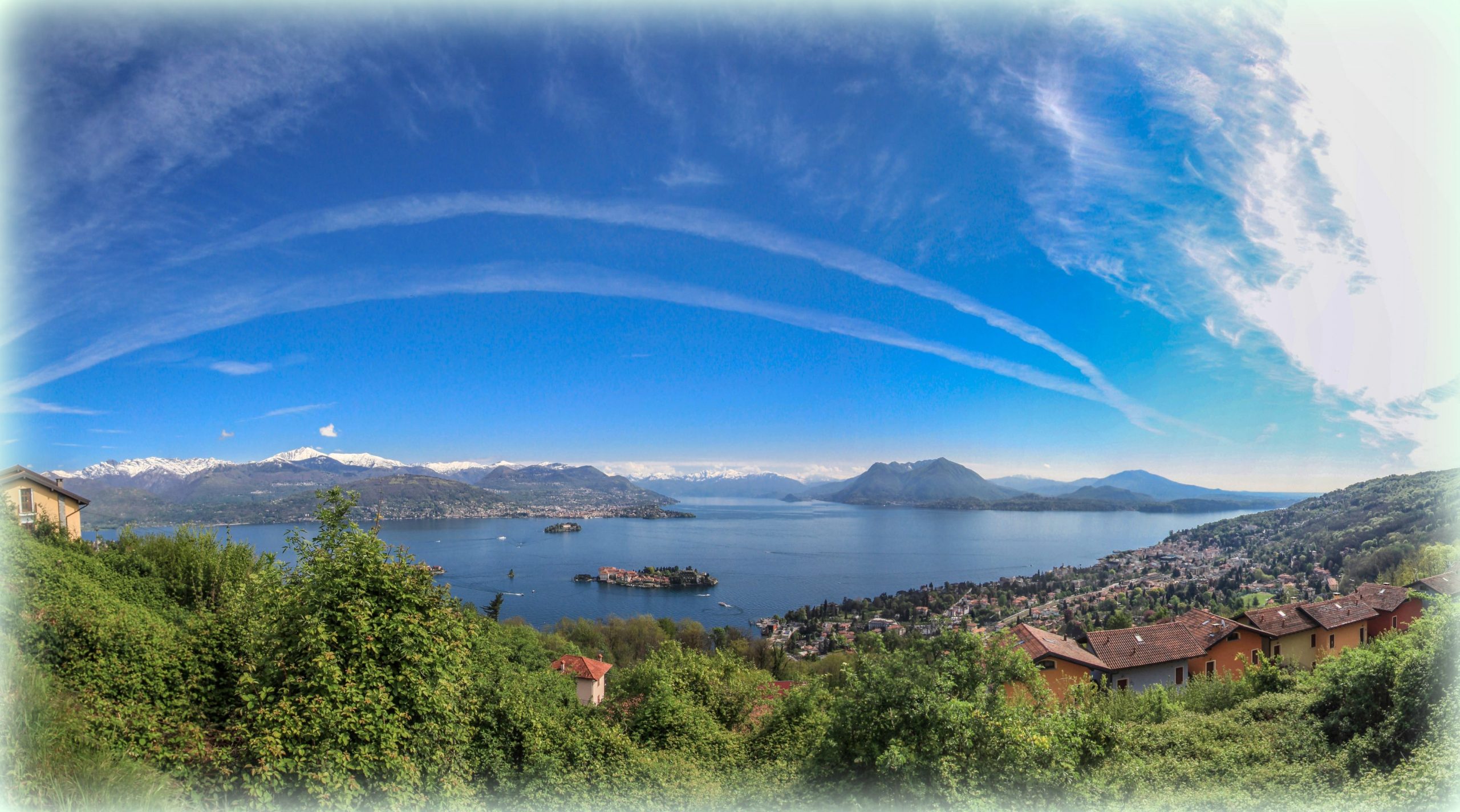
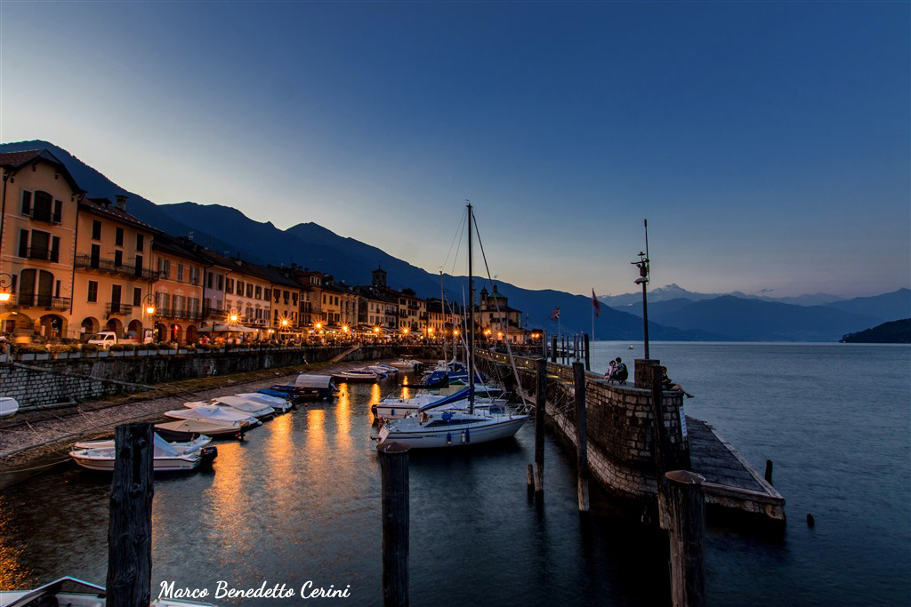
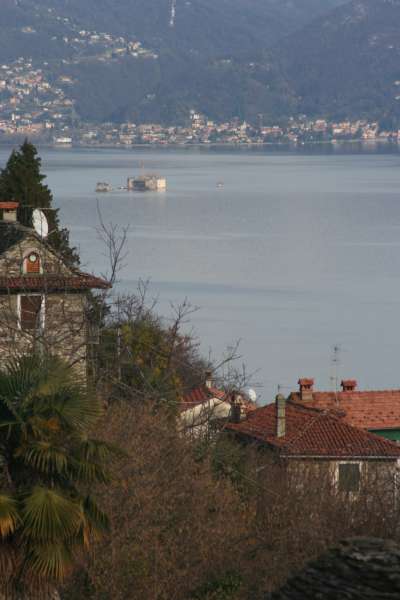
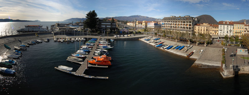
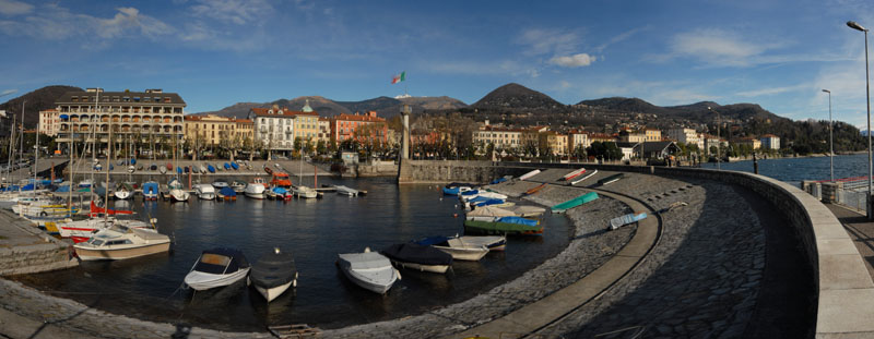
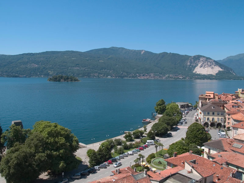
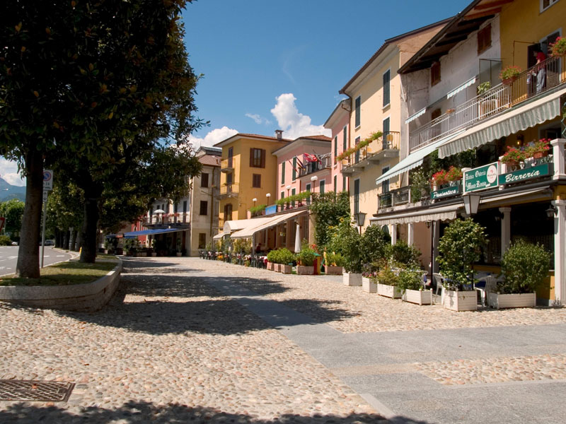
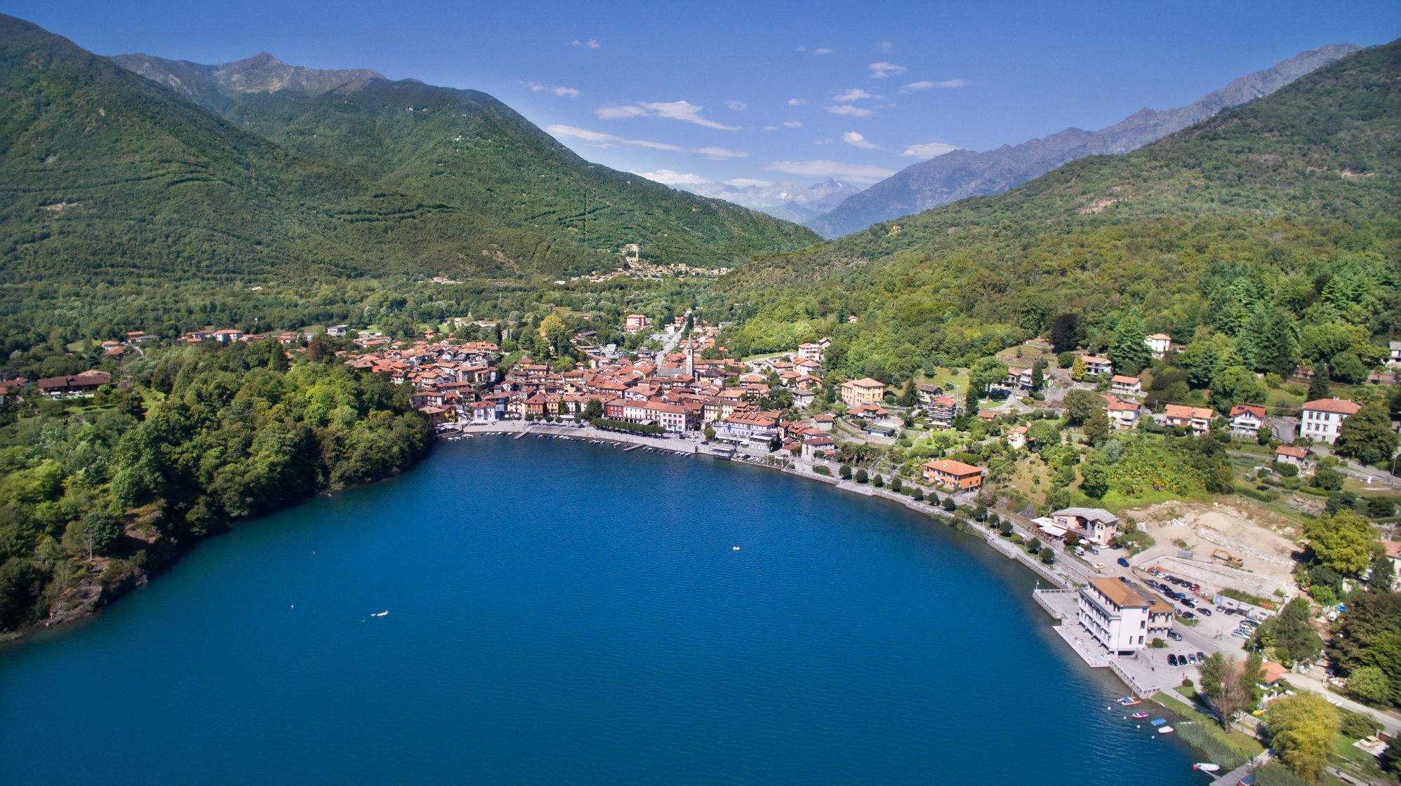
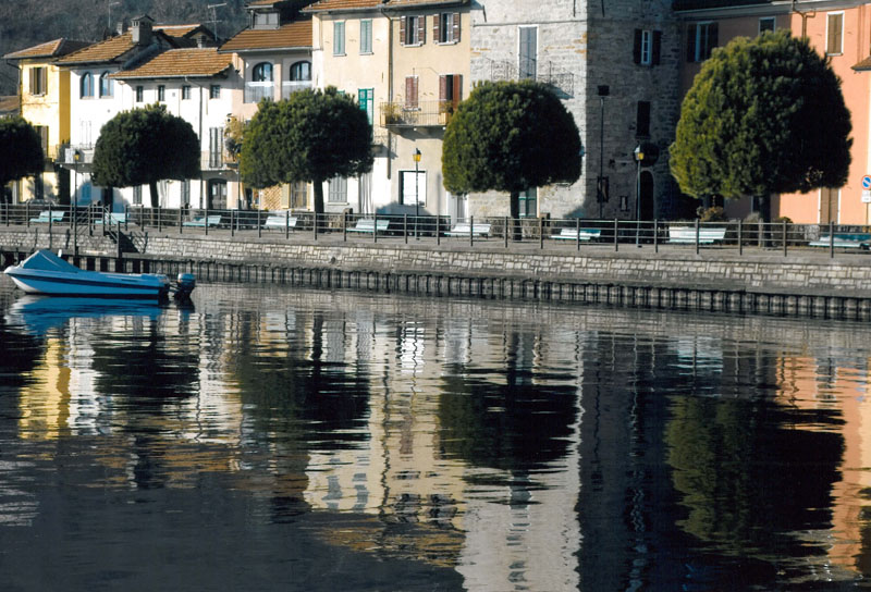
At Stresa, the itinerary runs along the lake, but a visit to the city centre is recommended, and also a boat ride (public or private) to the Borromean Islands (Isola Bella, Isola dei Pescatori and Isola Madre). After passing the big luxury hotels of the Stresa Riviera, it is a short walk up the Sempione State Road to the Hotel Villa Aminta, where the trail rises rapidly and we are immersed in a rural world that strongly contrasts with the lake’s touristic luxury image.
The trail seems level, and going through fields and woods, we reach the hamlet of Baveno and Roncaro, and then descend to the lakeshore.
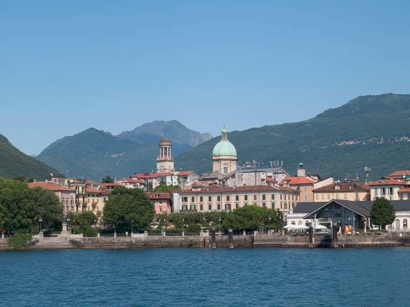
The itinerary touches the city’s tourist-cultural heart, with the Church of SS. Gervasio and Protasio, the Baptistery and the Granum Museum, dedicated to Baveno’s pink granite and the work of masons. Then we continue towards the hamlet of Oltrefiume, which stands at the foot of the quarries of fine granite.
We continue northwards, gradually turning away from the inhabited area and starting a short climb towards the hill that is home to the Tower of Feriolo, a medieval watchtower over the lake and the outlet of Ossola. We then descend to Feriolo, and along the bicycle-pedestrian path, we enter the Natural Reserve of Fondotoce, skirting the area of the reed bed, of considerable naturalistic importance and a place of nesting and passage of numerous species of birds. After leaving the reservation, the trail rises rapidly to the village of Cavandone, with its ancient yew tree, and then on a comfortable mule track we descend to the shore of Lake Maggiore, in the village of Suna.
POINTS OF INTEREST
Arona
Chiesa dei SS Martiri (Chiesa di San Graziano)
Collegiata della Natività di Maria Vergine
Chiesa di Santa Maria di Loreto (Chiesa di Santa Marta)
Colosso di San Carlo
Parco dei Lagoni di Mercurago
Civico Museo Archeologico
Civico Museo Mineralogico
Rocca borromea
Piazza del Popolo
Meina
Museo Meina
Chiesa Santa Margherita
Chiesa La Madonnina
Villa Bonomi
Villa De Savoiroux
Villa Eden
Villa Faraggiana
Villa Faraone
Villa Kitzerow
Villa Paradiso
Villa La Favorita
Lesa
Chiesa San Giorgio
Chiesa San Rocco
Chiesa San Giovanni Battista
Chiesa San Sebastiano
Chiesa San Martino
Santuario Madonna di Campagna
Museo Manzoniano
Palazzo Stampa
Villa Cavallini
Belgirate
Chiesa Santa Maria e San Carlo
Chiesa Vecchia
Oratorio di San Paolo
Casa De Fichard
Casa Martelli
Villa Conelli
Villa Serafini
Villa Principessa Matilde
Stresa
Isole Borromee
Villa Pallavicino
Villa Ducale
Baveno
Chiesa SS. Gervaso e Protasio
Battistero
Museo Granum
Oltrefiume
Torre di Feriolo
Feriolo
Suna
Chiesa di Santa Lucia
Oratorio della Beata Vergine del Buon Rimedio
Torraccia medievale
Cappelle devozionali lungo i Sentieri del Monterosso
Cavandone
Chiesa Parrocchiale della Natività di Maria
FACILITIES
STRUTTURE RICETTIVE
TECHNICAL NOTES
LEGS: the journey is recommended in three legs: from Arona to Belgirate (10 km), from Belgirate to Baveno (10 km), and from Baveno to Suna (13 km)
DIFFERENCE IN ELEVATION: minimum elevation of the itinerary: 204 m a.s.l.; maximum elevation 450 m a.s.l. See the map.
DURATION: from 3 to 6 hours for each leg
TYPE OF PATH: Hiking – MOSTLY DIRT roads but long stretches on asphalt
FOR MORE DETAILS
http://www.distrettolaghi.it
http://www.statuasancarlo.it
http://www.comune.meina.no.it/ComGuidaTuristica.asp
http://www.comune.lesa.no.it/ComGuidaTuristica.asp
http://www.comune.belgirate.vb.it/ComGuidaTuristica.asp
http://www.stresaturismo.it/default.asp
http://www.bavenoturismo.it
Back to the list of routes


From Suna to Cannobio
FROM VERBANIA TO THE SWISS BORDER ALONG THE “VIA DELLE GENTI”
Lago Maggiore
Route description
Itinerary Description
The itinerary involves the historic “Via delle Genti”, an ancient road between the towns of the upper Verbano area and Switzerland.
From Suna, we walk in the direction of Pallanza and take the bicycle-pedestrian path that leads to Intra, with its historical centre and the imposing bell tower of the Basilica of San Vittore.
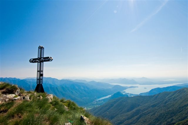
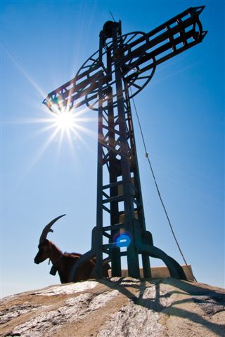
After crossing the San Giovanni river, the trail rises towards Antoliva to arrive at Carpiano: here the trail continues for Bozzela, Frino and finally Ronco, places where the path climbs up to the slopes of Mount Carciago, and the Sacro Monte of the SS. Trinity of Ghiffa.
From the Sacro Monte, we descend towards Deccio. Deviating from the main path leading southward, we cross a secondary road and reach Novaglio, where we get back on the mule-track that leads to Comogno and finally to Oggebbio.
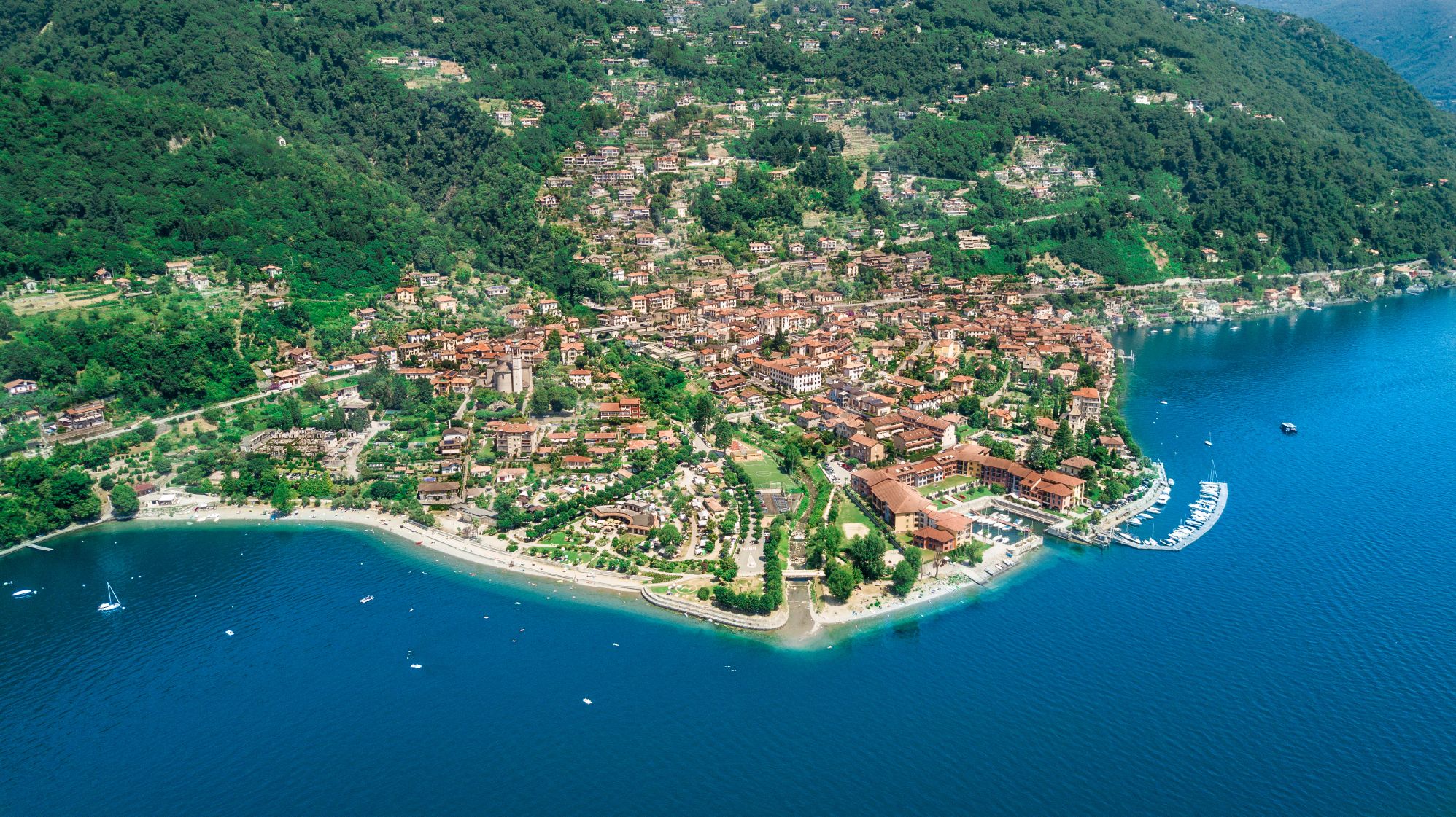
From here, the itinerary resumes halfway up the mountain, passing through Barbè and Cassino. We reach Cannero, whose mild climate and environmental characteristics make this town feel like a coastal location.
Leaving the inhabited centre, we take the ancient road for Switzerland, called “Via delle Genti” (Road of the Peoples), that winds through the woods and meadows, now overgrown with wild vegetation. We reach Carmine Superiore, with its church of San Gottardo. From this medieval village, we can even enjoy a wonderful view the Castles of Cannero .
Before continuing our excursion, we go to Viggiona – taking a mule track northwards – and thus discover the traces of the trenches of the Cadorna line.
Resuming the historic “Via delle Genti”, we reach Molineggi and descend to Cannobio, passing through Solivo. After crossing Cannobino, we continue towards Marchile and Formine: from here, we take a small detour northwards on a beautiful path through the chestnut trees to discover the Church of San Bartolomeo in Montibus.
POINTS OF INTEREST
Suna
Chiesa di Santa Lucia
Oratorio della Beata Vergine del Buon Rimedio
Torraccia medievale
Cappelle devozionali lungo i Sentieri del Monterosso
Cavandone
Chiesa Parrocchiale della Natività di Maria
Pallanza
Chiesa di Madonna di Campagna
Oratorio di San Remigio
Chiesa Parrocchiale di Santo Stefano
Chiesa Collegiata di San Leonardo
Palazzo di città
Villa Rusconi Clerici
Villa Taranto
Villa Giulia
Mausoleo Cadorna
Museo del Paesaggio
Intra
Basilica di San Vittore
Oratorio di Santa Marta
Chiesa di San Fabiano
Chiesa Evangelica Metodista
Casa del Lago
Palazzo Flaim
Ghiffa
Sacro Monte della SS. Trinità
Chiesa Parrocchiale di San Maurizio
Museo dell’Arte del Cappello
Oggebbio
Chiesa parrocchiale di San Pietro
Oratorio della natività di Maria (frazione Cadessino)
Chiesa di Sant’Agata (frazione Novaglio)
Villa Anelli (Gonte)
Cannero
Chiesa Parrocchiale di San Giorgio
Grotta della Madonna di Lourdes
Castelli di Cannero
Villa della Sabbioncella
Museo etnografico e della spazzola
Parco degli Agrumi
Oratorio di Santa Lucia (Piancassone)
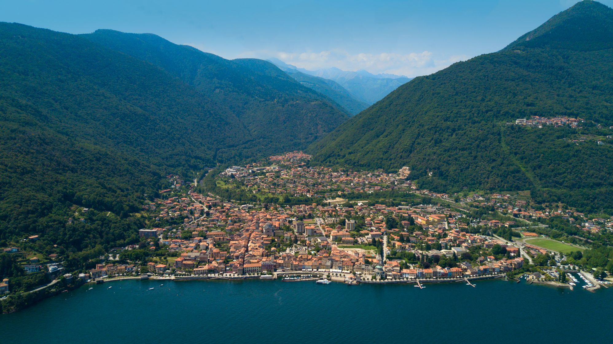
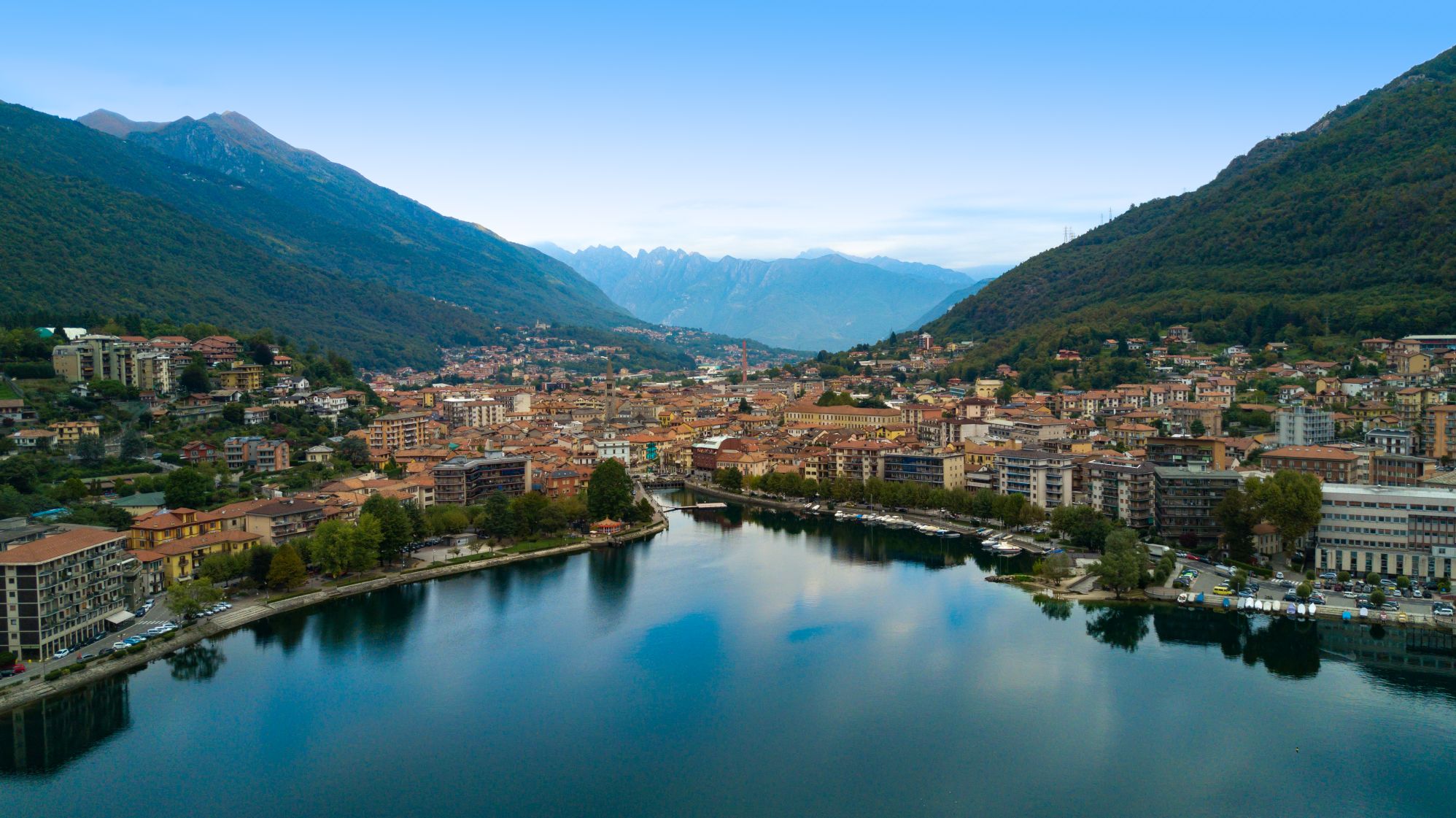
Cannobio
Santuario della SS. Pietà
Collegiata di San Vittore
Casa Pironi
Palazzo della Ragione
Chiesa di Sant’Agata
Chiesa di San Bartolomeo in Montibus
Orrido di Sant’Anna
FACILITIES
STRUTTURE RICETTIVE
TECHNICAL NOTES
LEGS: the journey is recommended in two legs: from Suna to Cannero Riviera (km), from Cannero Riviera to San Bartolomeo (15 km)
DIFFERENCE IN ELEVATION: minimum elevation of the itinerary: 204 m a.s.l.; maximum elevation 450 m a.s.l. See the map.
DURATION: from 3 to 6 hours for each leg
TYPE OF PATH: Hiking – MOSTLY DIRT roads but long stretches on asphalt
FOR MORE DETAILS
http://www.provincia.verbano-cusio-ossola.it
http://www.sacri-monti.com
http://www.distrettolaghi.it
http://www.sacromonteghiffa.it
http://www.cmverbano.net
Back to the list of routes
From Suna to Cannobio
FROM VERBANIA TO THE SWISS BORDER ALONG THE “VIA DELLE GENTI”
Lago d’Orta
Route description
Itinerary Description
The itinerary involves the historic “Via delle Genti”, an ancient road between the towns of the upper Verbano area and Switzerland.
From Suna, we walk in the direction of Pallanza and take the bicycle-pedestrian path that leads to Intra, with its historical centre and the imposing bell tower of the Basilica of San Vittore.
After crossing the San Giovanni river, the trail rises towards Antoliva to arrive at Carpiano: here the trail continues for Bozzela, Frino and finally Ronco, places where the path climbs up to the slopes of Mount Carciago, and the Sacro Monte of the SS. Trinity of Ghiffa.
From the Sacro Monte, we descend towards Deccio. Deviating from the main path leading southward, we cross a secondary road and reach Novaglio, where we get back on the mule-track that leads to Comogno and finally to Oggebbio.
From here, the itinerary resumes halfway up the mountain, passing through Barbè and Cassino. We reach Cannero, whose mild climate and environmental characteristics make this town feel like a coastal location.
Leaving the inhabited centre, we take the ancient road for Switzerland, called “Via delle Genti” (Road of the Peoples), that winds through the woods and meadows, now overgrown with wild vegetation. We reach Carmine Superiore, with its church of San Gottardo. From this medieval village, we can even enjoy a wonderful view the Castles of Cannero .
Before continuing our excursion, we go to Viggiona – taking a mule track northwards – and thus discover the traces of the trenches of the Cadorna line.
Resuming the historic “Via delle Genti”, we reach Molineggi and descend to Cannobio, passing through Solivo. After crossing Cannobino, we continue towards Marchile and Formine: from here, we take a small detour northwards on a beautiful path through the chestnut trees to discover the Church of San Bartolomeo in Montibus.
POINTS OF INTEREST
Suna
Chiesa di Santa Lucia
Oratorio della Beata Vergine del Buon Rimedio
Torraccia medievale
Cappelle devozionali lungo i Sentieri del Monterosso
Cavandone
Chiesa Parrocchiale della Natività di Maria
Pallanza
Chiesa di Madonna di Campagna
Oratorio di San Remigio
Chiesa Parrocchiale di Santo Stefano
Chiesa Collegiata di San Leonardo
Palazzo di città
Villa Rusconi Clerici
Villa Taranto
Villa Giulia
Mausoleo Cadorna
Museo del Paesaggio
Intra
Basilica di San Vittore
Oratorio di Santa Marta
Chiesa di San Fabiano
Chiesa Evangelica Metodista
Casa del Lago
Palazzo Flaim
Ghiffa
Sacro Monte della SS. Trinità
Chiesa Parrocchiale di San Maurizio
Museo dell’Arte del Cappello
Oggebbio
Chiesa parrocchiale di San Pietro
Oratorio della natività di Maria (frazione Cadessino)
Chiesa di Sant’Agata (frazione Novaglio)
Villa Anelli (Gonte)
Cannero
Chiesa Parrocchiale di San Giorgio
Grotta della Madonna di Lourdes
Castelli di Cannero
Villa della Sabbioncella
Museo etnografico e della spazzola
Parco degli Agrumi
Oratorio di Santa Lucia (Piancassone)
Cannobio
Santuario della SS. Pietà
Collegiata di San Vittore
Casa Pironi
Palazzo della Ragione
Chiesa di Sant’Agata
Chiesa di San Bartolomeo in Montibus
Orrido di Sant’Anna
FACILITIES
STRUTTURE RICETTIVE
TECHNICAL NOTES
LEGS: the journey is recommended in two legs: from Suna to Cannero Riviera (km), from Cannero Riviera to San Bartolomeo (15 km)
DIFFERENCE IN ELEVATION: minimum elevation of the itinerary: 204 m a.s.l.; maximum elevation 450 m a.s.l. See the map.
DURATION: from 3 to 6 hours for each leg
TYPE OF PATH: Hiking – MOSTLY DIRT roads but long stretches on asphalt
FOR MORE DETAILS
http://www.provincia.verbano-cusio-ossola.it
http://www.sacri-monti.com
http://www.distrettolaghi.it
http://www.sacromonteghiffa.it
http://www.cmverbano.net
Back to the list of routes


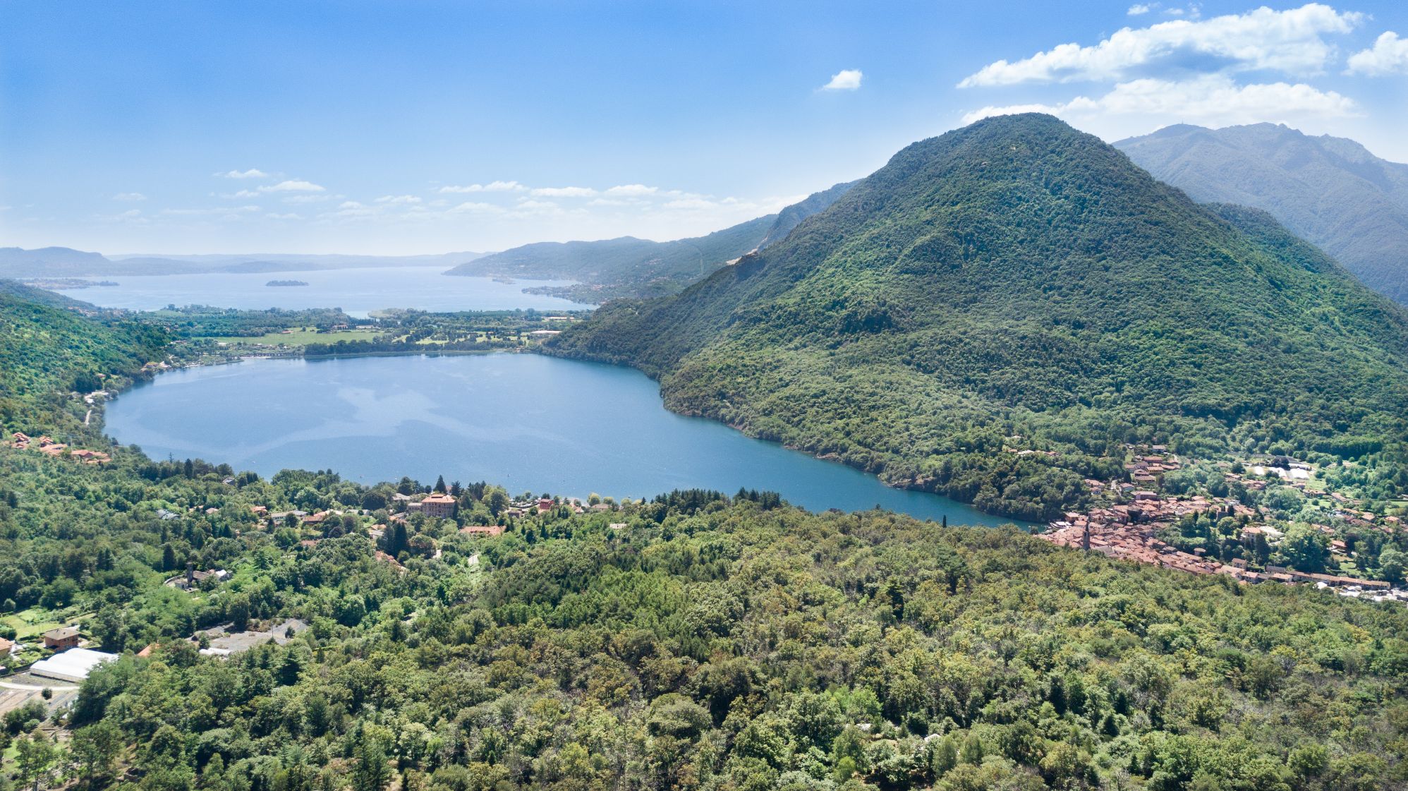
From Arona to Pella
PATH OF SAN CARLO: FROM LAKE MAGGIORE TO LAKE ORTA THROUGH THE VERGANTE
Lago d’Orta
Route description
Itinerary Description
This itinerary retraces the first part of the so-called “Journey of San Carlo“, the long religious pilgrimage that starts from Arona and – via the Sacred Mountains of Orta, Varallo and Oropa – joins the Via Francigena. In the mid-sixteenth century, Cardinal Carlo Borromeo travelled this path more than once, which is the reason behind its name.
Specifically, this itinerary unites the lakes Verbano and Cusio (Maggiore and Orta), from Arona to Pella, passing through the upper Vergante territory, through the green valleys of Vévera and Agogna. The slope on the Cusio side offers many devotional paths that ascend Monte Mesma to reach the convent and seventeenth century church. From the top of the hill, we can enjoy an impressive view of Lake Orta and, in particular, the majestic peaks of Monte Rosa.
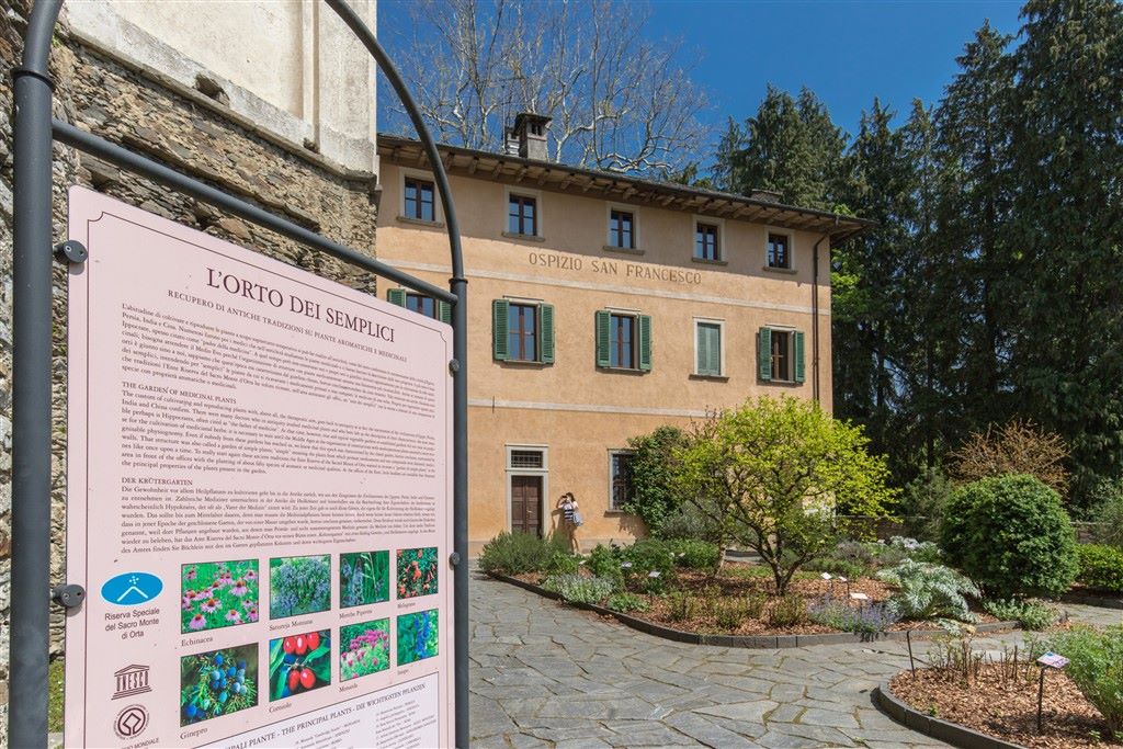
On the way down, we pass through Lortallo, Legro and Orta, where the Sacro Monte complex dedicated to San Francis of Assisi was built. The final part of this devotional journey ends at the lakeside village of Pella.
The trip starts in Arona, near the colossus of San Carlo, more commonly known as “San Carlone“. We go towards Dagnente and Meina, and after a certain distance on the road for Montrigiasco, we turn off in near the locality of Campagna and travel through the dense woodlands to reach the lakes of San Carlo.
The journey continues to the Church of Sant’Eufemia in Paruzzaro, and then on to Invorio, which is considered the “gate to Vergante” thanks to its central position between the lakes Cusio and Verbano. After leaving the town, we follow the provincial road that leads to the upper Vergante area and on dirt roads through dense vegetation we reach Monte Barro, where we can admire the ancient medieval village and small church dedicated to Santa Maria Annunziata (St. Mary of the Annunciation).
From here, we return by the same road and then go north, on a path with slight rises and drops on the east side of Mount Motto Alto. After this part, the trail turns into a mule path that descends towards the end of the river Agogna and reaches Ameno.
After crossing the bridge that connects Ameno to its hamlets beyond the Agogna River, the road continues to the small valley of the Membra Creek. We keep to the right bank of the Agogna until we reach the Special Natural Reserve of Monte Mesma, where the path becomes wilder, in close contact with the vegetation. Once on the provincial road from Bolzano Novarese, we continue along the devotional path that rises up toward the top of the hill, where there are many chapels. A series of turns brings the pilgrims to the tops of Monte Mesma, where we reach the convent and church, both seventeenth century architecture, run by Franciscan Friars.
From Monte Mesma, the path descends along the Via Crucis (Way of the Cross) that leads up to the provincial road of Bolzano Novarese and Miasino: after a short stretch of this road, we enter the path that leads to Lortallo, a hamlet in the Ameno municipality, and continues on to the meet the road that runs from Gozzano to Miasino.
We continue along the “pedestrian street of Prisciola”, to reach Legro, a hamlet in the Municipality of Orta. Its impressive frescoed houses have caused it to become one of “Italy’s painted villages“.
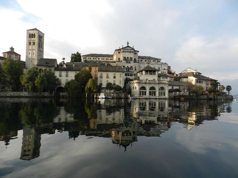
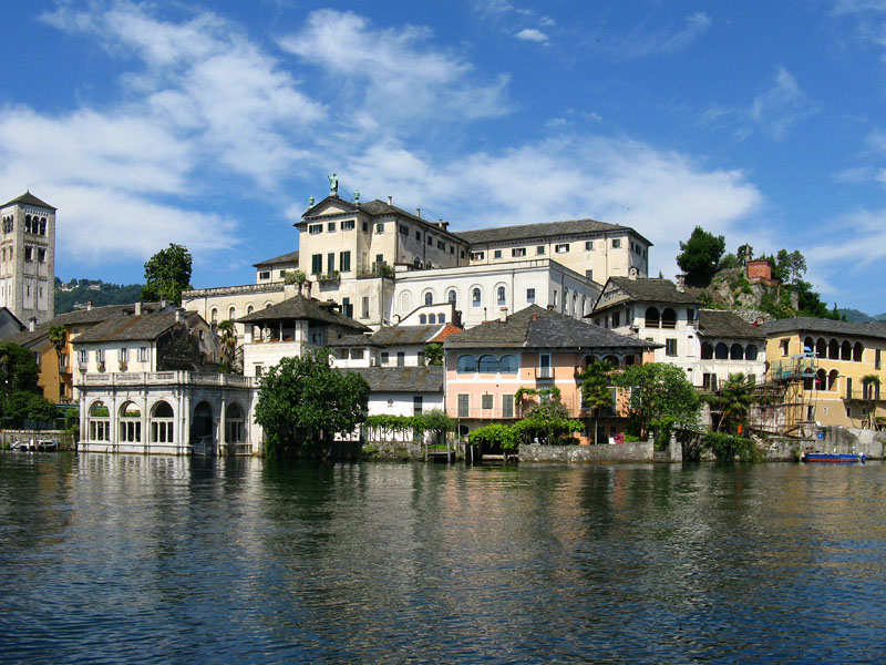
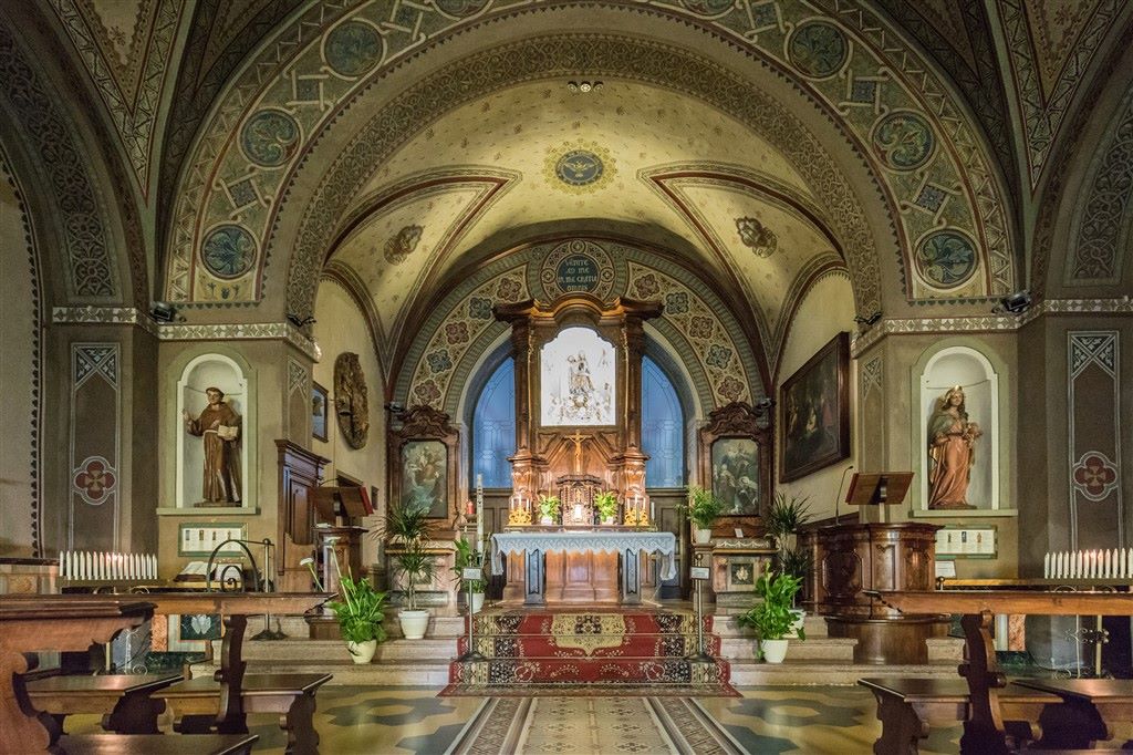
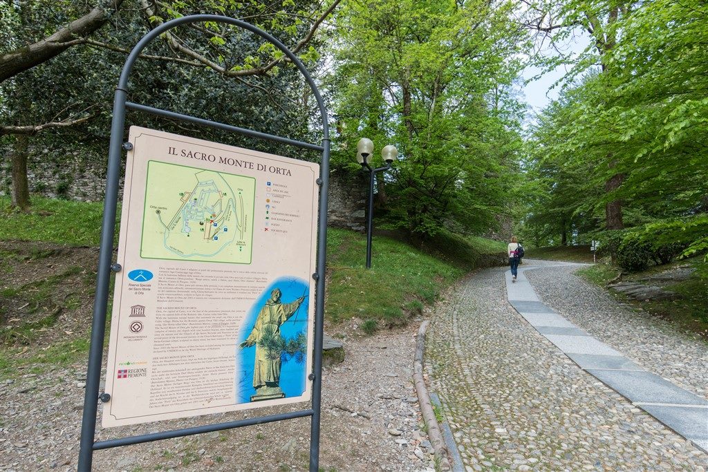
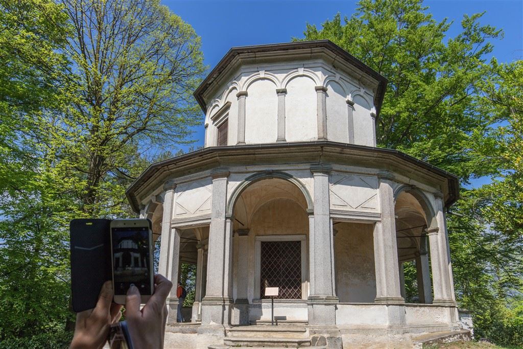
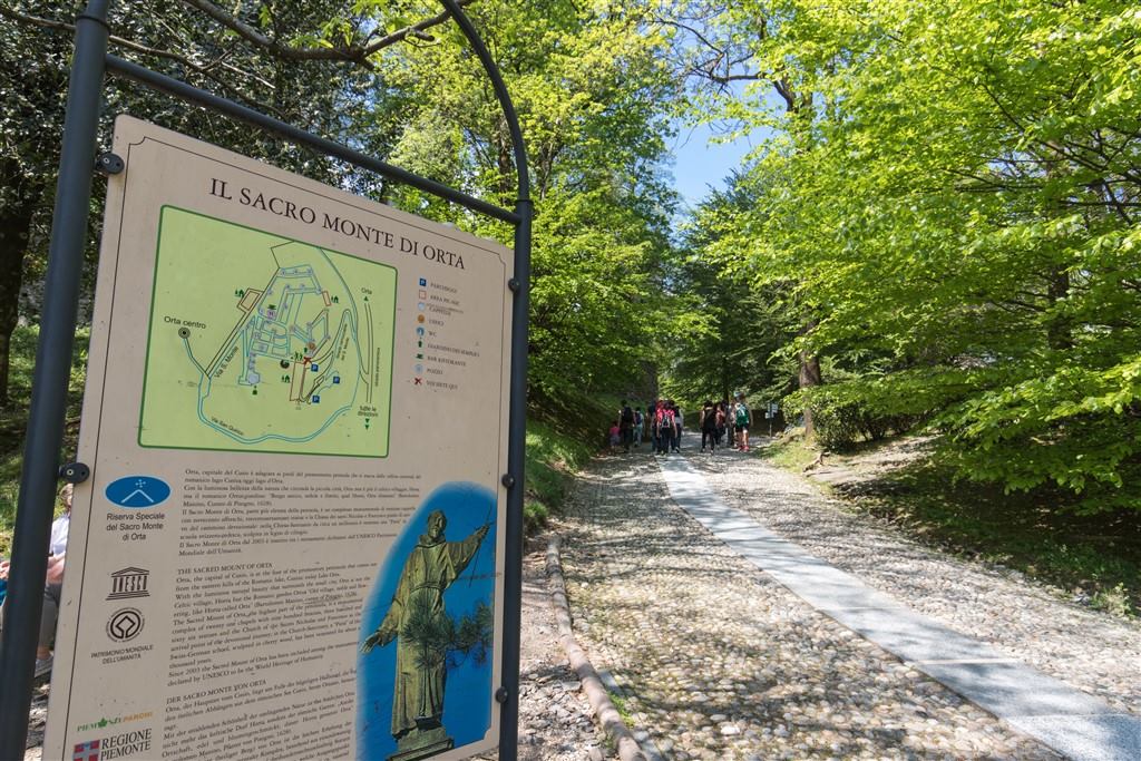
After leaving this lovely village, the journey leads to Orta on a pedestrian path that passes underneath the railway. Upon arrival in the suggestive town of Orta, we go towards the Sacro Monte devotional complex dedicated to the life of St. Francis of Assisi.
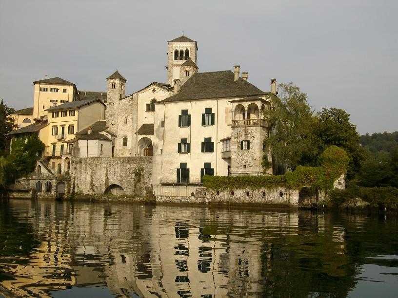
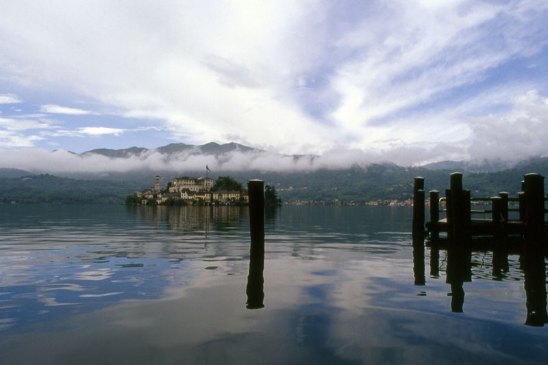
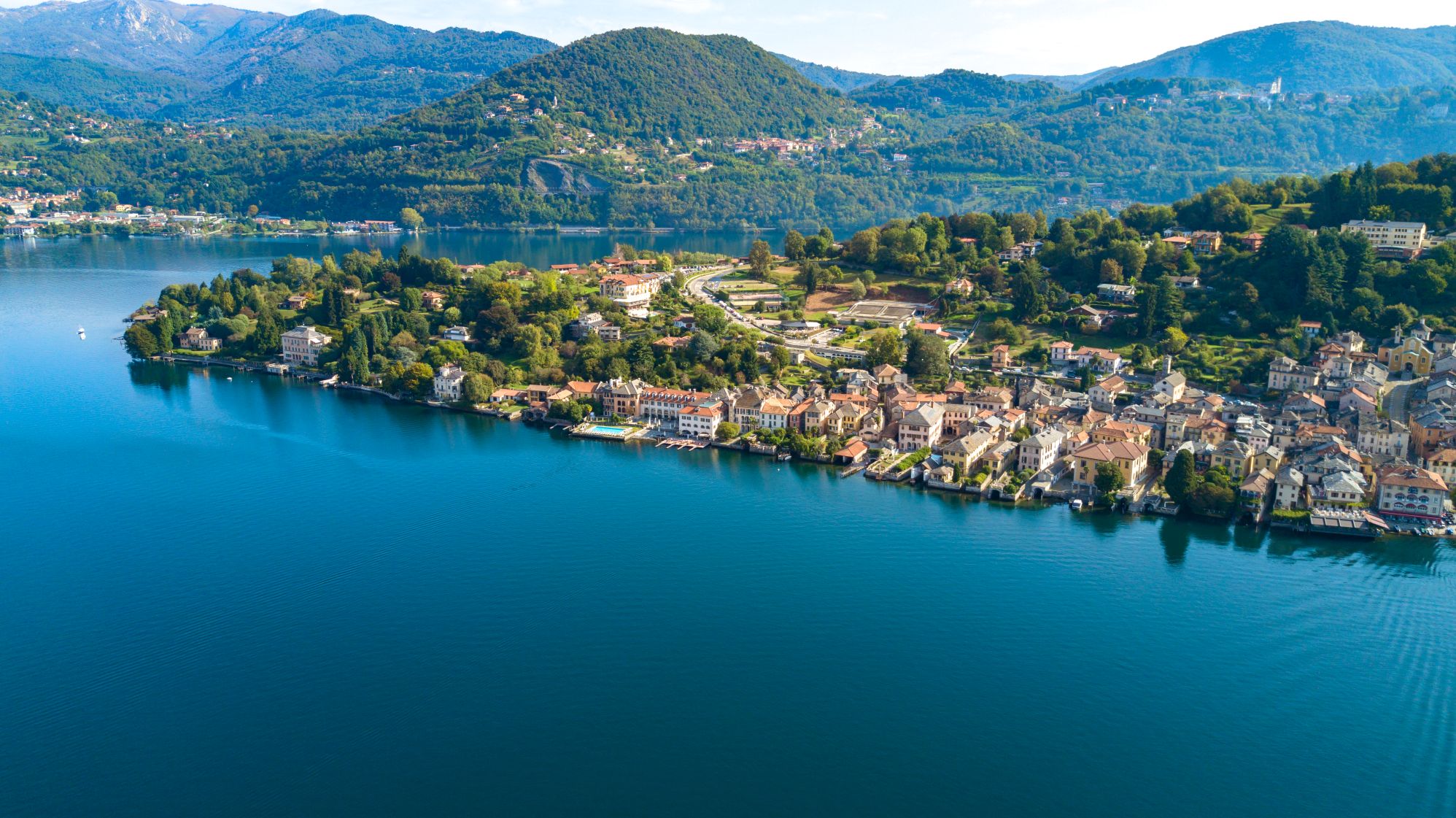
The journey descends on a beautiful paved road towards Piazza Motta, from which boats are available to reach San Giulio Island and the Benedictine abbey Mater Ecclesiae. The final leg of this journey takes place on the western shore of the Lago d’Orta, leading up to the village of Pella.
POINTS OF INTEREST
Arona
Chiesa dei SS Martiri (Chiesa di San Graziano)
Collegiata della Natività di Maria Vergine
Chiesa di Santa Maria di Loreto (Chiesa di Santa Marta)
Colosso di San Carlo
Parco dei Lagoni di Mercurago
Civico Museo Archeologico
Civico Museo Mineralogico
Rocca borromea
Piazza del Popolo
Invorio
Torre viscontea
Parrocchiale di San Giacomo (Inv. sup)
Parrocchiale di San Pietro e Paolo
Lortallo (frazione di Ameno)
Torre medievale
Orta
Borgo
Sacro Monte
Palazzo della Comunità (o Broletto)
Chiesa Parrocchiale dell’Assunta
Villa Bossi
Villa Crespi
Isola San Giulio
Legro (fraz. Orta)
Borgo
Pella
Masso Coppellato
Torre Medioevale
Chiesa di San Defendente
Chiesa di San Filiberto
Chiesa Parrocchiale di San Giovanni Battista
Chiesa Parrocchiale di Sant’Albino
Oratorio di San Giulio
TECHNICAL NOTES
LEGS: the entire distance is recommended in 1 leg, (22 km)
DIFFERENCE IN ELEVATION: lowest altitude of the itinerary, 200 m a.s.l.; highest, 470 m a.s.l. See the map.
DURATION: from 3 to 6 hours for each leg
TYPE OF PATH: Excursion – MAINLY DIRT ROADS
FACILITIES
STRUTTURE RICETTIVE
FOR MORE DETAILS
http://www.statuasancarlo.it
www.lagodorta.net
http://www.orta.net/sacromonte/
http://www.sacromonte-orta.com
Back to the list of routes

From Cannobio to Re
FROM LAKE MAGGIORE TO VIGEZZO VALLEY THROUGH CANNOBINA VALLEY
Lago Maggiore
Route description
Itinerary Description
The itinerary – known as the “Via Borromea” – traces the route that San Carlo Borromeo travelled in 1574 for his pastoral visit to the Pieve of Cannobio.
The path connects the Sanctuary of the Madonna della Pietà of Cannobio with the Sanctuary of the Madonna di Re, passing through the most beautiful parts of the Cannobina Valley.
Many of the tracks of this itinerary are also part of other paths of great regional and national interest, such as “Camminaitalia” and the Great Crossing (Grande Traversata: GTA) of the Piedmont Alps.
From the lakefront, the path passes through the centre of Cannobio, until it reaches the Sanctuary of the Madonna della Pietà. Then we leave the pleasant shores of lake and take bike trail that runs alongside the Cannobino River. We follow that until we get to Traffiume andOrrido di Sant’Anna, to then delve into the mountain area of the Cannobina Valley.
The historical road, marked with small devotional chapels along the way, is almost entirely preserved: most of the itinerary retraces the same road that San Carlo Borromeo used during his visit to the Pieve of Cannobio.
The entire itinerary, dedicated to the saint and also known as the “Circuit of San Carlo“, is the first road network documented in the Cannobina Valley.
We continue, therefore, by taking the mule track that runs from Traffiume to Cavaglio: along this stretch, two small shrines recall the episode of Borromeo falling off his mule. He miraculously escaped unharmed.
After Cavaglio, we turn west and find ourselves at the panoramic position of the oratory of S. Maria delle Grazie: we then continue toward the hamlet of Nivetta.
From here, a small detour toward Gurrone lets us retrace the legs of the Via Borromea exactly in the right order, and we go through Spoccia, Orasso, Cursolo, Finero and Re.
The itinerary proceeds instead towards Lunecco and Ponte Falmenta, which marked the border of the Republic of Ossola, 10 September – 14 October, 1944.
From here, the trail ascends on a cobblestone pavement to Crealla, a town surrounded by traditional chestnut woods and reachable by car only since 2001. This isolation has made it possible to preserve the original nucleus of the village and the local architecture.
After leaving Crealla, we ascend on a winding tiered path to Falmenta, where the Church dedicated to San Lorenzo stands on the panoramic terrace.
The path meanders along a beautiful mule track until we reach Gurro. Continuing westerly, we travel up the trail passing small chapels and rural buildings with votive paintings. In a short time, we get to the Square and then descend rapidly into the valley of Rio Calagno.
When we reach Daila, a small pasture refuge that is still partially used, we go back up to Provola and then to Finero, we cross the Crèves river, which marks the administrative border between Vigezzo Valley and Cannobina Valley.
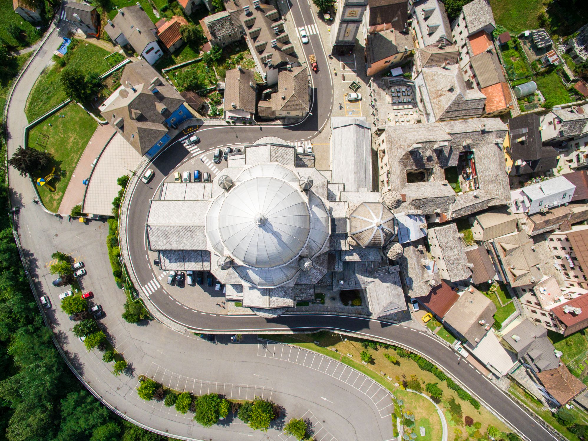
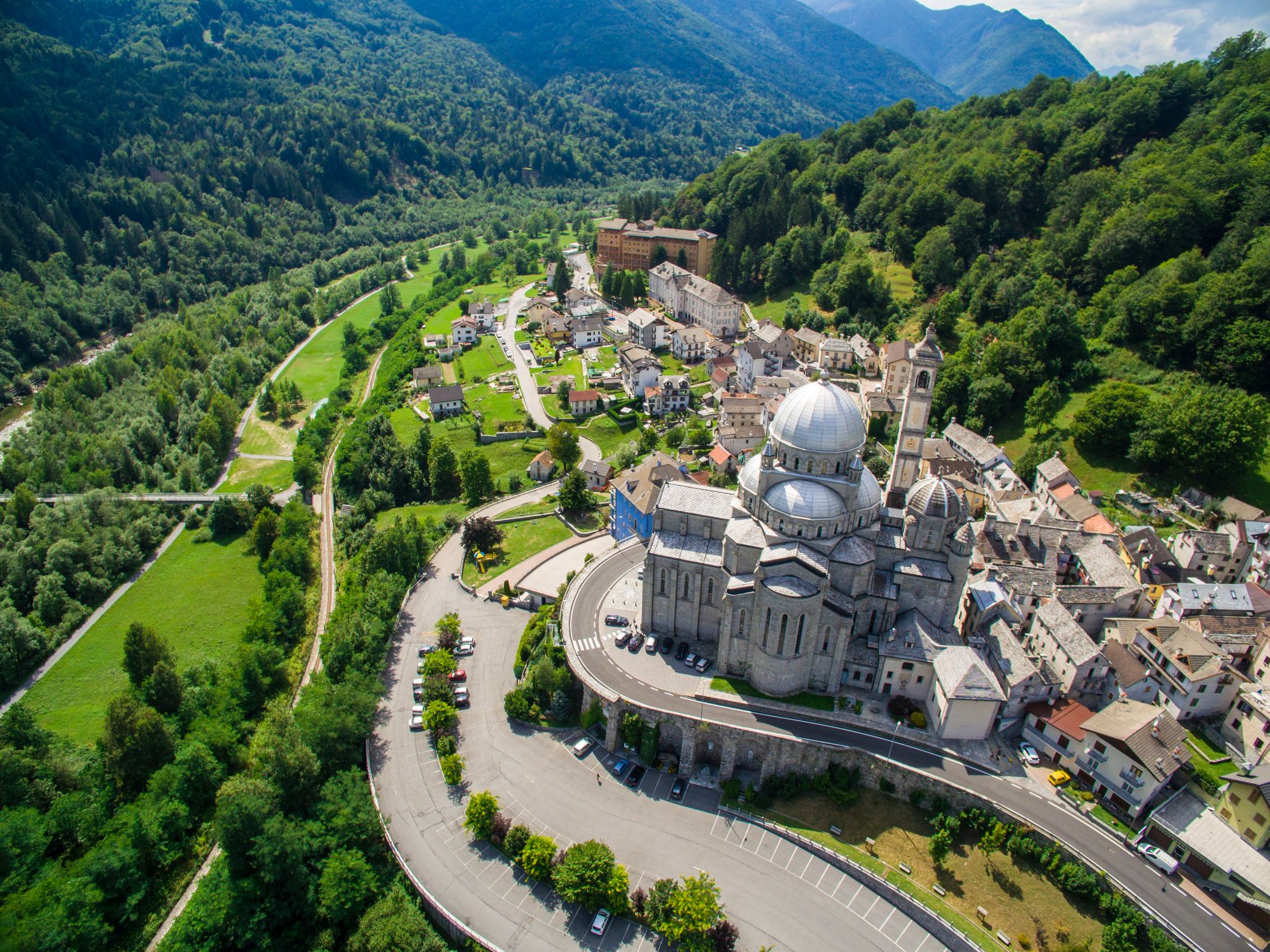
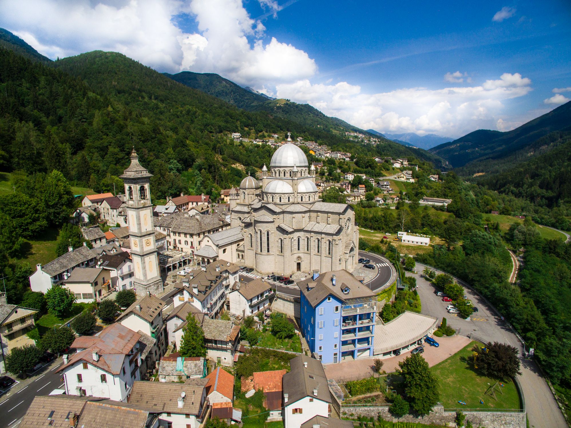
After leaving the village of Finero, the path continues as we discover the WWF Natural Oasis of Pian dei Sali, Passo Scopello and finally Re: here stands the Sanctuary of the Madonna del Sangue, the final stage of this itinerary.
POINTS OF INTEREST
Cannobio
Santuario della Madonna della Pietà
Collegiata di S. Vittore
Chiesa di S. Marta
Palazzo della Ragione
Casa Pironi
Borgo antico
Traffiume (fraz. Cannobio)
Chiesa di Santa Maria Purificatrice
Ponte romano
Orrido di Sant’Anna
Crealla
Antica “Grà”
Marcitoio
Falmenta
Chiesa di San Lorenzo
Antico torchio
Gurro
Museo etnografico
Casa di San Carlo
Antica “Grà”
Finero
Oasi naturale del WWF di Pian dei Sali
Re
Santuario della Madonna del Sangue
FACILITIES
STRUTTURE RICETTIVE
FOR MORE DETAILS
www.sentieridelverbanocusiossola.it
TECHNICAL NOTES
LEGS: the journey is recommended in 2 legs, from Cannobio to Falmenta (km 9.5), and from Falmenta to Re (km 9)
DURATION: from 3 to 6 hours for each leg
DIFFERENCE IN ELEVATION: lowest altitude of the itinerary, 200 m a.s.l.; highest, 1030 m a.s.l. See the map.
TYPE OF PATH: Excursion – MAINLY DIRT ROADS
Back to the list of routes