An unforgettable sport and adrenaline climb
THE MONTORFANO VIA FERRATA: ‘HANDS-ON’ GRANITE
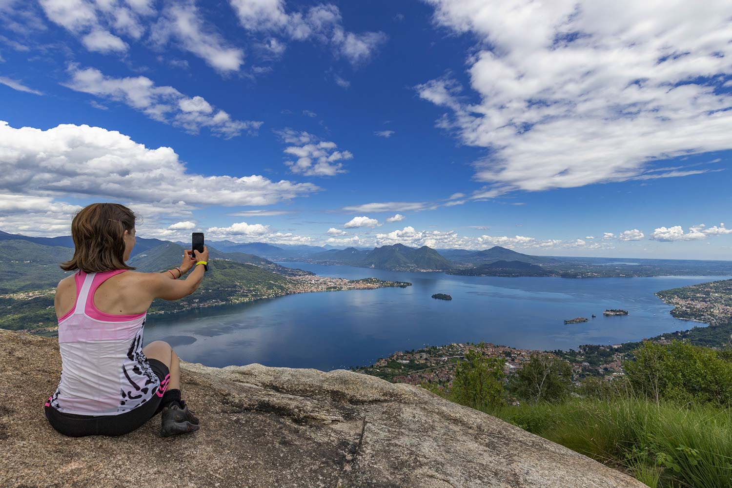
Lago di Mergozzo
Route description
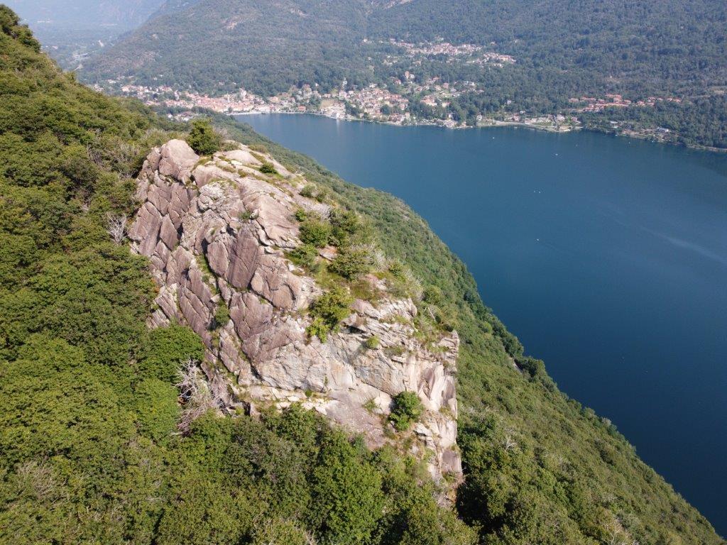
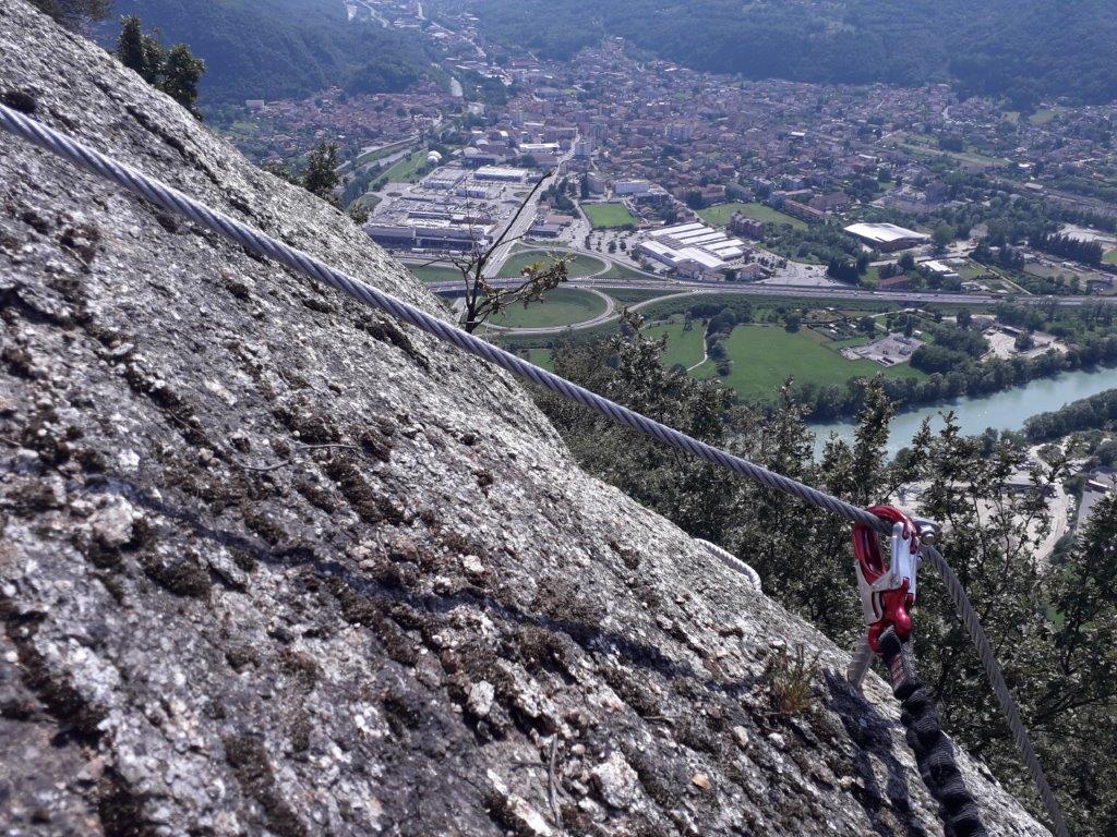
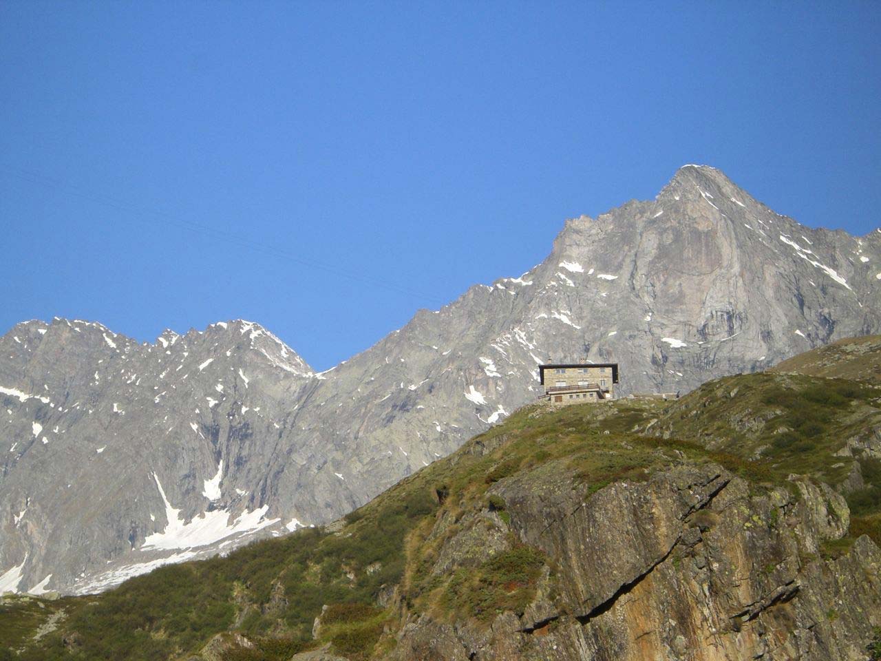
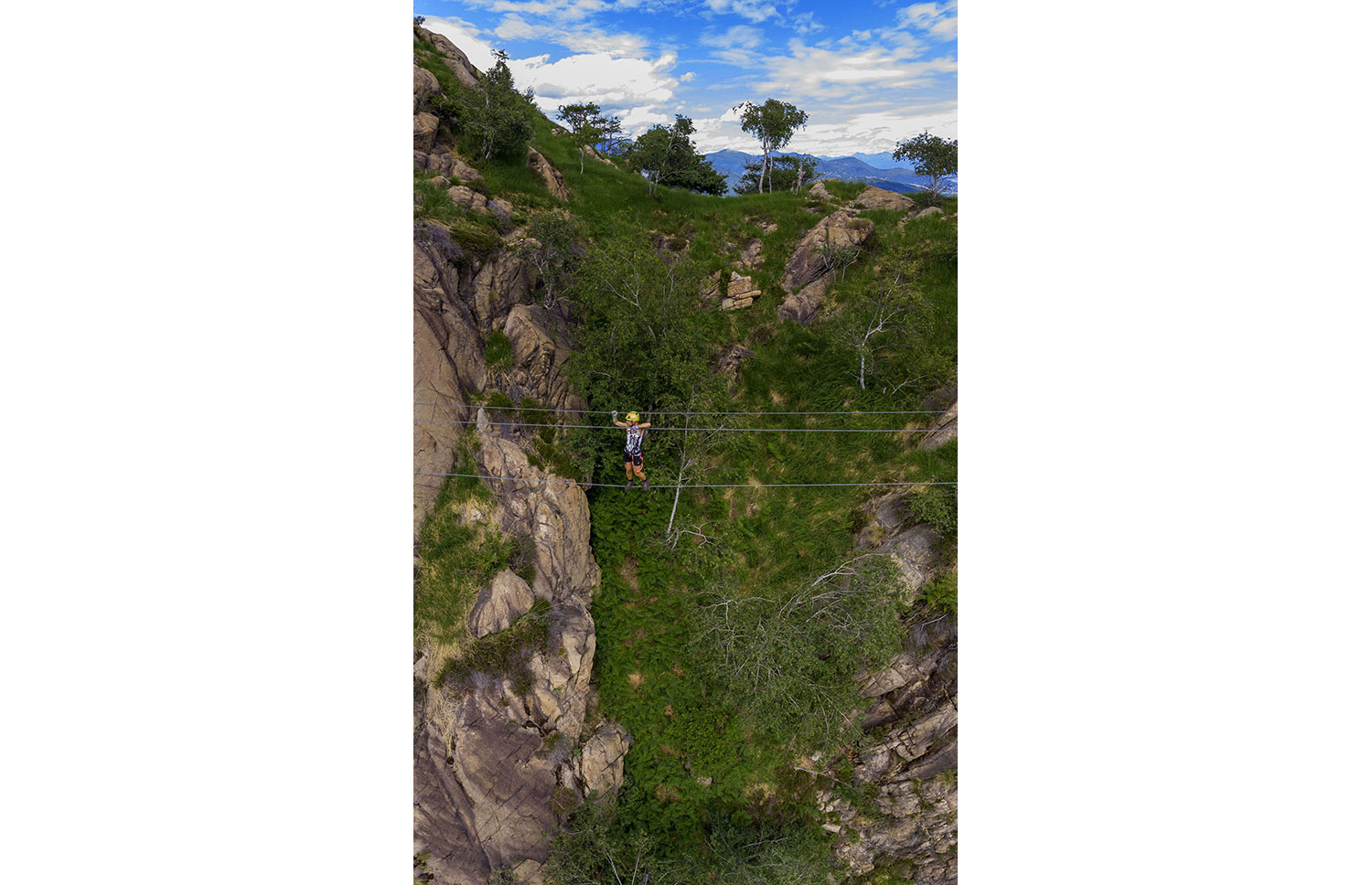
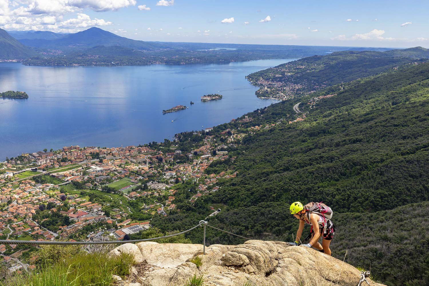
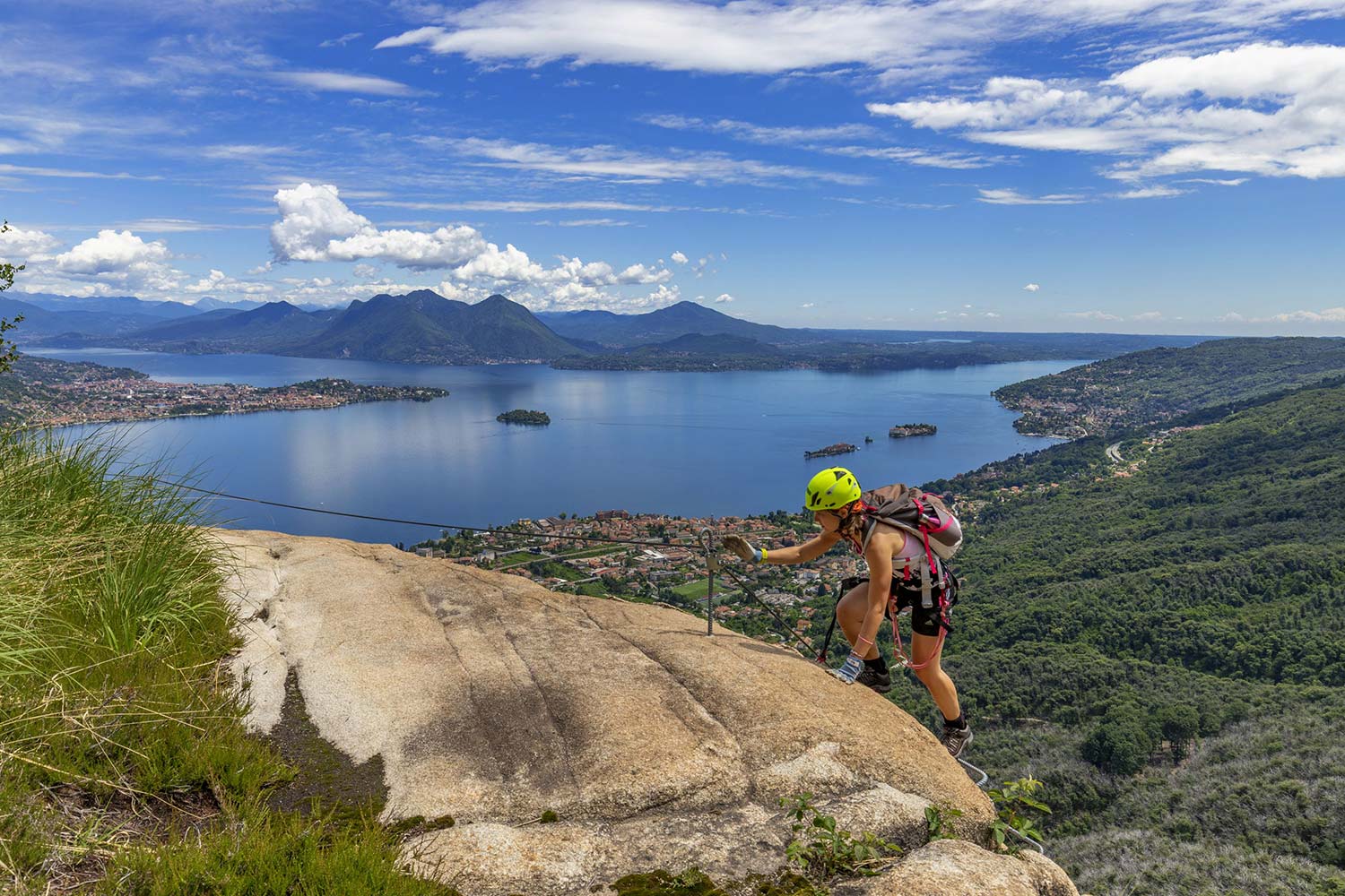
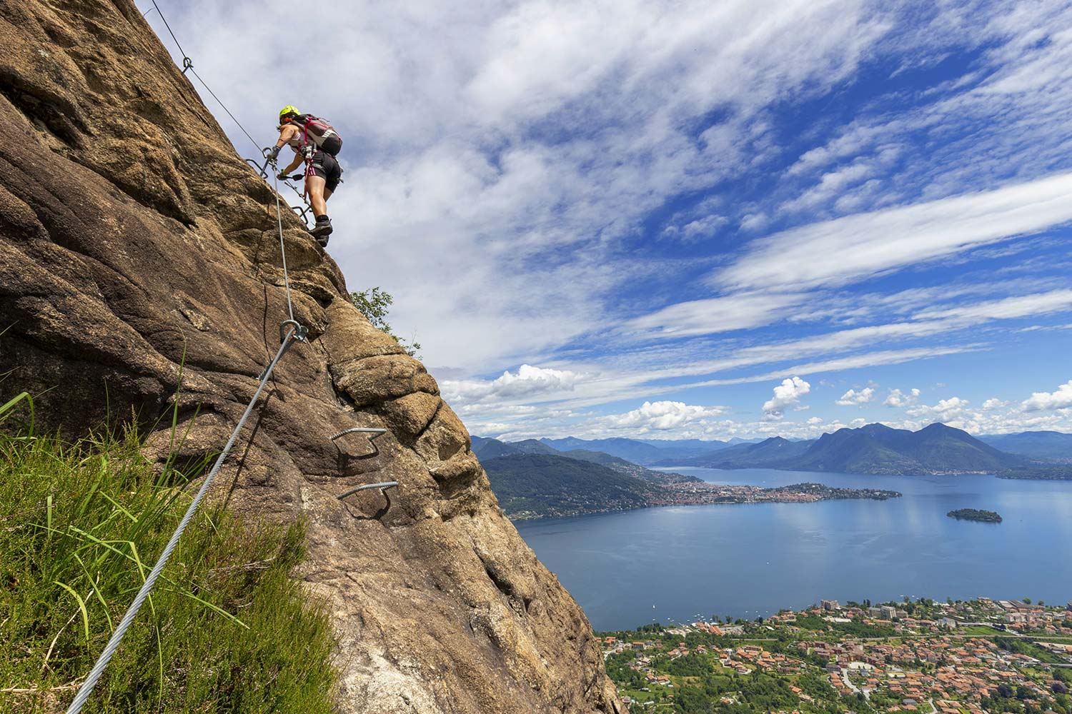
The MONTORFANO is a single block of granite, pure rock, marked by centuries of granite quarrying, embraced by Lake Mergozzo, Lake Maggiore and the River Toce, solitary in the alluvial plain of the Toce.
The Montorfano sport climbing itinerary allows you to “touch” this rock, spending an unforgettable day of sport climbing on the adrenaline-filled MONTORFANO VIA FERRATA and on the MONTORFANO CLIMBING CRAG (link to the GPX file available in the attachments).
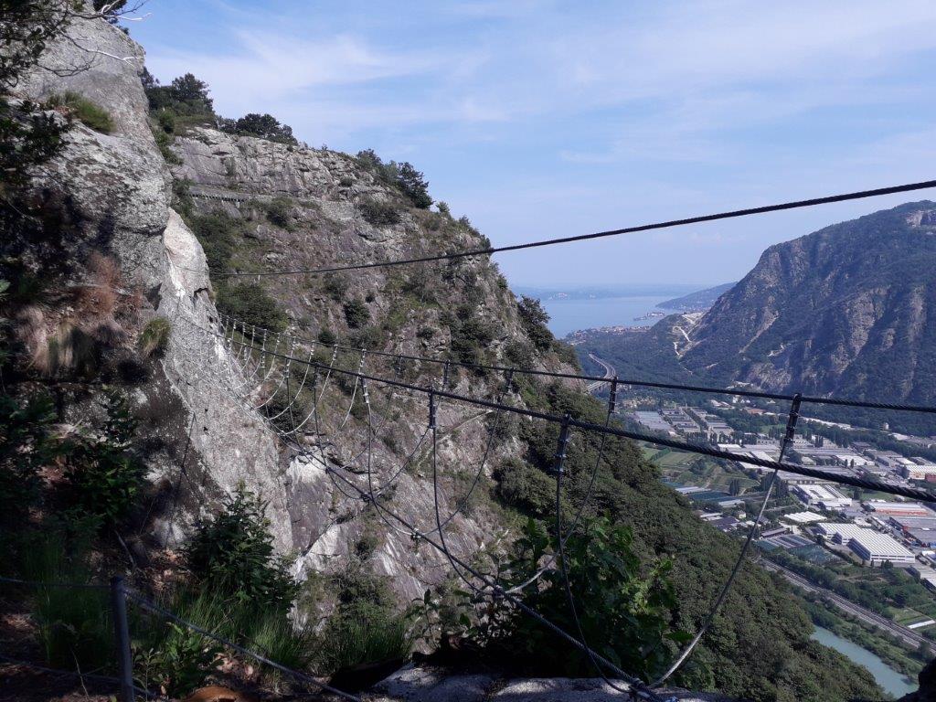
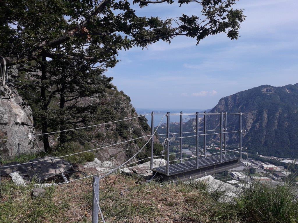
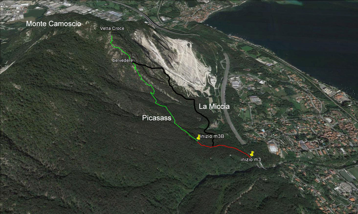
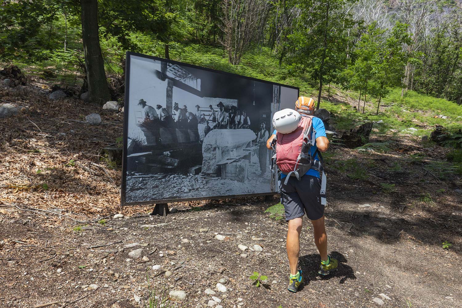
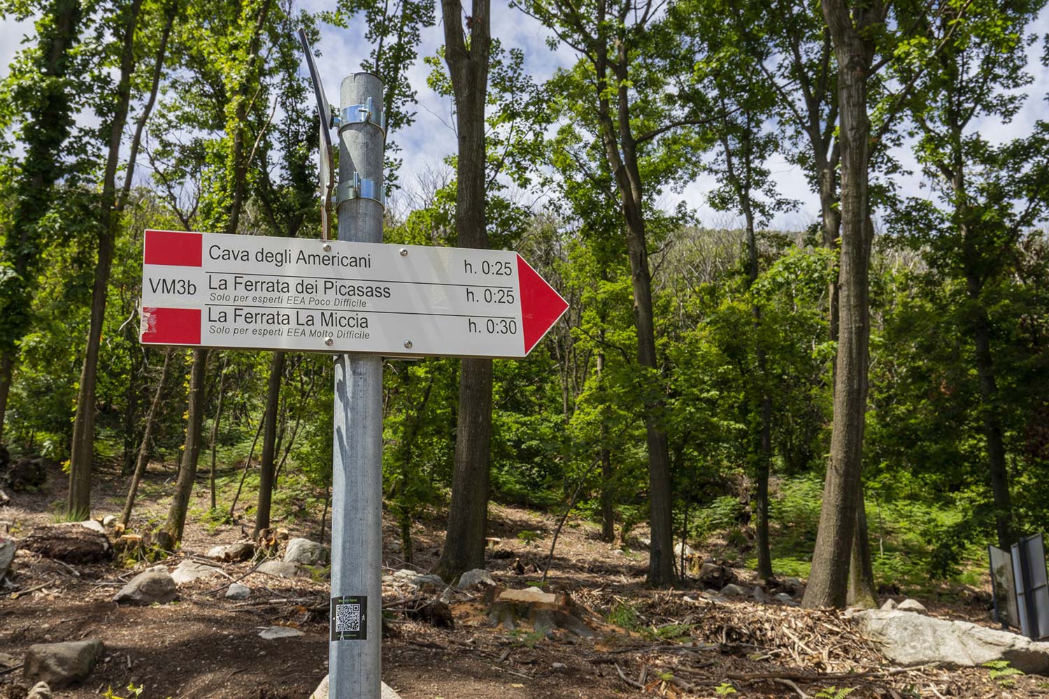
Along the itinerary you will find detailed explanatory panels, but we advise you to start the itinerary from the lakeside of Mergozzo, following path A58, which takes you in an hour to the via FERRATA MONTORFANO.
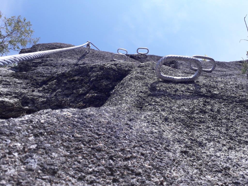
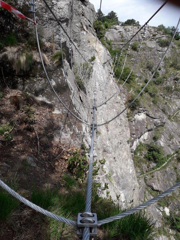
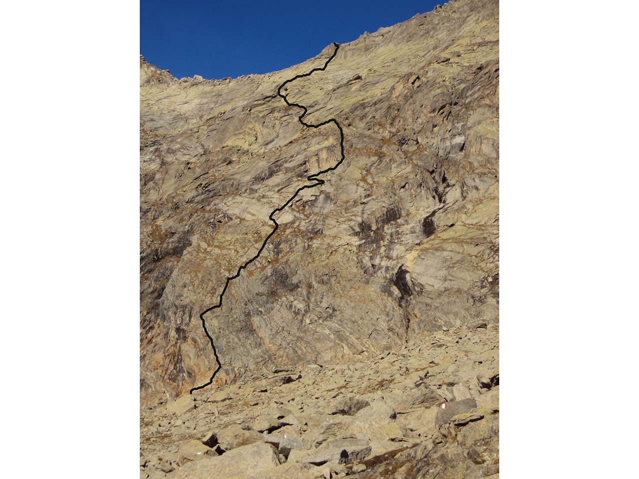
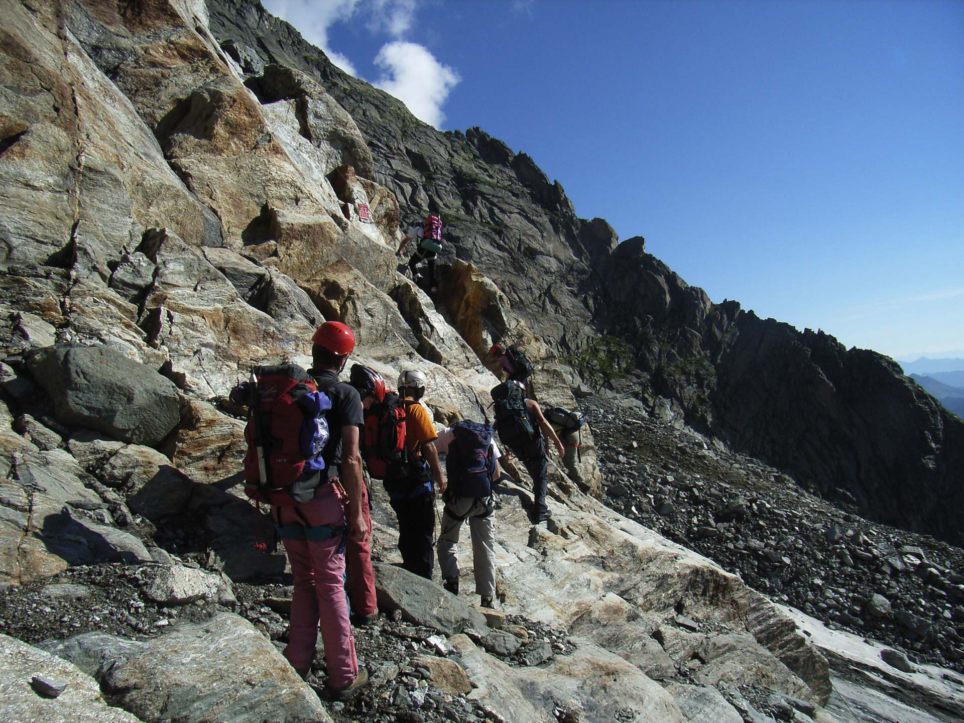
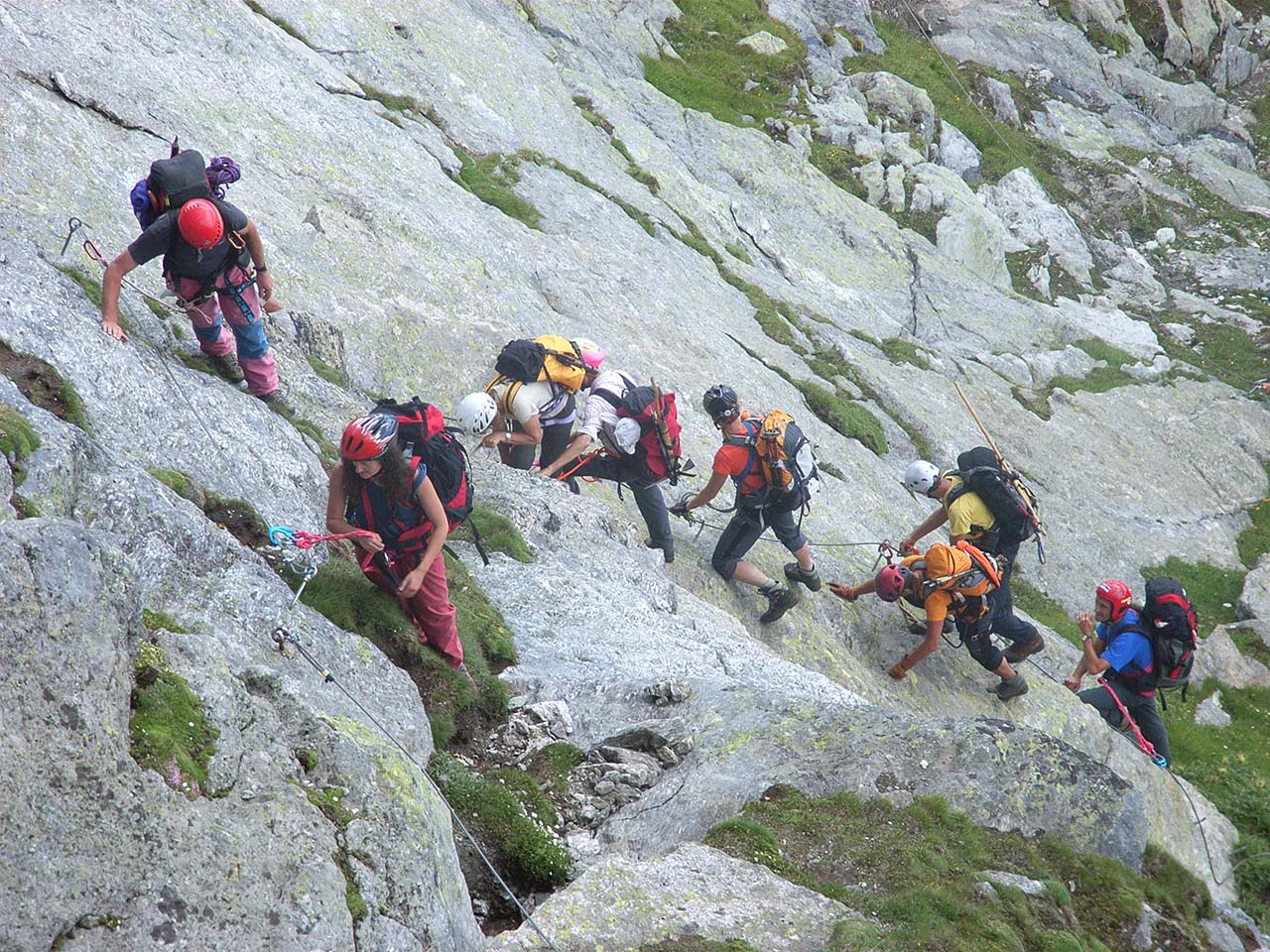
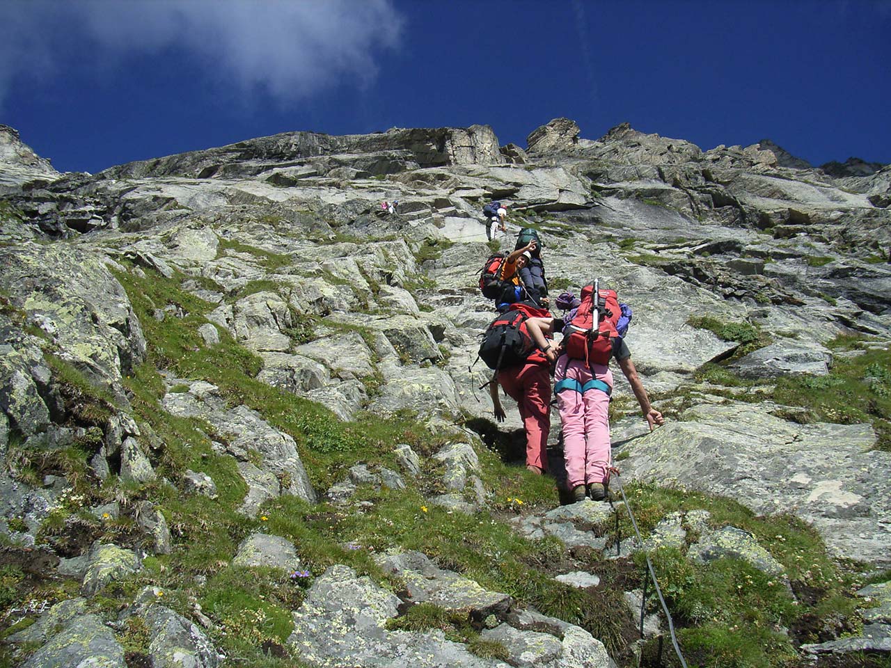
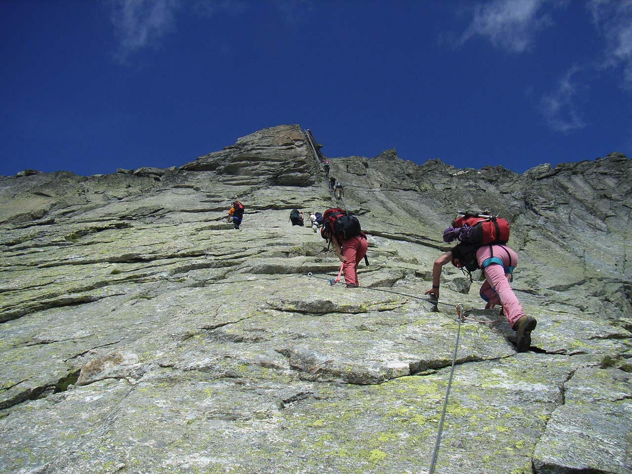
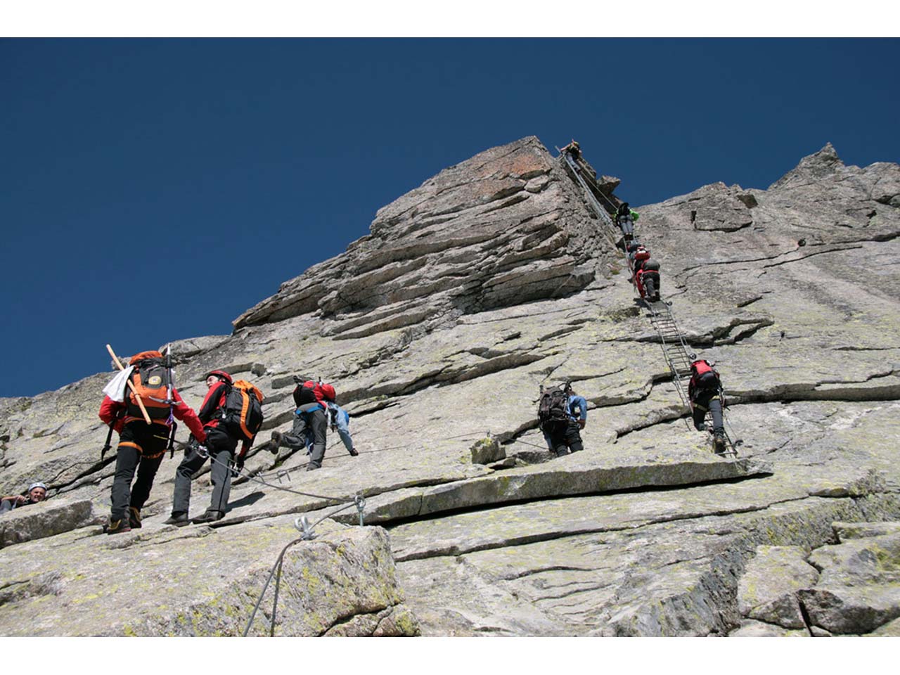
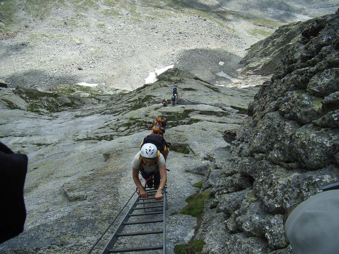
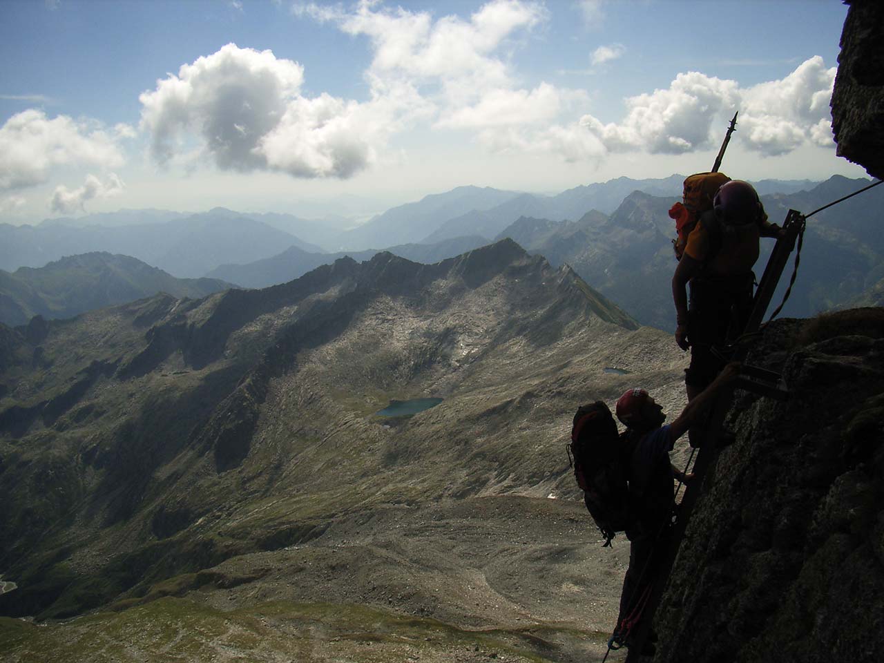
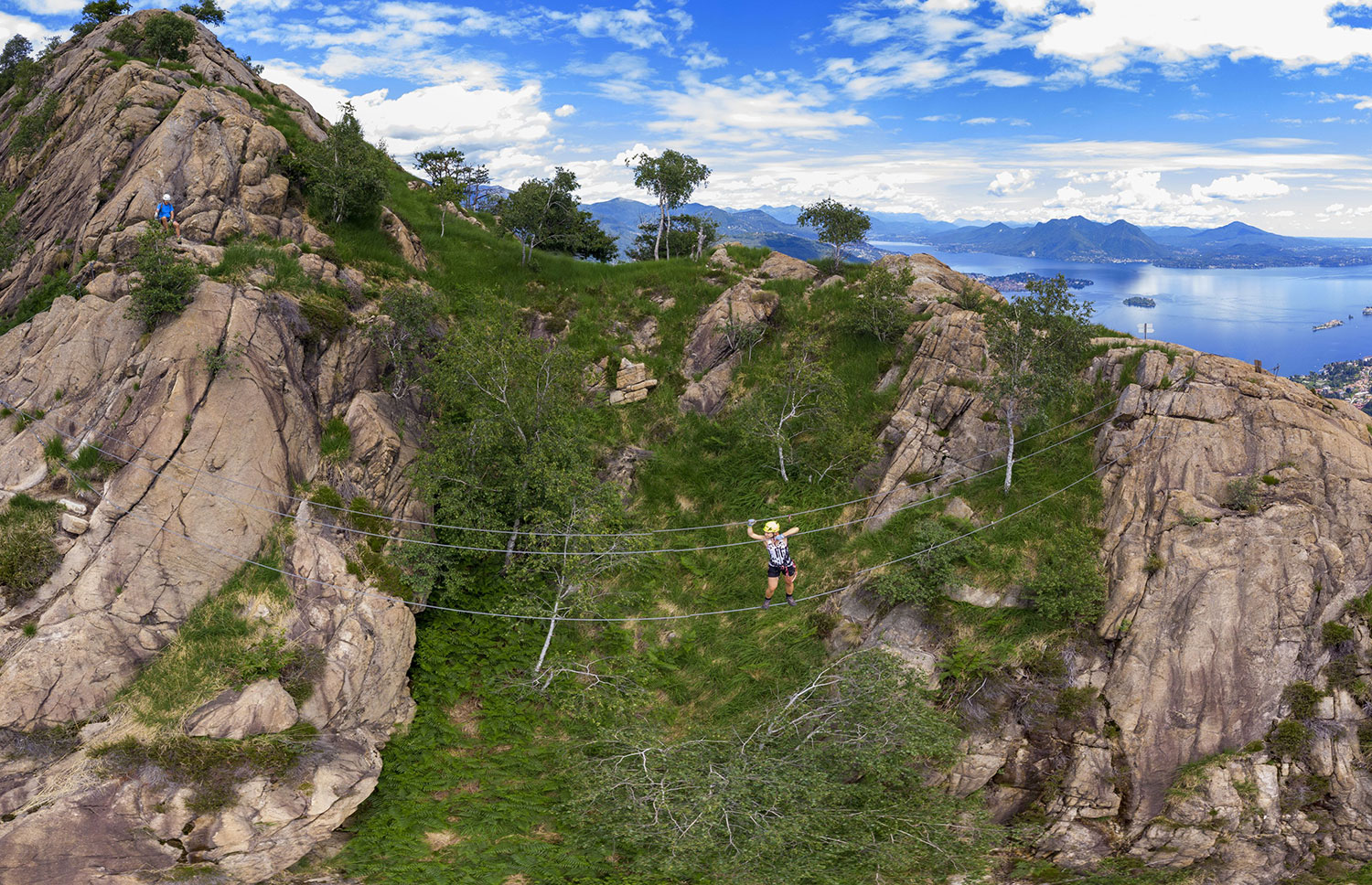
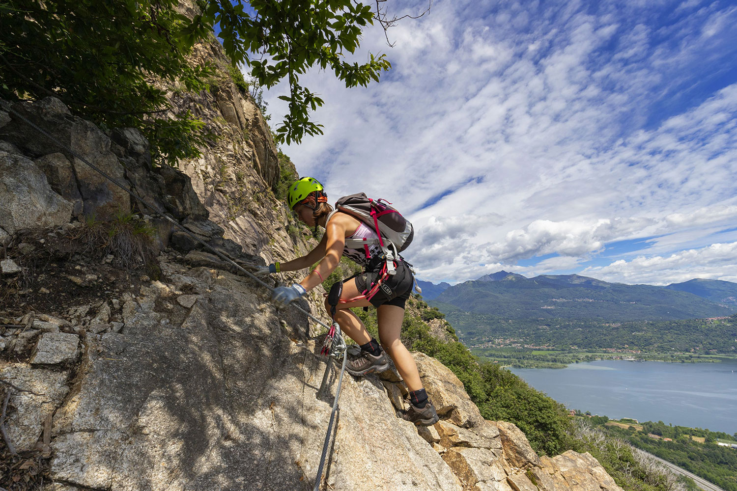
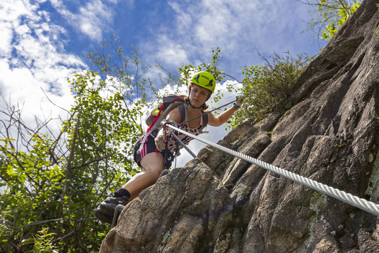
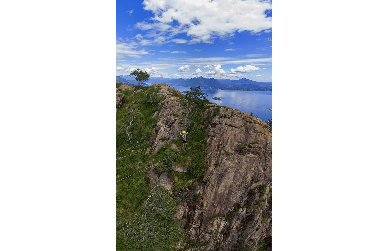
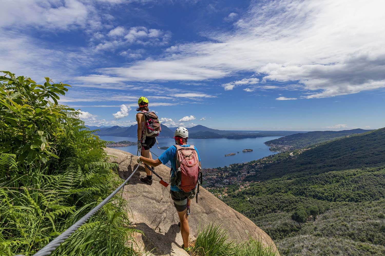
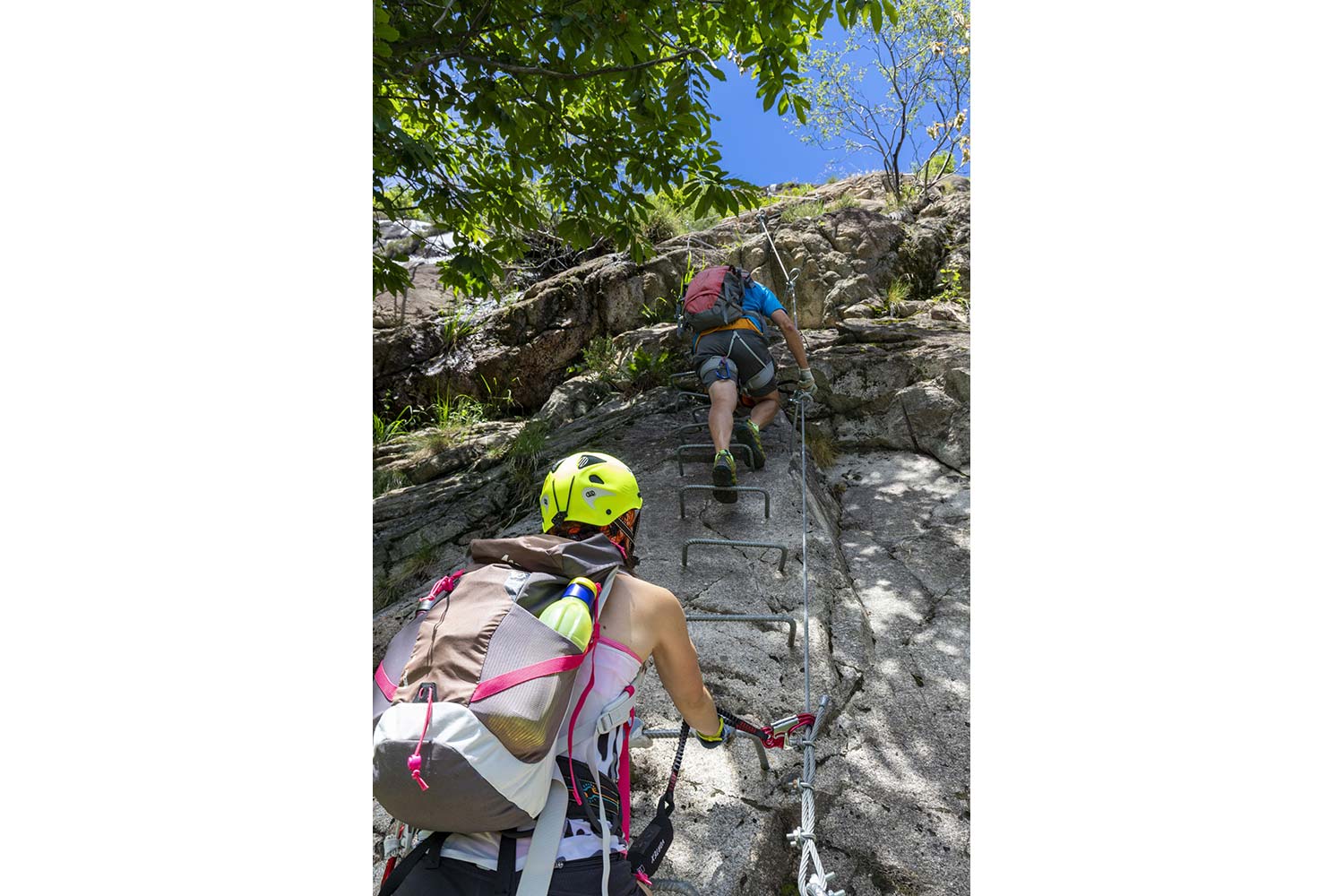
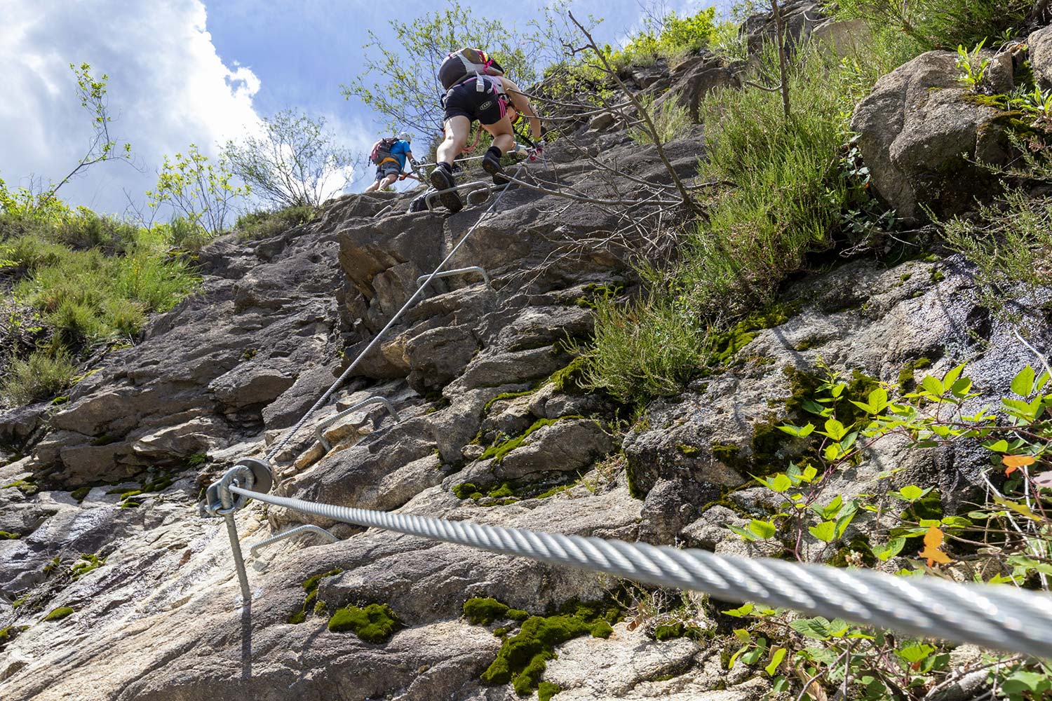
The via FERRATA MONTORFANO is classified as “D:DIFFICULT” and has very exposed sections that require not only a via ferrata set but also a special mastery of the void. Along the route you will find four climbing sectors and two spectacular thirty-metre Tibetan bridges that cross the void.
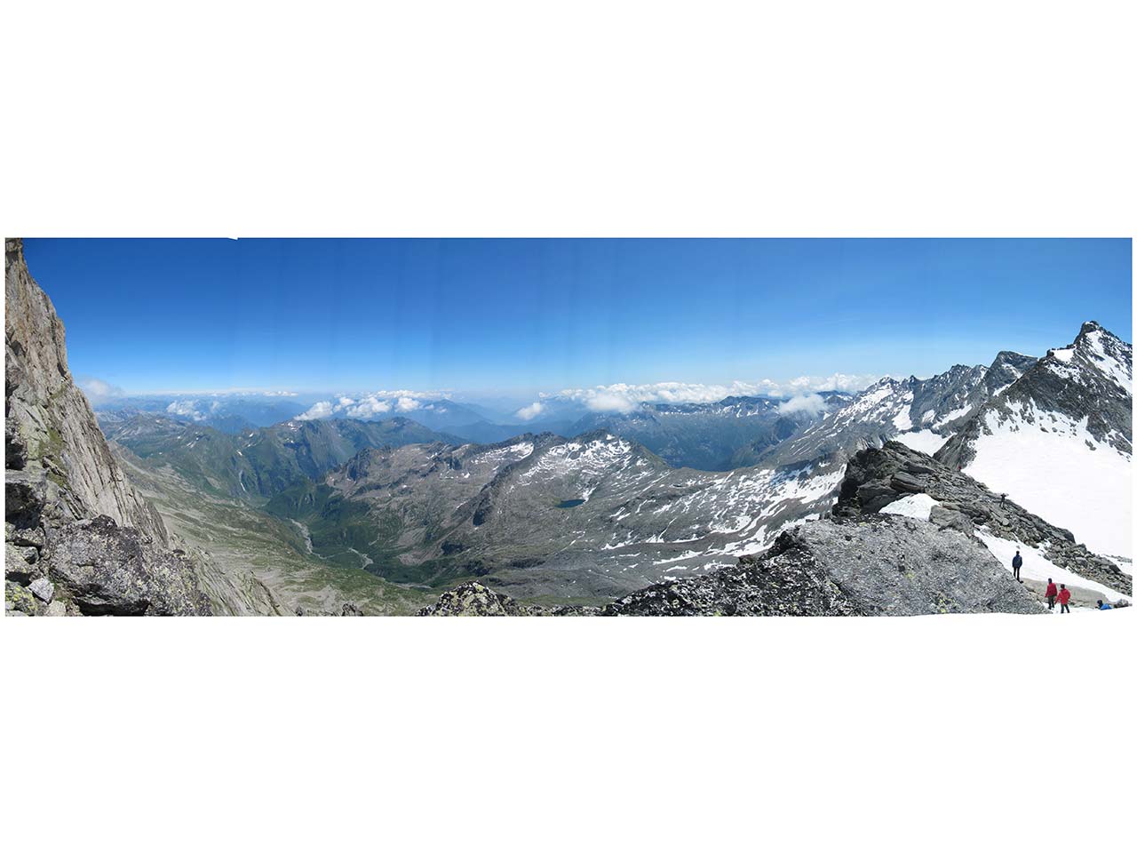
Once you have completed the via FERRATA MONTORFANO, you can continue the itinerary reaching the summit of Montorfano, and then descend on the opposite side reaching the CLIMBING CRAG MONTORFANO (FALESIA), a granite terrace on Lake Mergozzo, with three climbing sectors of varying difficulty.
From the climbing crag you go down to the village of Montorfano, where you will find the ancient Romanesque Church of San Giovanni Battista dating from the 11th-12th centuries, which is well worth a visit.
Close the loop by following the Blue Trail along the lake of Mergozzo, discovering suggestive panoramic views and the fresh water source called “del Vescovo”.
On Mergozzo’s lakefront, you can finally enjoy a moment of rest in a restaurant overlooking the lake, concluding an unforgettable day.
ADVICE FROM THE MOUNTAIN GUIDE
The Montorfano sport climbing itinerary is spectacular and fun.
However, it is necessary to pay the utmost attention to safety: on the via ferrata you must have a set (helmet, harness, energy dissipator) and you must be used to the void.
Back to the list of routes
Quick info
Dove: Montorfano (Frazione di Mergozzo)
Telefono: +39 0323 80101
Via Ferrata in Antigorio Valley
FERRATA WALSERFALL: A TRIBUTE TO THE ANCIENT WALSER PEOPLE AND THE AGÀRO WATERFALL
Valle Antigorio
Route description
Recommended period: MARCH-OCTOBER
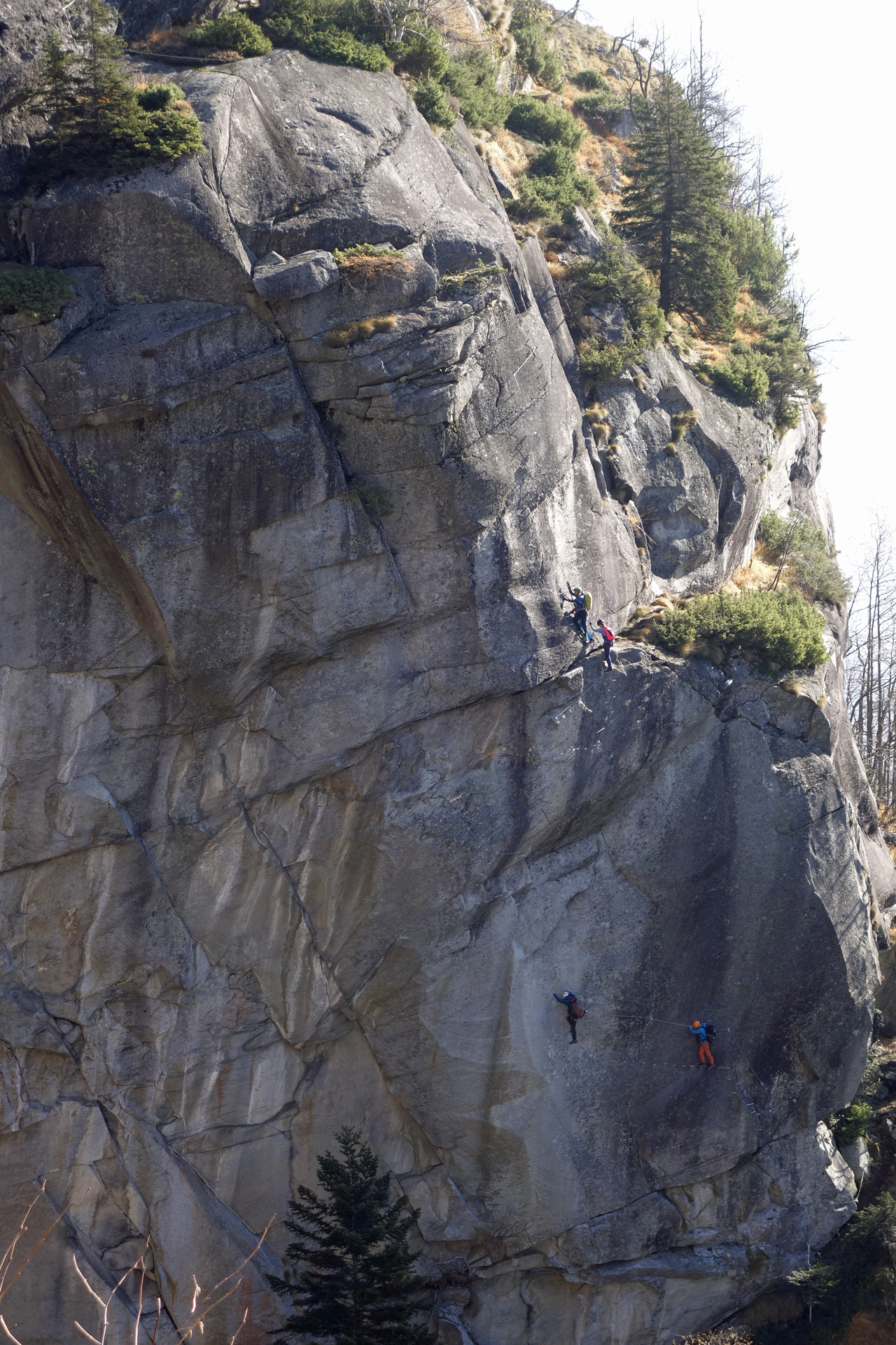
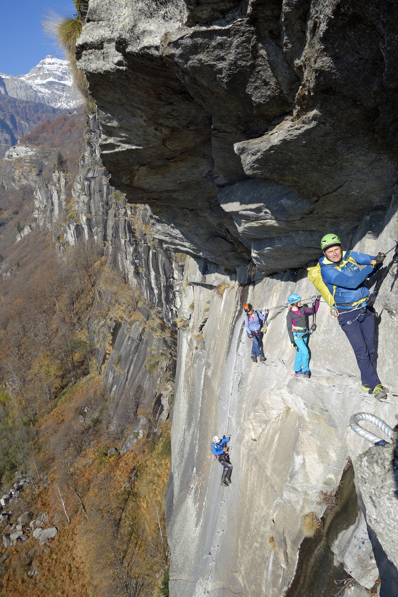
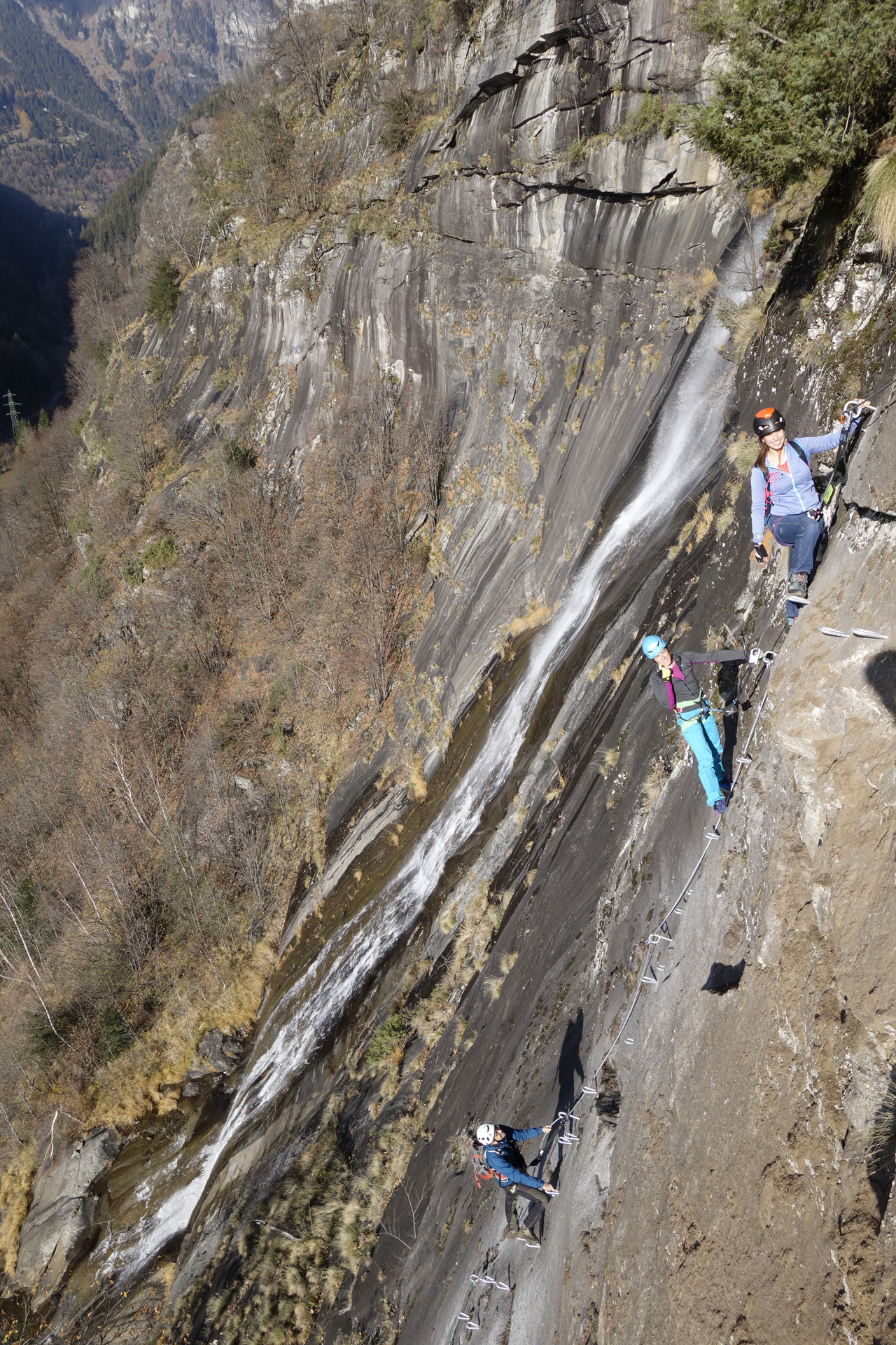
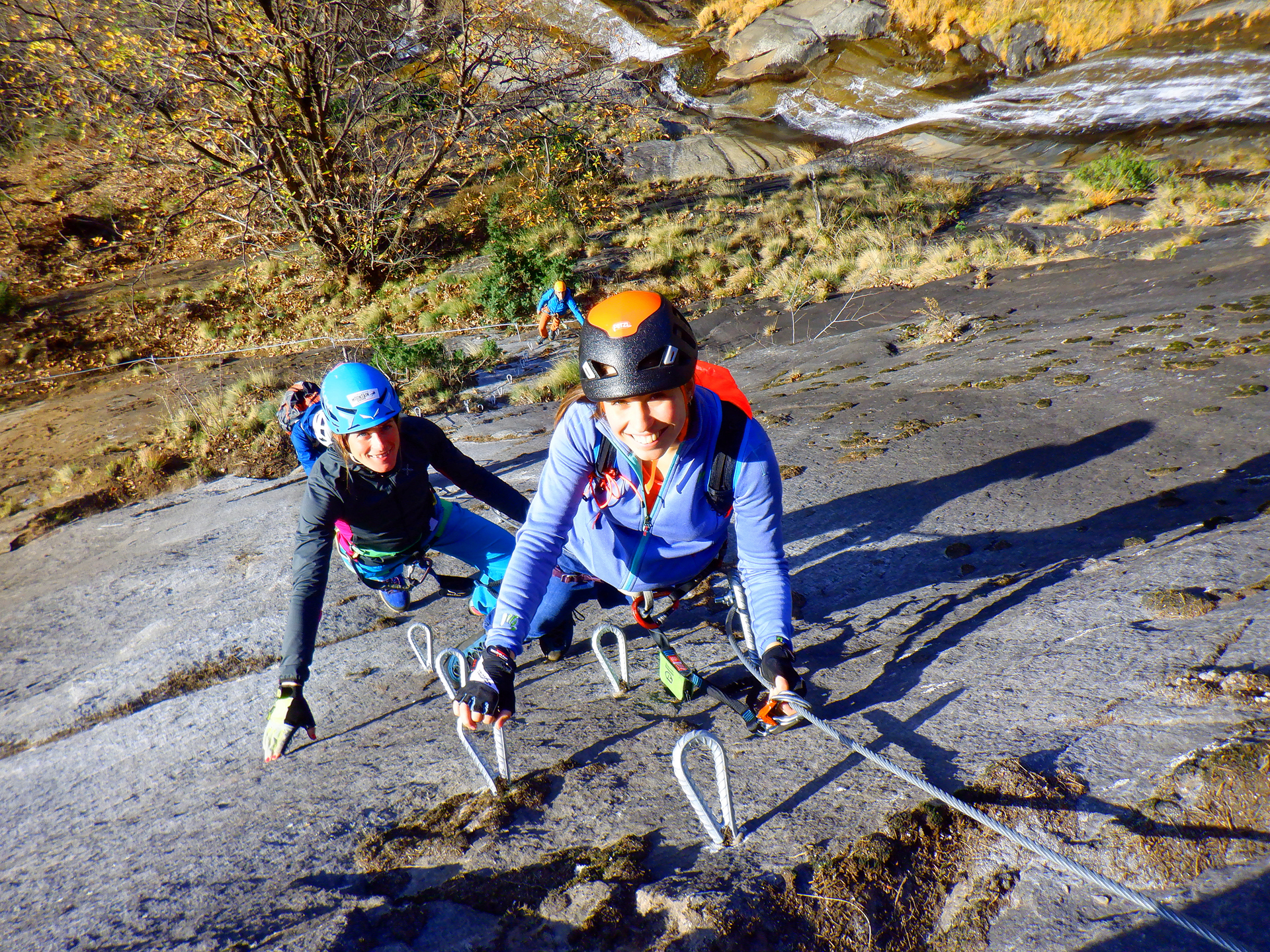
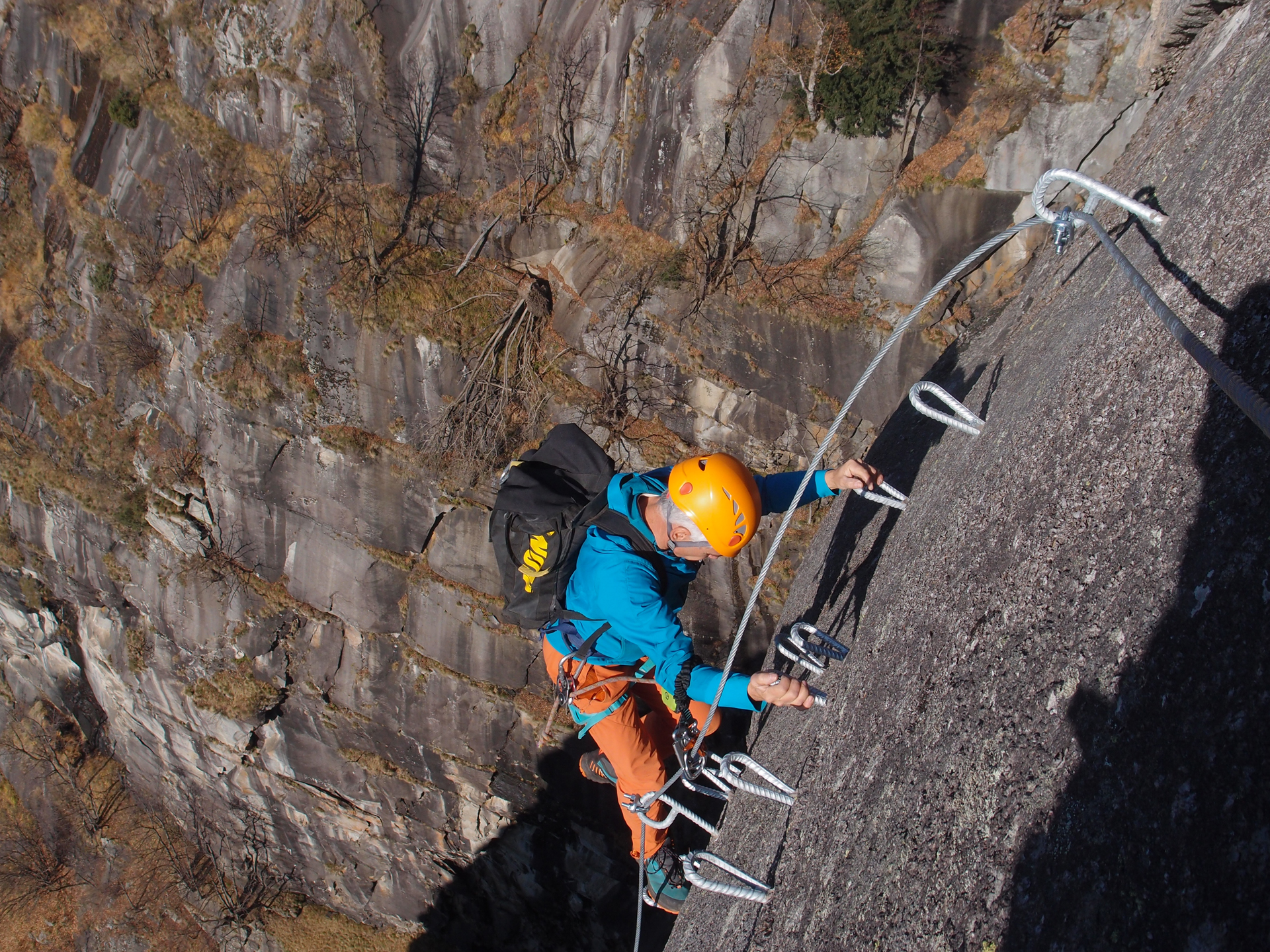
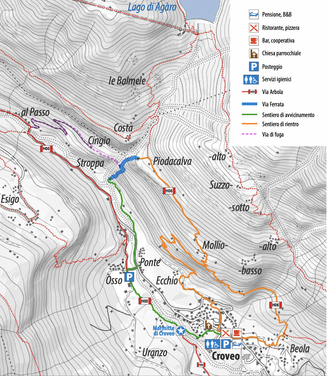
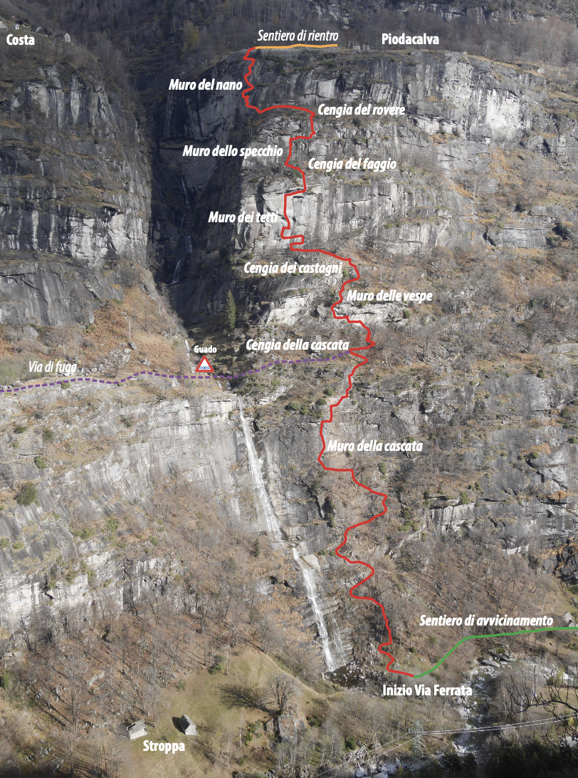
The WALSERFALL Via Ferrata runs along the rocky wall that skirts the Agàro waterfall, downstream of the lake by the same name. It reaches Piodacalva, where a handful of barns and huts stand on a wide and panoramic rocky terrace. This is the Walser region, and as a tribute to these ancient and wise mountain people, the via Ferrata has been named WALSERFALL, combining the terms “Walser” and “Wasserfall” (waterfall).
The access trail (code H00 up to Osso) starts behind the old dairy farm and is marked by specific signs. From the road bridge in Osso, follow a small trail along the river until reaching the Via Ferrata base.
From Piodacalva, the Via Ferrata’s arrival point, head back to Croveo in about 50 minutes following the H06 trail. Alternatively, from Mollio a trail descends to Ecchio and then to the village. These trails have some exposed, unprotected sections that require attention.
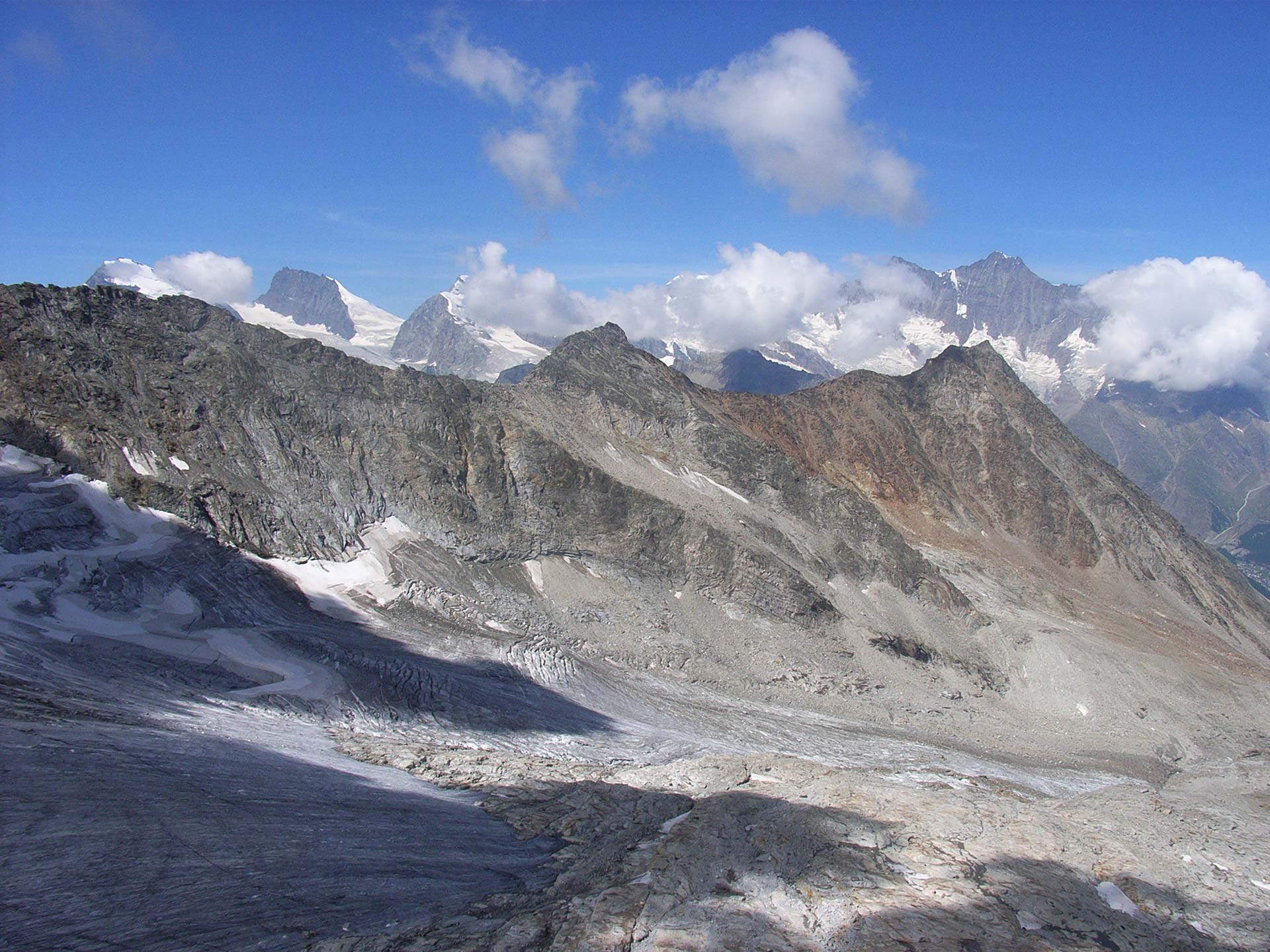
Wonderful views along the beautiful waterfall of the Rio di Agaro are awaiting you.
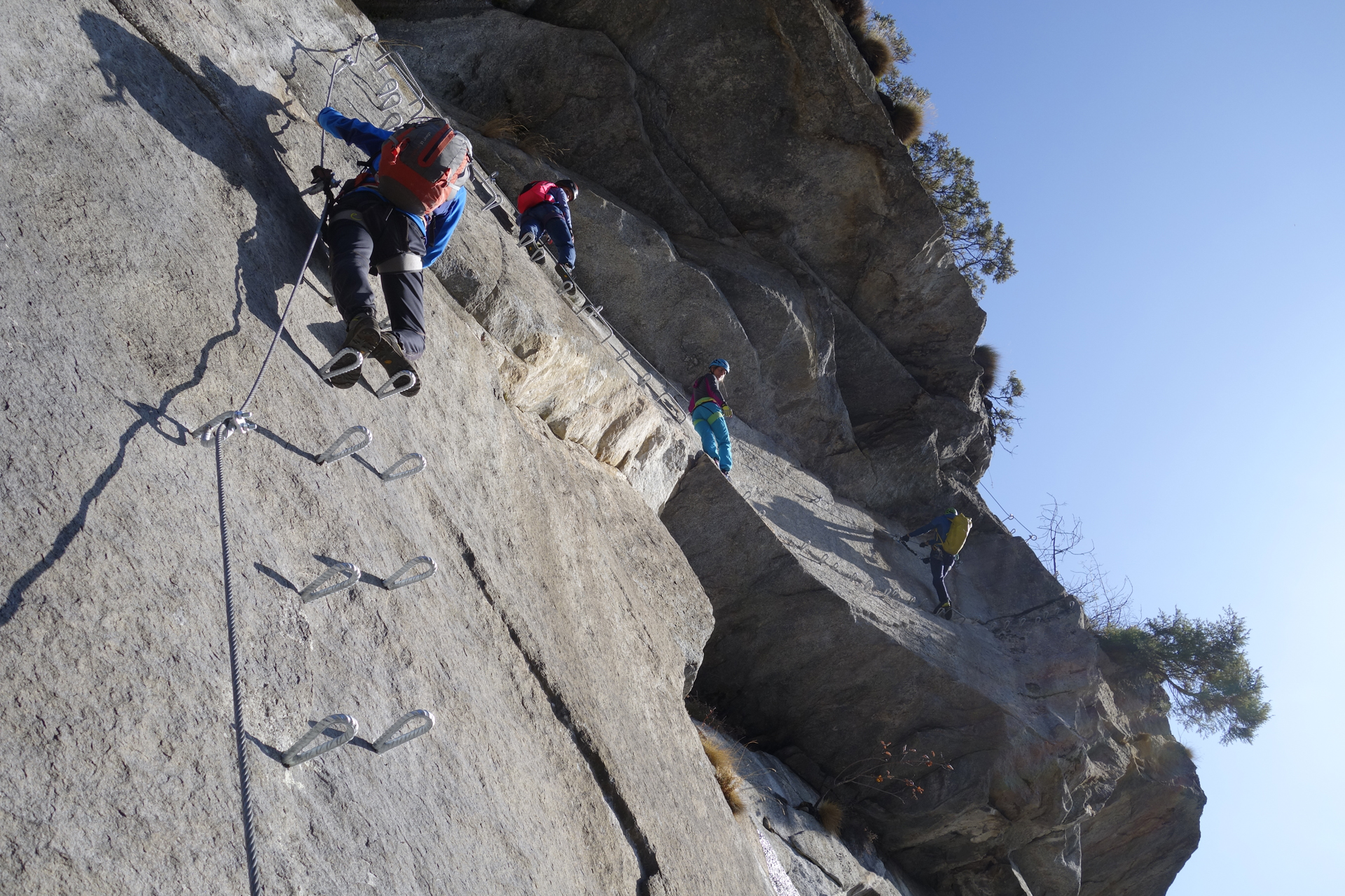
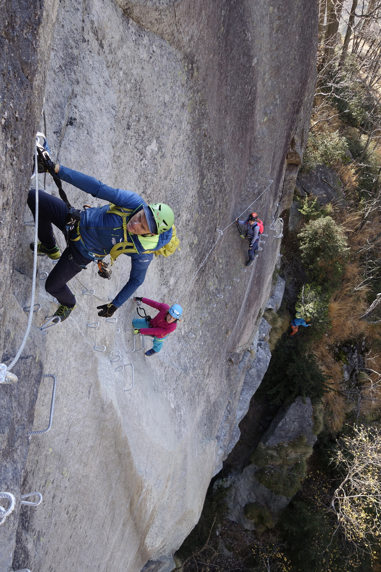
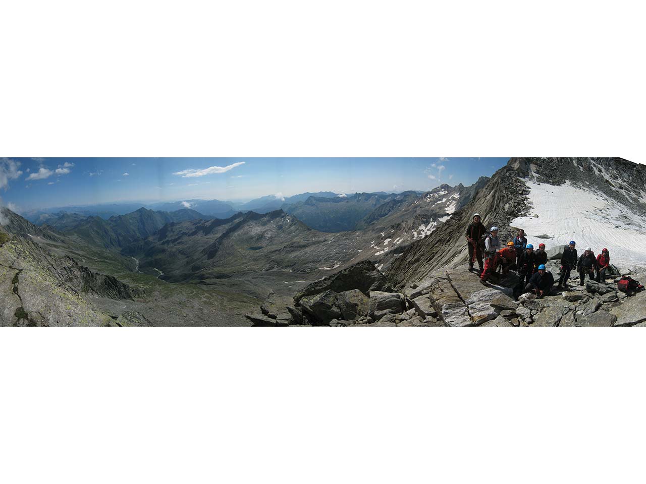
The most difficult sections are on the wall known as “dei tetti”. This wall has a long and aerial traverse. On the final wall that leads to Piodacalva there is a very exposed overhanging passage that requires significant fitness and expertise.
WARNING!
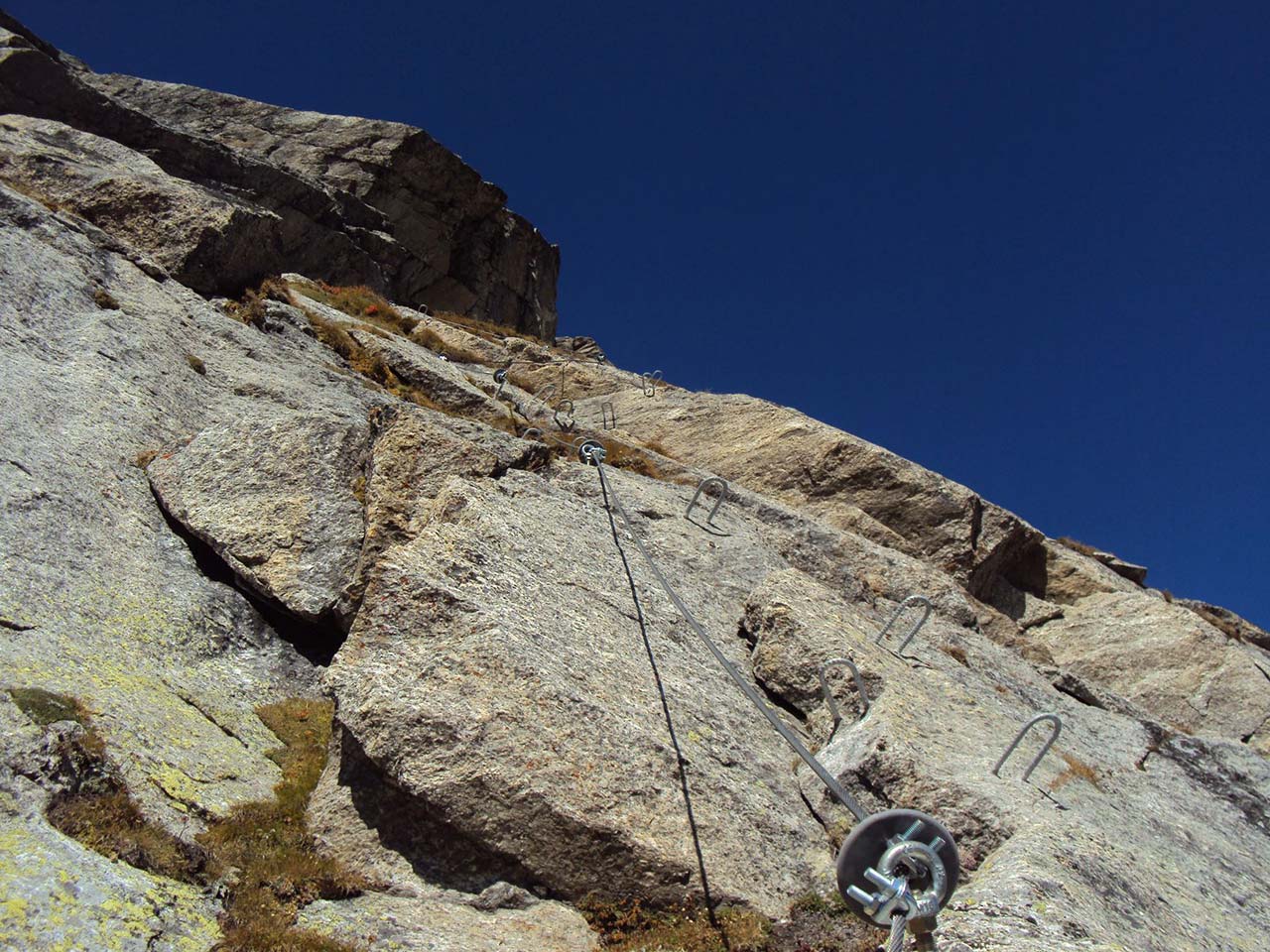
The Via Ferrata is a mostly artificial route that leads the mountaineer on steep walls provided with safety steel ropes and steps anchored to the rock.
It is fundamental to be experienced climbers, physically fit, and technically well trained with full awareness of how to handle void and climbing. Those who have never approached the Vie Ferrate’s climbs are recommended to hire a professional UIAGM Alpine Guide.
It is mandatory to be equipped with specific personal protection equipment suitable for the activity and to be familiar with its correct use:
- Climbing helmet
- Climbing harness fully latched and well-tight in the flanks and thighs plus self-belaying set with energy absorbers
- gloves
- rock climbing shoes
- A double safety longe already fastened to the harness is recommended
Keep in mind that the shocks caused by a fall from the Via Ferrata are extreme. No material can withstand such shocks, and thus the use of energy absorbers is mandatory
Design and Works Supervision Ms. Romina Marani, P.Eng. – Mr. Alessandro Pirocchi, Geologist
Works Coordination: Alpi-Vert di Dalla Gasperina Luca & C. Nusiglie Hamlet 44 10080 Locana (TO)
Final tracking and implementation: Giuseppe Burlone, Alpine Guide; Tazio Ferrari, Alpine Guide; Pietro Garanzini, Alpine Guide; Paolo Pettinaroli, Alpine Guide; Giorgio Sacco, Alpine Guide
For more info: https://www.piemonteoutdoor.it/it/attivita/ferrata/ferrata-walserfall
Back to the list of routes

Via Ferrata in Antigorio Valley
FERRATA WALSERFALL: A TRIBUTE TO THE ANCIENT WALSER PEOPLE AND THE AGÀRO WATERFALL
Valle Antrona
Route description
Recommended period: MARCH-OCTOBER
The WALSERFALL Via Ferrata runs along the rocky wall that skirts the Agàro waterfall, downstream of the lake by the same name. It reaches Piodacalva, where a handful of barns and huts stand on a wide and panoramic rocky terrace. This is the Walser region, and as a tribute to these ancient and wise mountain people, the via Ferrata has been named WALSERFALL, combining the terms “Walser” and “Wasserfall” (waterfall).
The access trail (code H00 up to Osso) starts behind the old dairy farm and is marked by specific signs. From the road bridge in Osso, follow a small trail along the river until reaching the Via Ferrata base.
From Piodacalva, the Via Ferrata’s arrival point, head back to Croveo in about 50 minutes following the H06 trail. Alternatively, from Mollio a trail descends to Ecchio and then to the village. These trails have some exposed, unprotected sections that require attention.
Wonderful views along the beautiful waterfall of the Rio di Agaro are awaiting you.
The most difficult sections are on the wall known as “dei tetti”. This wall has a long and aerial traverse. On the final wall that leads to Piodacalva there is a very exposed overhanging passage that requires significant fitness and expertise.
WARNING!
The Via Ferrata is a mostly artificial route that leads the mountaineer on steep walls provided with safety steel ropes and steps anchored to the rock.
It is fundamental to be experienced climbers, physically fit, and technically well trained with full awareness of how to handle void and climbing. Those who have never approached the Vie Ferrate’s climbs are recommended to hire a professional UIAGM Alpine Guide.
It is mandatory to be equipped with specific personal protection equipment suitable for the activity and to be familiar with its correct use:
- Climbing helmet
- Climbing harness fully latched and well-tight in the flanks and thighs plus self-belaying set with energy absorbers
- gloves
- rock climbing shoes
- A double safety longe already fastened to the harness is recommended
Keep in mind that the shocks caused by a fall from the Via Ferrata are extreme. No material can withstand such shocks, and thus the use of energy absorbers is mandatory
Design and Works Supervision Ms. Romina Marani, P.Eng. – Mr. Alessandro Pirocchi, Geologist
Works Coordination: Alpi-Vert di Dalla Gasperina Luca & C. Nusiglie Hamlet 44 10080 Locana (TO)
Final tracking and implementation: Giuseppe Burlone, Alpine Guide; Tazio Ferrari, Alpine Guide; Pietro Garanzini, Alpine Guide; Paolo Pettinaroli, Alpine Guide; Giorgio Sacco, Alpine Guide
For more info: https://www.piemonteoutdoor.it/it/attivita/ferrata/ferrata-walserfall
Back to the list of routes
Quick info
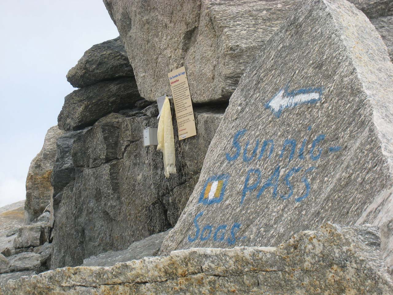
Departure altitude: 2850 m
Coordinates UTM/Wgs84:
32 T 045650 5103736Arrival altitude (Bocc.del Bottarello):
3147 mCoordinates UTM/Wgs84:
32 T 0424951 5103615Difference in altitude: m 297
Development: m 400 of which 30 m of ladders
Via Ferrata in Antigorio Valley
FERRATA WALSERFALL: A TRIBUTE TO THE ANCIENT WALSER PEOPLE AND THE AGÀRO WATERFALL
Lago Maggiore
Route description
Recommended period: MARCH-OCTOBER
The WALSERFALL Via Ferrata runs along the rocky wall that skirts the Agàro waterfall, downstream of the lake by the same name. It reaches Piodacalva, where a handful of barns and huts stand on a wide and panoramic rocky terrace. This is the Walser region, and as a tribute to these ancient and wise mountain people, the via Ferrata has been named WALSERFALL, combining the terms “Walser” and “Wasserfall” (waterfall).
The access trail (code H00 up to Osso) starts behind the old dairy farm and is marked by specific signs. From the road bridge in Osso, follow a small trail along the river until reaching the Via Ferrata base.
From Piodacalva, the Via Ferrata’s arrival point, head back to Croveo in about 50 minutes following the H06 trail. Alternatively, from Mollio a trail descends to Ecchio and then to the village. These trails have some exposed, unprotected sections that require attention.
Wonderful views along the beautiful waterfall of the Rio di Agaro are awaiting you.
The most difficult sections are on the wall known as “dei tetti”. This wall has a long and aerial traverse. On the final wall that leads to Piodacalva there is a very exposed overhanging passage that requires significant fitness and expertise.
WARNING!
The Via Ferrata is a mostly artificial route that leads the mountaineer on steep walls provided with safety steel ropes and steps anchored to the rock.
It is fundamental to be experienced climbers, physically fit, and technically well trained with full awareness of how to handle void and climbing. Those who have never approached the Vie Ferrate’s climbs are recommended to hire a professional UIAGM Alpine Guide.
It is mandatory to be equipped with specific personal protection equipment suitable for the activity and to be familiar with its correct use:
- Climbing helmet
- Climbing harness fully latched and well-tight in the flanks and thighs plus self-belaying set with energy absorbers
- gloves
- rock climbing shoes
- A double safety longe already fastened to the harness is recommended
Keep in mind that the shocks caused by a fall from the Via Ferrata are extreme. No material can withstand such shocks, and thus the use of energy absorbers is mandatory
Design and Works Supervision Ms. Romina Marani, P.Eng. – Mr. Alessandro Pirocchi, Geologist
Works Coordination: Alpi-Vert di Dalla Gasperina Luca & C. Nusiglie Hamlet 44 10080 Locana (TO)
Final tracking and implementation: Giuseppe Burlone, Alpine Guide; Tazio Ferrari, Alpine Guide; Pietro Garanzini, Alpine Guide; Paolo Pettinaroli, Alpine Guide; Giorgio Sacco, Alpine Guide
For more info: https://www.piemonteoutdoor.it/it/attivita/ferrata/ferrata-walserfall
Back to the list of routes
Quick info
Departure altitude: 2850 m
Coordinates UTM/Wgs84:
32 T 045650 5103736Arrival altitude (Bocc.del Bottarello):
3147 mCoordinates UTM/Wgs84:
32 T 0424951 5103615Difference in altitude: m 297
Development: m 400 of which 30 m of ladders
Via Ferrata in Antigorio Valley
FERRATA WALSERFALL: A TRIBUTE TO THE ANCIENT WALSER PEOPLE AND THE AGÀRO WATERFALL
Valle Anzasca
Route description
Recommended period: MARCH-OCTOBER
The WALSERFALL Via Ferrata runs along the rocky wall that skirts the Agàro waterfall, downstream of the lake by the same name. It reaches Piodacalva, where a handful of barns and huts stand on a wide and panoramic rocky terrace. This is the Walser region, and as a tribute to these ancient and wise mountain people, the via Ferrata has been named WALSERFALL, combining the terms “Walser” and “Wasserfall” (waterfall).
The access trail (code H00 up to Osso) starts behind the old dairy farm and is marked by specific signs. From the road bridge in Osso, follow a small trail along the river until reaching the Via Ferrata base.
From Piodacalva, the Via Ferrata’s arrival point, head back to Croveo in about 50 minutes following the H06 trail. Alternatively, from Mollio a trail descends to Ecchio and then to the village. These trails have some exposed, unprotected sections that require attention.
Wonderful views along the beautiful waterfall of the Rio di Agaro are awaiting you.
The most difficult sections are on the wall known as “dei tetti”. This wall has a long and aerial traverse. On the final wall that leads to Piodacalva there is a very exposed overhanging passage that requires significant fitness and expertise.
WARNING!
The Via Ferrata is a mostly artificial route that leads the mountaineer on steep walls provided with safety steel ropes and steps anchored to the rock.
It is fundamental to be experienced climbers, physically fit, and technically well trained with full awareness of how to handle void and climbing. Those who have never approached the Vie Ferrate’s climbs are recommended to hire a professional UIAGM Alpine Guide.
It is mandatory to be equipped with specific personal protection equipment suitable for the activity and to be familiar with its correct use:
- Climbing helmet
- Climbing harness fully latched and well-tight in the flanks and thighs plus self-belaying set with energy absorbers
- gloves
- rock climbing shoes
- A double safety longe already fastened to the harness is recommended
Keep in mind that the shocks caused by a fall from the Via Ferrata are extreme. No material can withstand such shocks, and thus the use of energy absorbers is mandatory
Design and Works Supervision Ms. Romina Marani, P.Eng. – Mr. Alessandro Pirocchi, Geologist
Works Coordination: Alpi-Vert di Dalla Gasperina Luca & C. Nusiglie Hamlet 44 10080 Locana (TO)
Final tracking and implementation: Giuseppe Burlone, Alpine Guide; Tazio Ferrari, Alpine Guide; Pietro Garanzini, Alpine Guide; Paolo Pettinaroli, Alpine Guide; Giorgio Sacco, Alpine Guide
For more info: https://www.piemonteoutdoor.it/it/attivita/ferrata/ferrata-walserfall
Back to the list of routes
Quick info
Departure altitude: 2850 m
Coordinates UTM/Wgs84:
32 T 045650 5103736Arrival altitude (Bocc.del Bottarello):
3147 mCoordinates UTM/Wgs84:
32 T 0424951 5103615Difference in altitude: m 297
Development: m 400 of which 30 m of ladders
Via Ferrata in Antigorio Valley
FERRATA WALSERFALL: A TRIBUTE TO THE ANCIENT WALSER PEOPLE AND THE AGÀRO WATERFALL
Lago Maggiore
Route description
Recommended period: MARCH-OCTOBER
The WALSERFALL Via Ferrata runs along the rocky wall that skirts the Agàro waterfall, downstream of the lake by the same name. It reaches Piodacalva, where a handful of barns and huts stand on a wide and panoramic rocky terrace. This is the Walser region, and as a tribute to these ancient and wise mountain people, the via Ferrata has been named WALSERFALL, combining the terms “Walser” and “Wasserfall” (waterfall).
The access trail (code H00 up to Osso) starts behind the old dairy farm and is marked by specific signs. From the road bridge in Osso, follow a small trail along the river until reaching the Via Ferrata base.
From Piodacalva, the Via Ferrata’s arrival point, head back to Croveo in about 50 minutes following the H06 trail. Alternatively, from Mollio a trail descends to Ecchio and then to the village. These trails have some exposed, unprotected sections that require attention.
Wonderful views along the beautiful waterfall of the Rio di Agaro are awaiting you.
The most difficult sections are on the wall known as “dei tetti”. This wall has a long and aerial traverse. On the final wall that leads to Piodacalva there is a very exposed overhanging passage that requires significant fitness and expertise.
WARNING!
The Via Ferrata is a mostly artificial route that leads the mountaineer on steep walls provided with safety steel ropes and steps anchored to the rock.
It is fundamental to be experienced climbers, physically fit, and technically well trained with full awareness of how to handle void and climbing. Those who have never approached the Vie Ferrate’s climbs are recommended to hire a professional UIAGM Alpine Guide.
It is mandatory to be equipped with specific personal protection equipment suitable for the activity and to be familiar with its correct use:
- Climbing helmet
- Climbing harness fully latched and well-tight in the flanks and thighs plus self-belaying set with energy absorbers
- gloves
- rock climbing shoes
- A double safety longe already fastened to the harness is recommended
Keep in mind that the shocks caused by a fall from the Via Ferrata are extreme. No material can withstand such shocks, and thus the use of energy absorbers is mandatory
Design and Works Supervision Ms. Romina Marani, P.Eng. – Mr. Alessandro Pirocchi, Geologist
Works Coordination: Alpi-Vert di Dalla Gasperina Luca & C. Nusiglie Hamlet 44 10080 Locana (TO)
Final tracking and implementation: Giuseppe Burlone, Alpine Guide; Tazio Ferrari, Alpine Guide; Pietro Garanzini, Alpine Guide; Paolo Pettinaroli, Alpine Guide; Giorgio Sacco, Alpine Guide
For more info: https://www.piemonteoutdoor.it/it/attivita/ferrata/ferrata-walserfall
Back to the list of routes
Quick info
Departure altitude: 2850 m
Coordinates UTM/Wgs84:
32 T 045650 5103736Arrival altitude (Bocc.del Bottarello):
3147 mCoordinates UTM/Wgs84:
32 T 0424951 5103615Difference in altitude: m 297
Development: m 400 of which 30 m of ladders

