From Punta di Migiandone to Forte di Bara
HISTORIC MOUNTAIN ROADS: LINEA CADORNA
Piana del Toce
Route description
The Cadorna Line is the defence system that was built near the Swiss border during World War I at the behest of General Luigi Cadorna, the then Chief of Staff of the Italian Army, who feared a German-Austrian invasion through neutral Switzerland.
The immense defence structure, built between the summer of 1915 and the spring of 1918, stretched from Ossola to Verbano and into Lombardy, becoming a dense network of military roads and mule tracks, trenches, artillery positions, lookout posts, camp hospitals and logistical facilities, barracks and outposts.
The work was carried out by local bricklayers and stonemasons and women also played a fundamental role in the construction of the defence line, particularly in transporting material and supplies to the work sites.
The Cadorna Line was never used for war purposes and today this military road is a historical heritage site that allows the community to learn about a historical moment of the 20th century.
It is also a natural heritage of trails for trekking and mountain-biking enthusiasts, offering routes that can be travelled almost all year round (be careful in the event of recent snowfall).
HIGHLIGHTS AND TOUR DETAILS
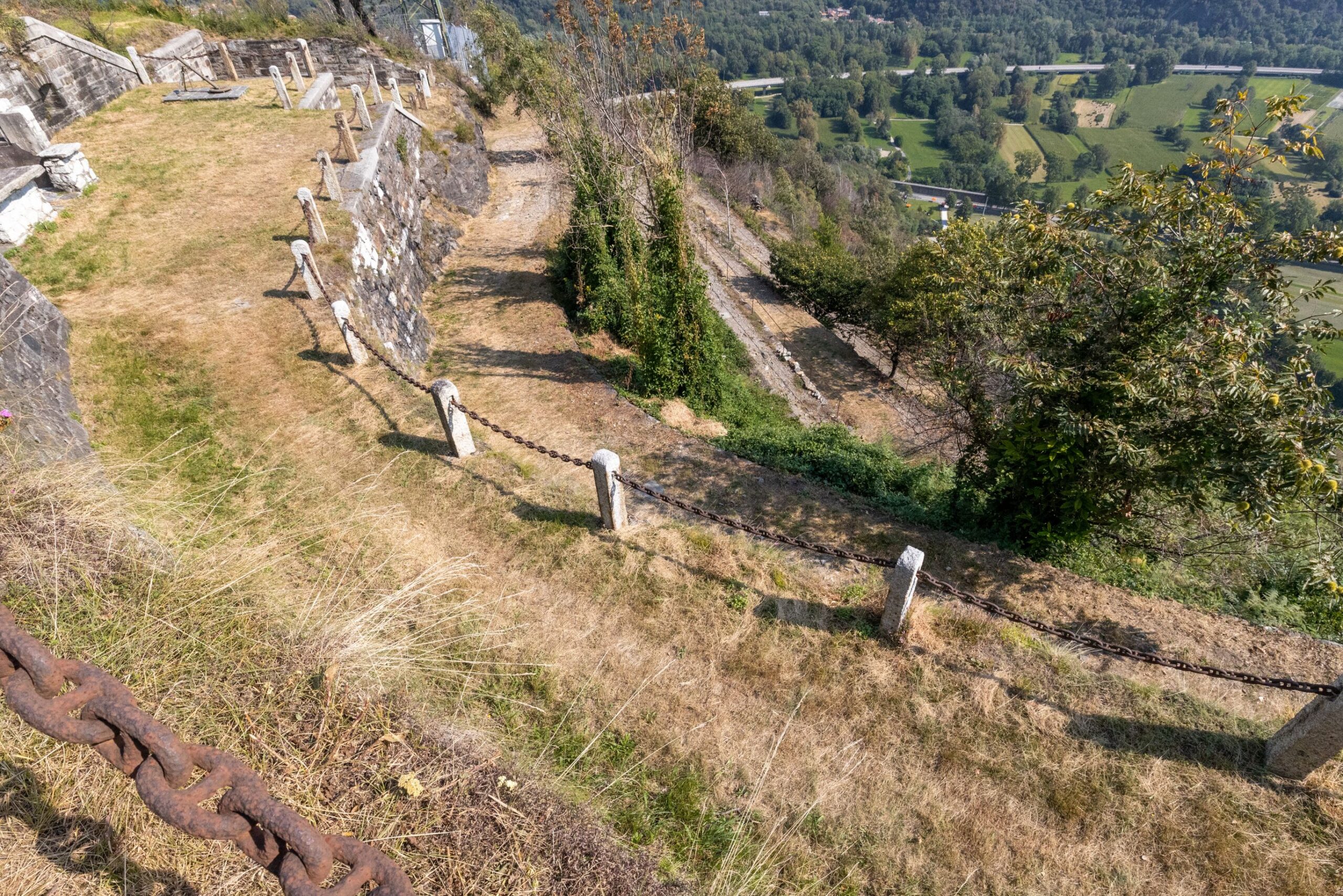
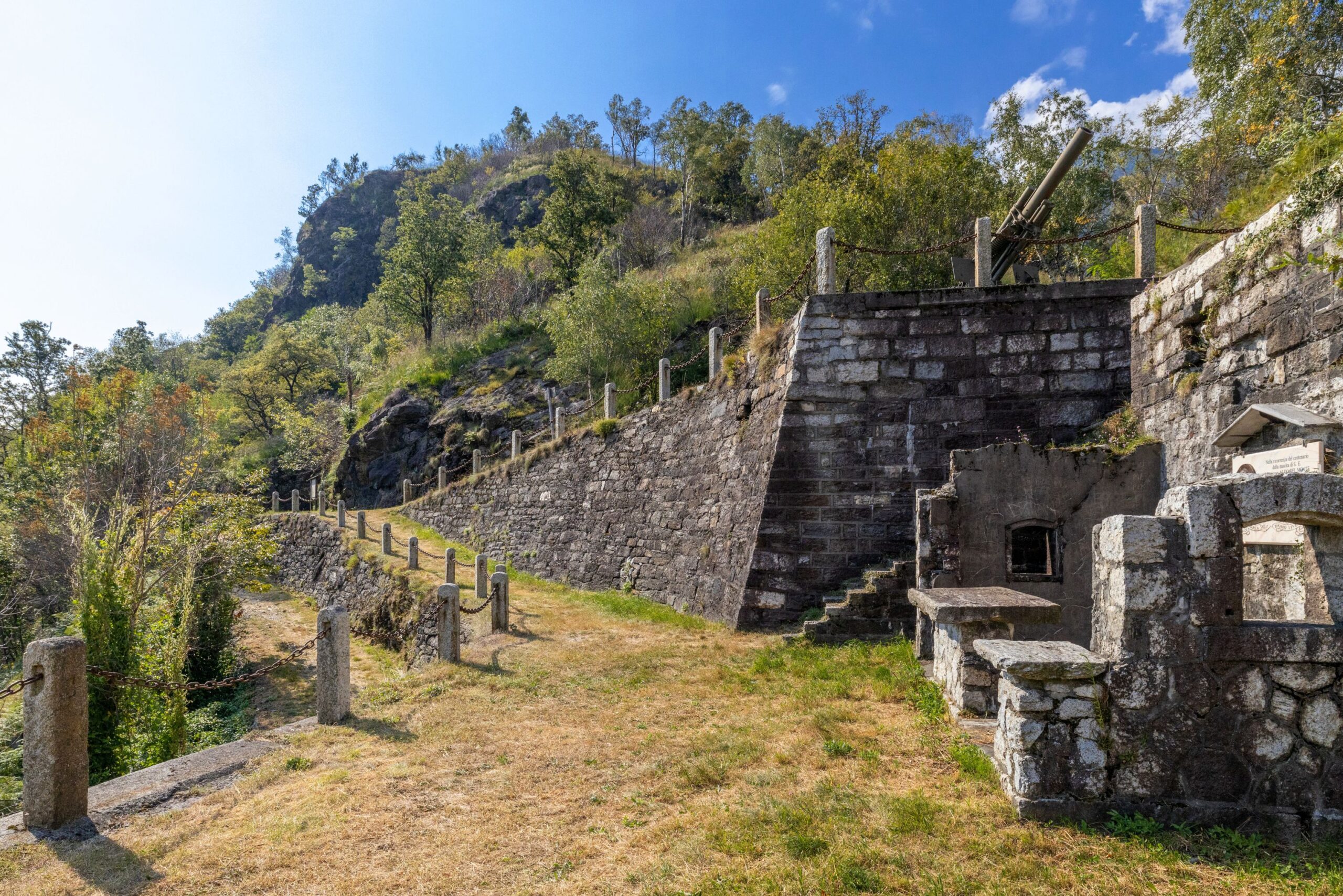
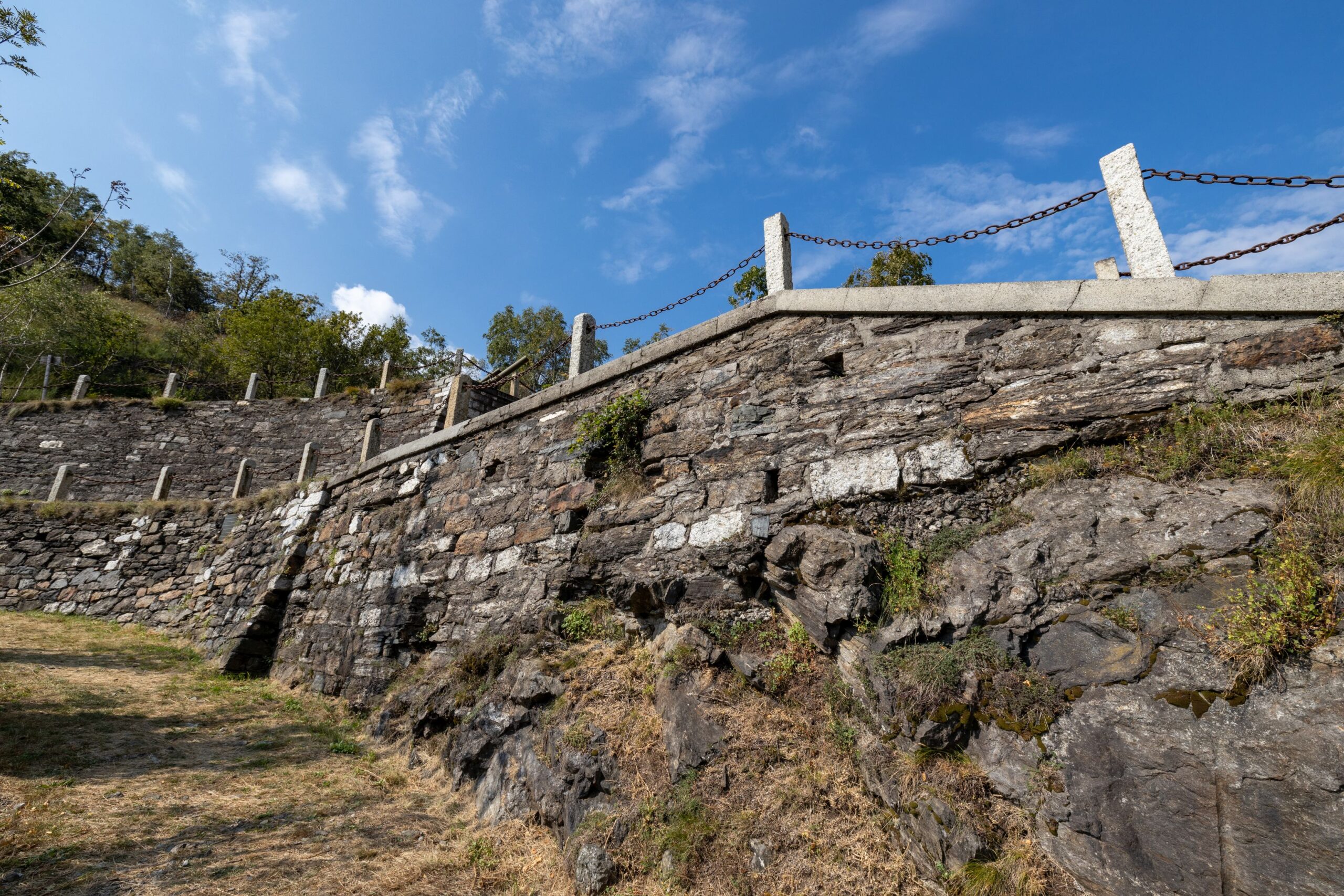
The route along this section of the Cadorna Line begins in Ornavasso in Bassa Ossola at the car park of Punta di Migiandone (210 m asl), where the well-preserved mule track winds its way with regularly sloping hairpin bends and stone walls towards Forte di Bara. You will encounter tunnels carved into the rock, trenches, walkways and machine gun emplacements along the route (it is useful to have a torch with you).
This mountain ridge was the ideal place to control the passage between Bassa Ossola and Lakes Maggiore and Mergozzo, at the narrowest point of the plain of the River Toce, known precisely as the “Stretta di Bara”.
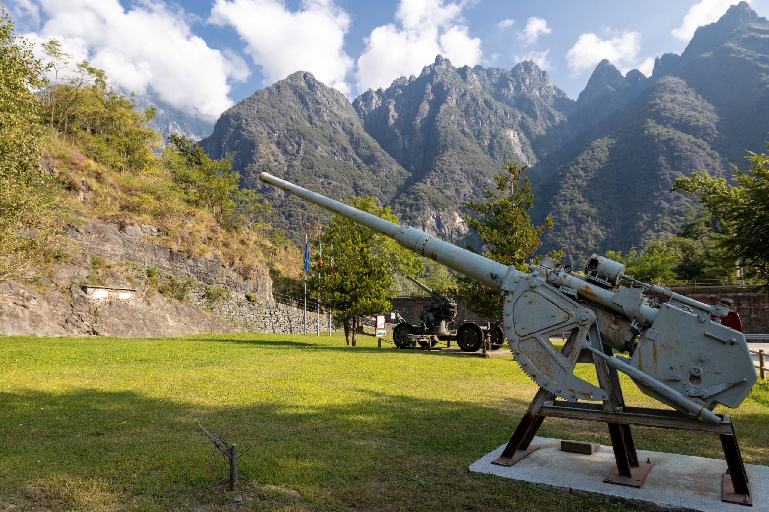
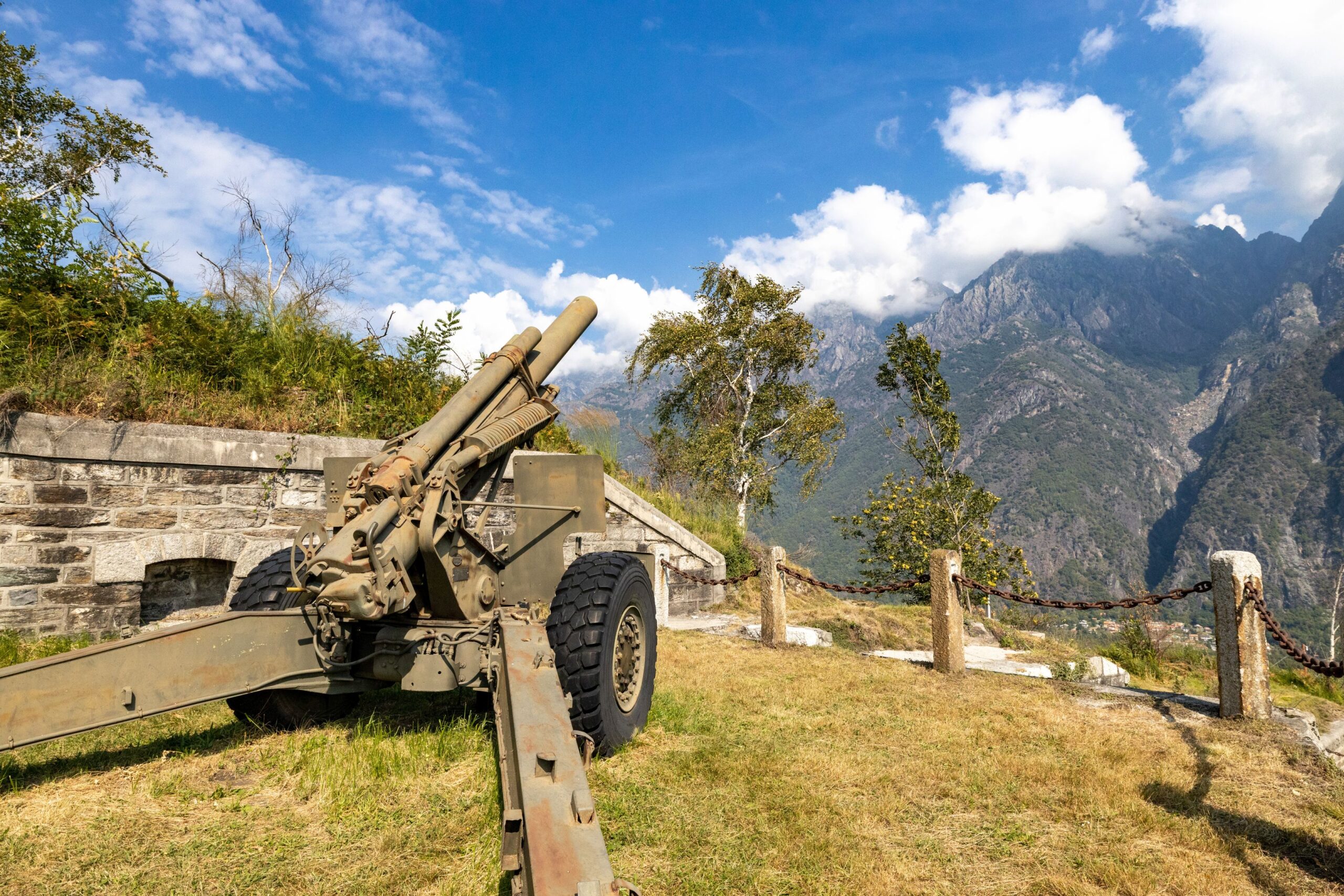
Arriving at Forte di Bara (410 m asl), the multi-level fortified emplacement can be admired, consisting of several embankments supported by square stone walls that were intended to house barracks and long-range cannons to protect the Ornavasso and Migiandone trench system. Cannons and mortars make this visit even more evocative.
A plaque commemorates the Battle of Ornavasso that was fought in October 1944 by the Italian Alpine soldiers and Partisans of the ‘Valtoce’ formation against the Germans to defend the Ossola Partisan Republic.
Risks: There is no protection in some parts of the road.
POINT OF INTEREST
Panoramic views of Lake Maggiore and Mergozzo, the peaks of Bassa Ossola and the Corni di Nibbio.
Still well-preserved and remarkably beautiful military artefacts.
From Punta di Migiandone you can rejoin the Ciclovia del Toce (Toce Cycle Route), which, coming from Alta Val Formazza, continues to Lake Maggiore, skirting the famous watercourse.
For lovers of local history, you can also visit the Enrico Bianchetti Archaeological Section of the Museo del Paesaggio (Landscape Museum) in Ornavasso village, with a large display of artefacts from the 8th century BC to the 4th century AD.
https://www.museodelpaesaggio.it/collezioni/archeologia/
and the Museo Partigiano (Partisan Museum) www.museopartigiano.it
From Forte di Bara, you can continue along the dirt road on flat ground to the Old Marble Quarry.
The Sanctuary of the Madonna del Boden and the Sanctuary of the Madonna della Guardia are also worth visiting.
(The project is promoted by Regional Law No. 9 of 19 May 2021, “Interventions for the valorisation of historic mountain roads of tourist interest”, which recognises and valorises historic mountain roads of tourist interest in order to promote the development of open-air tourism)
Back to the list of routes