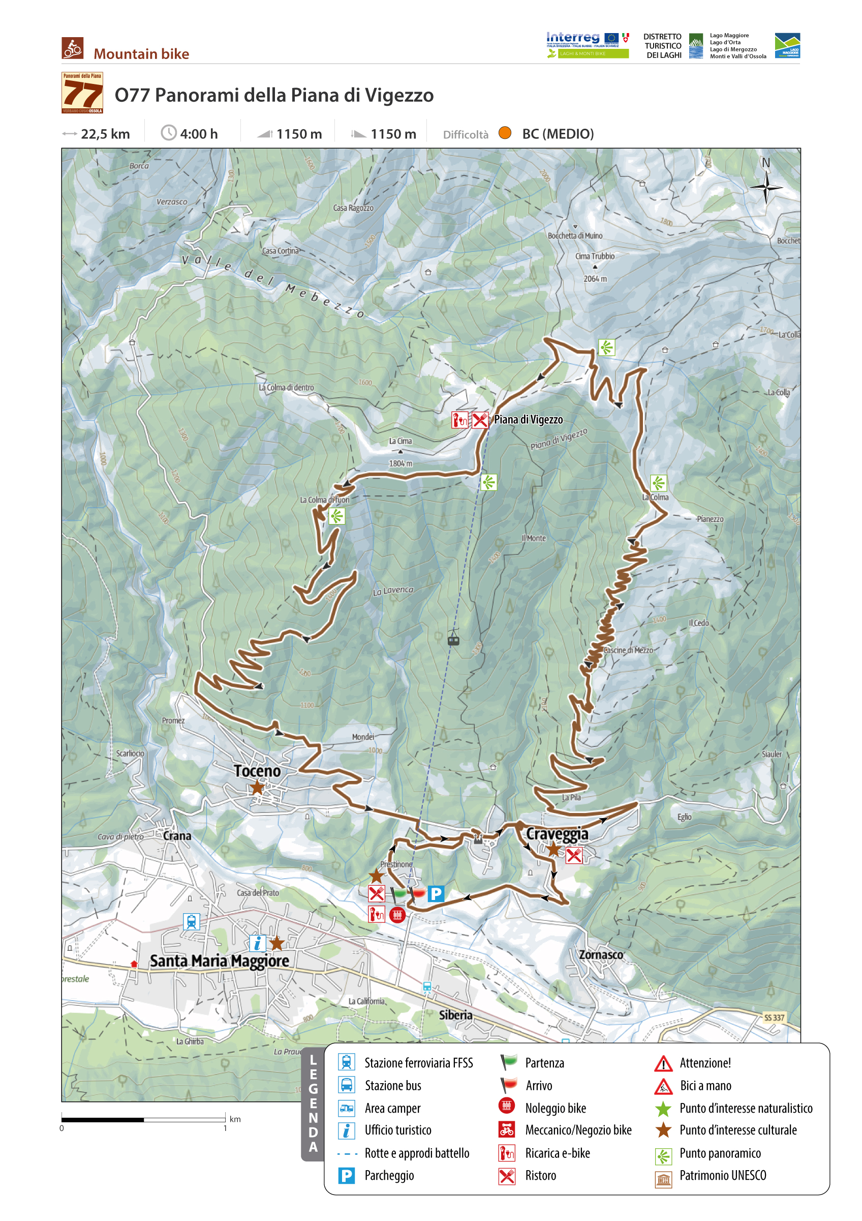
PANORAMAS OF PIANA DI VIGEZZO
Valle Vigezzo
Medium
Distance 22,5 km
Duration 4 hours
Elevation 1150
Difference in height + + 1006
Difference in height – N.P.
Gradient N.P.
Route description
Two dirt roads that connect the municipalities of Toceno and Craveggia to the Piana di Vigezzo allow for a ring of more than 20 km unique and unmissable for its fantastic landscapes and views.
Starting point of the route is the Piana di Vigezzo cable car station in Prestinone, which is equipped with parking, toilets, and an e-bike rental point.
Back to the list of routes