A breathtaking Via Ferrata!
THE VIA FERRATA OF THE PICASASS: A UNIQUE POINT OF VIEW ON LAKE MAGGIORE
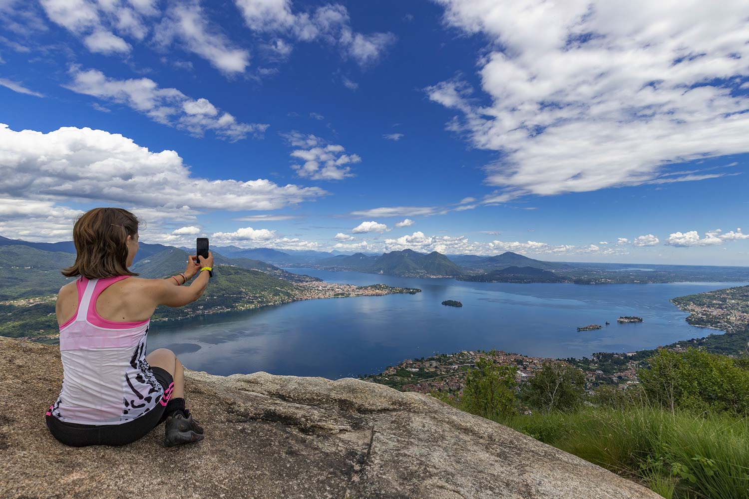
Lago Maggiore
Route description
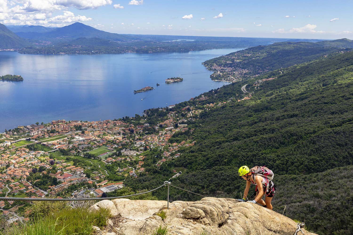
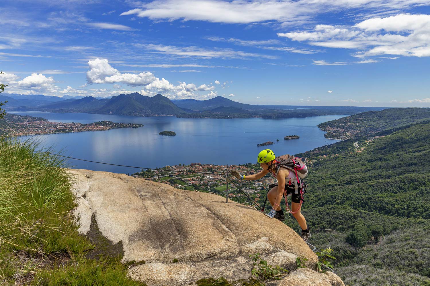
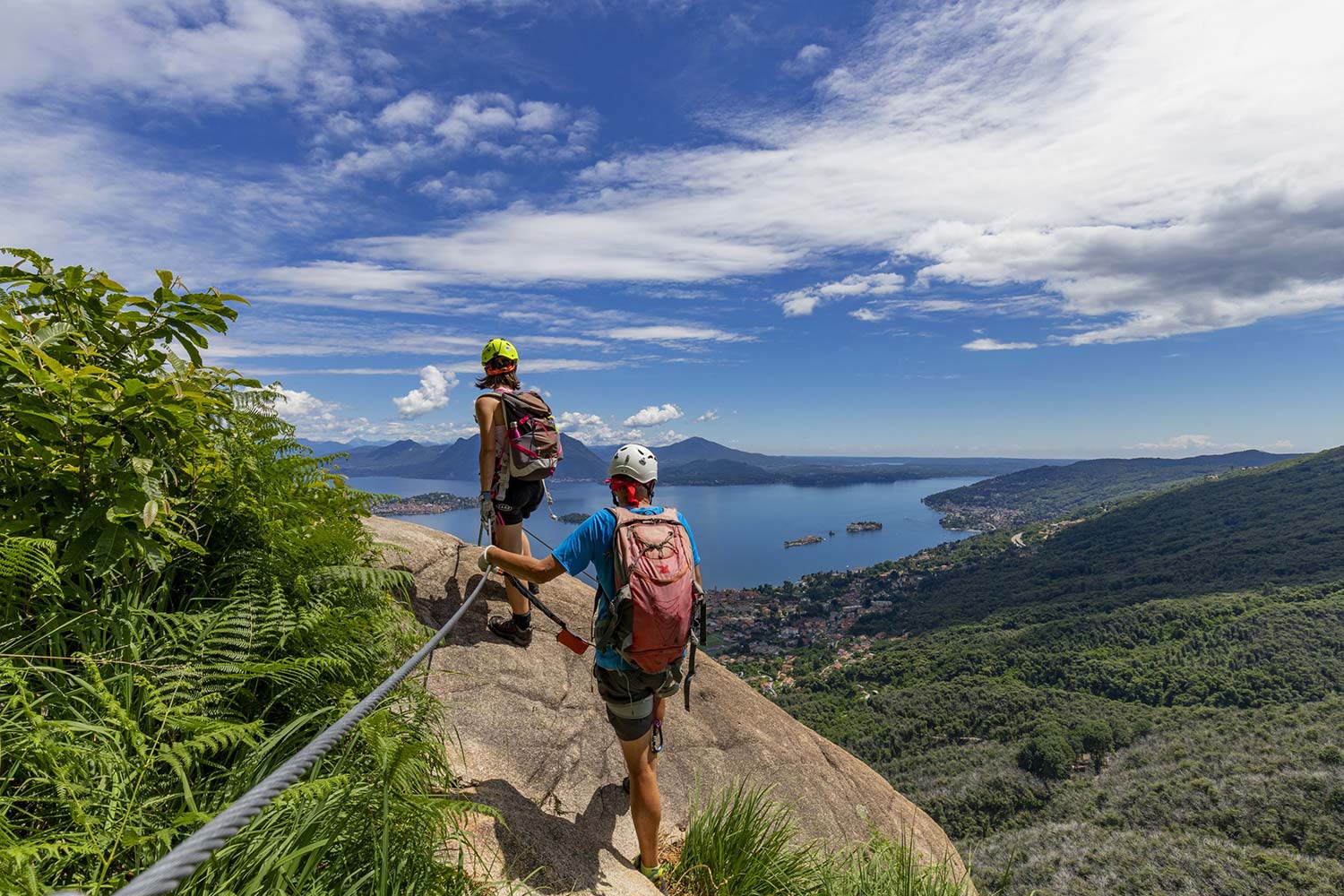
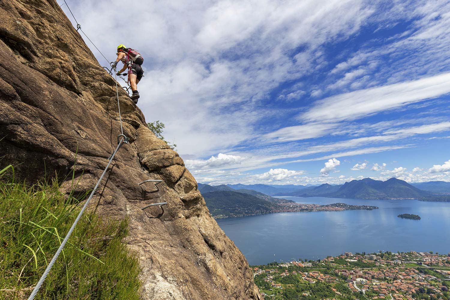
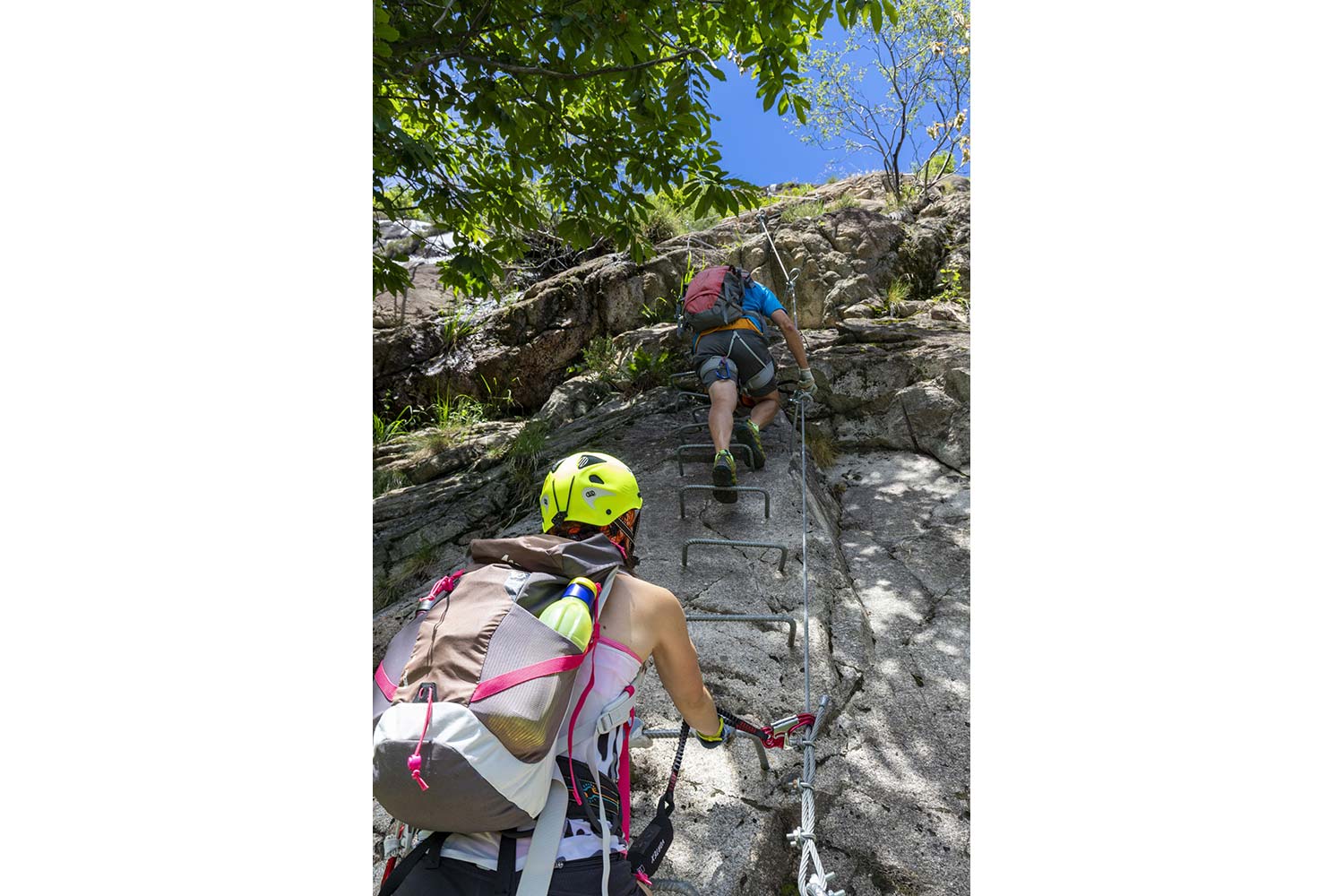
From the moment you start to climb along the via Ferrata and up to the peak, the view you can admire is spectacular: Lakes Maggiore and Varese, the Borromeo Gulf islands, the Lombardy shore, and the Prealps and the Alps form a truly magical landscape.
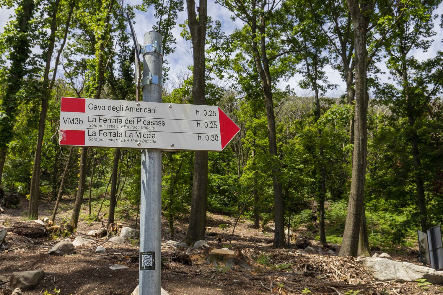
To reach the Ferrata, in Baveno, follow the signs heading toward Tranquilla (Oltrefiume hamlet). Near the campsite by the same name, you will find the signs pointing towards the M3 trail. After about 15 minutes, you will cross the Picasass M3b trail that leads to the beginning of the via Ferrata in about 20 minutes.
To climb, you must have your own climbing kit.
BY CAR: Take the A26 highway and exit at Baveno-Stresa. Take the second right. At the roundabout, take the first exit and follow the road for about 1 km. At Tranquilla, take the road in front of the washhouse.
BY PUBLIC TRANSIT: once in Baveno, reach the hamlet of Oltrefiume and in Tranquilla take the road in front of the washhouse.
Coming back from Monte Camoscio follow the M3 trail toward Baveno.
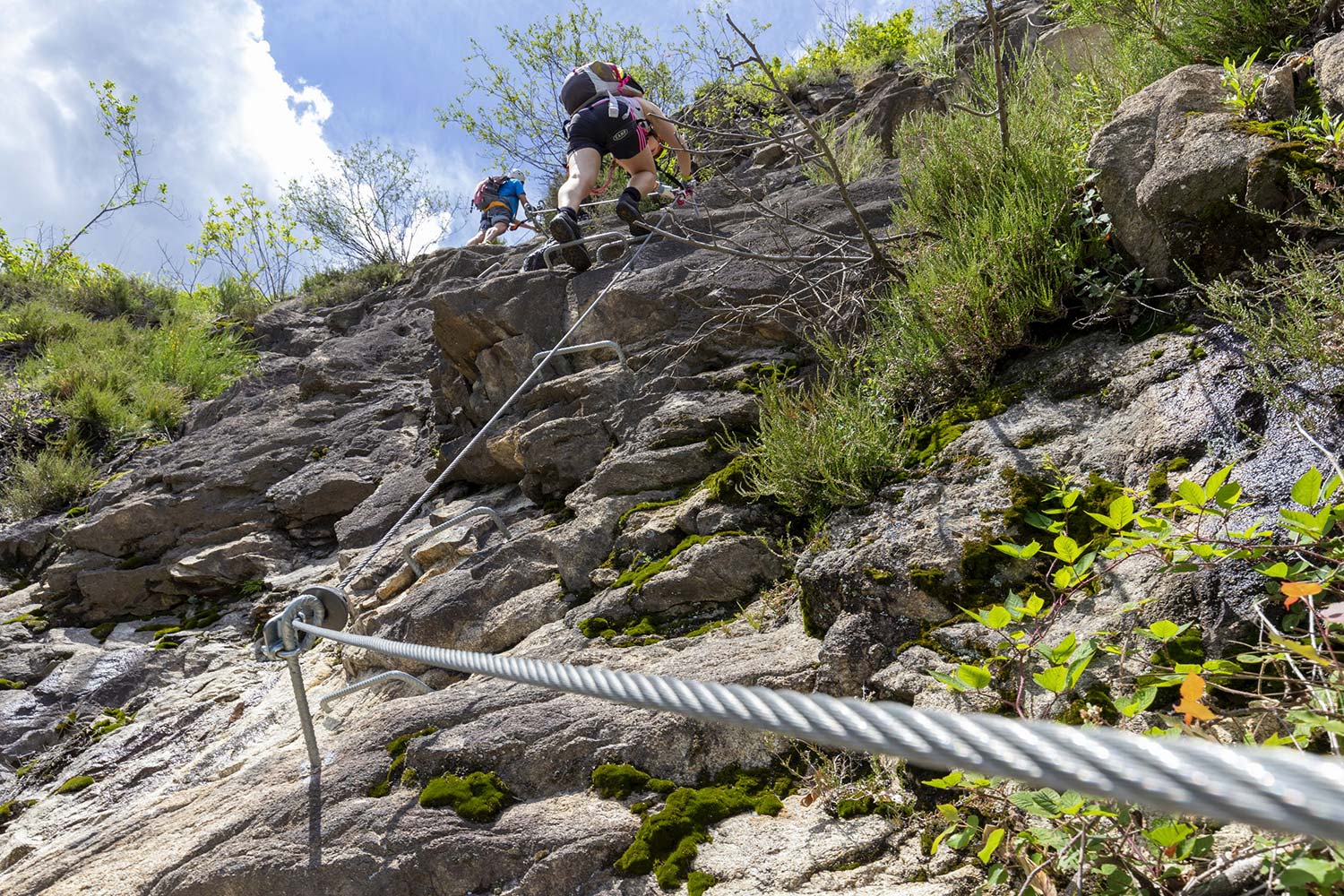
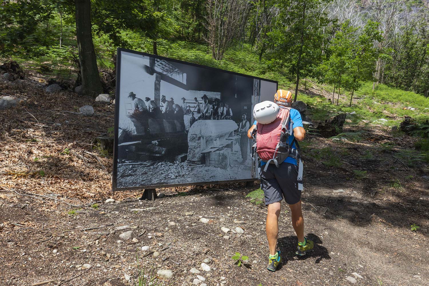
Inaugurated in July 2016 by the CAI chapter of Baveno, the name “Picasass” was chosen to pay homage to all the “picasass” (stonecutters) artisans who since the nineteenth century have been working on the extraction and processing of the famous pink granite from the quarries of Baveno. From the moment you start to climb along the via Ferrata and up to the peak, the view you can admire is spectacular: Lakes Maggiore and Varese, the Borromeo Gulf islands, the Lombardy shore, and the Prealps and the Alps form a truly magical landscape. The climb starts from a steep plateau facilitated by steps. Numerous traverses and a few slightly overhanging stretches (never challenging) lead to the key stretch that is the most challenging of the via Ferrata and at the same time the most entertaining: an exposed terrace to climb and then a vertical ledge equipped with brackets and supports to facilitate the climb. The climb resumes with increased ease until reaching a breathtaking panoramic terrace, where the “summit book” is located. From this point onwards, the difficulties end, and the climb becomes only an easy progression that does not need the use of brackets (since the granite wall offers excellent grip). Once below the peak, those who love excitement can experience the thrill of walking on a steel cable (Tibetan bridge) to cross the Valley and end the route passing on a small ridge that leads to the peak of Monte Camoscio (890 m), which represents the end of the via Ferrata. To reach the via Ferrata, in Baveno follow the signs toward Tranquilla. Near the campsite by the same name, you will find the signs pointing towards the M3 trail. After approximately 15 minutes, you will cross the “Picasass” M3b trail that leads to the start of the via Ferrata after about 20 minutes. Journey time: approx. 2 hours; height difference: 320 m; development 600 m; exposure North/East; difficulty: not too difficult; return from Monte Camoscio following the M3 trail towards Baveno. Descent time: approx. 80 minutes.
The via Ferrata requires appropriate equipment consisting of harness, approved climbing kit, helmet, and gloves. Read carefully the rules located at the start of the route and enjoy.
Back to the list of routes
Info:
Where: Baveno
Difficulty level: Easy
Travel time: from 1 to 3 hours
Difference in altitude: 320 m
Development: 250 m
Location: North-East
Descent time: about 80 minutes
Place of departure:
45° 54’ 42,29’’ N
08° 29’ 19,40’’ E
m. 285

