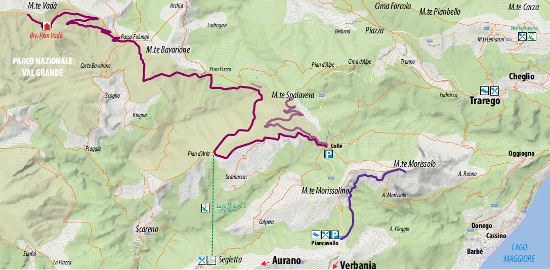
From Colle to Pian Vada’
HISTORIC MOUNTAIN ROADS: LA LINEA CADORNA
Alto Verbano
Route description
The Cadorna Line is the defence system that was built near the Swiss border during World War I at the behest of General Luigi Cadorna, the then Chief of Staff of the Italian Army, who feared a German-Austrian invasion through neutral Switzerland.
The immense defence structure, built between the summer of 1915 and the spring of 1918, stretched from Ossola to Verbano and into Lombardy, becoming a dense network of military roads and mule tracks, trenches, artillery positions, lookout posts, camp hospitals and logistical facilities, barracks and outposts.
The work was carried out by local bricklayers and stonemasons and women also played a fundamental role in the construction of the defence line, particularly in transporting material and supplies to the work sites.
The Cadorna Line was never used for war purposes and today this military road is a historical heritage site that allows the community to learn about a historical moment of the 20th century.
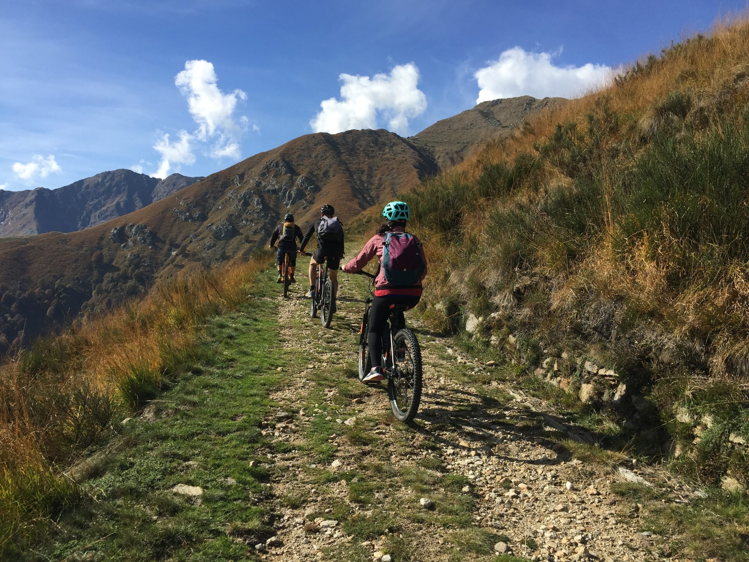
It is also a natural heritage of trails for trekking and mountain-biking enthusiasts, offering routes that can be travelled almost all year round. Be careful in the event of recent snowfall.
Highlights and tour details
The section of the Cadorna Line between Colle – Monte Spalavera – Passo Folungo – Rifugio Pian Vada’ begins in Colle (1238 m asl), a hamlet of Oggebbio.
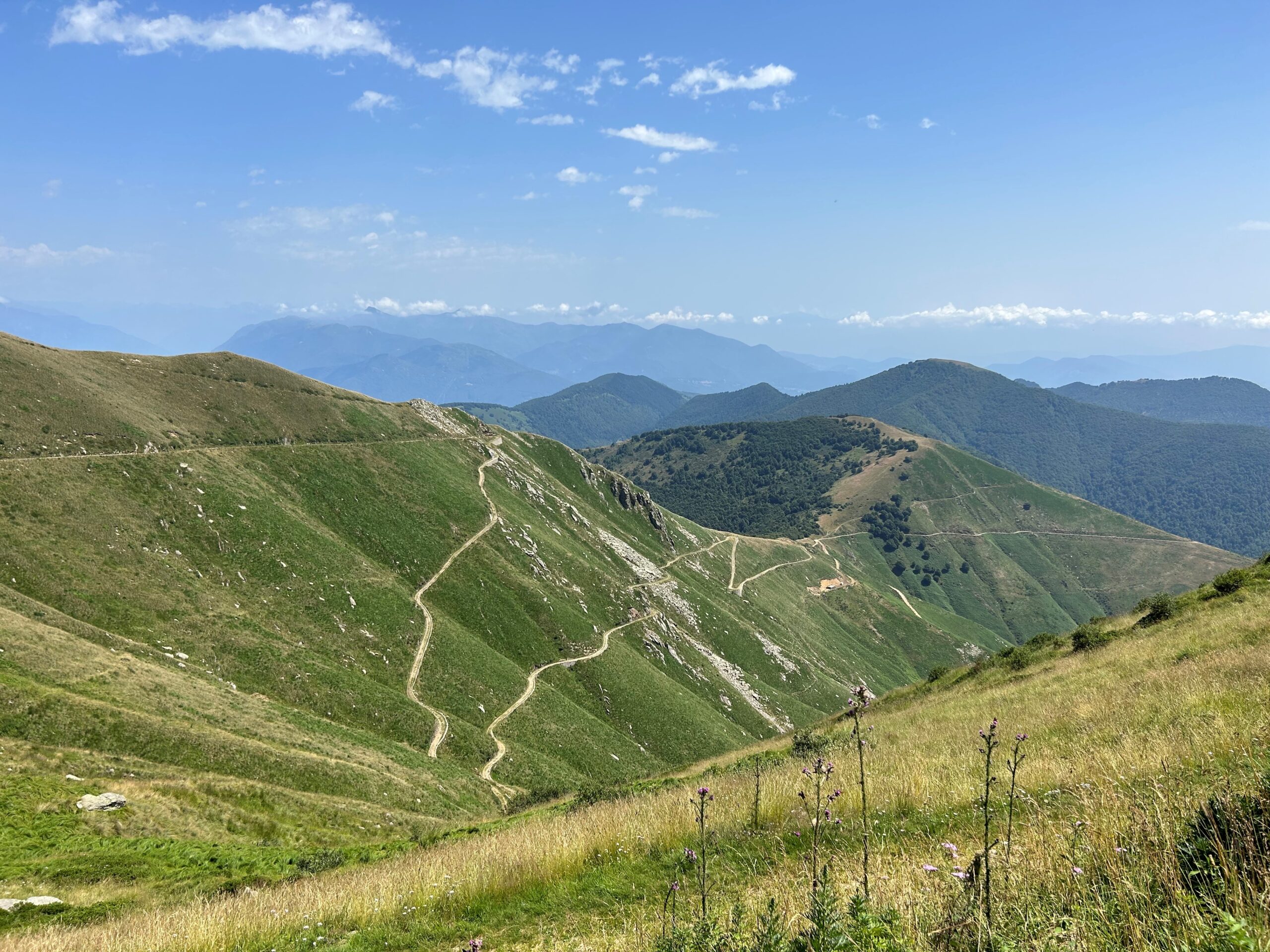
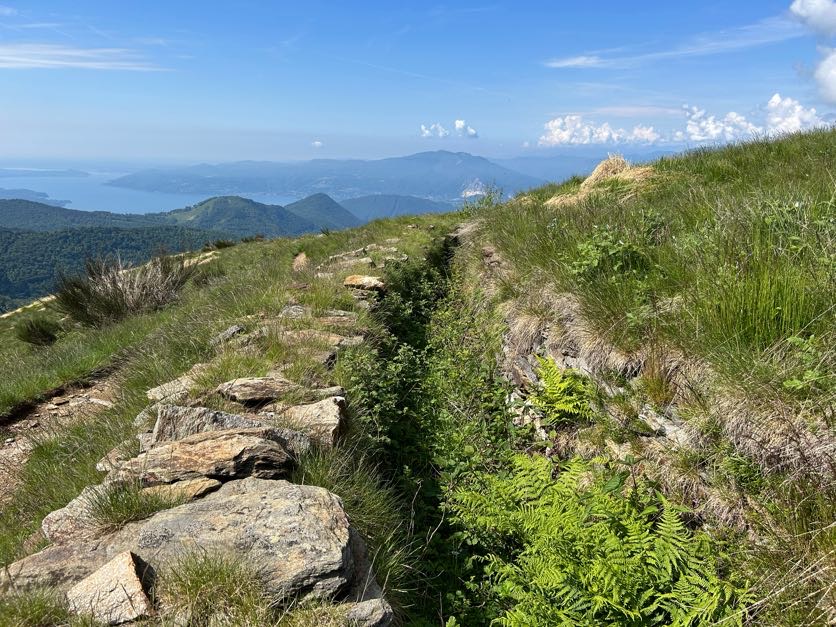
There is a convenient car park where you can leave your car and begin the first climb to Monte Spalavera (1534 m asl, an elevation gain of approximately 300 m and a route length of 2.7 km). The route follows a wide dirt road that then becomes an easy grassy path with no particular difficulties. The view ahead is truly spectacular, from the lakes to the peaks of the Val Grande National Park to the Monte Rosa group and the Swiss Alps. On reaching the summit cross, a panel shows the outline of the Alps with the names of their peaks, and here it is possible to admire well-preserved trenches.
Once back in Colle, take the Cadorna Line, now following the signs for Passo Folungo. Strada Cadorna is a dirt road and stretches for about 13 km. Along the way, you can admire the construction of a hospital camp and reach Passo Folungo (1369 m asl), where Strada Cadorna begins to climb with hairpin bends up to Rifugio Pian Vada’ (1711 m asl, approx. 6 km – elevation gain approx. 340 m).
From here, there is a wonderful view of Lake Maggiore, Valle Intrasca, the peaks of the Val Grande National Park and those of Ossola.
POSSIBLE RISKS: The road is without protection in certain sections. Always pay attention in case of recent snowfalls.
Points of interest
Scenic view of Upper Lake Maggiore and the Peaks of the Val grande National Park and the Peaks of the Ossola Valleys. Trenches and military constructions.
Possibility to visit the fortifications at Monte Bavarione (1505 m asl) and Monte Carza (1116 m asl).
Along the Strada Cadorna, between colle and Passo Folungo, you pass by Pian d’Ada, the departure point of the Lake Maggiore Zipline, the 1850 m long steel cable which allows you to try the experience of an adrenaline-packed flight of 1 and a half minutes at over 120 km/hr (www.lagomaggiorezipline.it – possibility to rent e-bikes at Alpe Segletta – Aurano).
A few kilometres away, at Monte Carza, an easy path leads you to the Big Bench of the Lake, with a breathtaking view over Alto Verbano and the Wonderwood Adventure Park (Trarego Viggiona) www.wonderwood.it.
Back to the list of routes