Ein 38 km langer Rundkurs von ungewöhnlicher Schönheit um den Monte Cistella
CISTELLA MTB TOUR
Valle Divedro
Routenbeschreibung
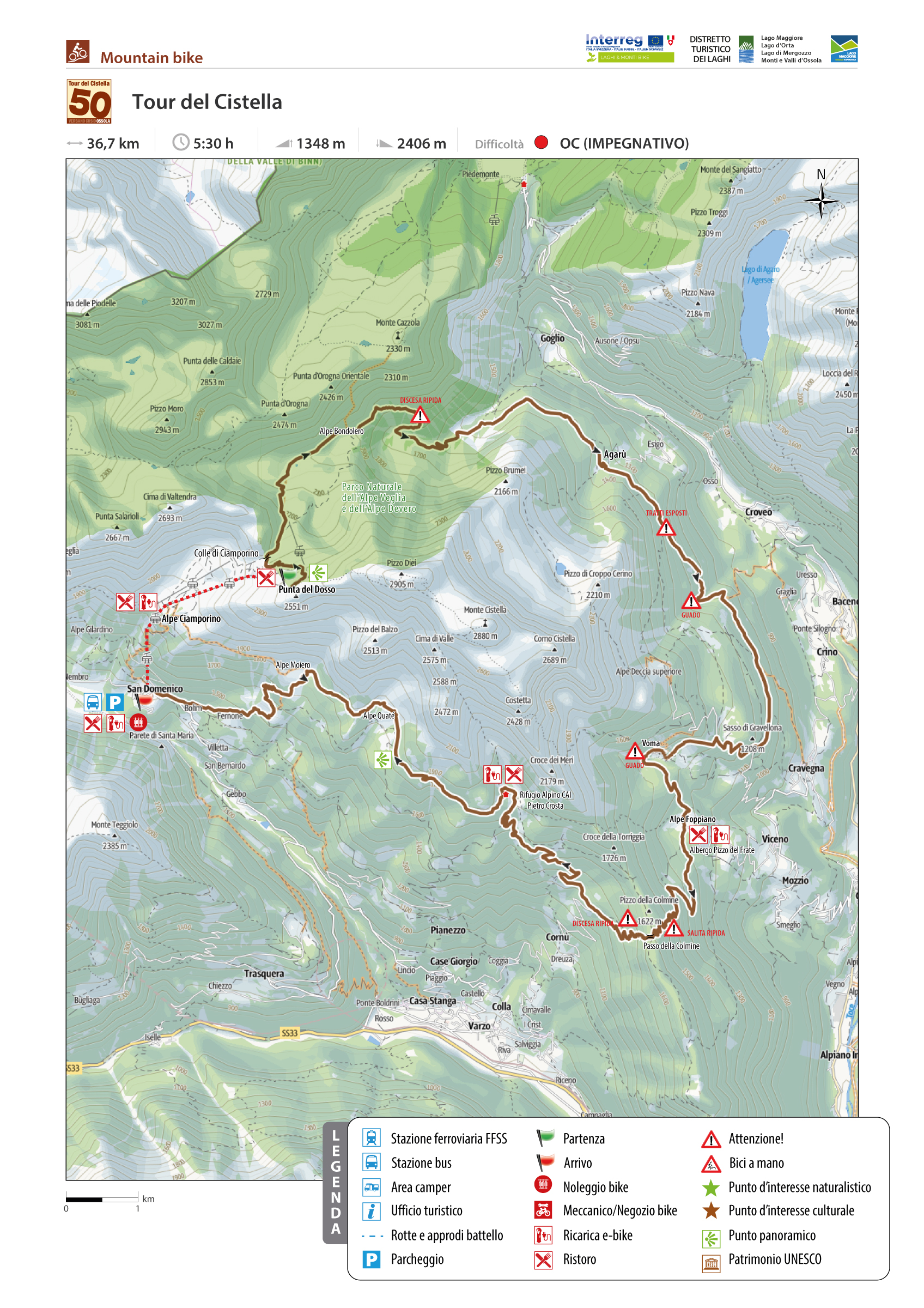
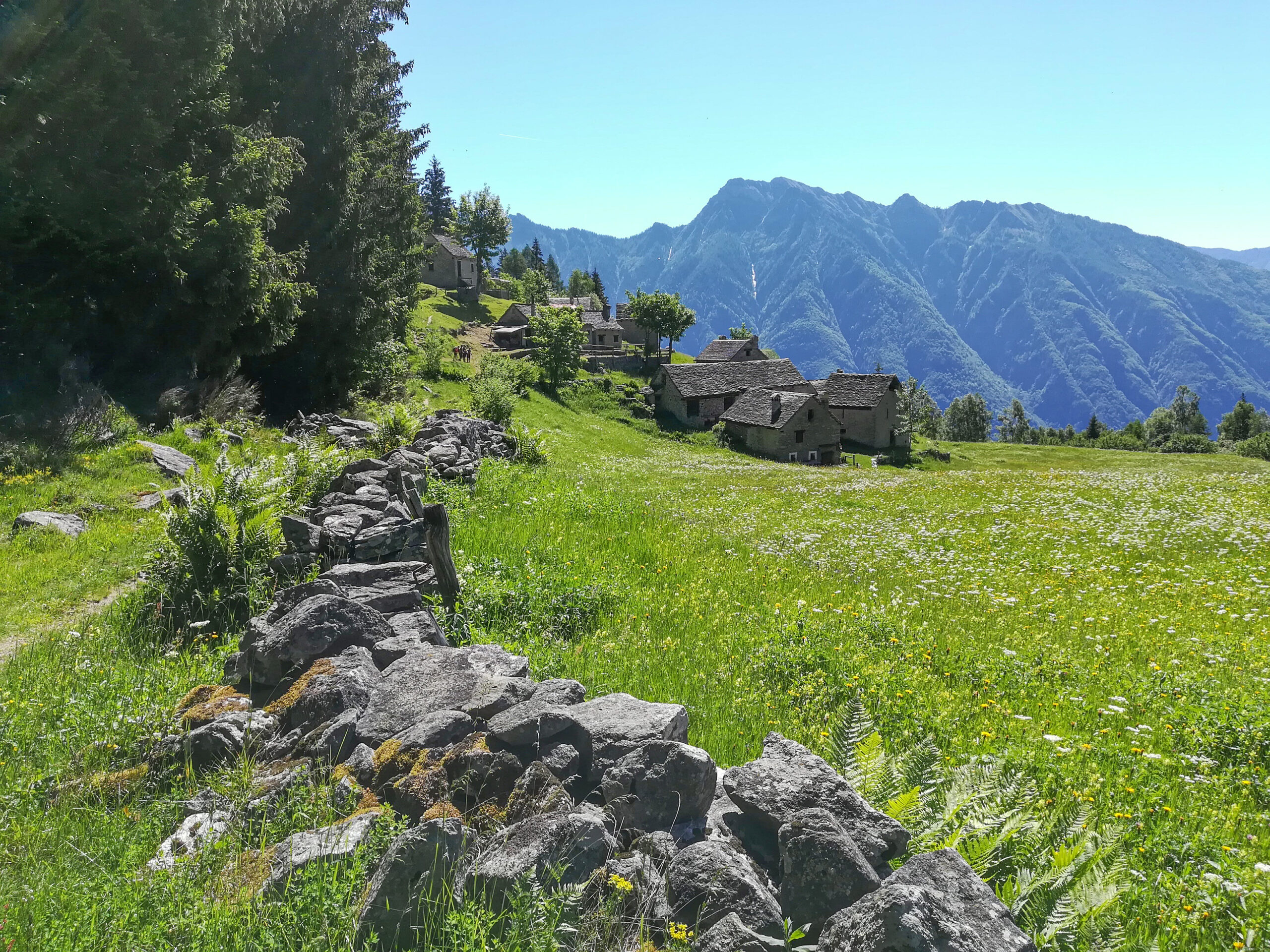
Die Cistella MTB Tour ist ein 38 km langer Rundkurs von ungewöhnlicher Schönheit um den Monte Cistella. Um diesen symbolhaften Berg des Alta Ossola Gebiets ranken sich mysteriöse und geheimnisvolle Legenden: Die Hexen des Cistella sind in der Erinnerung der Ossolaner
immer noch präsent. Das Hochplateau wurde mit Schrecken als „der große Ballsaal des Teufels“ bezeichnet.
Die Tour umfasst drei Gemeinden des Alta Ossola Gebiets (Varzo, Crodo und Baceno). Die Strecke verläuft in einem Netz von Wegen und vorhandenen Landwirtschafts- und Sammelstraßen.
Für die Abfahrt der Rundstrecke können zwei Ortschaften gewählt werden: Die Ortschaft San Domenico (Gemeinde Varzo), die auch mit öffentlichen Verkehrsmitteln erreichbar ist, oder Foppiano (Gemeinde Crodo), die nicht von öffentlichen Verkehrsmitteln bedient wird. Die letztere
Option hat den Vorteil, dass man mit noch frischen Kräften gleich zu Beginn den anspruchsvollsten Abschnitt der gesamten Tour zurücklegen kann: die Auffahrt zum Passo della Colmine.
Zurück zur Routenliste
A 38-kilometer loop of extraordinary interest around Monte Cistella, the iconic mountain of Alta Ossola
CISTELLA MTB TOUR
Valle Divedro
Routenbeschreibung
The Cistella MTB Tour is a 38-kilometer loop of extraordinary interest around Monte Cistella, the iconic mountain of Alta Ossola to which arcane and mysterious legends are linked: the witches of Cistella are still etched in the memory of Ossolans. The plateau was regarded with terror as “the grand ballroom of Messer lo Diavolo.”
It involves three municipalities in Alta Ossola (Varzo, Crodo, and Baceno). The route stretches along an existing network of agro-sylvo-pastoral and consortium trails and tracks.
The loop tour can be approached starting from two locations: San Domenico (municipality of Varzo), which can also be reached by public transport, or Foppiano (municipality of Crodo), which is not served by public transport but allows you to immediately tackle the most challenging section of the entire tour with fresh forces: the climb to the Colmine Pass.
Zurück zur Routenliste

