SLOW TREK ALONG THE SOUTHERN COAST of the second largest lake in Piedmont
Lake Orta: PELLA- ORTA SAN GIULIO
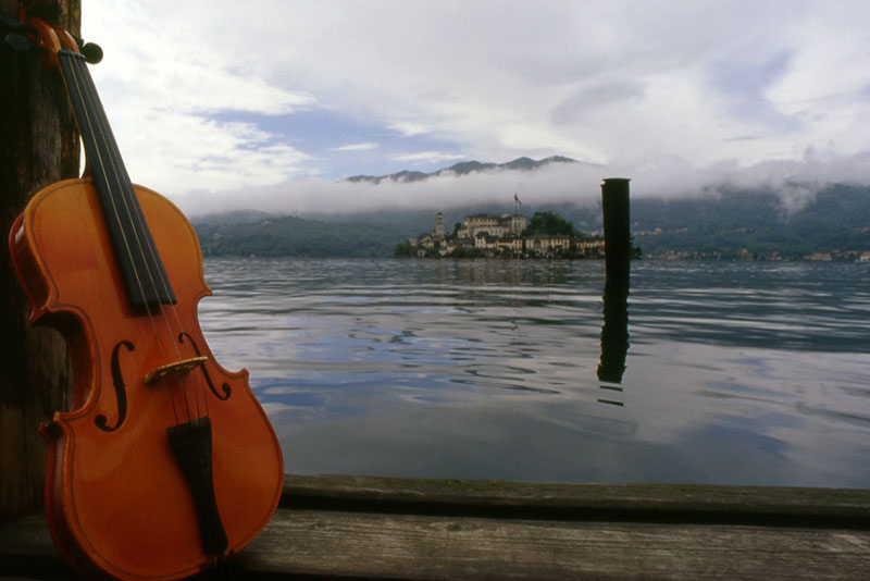
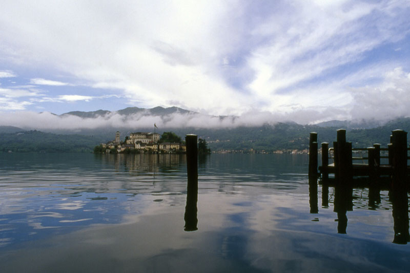
Lago d’Orta
Route description
A demanding hike, but worth the effort to see the charming landscape around the entire southern side of Lake Orta, the second largest lake in Piedmont. A long walk that offers magnificent views of the lake and unites all of the peculiar aspects of the Cusio area: it is an environmentally friendly way to get to Orta San Giulio, and a pleasant and relaxing “cruise” back by boat, the perfect conclusion of a beautiful nature walk.
Departure location: Pella (300 m)
Place of arrival: Orta San Giulio (295 m)
Maximum altitude: 410 m
Difference in altitude: About 300 m total (non-continuous)
Distance: 16 km
Walking time not counting stops: 6 hours total (excluding the return by boat). Consider taking one whole day.
Type of route: mixed (trail, asphalt, dirt road)
Signs: “Anello Azzurro” blue ring signs and red/white marks
Water: fountains in towns and along the path
Recommended period: all year round, but keep in mind that during winter, the path is long enough that it would be dark when you get back. We definitely do not recommend that!
How to get there: 15 km from Borgomanero and 21 km from Gravellona Toce. Located along the western side of Lake Orta. From A26 Borgomanero exit, go towards “Gravellona Toce”, after Borgomanero follow the blue signs for “Pella”. Parking is available on Via Lungolago and Via Don Gaetano Zanotti. By bus: Borgomanero-Alzo-Omegna line, stop Via Don Zanotti (www.comazzibus.com). By boat: Pella-San Filiberto-Lagna-Isola-Orta line (www.navigazionelagodorta.it)
Information: Distretto Turistico dei Laghi – www.distrettolaghi.it; IAT Office – via Bossi 11, Orta – tel. +39 0322 905163; Municipality of Pella – www.comune.pella.no.it; Municipality of San Maurizio d’Opaglio – www.comune.sanmauriziodopaglio.no.it; Municipality of Gozzano – www.comune.gozzano.no.it; Municipality of Bolzano Novarese – www.comune.bolzanonovarese.no.it; Municipality of Orta San Giulio – www.comune.ortasangiulio.no.it; Ecomuseum of Lake Orta and Mottarone – www.lagodorta.net
the itinerary
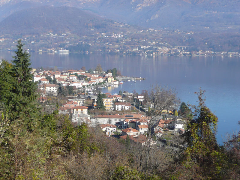
The “imbarcadero”, or landing stage, in Pella is not very wide, but there are shade trees and benches, a play area and many businesses. With your back to the lake, go left towards the medieval tower, the only remnant of the ancient fortifications, then take a right on via Roma, cross the main road, via Zanotti, and then arrive at the 16th century parish church of Sant’Albino.
If you parked in one of the car parks on via Zanotti, keep your eyes on the uniquely shaped bell tower, built in 1936. Once in front of the church, it is advisable to make a short detour to the right, towards the cemetery, to admire the beautiful stone humpback bridge, built in 1578 across the Pellino torrent. If you look up instead, you will see the impressive 18th century church, Santuario di Madonna del Sasso, built at 638 meters above the lake. It is the point of origin of a unique scenic route, known as the “balcony of Cusio”.
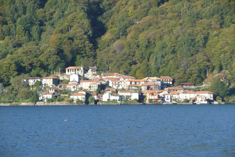
Take the alley and leave the parish church on your right (the sign says “San Filiberto”), and you will pass a car park to get to via Vignaccia. The asphalt gives way to a dirt road, and then morphs into a trail. Looking toward the left, at times you will be able to see the lake, and especially on the beautiful island of San Giulio. You will come to a votive pillar with benches around it, and then immediately afterwards, to a small wooden bridge where you can admire the waterfalls of the Rio Plesina, a very cool and pleasant place. The trail, paved with stones, climbs and then descends again (red/white sign “San Filiberto”) and then a trail leads between the houses. At the first clear junction, continue straight on and on the same level (red/white signs). However, be careful: the road right after this junction leads to a private gate. Of course, you must not go into this gate, but instead take the narrow passage to the left that leads around the perimeter of the home. Keep going straight along the gently sloping road to get to the cemetery parking area and then the asphalt road. Walk carefully along the asphalted curve toward the left, downhill and, as soon as possible, take the passage in the direction of the church of San Filiberto, which you should already be able to see. This is the most ancient chapel in the western shore of the lake, dating back to the 11th century. The magnificent Romanesque bell tower was built from 1075-1110, and the votive pillars that surround it date back to 1794. Cross the street and go to the right, passing next to the San Filiberto landing stage, and continuing on the side walk in the direction of Lagna. Unfortunately, the protected side walk ends, and you must cross on the cross walk and continue in the same direction on a more narrow side walk. After a parking area, you have to walk about 400 meters on asphalt, devoid of a side walk, and you must pay particular attention to traffic. Immediately after the tanks of a purifier that can be glimpsed among the trees, turn left along a narrow street and cross the bridge (or, if there is not much water, cross at the nearby ford). The path leads between the houses. You will go right at a T-junction to go towards the 17th century oratory of San Rocco. Just beyond the sacred building, take a left on via F.lli di Dio and walk among the lovely villas. Always stay on the main street until it turns into two streets: take the left street and stay on the smooth cement (red/white signs) that descends slightly as it passes between high hedges. You will come to the lake shore, on the Prarolo beach, the lido area of Lagna. Walk along the lake shore on this stretch of beach, with a entire along Lake, in this stretch beach with a wharf and a lovely view of the island of San Giulio. Continue on a pleasant dirt road in the woods, alternating with scattered houses, until you get back onto the asphalt near a bar-restaurant.
Three hundred meters before you get to the asphalt, on the right, is a path. After 0.5km with a difference in altitude of 60 meters, you will come to the small chapel of San Giulio situated in Opagliolo (a locality in the municipality of San Maurizio d’Opaglio). This is a charming little 16th century chapel surrounded by woods. A spring originates from this place, and it was believed to be miraculous (it could bring rain in times of drought). Legend has it that Saint Julius prayed here before embarking on his journey to the island which bears his name today. And he made that journey sailing on board … his cloak! The deviation is not long, but keep in mind that the hike is already very demanding. Therefore, be aware of how tired you and your little travellers are, and don’t tire yourselves out!
Now, continue on the asphalt, taking care to take a left along via Beltrami (watch for a fountain) with a slight and constant descent until it becomes a dirt road again.
Near a group of houses, you will fined another deviation, this time to the Church of the Madonna of Luzzara, a 12th century building that was altered during the 15th century, and with frescoes from the 16th century. The deviation is 1.2km long with a difference in altitude of 50 meters, but consider the same suggestion we provided for the oratory of San Giulio: carefully assess your strength because it’s a long walk!
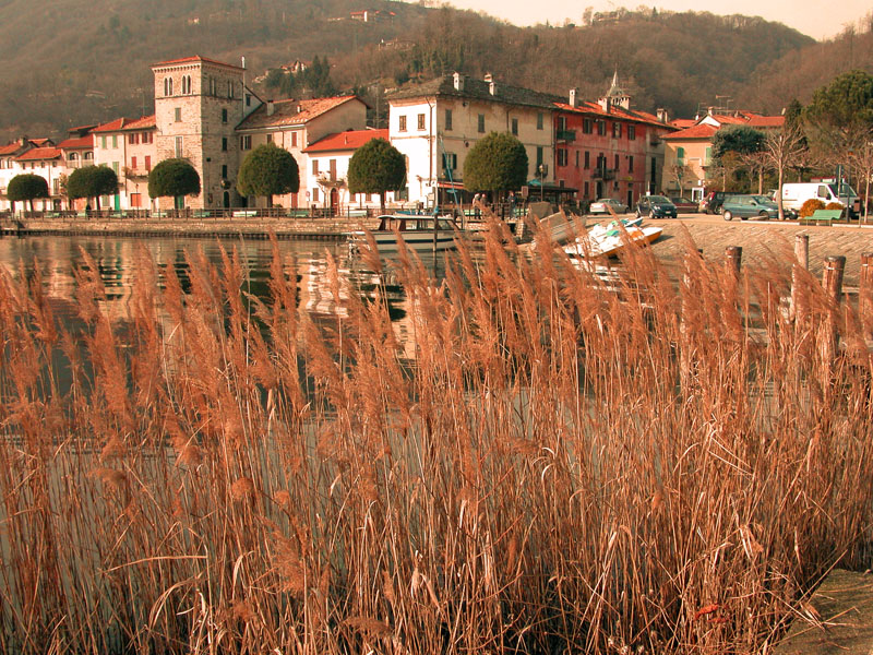
A pleasantly level path through the reeds and woods leads to the Lido of Buccione.
The route continues to the right, before getting to the Lido, along the grassy Via Francisca, but take the time to go to the Lido to find fountains, bar and restaurants, in addition to the small church of SS. Angeli Custodi, built in 1611 and Palazzo del Vescovo (the Bishop’s Palace) with frescoed coats of arms on the façade dating back to the 17th century.
The pleasant Via Francisca is partly grassy and partly paved. It leads first to the asphalt road Via Marangoni and then to the busy thoroughfare SP229. Take this road for about 150 meters in the direction of the centre of Gozzano, before you can turn left on Via Mario Motta (blue signs for “Bolzano N.”).
Be very careful when you are on the provincial road, and also on Via Mario Motta, because there is no side walk!
Note: If you realize that your small hikers are too tired, you can, at this point, take the bus line Borgomanero-Alzo-Omegna (Ventraggia-Pella stop) back to your destination. In this case, go along the provincial road entering in Borgomanero, following the blue signs for San Maurizio d’Opaglio, until you arrive at the Albergo Italia stop in via Beltrami (1.7 km). Attention: there is almost no side walk on the side of the road. Otherwise, you can ride to Orta on the bus line Borgomanero-Gozzano-Orta-Omegna, and get off at the Bolzano Novarese, via Vittoria stop (1.6 km). Attention: here is almost no side walk on the side of the road. Or you can take the railway line Gozzano-Orta Miasino (2 km).
Now, follow the asphalt road that passes in front of the monument commemorating the death of engineer Mario Motta, a strong supporter of the partisans after whom the street is named, and then enter Bolzano Novarese and keep going until you can see the railway crossing. Take a left on via Artogno, which is initially asphalt and then dirt as it winds through the cool woods where we find the Bersanella Fountain. The dirt road ends when it runs into an asphalt road. Follow that to the right for a short distance until you reach the bridge over the railway line.
On the left just before the bridge, the trail starts that leads to the Tower of Buccione, which rises above the forest (a deviation of 1.2 km, difference in altitude 75 meters). Visible already from the beginning of the excursion, it stands at an altitude of 410 m and has dominated a good part of the lake since at least the 13th century when it was part of a castle that could accommodate five hundred soldiers. Today, it is located in the Special Nature Reserve Colle della Torre di Buccione. The deviation is not very long, but keep in mind that the hike is already very demanding. Once again, be aware of how tired you and your little travellers are.
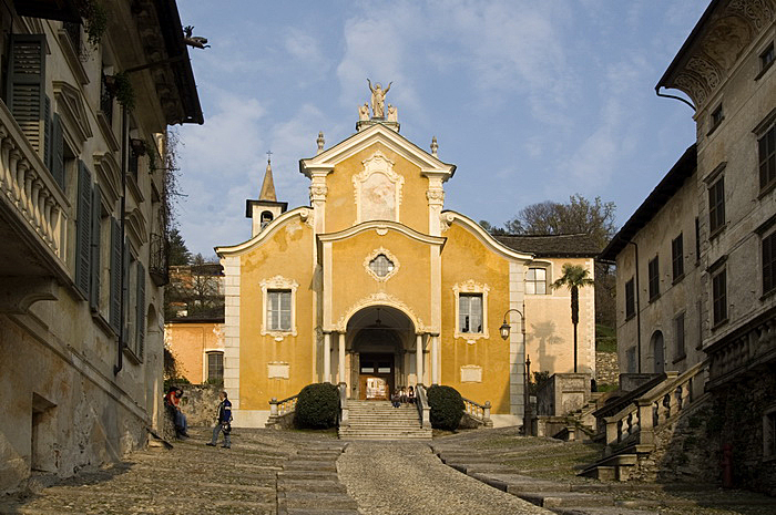
Before the railway bridge, take the trail on the left downhill (brown signs for “Orta”) that passes along the railway ballast, following signs red/white signs that say “Anello Azzurro” and the brown signs that say “passeggiata”. When you get back on the asphalt, follow it for a short stretch to then enter in the characteristic village of Corconio (367 m), with its narrow cobblestone streets and some 18th century buildings. Climb towards the 18th century church of St. Stephen, and take the cobblestone street that starts at the oratory, go over the bridge over the railway line and continue along the road overlooking the lake. Go down the asphalt road to get to Legro. When you get to the rail road, crosses through the underpass and go towards the sports facilities. Continue on the trail to Via Marconi, near the roundabout where the impressive Villa Crespi is located.
If for some reason it is not possible to take this path, just walk with the railway line to your right until you pass the station and reach Via Marconi. Here, go left and descend to the roundabout mentioned above, or take the smaller street Via D. Giovanni Bosco that runs parallel to this street and has no traffic.
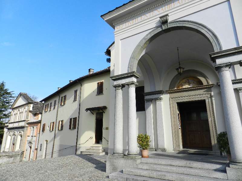
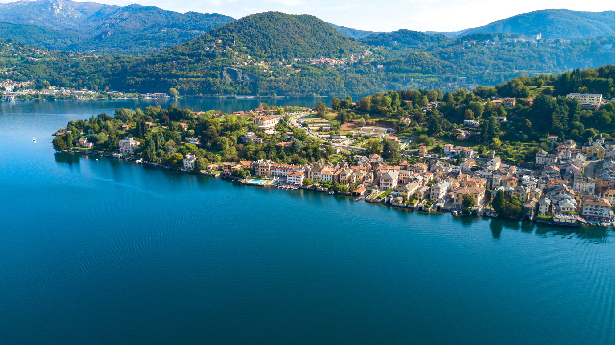
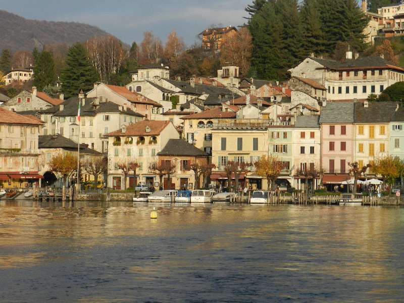
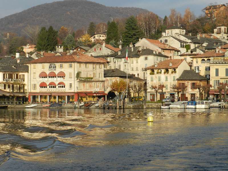
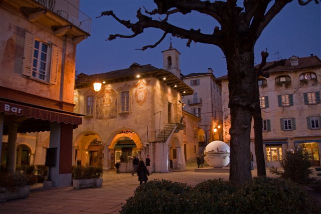
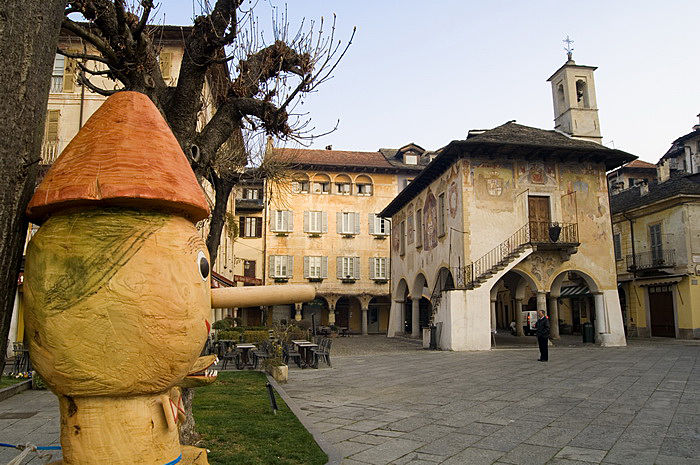
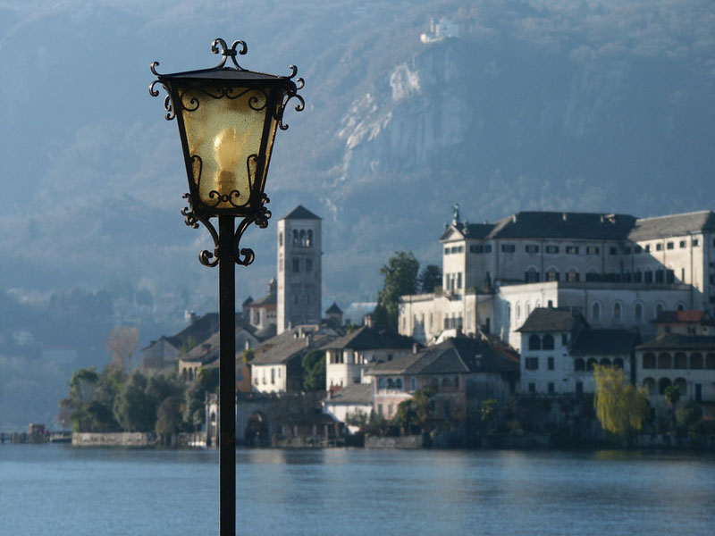
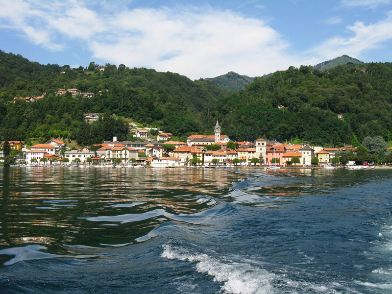
At the roundabout, Villa Crespi appears in all of its splendour. Today, it houses a hotel and restaurant, and boasts a famous television chef. You are now in Orta, one of the “Most Beautiful Villages in Italy” (www.borghipiubelliditalia.it). Turn right alongside the villa and take Via Fava, which will shortly lead along the lake shore until you arrive in Piazza Mario Motta, where there are several businesses and the boat landing stage. An interesting building with frescoes and a staircase stands on one end: this is “Palazzo della Comunità”, built in 1582 (it was the seat of the government of the state-feud of the Riviera di San Giulio, and is also known as “Palazzotto”). Orta unfolds in a maze of intricate streets, which are only apparently chaotic. In fact, it is sufficient to stay on via Olina, which continues behind the “Palazzotto” to explore the more typical alleys and gardens. You can also go up to the right in via Caire Albertoletti, also called “Salita della Motta”, to admire some of the oldest buildings, such as Casa Marangoni (14th century) also known as the Casa dei Nani (home of the dwarves) due to its small windows on the top supported by a long wooden lintel and decorated with frescoes. The return trip to Pella is by boat.
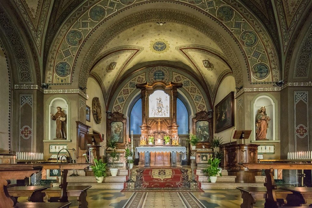
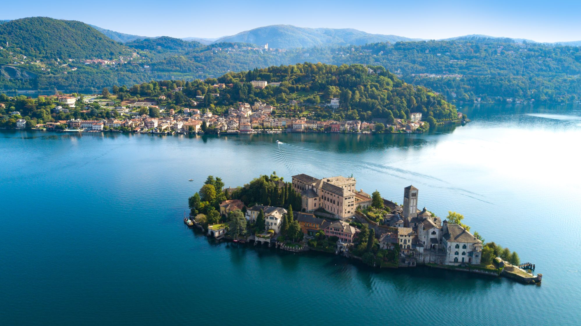
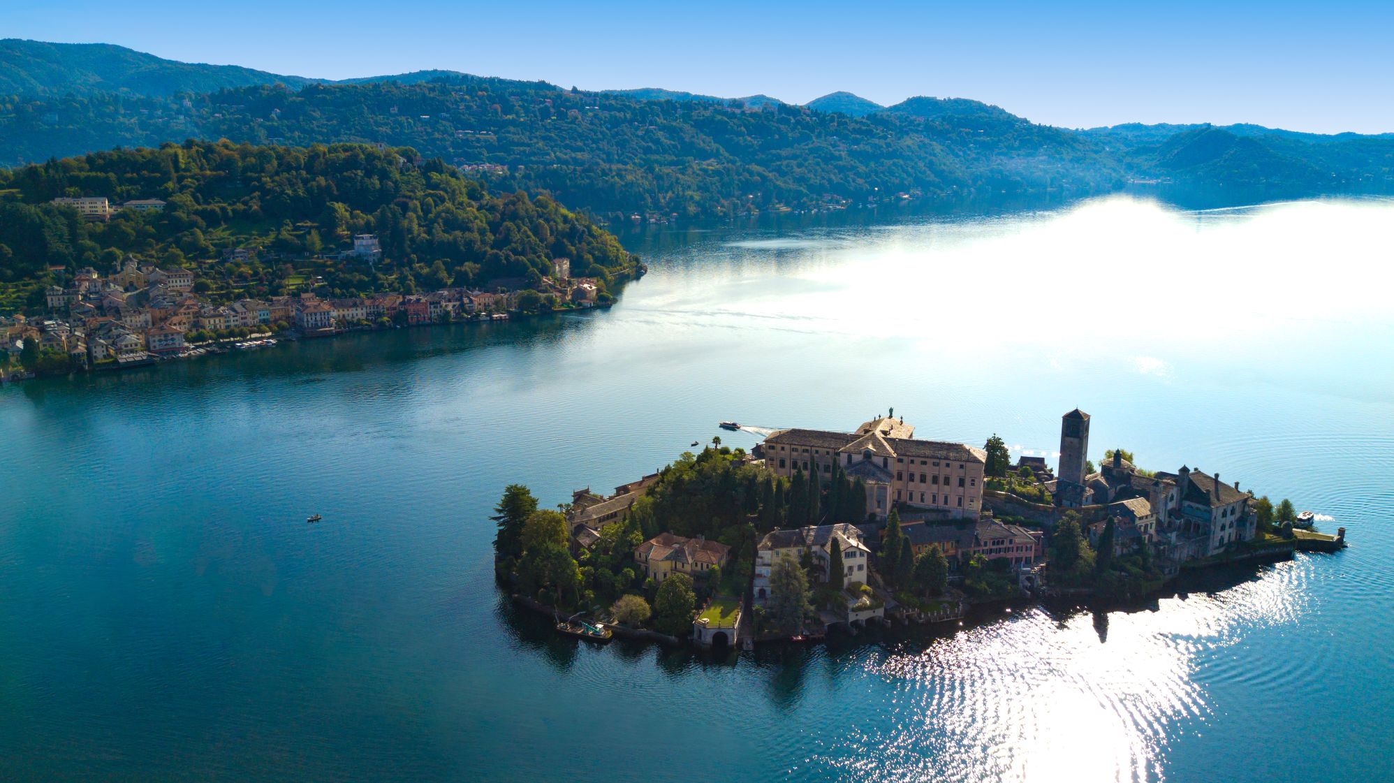
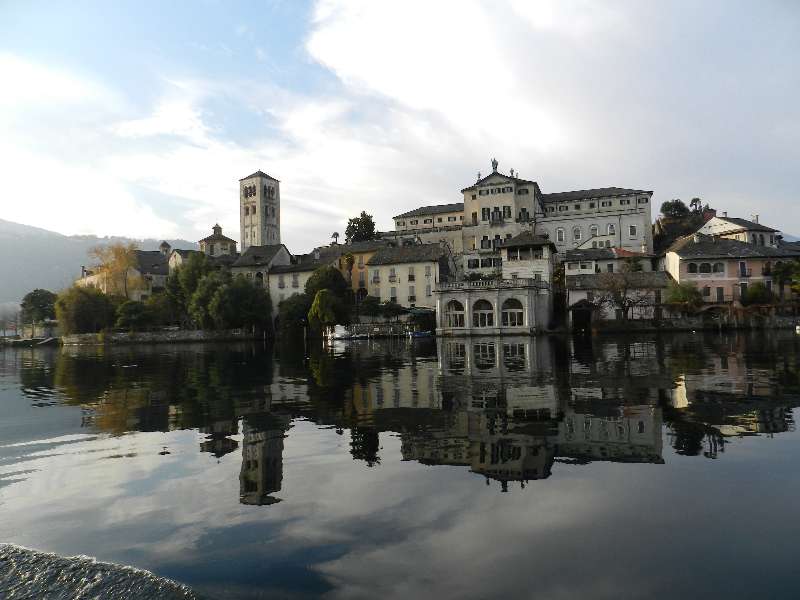
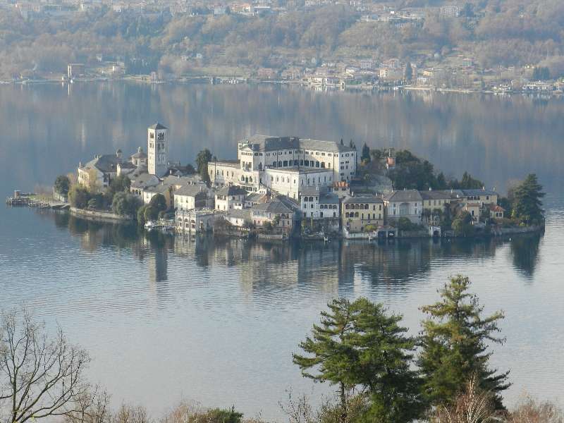
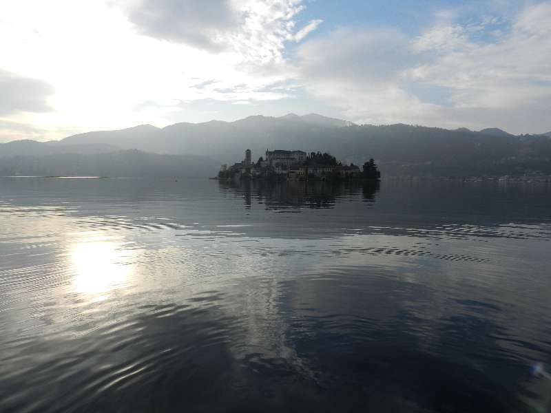
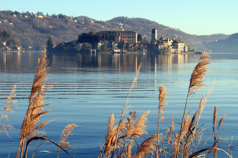
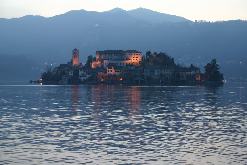
The boat stops at St. Julius Island (Isola di San Giulio), and if you have the time, it is certainly worth a visit to see its narrow alleys, staircases and stone arches that recreate an enchanting medieval scenario. Most of the buildings were built on the remains of an ancient castle, perhaps of Longobard construction, but the most spectacular is certainly the Basilica of San Giulio, with its pure Romanesque style exterior. The original church was built in the 4th century, apparently by the saint in person. It was rebuilt for the first time in the IX century as a fortified church by the Longobards, and then underwent further changes during the 10th and 11th centuries. Inside stands a precious 12th century pulpit that, despite the bronze colour, is completely made of stone and has interesting bas-reliefs. One of the most interesting is a mysterious human figure, traditionally identified as Guglielmo da Volpiano (962-1031, a Benedictine monk and abbot in Dijon, who was apparently born here during the siege of 962). Other significant artwork includes the frescos, done from the 14th to the 16th centuries, some by the school of the painter and sculptor Gaudenzio Ferrari (1475/80-1546). Inside the sacristy is a fossil vertebra, which is presumed to have been discovered in a cave on the Orta peninsula. Could it be the remains of one of the dragons hunted by St. Julius? Another very impressive is the Seminary, built in 1844 on the ruins of the ancient castle. Today, it is the Abbey Mater Ecclesiae and since 1973 has hosted a group of Benedictine cloistered nuns devoted to restoring textiles and tapestries.
to learn more
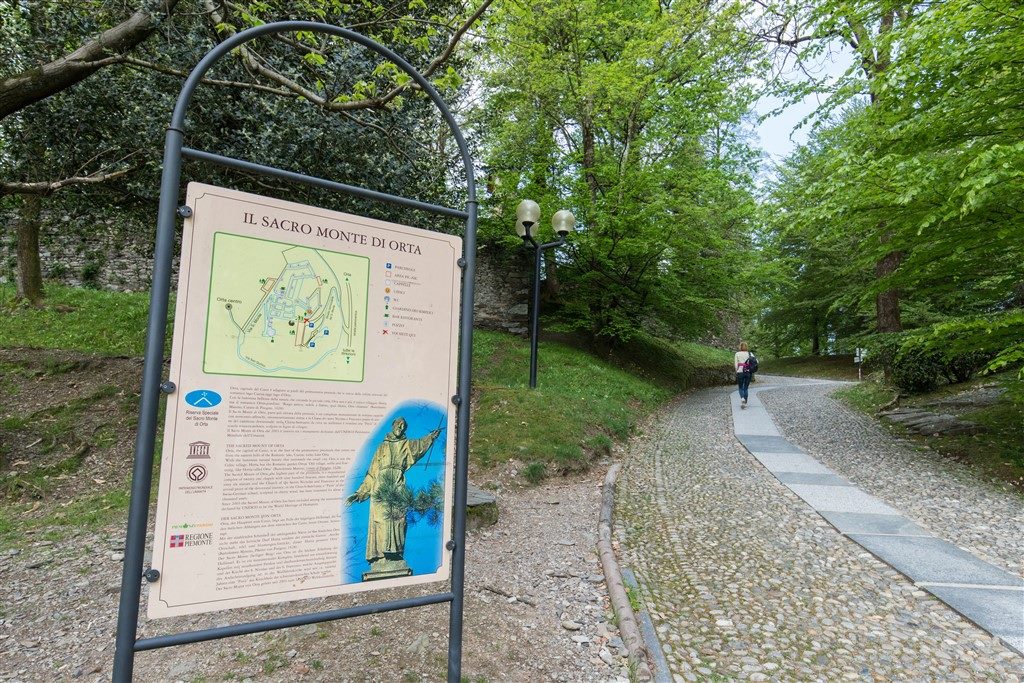
Orta – Sacro Monte
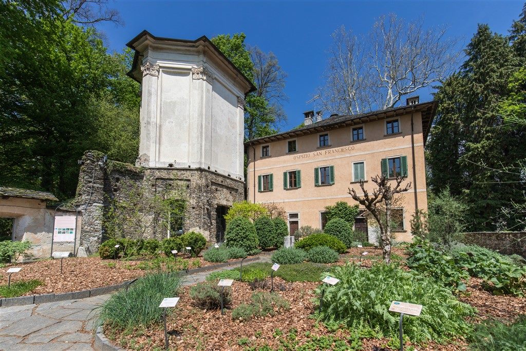
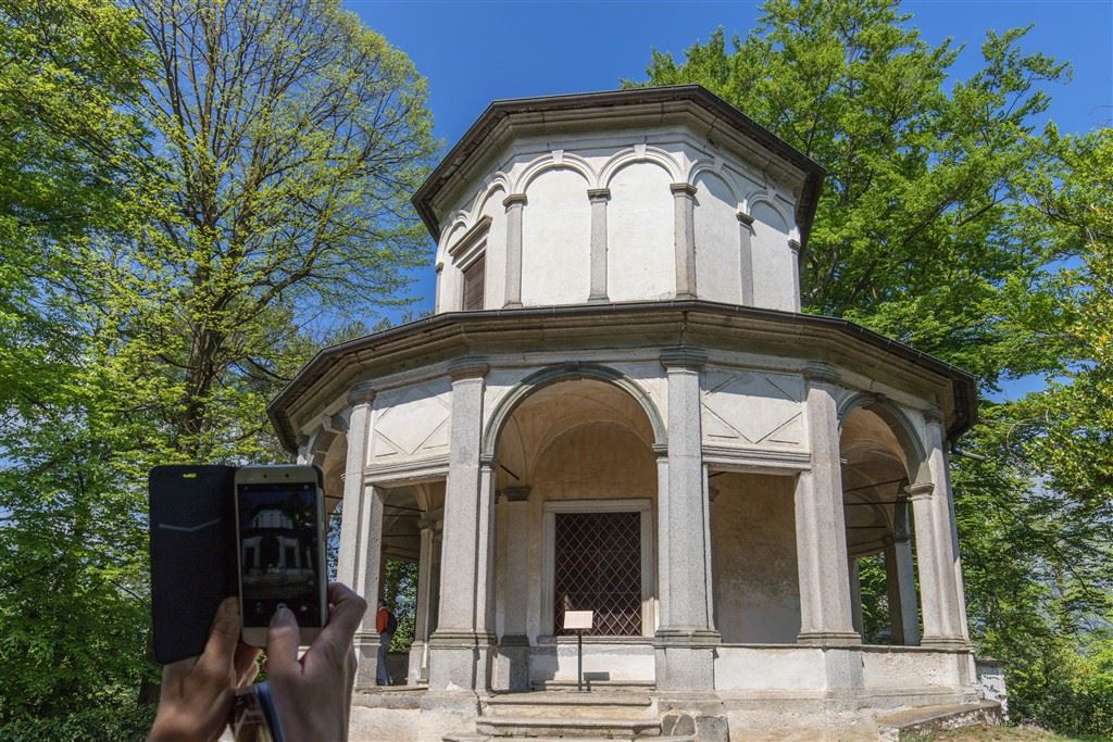
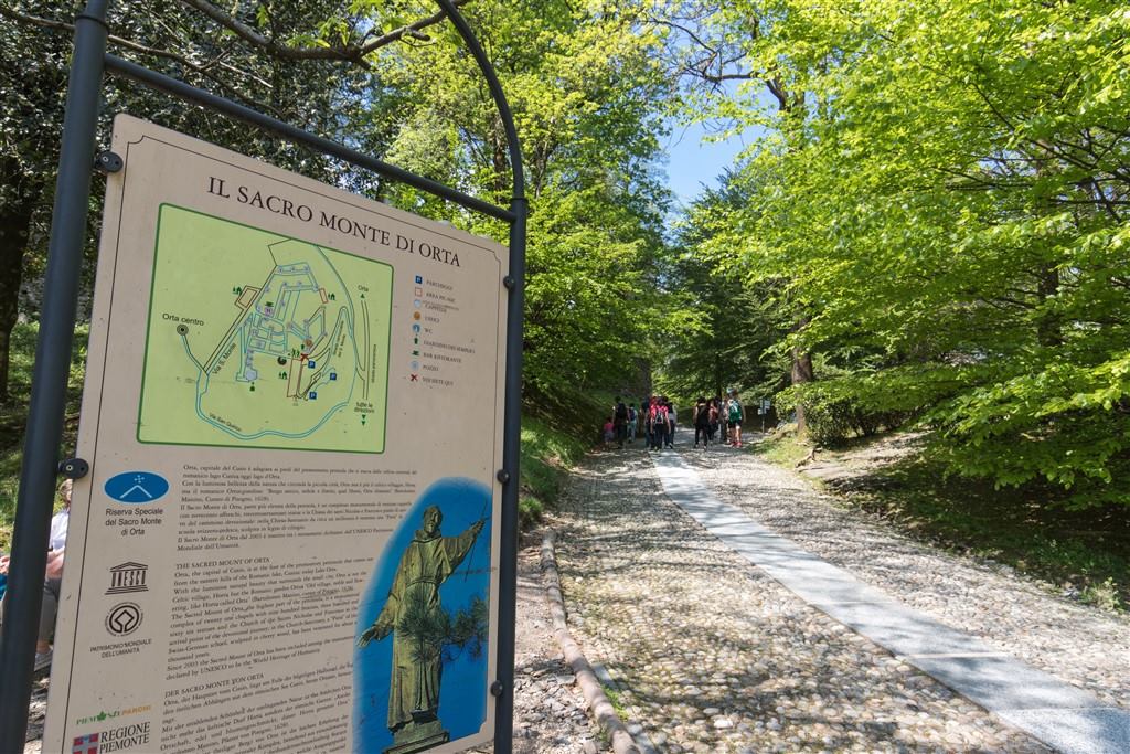
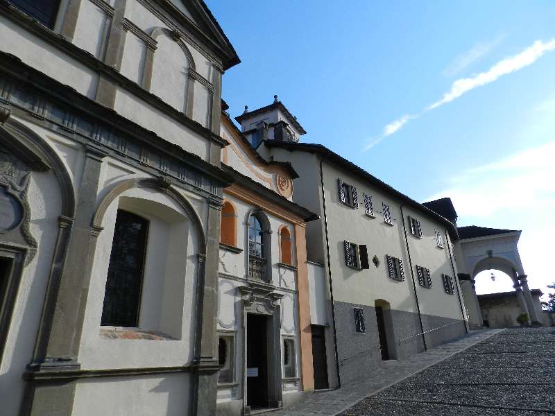
At the cemetery and the ancient church of San Quirico, one of the paths leading to the church of San Nicolao begins. This church is believed to have been founded in the 10th century. This is where the Sacro Monte path begins. Since 2003, the site has been a UNESCO World Heritage Site, since it is part of the Sacri Monti of Piedmont and Lombardy. Inside twenty chapels immersed in the natural landscape, there are 176 life-sized sculptures in hand painted terracotta, and 900 frescoes telling the story of Saint Francis of Assisi. Construction began in 1590 and finished in the 17th century, and it is very evident when we observe the evolution of artistic styles, which start with descriptive depictions and turn into spectacular baroque works and finally triumphant rococo. The Sacro Monte is part of the Special Natural Reserve of the same name, created with the purpose to protect, preserve and enhance the historical, religious and forestry assets of the Monte. The site is well suited for peaceful relaxing moments and offers picnic tables and toilets (www.sacromonti.org).
Orta – Villa Crespi
The curious shape of the building, with its clear Arabian style and even a minaret, was decided by the industrial entrepreneur Cristoforo Benigno Crespi, enchanted by the beauty of Baghdad where he went to buy cotton. Built in 1880, the home housed poets, industrial businessmen and rulers in the 1930s, and today it is a “Relais & Chateaux” hotel managed by the famous television chef Antonio Cannavacciuolo. Many films have featured landscapes of Orta. Among the many to choose from, we would like to point out an old movie from 1914 with the exotic title “Jvna, the Pearl of the Ganges” which portrayed mysterious India was carefully recreated right here at Villa Crespi.
The legend
In 390, Saint Julius was on the run with his brother Giuliano to escape from persecution in Greece. They came to the shores of lake and were fascinated by the island, which was infested by ferocious dragons and snakes. The two brothers obtained permission from Emperor Theodosius I to demolish the pagan temples and replace them with Christian churches and, while Giuliano was beginning to erect the 99th church in Gozzano, Julius decided to go to the island. Since he could not find a boat, the saint spread his own mantle over the water and sailed to island on it. He banished the ferocious beasts that lived there my merely speaking, and then built the 100th church.
Literature
Many forms of literature have mentioned the lake. We would like to mention only one work, for the sake of brevity, the novel: “C’era due volte il Barone Lamberto, ovvero i misteri dell’Isola di San Giulio”, and the story “Il ragionier Pesce del Cusio”, both by Gianni Rodari (1920-1980, originally from Omegna).
tips for young hikers
This is a very long excursion, absolutely recommended for its beautiful scenery, suitable only for older children who are already accustomed to walking without (too much) complaining. There are several places to stop and rest, but consider that it will probably take longer than the hours scheduled. Also consider taking the time to enjoy a delicious and well-deserved home-made ice cream in Orta!
Slow trekkers: Franco Voglino, Annalisa Porporato and Nora Voglino
Authors of texts: Franco Voglino and Annalisa Porporato
Back to the list of routes