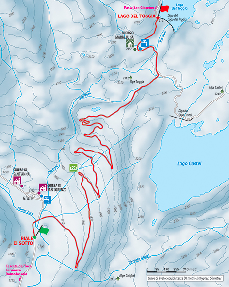
High-altitude hike in the snow-covered world of the Riale basin
SNOWSHOE HIKE TO MARIA LUISA REFUGE AND LAKE TOGGIA
Route description
High-altitude hike in the snow-covered world of the Riale basin, to reach a delightful lodge and a lake immersed in the frost of high-altitude winter.
Place of departure: Formazza, Fraz. Riale (1730 m.)
Place of arrival: Lake Toggia (2191 m.)
Height difference: +470 m one way
Distance: 6 km one way
Travel time net of stops: 3 hours one way
Signage: white/red signs
How to get there: 47 km from Domodossola. Strada Statale 33 del Sempione, Crodo exit. Follow the signs Crodo – Baceno – Val Formazza. When you reach the municipality of Formazza, continue to Fraz. Riale.
The itinerary:
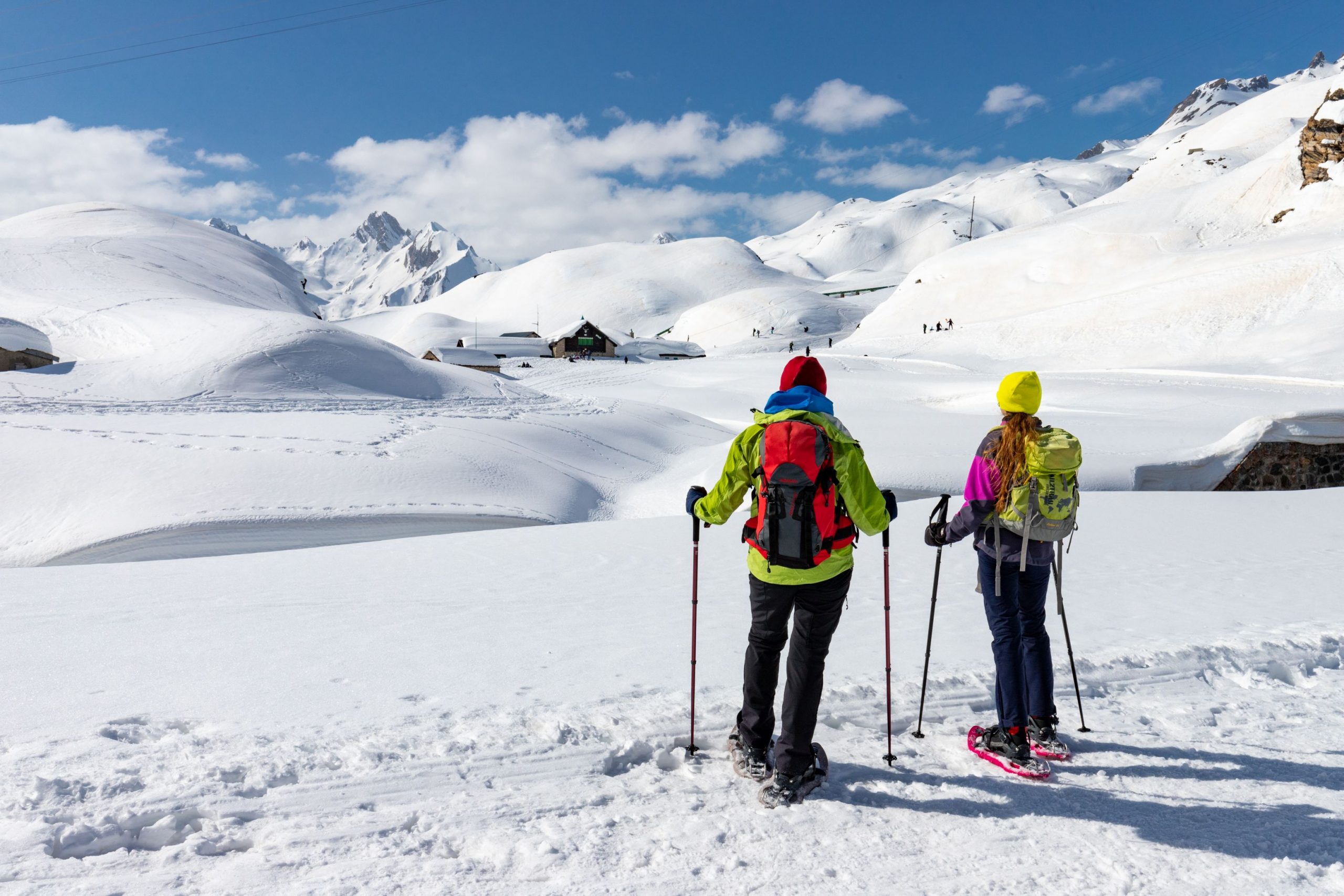
There are two possible car parks for Riale. From the first, the larger one, follow the asphalt road slightly uphill until reaching the second car park, located close to the first houses of Riale di Sotto. From this point, the route is no longer cleared of snow, leaving the entire basin available to skiers and snowshoers.
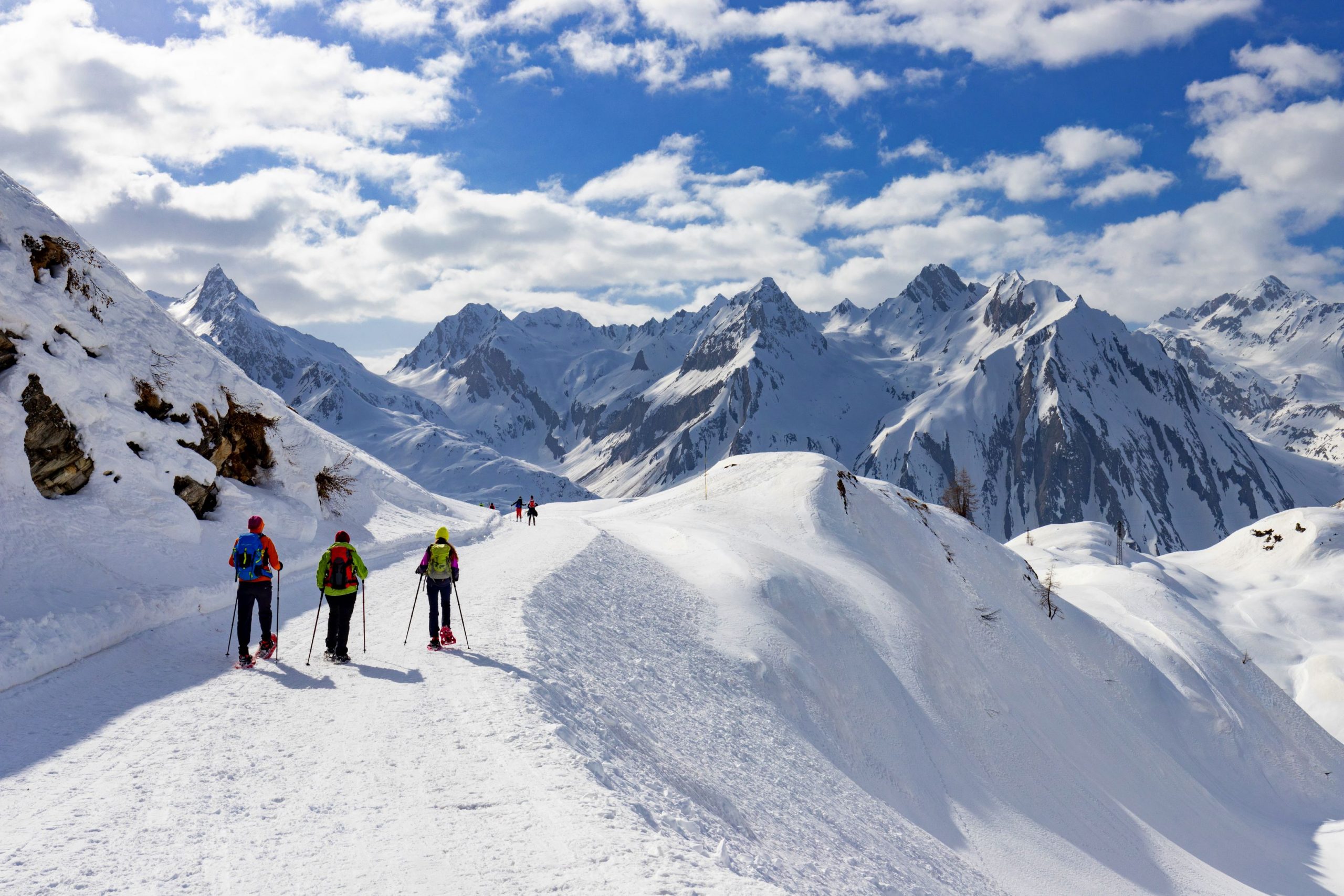
Continue on to a bridge, after which you come to a fork in the road. Continue straight ahead (signpost “G00 Rifugio Maria Luisa”) on the obvious snowmobile track that climbs gradually, crossing the cross-country ski track twice (please be careful and do not damage the ski rails). The track begins to climb with a long traverse to the right, following what is a dirt road in summer.
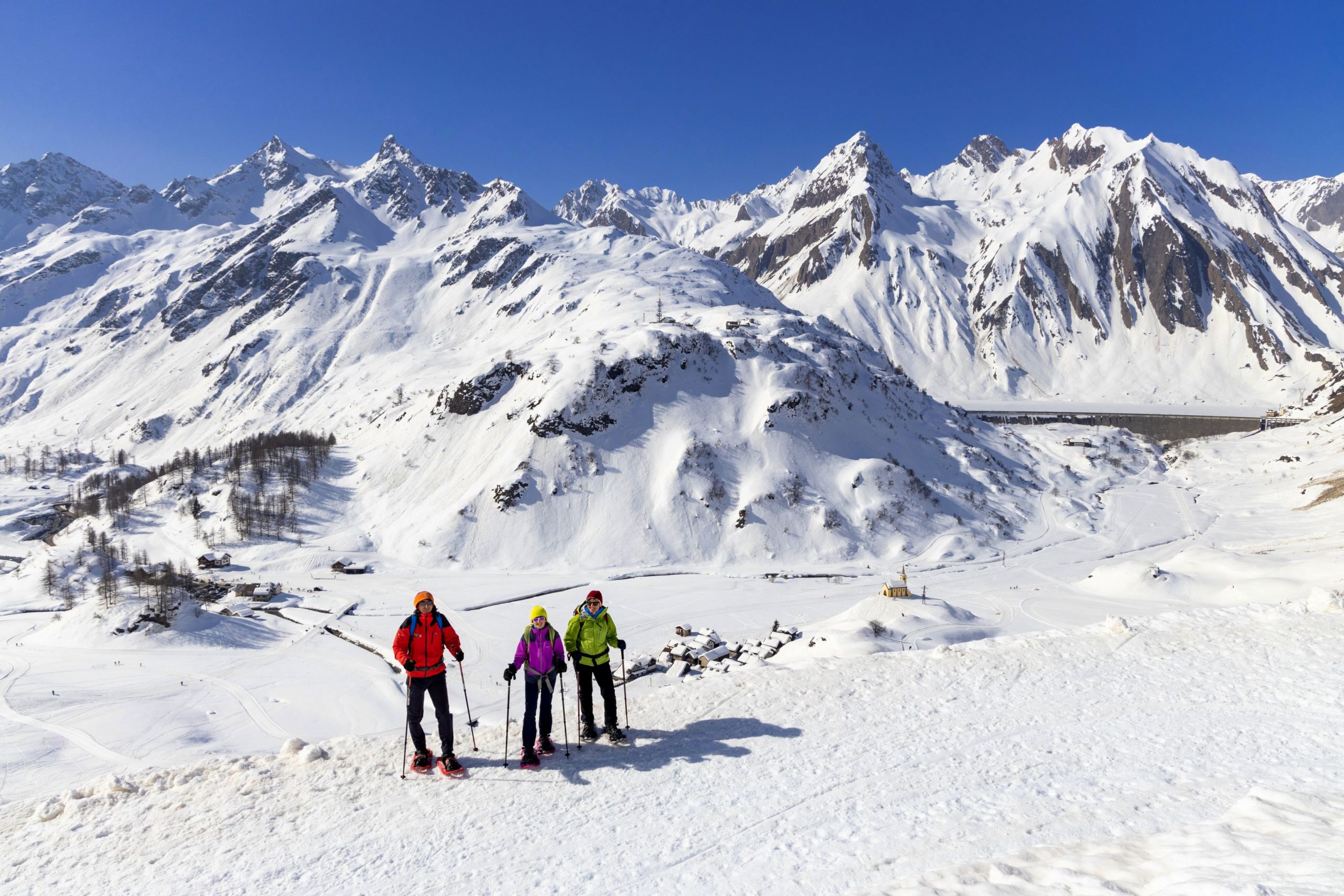
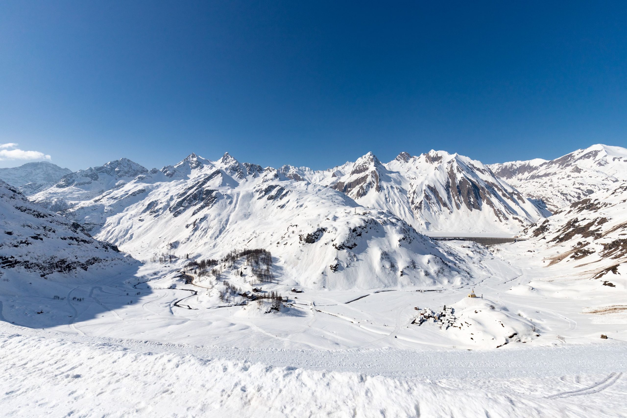
A hairpin bend leads to another long traverse, this time to the left. At the following hairpin bend, one of the most beautiful views of Riale opens up, with the magnificent St. Anne’s Church perched on a small rise and the Morasco Dam in the background under the steep walls of Mount Immel (2807 m) and the Punta di Morasco (2831 m).
The road continues to climb with wide hairpin bends that get closer together as you gain height, always very scenic especially at the bends that turn to the right.
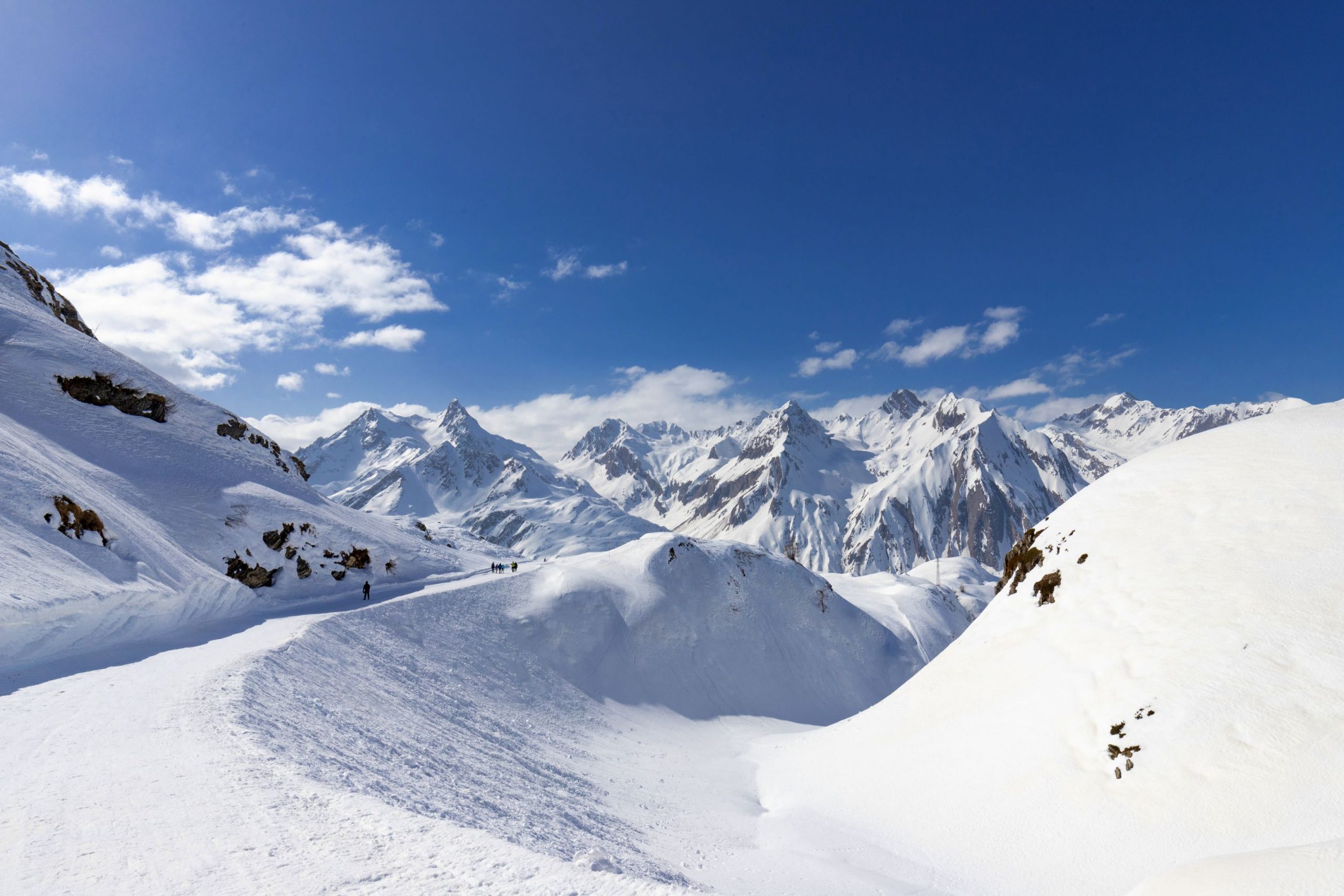
Almost at the height of a pylon, which is already visible from below, the road softens and pleasantly enters a plateau with a grandiose view behind it.
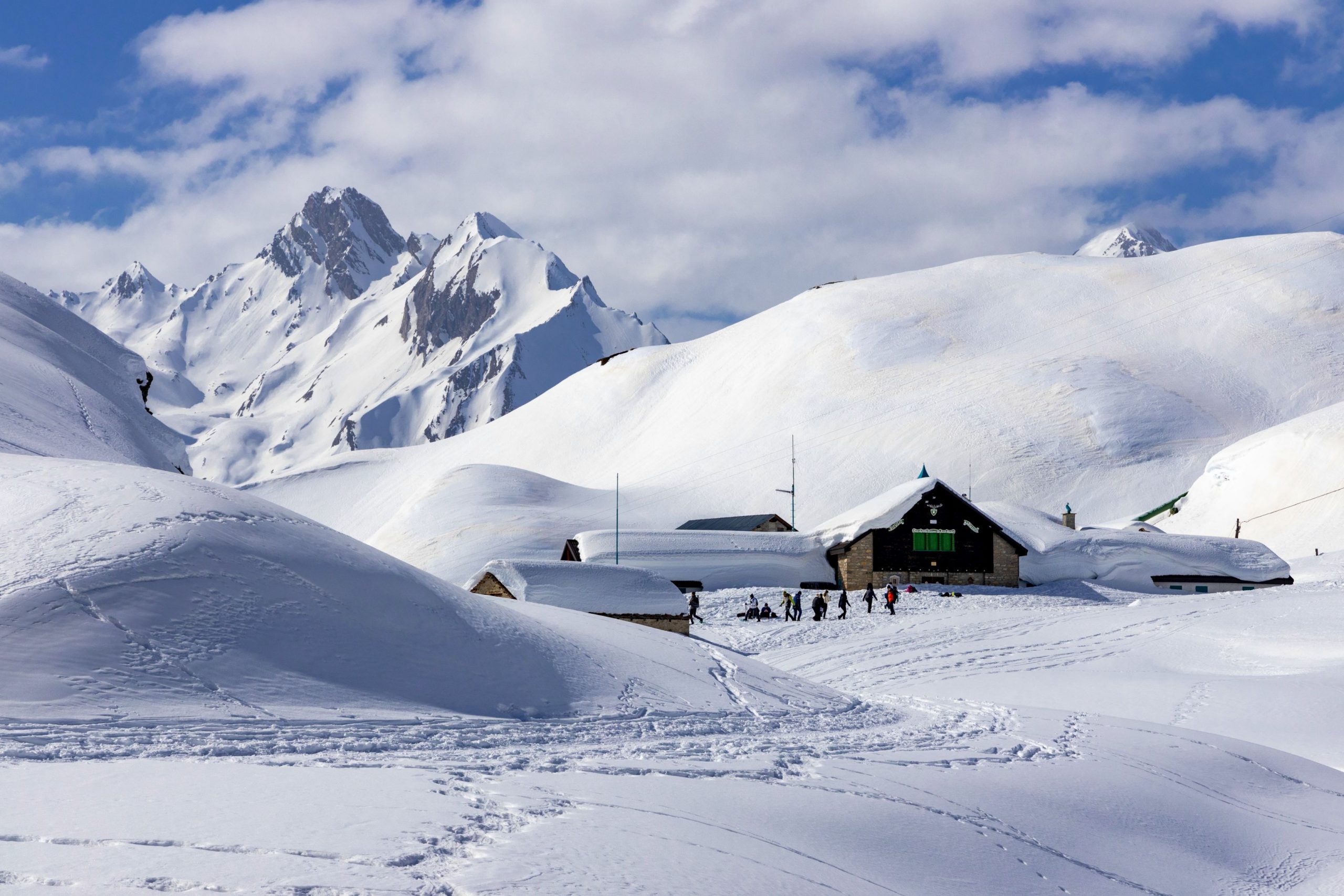
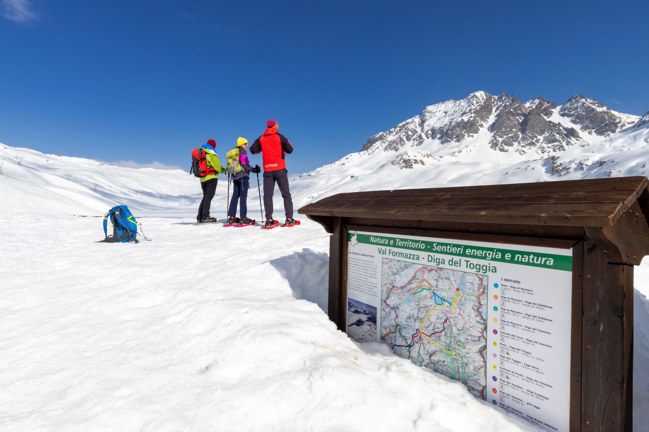
At an isolated building, the road bends towards the Toggia dam, while the hut is not visible at all. Turn left over a bridge and, after passing an isolated building, you find the beautiful refuge.
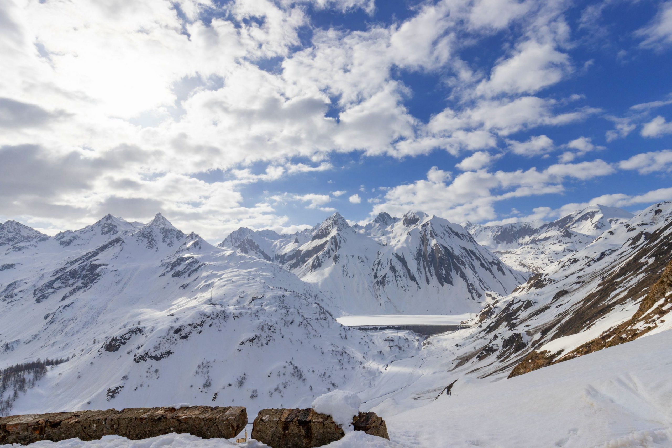
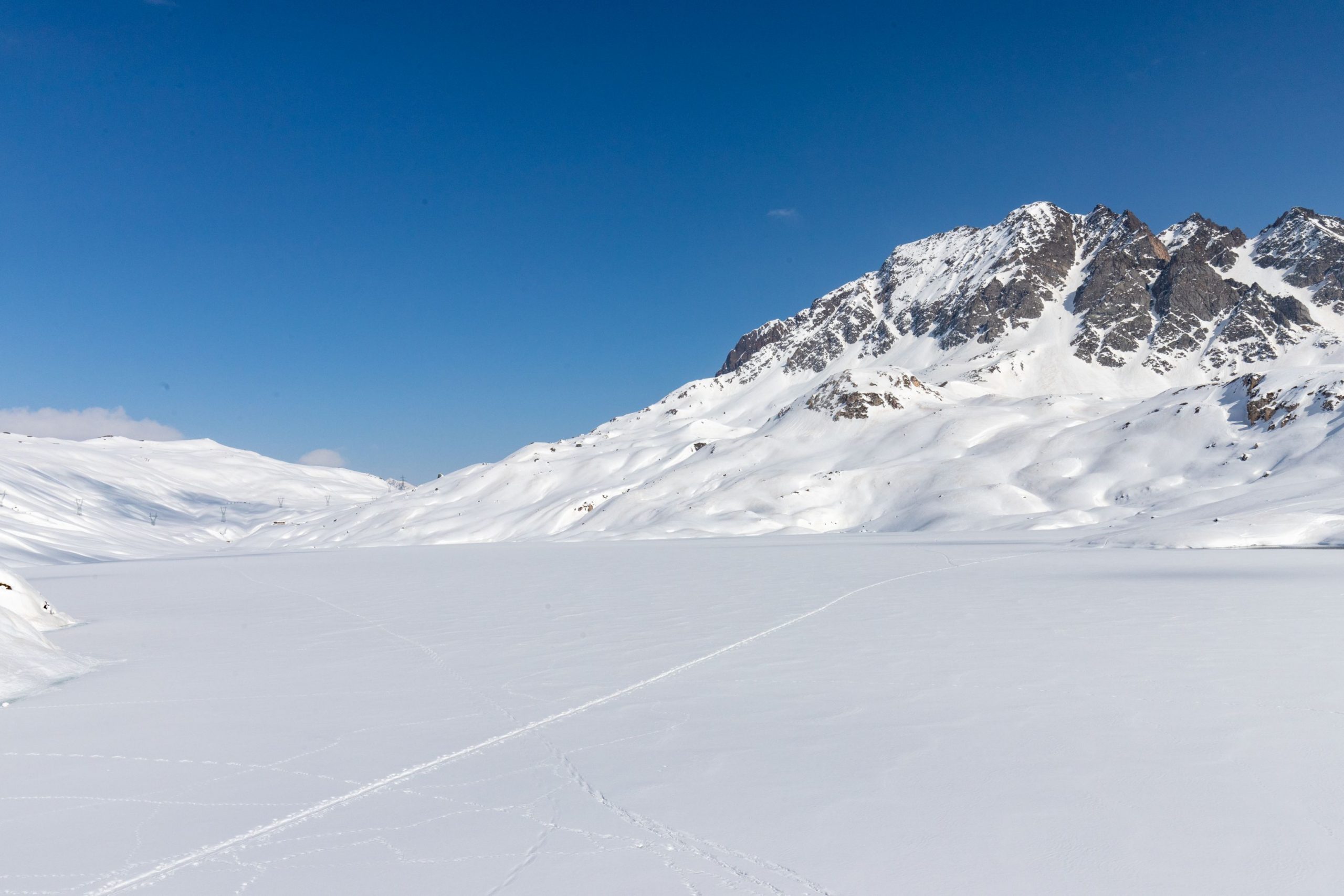
The dam is easily reached by following the road that starts in front of the lodge and passes under the service building to look out over the Toggia basin, which is often completely frozen.
The return journey is by the same route as the outward journey.
Tips for baby snowshoers
The hike is technically very easy and well-marked, but the length in kilometres will be felt especially on the way back, something to be taken into account. Suitable for grown-up children or children who are well used to walking. Keep in mind the altitude: above 2000 metres, sun cream is absolutely essential!
Caution: Avalanches can occur at some points along the road in certain conditions: always enquire before setting off at the Centro Fondo Riale.
CONTACTS FOR TOURIST INFORMATION
CENTRO FONDO RIALE
Fraz. Riale – 28863 Formazza (VB)
Tel. +39 380 3100773
Email: mountainsportformazza@gmail.com
Path makers: Franco Voglino, Annalisa Porporato and Nora Voglino
Author of the text: Franco Voglino, Annalisa Porporato
The path is described in the book “SNOW TREK” of Distretto Turistico dei Laghi – edition 2021
The routes were suggested by ski operators and municipalities Partner of Neveazzurra project. We decline any responsability regarding the effective feasibility and any changes that the routes can suffer. Maps and tracks are purely indicative of the route.
Safety annotations:
Here are some practical tips: find out about weather and snow conditions, checking the forecasts especially at local level; check the avalanche bulletin for the relevant area; equip yourself with and carry PSA self-rescue equipment: shovel, probe and ARTVa; wear warm, waterproof clothing that is comfortable and consists of several layers… despite the snow, you will get warm as you move; hiking shoes or mountain boots depending on the area, terrain and altitude where the hike takes place; bring gloves, cap, sunglasses and sunscreen; pack a rucksack with a spare shirt and hot drinks; during the hike, always check the slopes above you; avalanches usually break off on slopes with a gradient of more than 25° and can also continue on flat sections.
Back to the list of routes
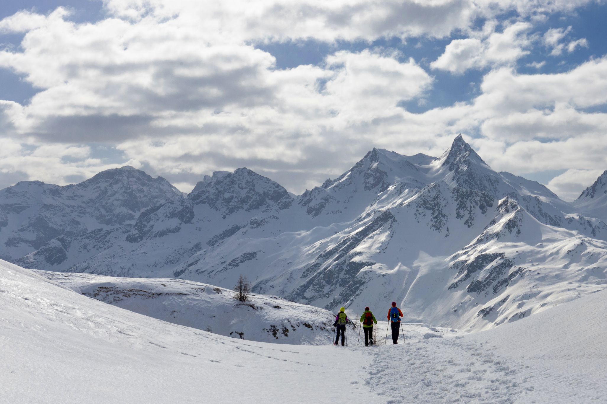
Escursione di alta quota nel mondo imbiancato della conca di Riale
CIASPOLATA AL RIFUGIO MARIA LUISA E LAGO TOGGIA
Route description
Escursione di alta quota nel mondo imbiancato della conca di Riale, per raggiungere un delizioso rifugio e un lago immerso nel gelo dell’inverno delle alte quote.
Località di partenza: Formazza, Fraz. Riale (1730 m.)
Località di arrivo: Lago Toggia (2191 m.)
Distanza: 6 km sola andata
Tempo di percorrenza al netto delle soste: 3 ore sola andata
Segnaletica: cartelli bianco/rossi
Come arrivare: dista 47 km da Domodossola. Strada Statale 33 del Sempione uscita Crodo. Seguire indicazioni Crodo – Baceno – Val Formazza. Raggiunto il comune di Formazza, proseguire fino alla Fraz. Riale.
L’itinerario:
Due sono i possibili parcheggi per Riale, dal primo, più grande, si percorre la strada asfaltata in leggera salita fino a raggiungere il secondo parcheggio, posto a ridosso delle prime abitazioni di Riale di Sotto. Da questo punto la via non viene più ripulita dalla neve, lasciando l’intera conca a disposizione degli sciatori e dei ciaspolatori.
Si prosegue arrivando ad un ponte, superando il quale ci si trova ad un bivio. Si continua dritti (cartello “G00 Rifugio Maria Luisa”) sull’evidente pista battuta dal gatto delle nevi che sale in maniera graduale, facendo attraversare due volte la pista di fondo (prestare attenzione e non danneggiare i binari per gli sci, per favore). La pista prende a salire con un lungo traverso verso destra, seguendo quella che in estate è una strada sterrata.
Un tornante fa compiere un altro lungo traverso, questa volta a sinistra. Al tornante dopo si apre una delle più belle viste su Riale, con la magnifica chiesa di Sant’Anna issata su un piccolo dosso e sullo sfondo la Diga di Morasco sotto alle ripidi pareti del Monte Immel (2807 m.) e della Punta di Morasco (2831 m.).
La strada continua a salire con ampi tornanti che si fanno via via più ravvicinati man mano che si prende quota, sempre molto panoramica soprattutto ai tornanti che voltano verso destra.
Giunti quasi all’altezza di un traliccio, già visibile da sotto, la strada si addolcisce e si inoltra piacevolmente nell’altipiano con una vista grandiosa alle spalle.
Giunti ad un isolato edificio, la strada curva verso la diga di Toggia, mentre il rifugio non è assolutamente visibile. Si devia a sinistra su un ponte e superato un edificio isolato, ecco il bel rifugio.
La diga è quindi facilmente raggiungibile seguendo la strada che parte da davanti al rifugio e passando sotto l’edificio di servizio porta ad affacciarsi sul bacino del Toggia, spesso completamente ghiacciato.
Il ritorno è sulla medesima via dell’andata.
Consigli per i baby ciaspolatori
Escursione tecnicamente molto facile e ben evidente ma la lunghezza in chilometri si farà sentire soprattutto al ritorno, cosa di cui tener conto. Adatta a ragazzi già più grandicelli o bambini ben abituati a camminare. Da tenere a mente la quota: superando i 2000 metri è assolutamente indispensabile la crema solare!
Attenzione: in determinate condizioni, in alcuni punti della strada si verificano valanghe: informarsi sempre prima di partire al Centro Fondo Riale.
CONTATTI PER INFORMAZIONI TURISTICHE
CENTRO FONDO RIALE
Fraz. Riale – 28863 Formazza (VB)
Tel. +39 380 3100773
Email: mountainsportformazza@gmail.com
Realizzatori del percorso: Franco Voglino, Annalisa Porporato e Nora Voglino
Autori dei testi: Franco Voglino, Annalisa Porporato
Percorso presente nella pubblicazione “SNOW TREK” del Distretto Turistico dei Laghi – ediz. 2021
I percorsi sono stati segnalati a cura di Impiantisti e Comuni Partner del progetto Neveazzurra. Si declina ogni responsabilità sull’effettiva percorribilità degli stessi ed eventuali modifiche che i tracciati possano subire. Mappe e tracce sono puramente indicative.
NOTE SULLA SICUREZZA:
Qui di seguito riportiamo alcuni pratici consigli: informarsi sulle condizioni meteo e della neve, controllando le previsioni soprattutto a livello locale; controllare il bollettino valanghe per la zona di riferimento; dotarsi e portare sempre con sé l’attrezzatura PSA per l’autosoccorso: pala, sonda e ARTVa; indossare un abbigliamento caldo e impermeabile che sia confortevole e composto da più strati…nonostante la neve, muovendosi ci si scalda; scarpe da trekking o scarponi da montagna a seconda della zona, della morfologia e dell’altitudine ove si svolge l’escursione; portare con sé guanti, berretto, occhiali da sole e crema solare; dotarsi di zaino con maglia di ricambio e bevande calde; durante l’escursione controllare sempre i pendii sovrastanti; le valanghe si staccano, di solito, su pendii al di sopra dei 25° di pendenza e possono continuare la loro corsa anche sul piano.
Back to the list of routes

