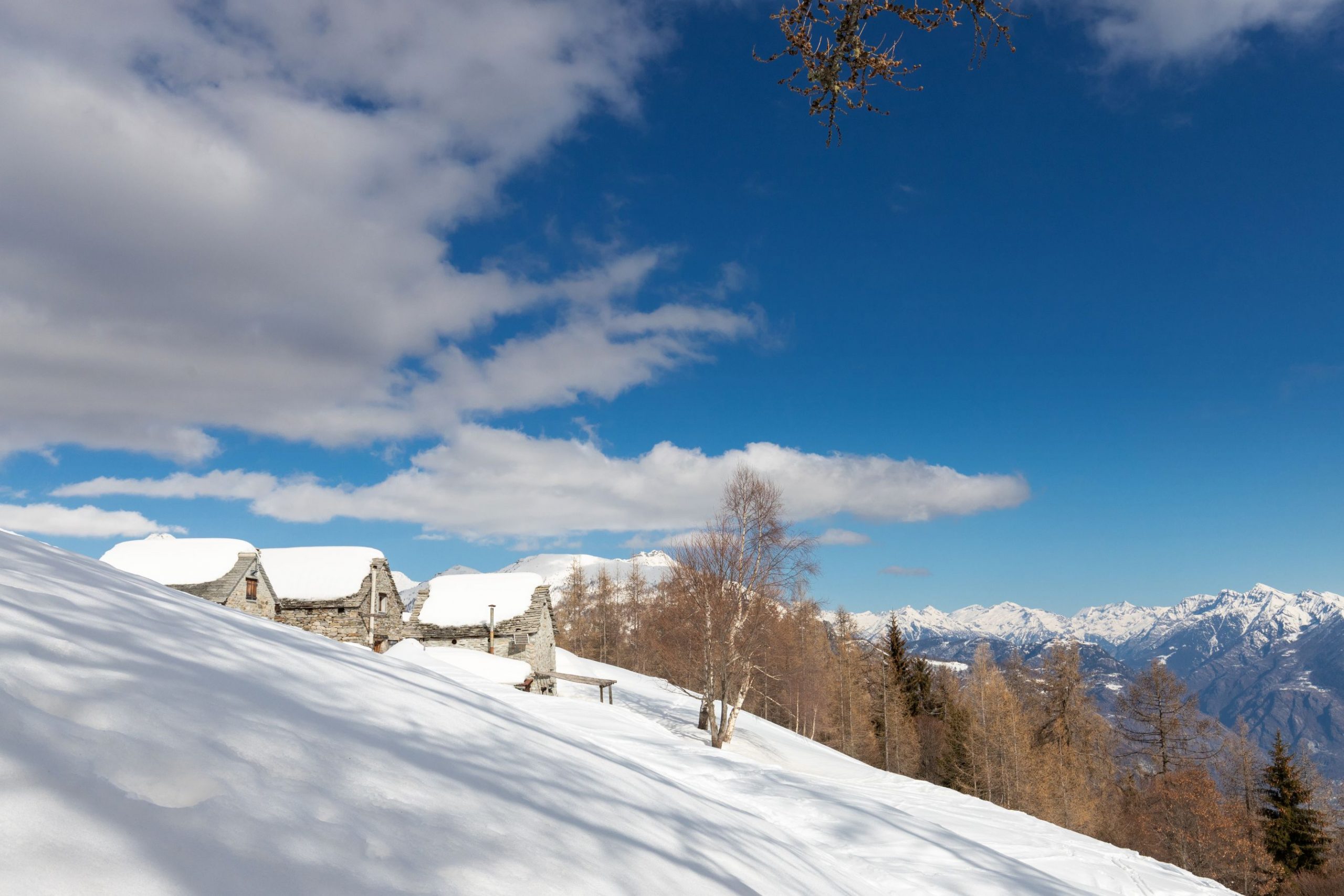
Through an evocative forest
SNOWSHOE HIKE TO THE GREAT VIEWS FROM ALPE LUSENTINO TO ALPE CASALAVERA
Route description
Excursion to the grandiose panoramas of Alpe Casalavera, through an evocative forest
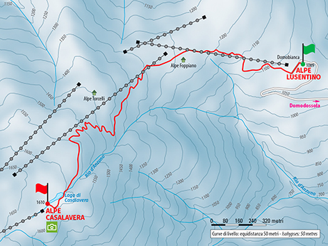
Place of departure: Domodossola, Alpe Lusentino (1089 m.)
Place of arrival: Alpe Casalavera (1610 m.)
Height difference: 550 m one way
Distance: 3 km one way
Travel time net of stops: 2 hours 30 minutes one way
Signage: white/red “Ski Alp” arrows
How to get there: 11 km from Domodossola. From Domodossola follow the signs for Domobianca – Alpe Lusentino
The itinerary:
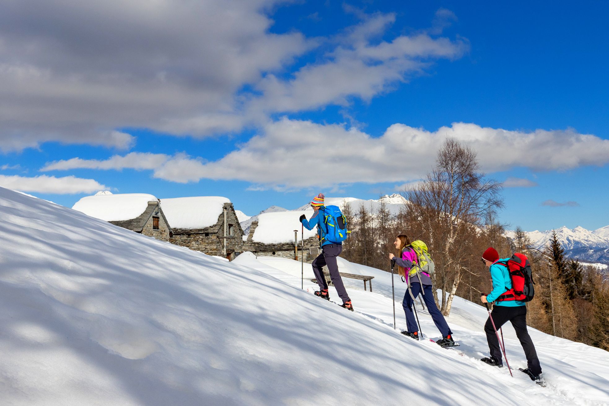
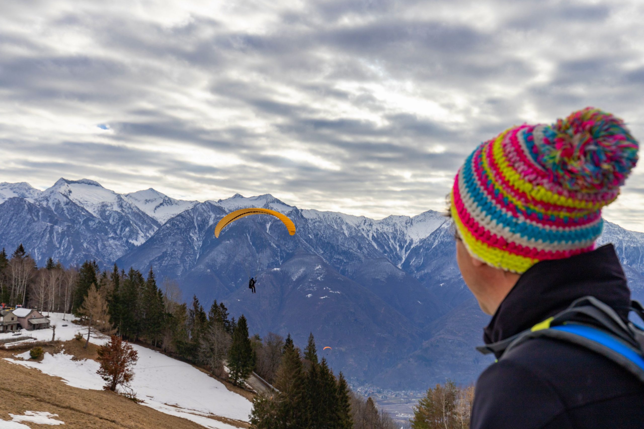
From the Alpe Lusentino car park, head in the direction of the Ski School and then towards the start of the Motti chairlift on the left. Go around the coffee shop building, keeping it on your right, and take the dirt track behind it, which begins to climb, passes between some buildings, and then cuts diagonally across an open stretch used for paraglider launch.
When you reach an isolated building, go around it, passing just upstream, to climb diagonally towards the chairlift until you reach and pass it. Once past this point, continue uphill, keeping the chairlift cables to your left, following the yellow and white/red signs.
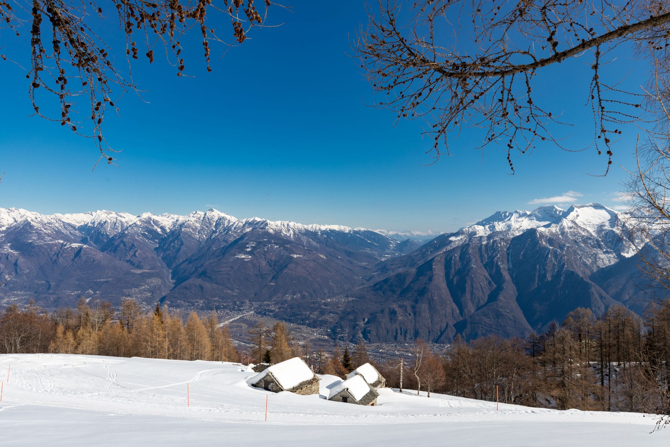
The climb leads to a flat road, cross it and continue along the line of the chairlift until reaching the Foppiano plateau, just downhill from the snow park and the restaurant at the arrival point of the chairlift.
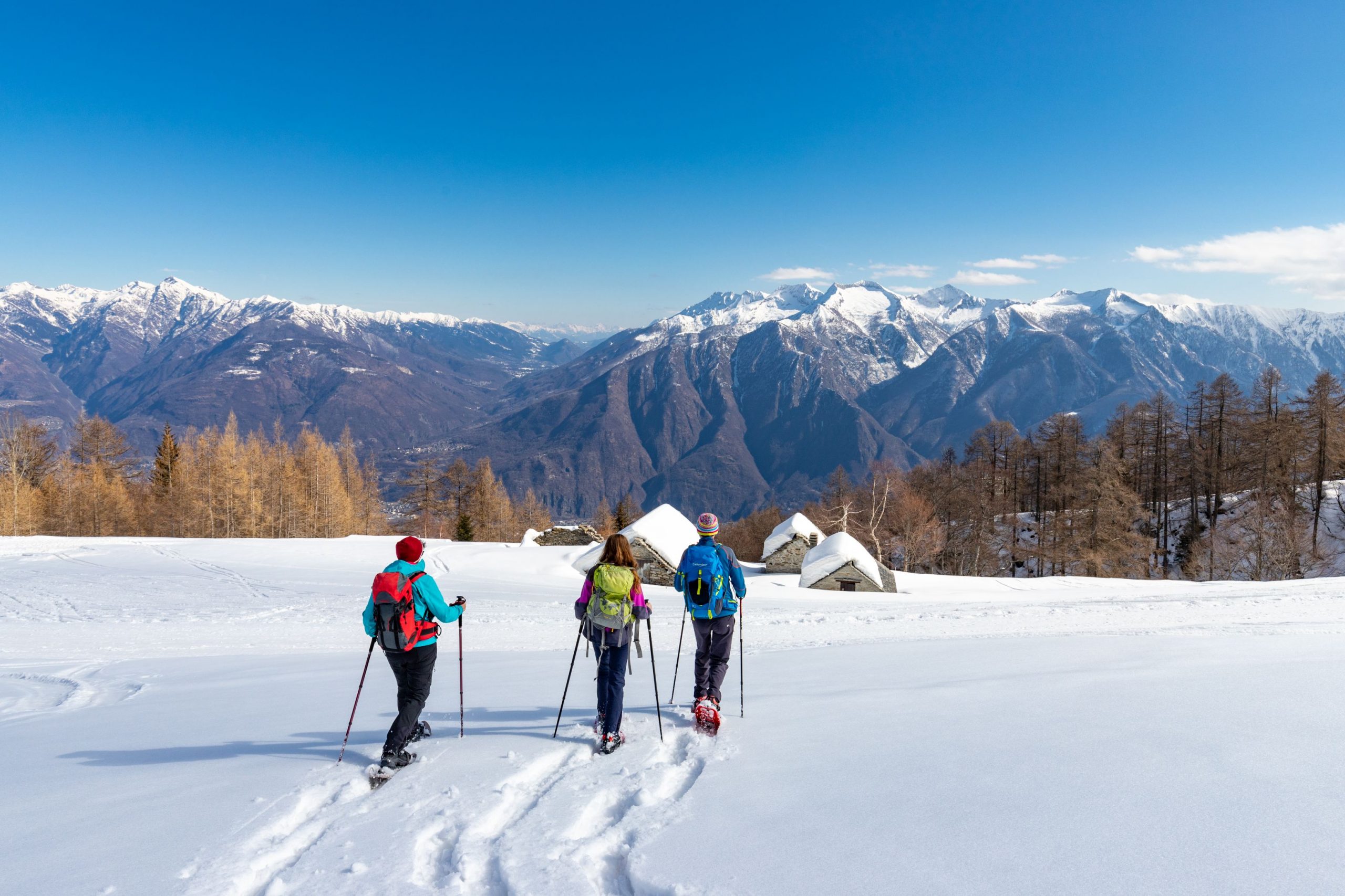
Keeping to the left, go around the ski slopes and up towards a ruined building. Just beyond this point, head for the Prel chairlift pylon and then turn left onto the track that leads into the wood (white/red “Ski Alp” sign).
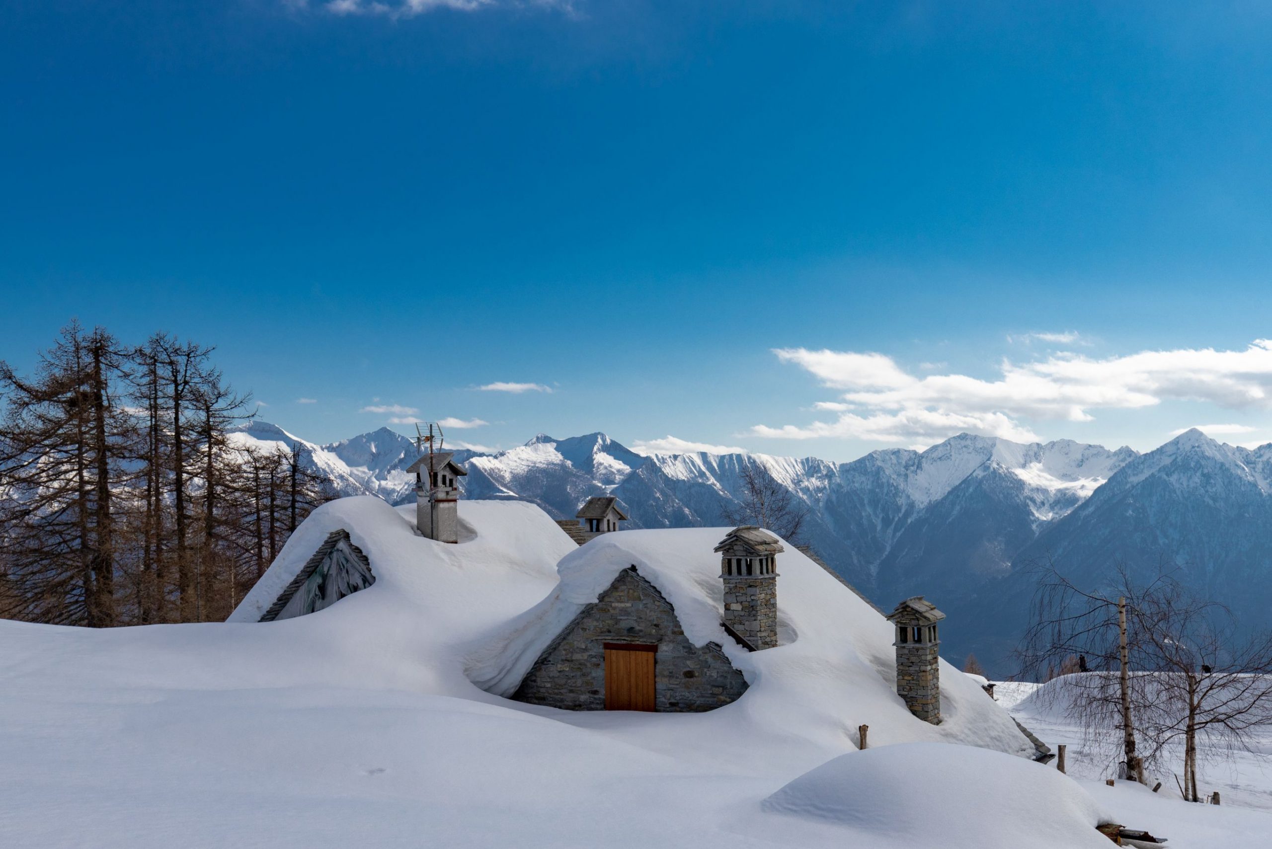
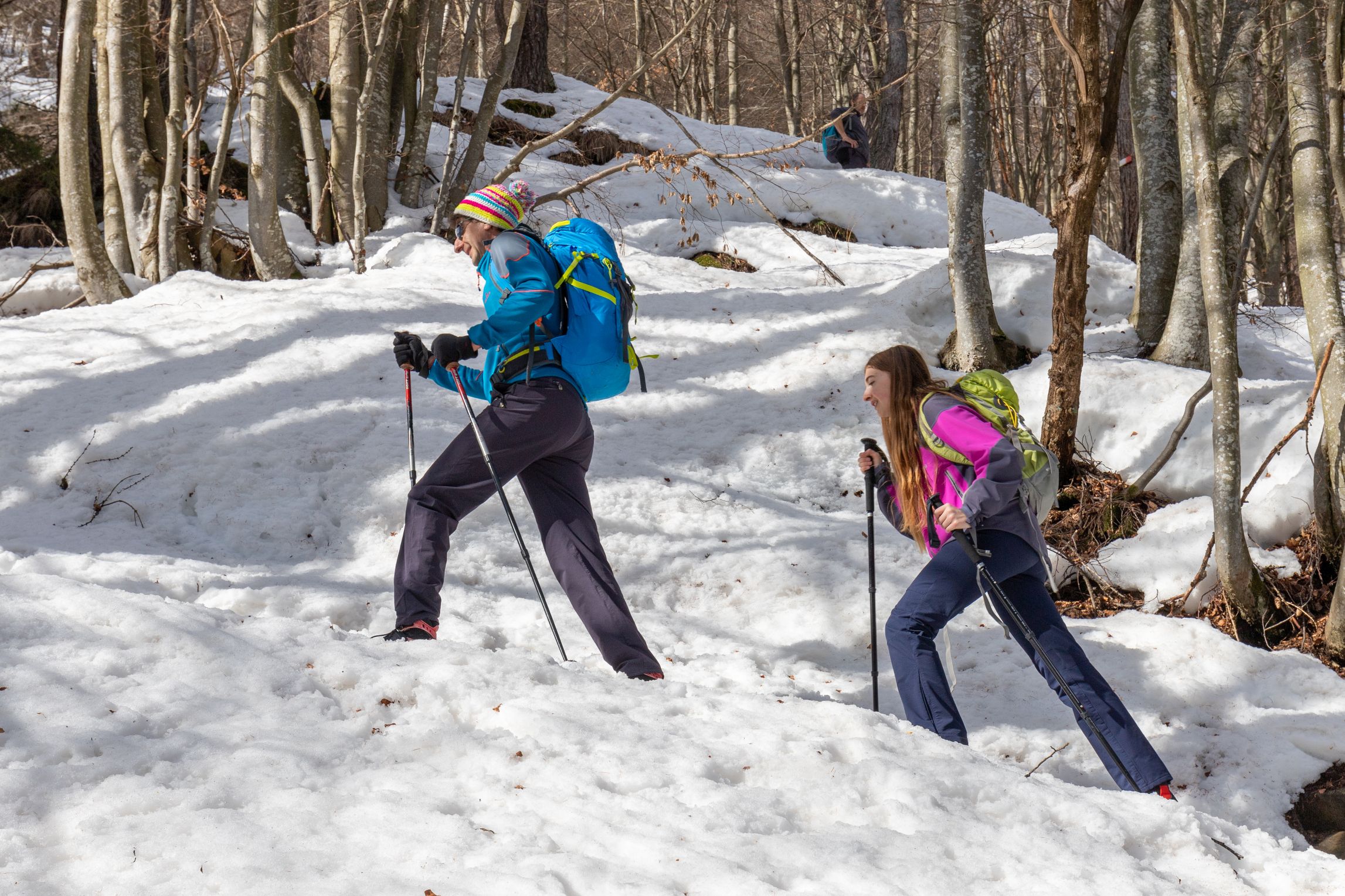
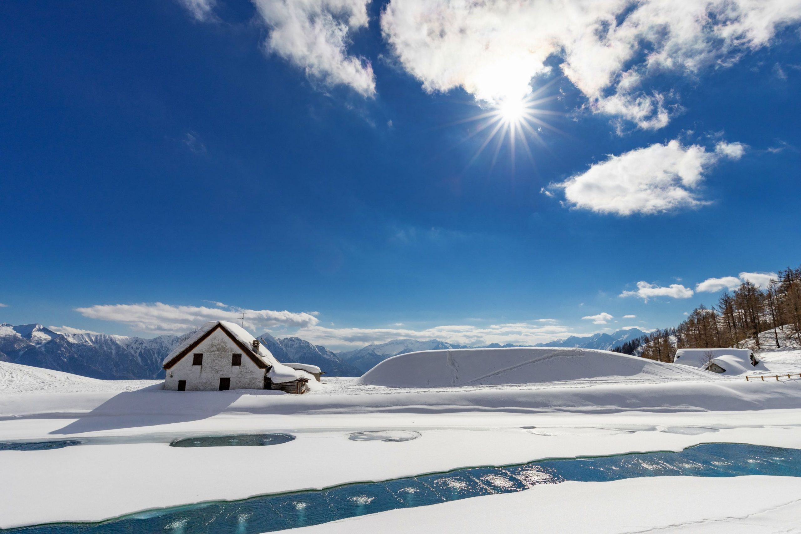
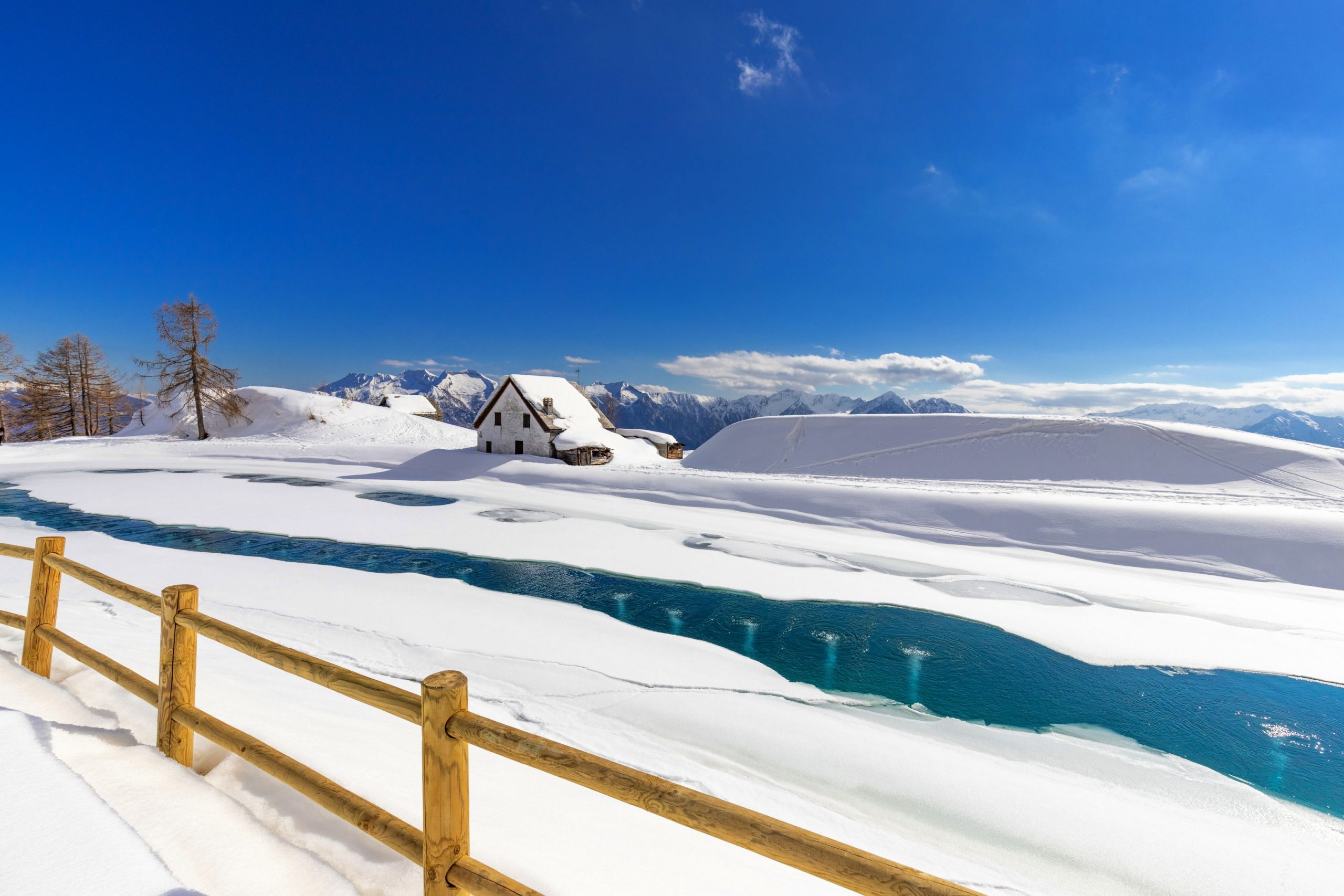
You begin to climb in narrow zigzags, immersed in the woods and far from the ski lifts and slopes, in a charming and fascinating environment. As the wood thins out, the trail lengthens, following the course of the Rio d’Anzuno, while to the right there are immaculate slopes with snow-covered houses, and then it comes out near the enchanting Casalavera pond.
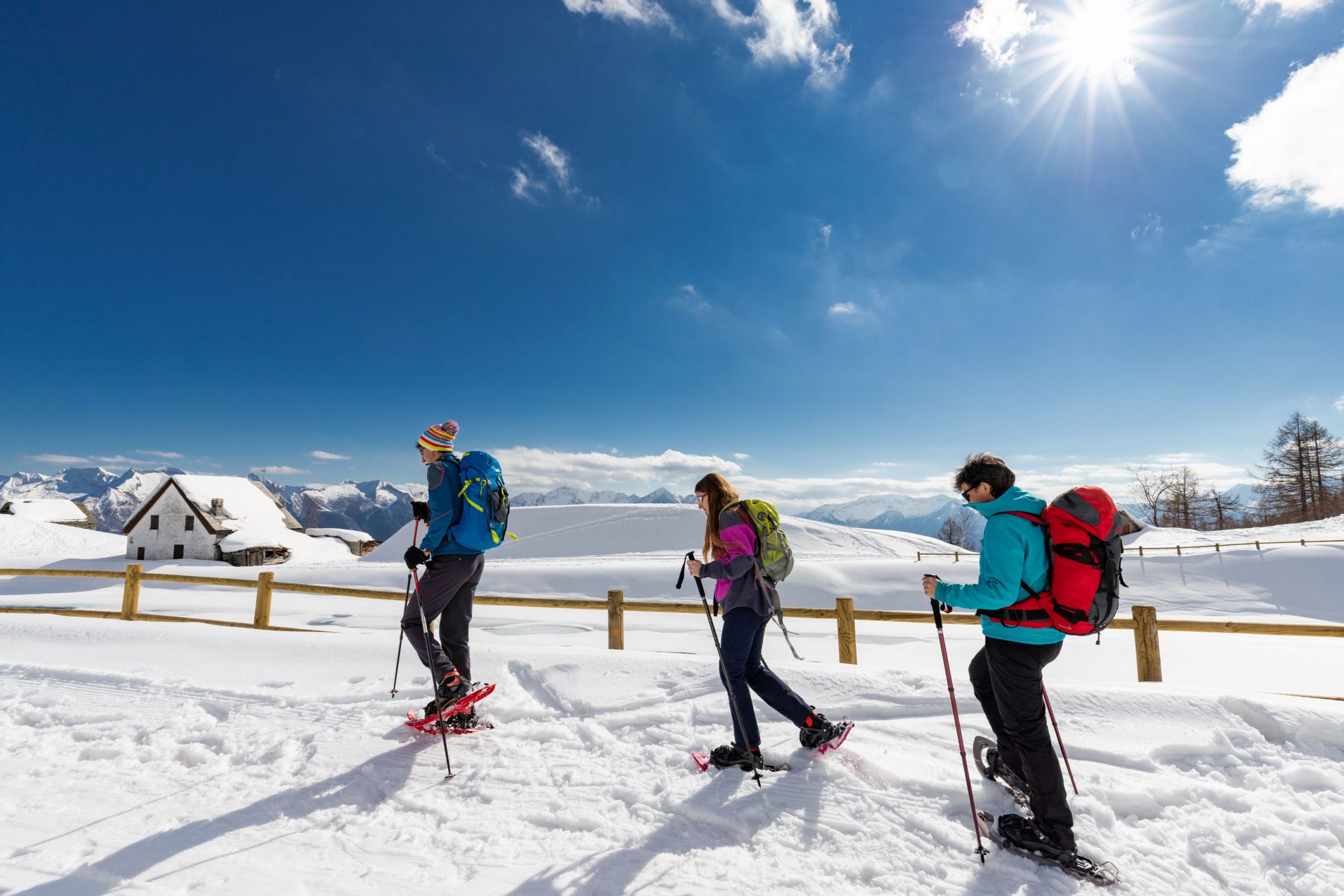
Going round it to the left, you reach a magnificent viewpoint towards the Ossola valleys.
If you wish, you can take the path from the pond on the right uphill, which leads in about 10 minutes to a coffee shop near the arrival of the Prel chairlift. Some care must be taken when crossing the ski slopes.
The return journey is by the same route as the outward journey.
Tips for baby snowshoers
A demanding but fascinating hike, suitable only for frown-up children. With younger children it is recommended to only go as far as Foppiano (+170 m, 1.2 km, 45 minutes).
It is also possible to take the Motti chairlift to Foppiano and walk only a part of the hike, or to take the Prel chairlift up to Casalavera and then walk downhill.
CONTACTS FOR TOURIST INFORMATION
DOMOBIANCA 365
Alpe Lusentino – 28845 Domodossola (VB)
Tel. +39 0324 44652
Email: info@domobianca.it
Path makers: Franco Voglino, Annalisa Porporato and Nora Voglino
Authors of text: Franco Voglino, Annalisa Porporato
The path is described in the book “SNOW TREK” of Distretto Turistico dei Laghi – edition 2021
The routes were suggested by ski operators and municipalities Partner of Neveazzurra project. We decline any responsability regarding the effective feasibility and any changes that the routes can suffer. Maps and tracks are purely indicative of the route.
Safety annotations:
Here are some practical tips: find out about weather and snow conditions, checking the forecasts especially at local level; check the avalanche bulletin for the relevant area; equip yourself with and carry PSA self-rescue equipment: shovel, probe and ARTVa; wear warm, waterproof clothing that is comfortable and consists of several layers… despite the snow, you will get warm as you move; hiking shoes or mountain boots depending on the area, terrain and altitude where the hike takes place; bring gloves, cap, sunglasses and sunscreen; pack a rucksack with a spare shirt and hot drinks; during the hike, always check the slopes above you; avalanches usually break off on slopes with a gradient of more than 25° and can also continue on flat sections.
Back to the list of routes
Attraverso un suggestivo bosco
ESCURSIONE CON RACCHETTE AI GRANDIOSI PANORAMI DALL’ALPE LUSENTINO ALL’ALPE CASALAVERA
Route description
Escursione ai grandiosi panorami dell’Alpe Casalavera, attraversando un suggestivo bosco
Località di partenza: Domodossola, Alpe Lusentino (1089 m.)
Località di arrivo: Alpe Casalavera (1610 m.)
Distanza: 3 km sola andata
Tempo di percorrenza al netto delle soste: 2 ore e 30 minuti sola andata
Segnaletica: frecce bianco/rosse “Ski Alp”
Come arrivare: dista 11 km da Domodossola. Da Domodossola seguire le indicazioni per Domobianca – Alpe Lusentino
L’itinerario:
Dal parcheggio dell’Alpe Lusentino ci si dirige in direzione della Scuola Sci per puntare quindi verso la partenza della seggiovia Motti, a sinistra. Si aggira l’edificio del bar tenendolo alla propria destra per imboccare la sterrata alle sue spalle che comincia a salire passando tra alcuni edifici, per poi tagliare in diagonale un tratto aperto da cui si lanciano con il parapendio.
Arrivati ad un edificio isolato lo si aggira passando poco a monte, per salire in diagonale verso la seggiovia fino a raggiungerla e superarla. Una volta oltre si prosegue in salita tenendo i cavi della seggiovia alla propria sinistra, seguendo cartelli gialli e i segni bianco/rossi.
La salita porta su una strada pianeggiante, la si attraversa per proseguire sempre lungo la linea della seggiovia fino ad arrivare sulla spianata di Foppiano, poco a valle dello snow park e del ristorante che si trova all’arrivo della seggiovia.
Tenendo la sinistra si aggirano le piste da sci risalendo in direzione di un edificio in rovina. Appena oltre si punta verso il pilone della seggiovia Prel, per poi deviare a sinistra verso la traccia che si inoltra nel bosco (cartello bianco/rosso “Ski Alp”).
Si comincia a salire con stretti zig zag, immersi nel bosco e lontano da impianti di risalita e piste, in un ambiente suggestivo e affascinante. Quando il bosco si dirada il tracciato si allunga seguendo il corso del Rio d’Anzuno mentre verso destra si aprono pendii immacolati con casette sommerse dalla neve, per poi sbucare nei pressi dell’incantevole laghetto di Casalavera.
Aggirandolo verso sinistra si arriva ad un grandioso punto di vista verso le Valli dell’Ossola.
Volendo, è possibile imboccare il percorso che parte dal laghetto, a destra in salita, che porta in circa 10 minuti ad un bar posto nei pressi dell’arrivo della seggiovia Prel. Va prestata un po’ di attenzione durante i relativi attraversamenti delle piste da sci.
Il ritorno è sulla medesima via dell’andata.
Consigli per i baby ciaspolatori
Escursione impegnativa per la pendenza ma dal grande fascino, adatta solo a bambini più grandicelli. Con bambini più piccoli è consigliato arrivare solo fino a Foppiano (+170m, 1,2km, 45 minuti).
È possibile anche raggiungere Foppiano con la seggiovia Motti e percorrere solo un tratto dell’escursione, oppure salire ancora con la seggiovia Prel fino a Casalavera e quindi percorrere il tracciato in discesa.
CONTATTI PER INFORMAZIONI TURISTICHE
DOMOBIANCA 365
Alpe Lusentino – 28845 Domodossola (VB)
Tel. +39 0324 44652
Email: info@domobianca.it
Realizzatori del percorso: Franco Voglino, Annalisa Porporato e Nora Voglino
Autori dei testi: Franco Voglino, Annalisa Porporato
Percorso presente nella pubblicazione “SNOW TREK” del Distretto Turistico dei Laghi – ediz. 2021
I percorsi sono stati segnalati a cura di Impiantisti e Comuni Partner del progetto Neveazzurra. Si declina ogni responsabilità sull’effettiva percorribilità degli stessi ed eventuali modifiche che i tracciati possano subire. Mappe e tracce sono puramente indicative.
NOTE SULLA SICUREZZA:
Qui di seguito riportiamo alcuni pratici consigli: informarsi sulle condizioni meteo e della neve, controllando le previsioni soprattutto a livello locale; controllare il bollettino valanghe per la zona di riferimento; dotarsi e portare sempre con sé l’attrezzatura PSA per l’autosoccorso: pala, sonda e ARTVa; indossare un abbigliamento caldo e impermeabile che sia confortevole e composto da più strati…nonostante la neve, muovendosi ci si scalda; scarpe da trekking o scarponi da montagna a seconda della zona, della morfologia e dell’altitudine ove si svolge l’escursione; portare con sé guanti, berretto, occhiali da sole e crema solare; dotarsi di zaino con maglia di ricambio e bevande calde; durante l’escursione controllare sempre i pendii sovrastanti; le valanghe si staccano, di solito, su pendii al di sopra dei 25° di pendenza e possono continuare la loro corsa anche sul piano.
Back to the list of routes

