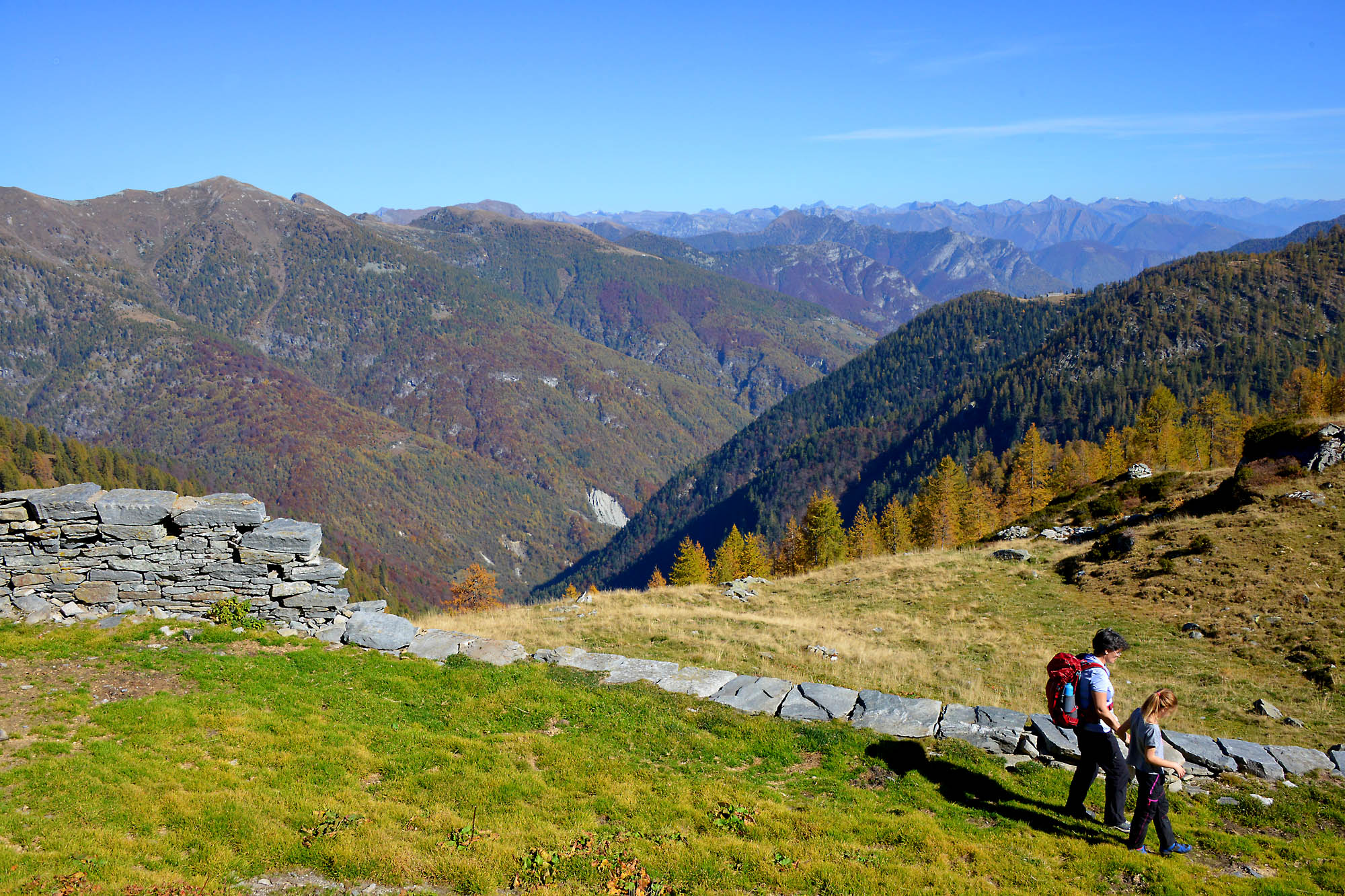
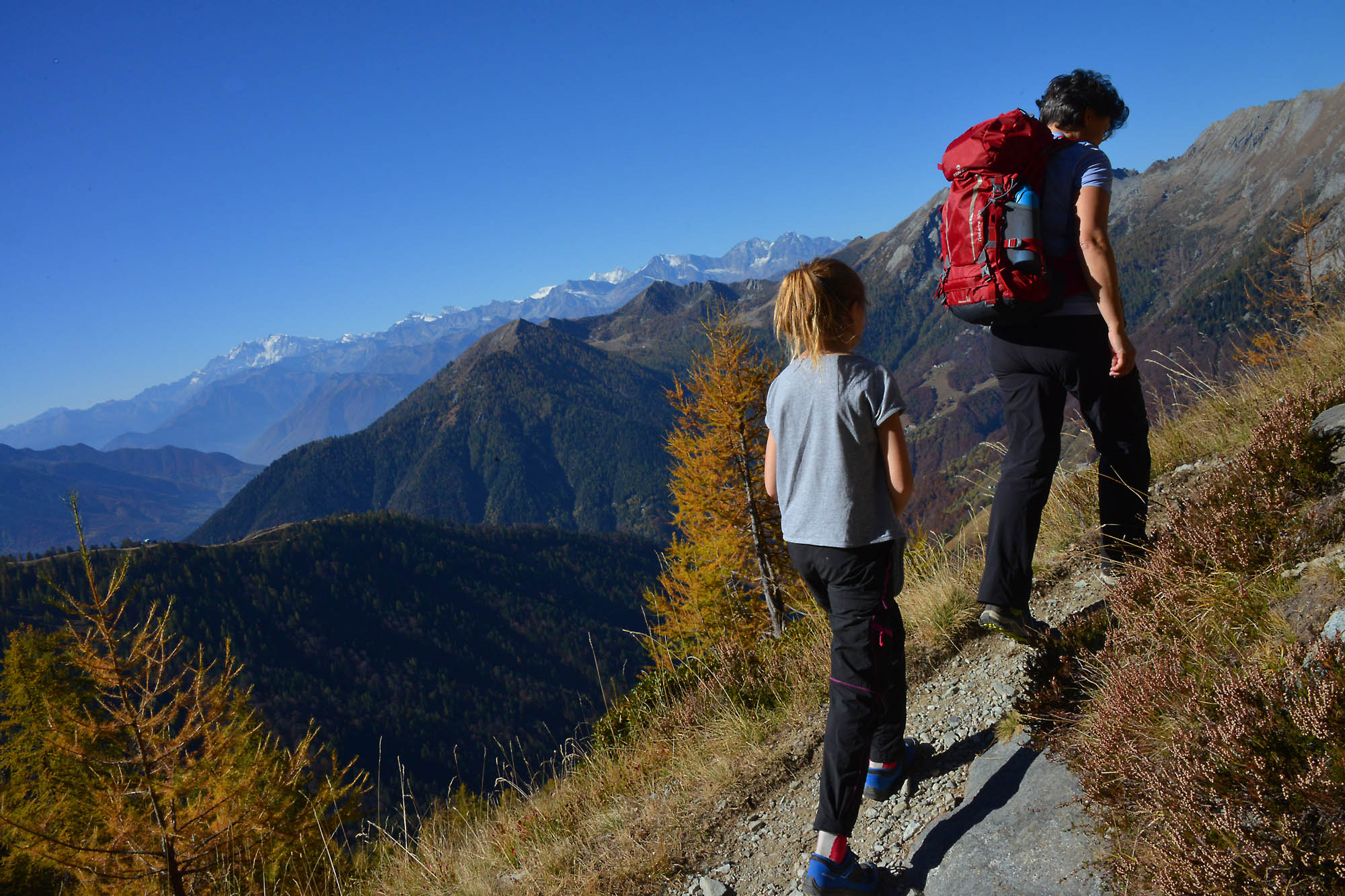
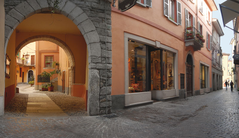
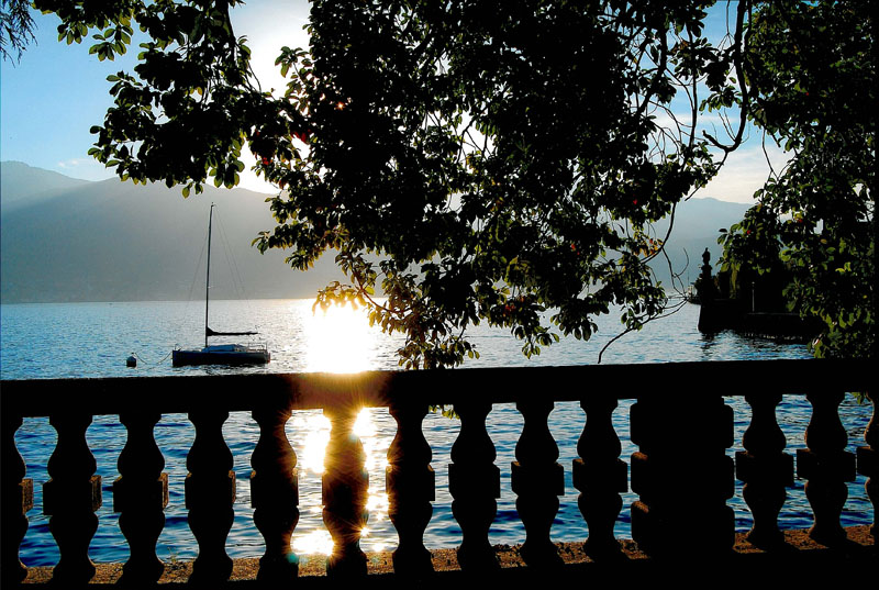
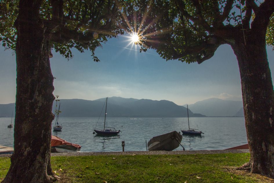
From Suna to Cannobio
FROM VERBANIA TO THE SWISS BORDER ALONG THE “VIA DELLE GENTI”
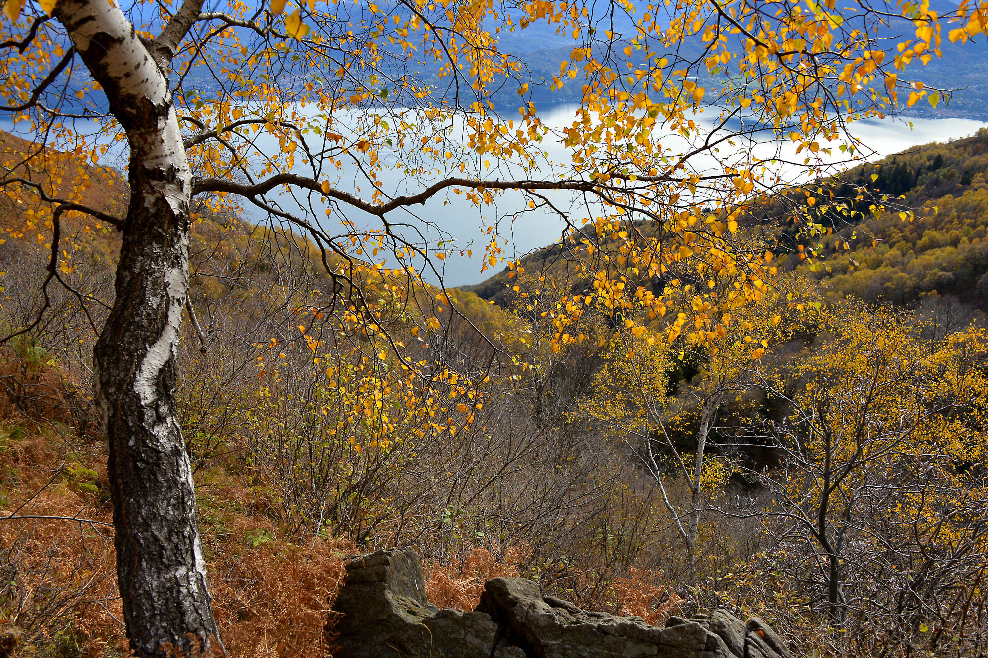
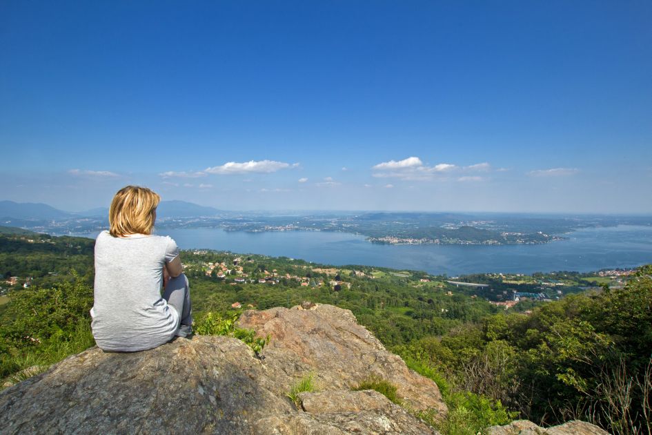
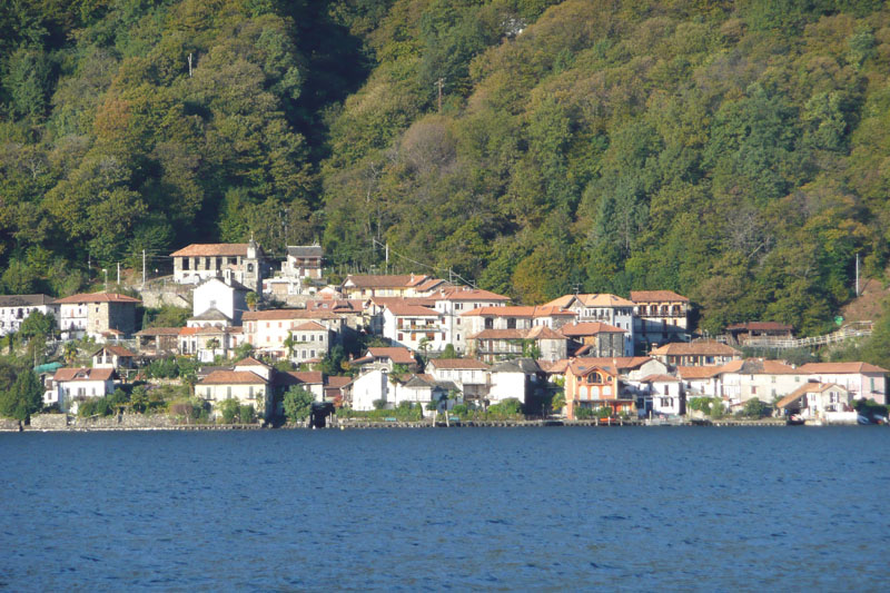
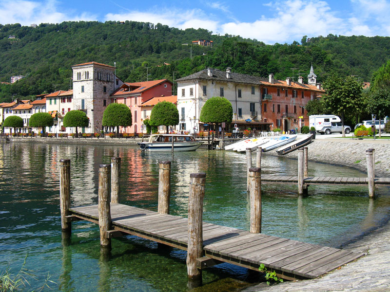
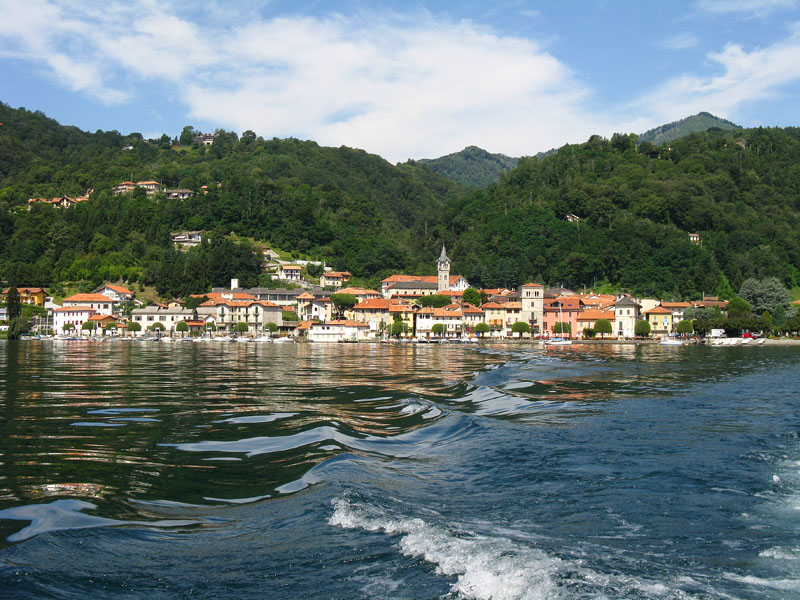
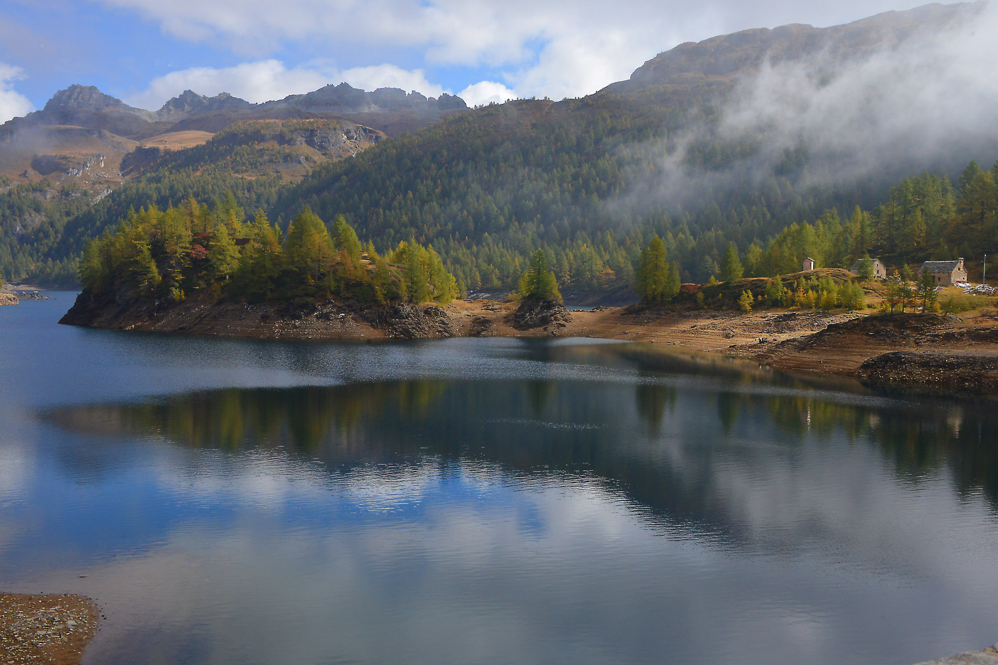
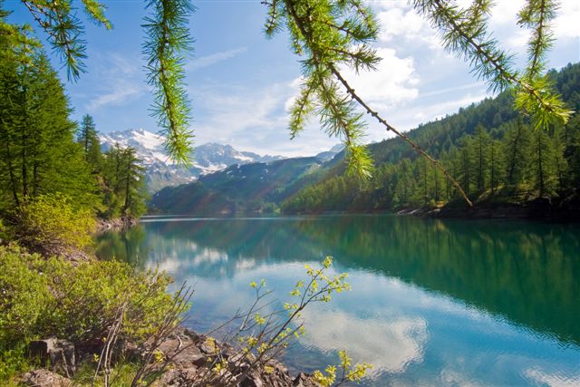
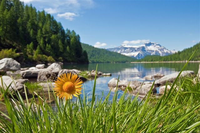
Lago Maggiore
Route description
Itinerary Description
The itinerary involves the historic “Via delle Genti”, an ancient road between the towns of the upper Verbano area and Switzerland.
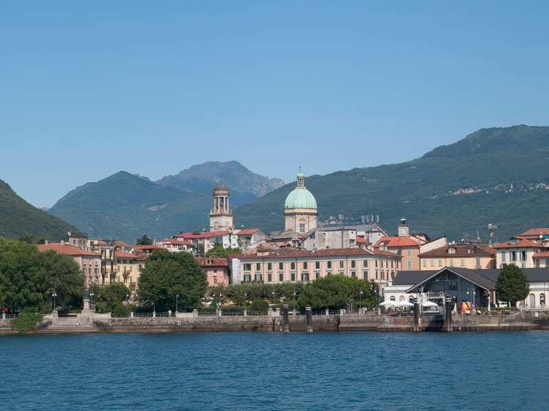
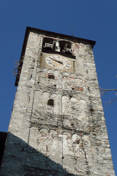
From Suna, we walk in the direction of Pallanza and take the bicycle-pedestrian path that leads to Intra, with its historical centre and the imposing bell tower of the Basilica of San Vittore.
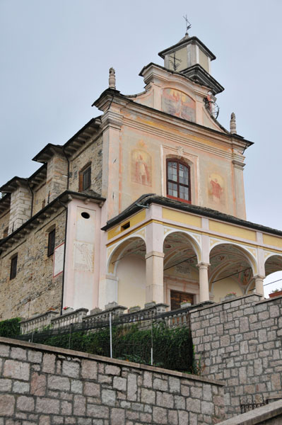
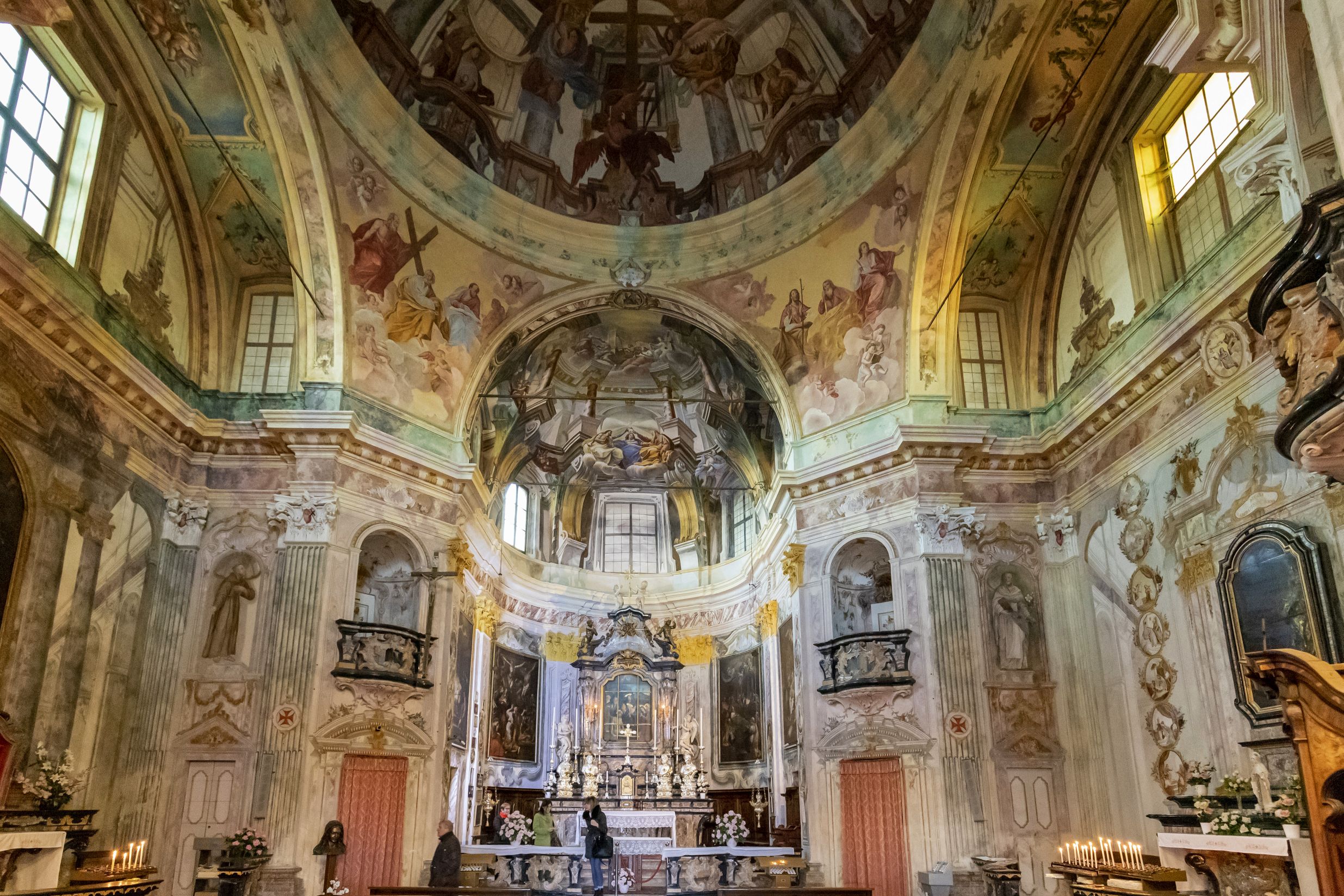
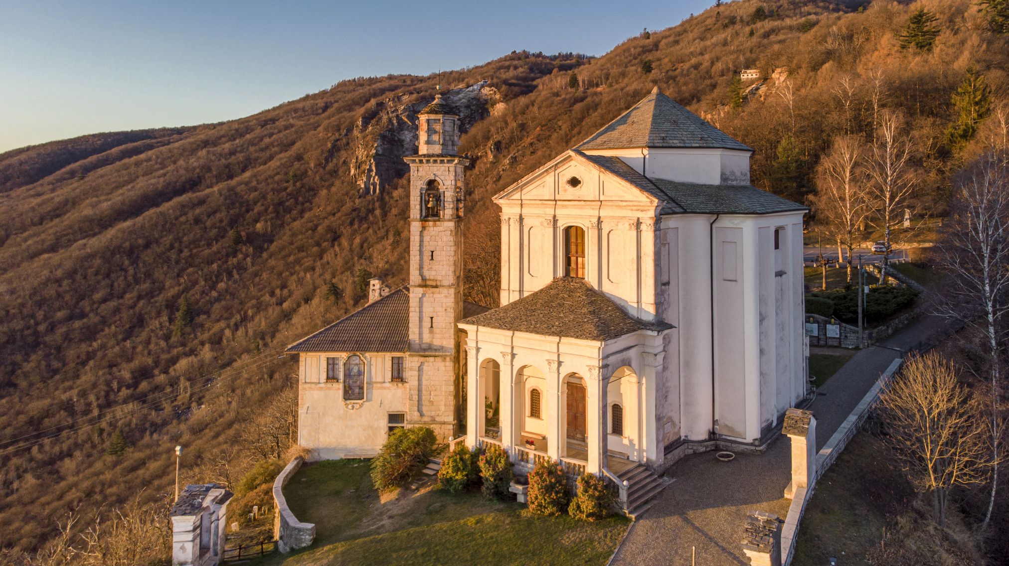
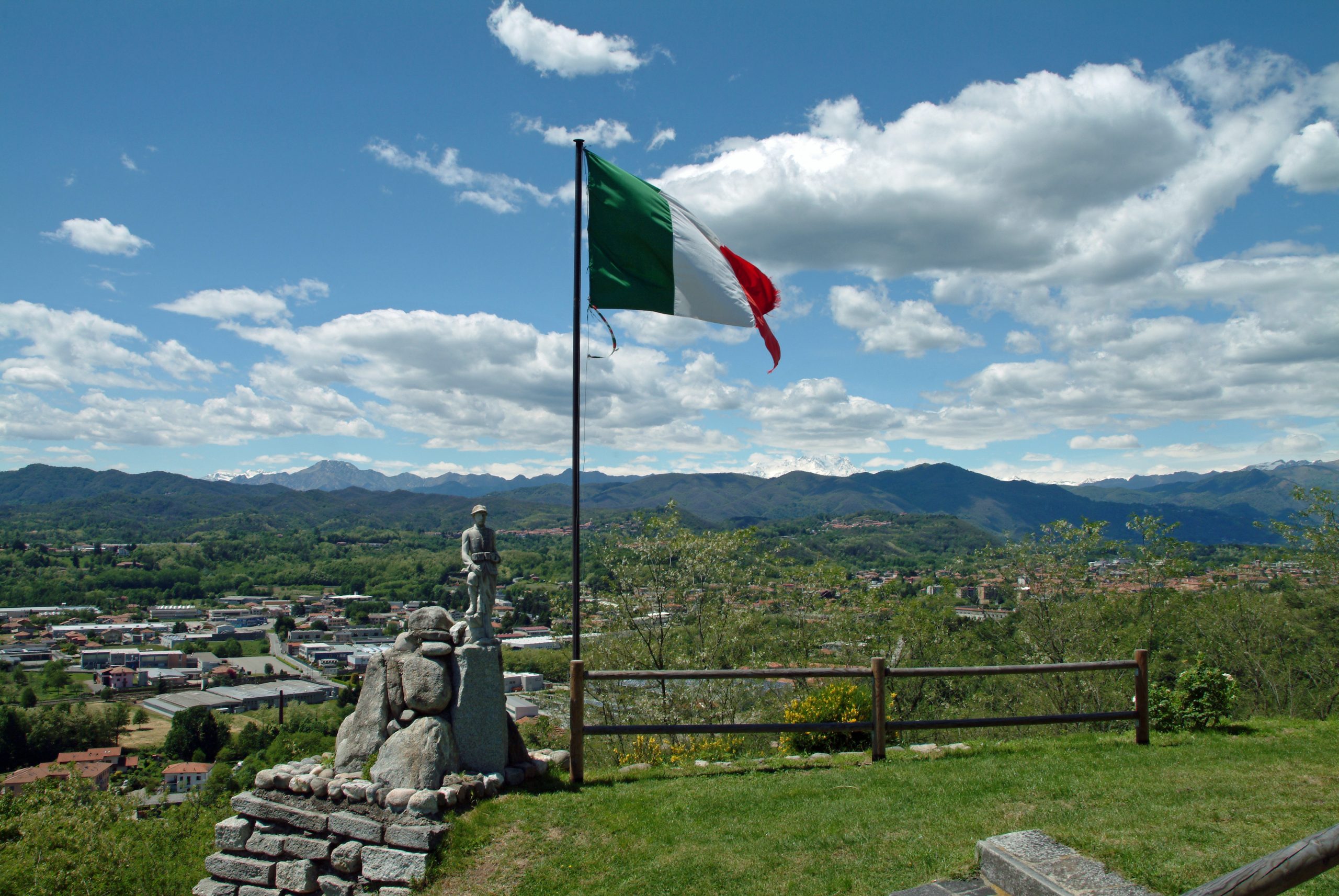
After crossing the San Giovanni river, the trail rises towards Antoliva to arrive at Carpiano: here the trail continues for Bozzela, Frino and finally Ronco, places where the path climbs up to the slopes of Mount Carciago, and the Sacro Monte of the SS. Trinity of Ghiffa.
From the Sacro Monte, we descend towards Deccio. Deviating from the main path leading southward, we cross a secondary road and reach Novaglio, where we get back on the mule-track that leads to Comogno and finally to Oggebbio.
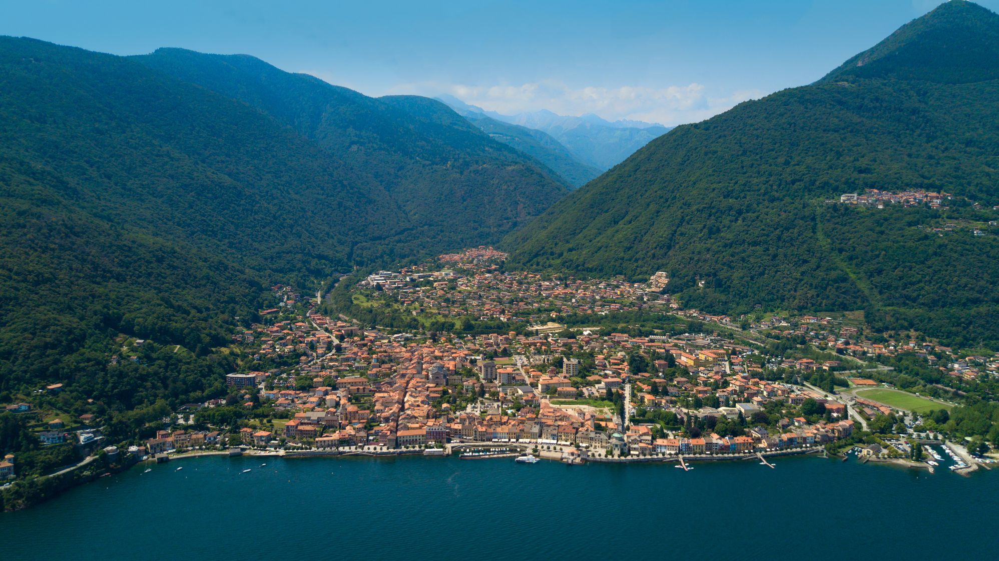
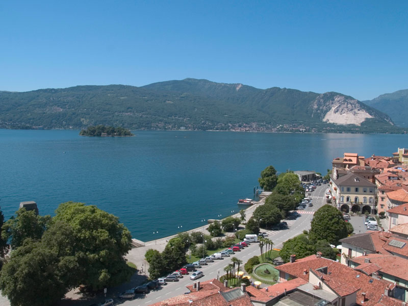
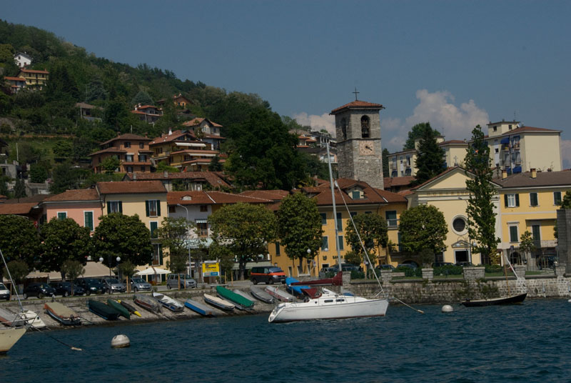
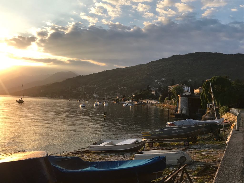
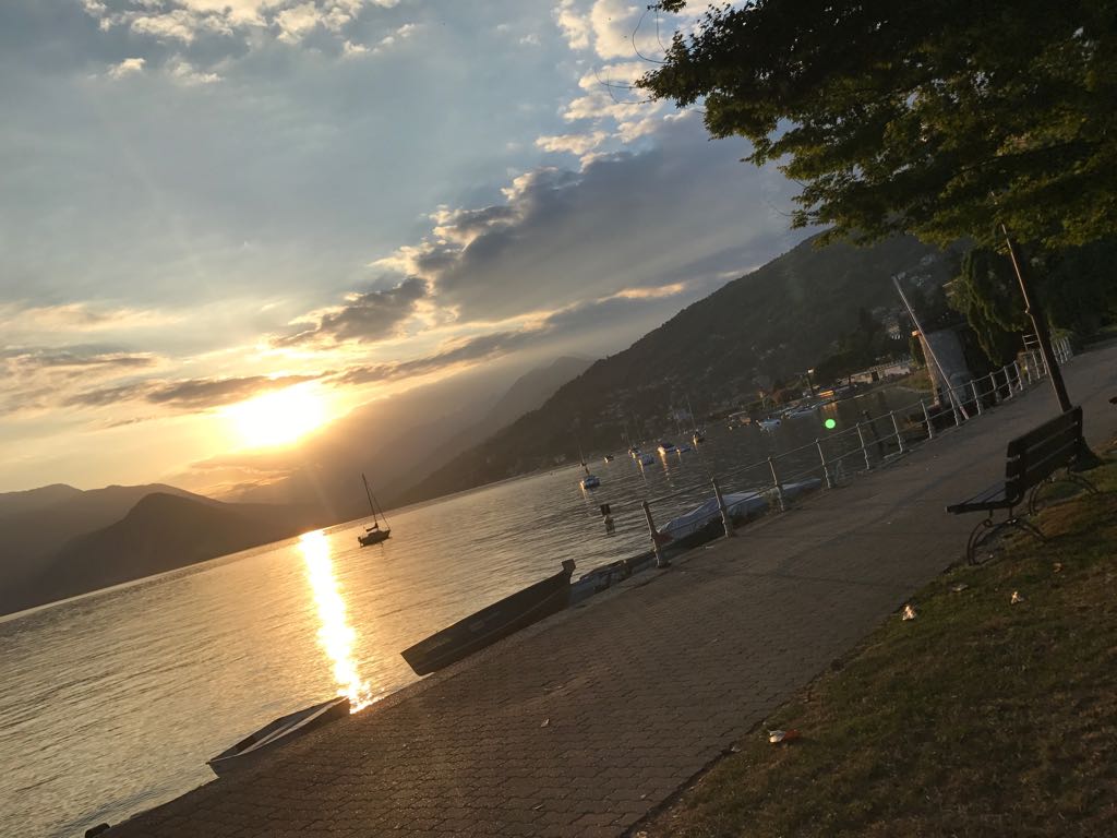
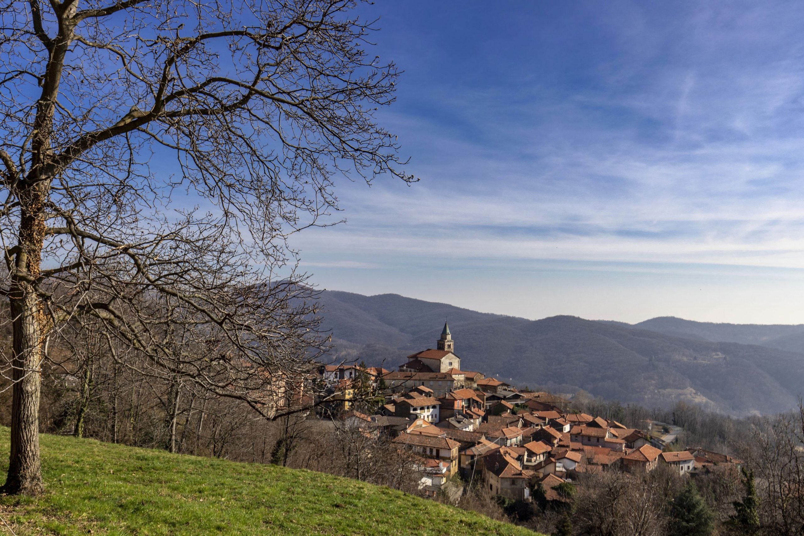
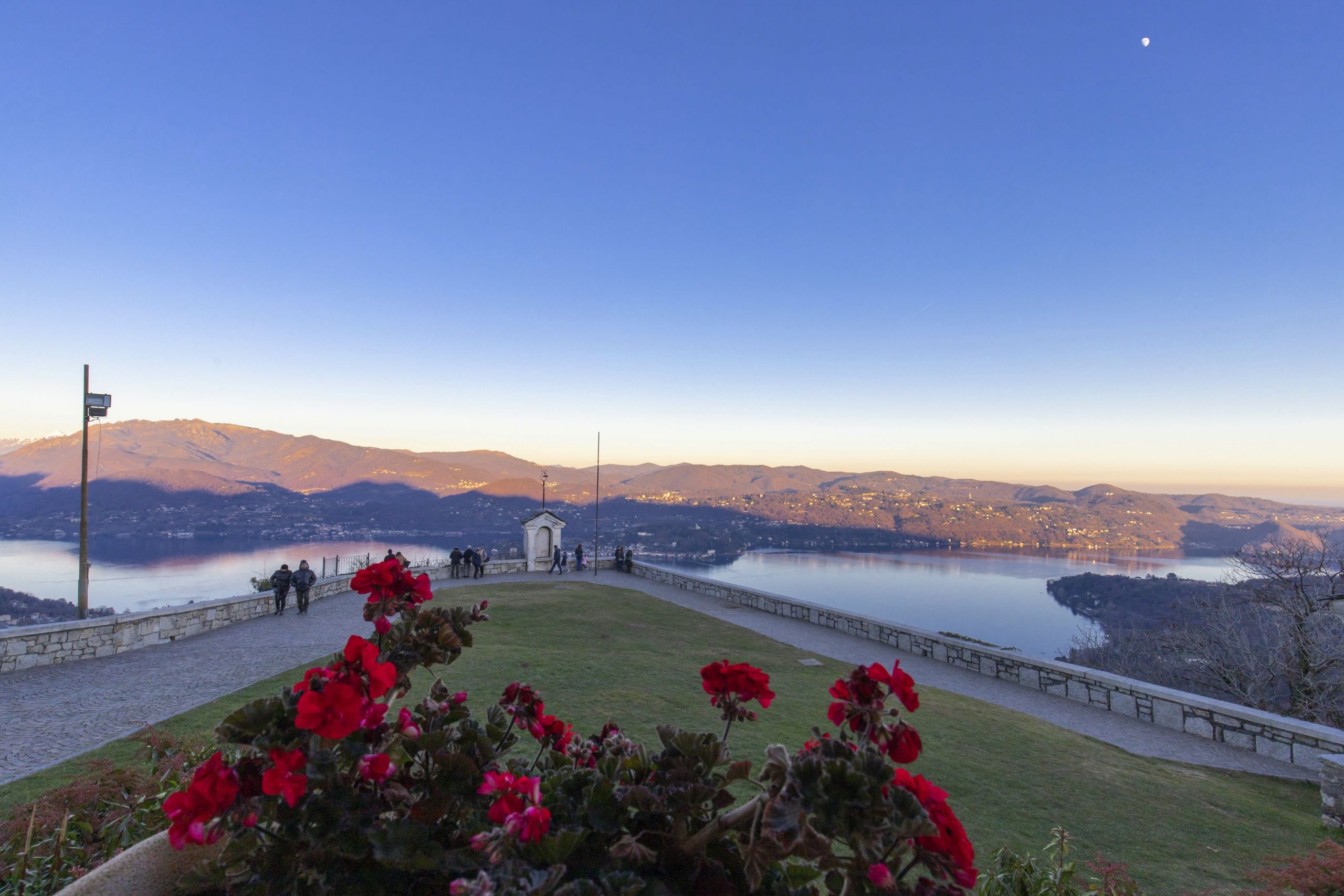
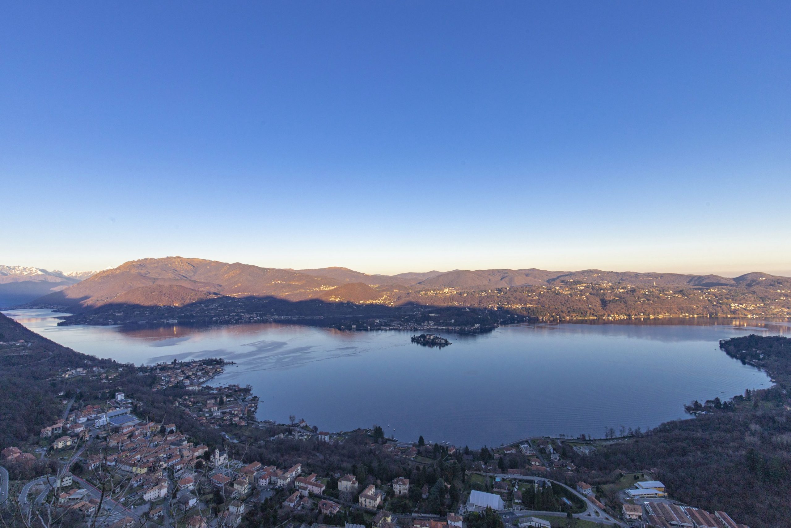
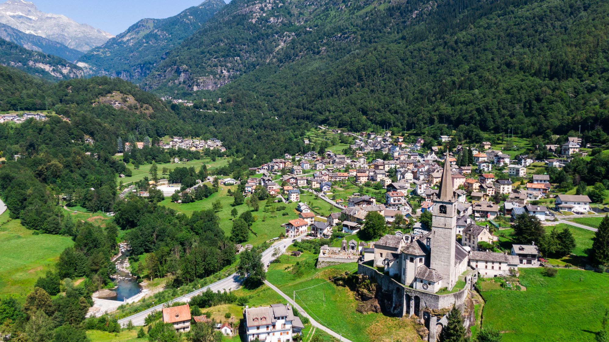
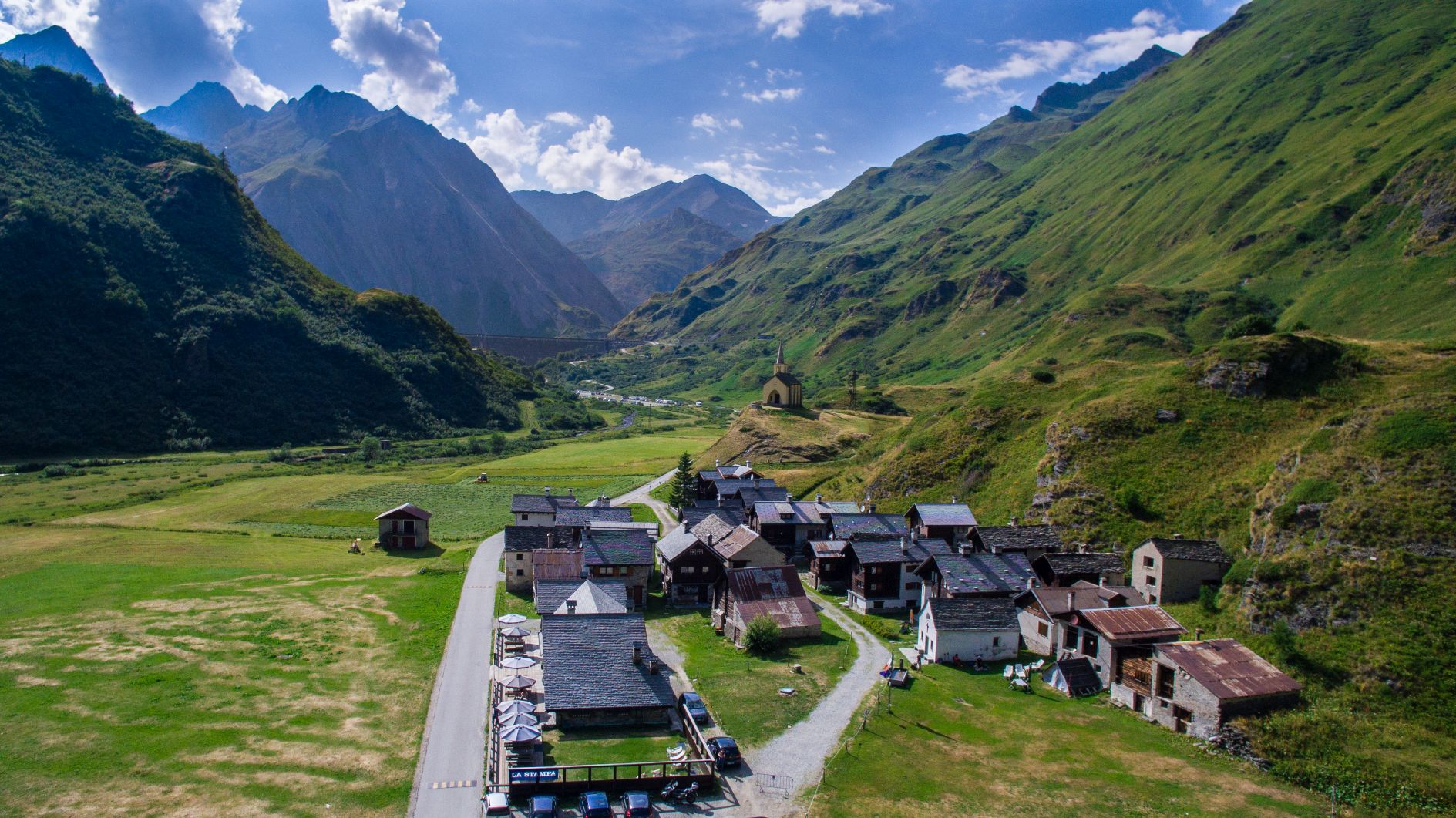
From here, the itinerary resumes halfway up the mountain, passing through Barbè and Cassino. We reach Cannero, whose mild climate and environmental characteristics make this town feel like a coastal location.
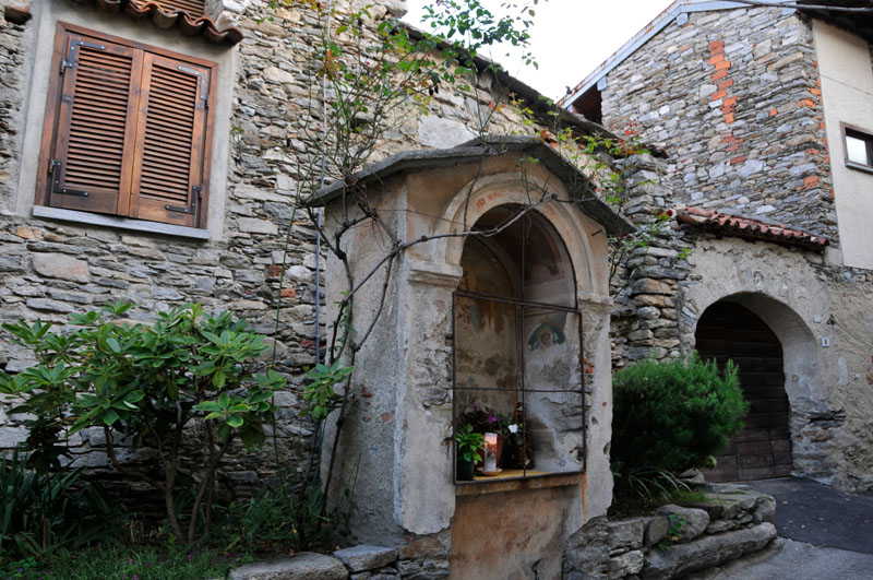
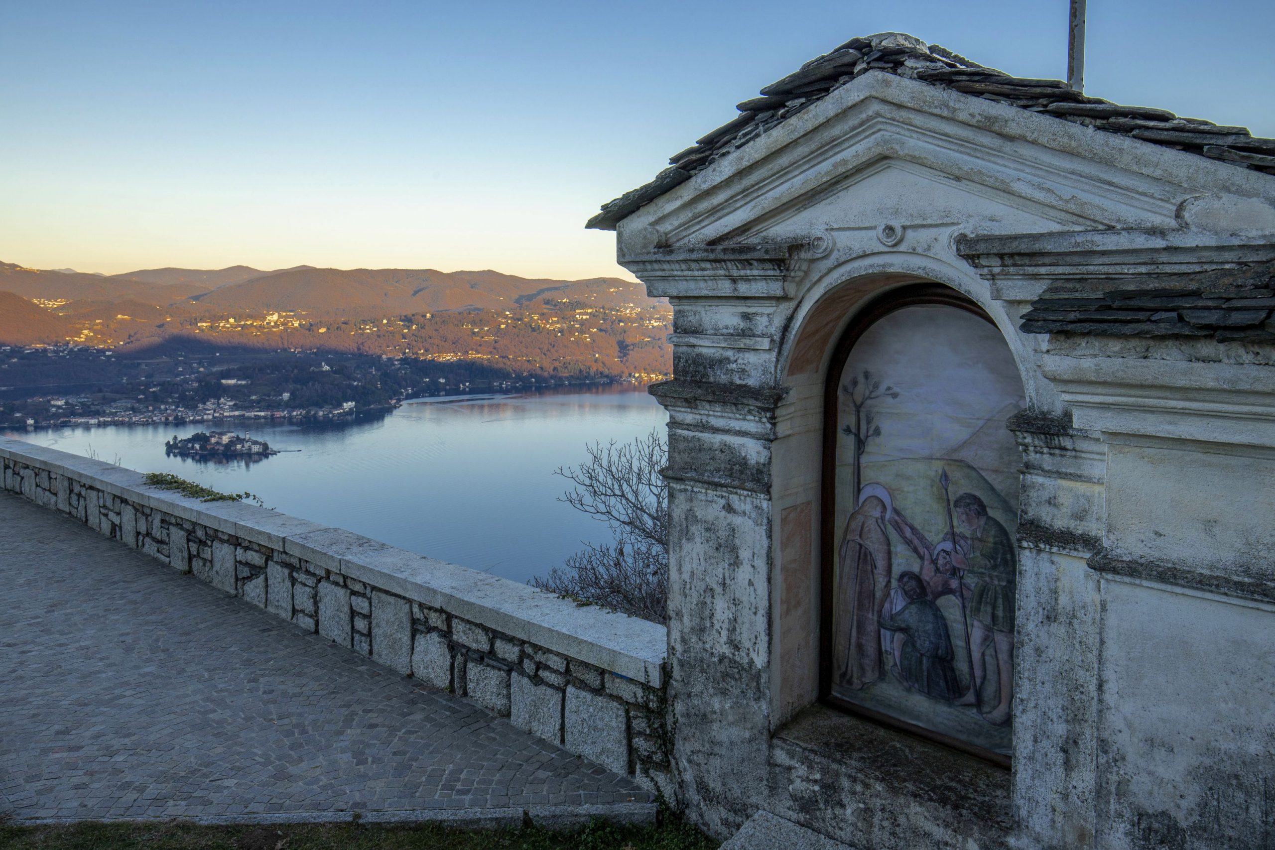
Leaving the inhabited centre, we take the ancient road for Switzerland, called “Via delle Genti” (Road of the Peoples), that winds through the woods and meadows, now overgrown with wild vegetation. We reach Carmine Superiore, with its church of San Gottardo. From this medieval village, we can even enjoy a wonderful view the Castles of Cannero .
Before continuing our excursion, we go to Viggiona – taking a mule track northwards – and thus discover the traces of the trenches of the Cadorna line.
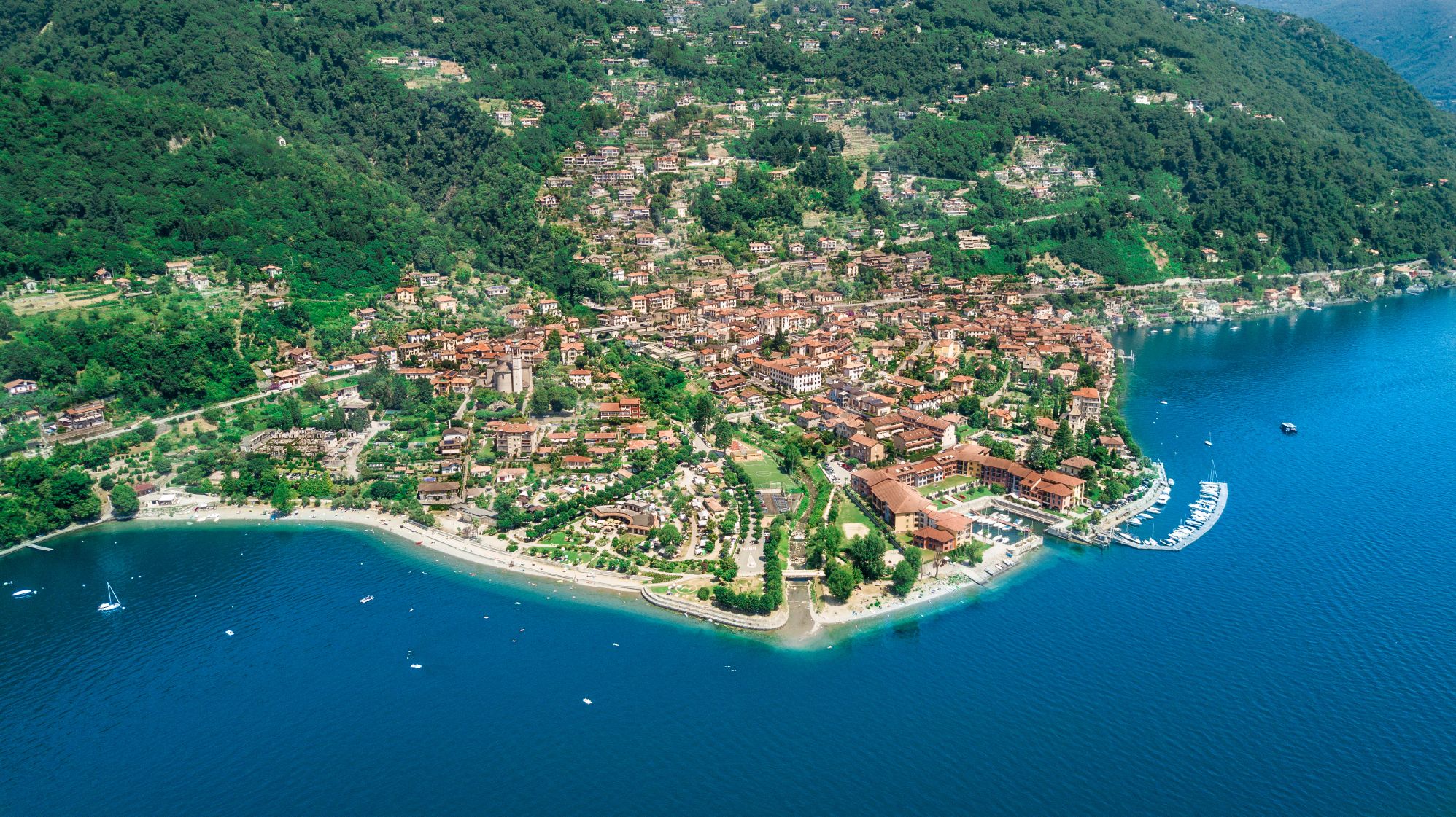
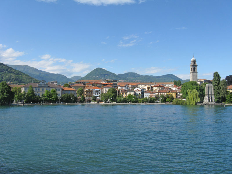
Resuming the historic “Via delle Genti”, we reach Molineggi and descend to Cannobio, passing through Solivo. After crossing Cannobino, we continue towards Marchile and Formine: from here, we take a small detour northwards on a beautiful path through the chestnut trees to discover the Church of San Bartolomeo in Montibus.
POINTS OF INTEREST
Suna
Chiesa di Santa Lucia
Oratorio della Beata Vergine del Buon Rimedio
Torraccia medievale
Cappelle devozionali lungo i Sentieri del Monterosso
Cavandone
Chiesa Parrocchiale della Natività di Maria
Pallanza
Chiesa di Madonna di Campagna
Oratorio di San Remigio
Chiesa Parrocchiale di Santo Stefano
Chiesa Collegiata di San Leonardo
Palazzo di città
Villa Rusconi Clerici
Villa Taranto
Villa Giulia
Mausoleo Cadorna
Museo del Paesaggio
Intra
Basilica di San Vittore
Oratorio di Santa Marta
Chiesa di San Fabiano
Chiesa Evangelica Metodista
Casa del Lago
Palazzo Flaim
Ghiffa
Sacro Monte della SS. Trinità
Chiesa Parrocchiale di San Maurizio
Museo dell’Arte del Cappello
Oggebbio
Chiesa parrocchiale di San Pietro
Oratorio della natività di Maria (frazione Cadessino)
Chiesa di Sant’Agata (frazione Novaglio)
Villa Anelli (Gonte)
Cannero
Chiesa Parrocchiale di San Giorgio
Grotta della Madonna di Lourdes
Castelli di Cannero
Villa della Sabbioncella
Museo etnografico e della spazzola
Parco degli Agrumi
Oratorio di Santa Lucia (Piancassone)
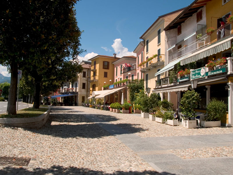
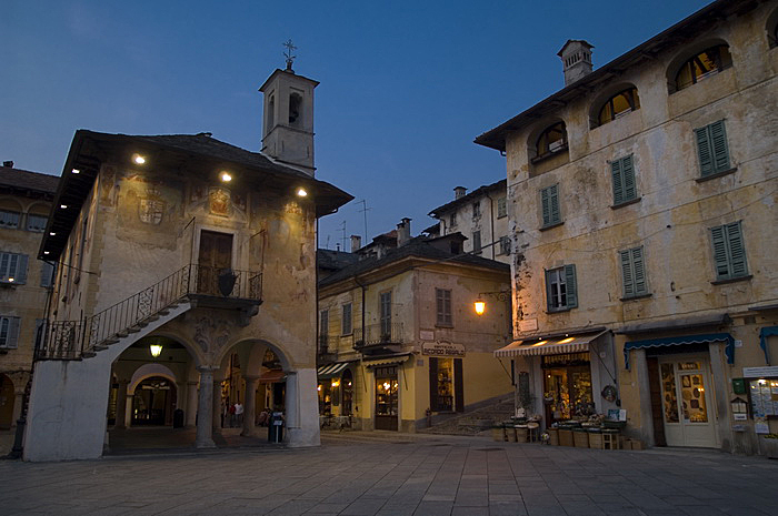
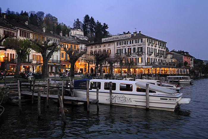
Cannobio
Santuario della SS. Pietà
Collegiata di San Vittore
Casa Pironi
Palazzo della Ragione
Chiesa di Sant’Agata
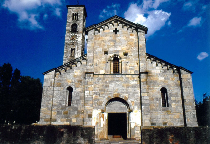
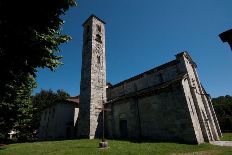
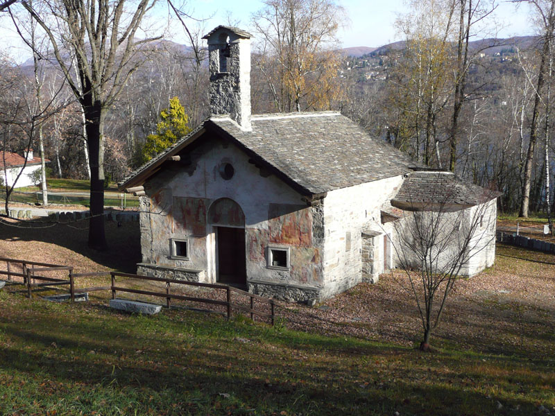
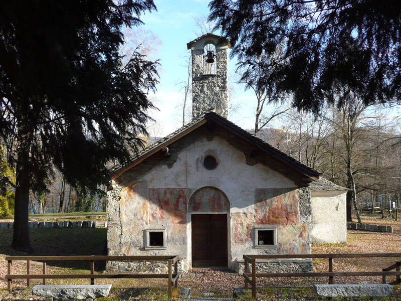
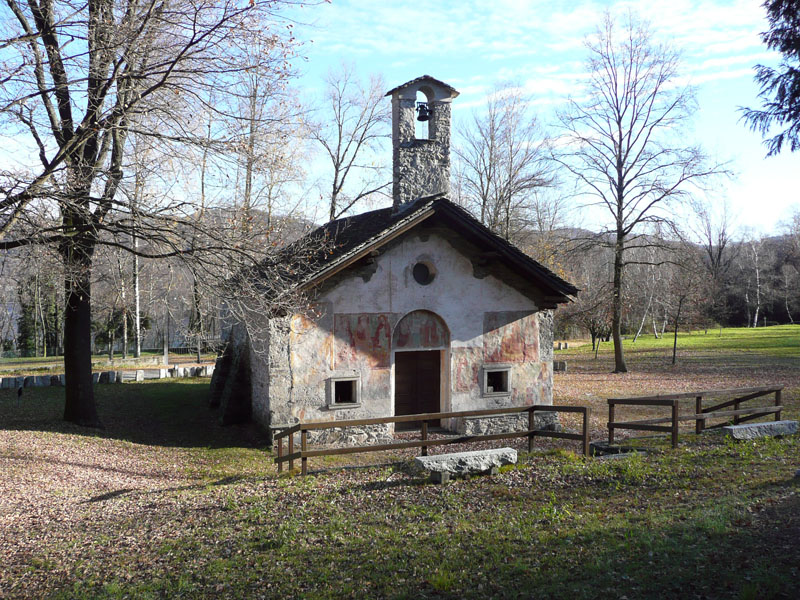
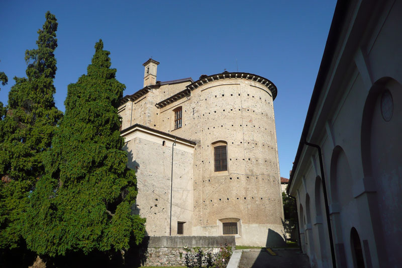
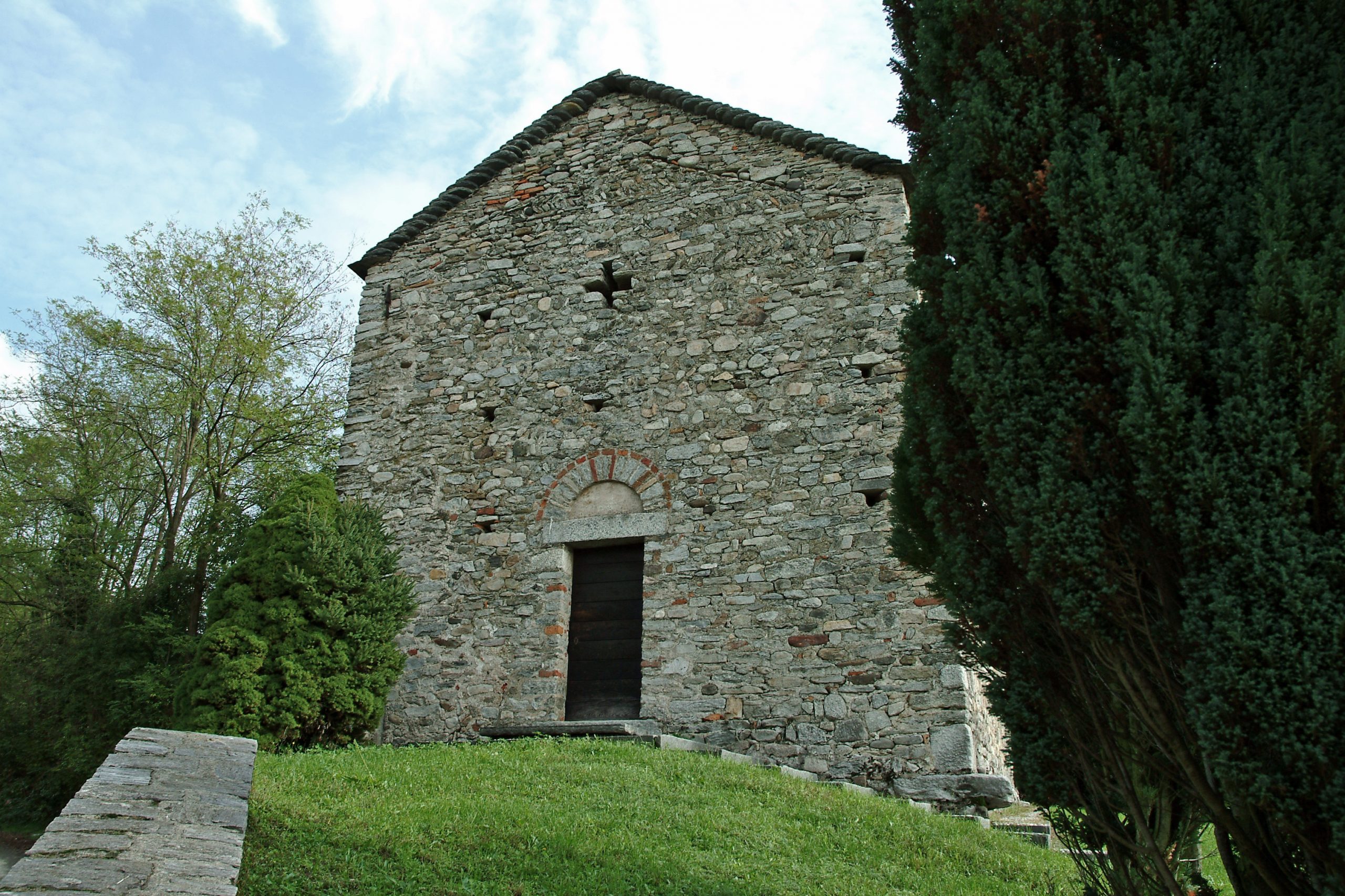
Chiesa di San Bartolomeo in Montibus
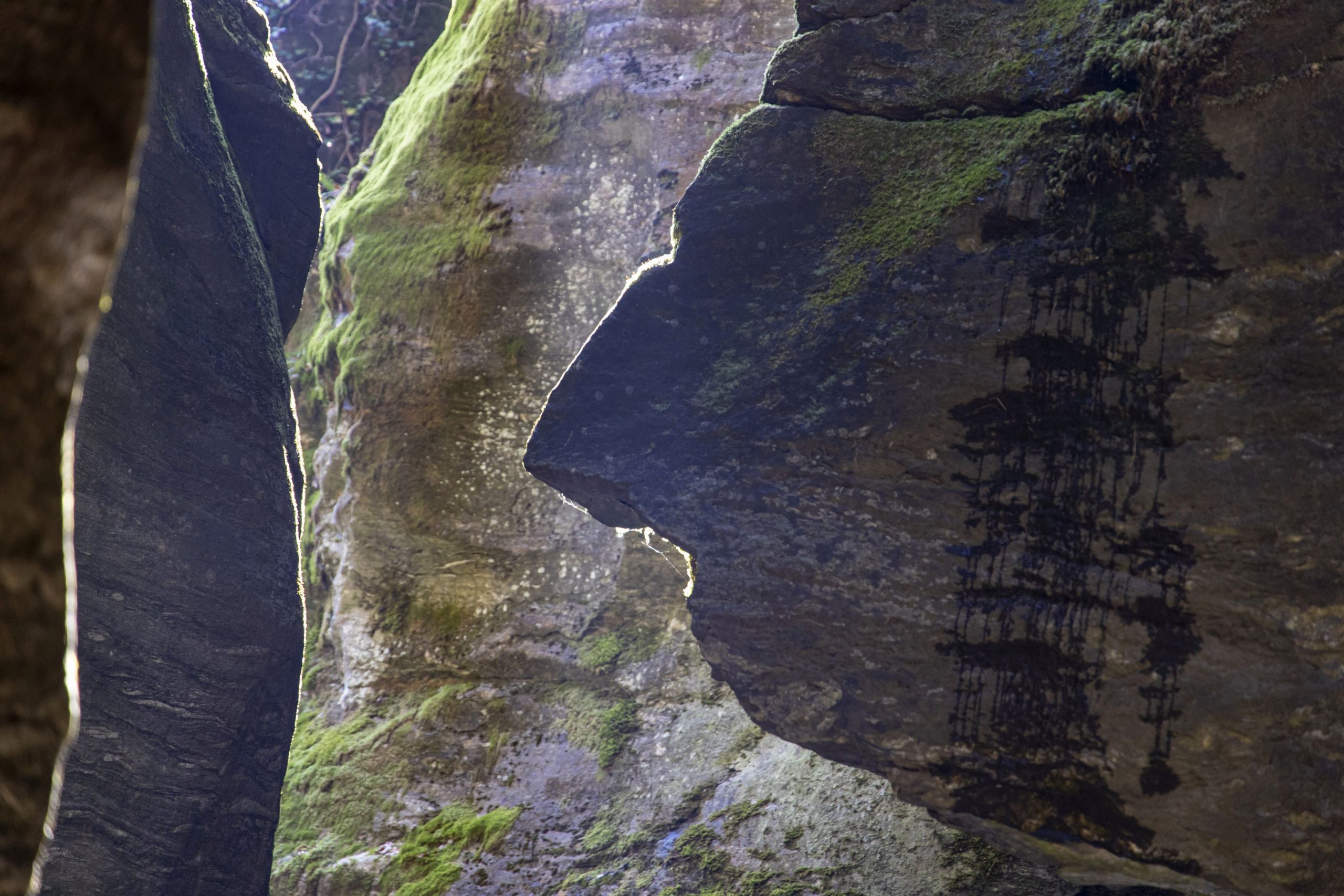
Orrido di Sant’Anna
FACILITIES
STRUTTURE RICETTIVE
TECHNICAL NOTES
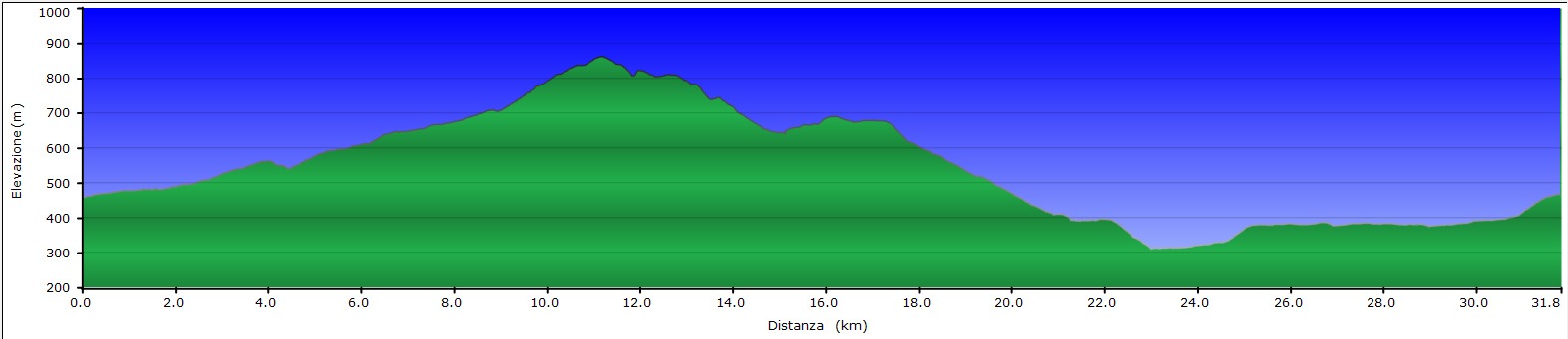
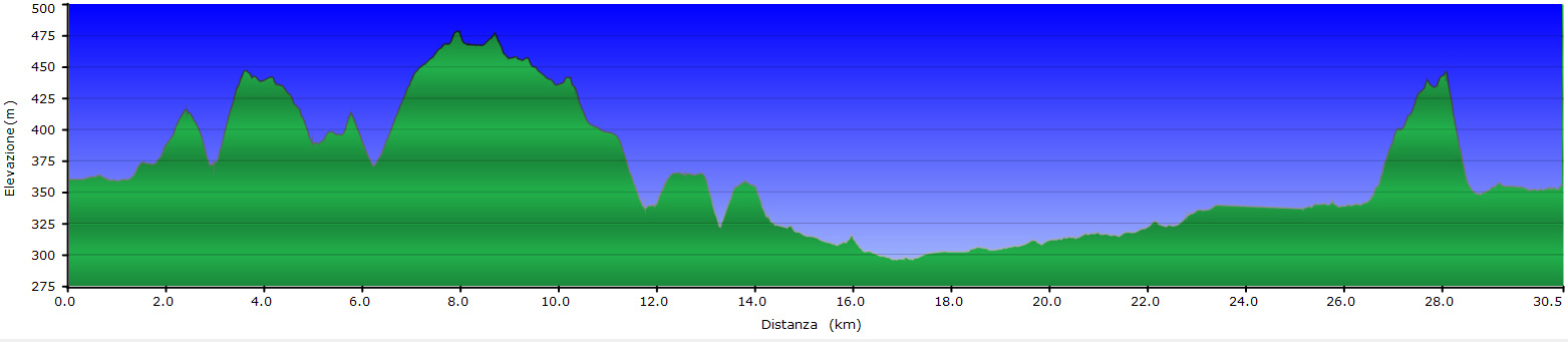
LEGS: the journey is recommended in two legs: from Suna to Cannero Riviera (km), from Cannero Riviera to San Bartolomeo (15 km)
DIFFERENCE IN ELEVATION: minimum elevation of the itinerary: 204 m a.s.l.; maximum elevation 450 m a.s.l. See the map.
DURATION: from 3 to 6 hours for each leg
TYPE OF PATH: Hiking – MOSTLY DIRT roads but long stretches on asphalt
FOR MORE DETAILS
http://www.provincia.verbano-cusio-ossola.it
http://www.sacri-monti.com
http://www.distrettolaghi.it
http://www.sacromonteghiffa.it
http://www.cmverbano.net
Back to the list of routes
An easy circular path that leads to the discovery of the historic ruins of the Cadorna Line
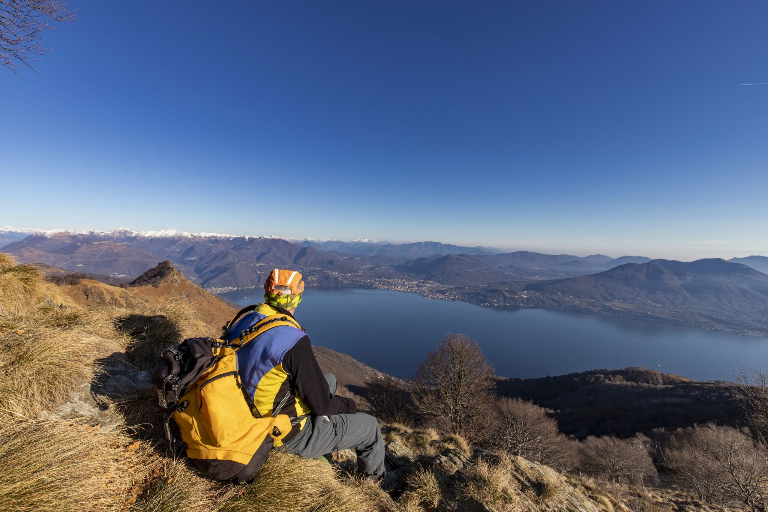
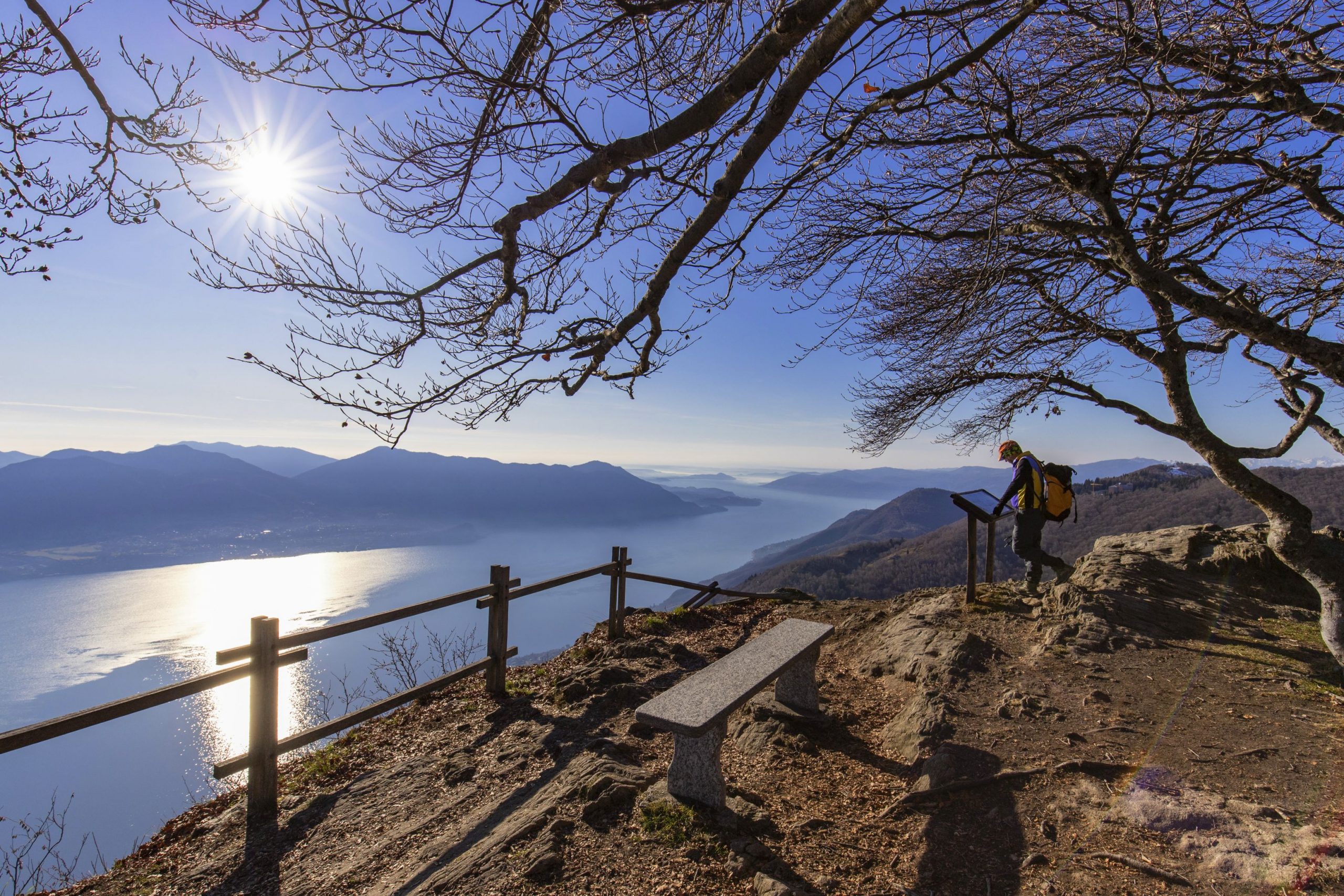
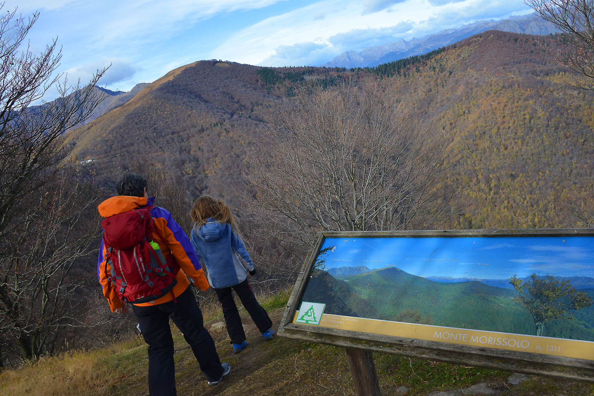
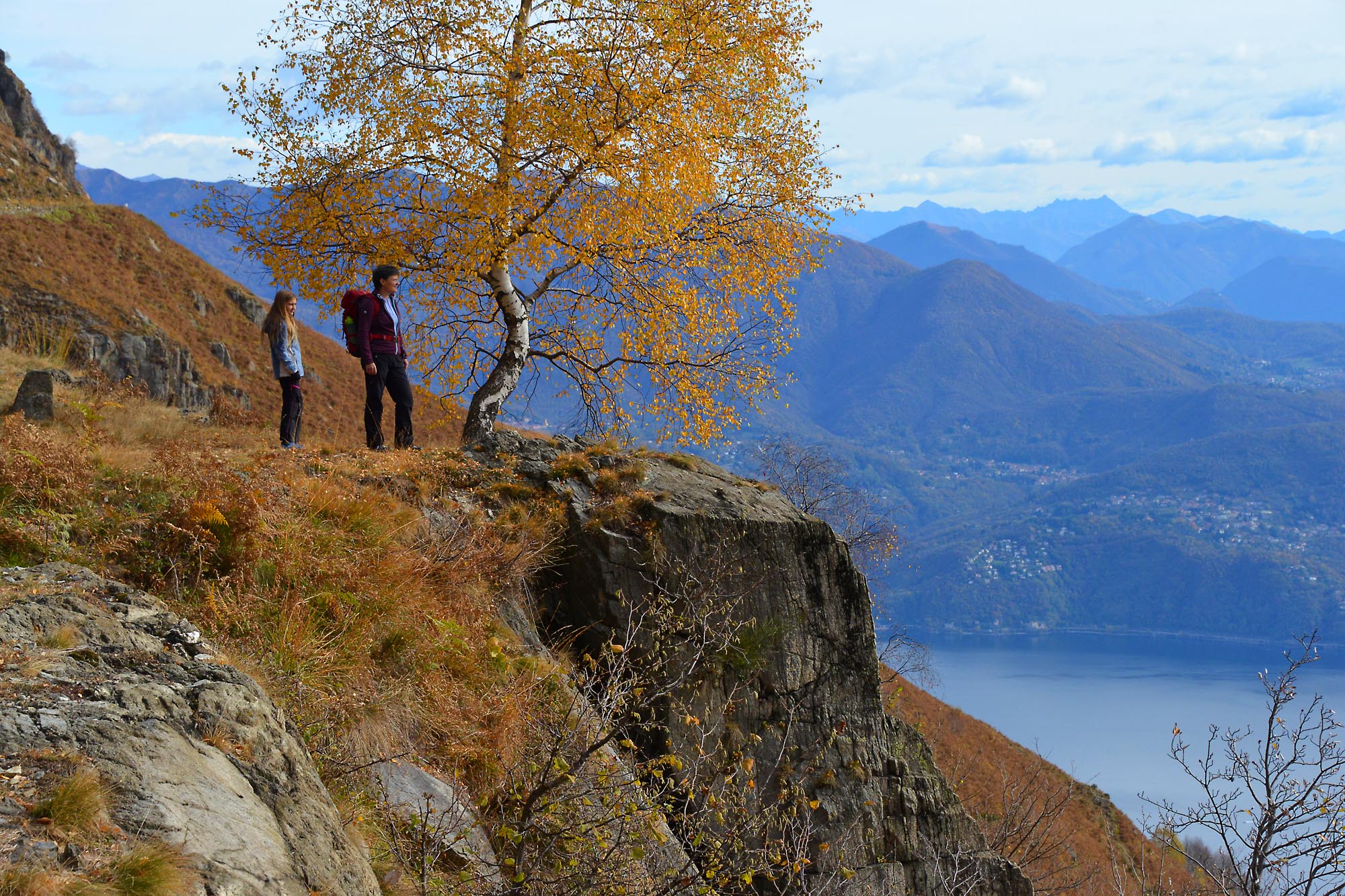
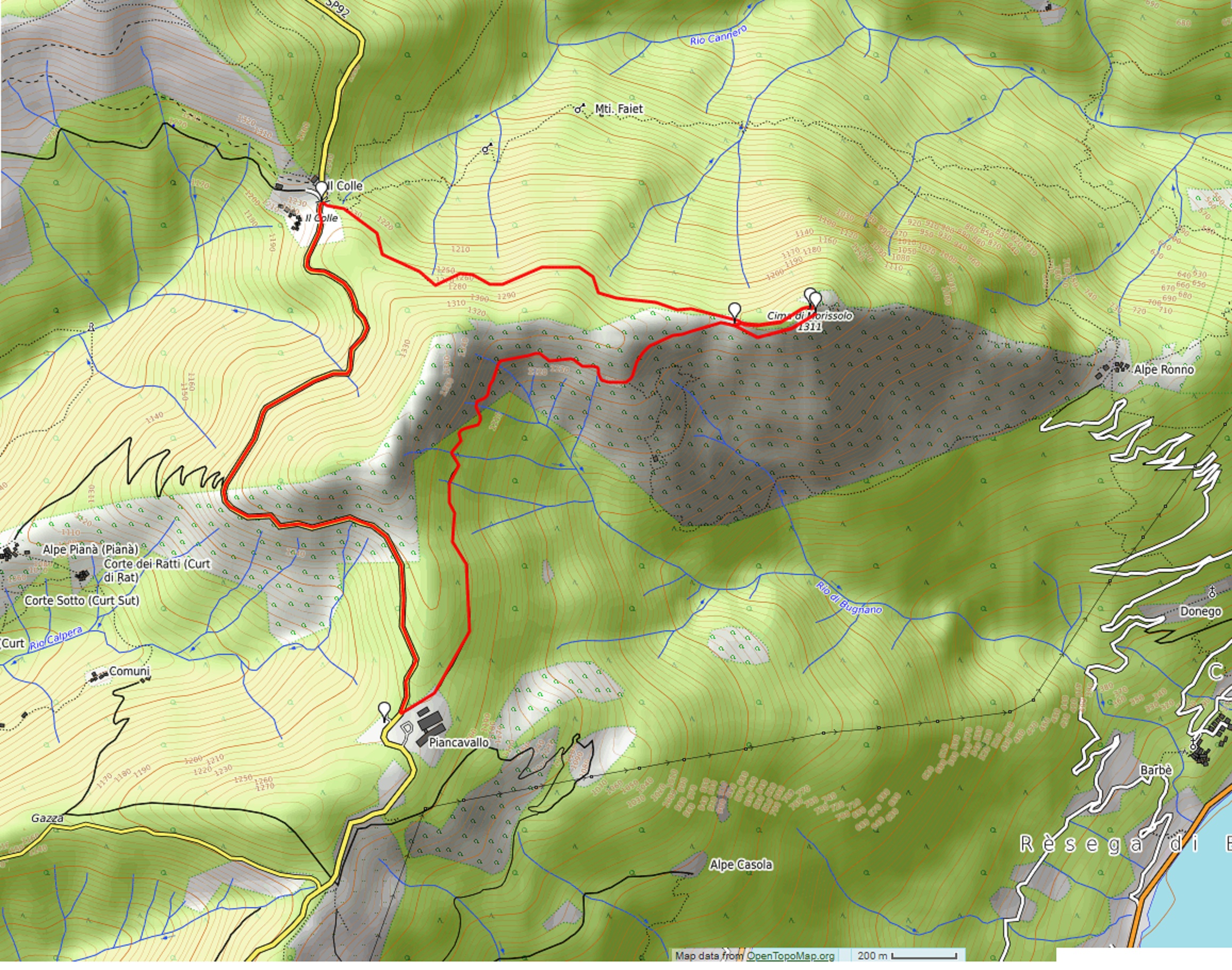
MOUNT MORISSOLO-CADORNA LINE
Alto Verbano
Route description
Departure location: Piancavallo (1247 m)
Place of arrival: Mount Morissolo (1313 m)
Difference in altitude: about 150 m
Distance: 7 km
Walking time not counting stops: 3 hours
Type of route: mixed (trail, asphalt, dirt road)
Signs: signs, number 1 and red/white marks
Water: fountain in Colle
Recommended period: all year round, without snow
How to get there: 23 km from Verbania. Direction for “Premeno” (blue signs), follow signs for “Pian di Sole” and then “Piancavallo” and “Centro Auxologico”. Large parking area near the hospital. By bus: line 4 Verbania-Premeno-Piancavallo, stop Piancavallo (www.vcotrasporti.it).
Information: Distretto Turistico dei Laghi – www.distrettolaghi.it
the itinerary
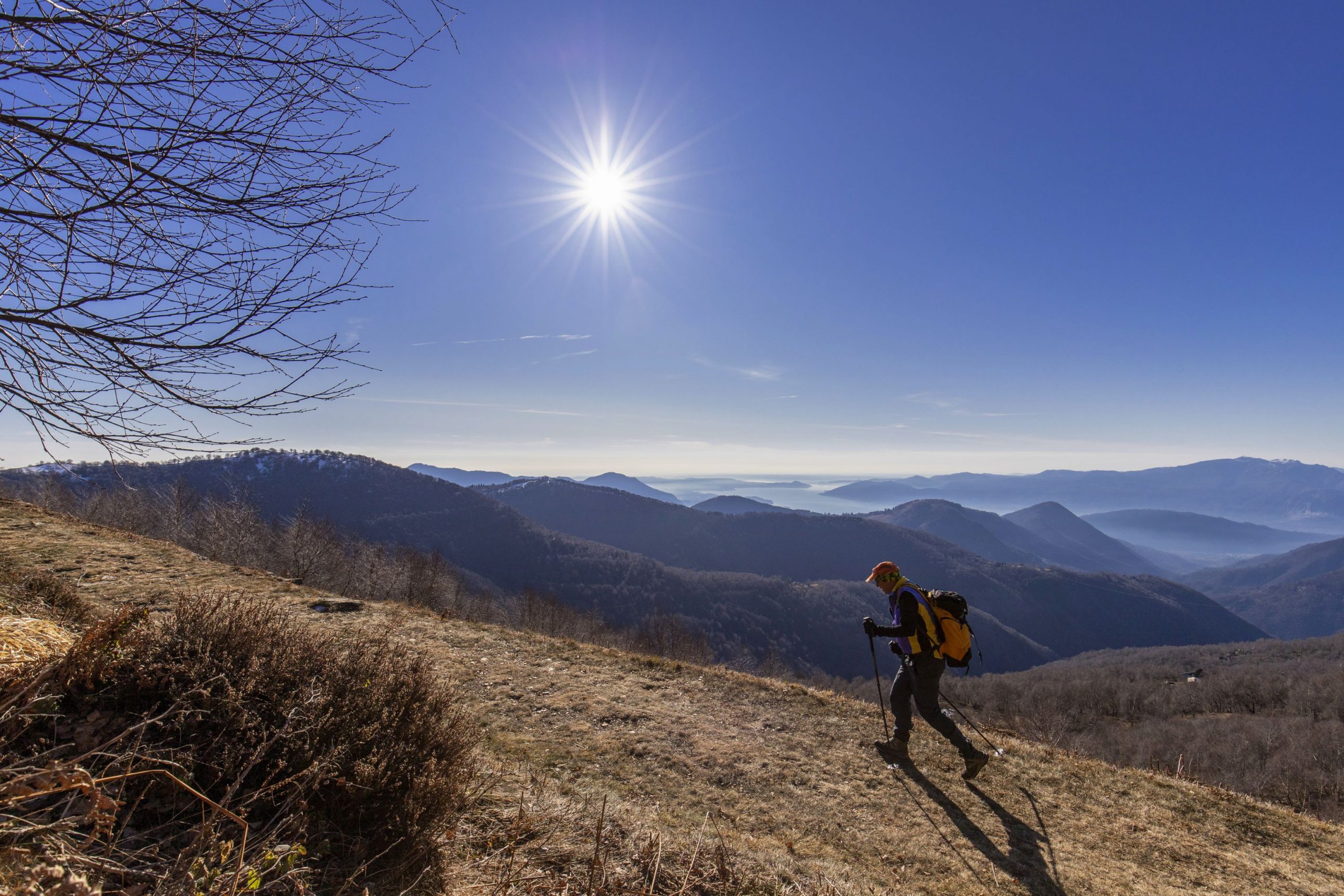
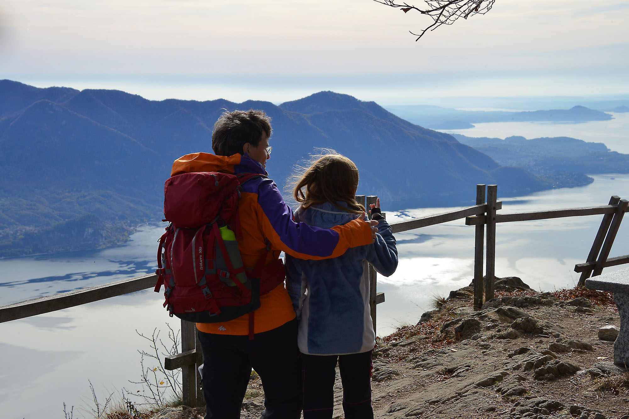
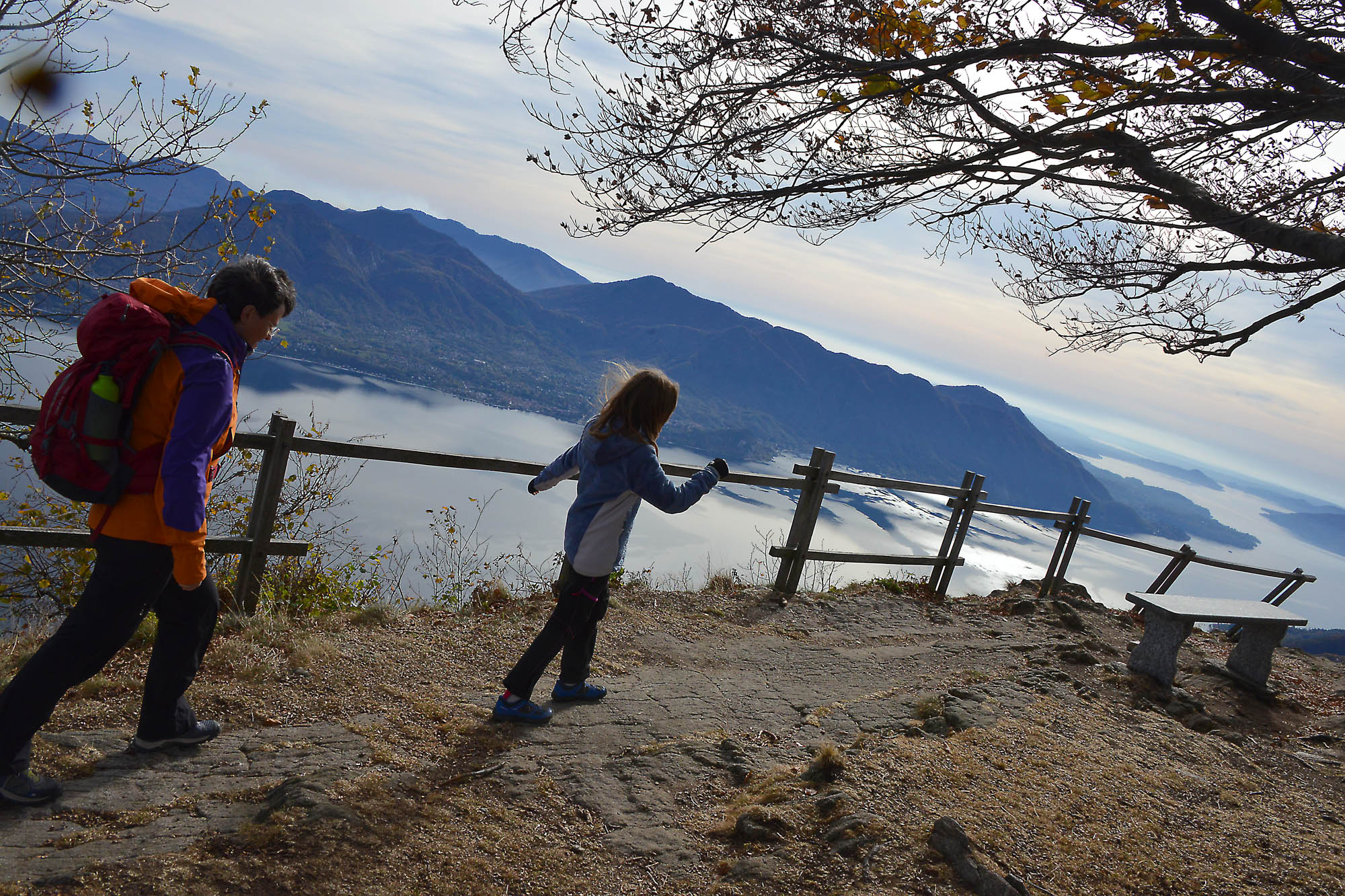
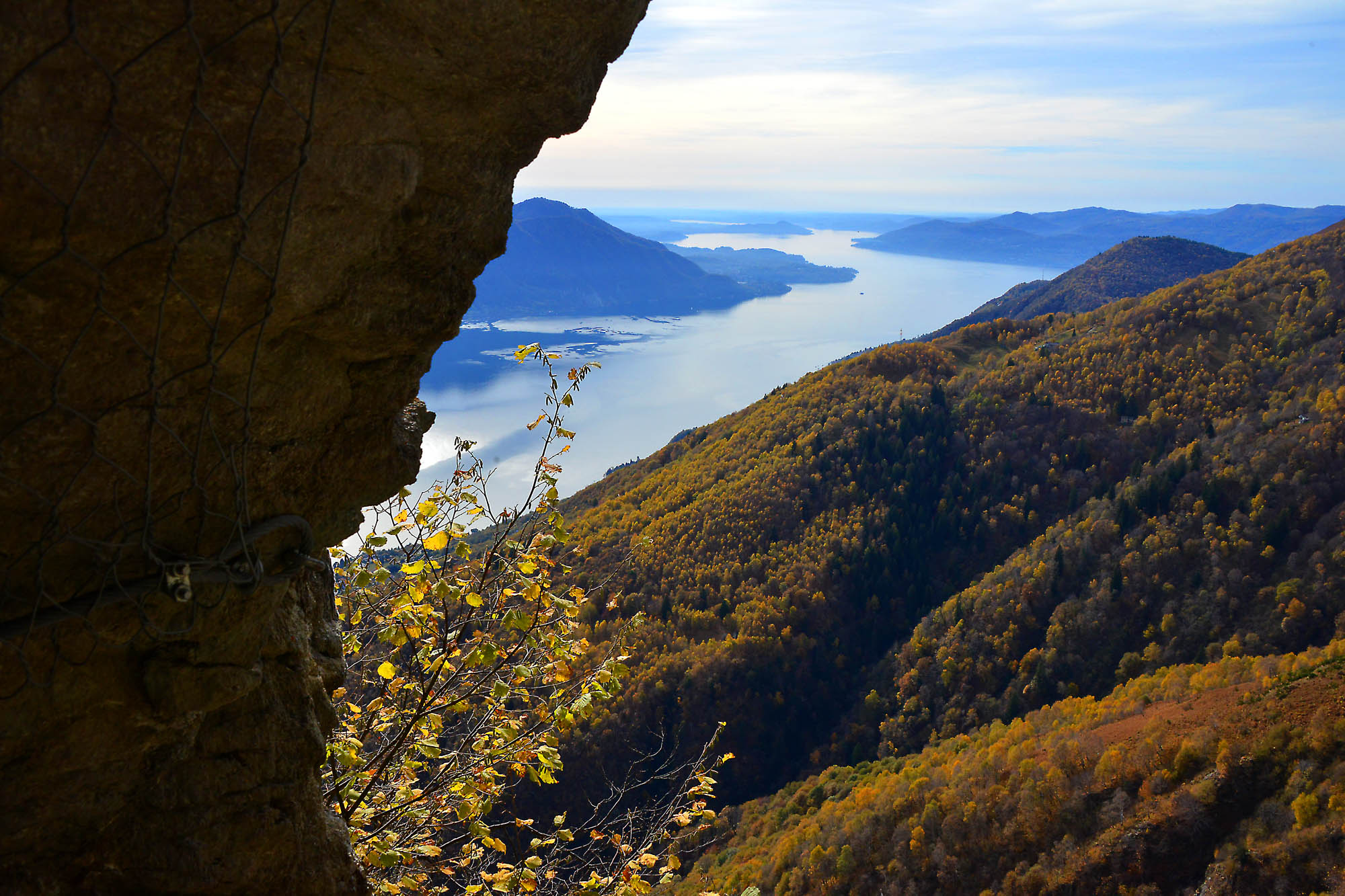
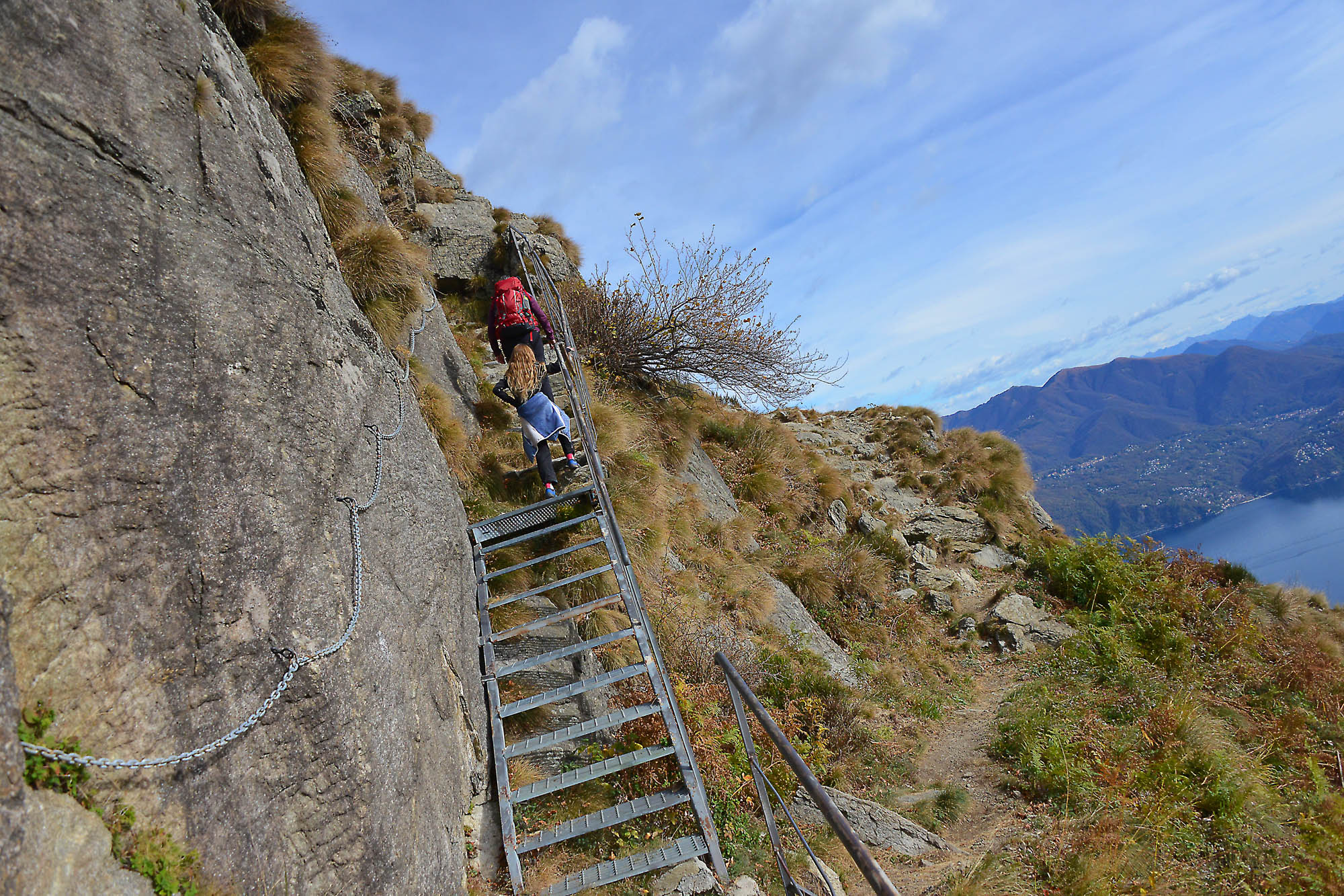
Take the asphalt road towards “Colle” passing next to the hospital and a restaurant bar but, just after a few steps, keep right, passing next to the fence of the hospital structure up to a barrier (signs say “Gallerie Monte Morissolo 0h45”). After the barrier, continue on a pleasant and large military mule track that goes uphill though it seems to be almost flat and leads towards Mount Morissolo passing, initially, through a beautiful beech wood.
Attention: the road is very wide but without protection, and since the beech grove is on an accentuated slope, be sure to keep an eye on lively little walkers.
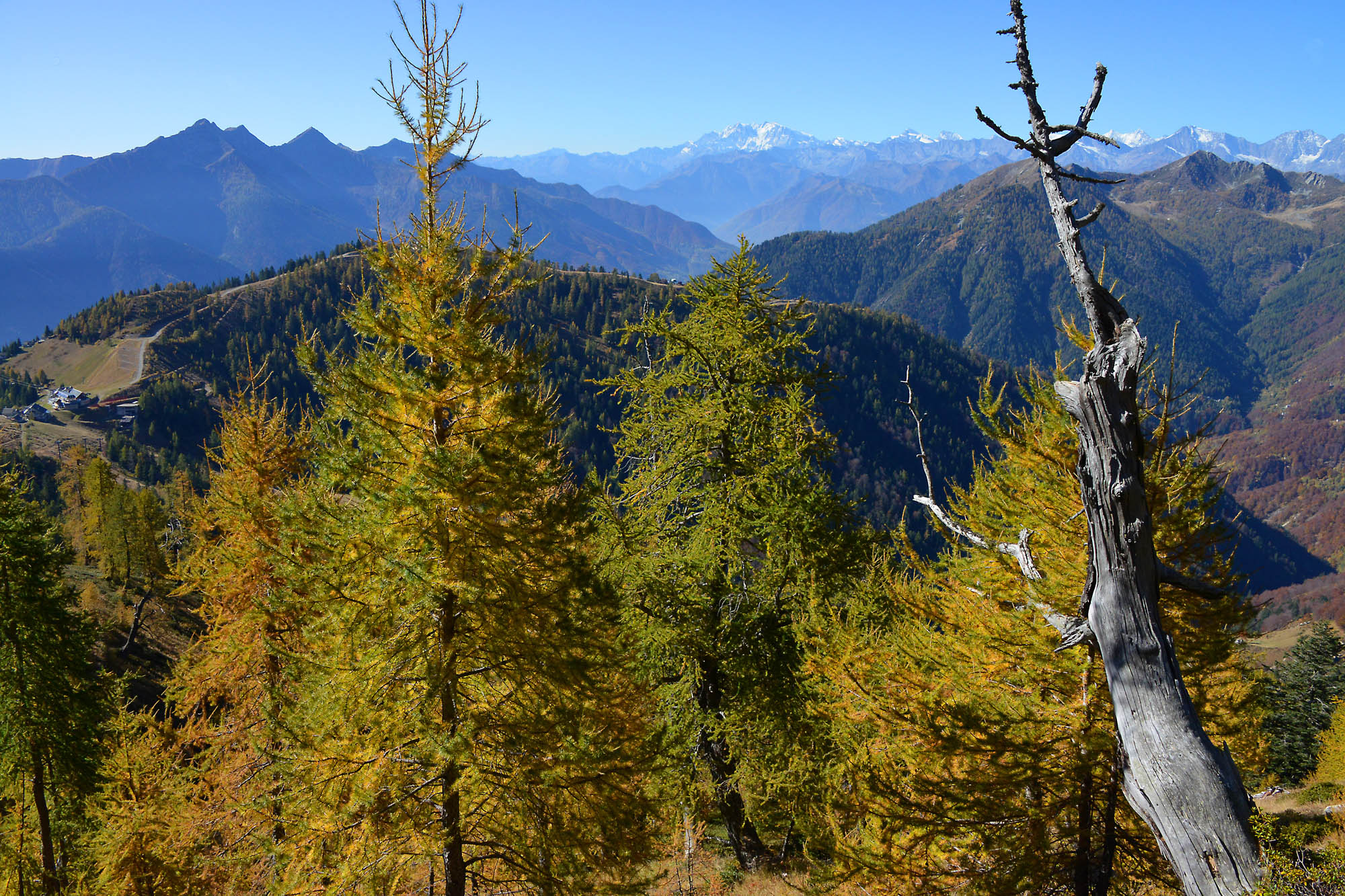
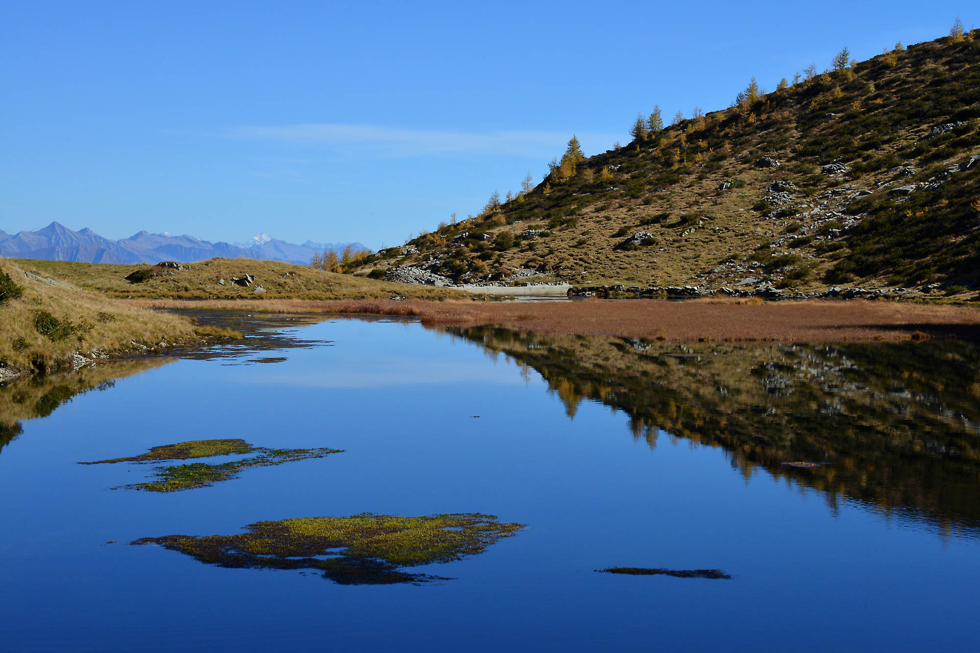
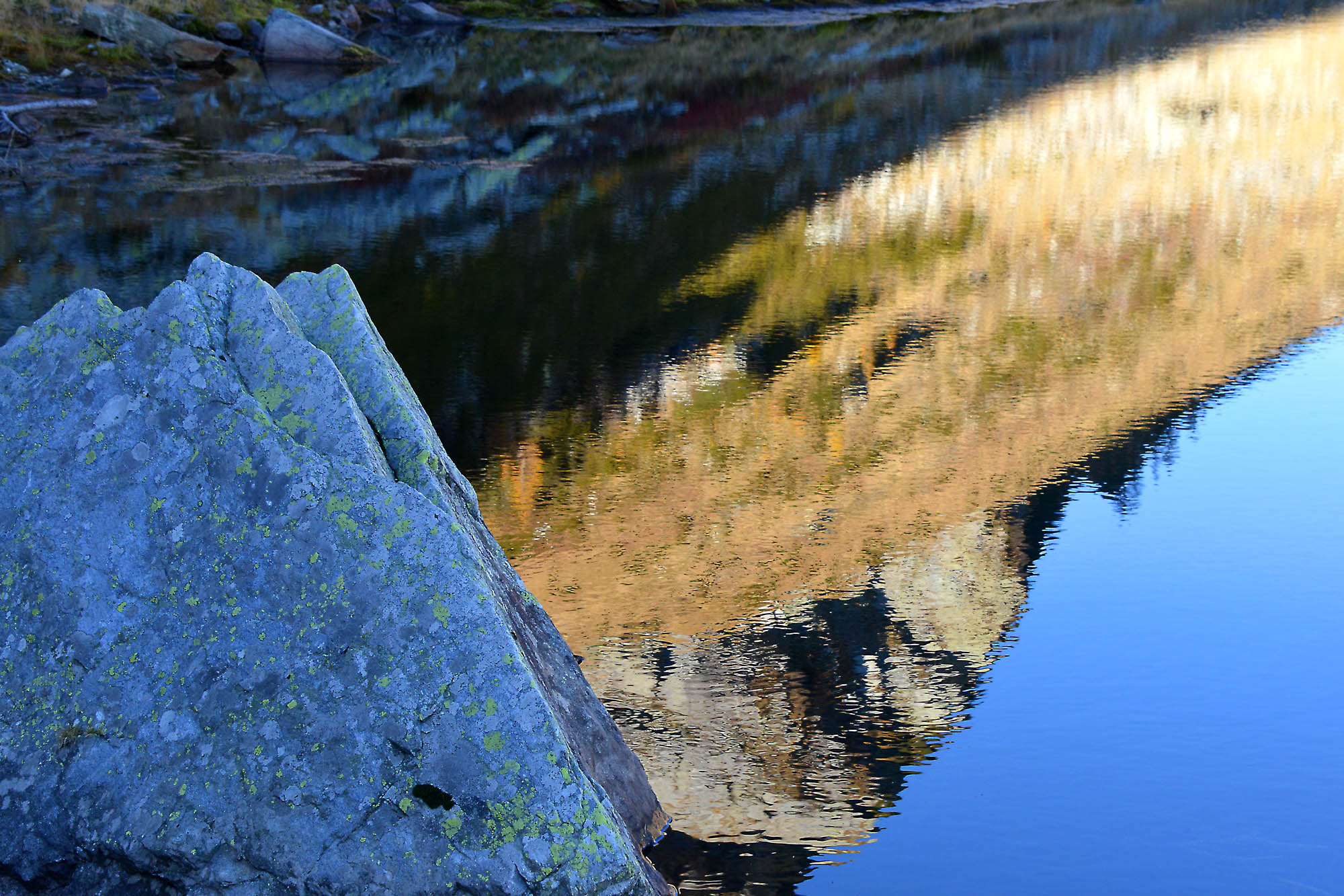
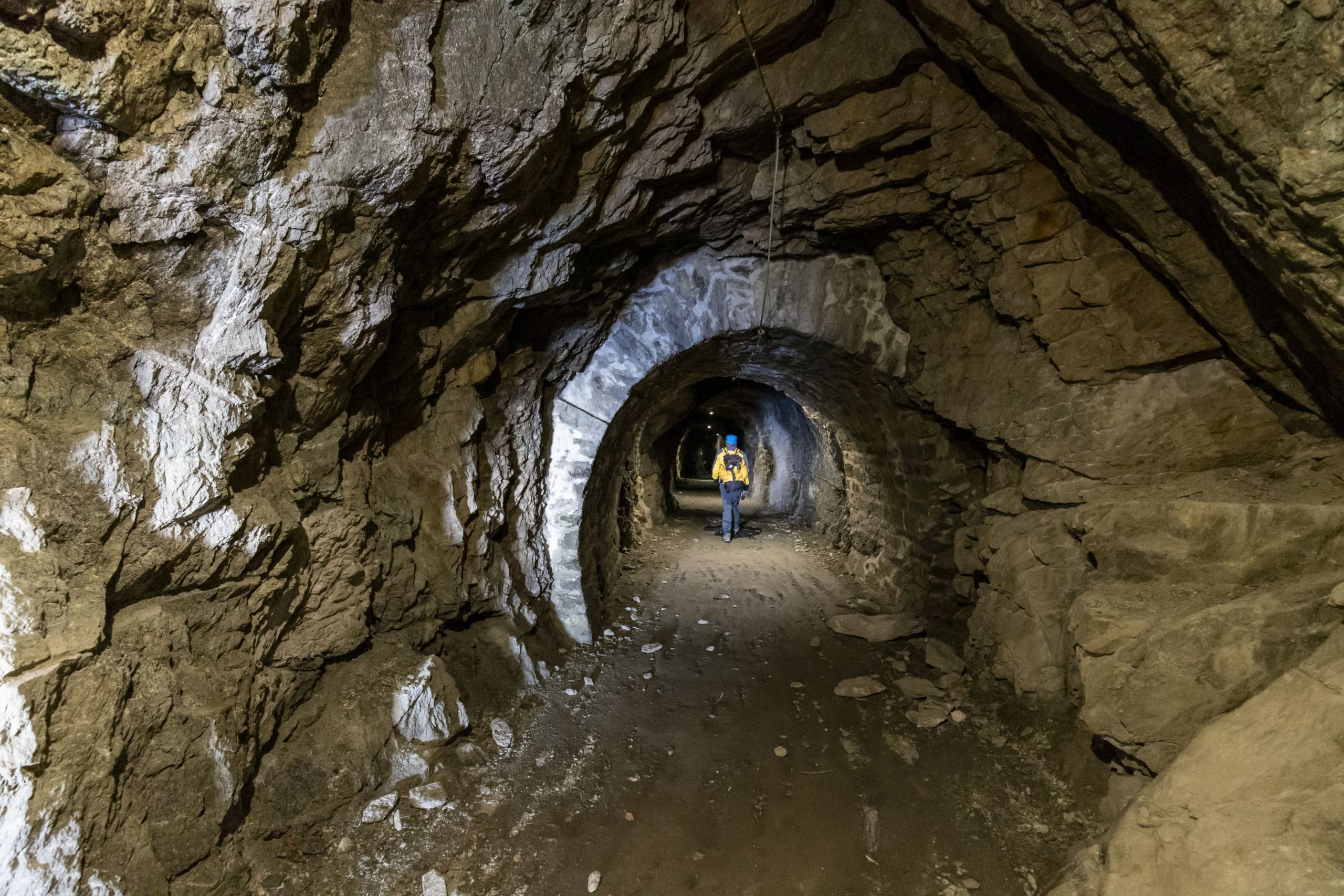
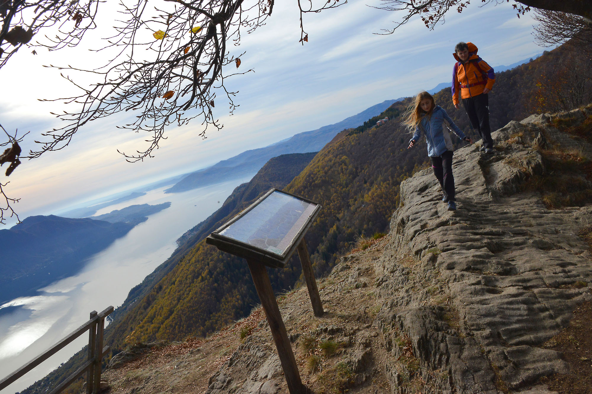
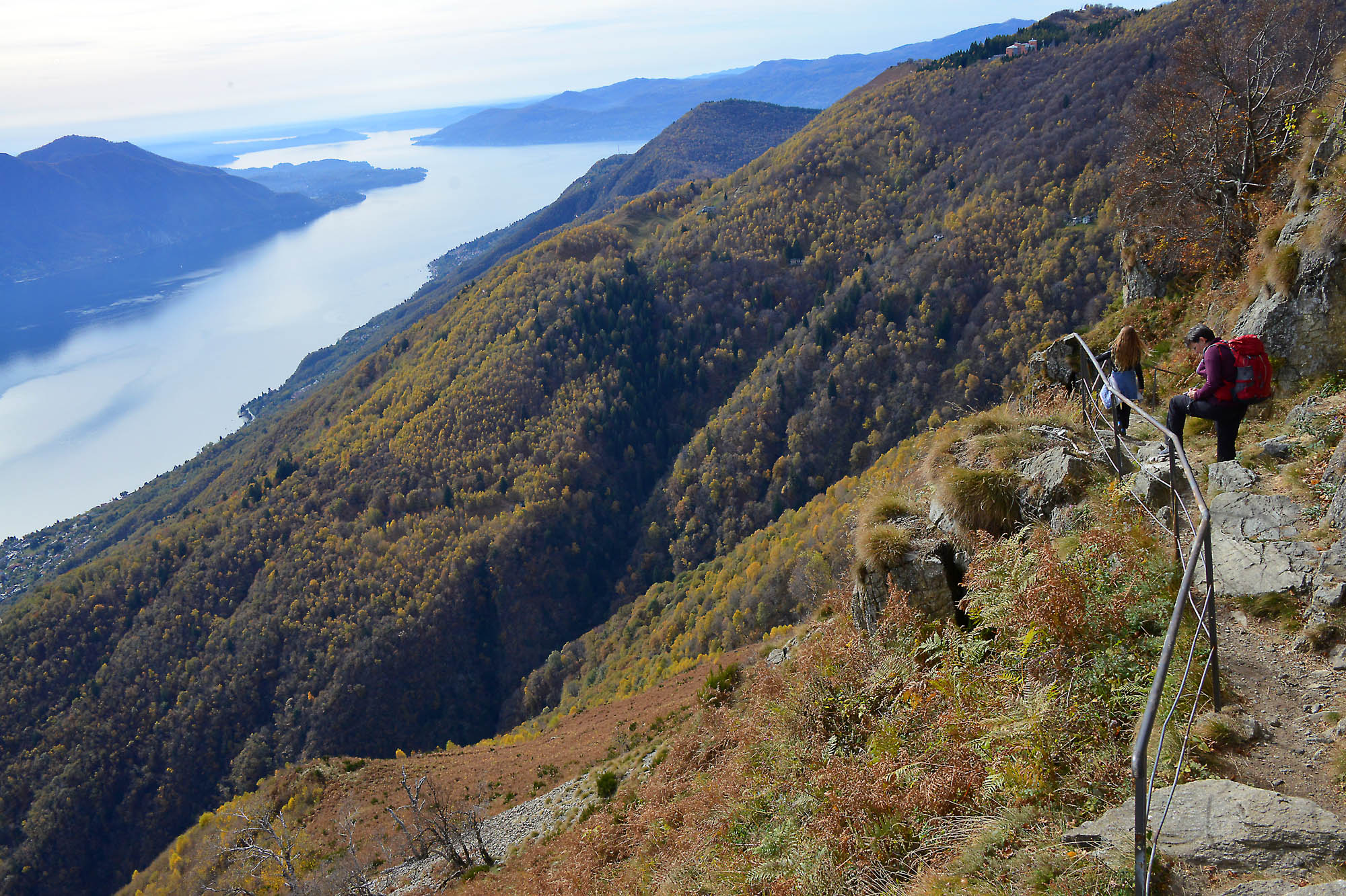
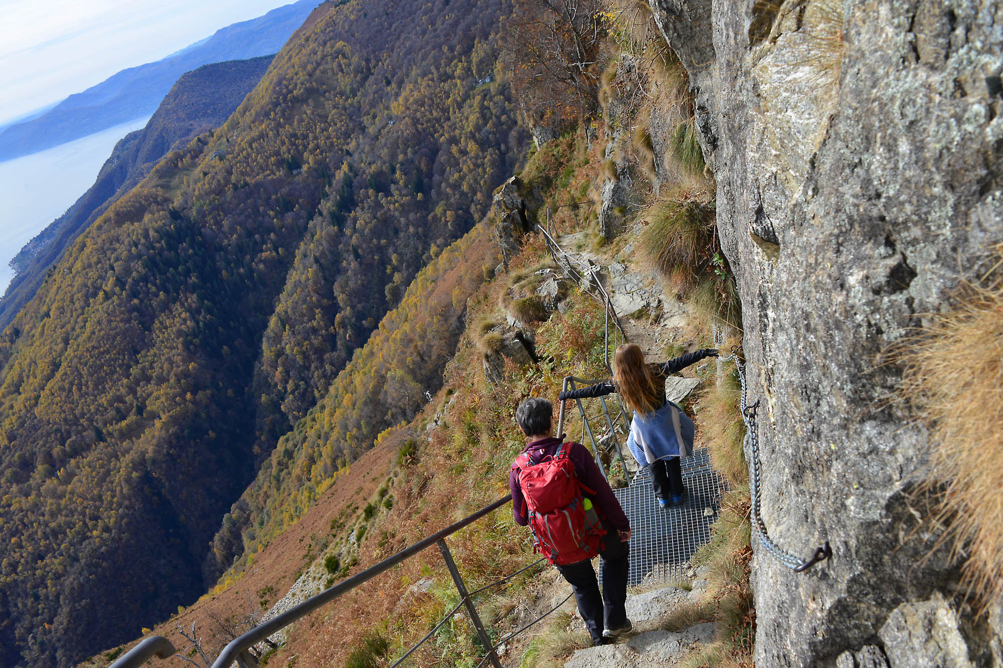
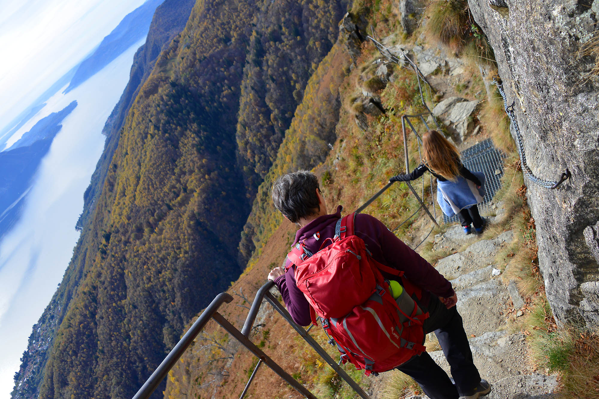
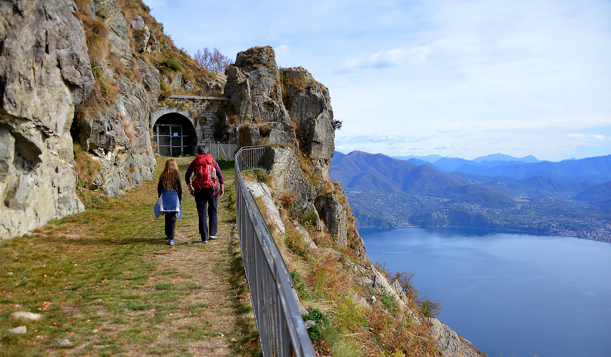
The path is easy, because the wide mule track slopes gently (ignore all junctions that you meet leading away from the trail) passing from the pleasant beech grove to wide openings with spectacular views of Lake Maggiore, until you get to a small hill where there is a pool of water (not fit for drinking). Just beyond the pool, you will see a small rock station, but to see the interesting part, you must follow the road on the right that still continues flat for a short stretch, passes a bottleneck between the rocks and leads to the first of the tunnels. From this point, you will pass through tunnels dug into the rock alternated with open balconies on the lake, all with gates that must be carefully closed after passing through, to prevent them from becoming shelter for numerous goats that graze in this area. The third tunnel in which you enter is the end, and it winds like a labyrinth with different branches, but have no fear: all of the tracks lead to rooms (the cannon rooms) so you cannot get lost. You will not need flash lights or torches, because the lighting system allows you to visit the station safely, and even if the light should go out suddenly (this is a timed system), you only need a smart phone to light your way to one of the numerous switches.
The so-called “Cadorna Line” was a system of fortifications built along the northern border during the First World War (1915-18). It was never used, also because neighbouring Switzerland remained neutral, but it was built in the event of an attack by the Austro-Hungarian Empire through Swiss territory. This stretch of Mount Morissolo covered the Lombard shore of Lake Maggiore up to Locarno, and its cannons would have been able to launch heavy projectiles weighing 80 kg as far as 14 km.
The first tunnel on the right leads to a gate that, if you open it and go through, you will come out towards the lake. A steep stairway leads easily to an observatory situated in a panoramic position, with numerous slits to cover the territory more effectively.
Note: pay attention to where you put your feet inside of the observatory, which is not cleaned everyday…
Along this stairway, you will notice an arrow with the word “vetta” indicating a trail shortly before the observatory: this trail leads to the summit of Morissolo, but we do not recommend this track there are some exposed passages. You can reach the summit on an easier trail. After visiting the stations in the tunnel, back to the hill where you the fountain is located. From here you can climb to the summit of Morissolo on a steep trail (sign for “Monte Morissolo cima 0h15”).
Warning: this trail has difficult steep stretches because of the numerous roots and the slippery sandy terrain. We advise you to undertake with it only with children who are skilled at hiking and with good weather.
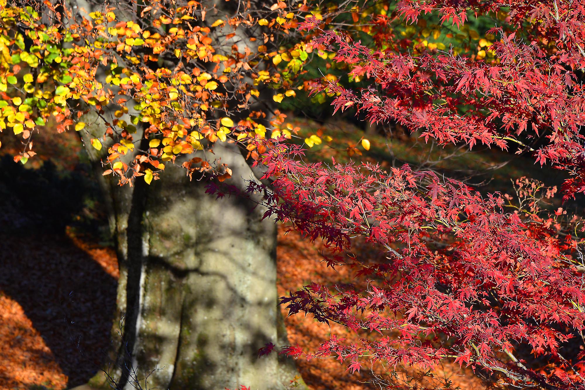
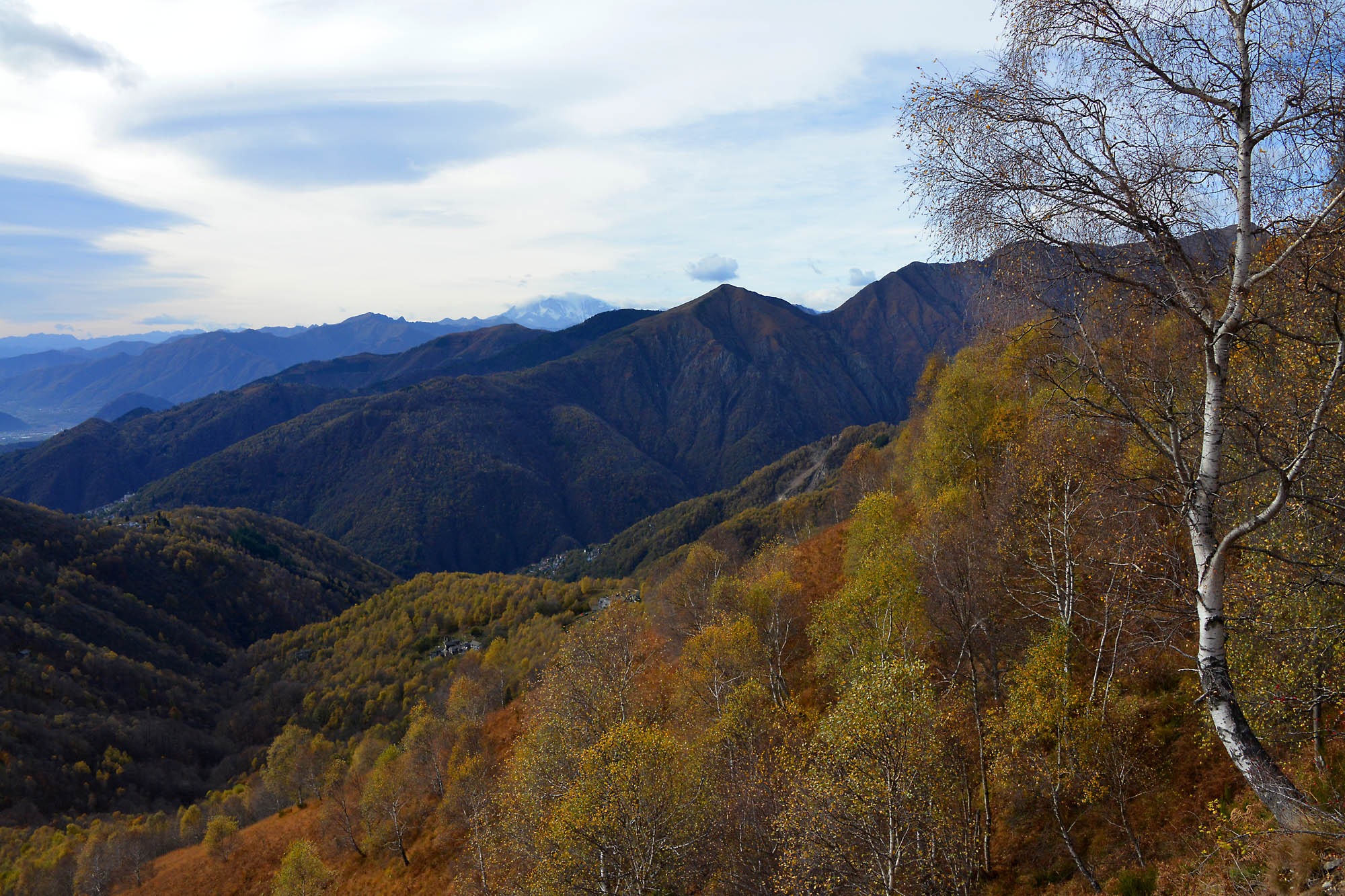
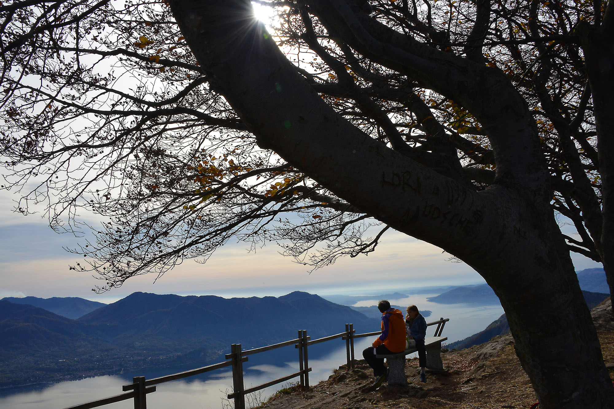
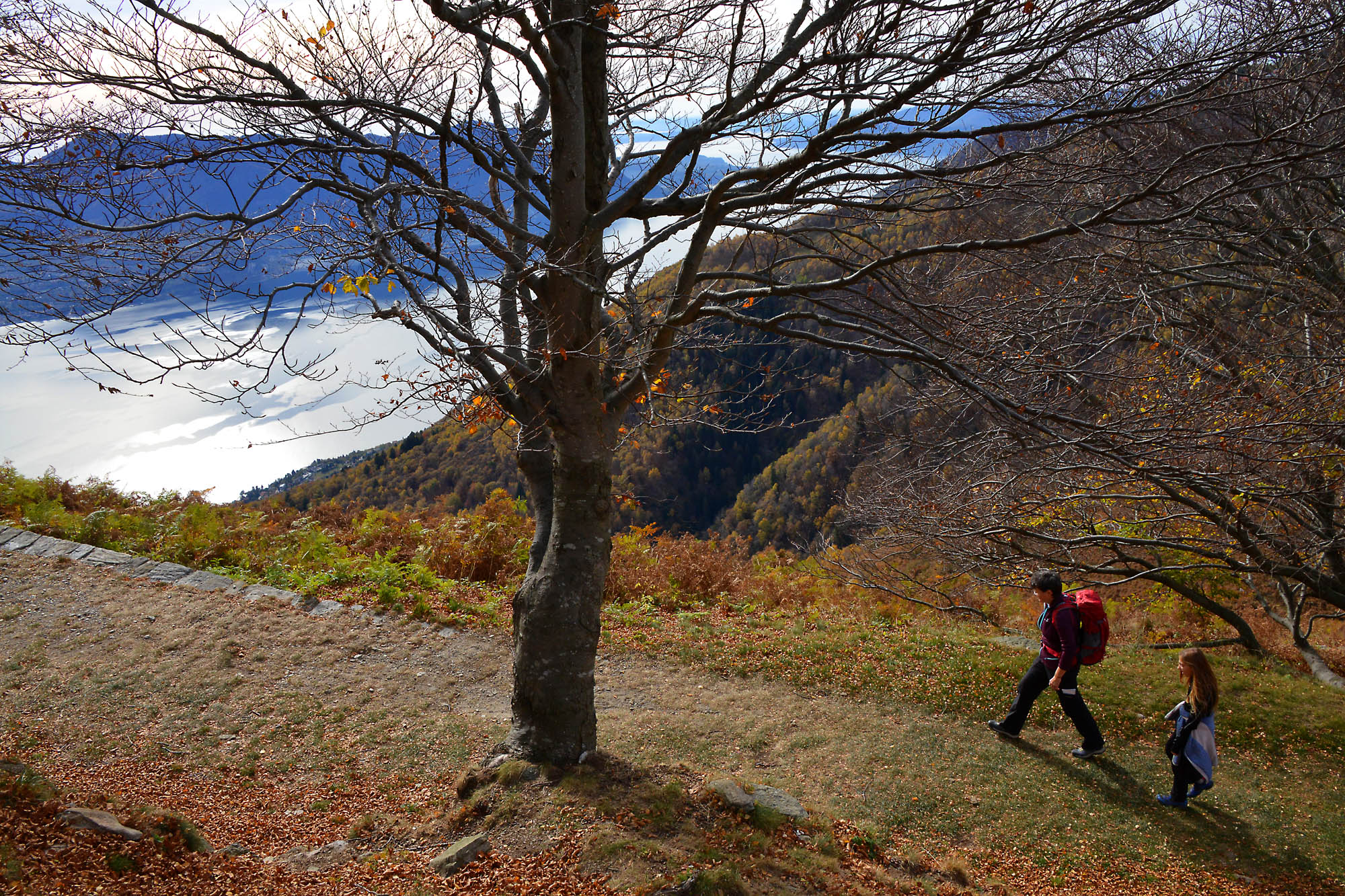
At the top of the mountain, you will find a bench to enjoy the panorama and two panels that list the names of the peaks and the localities in view. The panorama is really great: stretching from Locarno to almost the entire Lake Maggiore on one side, while on the opposite side, it opens toward the Vigezzo Valley and the peaks of the Val Grande National Park. In this position, there used to be an open space for a small cannon that complemented the guns placed in batteries in the rock. A little further down, you will find a sub peak with three metal crosses (steep narrow trail). When you go to the usual hill, it is time to start the rest of the path that winds along a wonderful beech grove, shady and cool, the perfect place to go in the hot season, and a wonder for the eyes during the autumn.
Note: the tour proposed is circular, and comprises a stretch of about 2.5 km of asphalt road. If you do not intend to use that road, it is better to go back on the road you took at the start.
From the hill, now take the path (sign for “Colle 0h45”) which runs flat a bit more to the right of the military road. The beautiful trail winds flat for a bit and then descends a little, and then climbs while always remaining inside the thick beech grove until you reach Colle (1238 m – fountain).
At Colle, you are at the edge of the Val Grande National Park and from here, there is a path that leads to Mount Spalavera (1534 m), along another portion of the Cadorna Line with some of the trenches.
From this point, follow the asphalt road towards the right. It is very scenic, and you will come back to your starting point (watch for cars).
to learn more
The Cadorna Line
For the construction of fortifications of the Cadorna Line, women were also employed to carry water, cement and supplies. They were paid one lira and a loaf of bread per trip.
Centro Auxologico
This is a hospital known mainly as an important reference point and an excellent structure for research, care and rehabilitation of diseases such as severe obesity, eating disorders, disorders of growth and neurological diseases.
tips for young hikers
Accessible with pushchairs from the Centro Auxologico up to the hill in front of the tunnels. With a little effort, you can go inside the batteries with pushchairs (the gates are the bigger part of the problem). Everyone should avoid the climb to the peak from the observatory, because it is too exposed. On warm Sundays when there are many hikers, it is better to avoid going completely around on the stretch of asphalt road. In this case, it is preferable to go back on the same trail you took to climb Mount Morissolo.
Slow trekkers: Franco Voglino, Annalisa Porporato and Nora Voglino
Authors of texts: Franco Voglino and Annalisa Porporato
Back to the list of routes


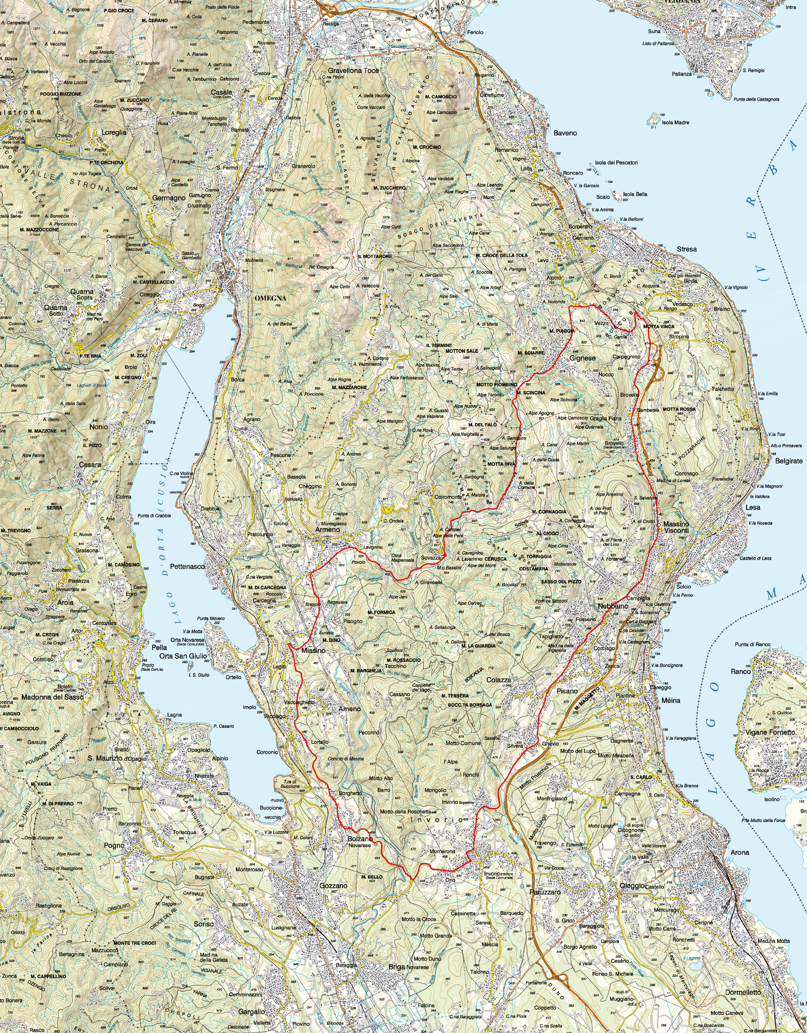
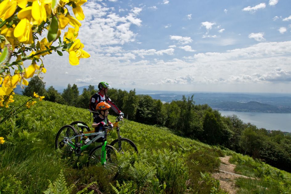
Cycle tour, departure from Invorio
TOUR VERGANTE–GIGNESE-ARMENO
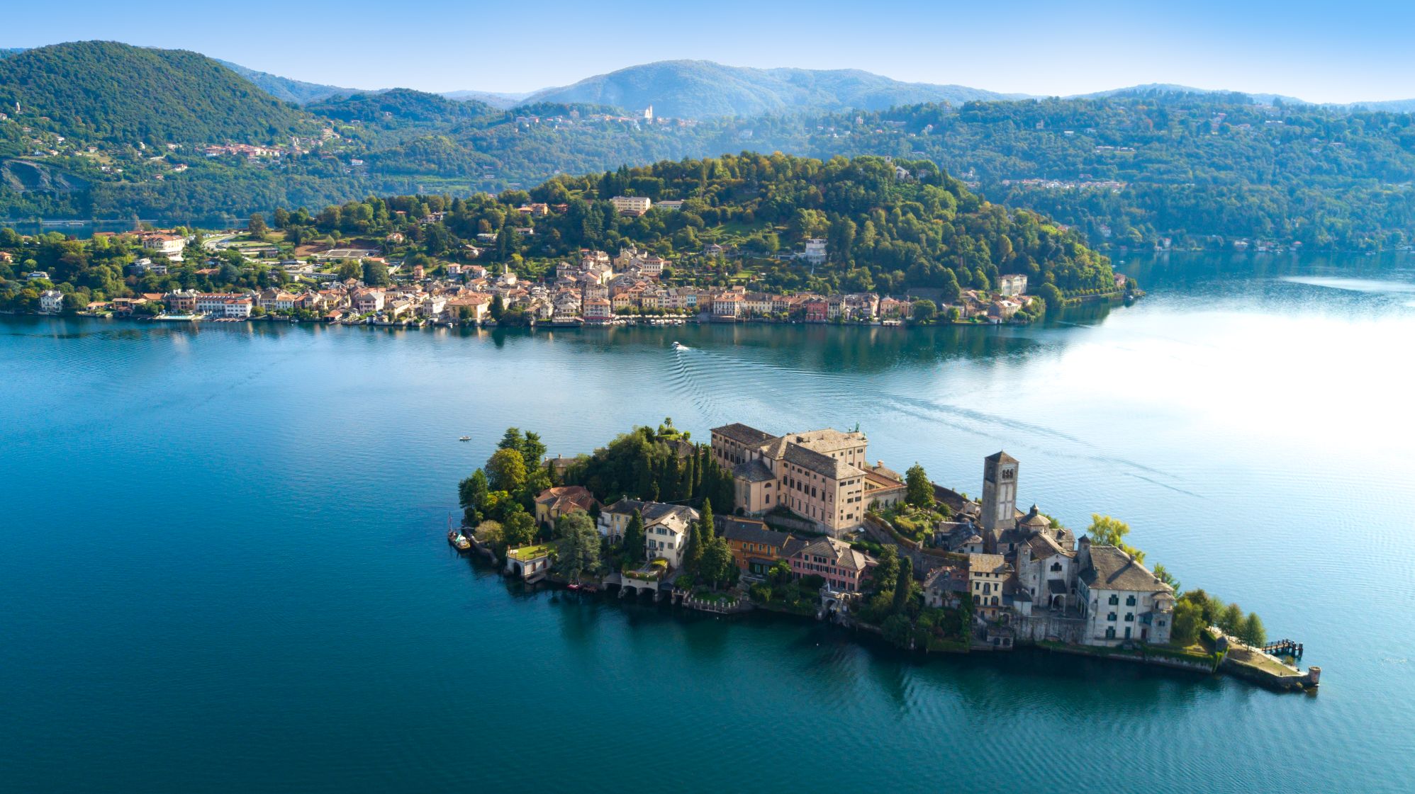
Lago d’Orta
Route description
The starting point for this route is viale Europa in Invorio near the parish church where there is a large car park.
Cycle along viale Europa to the stop sign where you turn right and then immediately left along via Marconi. At the next stop sign turn left again in the direction of the Alto Vergante. Now continue downhill to the village of Ghevio. At the roundabout go straight on in the direction of the Alto Vergante. Pass through Pisano and start the climb followed by a short descent to the village of Nebbiuno. Keep going along the main road passing through Massino Visconti and Brovello Carpugnino. After the A26 motorway on-ramp turn left uphill toward first to Vezzo and then Gignese.
The path is rather challenging on account of the steep gradient. After the village of Gignese the road flattens out and with a few ups and downs you continue in the direction of Sovazza. A steep descent leads you toward the motocross area of Armeno after a bridge over the River Ondella.
Continuing on the strade delle due Riviere you pass through the village of Armeno and descend toward Miasino. At the junction near Villa Nigra turn left in the direction of Ameno and after a few meters turn left again uphill. After passing the castle of Miasino on the right you continue to climb until you come to Vacciago where a short but steep descent in the direction of the village of Lortallo awaits you. Continue downhill until you reach Bolzano Novarese. In the centre of the town turn left into via Rimembranza climbing up to the cemetery and the beautiful church of San Martino. From the church of San Martino you go down again to Invorio. After the bridge over the River Agogna the road climbs again alongside a riding stable. Turn left at the roundabout and after a short climb you come to Invorio again at the starting point.
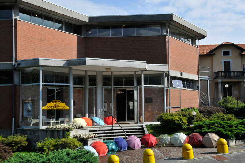
To see: ad Armeno la Chiesa di S. Maria Assunta, a Gignese il Museo dell’Ombrello e del Parasole.
AUTHOR: Fabio Valeggia
Back to the list of routes
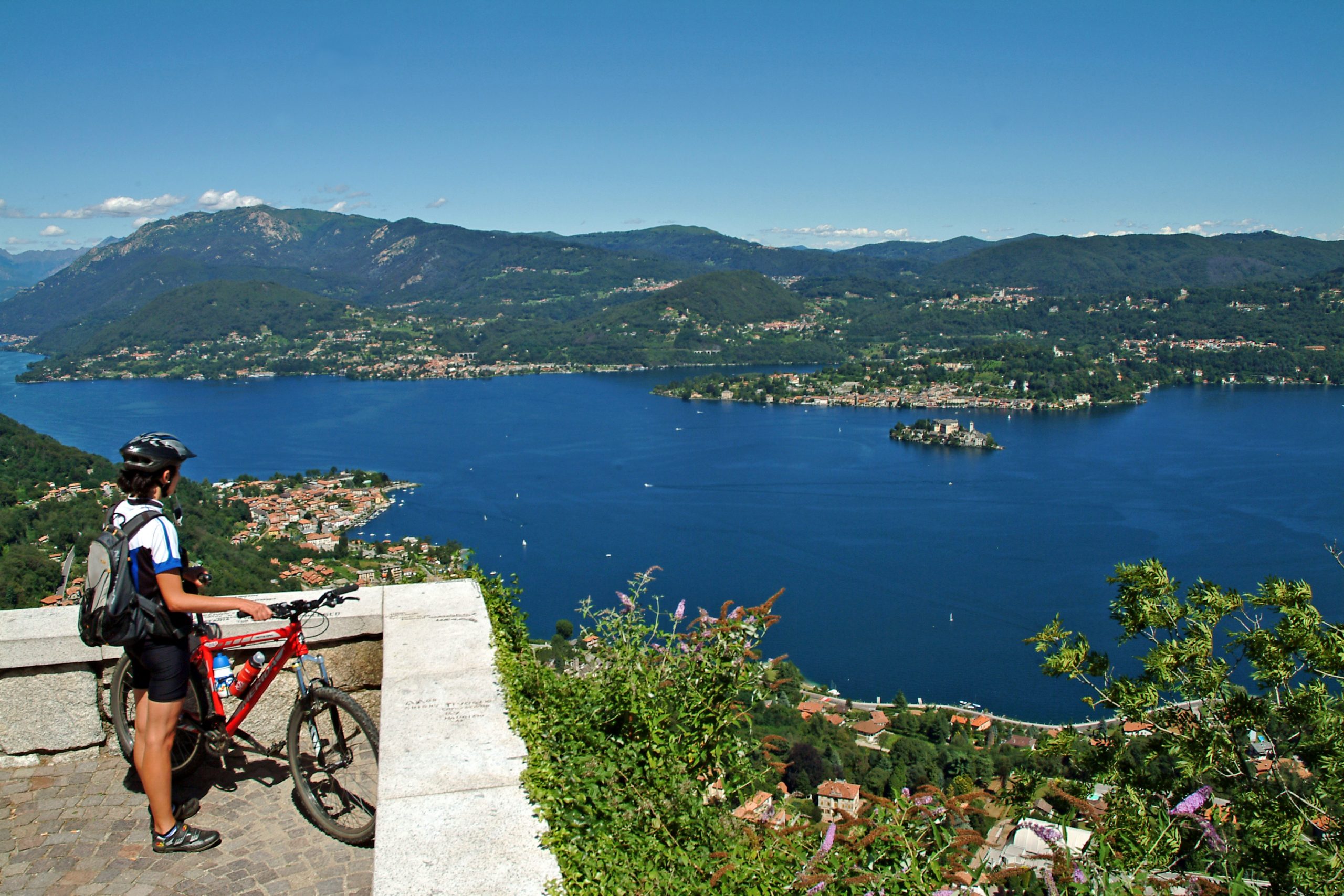
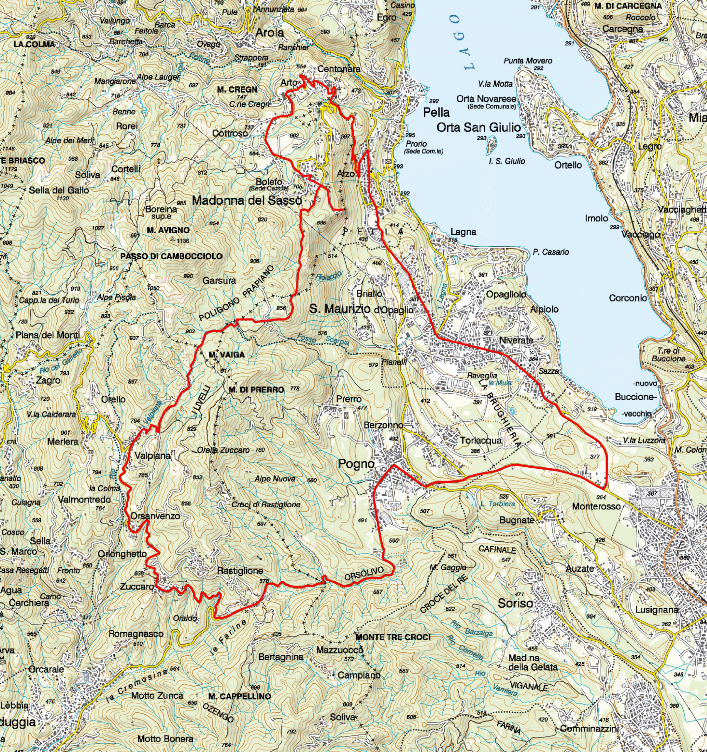
Departure from Pogno and return
POGNO–MADONNA DEL SASSO–ALZO-POGNO
Lago d’Orta
Route description
Starting from the main square of Pogno, shortly after the parish church, you set off along the Cremosina road climbing slowly to the S. Bernardo tunnel.
Exiting the tunnel, turn right after a hundred meters and follow the signs for Zuccaro and Valpiana.
The road rises steeply and on the left we come to the turn off for Oraldo. Continue straight on until you reach Zuccaro, a village in the district of Valduggia.
Continue uphill passing the villages of Seula, Orsanvenzo and then to Valpiana. Here the road climbs steeply with a series of hairpin bends. Take special care as the road surface is in very poor condition. Continue through the woods of birch and beech trees and then pass through the Sabbioni area of white granite blocks in decomposition.
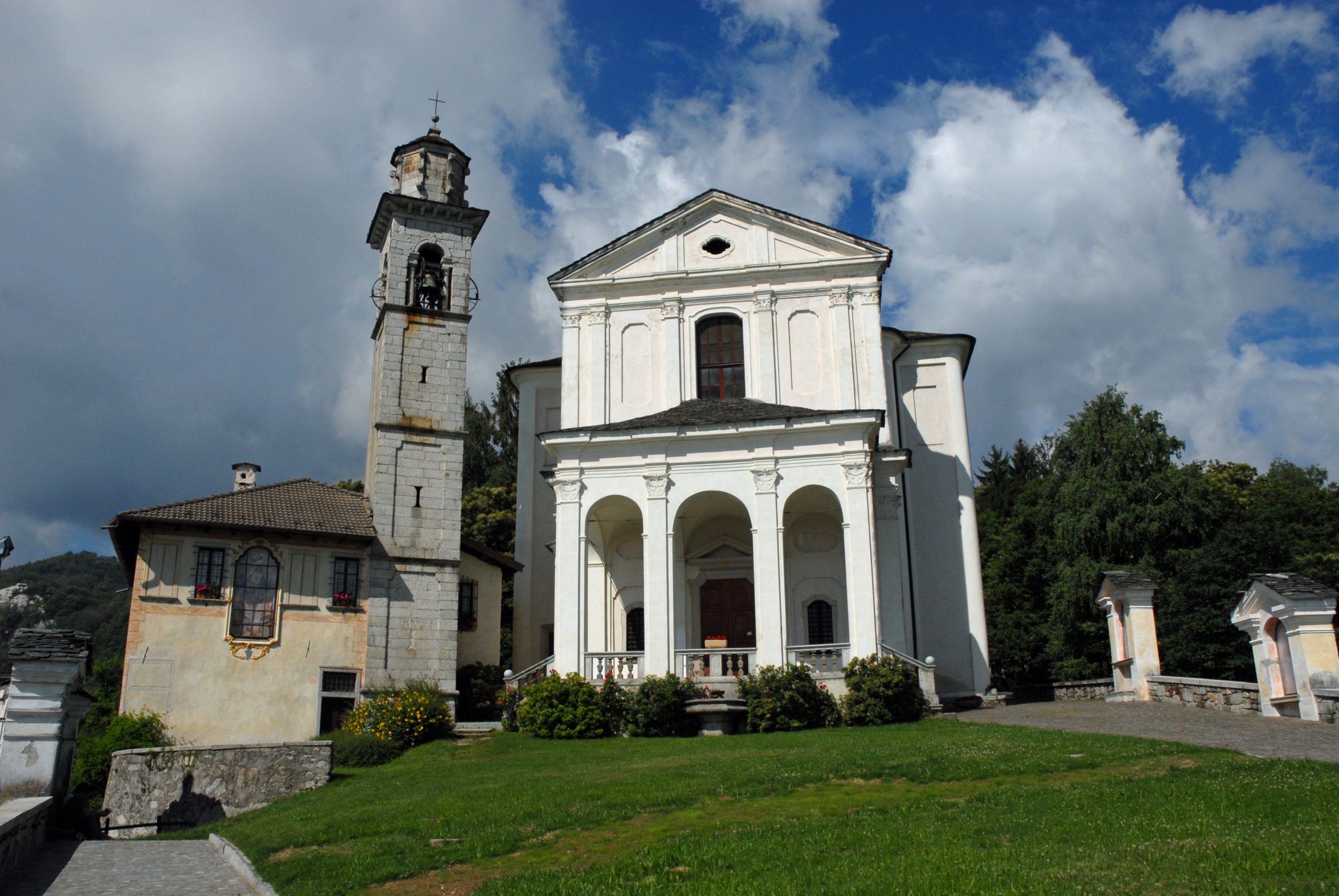
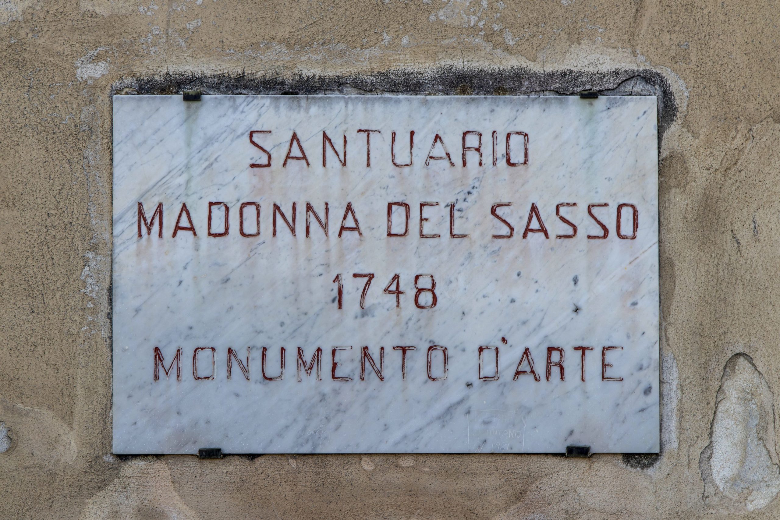
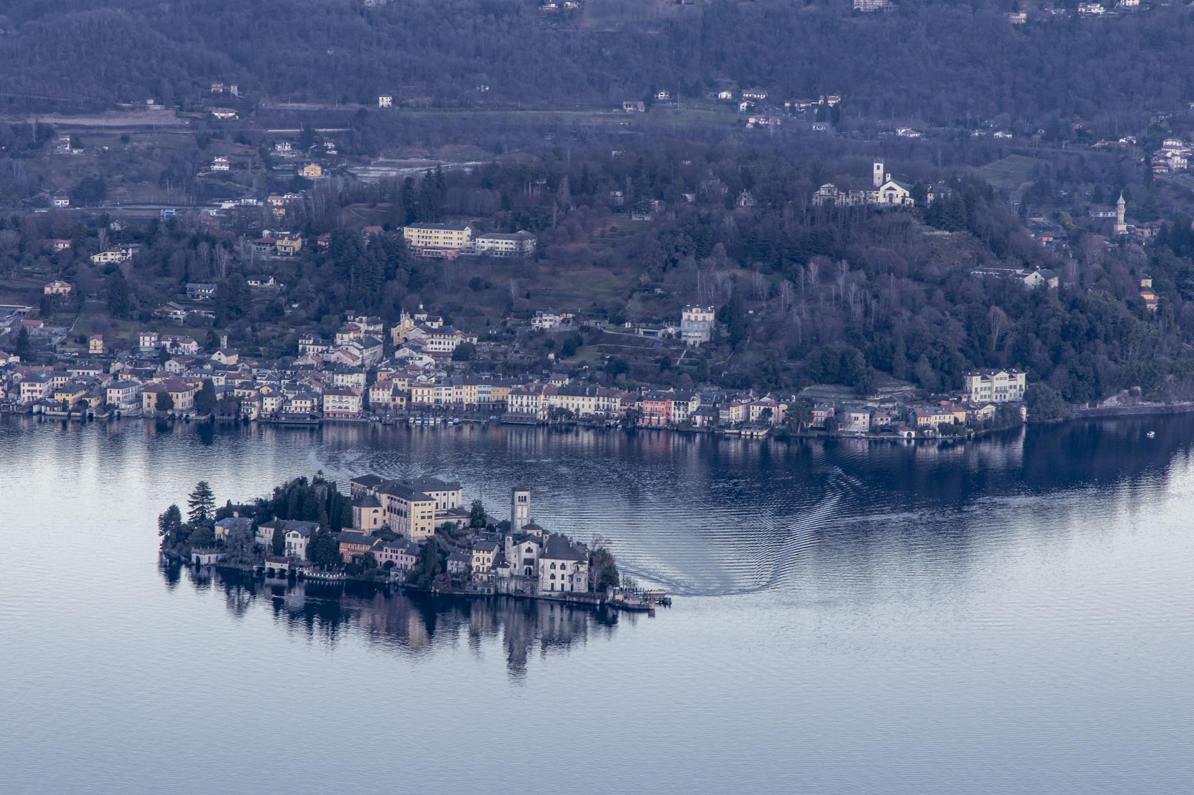
At the entrance to Boleto turn right and follow via Monte Avigno. When you come to the Sanctuary of the Madonna del Sasso (Our Lady of the Rock) its panoramic square with a view of Lake Orta.
Retrace your steps and follow via Santuario, then at the stop sign turn right along via Riotti. At the next stop sign turn left and then follow the signs for Artò and Centonara.
Continue past the sports field passing through the small village of Artò. On the left you come to the parish church of San Bernardino and continue downhill in the direction of the village of Centonara.
Keep going in the direction of Alzo di Pella and turn left at the end of the descent at the stop sign, then at the next stop turn right toward the centre of the village of Alzò. Pass the parish church and a roundabout and then turn left downhill following the signs for Pella. The route descends rapidly to the church of S. Filiberto. At the stop sign turn right and continue in the direction of San Maurizio d’Opaglio. After the climb you come to the traffic lights. Here you turn left along via Roma in the direction of Gozzano. Continue on a long flat stretch to the area of the sports field in Gozzano. At the roundabout turn right in the direction of Pogno and after the ordeal of a last steep climb (known as il chilometro the kilometre) you return to the starting point at Pogno.
To see : the Sanctuary of the Madonna del Sasso (Our Lady of the Rock), the Church of San Filiberto of Pella.
AUTOR: Fabio Valeggia
Back to the list of routes
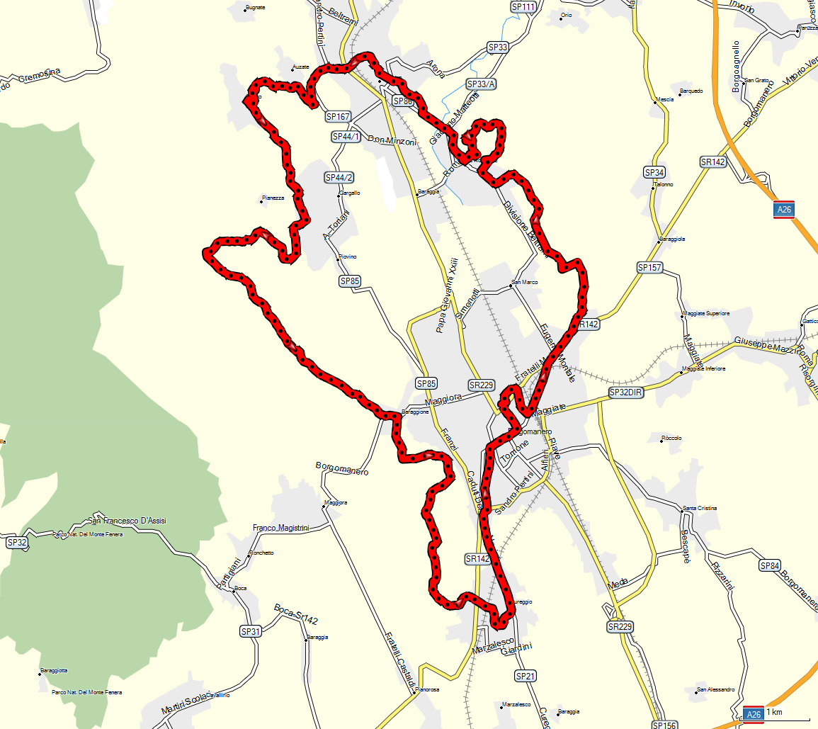
Departure from Gozzano -mtb
HILLS OF THE LOWER CUSIO AREA
Lago d’Orta
Route description
The starting point of the route is the square in front of the cemetery of Gozzano where you can conveniently leave the car.
Take via Madonna del Boggio and at the stop sign turn right toward the centre of Gozzano. Cycle about a hundred meters then turn left again into via 1° Maggio. Now follow the signs for Auzate and climb to the parish church. Shortly after take a path that goes downhill to the River Grua.
Cross the bridge over the river and after a short by very steep stretch you come to Soriso.
At the top of the hill turn left and go down to the intersection with viale delle Rimembranze then continue toward the cemetery of Soriso. On reaching Gargallo and keeping to the right you come to the oratory of San Michele, then turn right uphill along via San Michele.
After the Rio Pergallo where a demanding climb starts, you reach a large unsurfaced area where there is a bulletin board. At this point you must turn left into the woods. Remain on the main path and you come to the tarmac road which connects Borgomanero to Maggiora.
At the stop sign turn left and after passing the bridge turn right into via Baraggioni and the climb that leads up to Colle del Colombaro. At the church of the Sacro Cuore (Sacred Heart) turn left past the Civil Defence Headquarters and you come to the Oratory of S. Bernardo.
Follow the signs to Cascina Convent. At the end of the climb the road becomes unmade and you come to a junction with a chapel in the centre. Turn right and continue straight ahead to the first houses of Barbarana where the road becomes tarmac again. Pass the Cascina Carlottina and turn left following via Castellazzo. After passing the top of the hill you descend on the right and come to Cureggio. Cross the regional road 142 and then take via Cassoli passing under the bridge of the railway line.
Turning right you arrive at the historical centre of Cureggio and follow the signs to Borgomanero. At the roundabout turn right and then immediately left into via Molli: continue passing by the municipal swimming pool and then turn right into via Matteotti. Take Corso Mazzini and you come to the centre of Borgomanero near the parish church and the municipal building.
Go straight ahead along Corso Cavour and then turn right into Viale Don Minzoni. When you arrive at piazzale Salvo d’Acquisto turn right following the indications to Arona.
Cross the overpass and the Fire Station on the right then at the roundabout continue straight on along via Santa Cristinetta.
A few hundred meters further on, near the right bend, turn left into via San Michele.
Continue on an unmade road passing by the Cascina Ghiacciaia and then cycle along via Divisione Garibaldi. Turn right and then right again continuing toward the Cascina Pizzarini. You arrive at the tarmac road in the vicinity of the church of San Tommaso di Briga Novarese and continue downhill to the roundabout. Turn right into via Marconi, heading toward the centre of Briga. After about one hundred metres, turn right and continue uphill on the road that leads up to the top of the hill of San Colombano. Descending the hill again on a steep unmade mule track next to the steps of the church, you come to Piazza Unità d’Italia and turn right following via Sant’Antonio. Climb up to the next junction where you continue left in the direction of Gozzano. Turn into via San Lorenzo and after the church turn left and you come to the forecourt of the cemetery and the end of the route.
To see: la Chiesa di San Lorenzo a Gozzano, la Chiesa di San Colombano e resti del castello a Briga Novarese, la Chiesa di San Tommaso a Briga Novarese, il Battistero di Cureggio.
AUTHOR: Fabio Valeggia
Back to the list of routes
A charming circular path through various different mountain landscapes, from lush shady woods to open meadows
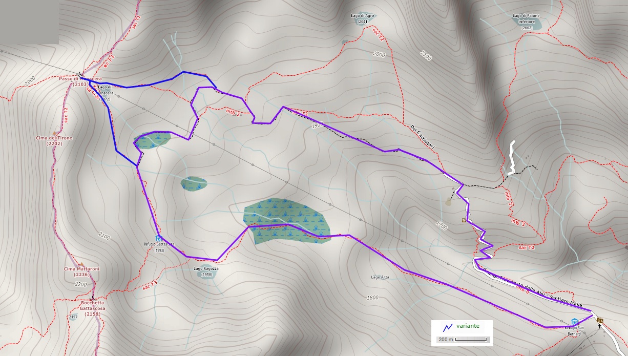
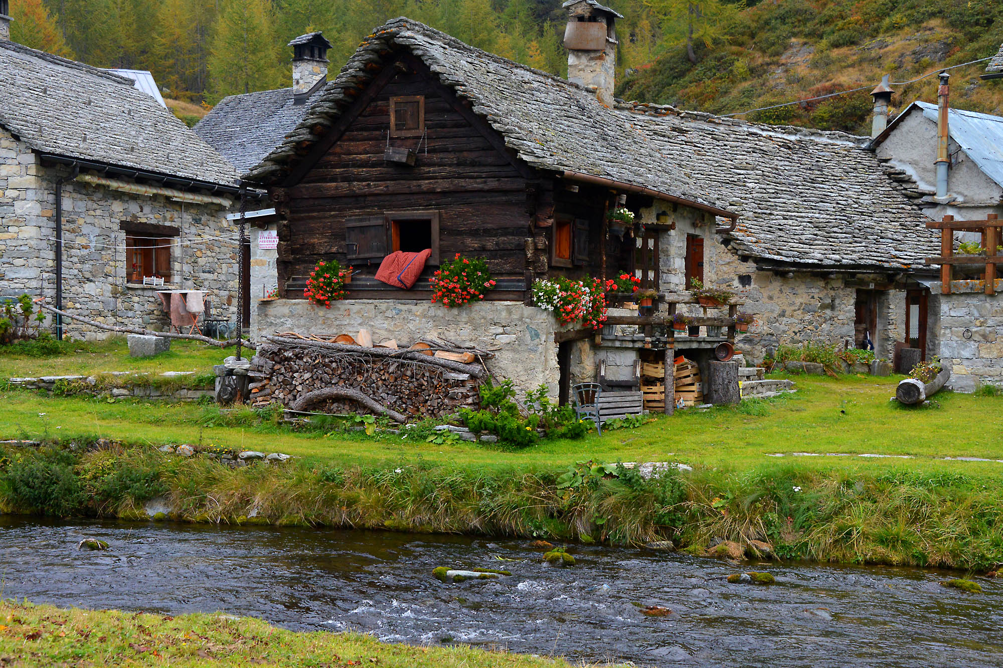
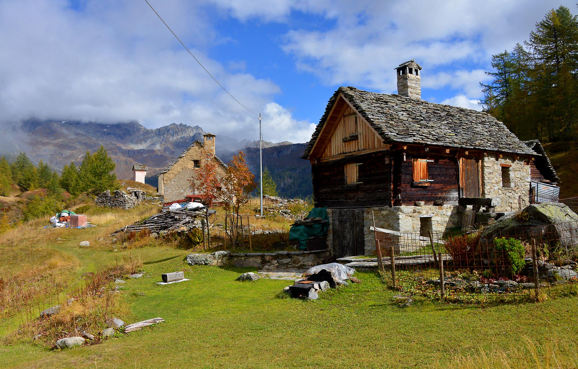
BOGNANCO VALLEY: THREE REFUGE TOUR
Valle Bognanco
Route description
Departure and arrival location: San Bernardo (1630 m)
Maximum altitude: 2016 m
Difference in altitude: 500 m total
Distance: 9 km total
Walking time not counting stops: 3 hours and 30 minutes total
Type of route: mixed (trail, asphalt, dirt road)
Signs: red/white “D00” “D08” signs, wood signs and red/white marks
Water: fountains in San Bernardo and at Rifugio Gattascosa
Recommended period: this tour is ideal from June to October. It can also be done during winter, after contacting Rifugio Gattascosa to get information about conditions on the trail in case of snow (the trail takes twice the time to complete if there is snow).
How to get there: 20 km away from Domodossola. After reaching Bognanco, take a narrow road to the Oratory of San Bernardo (drive carefully). There is a large parking area after the church, in front of Rifugio San Bernardo. By bus: Domodossola-Bognanco line (www.comazzibus.com)
Information: Distretto Turistico dei Laghi www.distrettolaghi.it; Tourist office – Via Cavallini, Bognanco Terme, tel. +39 0324 234127; Municipality of Bognanco www.comune.bognanco.vb.it; Rifugio San Bernardo – tel. +39 338 7884574; Rifugio Gattascosa – tel. +39 328 3151669, www.rifugiogattascosa.com; Rifugio Il Dosso – tel. +39 348 8678958
the itinerary
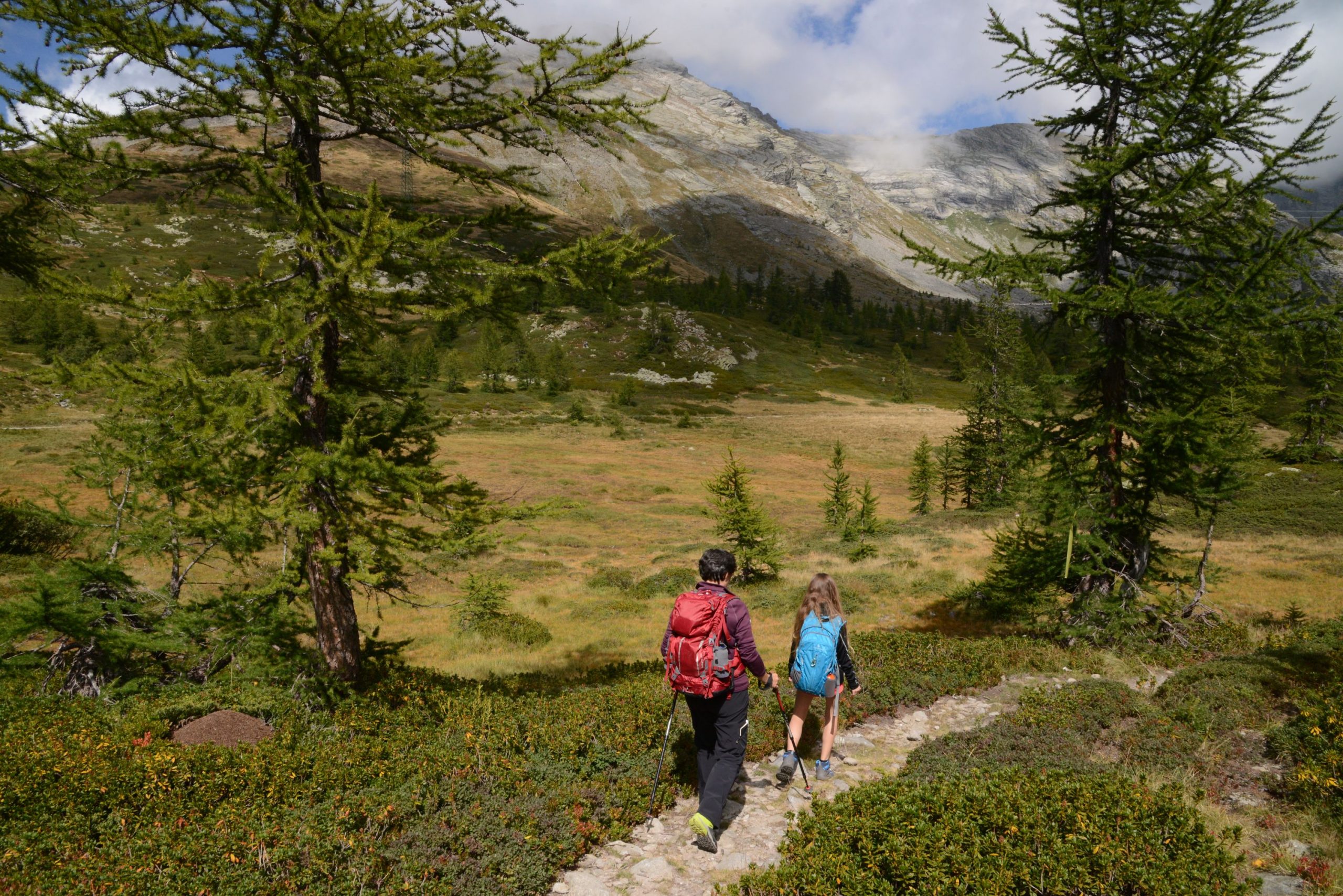
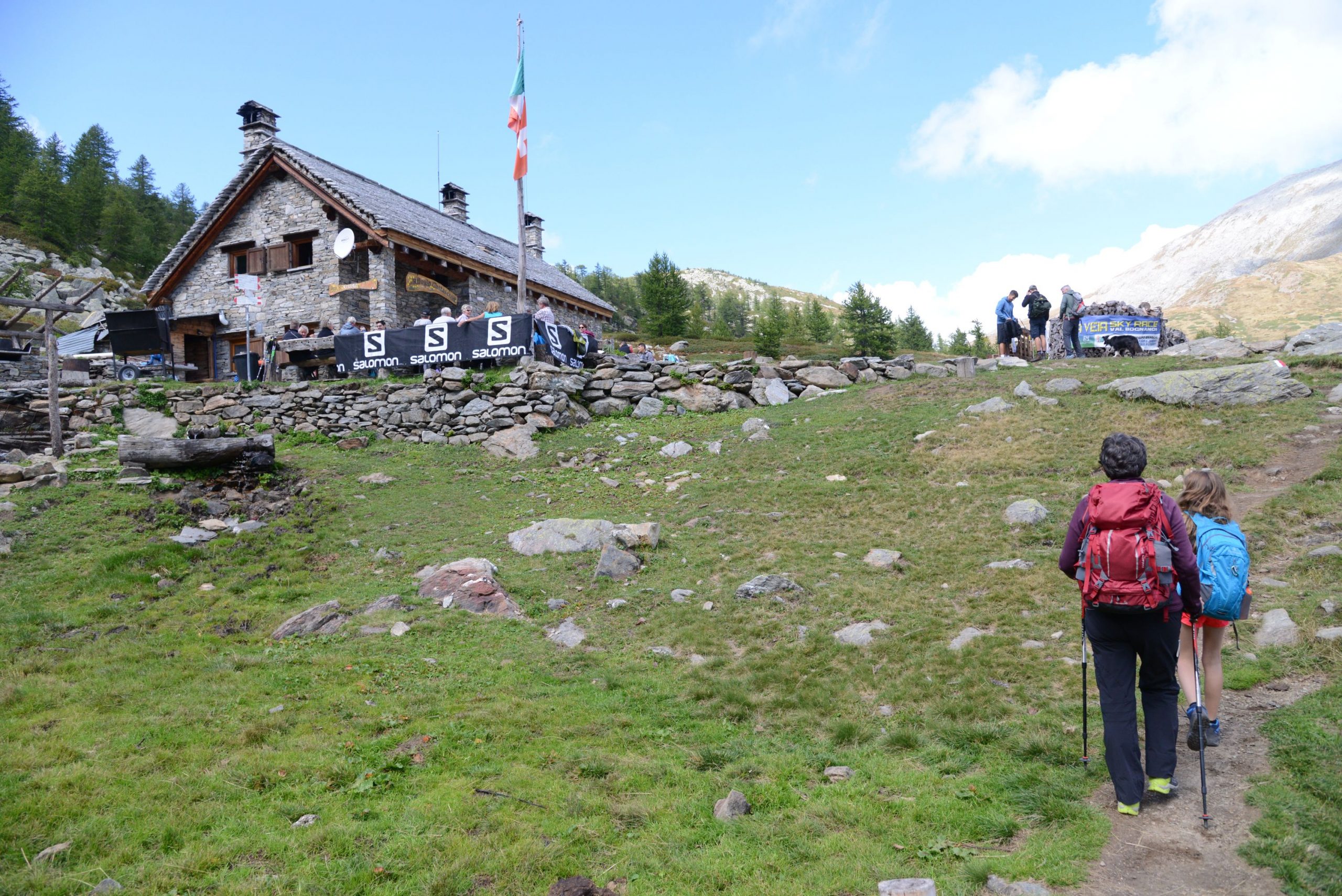
From the road, go past the white oratory dedicated to San Bernardo (with its fountain and pleasant picnic area) and bear left to reach the first refuge in our itinerary: Rifugio San Bernardo, at 1630 m a.s.l. (with rest rooms). Our itinerary begins right next to the parking area entrance (sign for Lake Ragozza). It climbs steadily on a trail that starts out stony and then softens, but always stays in the shade, under leafy larch trees.
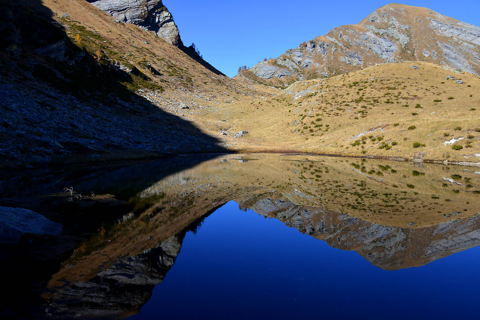
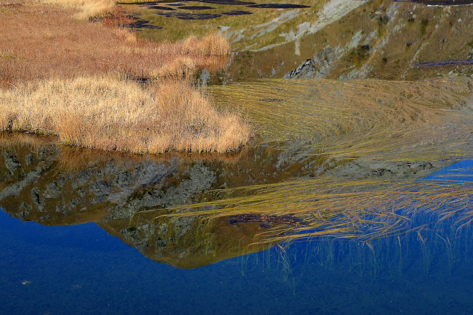
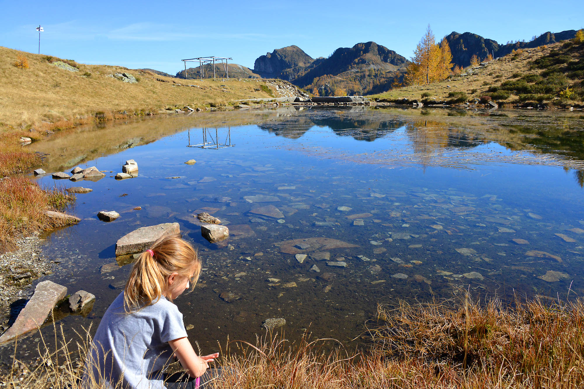
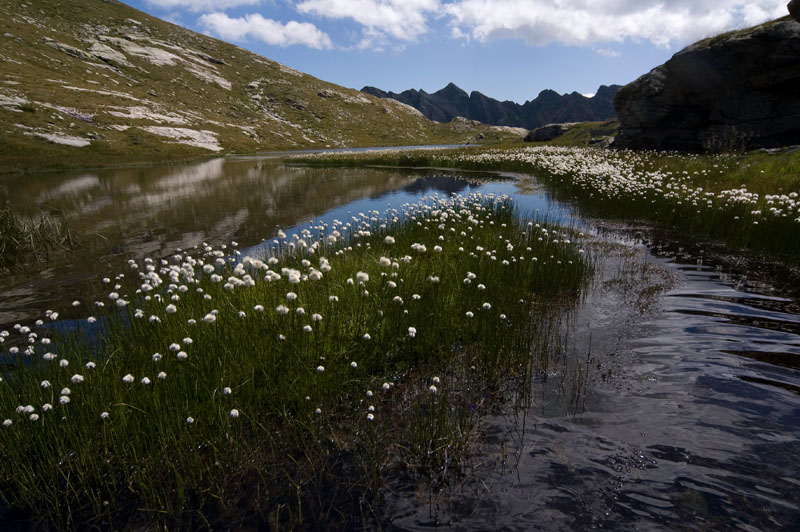
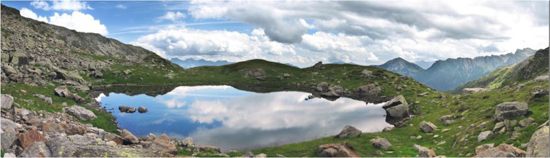
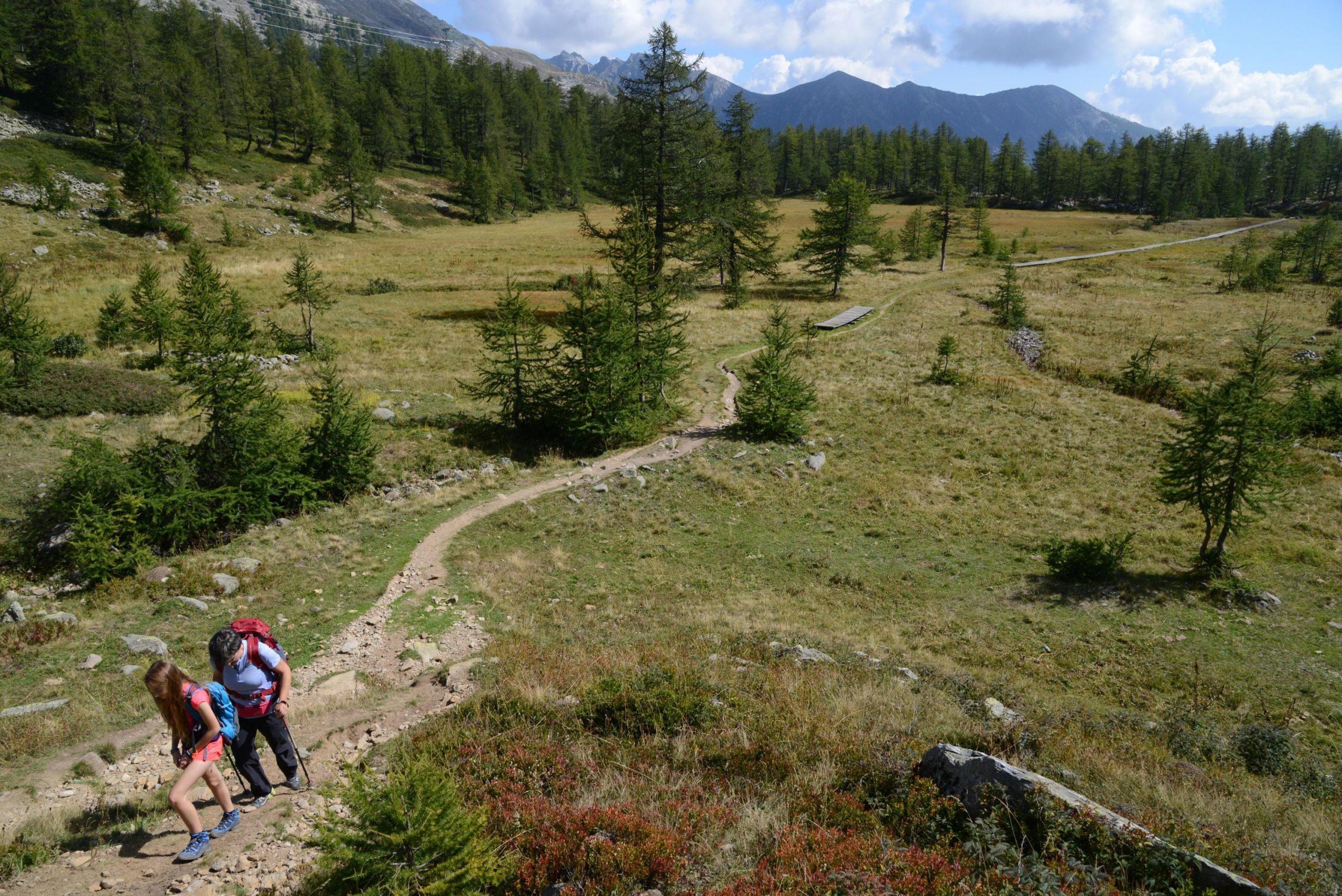
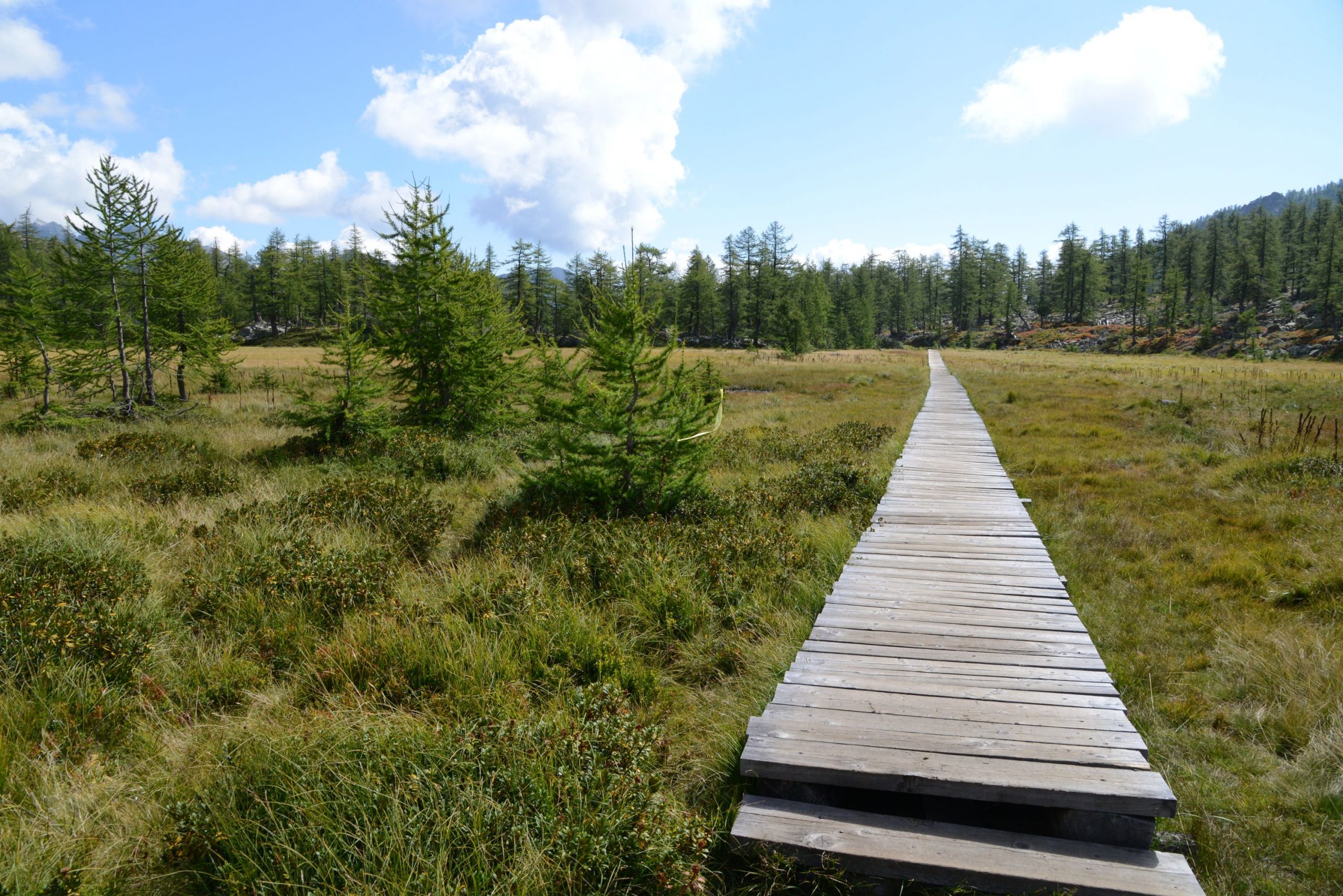
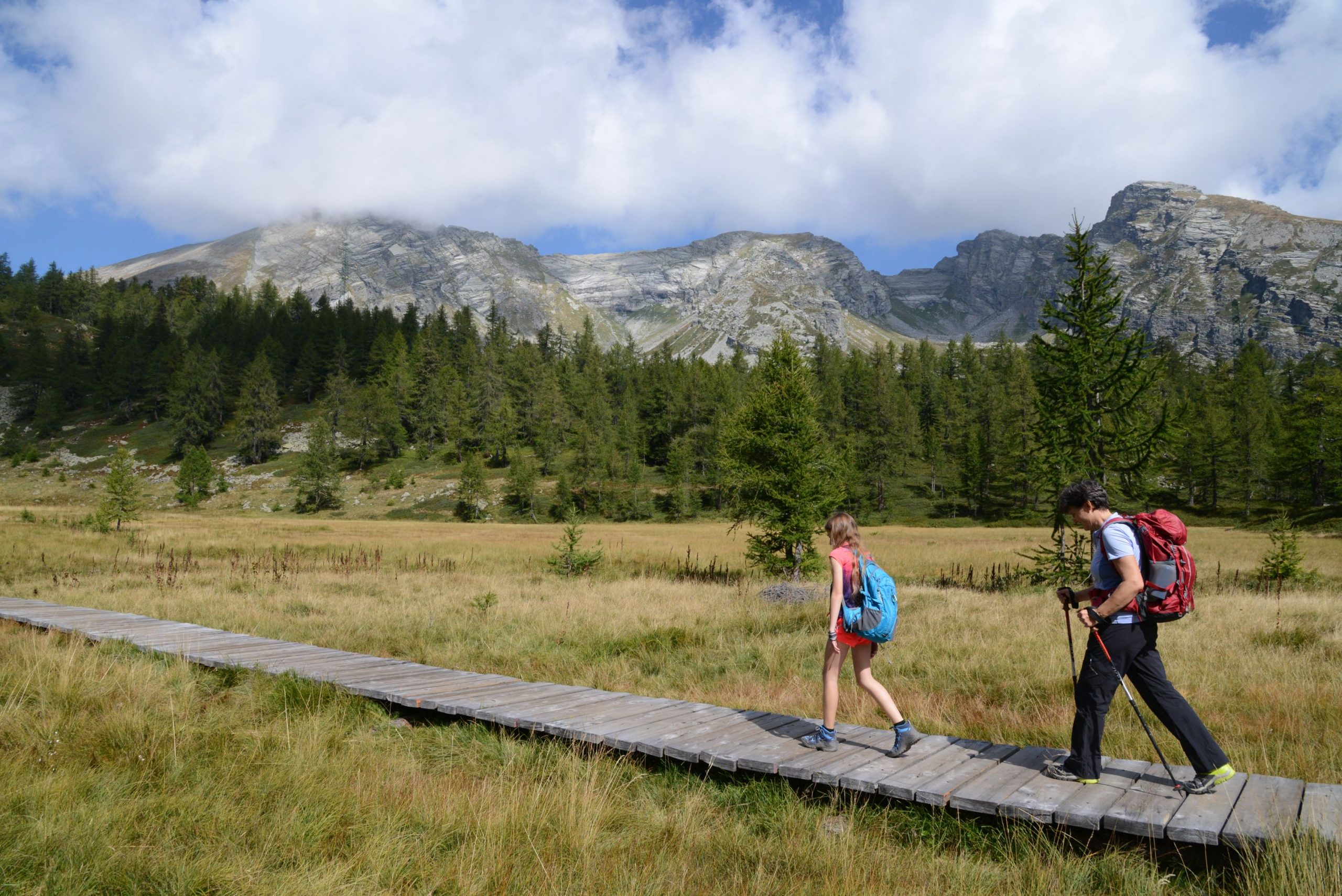
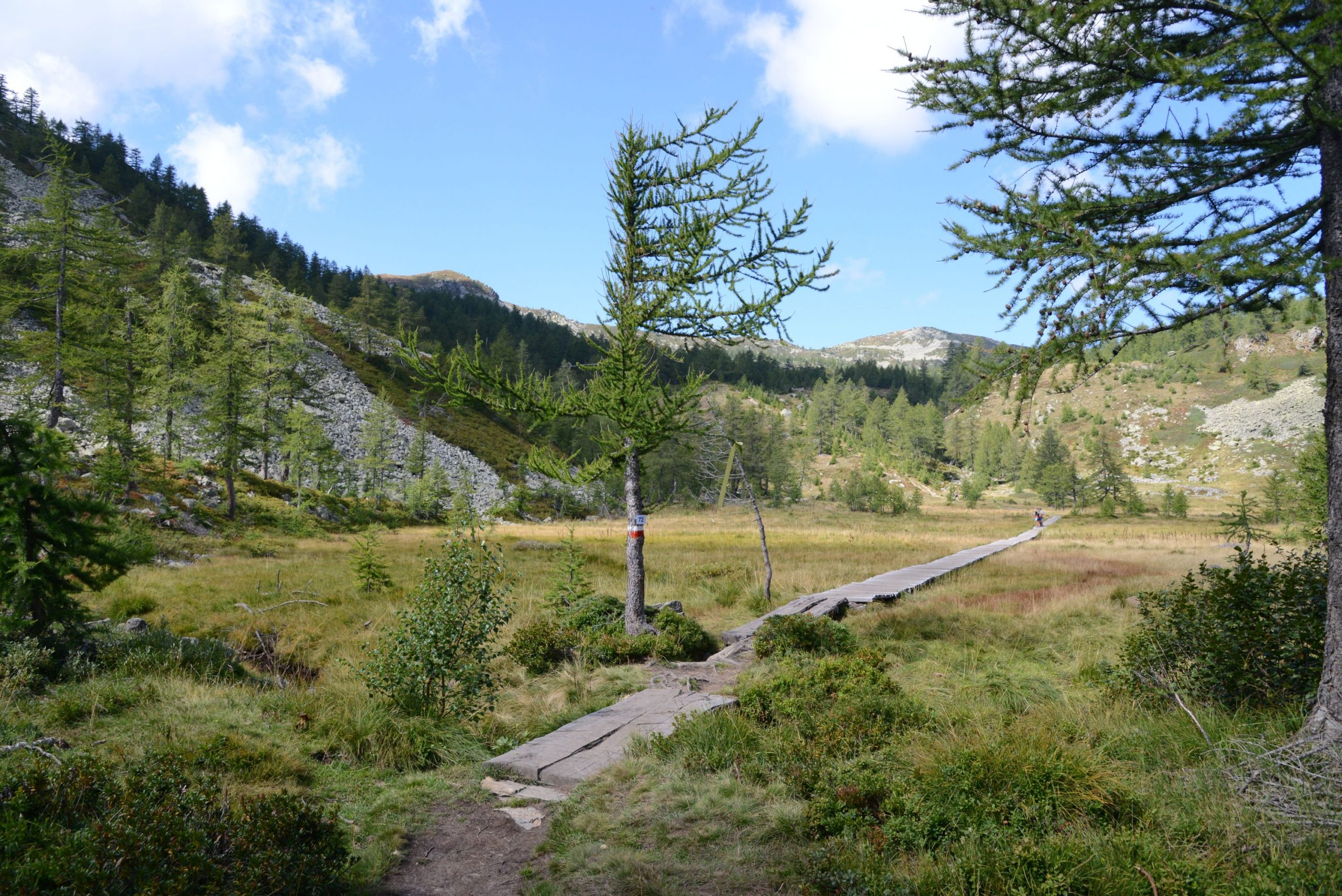
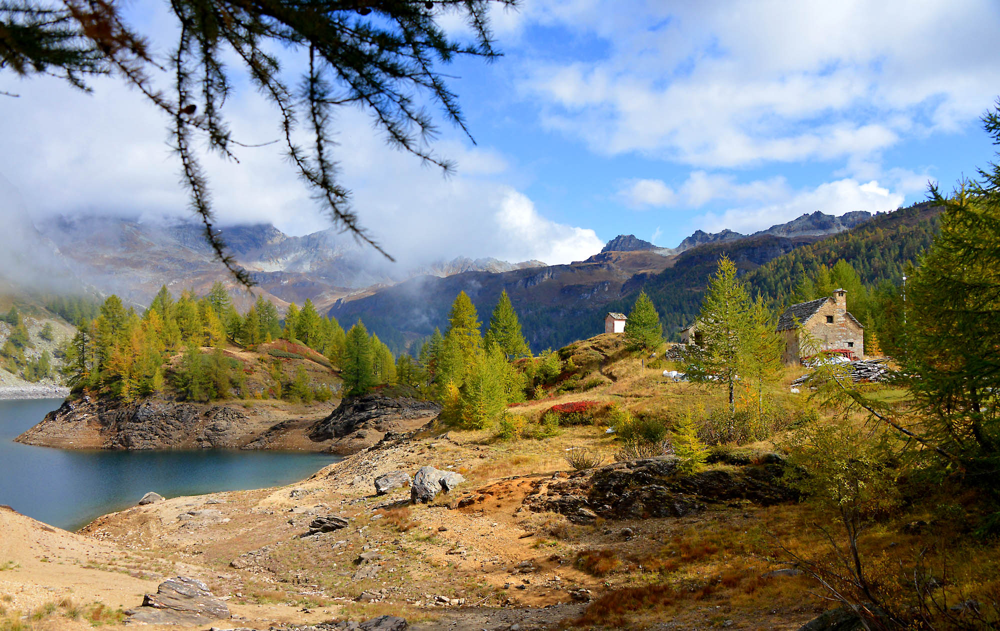
A sign points towards Lake Arza. This lake lies to the left, but is difficult to reach, so it is better to not leave the path to look for it. Go forward, up the hill, towards the bog “Torbiera di Gattascosa”, which can be crossed on wooden walkways. Children love to walk on these types of structures, so they will really like this part of the path! This segment of the trail looks a bit like the Far North: it almost feels like walking the legendary Kungsleden, the “King’s Trail” in Swedish Lapland. The last part of the climb leads to the lovely Lake Ragozza (1960 m): set like a jewel between the steep rock walls, the lake is bordered with rocks to sit on and rhododendrons.
The path continues beyond the lake on the right, climbing gradually to Rifugio Gattascosa (2000 m) in a short time. Hikers can enjoy a breath-taking view of the valley that they have just walked through (water fountain). After passing in front of the building, take the dirt road to reach the highest point of the itinerary, which is also the location of a fork with a trail leading off to the left.
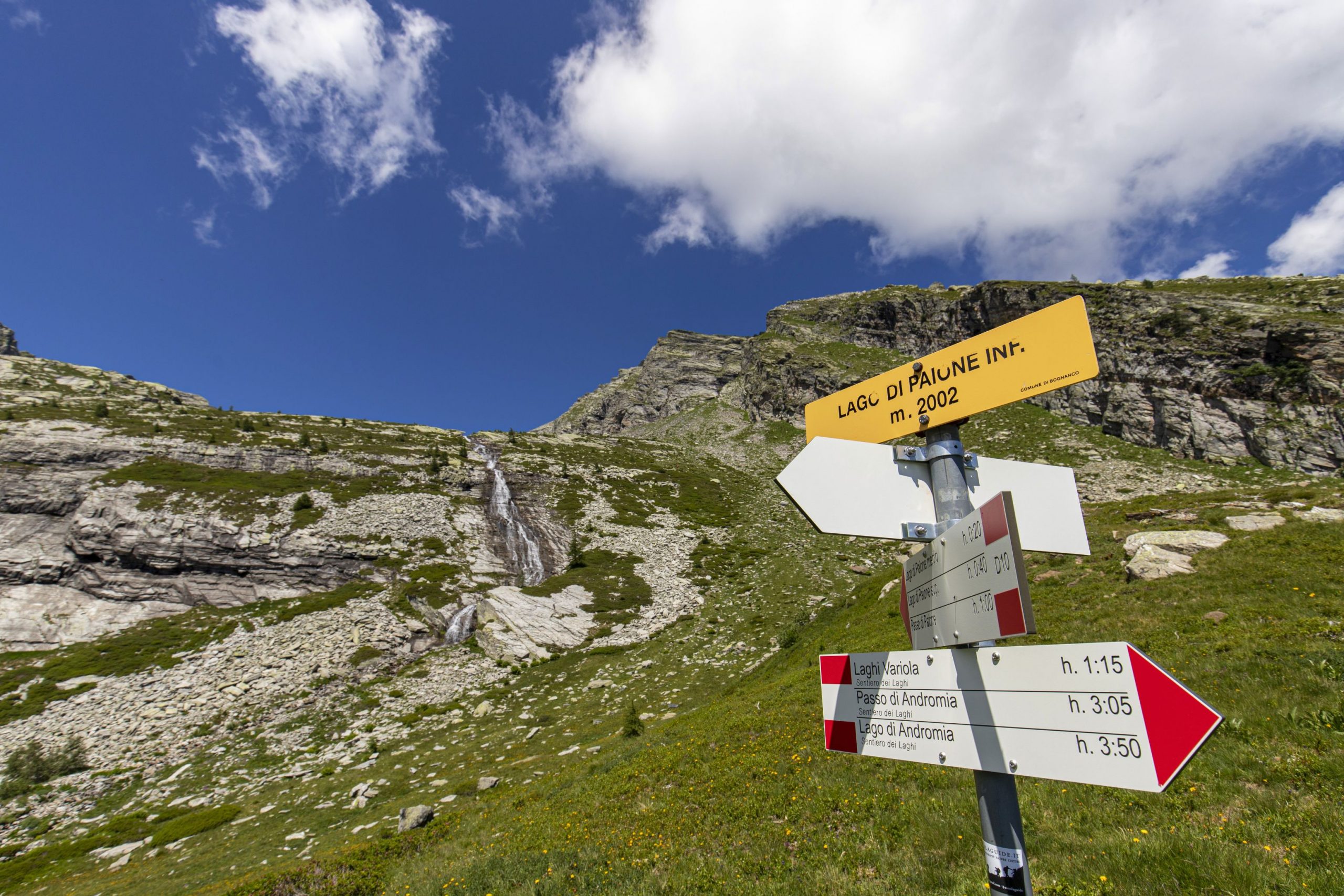
Note: our trail goes straight along the dirt road, but, if you like, you can take that trail and, in just over 30 minutes, go up to the Monscera Pass and Lake Monscera (2103 m in altitude; a difference in altitude of +100 metres, another 1.7 km, about 40 minutes longer than the itinerary described here), where you can admire the beautiful peaks of Canton of Wallis, Switzerland.
Now, you have two options: simply follow the dirt road and make a wide curve around a humid pasture area, or take the trail on the right to cut straight through it. After getting back on the dirt road, follow it downhill. You will pass next to Alpe Monscera and then go towards a panoramic memorial, continuing downhill on the dirt road. Take a moment to look closely at the strip on the lower part of the memorial. It is in metal and decorated with figures of travellers… People that you will meet here and there on the next trail! The dirt road becomes steeper, turns into asphalt and passes near a second village, Arza (water fountain). Then we come to the third refuge on this itinerary: Rifugio Il Dosso (1740 m). After the building, the road descends steeply in a few hairpin turns. You will cross a bridge, and then the road will level off before you get to Rifugio San Bernardo, your starting point.
Tips for young hikers
A long but easy walk. The dirt road from San Bernardo going straight to Rifugio Il Dosso and then to Rifugio Gattascosa is suitable for pushchairs. Allow a lot more time for this path due to the many stops at the lake and at the refuges.
Trail creators: Franco Voglino, Annalisa Porporato and Nora Voglino
Content authors: Franco Voglino and Annalisa Porporato
Back to the list of routes

A ring-shaped walk amid relaxing pastures in the Alpe Devero area
VEGLIA-DEVERO NATURE-PARK: DEVERO BETWEEN THE ALPS AND THE LAKE
Alpi Veglia-Devero
Route description
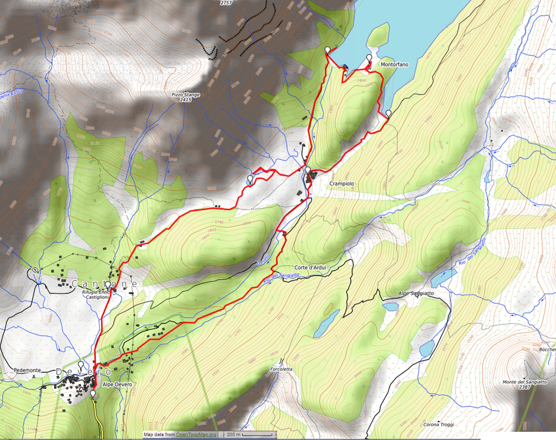
Departure and arrival location: Alpe Devero, area Ai Ponti (1640 m)
Maximum altitude: Montorfano-Lake Devero (1863 m)
Difference in altitude: About +300 m
Distance: 8,5 km
Walking time not counting stops: 2 hours and 30 minutes
Type of route: trail and dirt road
Signs: red/white road signs and wood signs
Water: fountains in Alpe Devero, Cantone and Crampiolo
Recommended period: all year round. In late spring, to see the blooming meadows, in summer for the coolness of Lago delle Streghe, in autumn for the warm colours and the deer, and during winter for a quiet walk with snowshoes.
How to get there: it is 33 km from Domodossola. Go towards Crodo and then towards Valle Formazza to Baceno. Then follow signs for Devero (blue signs) and Parco Naturale Alpe Veglia – Devero (brown signs) for 12 km. Parking for cars at Alpe Devero is not free. By bus: Domodossola-Formazza line to Baceno (www.comazzibus.com) and between Baceno and Alpe Devero use the ProntoBus service (www.unionemontanaaltaossola.it).
Information: Distretto Turistico dei Laghi – www.distrettolaghi.it; Tourist Office Pro Loco Baceno – Via Roma 56, Baceno – tel. +39 0324.9348025; IAT Office – loc. Bagni 20, Crodo – tel. +39 0324.600005; Ente Gestione Aree Protette Ossola – www.areeprotetteossola.it; Municipality of Baceno – www.comune.baceno.vb.it; Unione Montana Alta Ossola – www.unionemontanaaltaossola.it
the itinerary
We are in the heart of the Natural Park Alpe Veglia-Devero.
In 1995, two park administrations consolidated: Veglia (1978, the first park in the Piedmont Region) and Devero (1990). The new park covers 86 square kilometres characterized by a typical alpine environment going from an altitude of 1600 to 3500 meters, even if the landscape has been modelled by people with gentle meadows surrounded by the harsh peaks. The park incorporates territories in the municipalities of Baceno, Crodo, Varzo and Trasquera. Veglia and Devero, which give the park its name, are the two largest alpine pastures in the Ossola Valley.
Start the walk by going between the houses of the hamlet on the beautiful cobblestone main street up to the 12th century Oratory of San Bartolomeo, then cross the bridge over Rio Buscagna.
If you like, you can change your plans by going to a large playground area on the left, delimited by this stream and Rio della Rossa. Just beyond, you will find the Museum of the Mountain Pasture (Museo dell’Alpeggio), housed in the ex-arrival station of the Goglio-Devero cable way (open in summer, info tel. +39 0324.72572). A cable way linked the two locations until the seventies. In 1939, this transportation line was opened to move materials and employees of Edison Volta (which became Enel). In 1944, a tragic event occurred when the Nazi-Fascists shot a machine gun at the cabin just after departure, killing four partisans. It was then used for tourism, and was closed when the asphalt road reached Alpe Devero.
Just beyond the bridge, there is a white house with a sundial on it. If you look up, you can see the level that the snow can reach. Impressive! Ignore the road to the right and continue straight ahead next to the building with the bar and inn, following the red and white signs for “Lago delle Streghe 0.45”. The path leads between relaxing open fields of Alpe Devero, on a stretch identified as being for everyone (“un percorso per tutti”), also accessible to strollers.
The large plateau was formed when an ancient glacial lake dried up long ago. In the Middle Ages, the area was still rather swampy but subsequent reclamation works have reduced the wetlands greatly, and widened the grassland and pasture.
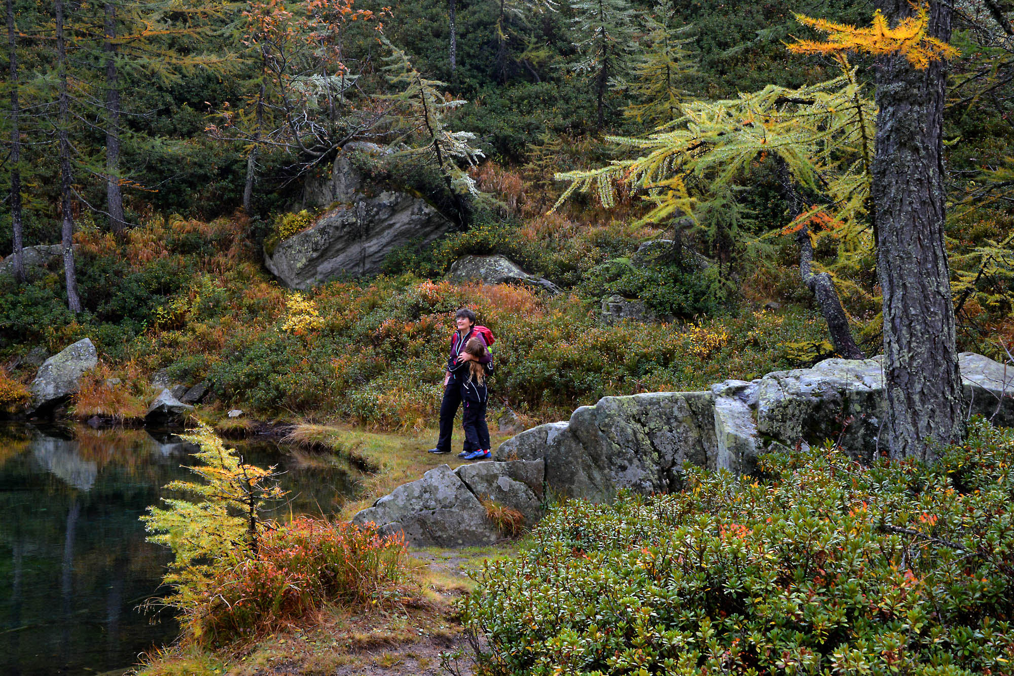
Ignore the road to the right that runs slightly uphill, and take the path with practically no slope that leads to the village of Cantone (1640 m approximately), where you will also find the CAI Refuge. When you get to the first houses, turn right. The trail will begin to rise slightly (wooden signs). Just beyond that, abandons the dirt road and take a trail on the right (small sign for “Crampiolo-lago”) that climbs a bit more decisively, bordered by vertical stones, and leads to an isolated mountain pasture (fountain). The trail becomes more gradual and continues through a pleasant small valley called Vallaro, delimited between meadows and trees and studded with large boulders that invite you to climb on them. There are also isolated houses of stone that appear suddenly, almost by magic, along the path, while the landscape slowly becomes more wooded and enchanting. A steeper and shorter path leads to just behind some houses in wood and stone.
Going to the left for about 5 minutes, you will reach the remains of an old limestone kiln located on the Nature Trail. These kilns were lit to cook calcareous rocks for a week, with flames which burned continuously so that the temperature could reach one thousand degrees centigrade. This is how they obtained “quicklime” that became “slaked lime” when mixed with water. Slaked lime was used in the building industry or, with the addition of a lot more water, “lime render”, which has disinfectant properties and is used for whitewashing walls.
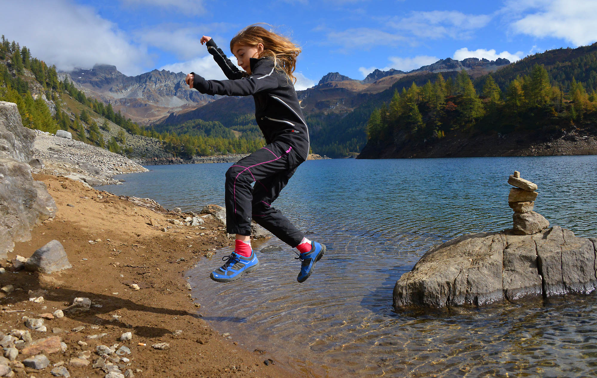
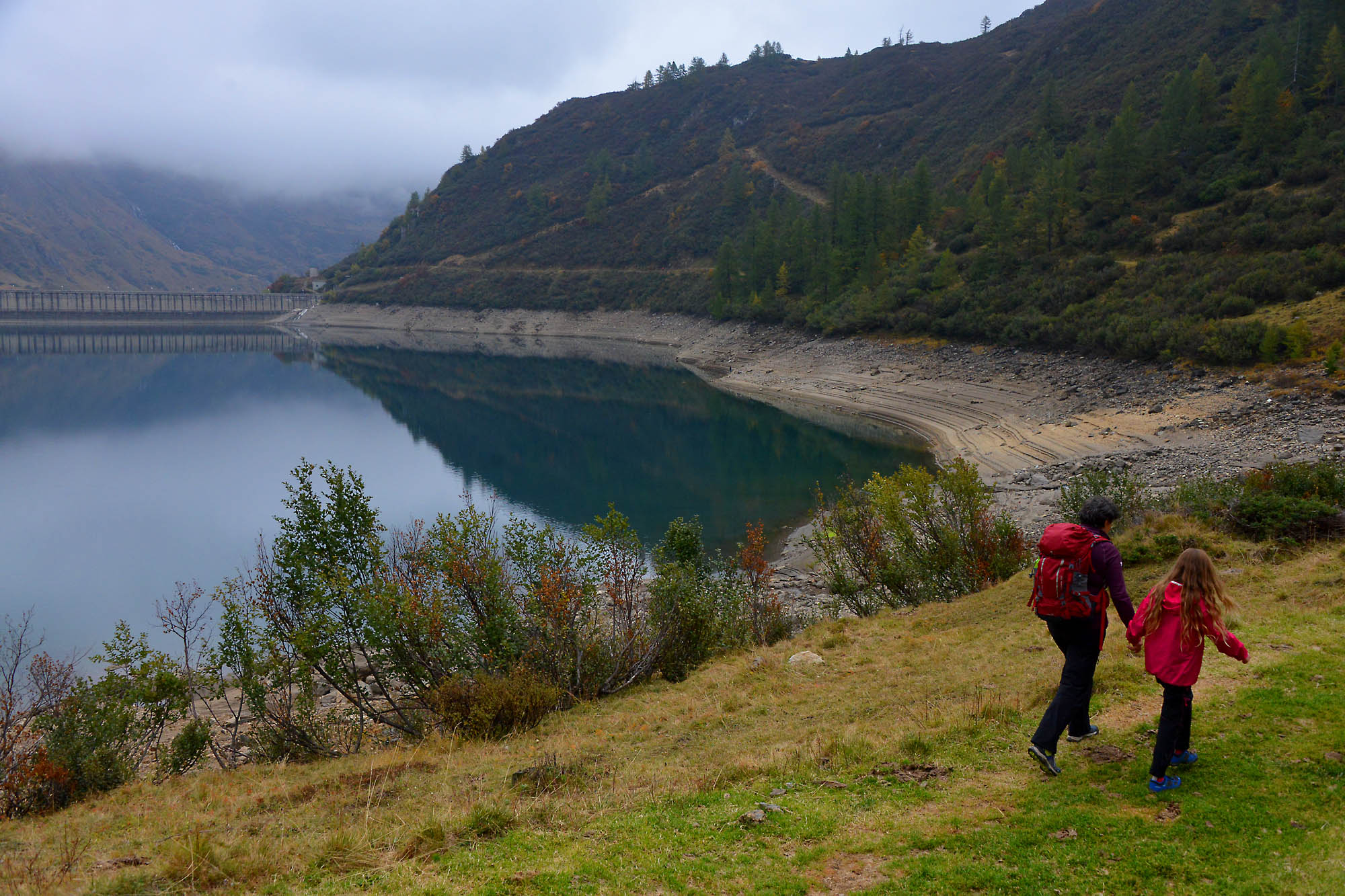
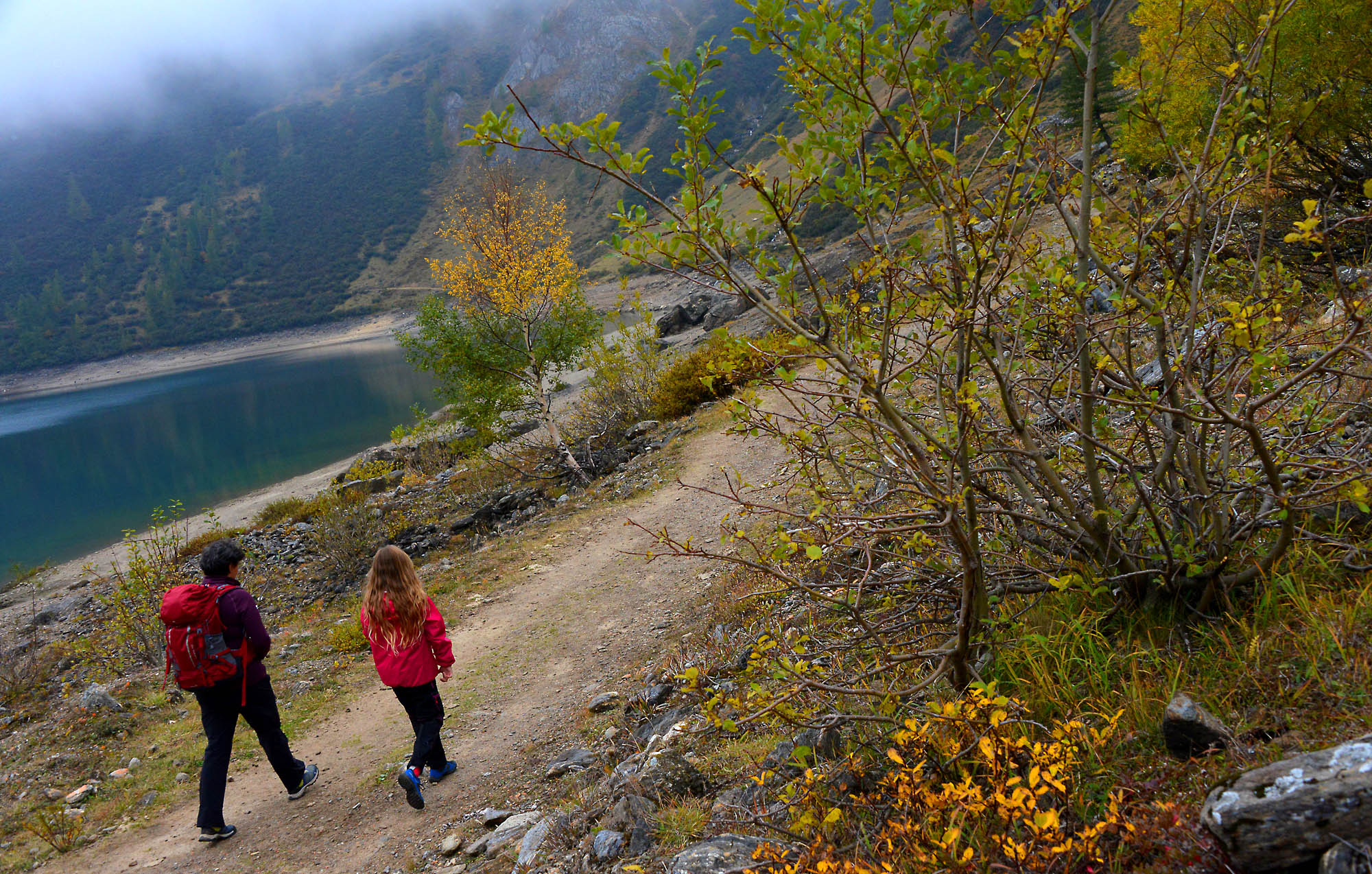
Go to the right (follow the sign for “Crampiolo 0.15”) and after a few steps, leave the wide trail that goes directly to Crampiolo and take the smaller trail to the left (sign for “Lago delle Streghe”) that rises decisively amid low junipers, blueberry bushes and rhododendrons. The climb takes little time, and soon the trail becomes more gradual even though almost closed by the vegetation. The appearance of the area makes the approach to the lake evocative, almost as if the witches have cast a spell to protect their lake. The body of water appears almost as a surprise among the dense vegetation. Now you are at the southern end of the Lago delle Streghe (1772 m), and a path on the right allows you to travel along the eastern shore, so as to arrive at the opposite end characterized by sparse marshy vegetation that does not grow tall. The path goes high enough with respect to the water level, a very good point of view to see the limpid waters gushing from an underground spring, to then descend to a bridge-catwalk that allows you to cross the wetlands and walk along a short stretch on the opposite shore up to a large boulder blocking the passage on the shore, near a squared stone at the foot of a niche that protects a sacred image. When you return to the bridge, continue along the trail to the left (wood sign for “Crampiolo 0.10”), and shortly you will reach the town. The road leads to the bridge over the Devero torrent, but do not cross it: continue along the dirt road keeping the water course to your right (follow the red and white sign for “Lago Devero 0.20”). Soon the dirt road becomes a very steep cobblestone road, and in few meters, it climbs and becomes a trail. It finishes right next to the dam of Codelago (1856 m.), overlooking the turquoise waters of Lake Devero, in the heart of the Natural Park Alpe Veglia-Devero.
The Codelago dam was one of the first in the Ossola region, erected between 1908 and 1912, thus raising level of the pre-existing lake by 20 meters.
After a stop on the lake shores to admire the peaks that surround and embrace the area in all their magnificence, follow the path along the top of the dam (the sign says “giro del lago”), and then go up the stairs and follow the path that passes behind and around the power plant buildings. Be careful at the first fork on the left, immediately after the plant buildings. The trail drops drops steeply toward the lake shore and there is a chain to help long a very short rocky passage that is not difficult (but watch small children carefully). Go along a short stretch along the lake and then come slightly away from the lake and go towards the partially abandoned town of Montorfano (1863 m.). Near the votive pillar, positioned on the top of the small promontory, you’ll have a magnificent view of the lake surrounded by mountains. After leaving the town, get back on the trail (signs for “Crampiolo via Dighetta”) that skirts the top edge of the small recess of the lake located to the east of Montorfano, until you get to a smaller dam.
In 1921-24, the Codelago dam was raised higher, and this made it necessary to create a barrier to the east of the promontory of Montorfano, thus creating the Dighetta, or little dam.
You can cross on its top and, when you get to the end, climb along the trail which leads to the dirt road that arrives from the circle road around Lake Devero. Now, take this road toward the right, with a slight continuous descent, and pass over another small dam. Without any other deviations, descend on a cobblestone and dirt road to the village of Crampiolo (1767 m) whose stone houses are grouped around the white Oratory of San Antonio Abate, built in the 17th century.
Here there are many places where you will be able to get something to eat or drink: agritourism places, restaurants, wine tastings and sales of typical products… Try Bettelmatt, a mountain pasture cheese already known in the 17th century.
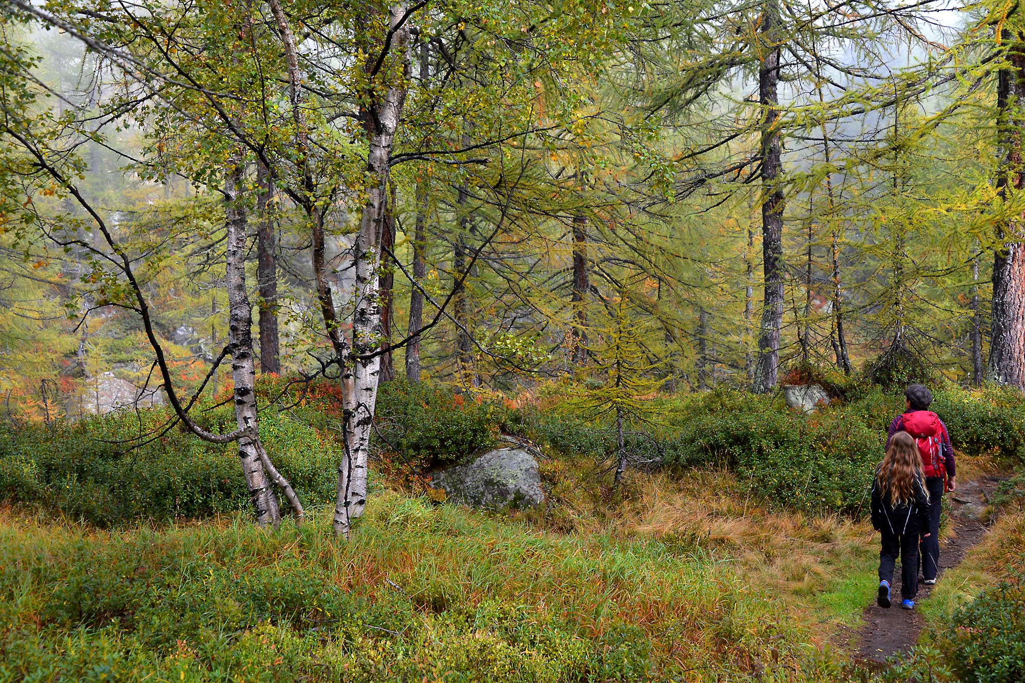
After crossing the town, cross the Devero torrent on the wooden bridge and take the dirt road downhill (red and white sign for “Devero 0.25”), ignoring the first path to the right (which leads to the Lago delle Streghe) and turning left after about 300 meters on a wooden bridge (brown sign “Devero percorso invernale” (Devero winter path)). Go past the houses at Il Motto di Crampiolo (1770 m approximately) to follow a beautiful mule track in the woods that leads to the hamlet of Corte d’Ardui. Here, at the junction, continue to the right and always keep the Devero to your right as you walk along a relaxing woodland section where the trail descends gradually, with alternating sections of mule track and stretches of trail, until you return to Alpe Devero, thus concluding this pleasant ring hike.
Extension: with older children, it is possible to complete the hike around Lake Devero by travelling another 4.5km, +125m, in 2h. In this case, you do not pass on the top of the dam, but instead continue along the shore, with the water to your right (follow signs for “Giro del Lago”), passing through Alpe Codelago, the end of the Pianboglio basin, and then going back along the opposite bank. The track is part trail and part dirt road, with some passages that are a little exposed and on a cliff, with chains to help guide hikers.
to learn more
The Legend of the Lago delle Streghe (“Witches’ Lake”)
A long time ago, there was a damsel who was in love with a young man who, unfortunately for her, had eyes only for another girl. One day, the unhappy girl was out wandering and she met an old woman sitting on a boulder, intent on spinning yarn. Looking into her eyes, the girl realised that the woman was more than what she appeared, and felt the need to tell her the sad story. Therefore, the damsel told the old woman of her anxieties, and implored her to cast a spell to make the young man love only her. The old woman tried to dissuade her, but without success. Then she agreed to work the spell, but on one condition: first the girl had to look at another man. They went into a cave, and deep within it was a warm and welcoming room, where there were two other witches. The old woman asked the damsel to look into two pools of spring water. In the first, she saw the face of her sweetheart but, as she looked, he became old and wrinkled, with white hair and yellow teeth. Horrified, the girl wanted to run away, but she also had to look into the other pool. There, she a handsome young man, as beautiful a god with loving gaze and the strength of a king. And she understood. In the first pool, she had seen human love, which is fleeting and short-lived, and can make one happy but not for ever. In the second pool, she had seen divine love that never ceases. The girl realized that this was what she really wanted, and thus began to dance with the other witches. The cave disappeared and the small pond grew so much so as to become a torrent and fill the plateau. Creating the “Witches’ Lake”.
The Story of the Witches of Croveo
In reality, the area between Baceno and Croveo is sadly known for a real witch-hunt that occurred as the 16th century ended and the 17th century began. Dozens of women and even a few men were captured and killed, tortured and burned at the stake. According to historians, such fury was caused by the nearness to Switzerland, and the Calvinist faith, but others believe that it was the result of ancient pagan beliefs that survived due to isolation in the valleys. Whatever the truth may be, this remains a sad, dark event in the local history and religion.
The Devero Waterfall
The road to Alpe Devero (which can be driven on), travellers pass through a lovely tunnel dug in the rock. Just beyond after the tunnel, at a bend that turns to the right, they can see a superb view on the left of an impressive waterfall created by the Devero torrent. This spectacular sight deserves a stop in the parking areas located just before the hairpin bend. These parking areas are approximately 2.5 km away from the village, and are the last free spots available.
tips for young hikers
This walk, as we have presented it, is suitable for children of all ages. The only place where you must be very careful is the passage on rocks just before Montorfano. The complete trip around Lake Devero, in addition to this, may be long and suitable only for older children. However, these walks are not suitable for prams and strollers. In this case, it is better to stay on the dirt road that connects Alpe Devero to Crampiolo. If you like, and you want to push yourselves a bit, you can also reach Lake Devero if you follow the cobblestone road that runs alongside the torrent, on the orographic right side.
Slow trekkers: Franco Voglino, Annalisa Porporato and Nora Voglino
Authors of texts: Franco Voglino and Annalisa Porporato
Back to the list of routes
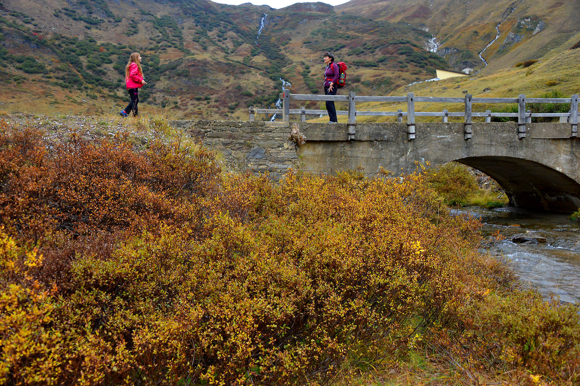
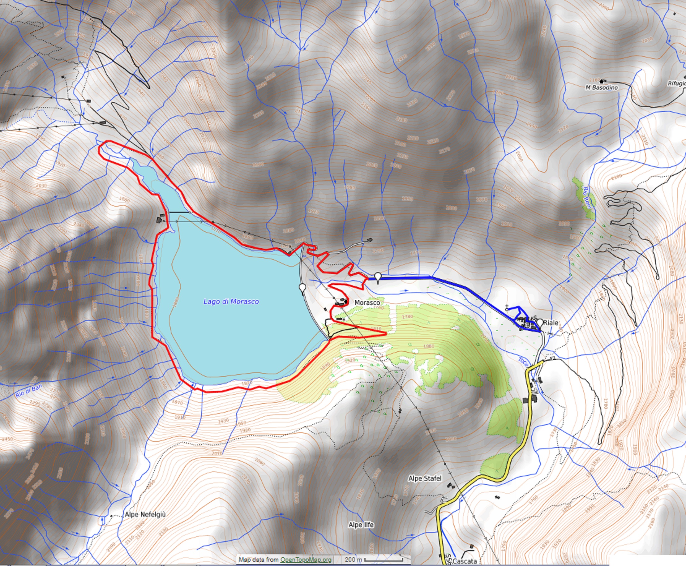
A ring-shaped walk along the shores of Lake Morasco
FORMAZZA VALLEY: RIALE AND LAKE MORASCO
Valle Formazza
Route description
Departure and arrival location: parking areas at the base of the dam (1747 m)
Maximum altitude: the south shore (about 1850 m)
Minimum altitude: Riale (1734 m)
Difference in altitude: about 150 m
Distance: 8,5 km
Walking time not counting stops: 3 hours
Type of route: mixed (trail, asphalt, dirt road)
Signs: G00 red/white signs
Water: fountains in Riale
Recommended period: from May to October (from November to April it is a cross country skiing track)
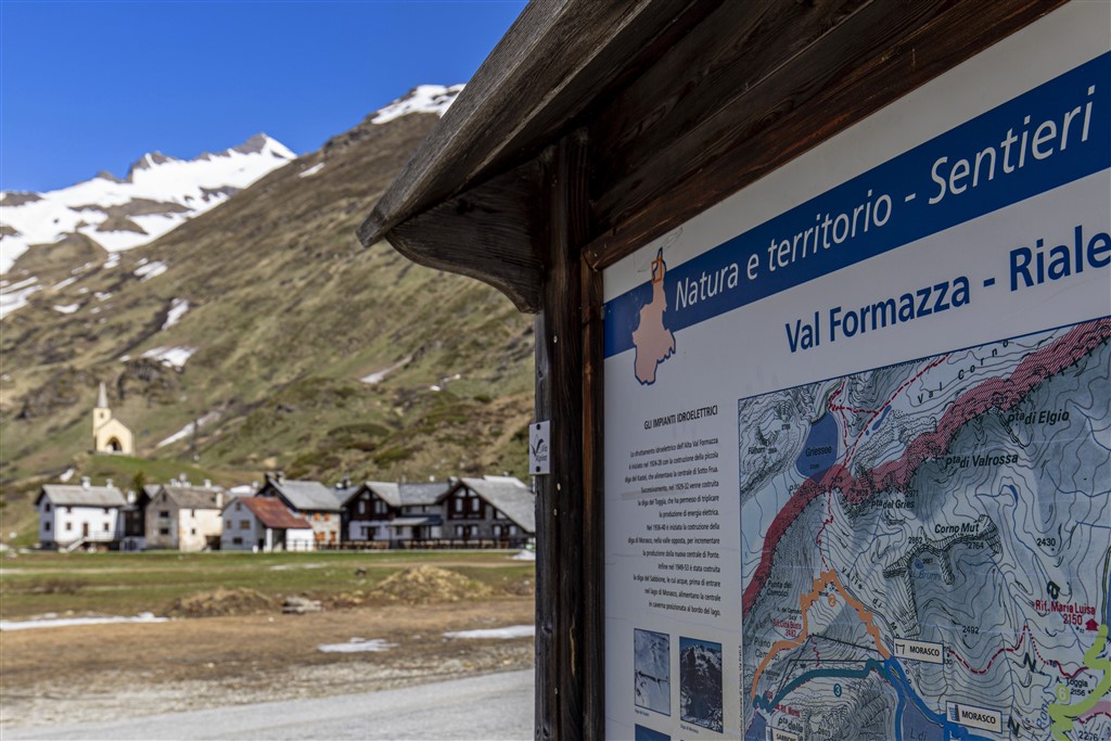
How to get there: 50 km away from Domodossola. Go towards Crodo and then towards Valle Formazza to Riale. The SS659 ends there. A pay car park and camper area are located at the foot of the dam. By bus: Domodossola-Formazza line, stop Riale (only in July and August, in other seasons it stops at Ponte di Formazza) (www.comazzibus.com).
Information: Distretto Turistico dei Laghi – www.distrettolaghi.it; IAT Office – loc. Ponte, Formazza – tel. +39 0324 63059 www.valformazza.it; Municipality of Formazza – www.comune.formazza.vb.it; Unione Montana Alta Ossola – www.unionemontanaaltaossola.it
the itinerary
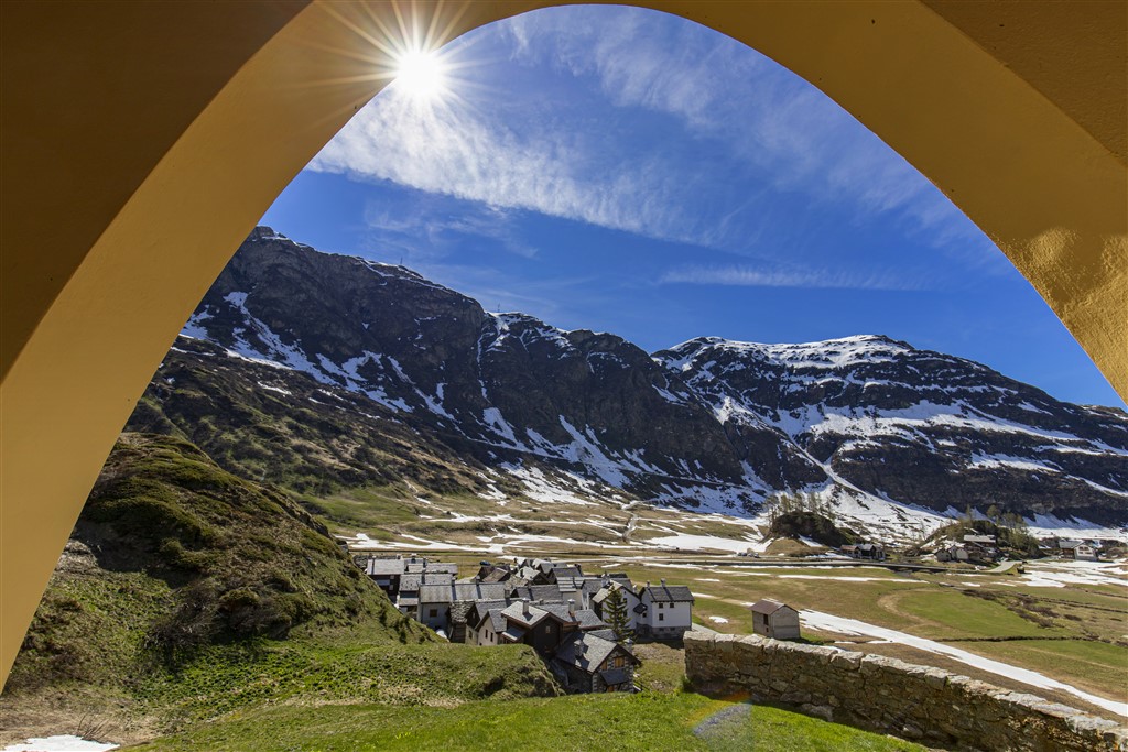
The hike starts from the plain of Riale, a village belonging to the municipality of Formazza that can boast of being the most northern part of Piedmont. In fact, Val Formazza is the extreme offshoot of this region, a peg stuck right into Switzerland that is connected through the Gries mountain pass (2479 m). Precisely from this road during the 12 century came the Walser population from Canton Wallis, who settled in the valleys next to Mount Rosa, between Piedmont and Aosta Valley, with their distinctive culture that they maintained almost until the present times. From the large pay car park adjacent to the camper area, take the asphalt road on the right that goes uphill towards the top of the dam (“G00 Lake 0h15” sign).
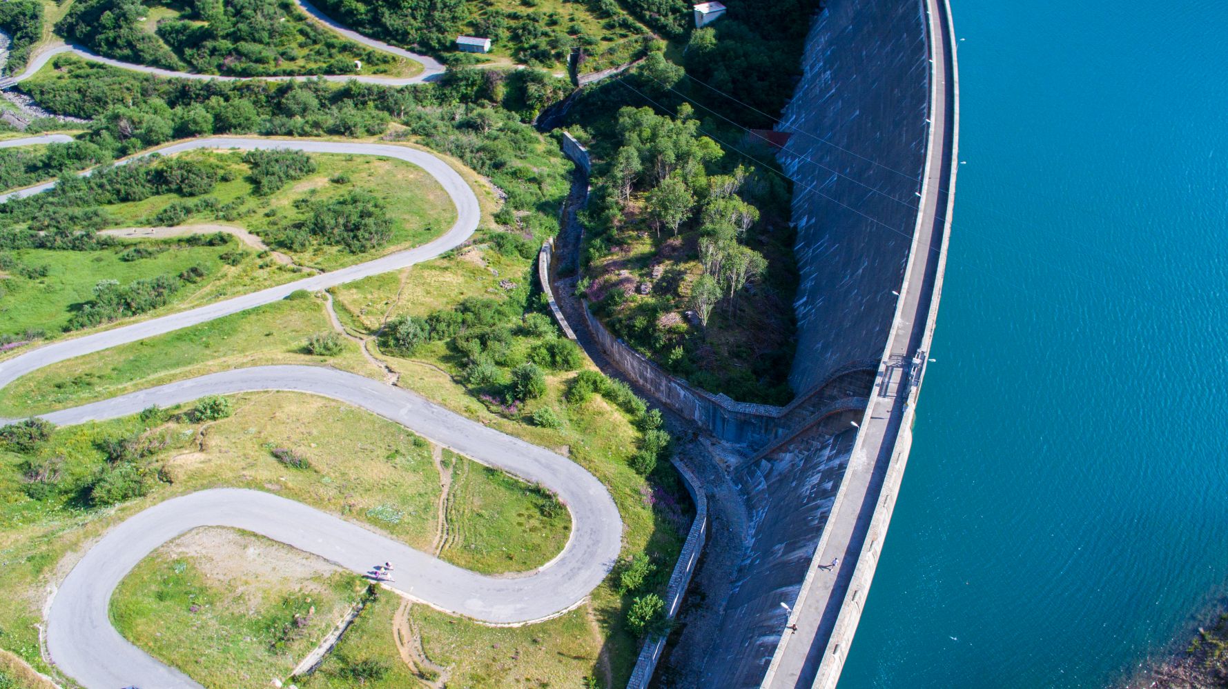
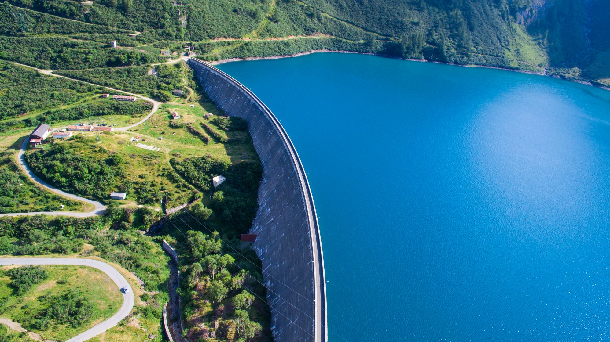
The Morasco dam was built between 1936 and 1940. It feeds the Ponte power station and produces sufficient energy for 30,000 families. When it was built, the lake submerged the village of Ponte, which was built here in the 15th century.
If you stay on the road, the uphill climb is gentle and gradual, but you can also use the trails that “cut” a more direct path up the steep curves, shortening the distance. When you reach the top of the dam, on which it would be possible to walk, continue along the dirt road that winds flat alongside the lake, and keep the water to your left. You will find a metal footbridge over the water where the lake narrows Unfortunately, it is not accessible because it serves as a winter passage for the dam personnel. You’ll have to continue on dirt road and be careful. Just a short distance ahead, you can abandon the “G00” road for a trail to the left that leads down to the bridge on the Rio Gries. After crossing the bridge, the path starts to climb up to the buildings of the electrical power plant, where it then flattens back out to become a pleasant mule track. This path winds around the western and southern sides of the lake and returns to the dam. Here, there would be a path that goes directly to the buildings below, but at certain times when vegetation is thick, it is difficult to interpret. It is better continue beyond the dam on the more obvious trail and then bend to the left and descend gradually on the dirt road that passes next to some alpine pastures where the well-known cheese Bettelmatt is produced. The road will turn to asphalt, and it leads to a refuge. From the refuge, continue on asphalt up to return to the parking area. Now, continue on the asphalt road to the village of Riale, a pleasant deviation amid the large flat pastures. After passing the building where a restaurant-inn is located, walk into the hamlet amid the houses to the left, and you will come to a small white church (fountain). If you look carefully at its façade, you will see how deep the snow was in 1951. Amazing!
As you can see from the signs in the vicinity of the village, you are now on the “Sbrinz-Route” (also known as the “Via del Gries”), a path 150 km long that goes through the Gries Pass to connect Lucerne and Domodossola. Every year in August, a parade takes place to commemorate this ancient trade route, with participants in costume and with horses and mules.
Cross the hamlet with its beautifully renovated homes (fountains), and climb to the right along a path that shortly leads to the top of the hillock where the Oratory of S. Anna stands. This 19th century building was erected in memory of the little church of the village of Morasco, submerged by the waters of the dam. The path goes back to the asphalt road that you will then follow back to your starting point.
to learn more
Gastronomy: cheese…
Bettelmatt is a cheese obtained from processing the milk from only one milking, mainly produced by Bruna Alpina cows, ripened for a minimum of two months. The forms weigh 4-6 kg, and have a smooth crust, compact consistency and a soft colour ranging from yellow gold to straw and bird’s eye holes. The cheese is produced between the first of June and the beginning of September in just nine Alpine pastures in the Formazza and Antigorio Valleys, located between 1800 and 2400 m: Bettelmatt, Kastel, Morasco, Toggia, Regina, Vannino, Forno, Pojala, Sangiatto. Records seem to show that it was already known in the 13th century and that the name derives from Walser word bettel (collection, in the sense of begging for alms) and matt (pasture), hence “pasture of the collection”, and they were normally used as commodities to exchange or as payment. Other delicious cheeses from the area include Formazza (fresh or aged), Formazza Blu (blue cheese), Sümmer (only made in summer from milk from cows that eat only fresh grass).
…and potatoes
A basic food for the mountain inhabitants for centuries, the following varieties are available: Pomater Häpfa (yellow flesh and reddish skin), Walser (yellow flesh and skin) and Occhi Rossi Roti Öigje (yellow flesh and skin, with red eyes).
The Toce Fall
You cannot climb to Riale without admiring this waterfall which, being 143 meters, is one of the highest in Europe. It was mentioned by many illustrious visitors such as Richard Wagner, Gabriele D’Annunzio, Queen Margherita, King Vittorio Emanuele III and Giosuè Carducci, just to name a few. At an altitude of 1657 m, it is easily visible from the road from Formazza to Riale, just two kilometres before the town. From the large car park, it is easy to walk to the wooden footbridge suspended over the falls, though best view is no doubt along the downhill path that runs alongside it, following a part of the track of the Via del Gries/Sbrinz-Route trail (0.7 km -150 m up to the bridge over the Toce, then you need to go further up; alternatively, from the bridge, continue up to the village Sotto Frua – where there is a power plant and an interesting Salesian chapel dedicated to the Santa Madre dell’Esperanza. You can return by bus (www.comazzibus.com). Unfortunately, since it is used to produce electricity, the waterfall is not always at its maximum strength and so, we could say that it has opening hours (www.comune.formazza.vb.it). The hotel that often appears in the photos near the waterfall is located near the parking lot and dates back to 1863. Its present appearance was achieved around 1926.
Casa Forte – Steinhause
In the hamlet of Ponte, just before the power station, we find the located the austere building called Casa Forte-Steinhause, or “Schtei hüs” (stone house). Built in 1569, it was a garrison and a check point for goods in transit along the Swiss Route. Today, it houses an ethnographic museum with objects linked to transportation of goods by pack animals (horses, mules and donkeys), storage and stocking of goods, and furnished rooms (for opening times www.comune.formazza.vb.it).
tips for young hikers
About half of the walk around the lake is accessible for pushchairs (from the car park to the dam and along the northern shores up to the power station buildings), as well as the stretch from the car park to the village and the trail that goes up to the refuge. However, pushchairs cannot travel on the section that goes from the power station buildings up to the dam (western and southern side of the lake).
Slow trekkers: Franco Voglino, Annalisa Porporato and Nora Voglino
Authors of texts: Franco Voglino and Annalisa Porporato
Back to the list of routes
A fascinating journey from the center of the Earth to the spectacular “Marmitte dei Giganti”
ANTIGORIO VALLEY: URIEZZO GORGES
Valle Antigorio
Route description
Departure and arrival location: Baceno (655 m)
Maximum altitude: Orrido Nord-Est (north east ravine – about 700 m)
Minimum altitude: Verampio (530 m)
Difference in altitude: About 200 m
Distance: 6,5 km
Walking time not counting stops: 2 hours
Type of route: mixed (trail, asphalt, dirt road)
Signs: red/white road signs
Water: fountains in centre of Baceno, others along the path
Recommended period: from March to November
How to get there: it is 20 km from Domodossola. Go towards Crodo and then towards Valle Formazza to Baceno. Car parks close to the tourist office are regulated with a parking disc. It is better to park in Piazza Aldo Moro (at the beginning of the village just after the pharmacy, on the right coming from Domodossola; parking is prohibited on Wednesdays for the street market). By bus: Domodossola-Formazza line, stop Baceno (www.comazzibus.com).
Information: Distretto Turistico dei Laghi – www.distrettolaghi.it; Municipality of Baceno – www.comune.baceno.vb.it; Unione Montana Alta Ossola – www.unionemontanaaltaossola.it
the itinerary
From the car park in Piazza Aldo Moro, cross the main road to immediately take via Fornara Francesco uphill (brown sign for “chiesa monumentale” and “orridi”), passing in front of the Fire Brigade (rest rooms) and climbing up to the monumental church dedicated to San Gaudenzio.
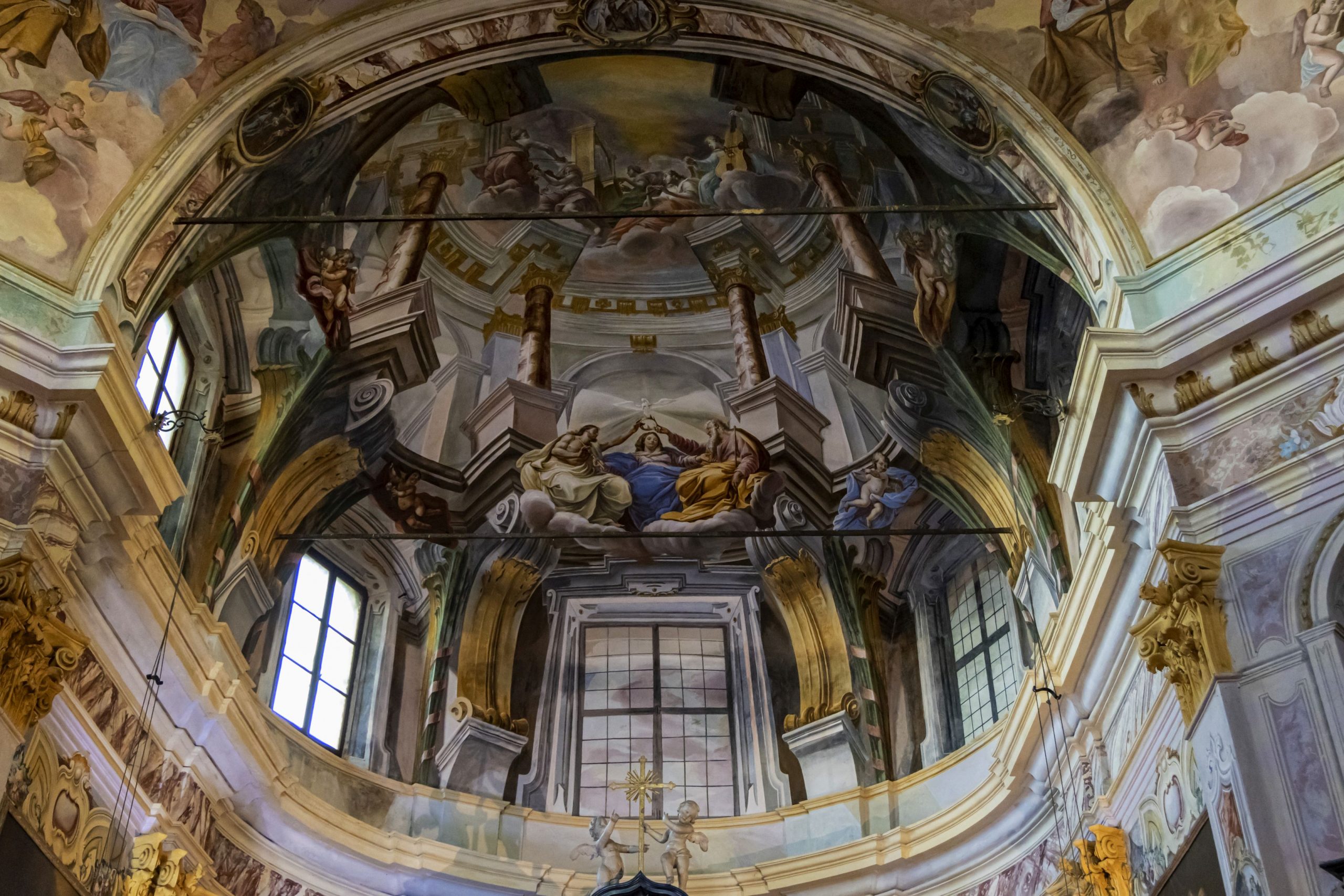
Dating back to the 10th century, the church still has a strongly Romanesque layout. It was built on a rocky spur that allows it to dominate from above. The fresco on the façade is a depiction of St. Christopher from 1542 (considered the patron saint of travellers, usually represented in very large size to make it visible from a distance and, often, used to indicate fords and bridges). Inside, saints and nobles have been painted on columns, and there is an impressive fresco depicting a crucifixion. The paintings are mostly from the 16th and 17th centuries.
Looking at the church façade, take the passage on the left, downhill under an arch (red and white sign for “H00 Orridi di Uriezzo”) and pass beneath the impressive stone arches that support the structure of the church, hoisted on the rock. The partly paved mule track leads downhill to converge onto a dirt road that must be followed to the left. In Balmacor, take a right (wood sign), still going downhill, passing in the centre of what was, at one time, a giants kettle. Just beyond a votive pillar, there is a fountain below the rocky wall, and immediately after that the road becomes flatter with a nice section among chestnut trees. At the following fork, take the right path downhill (sign for “Verampio”) to go to the left, uphill, to the fork located immediately afterwards (sign for “G34c Orrido e Oratorio Santa Lucia”).
Note: memorise this fork because you find it again on your return.
When you arrive at a beautiful isolated house (fountain), go right around the corner of the building and follow a stretch of elevated road (follow the signs for “orridi” painted on the rock) and finally you will reach the hydroelectric power station of Maiesso (fountain). Behind the power station, take the trail (highlighted by handrail) that climbs steeply and then descends gradually in the midst of a beautiful woods made up of broad leaf trees (mainly beech, birches, and alders) and a few fir trees. Once you get to the dirt road, go to the left (sign for “Orridi e Oratorio”). Ignore the staircase to the right and continue straight ahead on the dirt road (the staircase leads to the south ravine (Orrido Sud) – you’ll go there later), crossing a zone of open meadows. Please take the time to make a short detour to the right marked with the sign “Cippo del Partigiano” and “Ponte di Balmasurda 0h05”. At the end of the meadow, you will find a memorial dedicated to the partisan Luigi Fradelizio.
On 30 June 1944, during a transfer, he was shot to death by the Nazis and was not buried for several days. He left a young wife, a 2-year-old daughter and a baby boy just four months old.
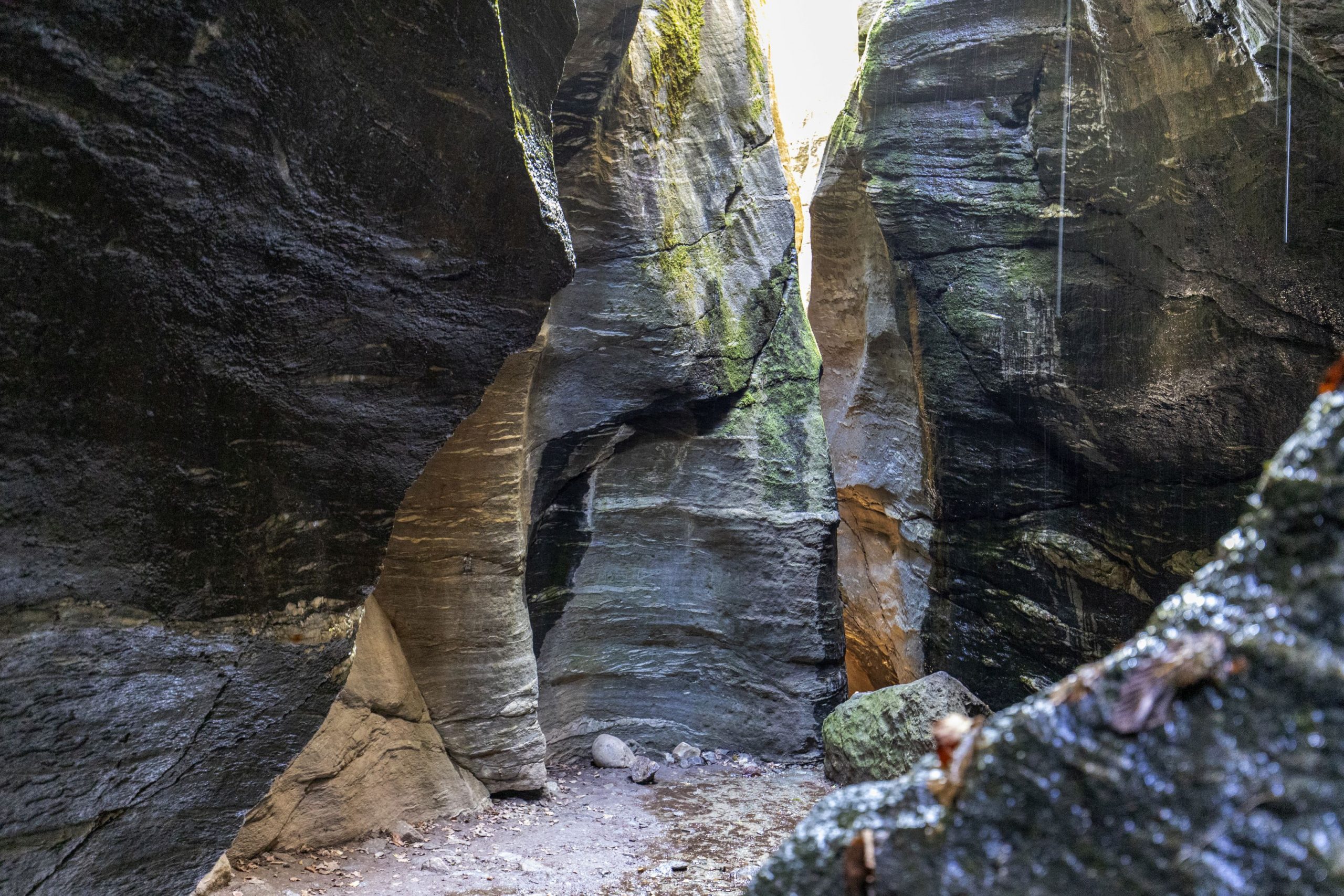
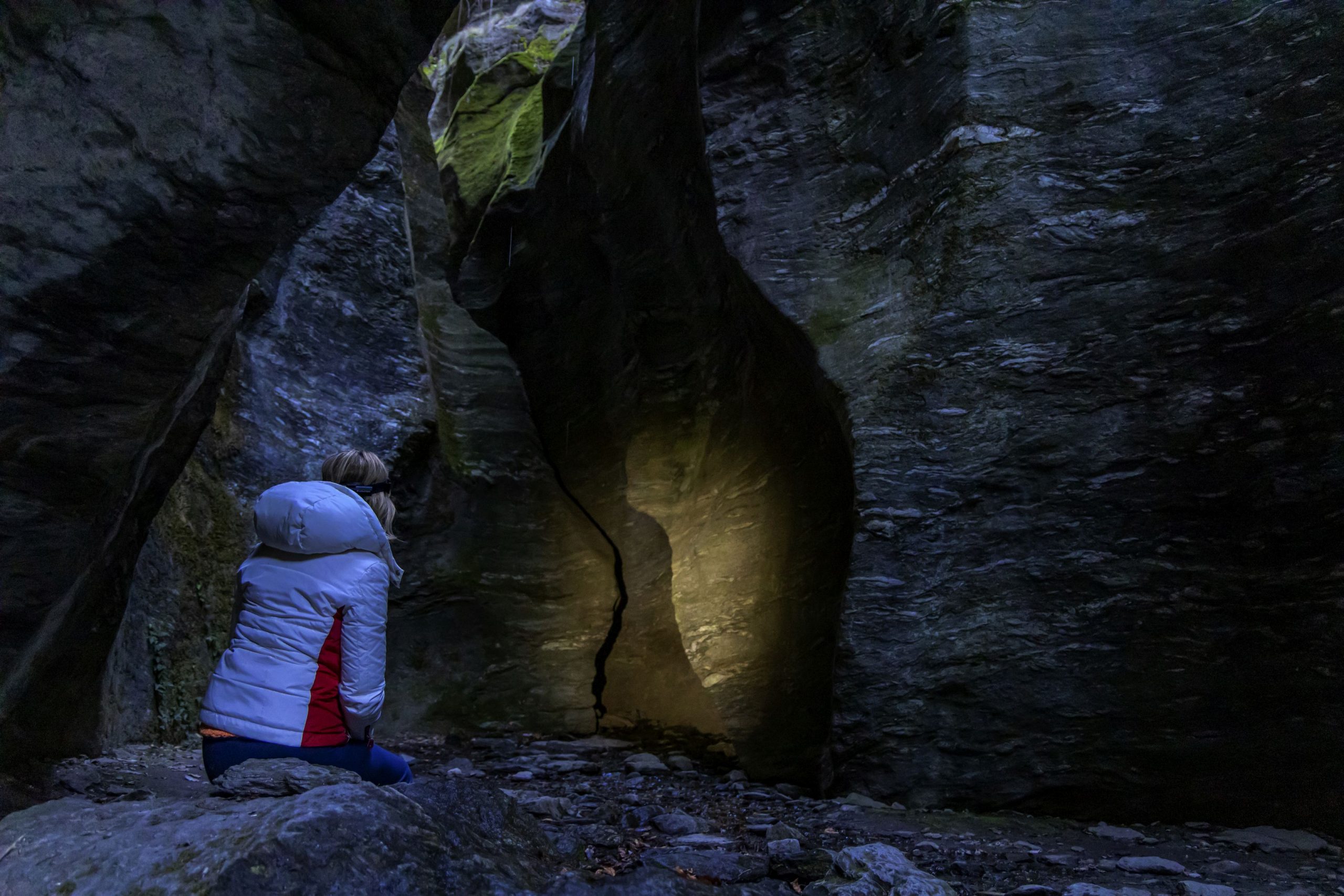
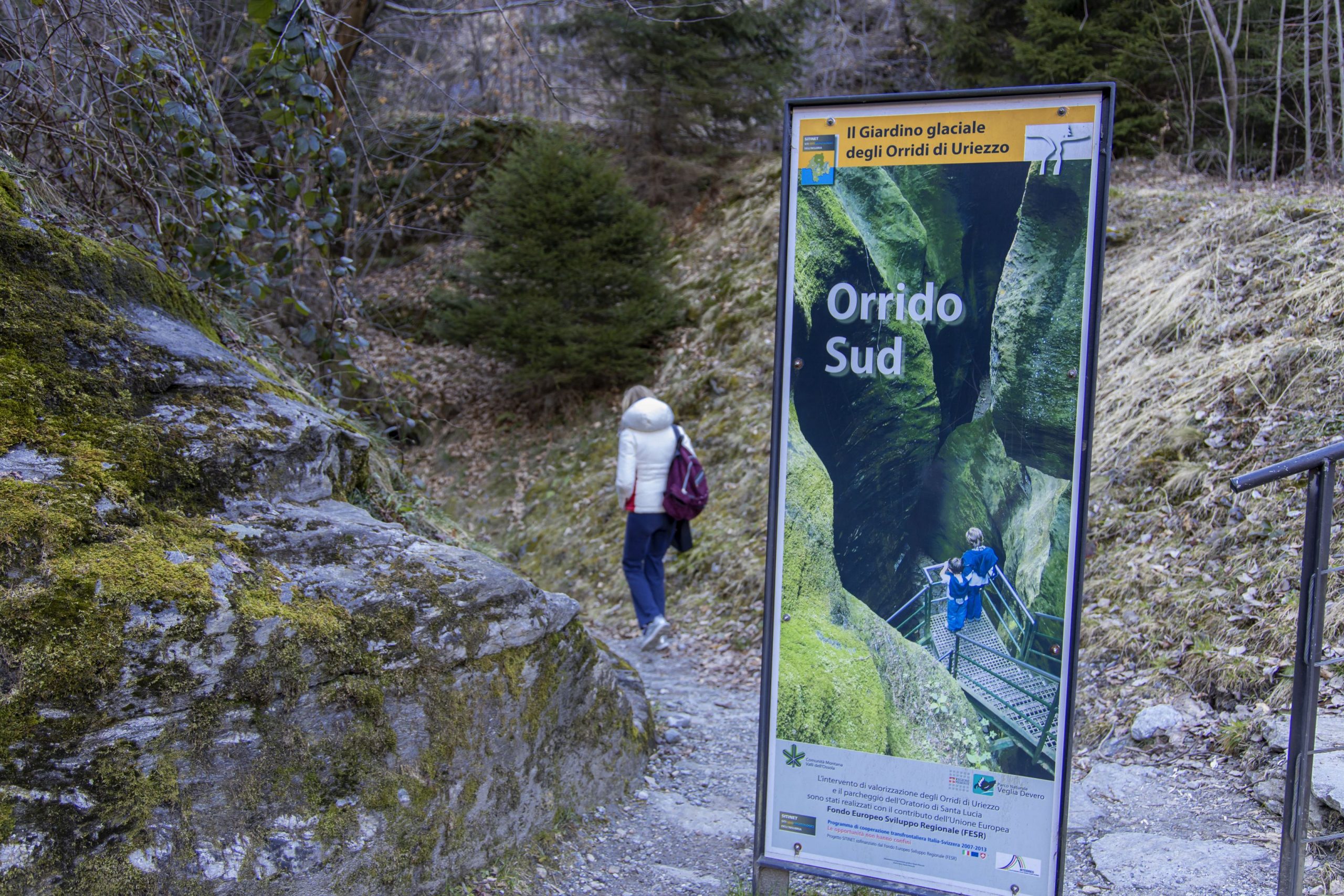
Just beyond the memorial, a short descent leads to the bridge on the spectacular Orrido di Balmasurda (gorge) where the water of the Toce river flows impetuous. Go back to the main dirt road, and travels until you reach the asphalt, where it diverts to the left uphill to follow almost immediately a path on the right (sign “Orrido sud-est”). This is where you enter the fascinating world of the Orridi.
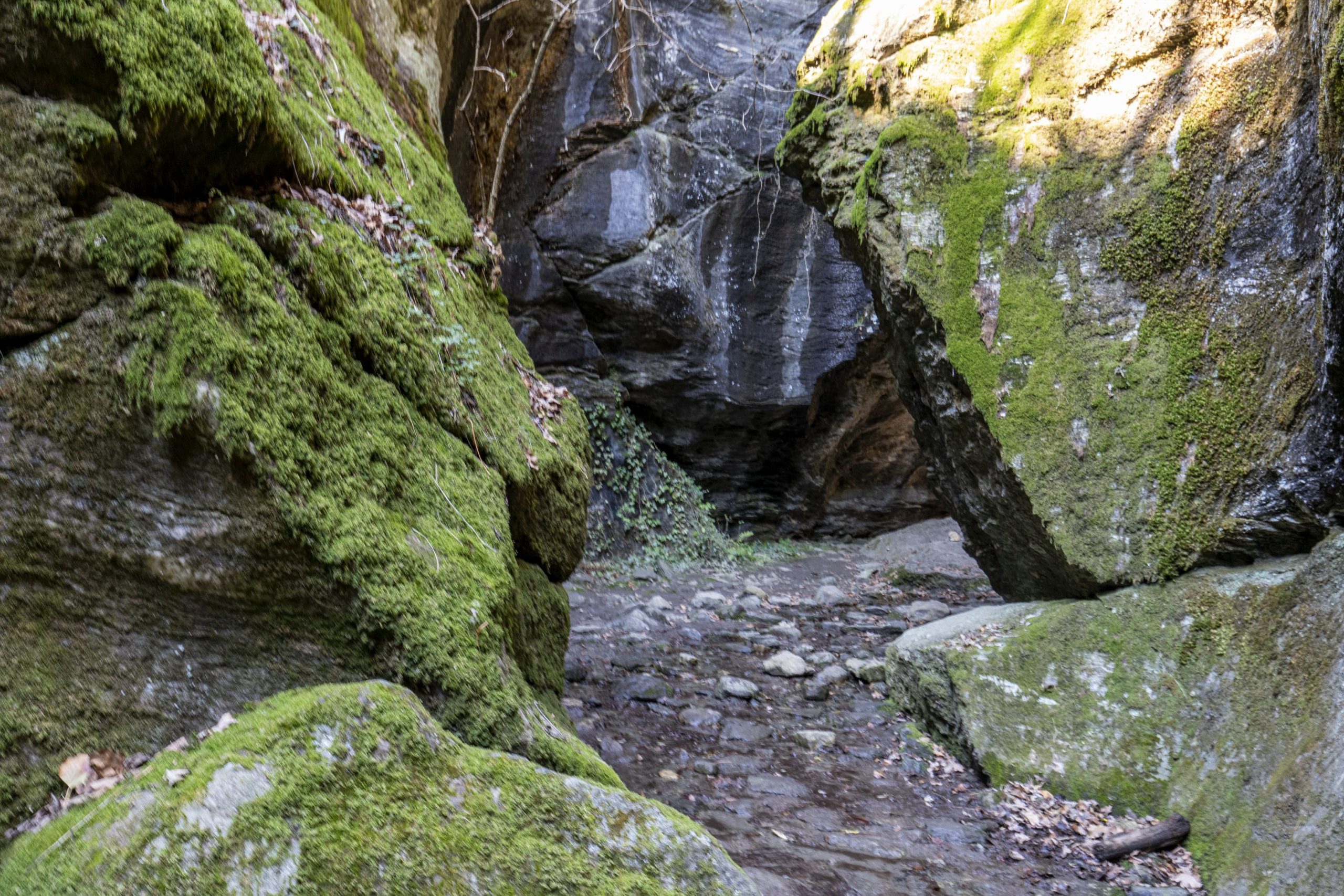
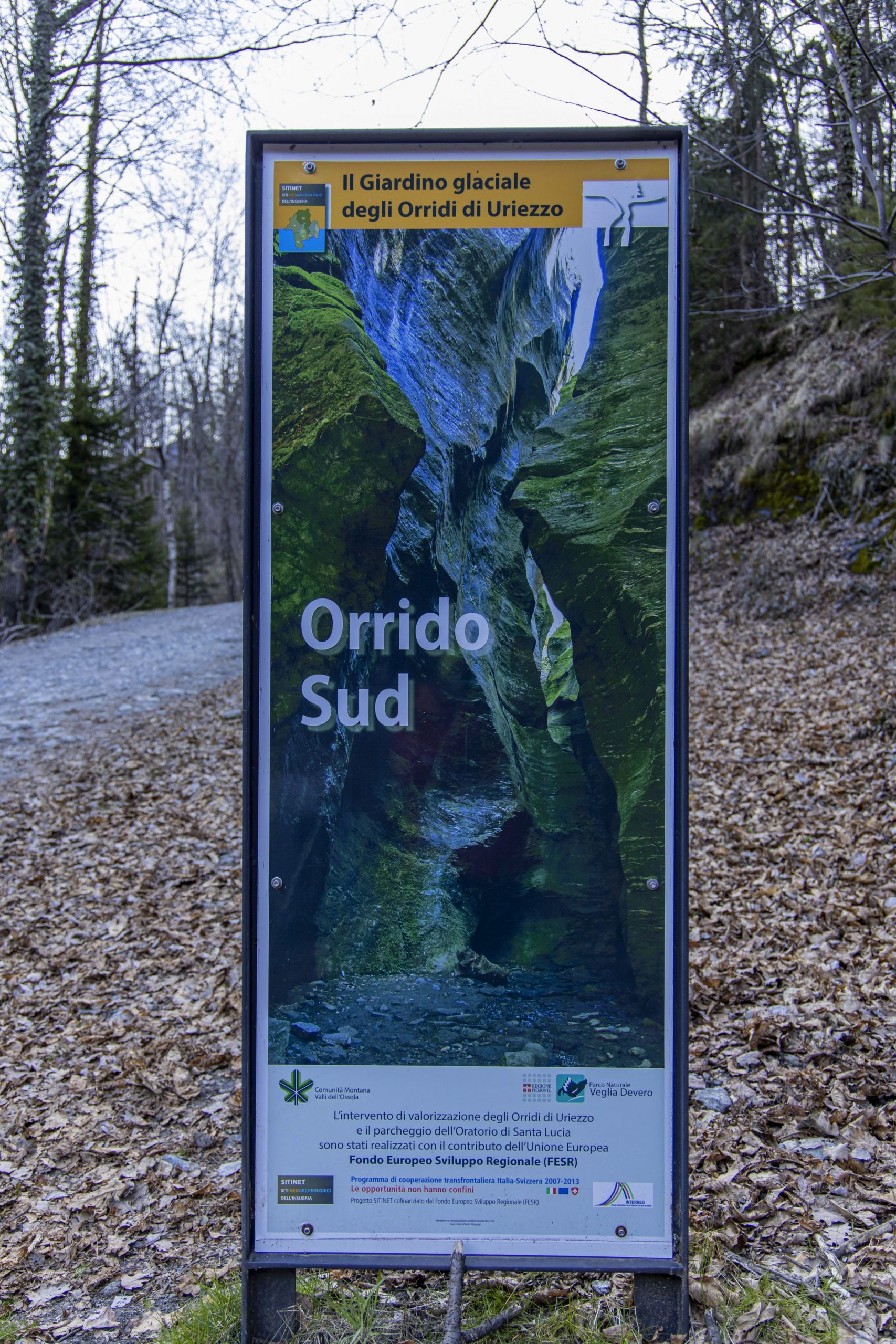
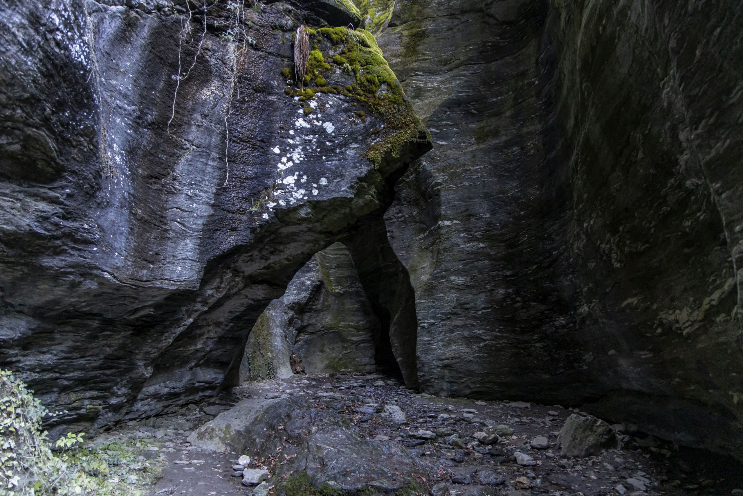
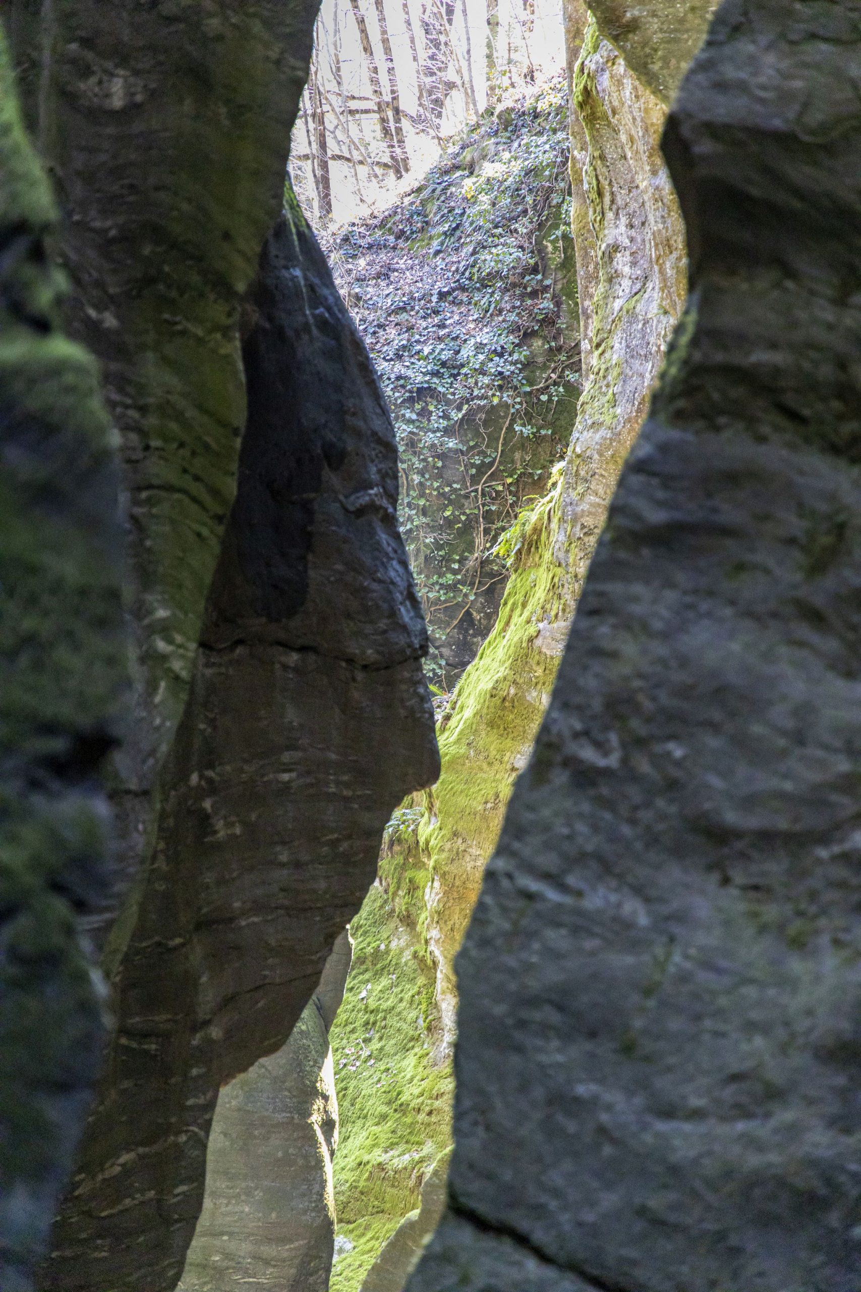
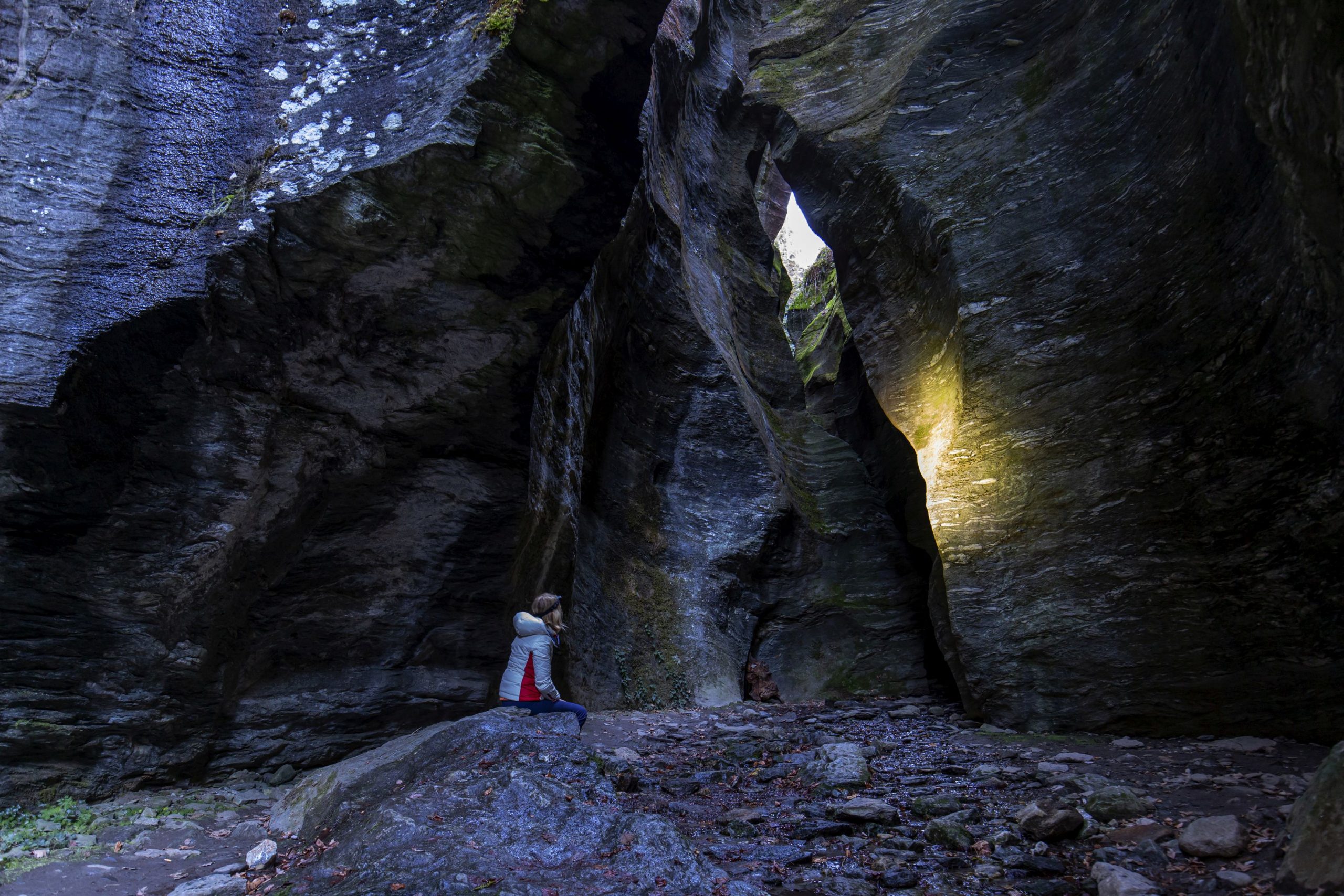
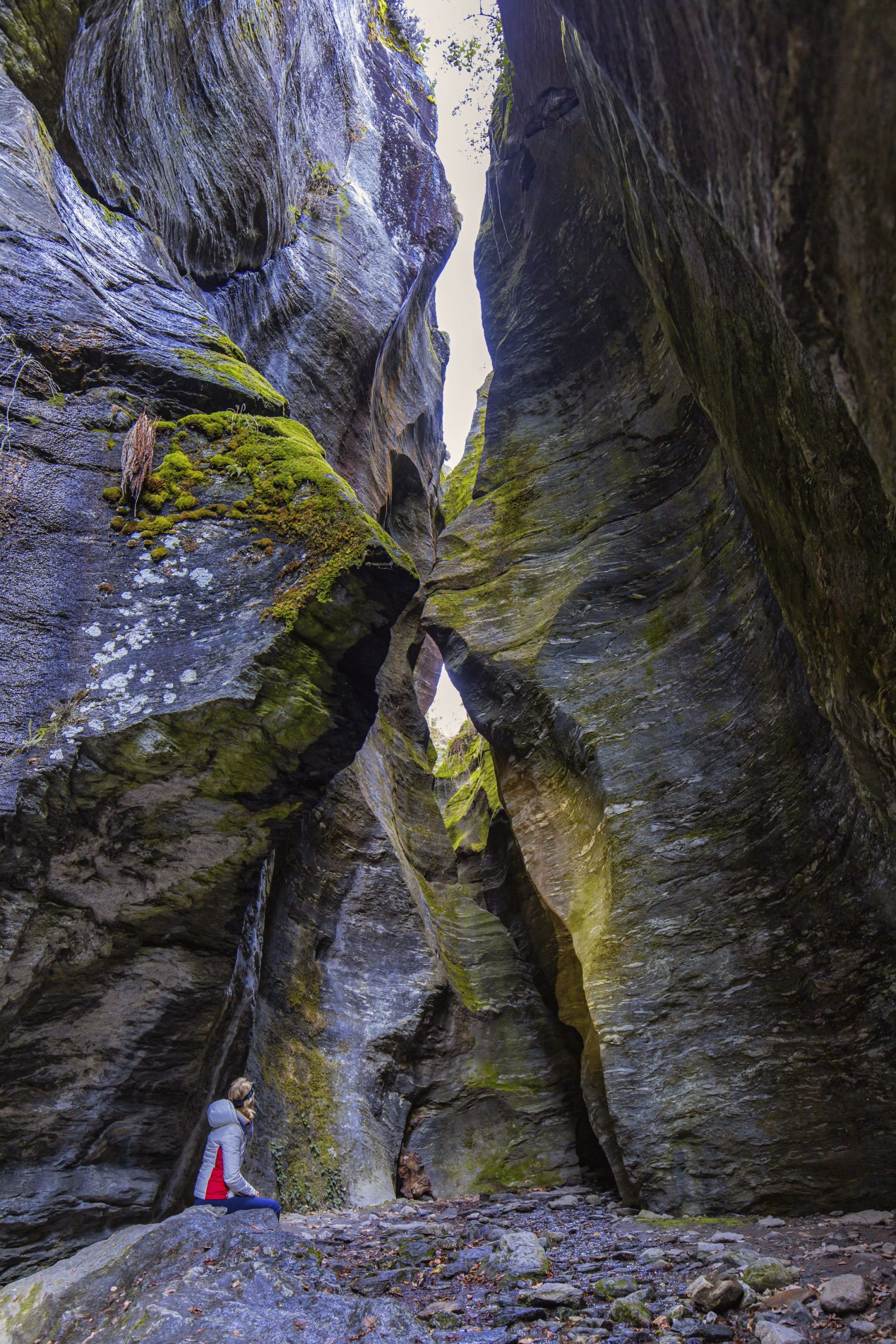
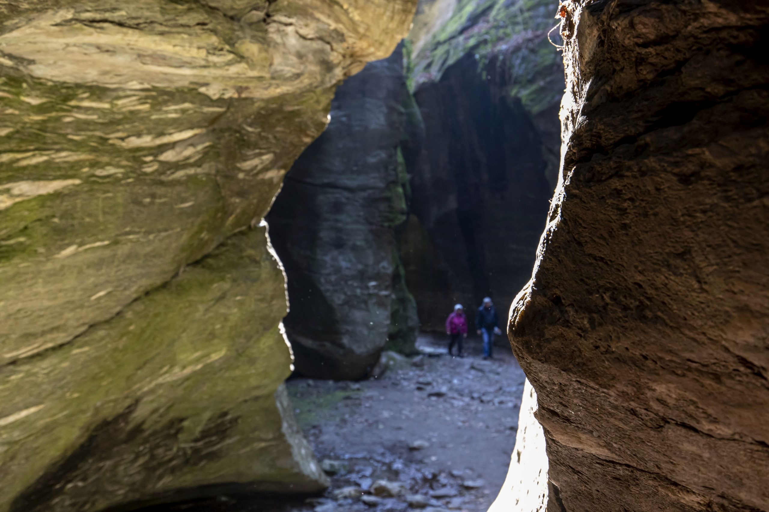
What are they? During the Würm glaciation (from 120,000 to 15,000 years ago), the territory was covered by a layer of ice that in this point was estimated to be six kilometres wide and over one thousand meters thick. The surface waters of the glacier melted and created torrents which flowed also very quickly in the layer between the rock and ice, dragging rocks and debris. This action created “holes” (Marmitte dei Giganti or Giant’s Kettle) and deep crevices, today partly dry and practicable (the ravines, “Orridi”). In the area of Uriezzo, there are three distinct ravines: the Orrido Ovest (West Ravine) is less characteristic and exposed, only for experts; the Orrido Sud (South Ravine) that you will see later; and the Orrido Nord-Est (Northeast Ravine) which is about 100 meters long.
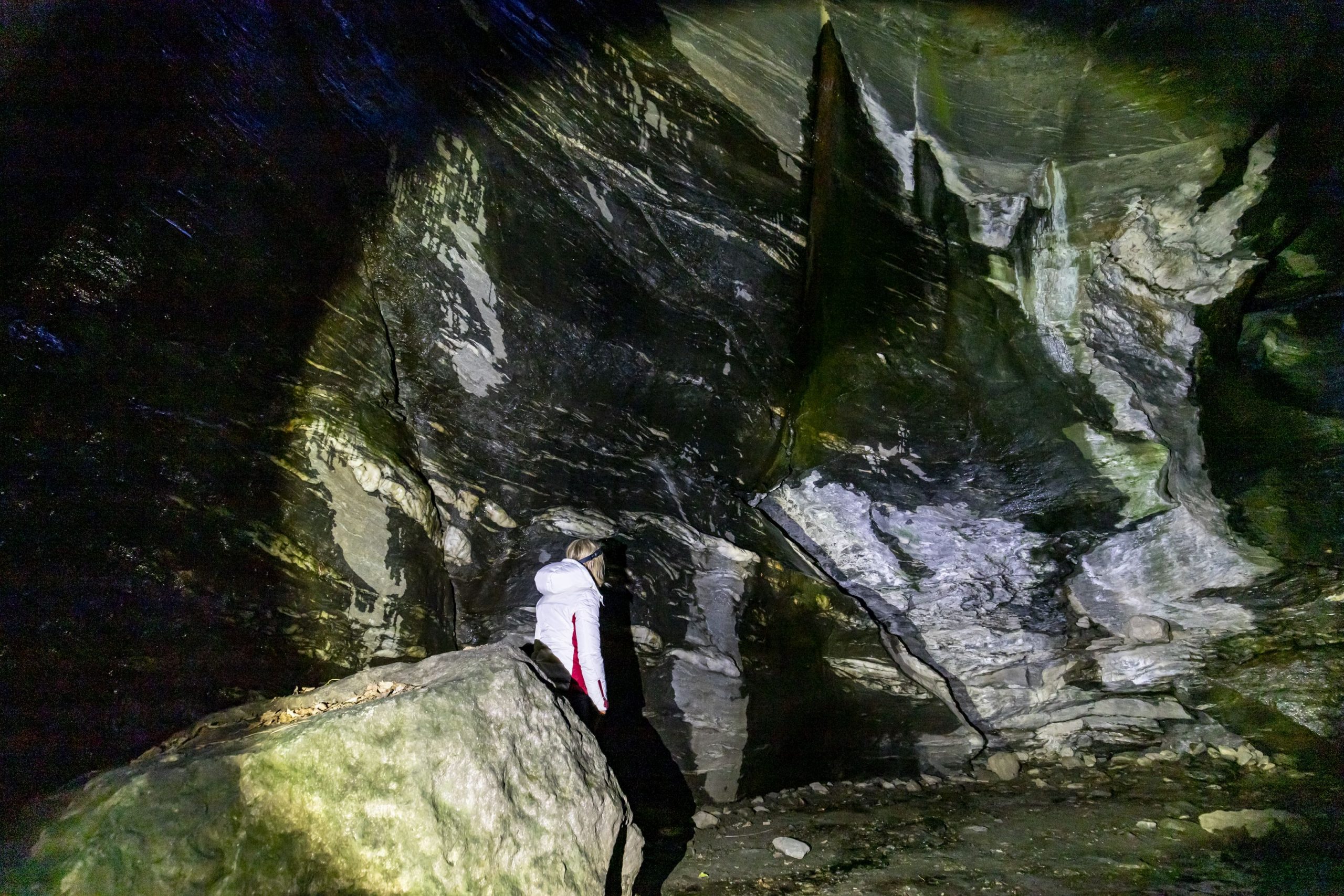
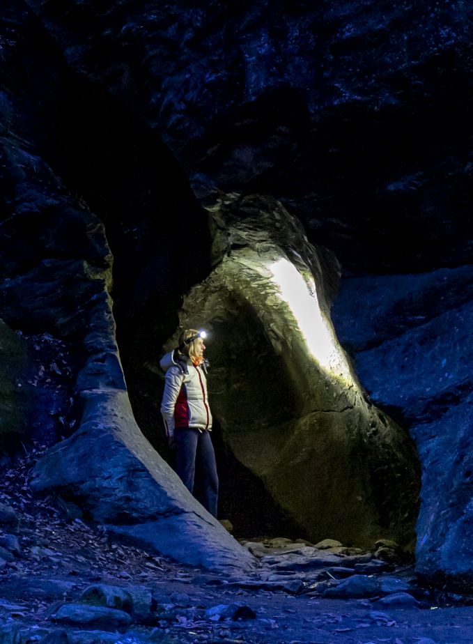
The first section is the most beautiful and characteristic, with narrow passages which seem to disappear. Not being particularly deep, the ravine is bright and pleasant, even though it does give you a strong feeling that you are entering a magical world of dwarfs and trolls. A staircase leads to the second stretch, lower and more open, that leads to an exit in a beautiful forest. From here, go back passing through the ravine again.
You can follow an alternative route along the trail in the woods, to the left, that leads to the asphalt road. From here, take a left and return to the starting point.
You can retrace the asphalted road and, if you wish, take a very short detour toward the Oratory of Santa Lucia, built in 1663, already in view. You can retrace the dirt road that you followed to return to the staircase seen previously, and from here, it is possible to descend inside the South Ravine, also called the “trumpet of Uriezzo” (Tromba d’Uriezzo). About 200 meters long, the ravine has narrow passages that alternate with wide rooms while the walls rise as much as twenty or thirty meters in a continuum of suggestions that are difficult to make in a few words. At the end, you come out near a bridge: if you go under it, you will see two small waterfalls; if you climb up the stairs before you get to it, you will be on the dirt road.
If you want to relive the excitement of the ravine, go back through it. Once you get back, the dirt road bends to the left always following the signs for “Verampio”, and you will find yourself on top of this bridge.
Continue on the dirt road (towards left when you come out of the bridge stairs) in continuous and constant descent, until you get to a fork. Take the left again (follow the sign for “Marmitte dei Giganti”) and in a short time you will come to a bridge over a stretch of the Toce River where a long time ago, most of these geological formations formed (fountain).
Carefully (the rock can be very slippery: Caution!) you can descend to the edge of the water, but watch lively children closely because too lively since the current is strong. Better to stay at the “conche”, the smaller and quieter points.
Admire the Giant’s Kettle, and then dirt road going back up to the fork (signs for “Verampio”) and, always going downhill, you will reach the first houses of this village. Cross a ford and take a right (sign for “Baceno”), passing between some homes on a grassy track that leads to a humpback bridge (sign for “Baceno Chiesa”). After you pass that, you will start to climb along a path that is partly cobblestones (slippery if it rains). The climb is continuous and marked, and passes through a small abandoned village with a small oratory, a trough fountain and a building with a fresco. You will reach the fork that you passed through previously (see the first “note” above). From this point, you can retrace your way back on the trail that you took at the beginning of the walk to return to the monumental church of Baceno.
to learn more
Croveo, the “torchio” and “marmitte”
In Croveo, a hamlet just above Baceno, you will find an ancient “Piedmont-style” lever wine press (“torchio”) with a beam 8 metres long. It was recorded in the history books as early as 1860, but it was probably already present before that because the beam is engraved with the date 1766. It was private property, but was used by the whole community, and it represented a meeting point because it took eight people to manoeuvre it. They took turns alternating two teams of four at a time. The term “torchio” not only indicate the actual wine press, but the whole building, which also houses a millstone. Once used to process apples, nuts, and hemp, it was also used in squeezing a now extinct type of pear, the “pir”, a tart fruit that was not really pleasant. The juice of this fruit was used to make a sort of sweet wine, the “vino di pir” (probably similar to the current French “poirè”, a cider made from actual pears).
Croveo is also the location of the Marmitte di Croveo, geological formations similar to the Giant’s Kettle that are visible from the stone bridge. They can be reached in 5 minutes by foot, starting from the central square.
tips for young hikers
Pushchairs and strollers cannot go inside the ravines because the trail is not level and there are metal stairs. This hike can be very muddy and slippery in case of rain.
Slow trekkers: Franco Voglino, Annalisa Porporato and Nora Voglino
Authors of texts: Franco Voglino and Annalisa Porporato
Back to the list of routes
High altitude walk with wide and spectacular panoramas
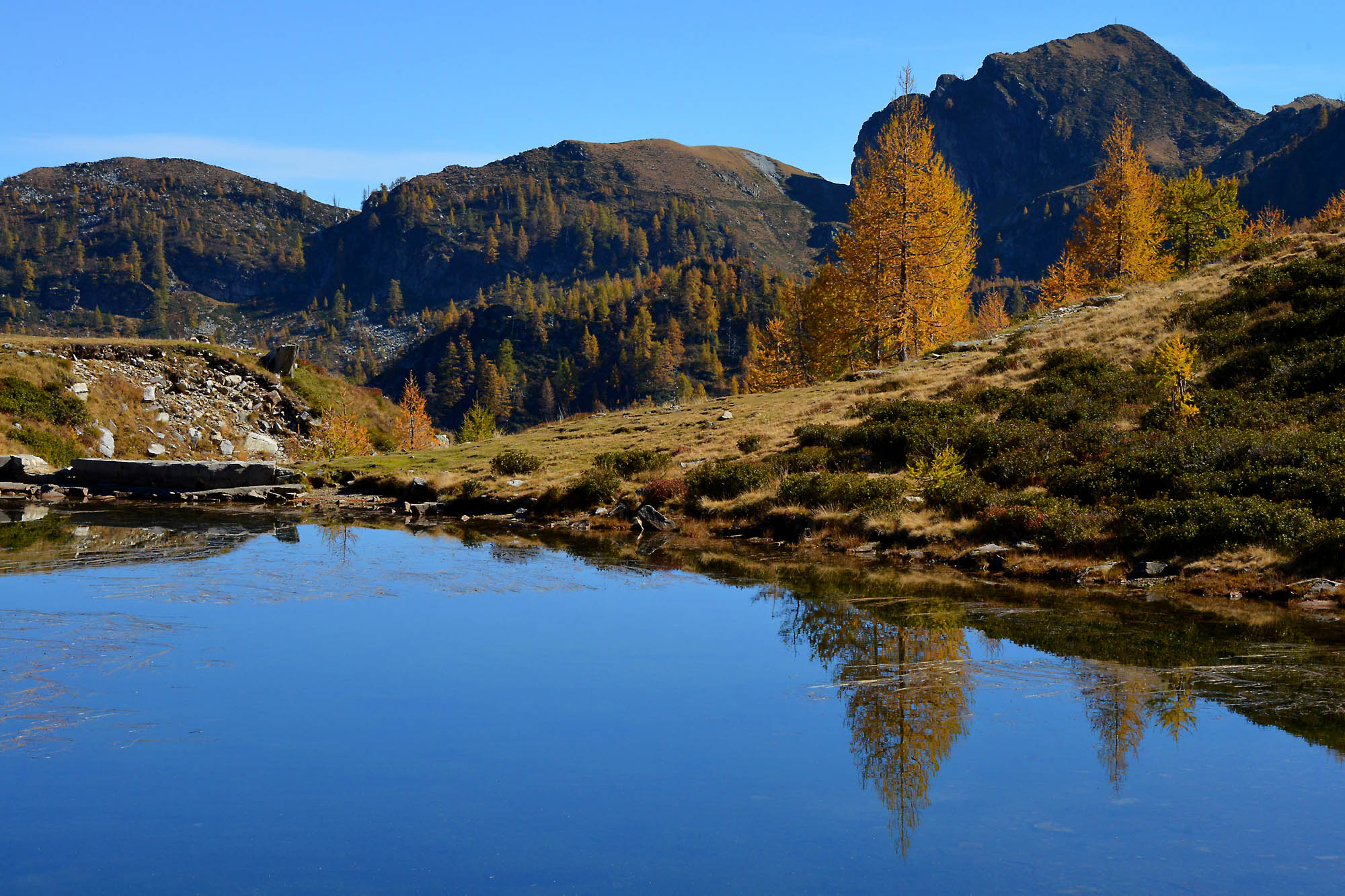
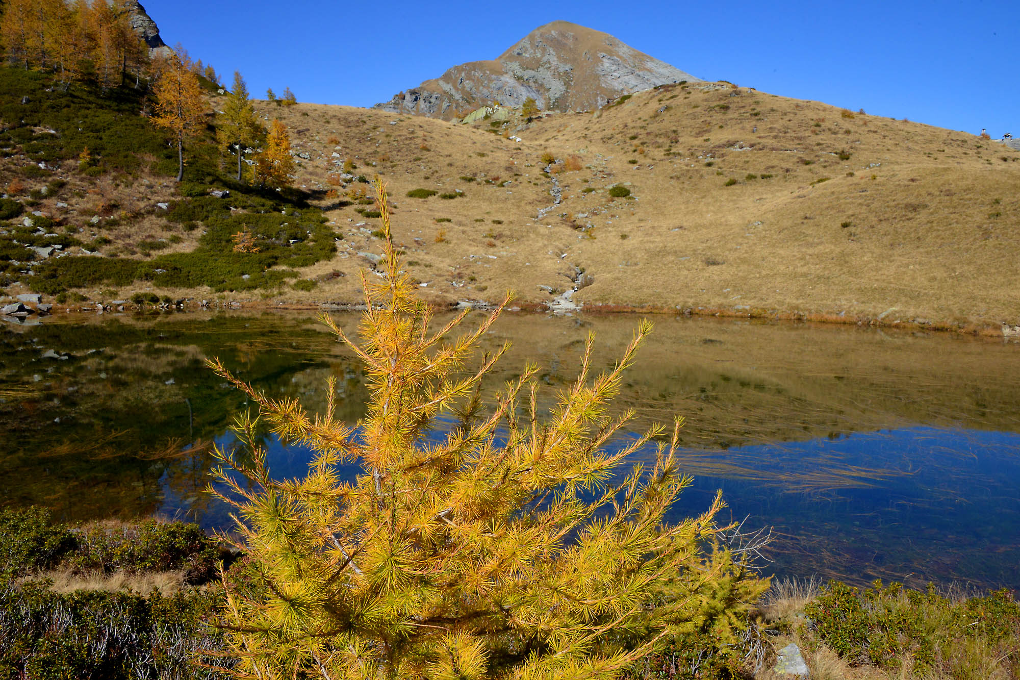
VIGEZZO VALLEY: MUINO LAKES
Valle Vigezzo
Route description
Departure location: Piani di Vigezzo (1700 m)
Place of arrival: Muino Lakes (1922 m)
Maximum altitude: Bocchetta di Muino (1974 m)
Difference in altitude: +300 m -80 m approx. one way
Distance: 3 km one way
Walking time not counting stops: 1 hour and 30 minutes, one way
Type of route: dirt road and trail
Signs: M25 red/white signs
Water: fountain at Piani di Vigezzo and along the dirt road
Recommended period: from June to October
How to get there: 18 km away from Domodossola. Head in the direction of Valle Vigezzo and Locarno along SS337. Just after the village of Santa Maria Maggiore, follow signs on the right for “Craveggia” and shortly thereafter to the left (white sign “Benvenuti a Prestinone”). Parking areas near the cable car station in Via Carlo Fontana (www.pianadivigezzo.it). By train: Vigezzina-Centovalli line, stop Prestinone, 700 meters from the cable car station (www.vigezzinacentovalli.com)
Information: Distretto Turistico dei Laghi – www.distrettolaghi.it; IAT office – Piazza Risorgimento 28, Santa Maria Maggiore – tel. +39 (0)324.95091; Municipality of Craveggia – www.comune.craveggia.vb.it; Unione Montana Valle Vigezzo – www.unionemontanavallevigezzo.it
the itinerary
In ten minutes, the Prestinone cable way will take you from 825 to 1726 meters at Piana di Vigezzo, a difference in altitude of 901 meters. Leaving the station, with the cable way facilities behind you, stop for a moment to admire the panorama that opens from the meadow in front of the houses. Then take a left after passing between the houses (red/white sigh “GTA L.tti Muino M25″). The wide stony dirt road starts climbing decisively and becomes steep. A short detour on the left leads to a fountain. A second fountain is located in a little further up, near some wooden tables. After these, the dirt road becomes slightly more gradual and abandons itself to a net curve to go toward the left, along a footpath (red/white sign for L.tti Muino M25”), which continues to climb steadily and continuously, without interruption, until it brings you to Bocchetta di Muino (1974 m) characterized by a votive pillar and a wooden statue dedicated to smugglers (“spalloni“).
The “spalloni” were smugglers who went back and forth across the Alps between Switzerland and Italy, introducing different products illegally (from salt to cigarettes, depending on the time period). However, they have taken on a romantic aura because although they ran an illegal business, they literally helped the populations of the border to survive.
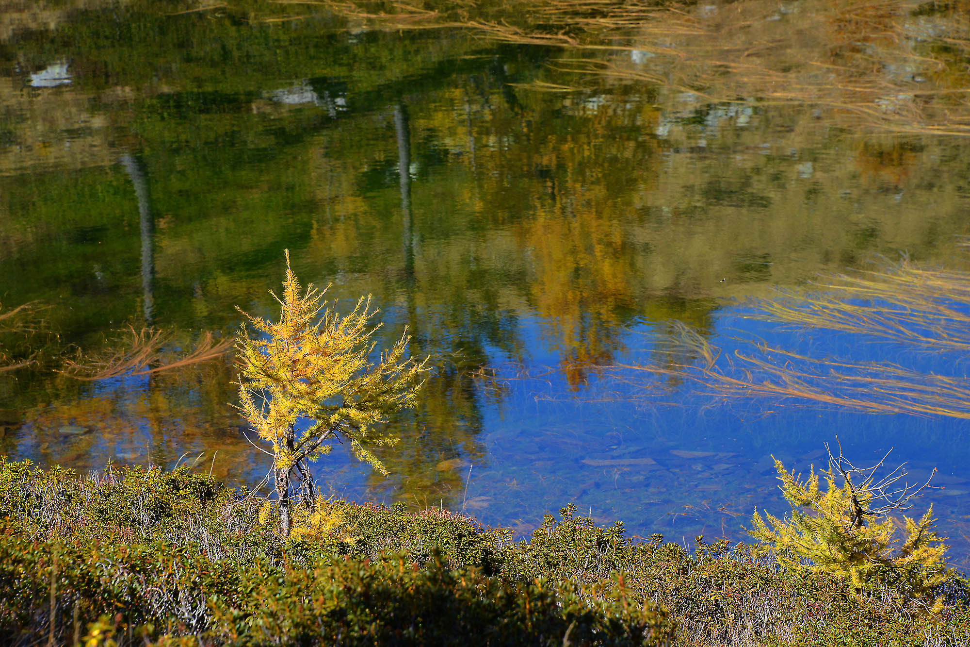
The climb is finished, and the trail goes downhill beyond Bocchetta di Muino continuing in the Onsernone Valley along the downhill path (red/white sign for “M25 L.tti Muino”) that goes much more uphill from Alpe Canva (note the curious shape of the higher building: this is an avalanche barrier), and dramatically changing environment since you are going from areas planted with trees to large mountain grasslands right before the first of the lakes (1922 m).
If you pay a little attention, it is possible to walk around the whole perimeter of the lake and, especially toward the area furthest from the path, you can see many frogs that populate the area while the tadpoles prefer the area closest to the trail.
After passing the lake, go towards the refuge bivouac of CAI Vigezzo, continuing beyond, the trail is now flat and soon leads to Alpe Ruggia (1880 m) and the second lake, larger than the first and usually full of vegetation that is transforming it into a peat bog.
to learn more
Vigezzo valley
A unique valley in the Ossola area that extends from west to east. It has an average altitude of 800 meters, and is very wide and gradual, and lends itself well to “horizontal” sports such cross country skiing or dog sledding. It is called the “Valley of Painters” for its well-rooted painting traditions. Starting in the second half of the 17th century until the 19th century, artists from this area left to paint all over Europe. A well-illustrated story is proven by the presence, in Santa Maria Maggiore, of the Art School founded by the painter Rossetti Valentini, who made sure it was free to teach anyone the basics of painting. But there is also a history of hard physical work, such as the profession of the chimney sweeps that also came from this valley. Many were children, and they travelled afar to work. They are remembered in the Museum of the Chimney Sweep, at Santa Maria Maggiore (www.museospazzacamino.it; www.santamariamaggiore.info; www.comunesantamariamaggiore.vb.it). Today, the valley is known mainly for the tourist train Vigezzina-Centovalli that connects Domodossola to Locarno in Switzerland. The journey is unforgettable! The Vigezzo valley, through the town of Malesco and the Loana valley, is also one door to Val Grande National Park, the largest wilderness area in Italy, wild and isolated. You should try these paths only if your are good shape. Families can get a taste of this large park through some nature trails (www.parcovalgrande.it).
tips for young hikers
An easy walk, that presents no particular difficulties except for the steep initial climb on the dirt road, which small hikers could find a little boring. “Boredom” will soon be forgotten at the two small lakes where tadpoles and frogs swim. Not suitable for pushchairs.
Slow trekkers: Franco Voglino, Annalisa Porporato and Nora Voglino
Authors of texts: Franco Voglino and Annalisa Porporato
Back to the list of routes