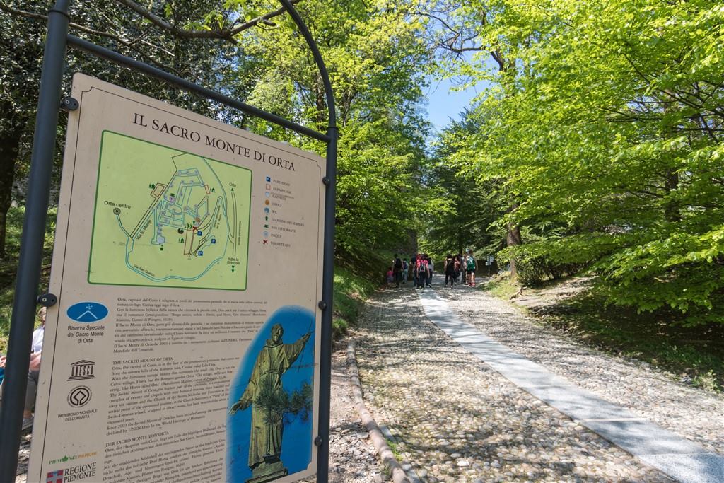
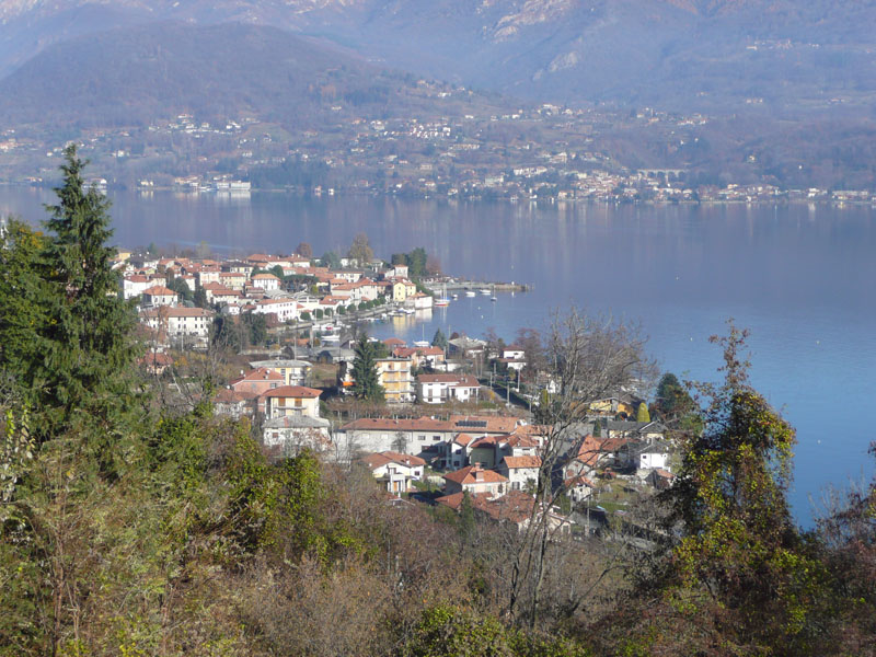
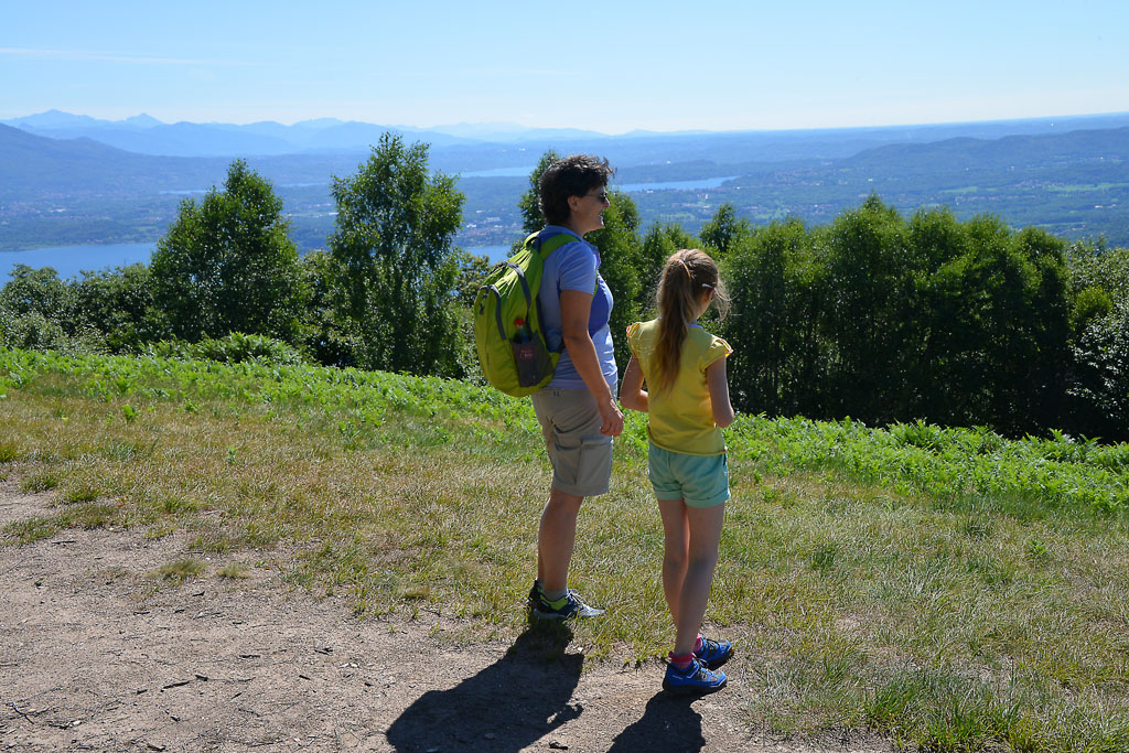
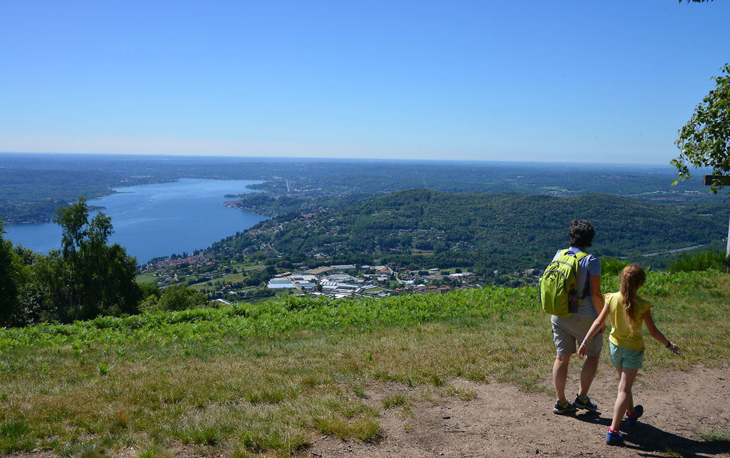
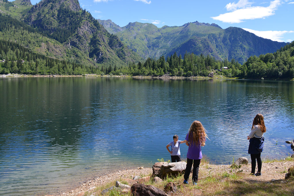
A circular walk of easy to moderate difficulty starting in centre of Domodossola and leading to one of the Sacri Monti
THE ANCIENT VILLAGES OF DOMODOSSOLA
Domodossola e dintorni
Route description
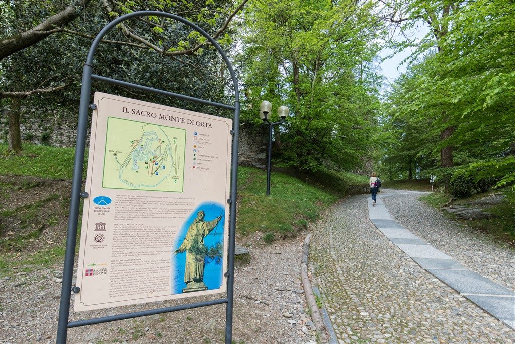
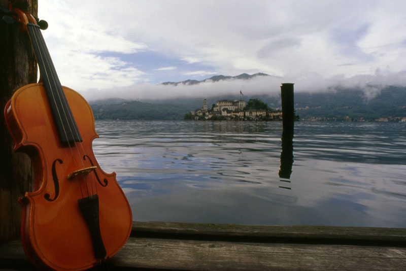
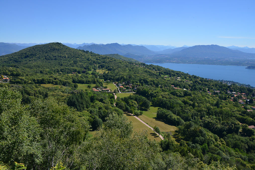
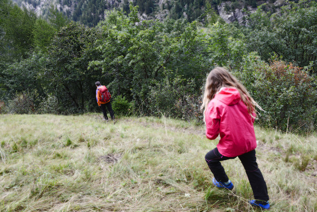
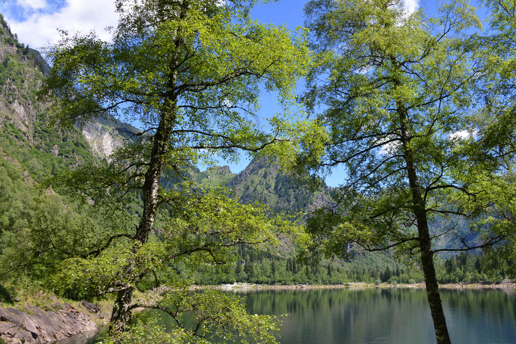
A circular walk of easy to moderate difficulty starting in centre of Domodossola and leading to one of the Sacri Monti (a UNESCO World Heritage Site). The path goes through the ruins of ancient villages in what used to be the municipality of Vagna.
Departure and arrival location: Domodossola railway station (270 m)
Maximum altitude: Vallesone (670 m)
Difference in altitude: About 400 m total
Distance: 8 km total
Walking time not counting stops: 3 hours total
Type of route: mixed (trail, asphalt, cobblestones, dirt road)
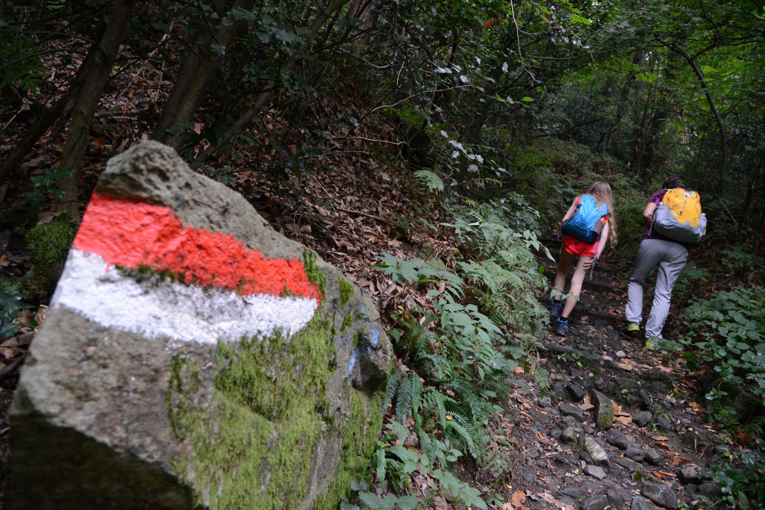
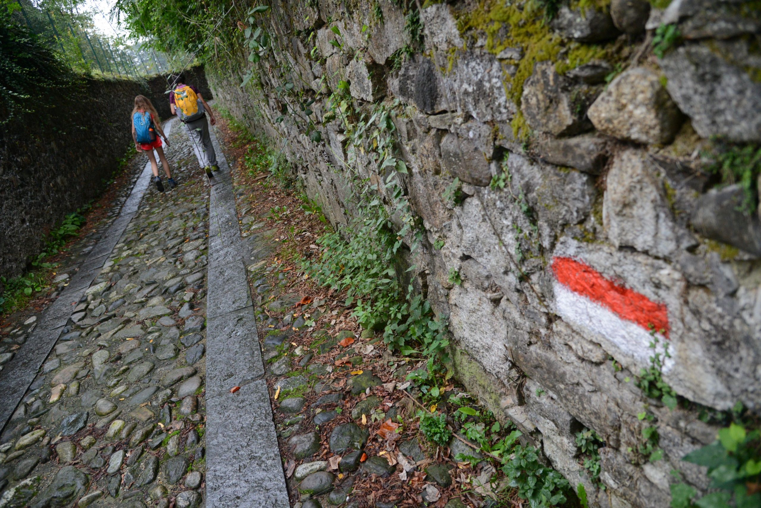
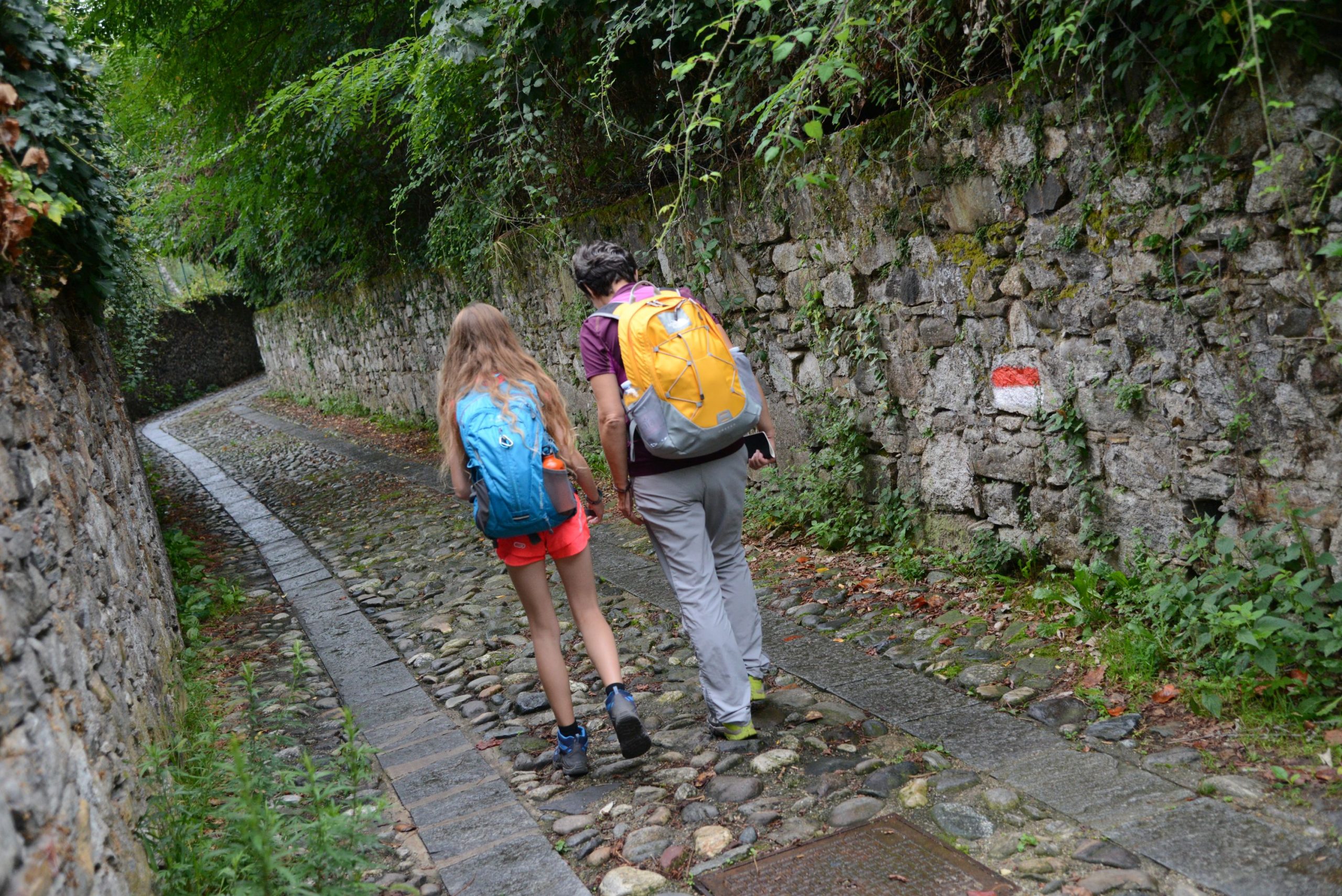
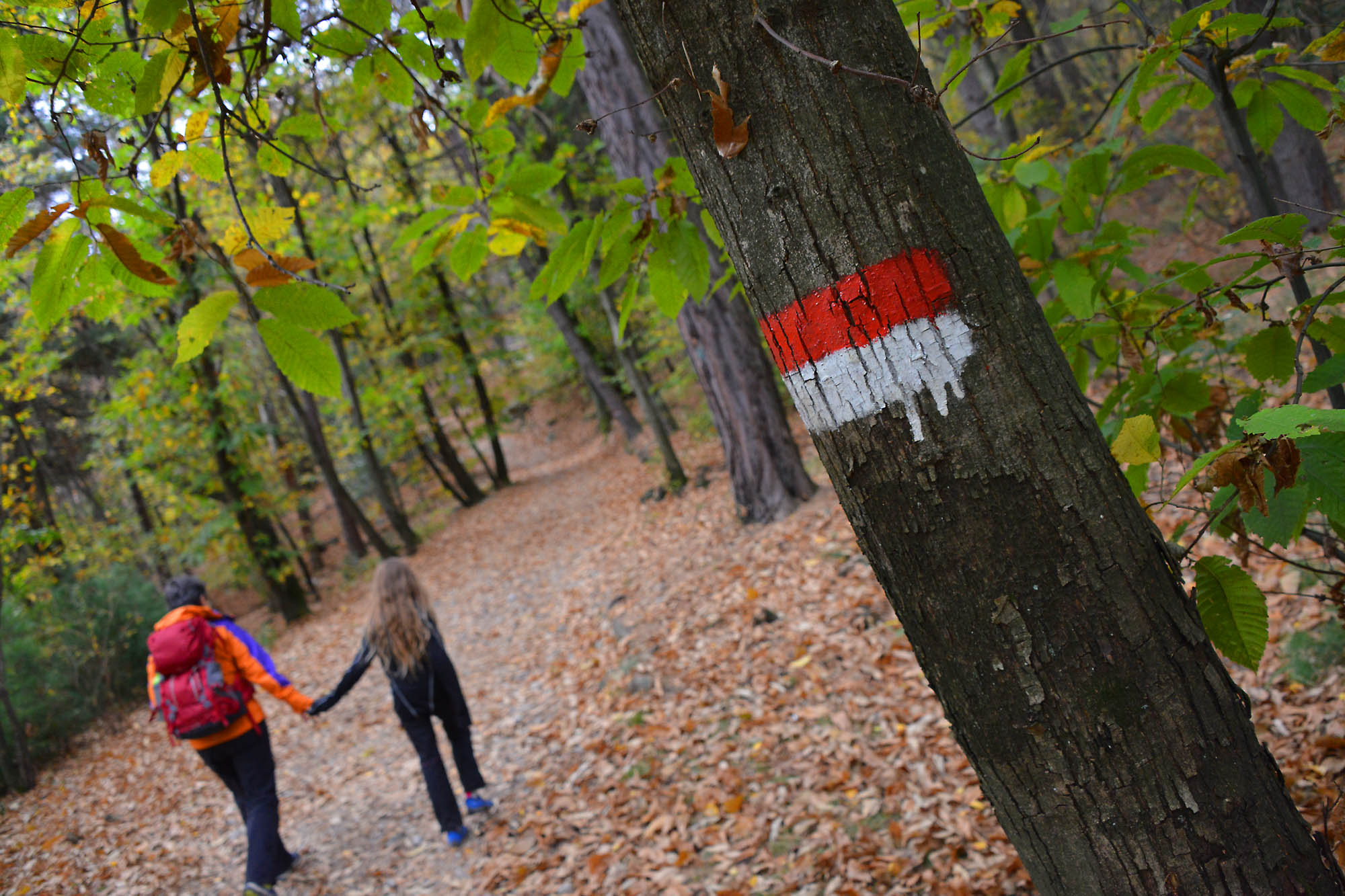
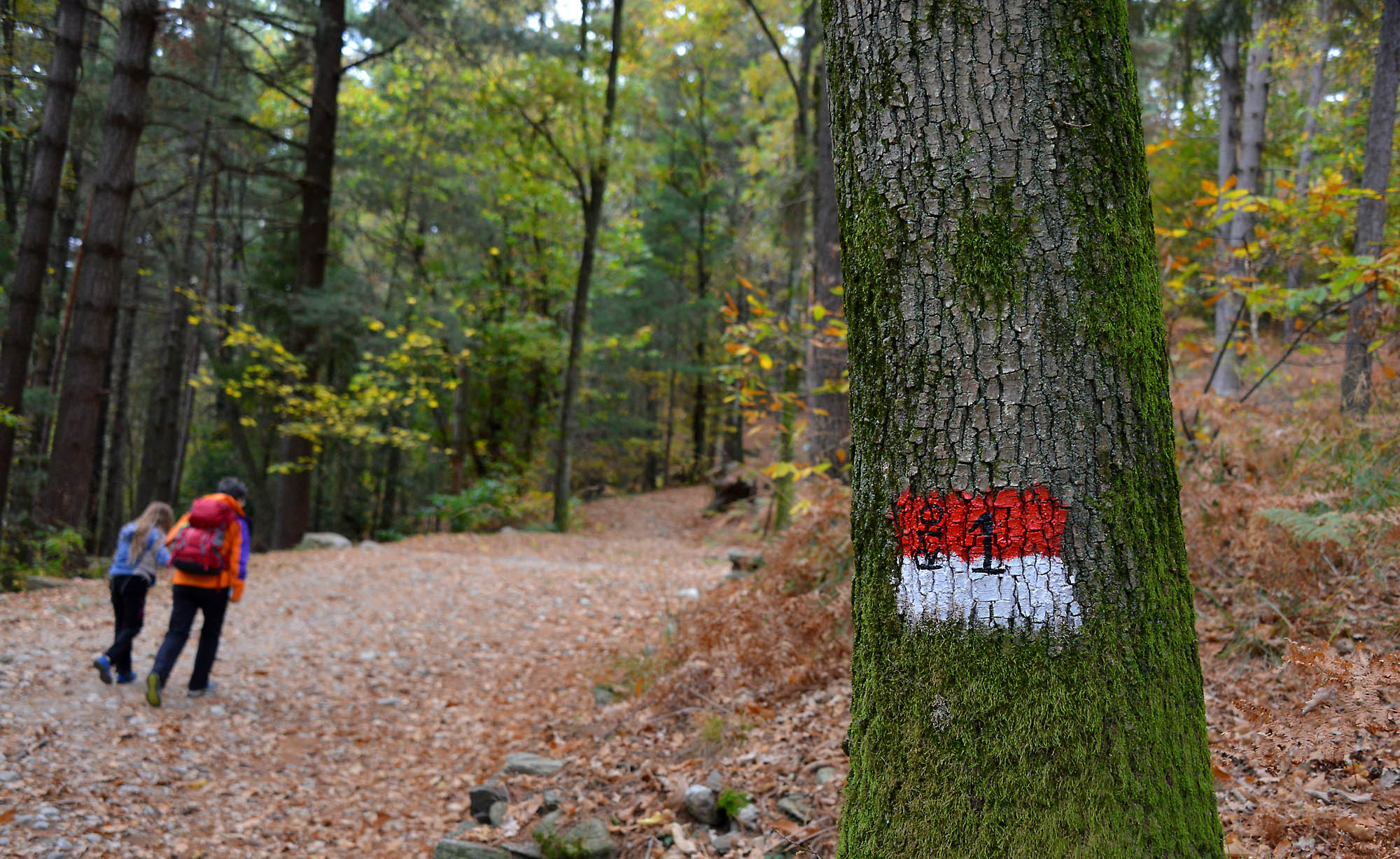
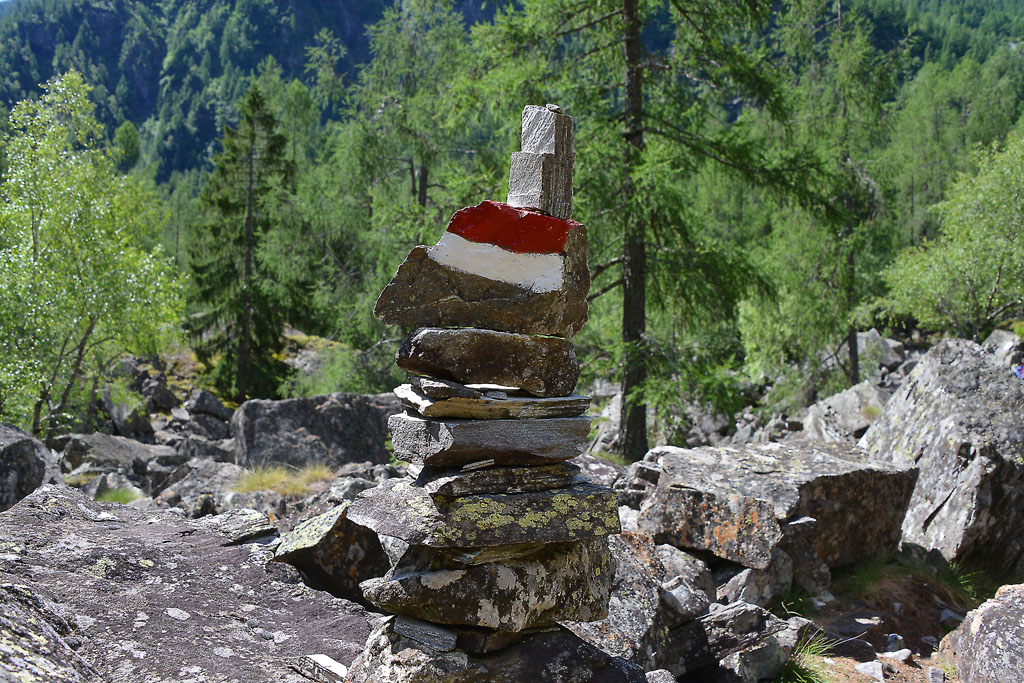
Signs: road signs and red/white marks
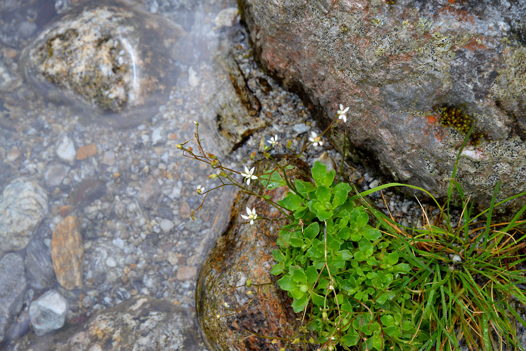
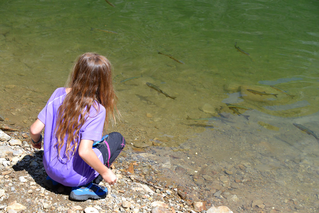
Water: fountains in Domodossola, at Sacro Monte Calvario and in some of the villages
Recommended period: all year round, without snow
How to get there: at the Domodossola train station there are free or paid parking spaces. By bus: connections to the main locations (www.comazzibus.com). By train: Milan-Domodossola and Novara-Domodossola lines, connections also with Switzerland (www.trenitalia.com)
Information: Distretto Turistico dei Laghi www.distrettolaghi.it; Tourist Office – Piazza G. Matteotti c/o Stazione FS, Domodossola, tel. +39 0324.248265; Municipality of Domodossola www.comune.domodossola.vb.it; Sacro Monte Calvario www.sacrimonti.org / www.sacromontecalvario.it
the itinerary
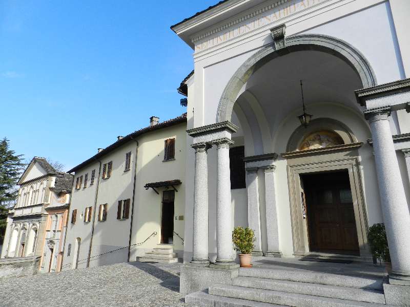
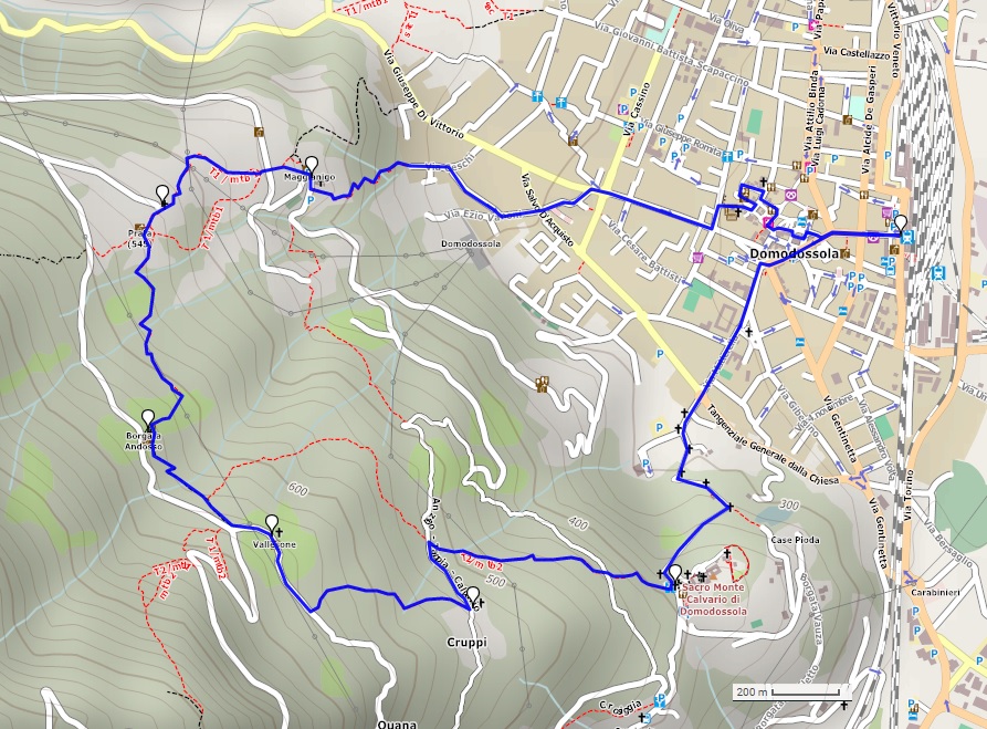
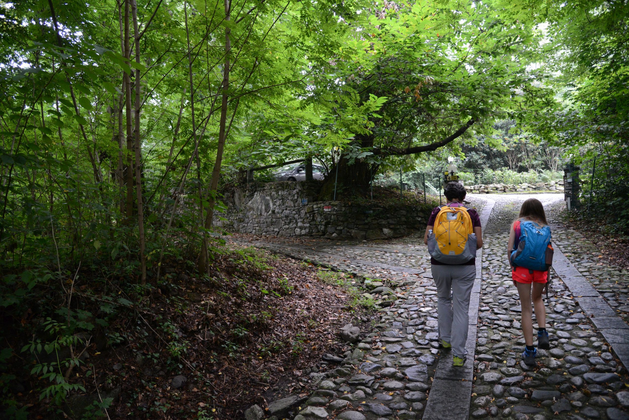
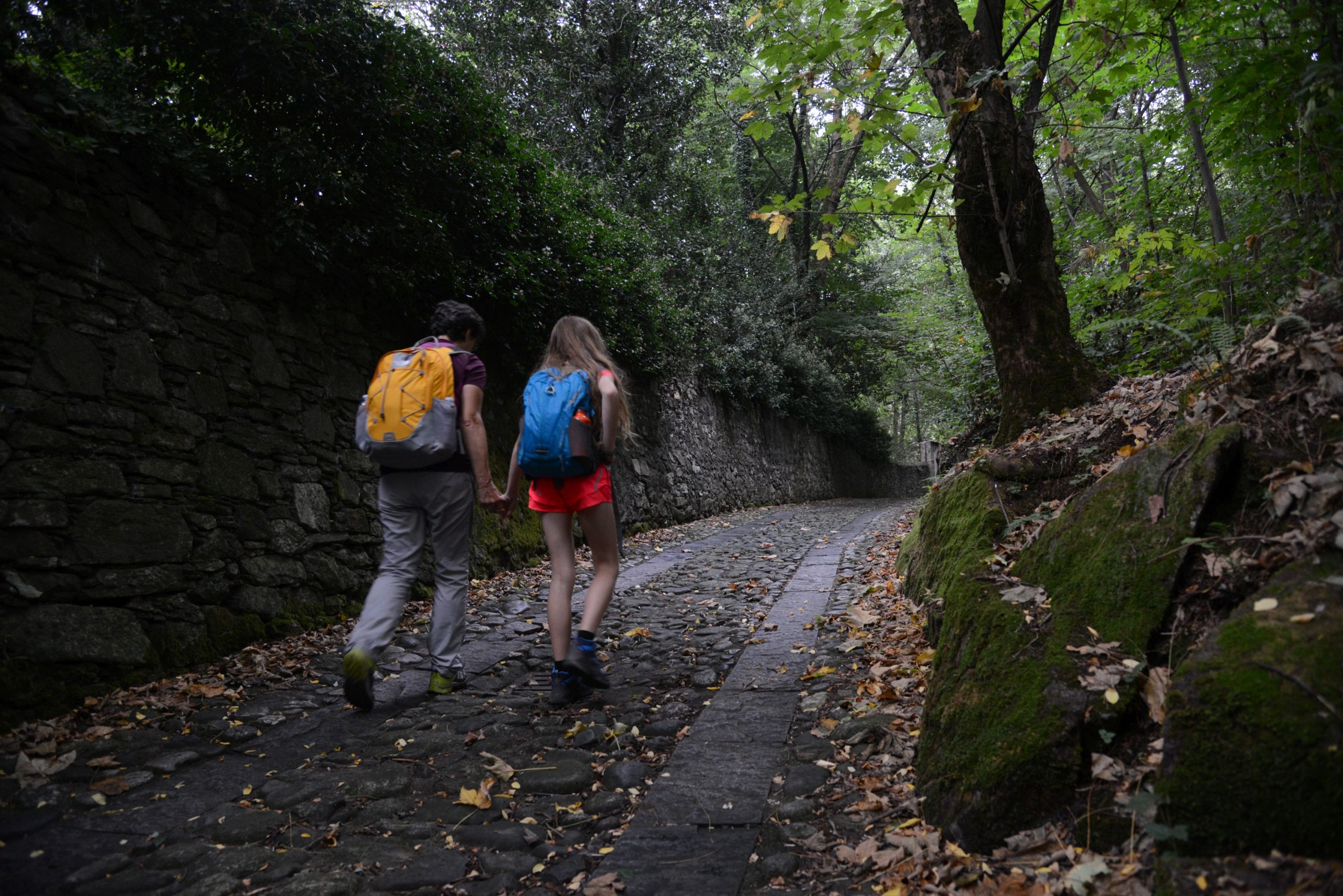
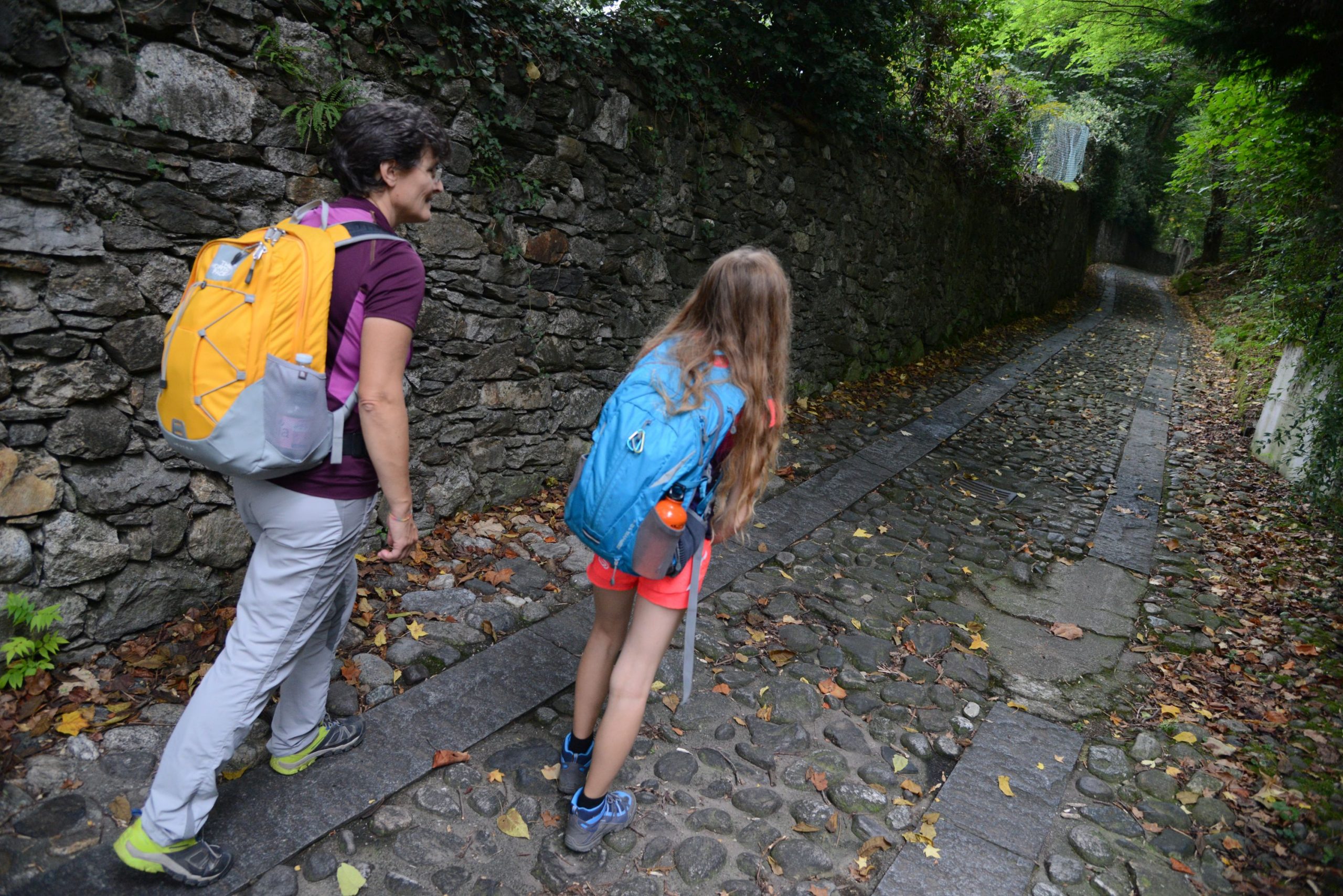
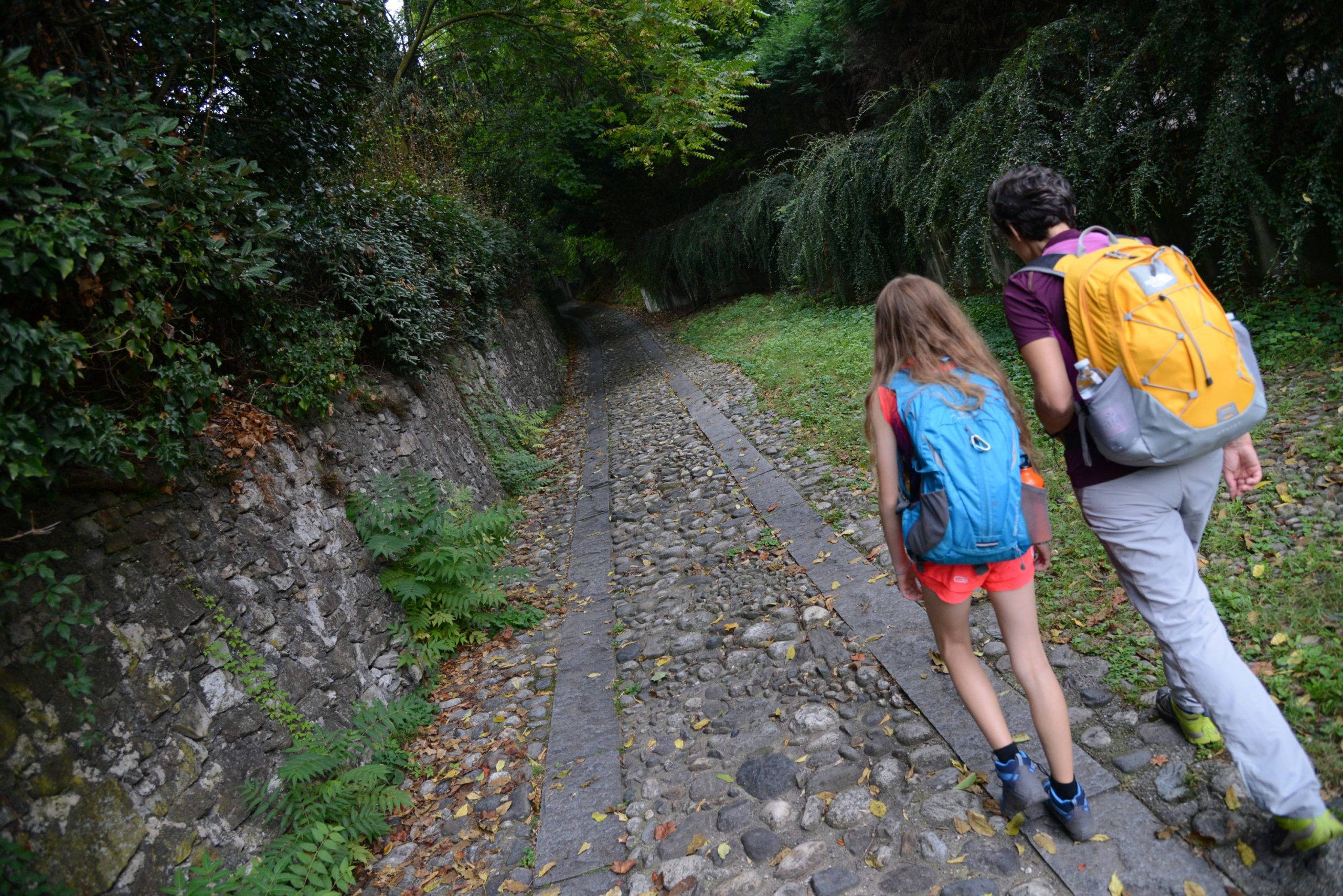
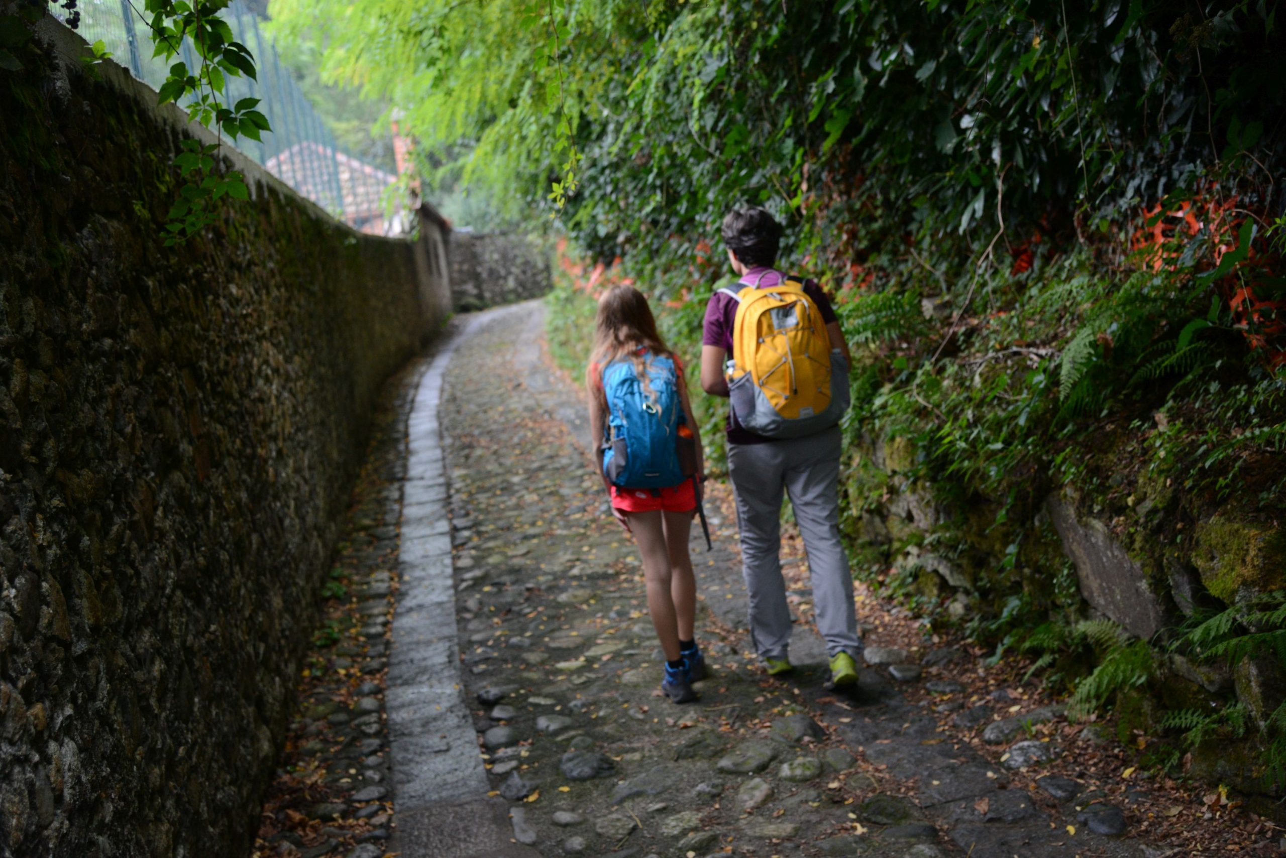
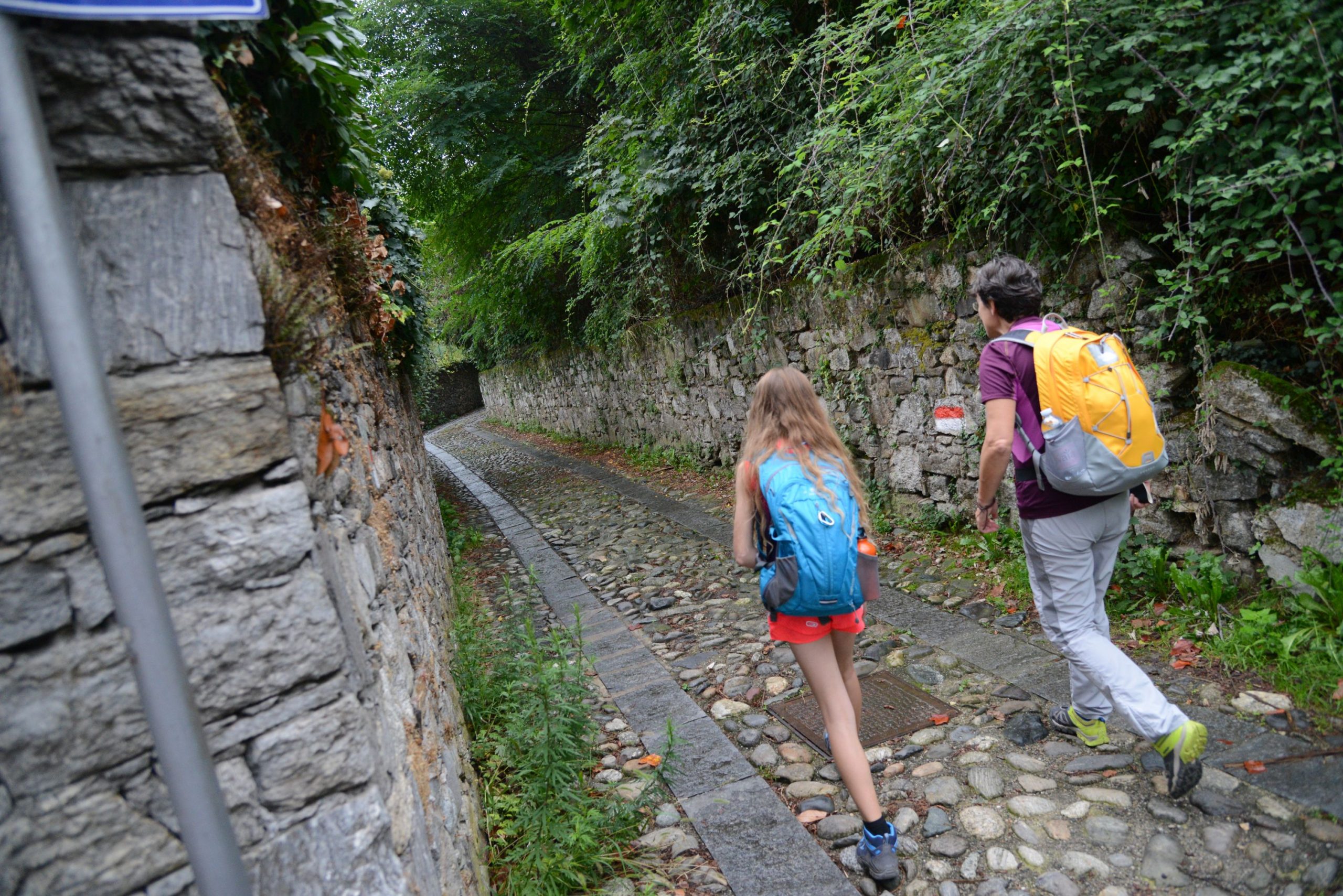
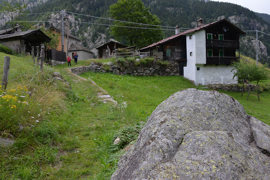
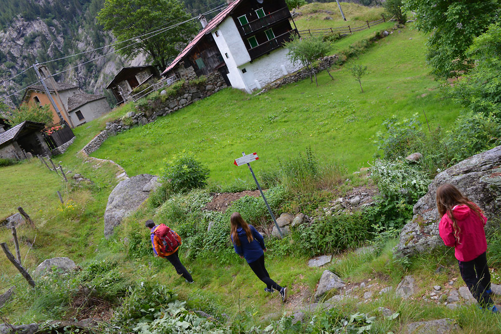
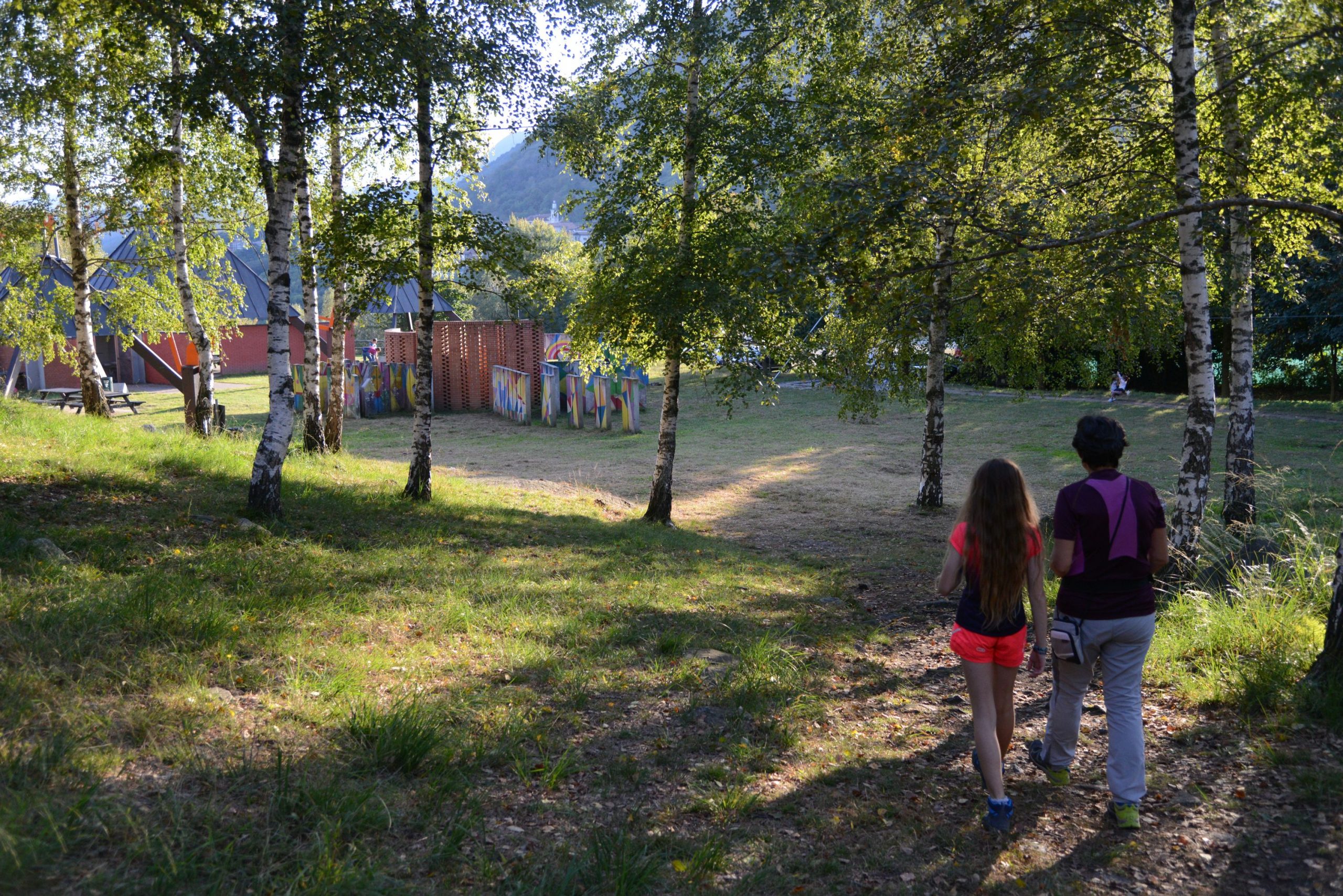
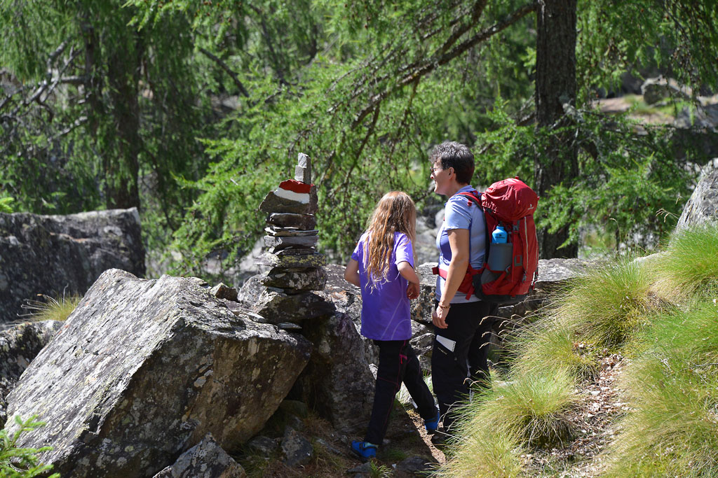
From the Domodossola train station, take Via Ferraris, which leads towards the the centre. You won’t enter the real city centre now (you will when you return) but you come close to it on the street Via Fratelli di Dio, which then becomes Via Garibaldi. Cross the triangular Piazza Tibaldi and take Via Rosmini (red/white signs for Sacro Monte Calvario). This street turns into Via Mattarella (yellow signs for Monte Calvario Via Crucis).
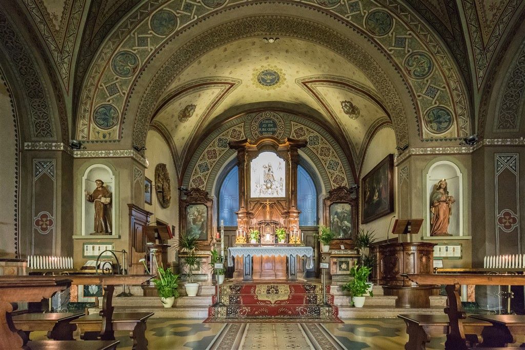
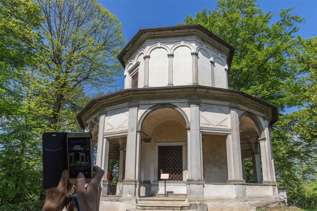
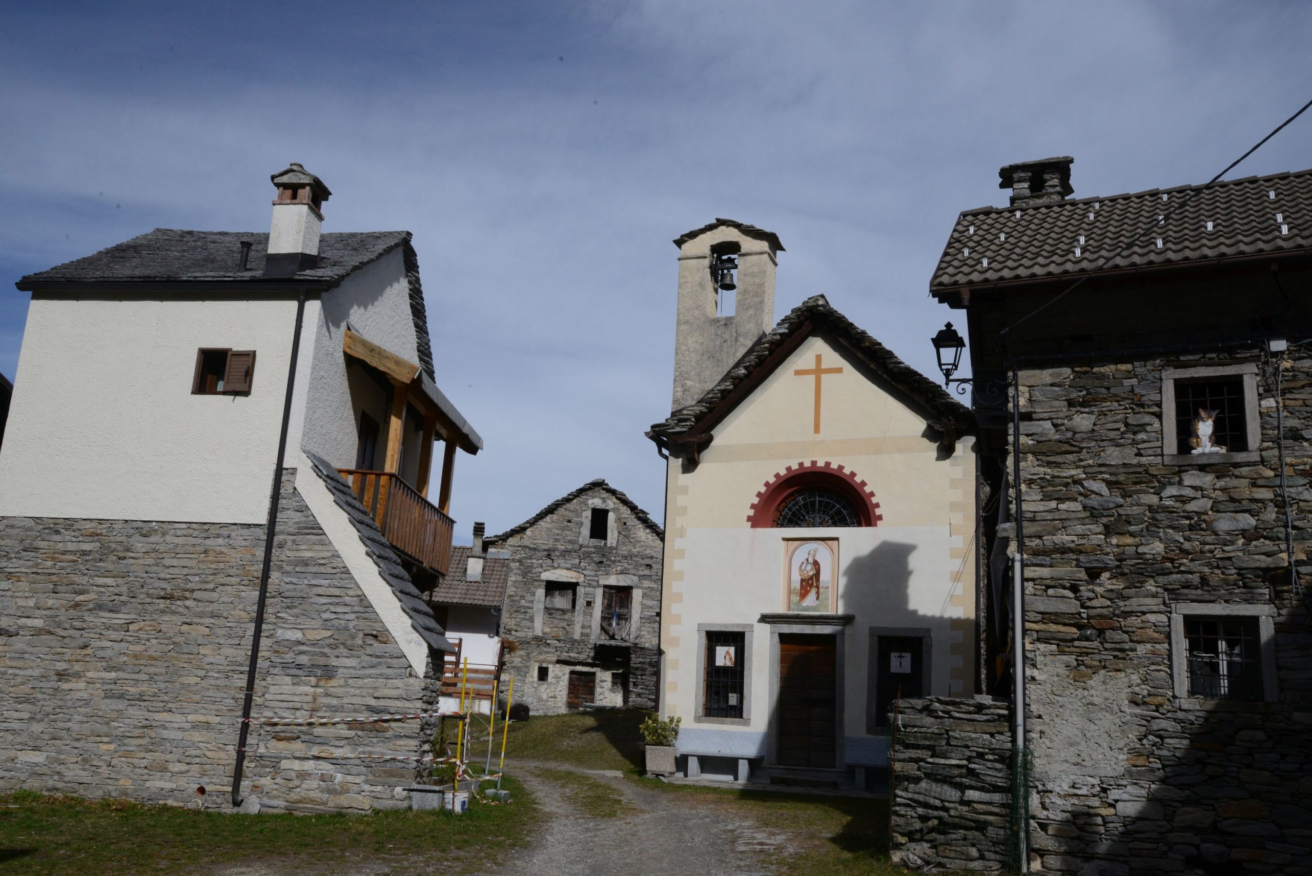
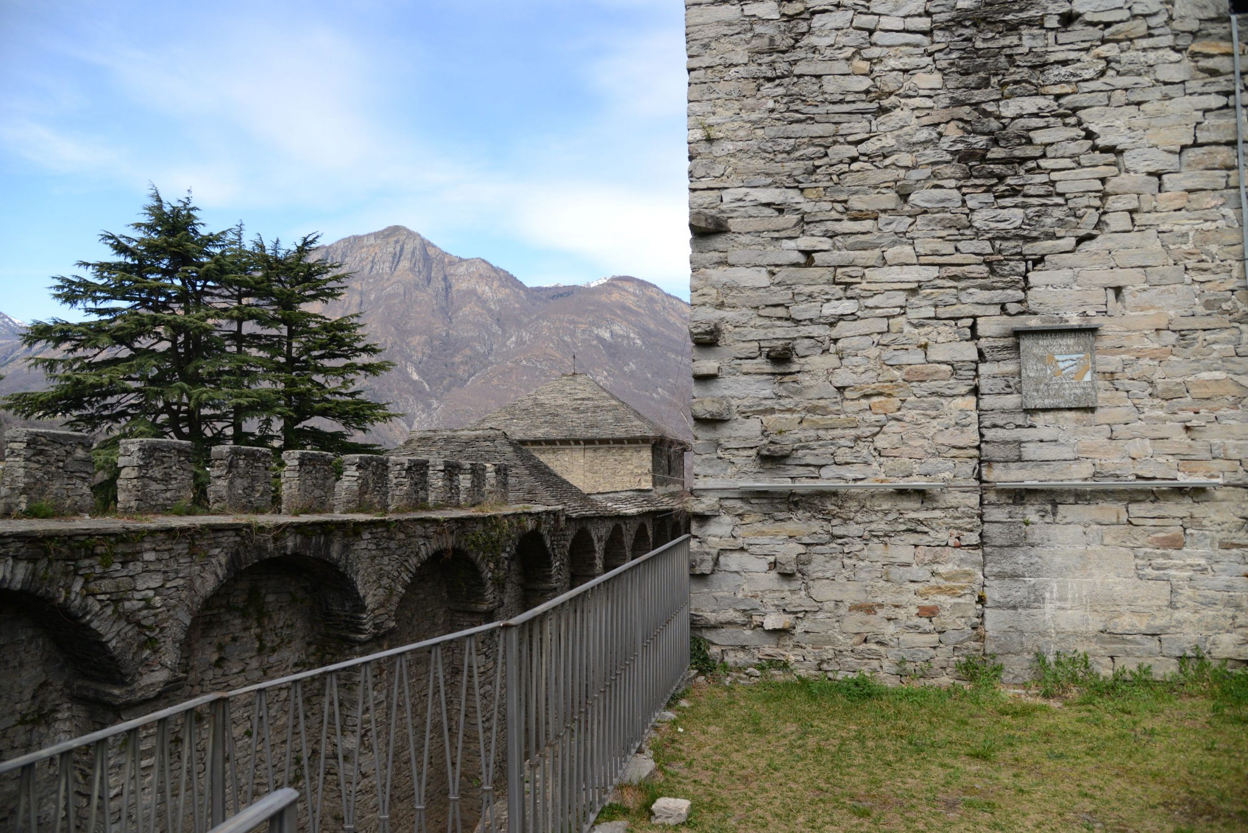
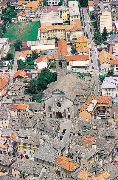
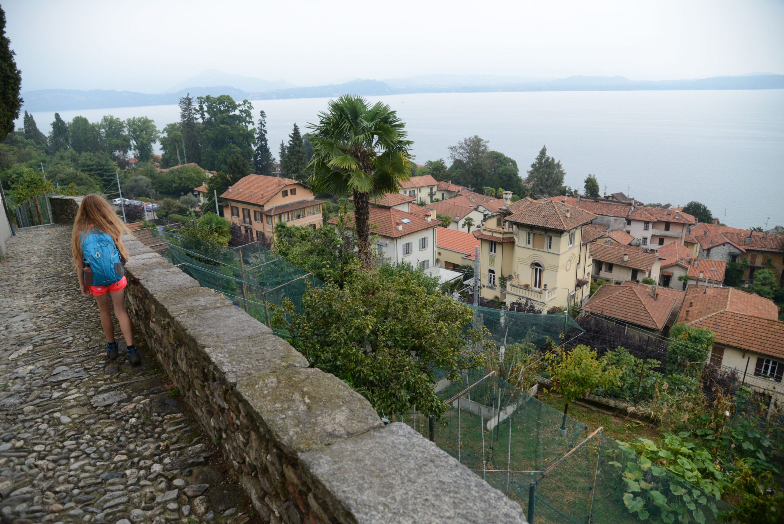
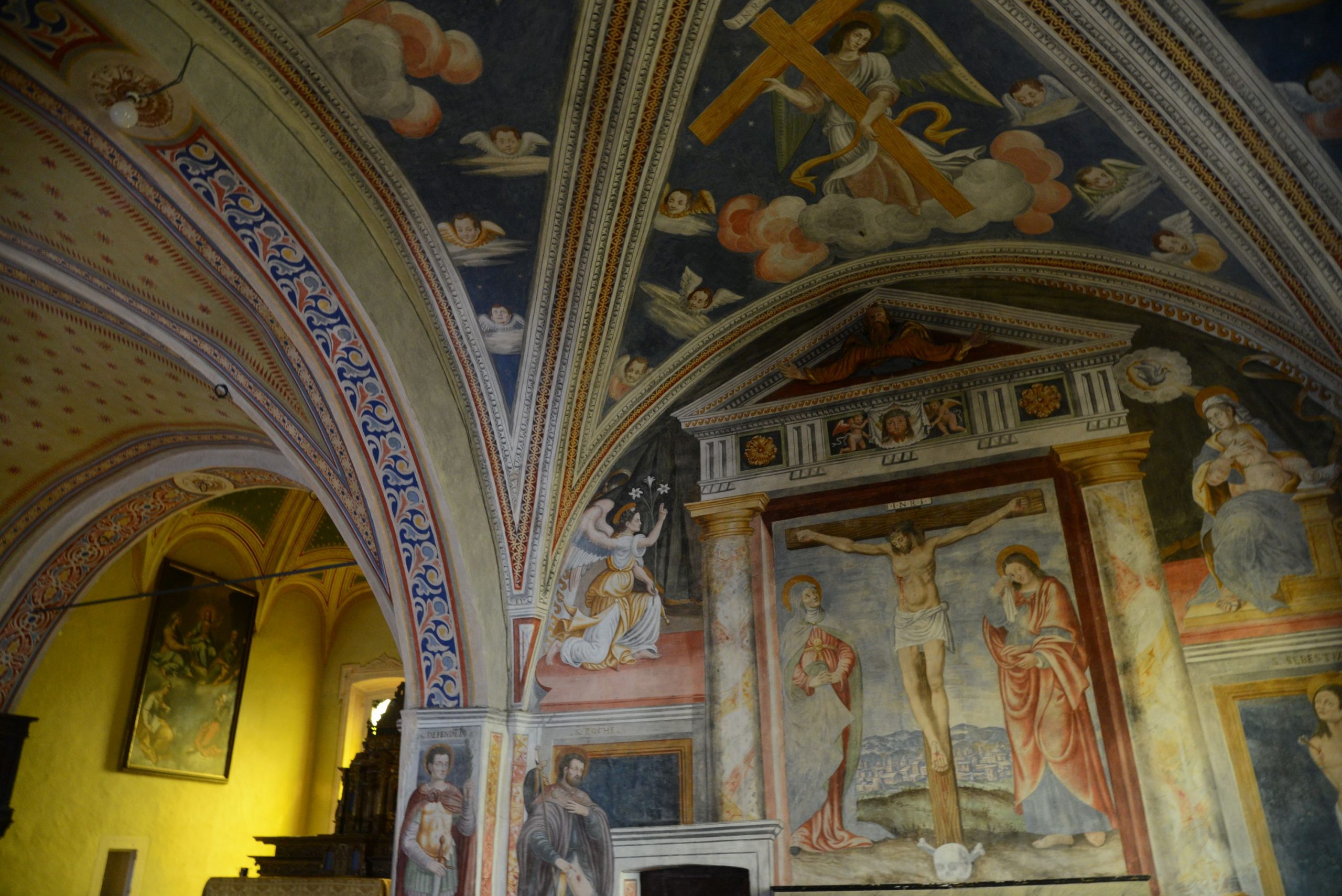
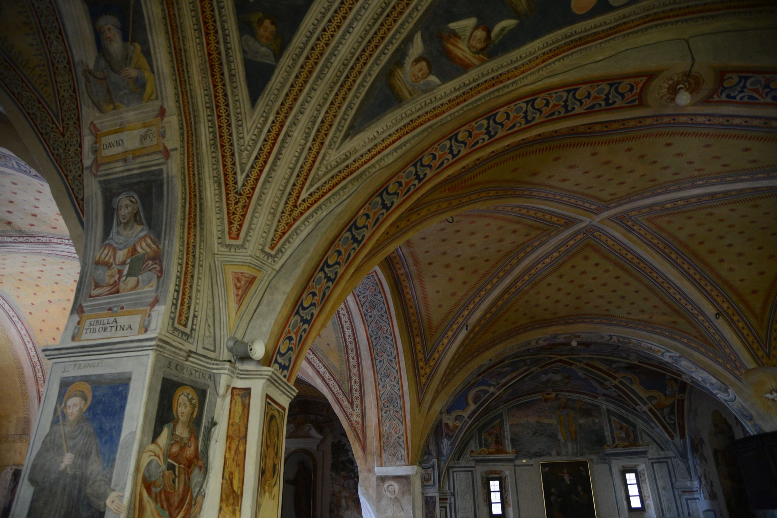
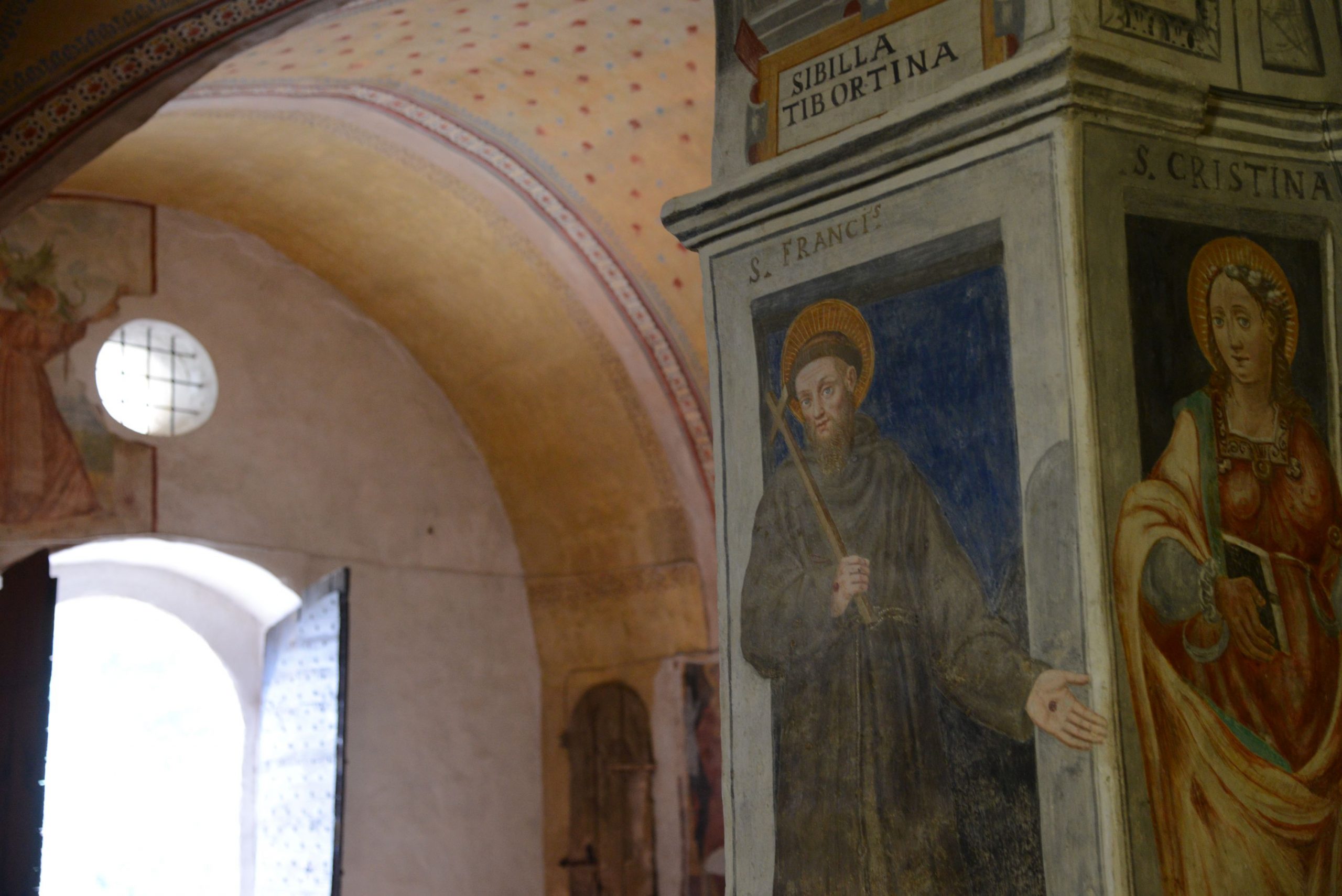
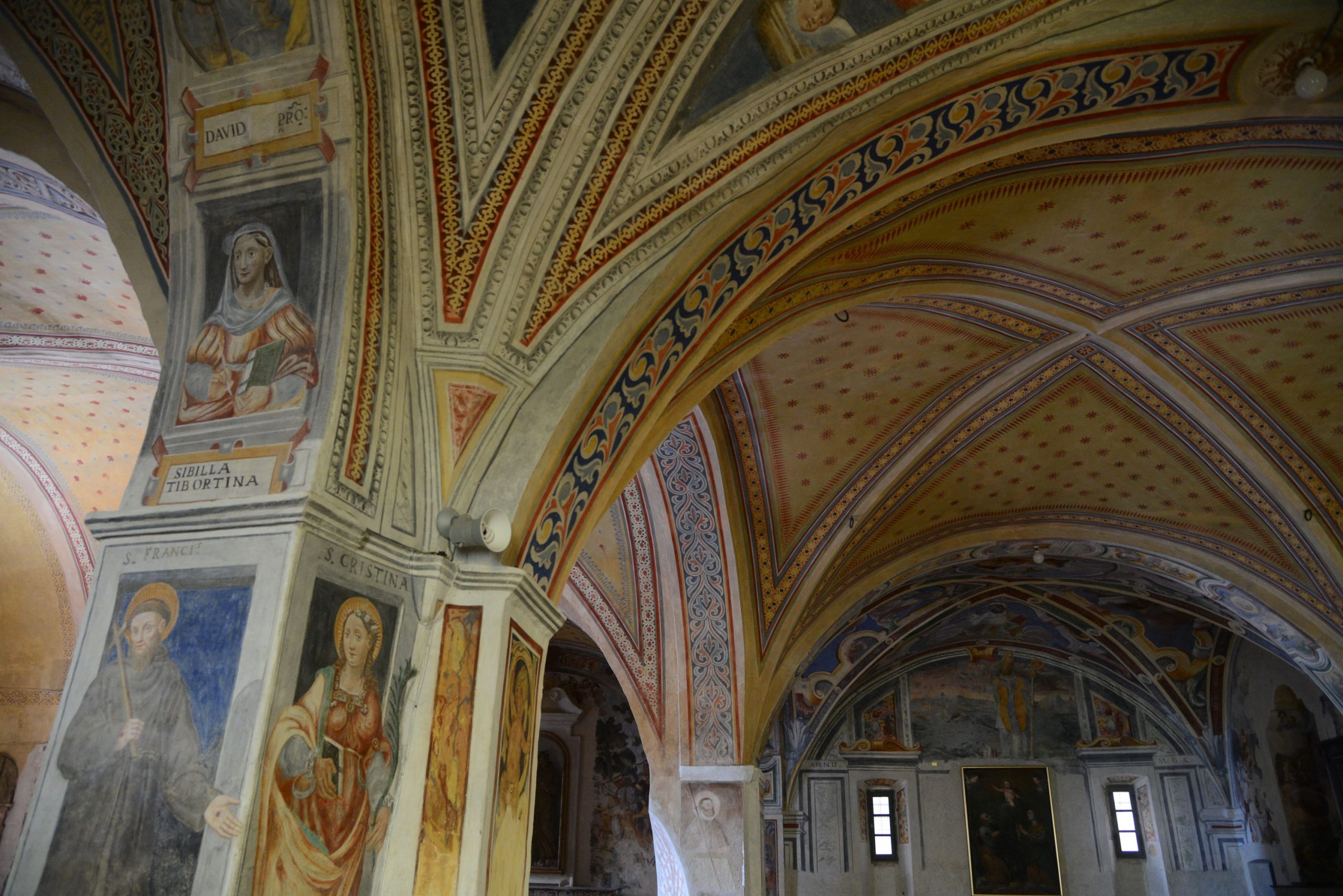
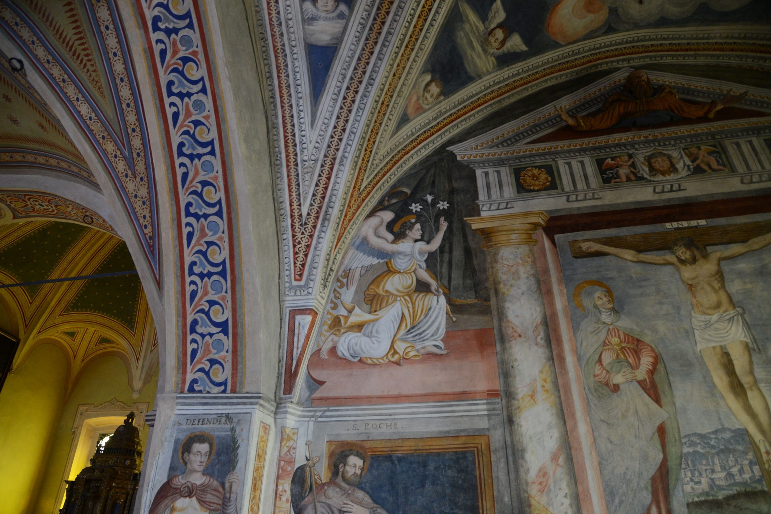
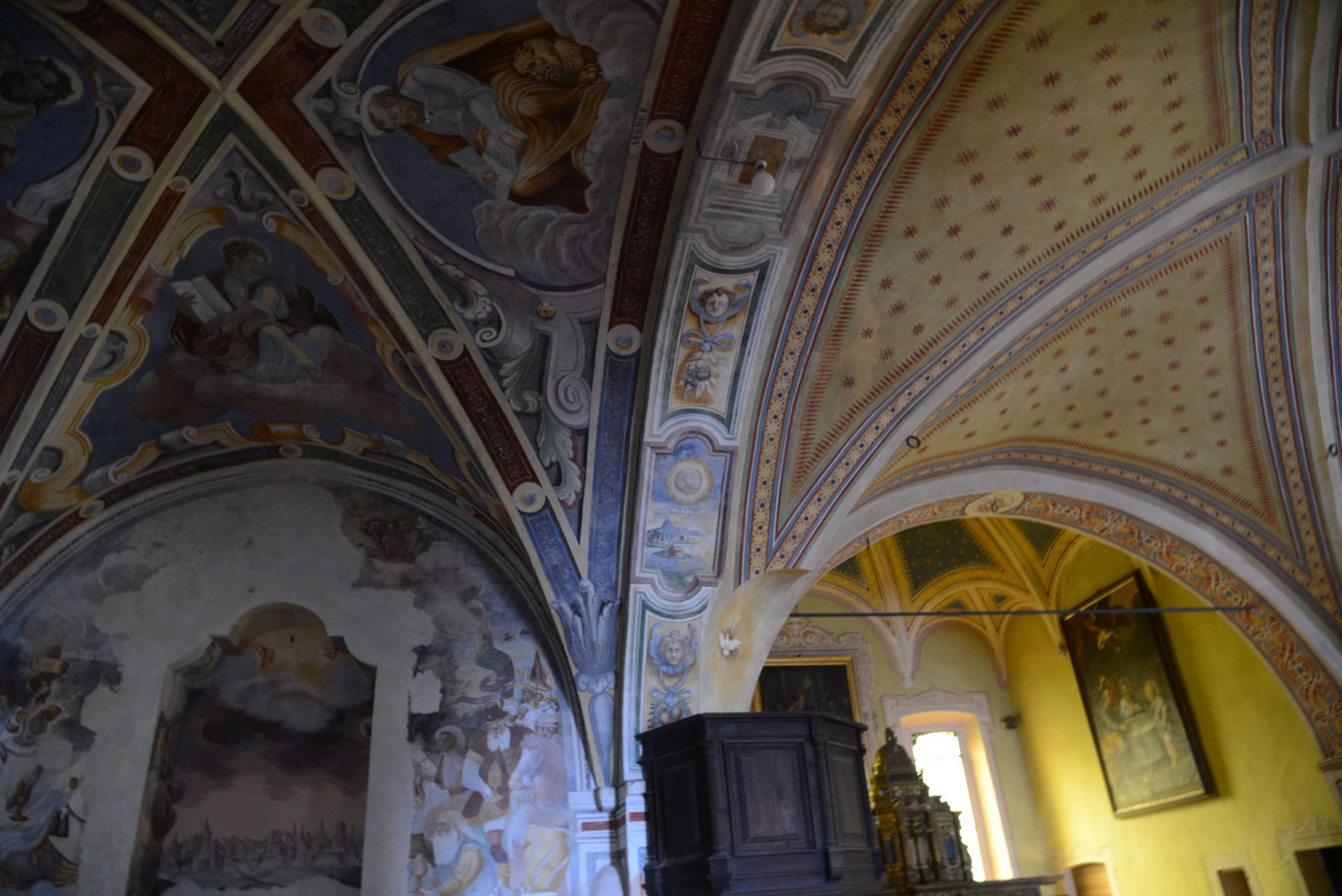
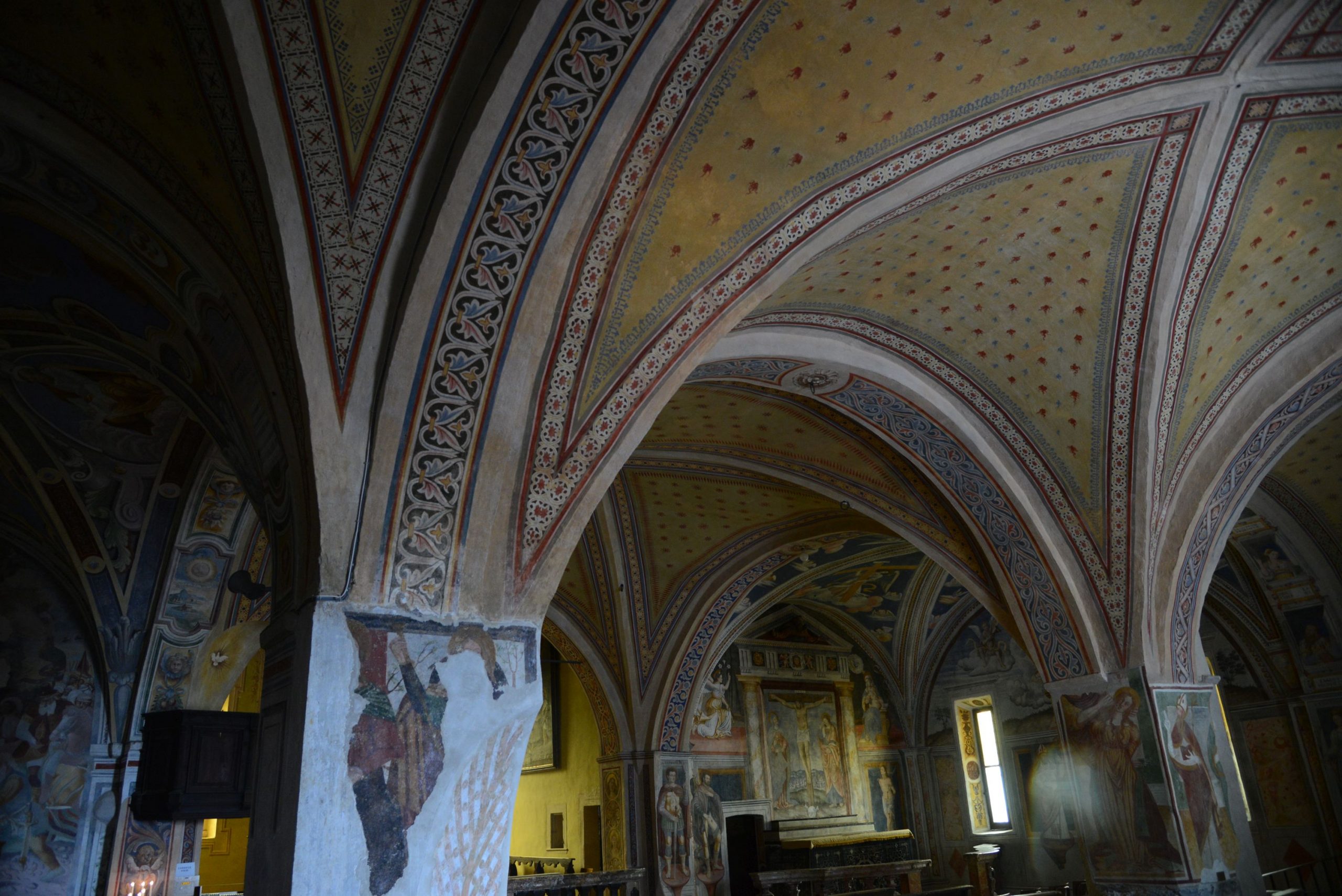
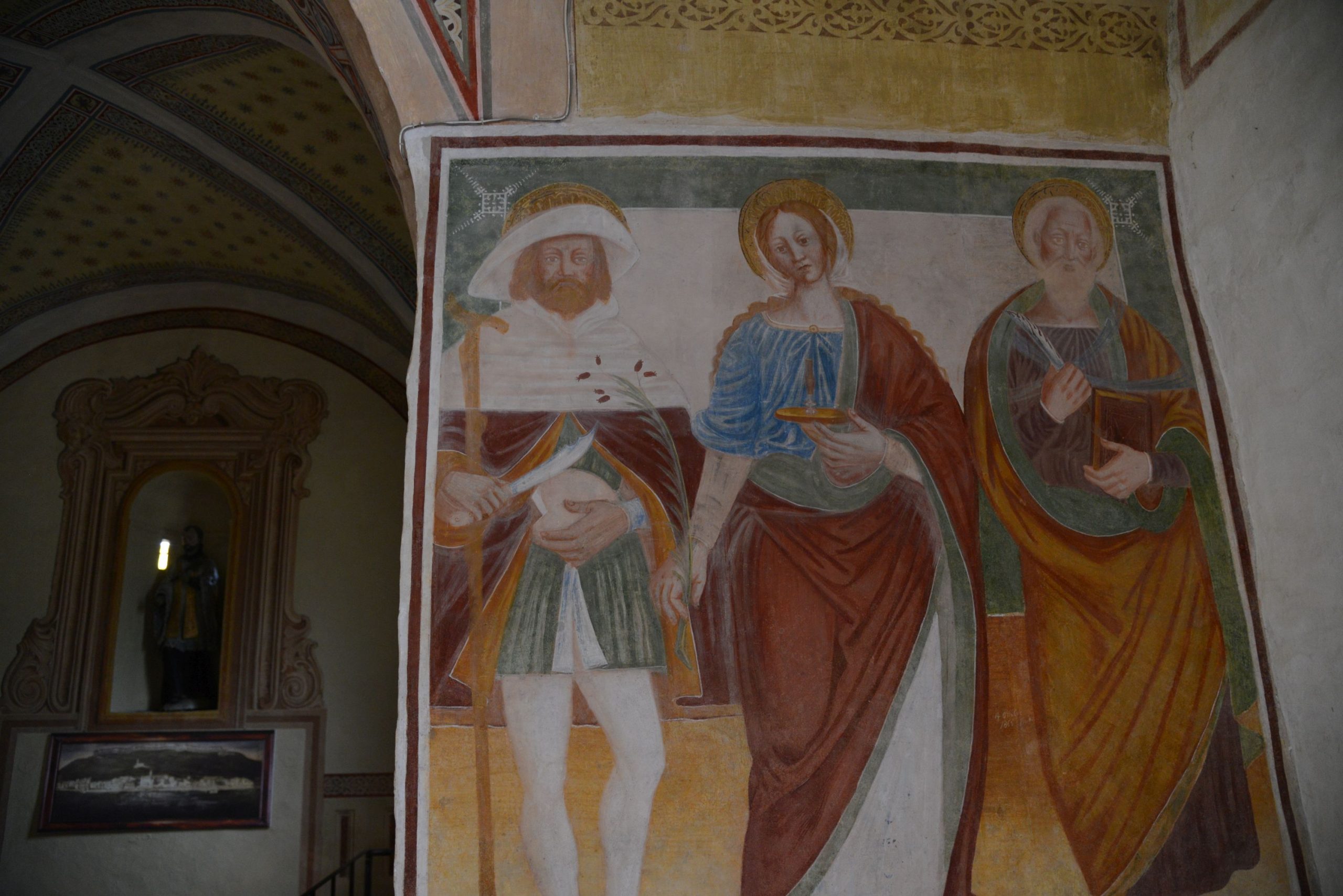
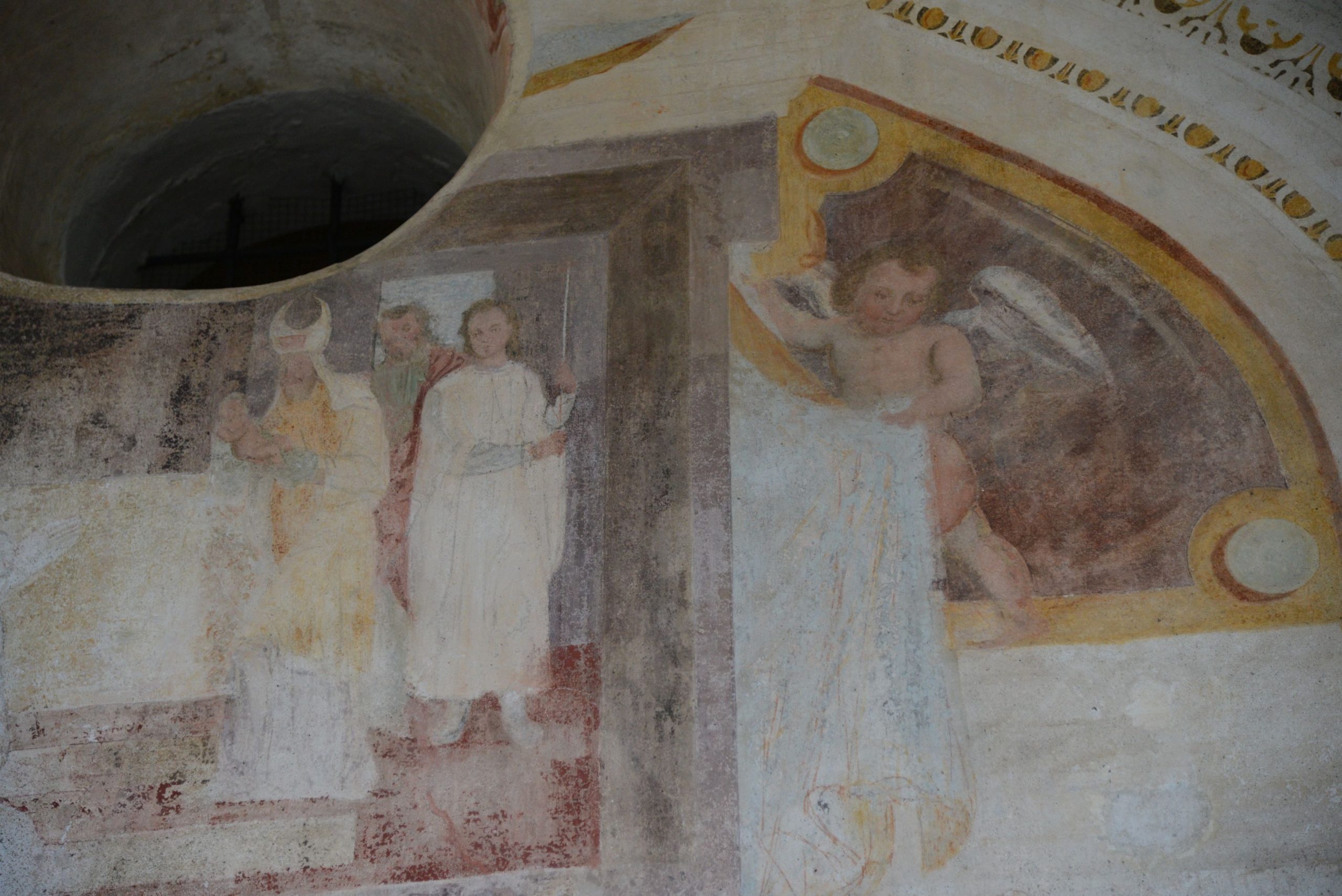
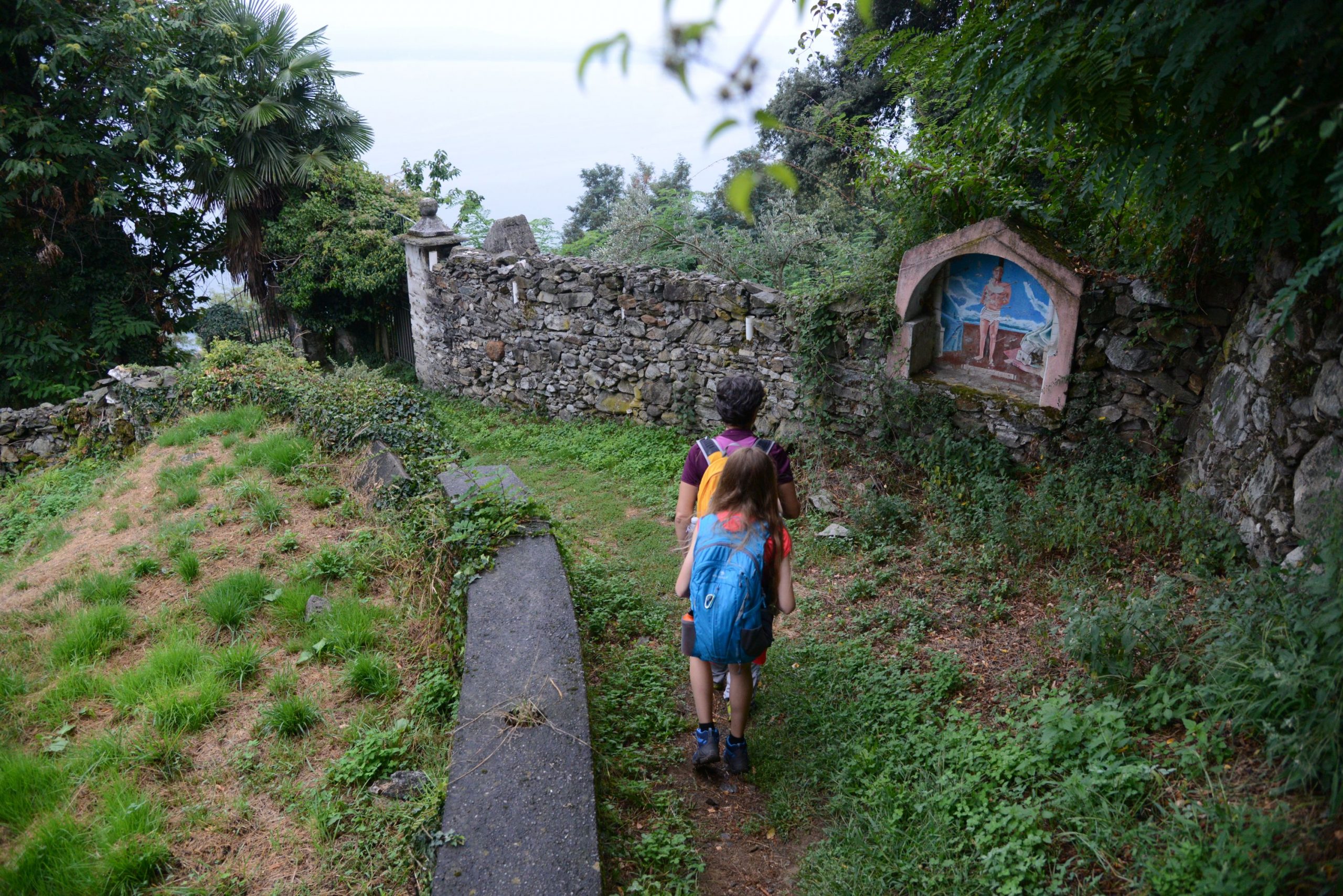
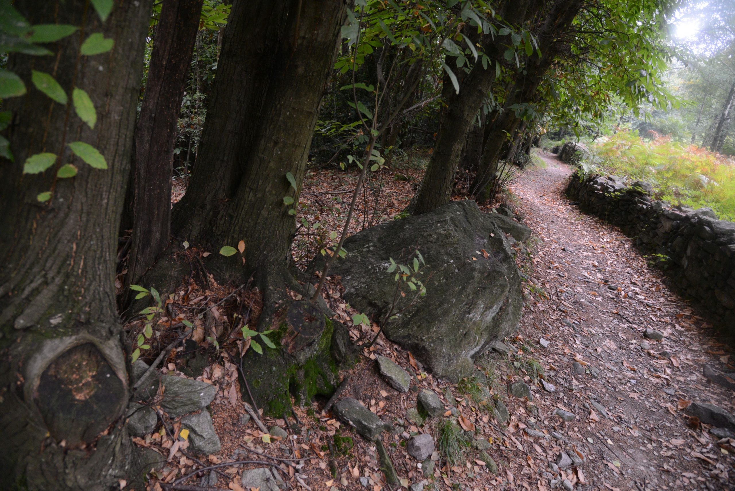
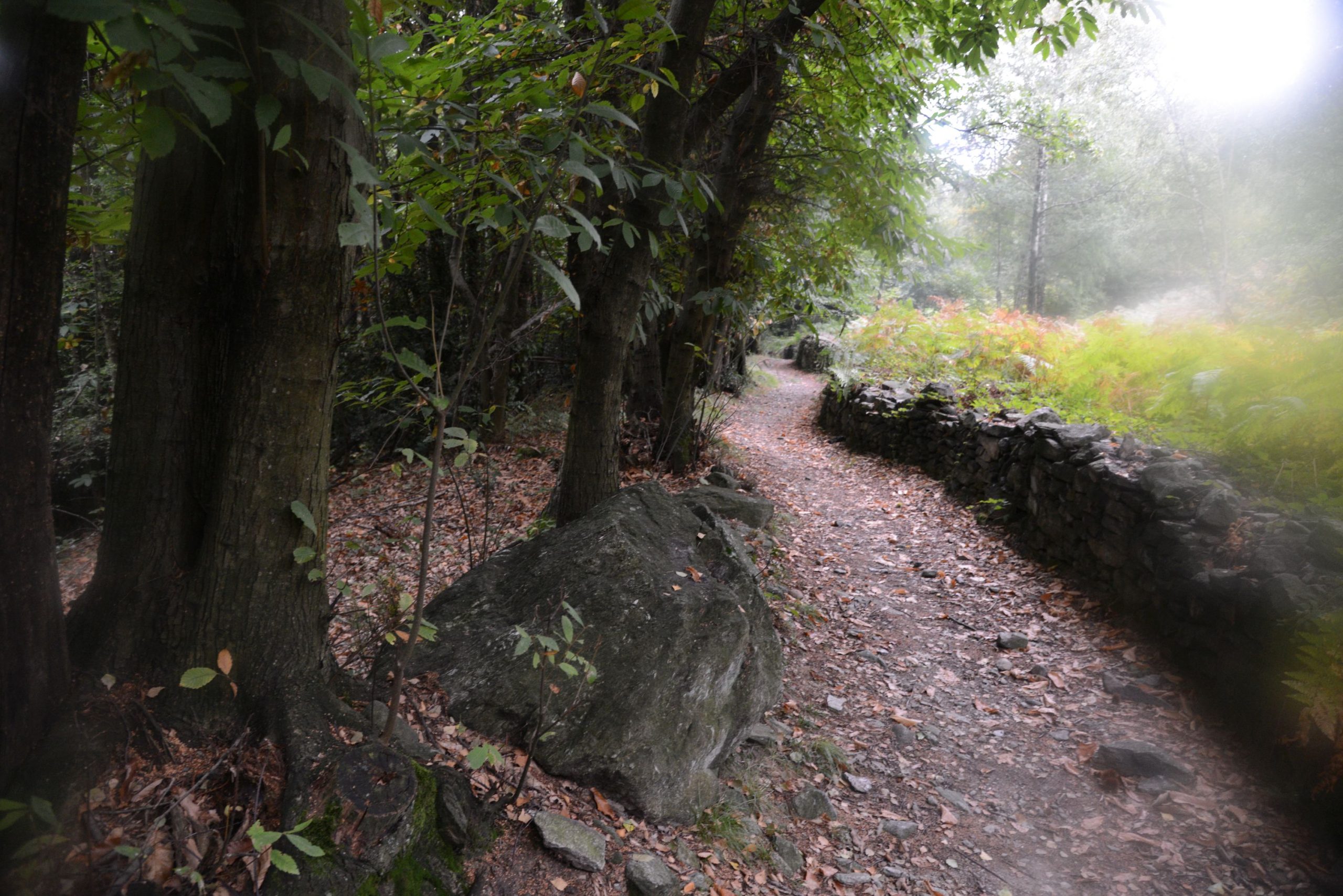
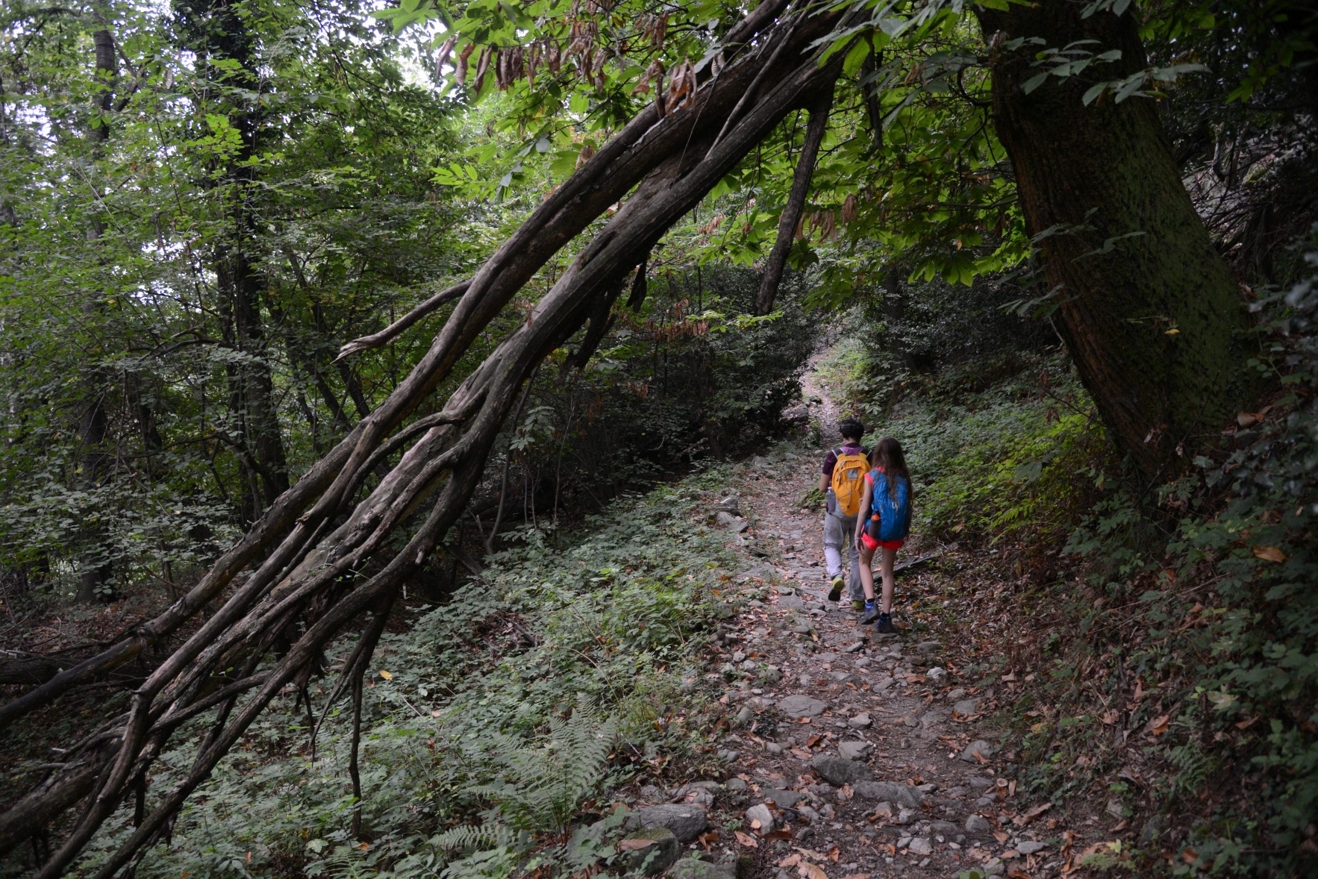
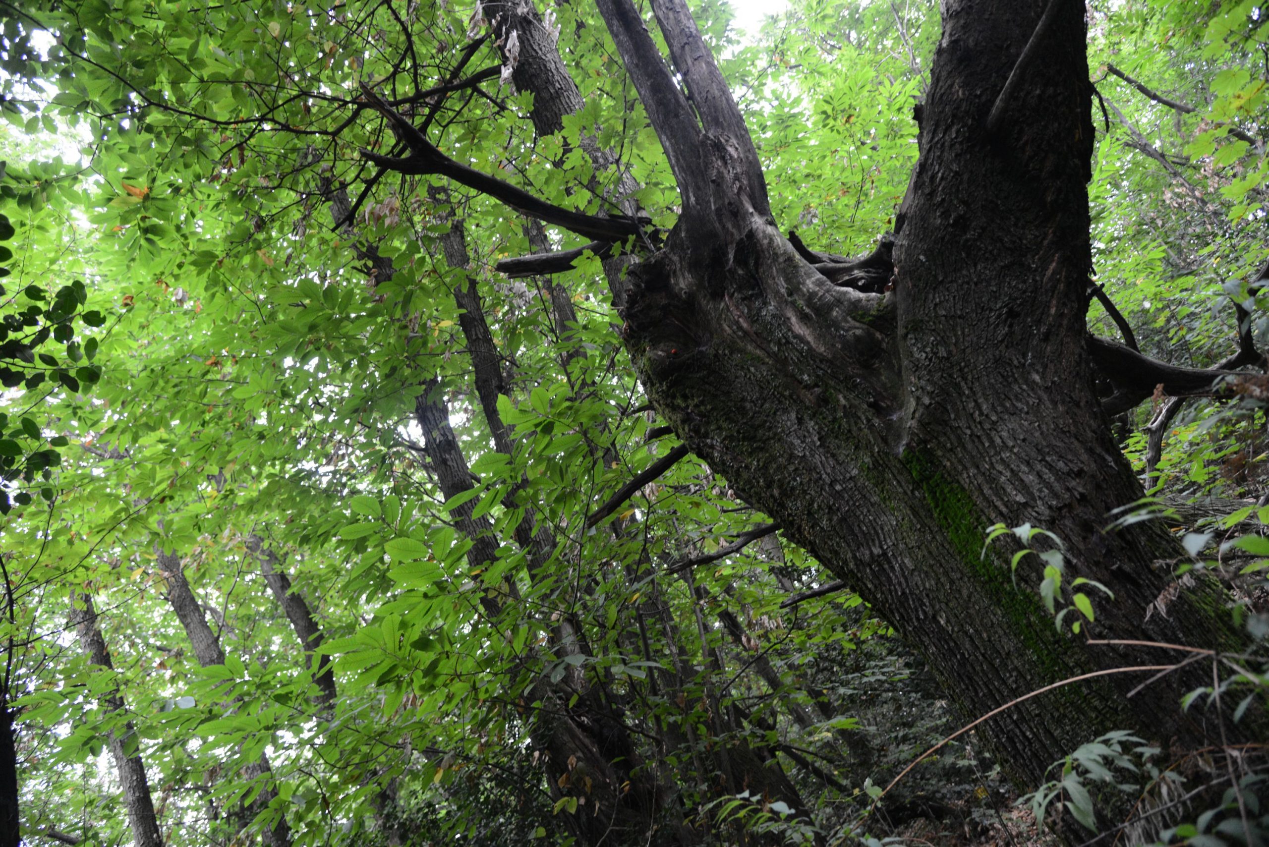
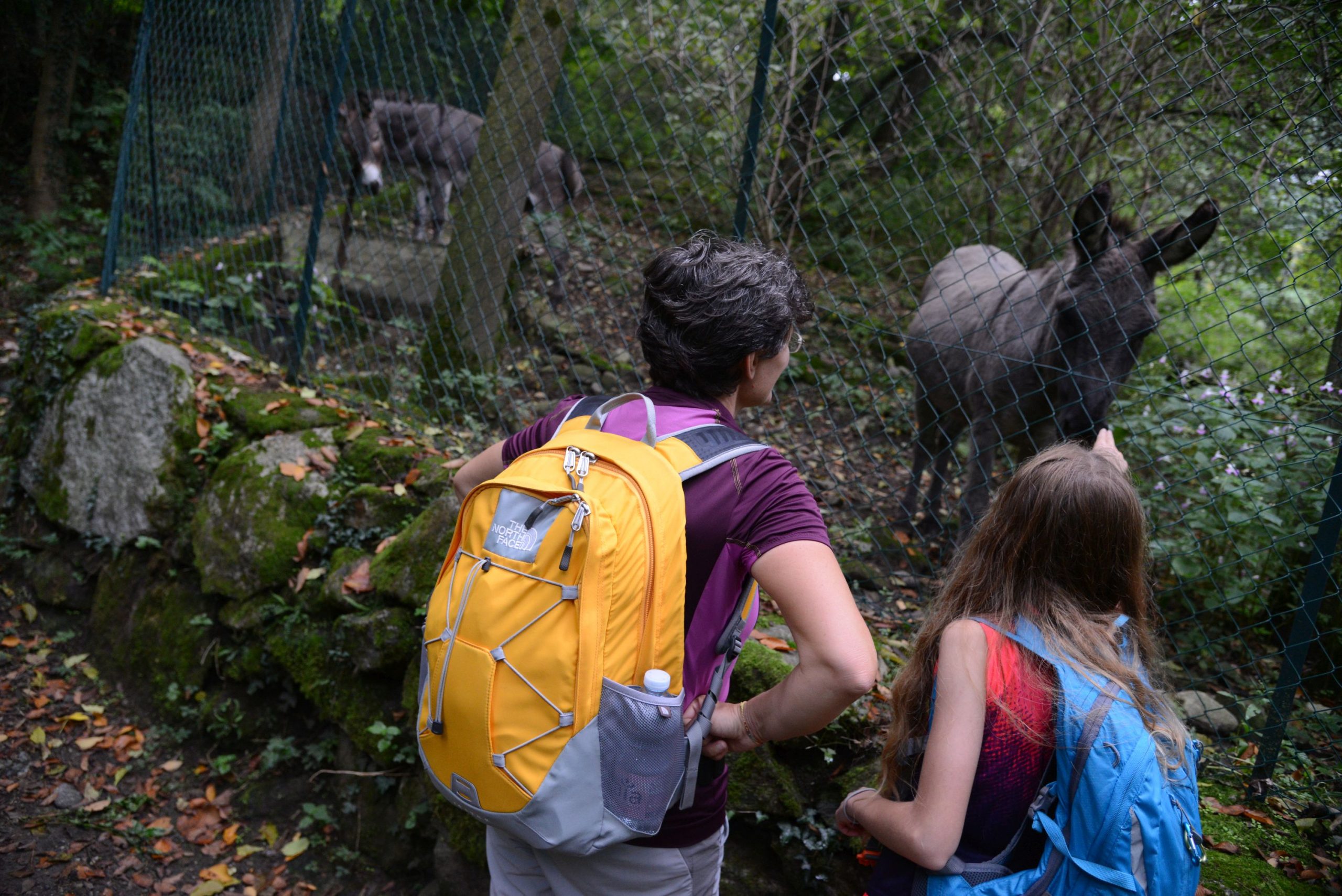
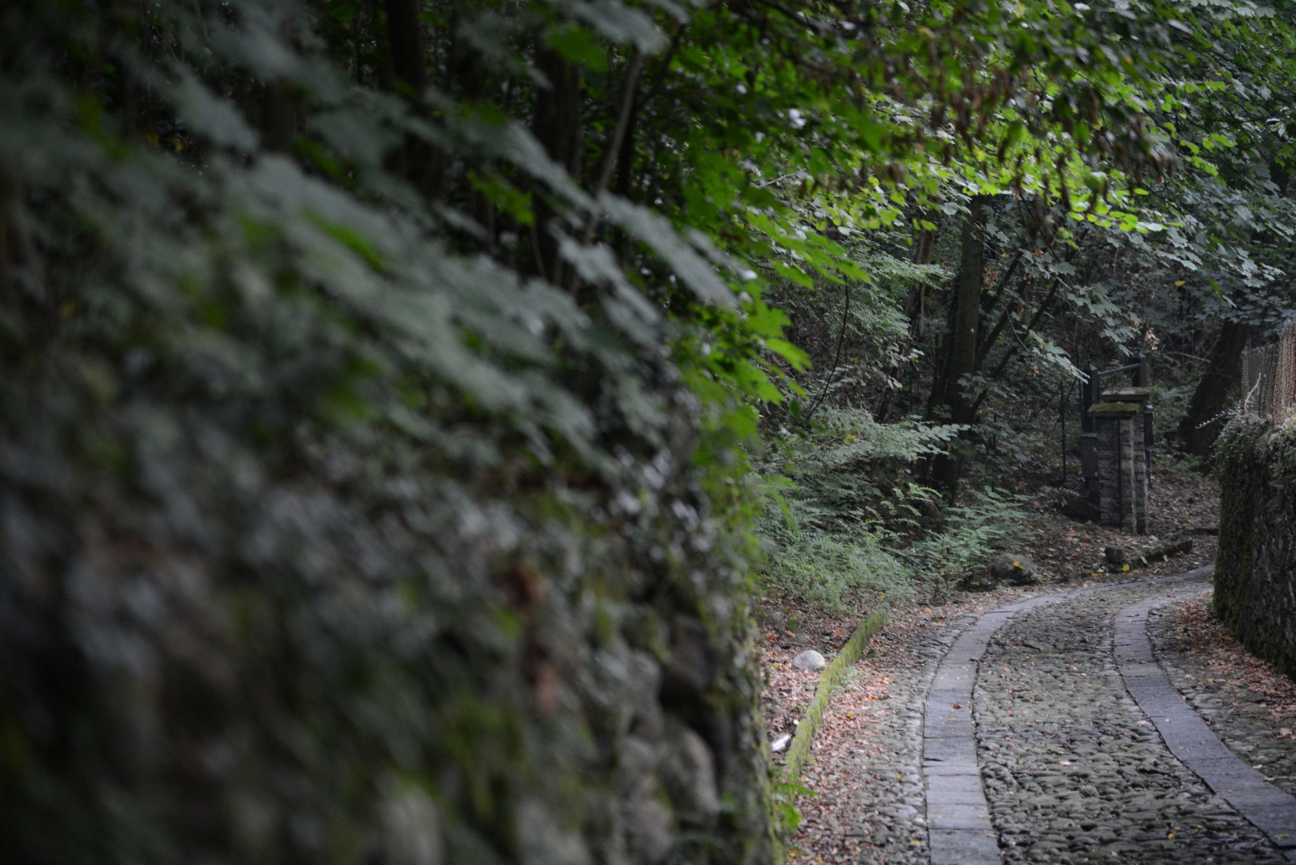
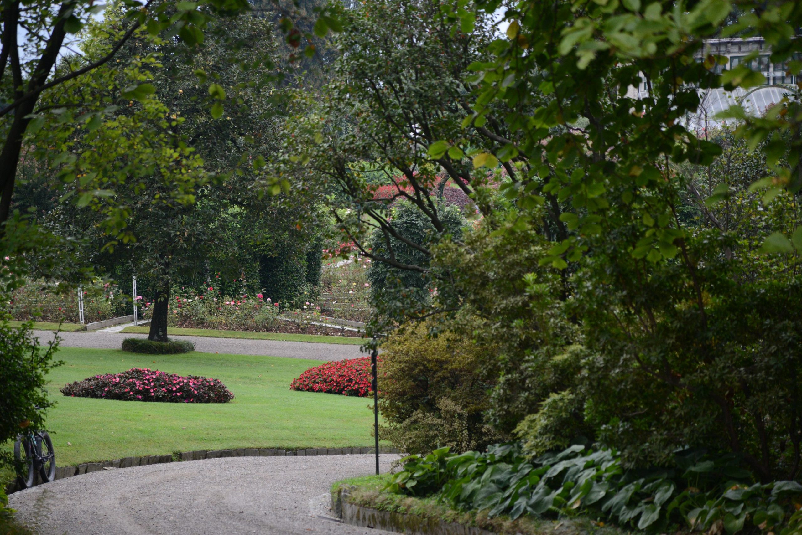
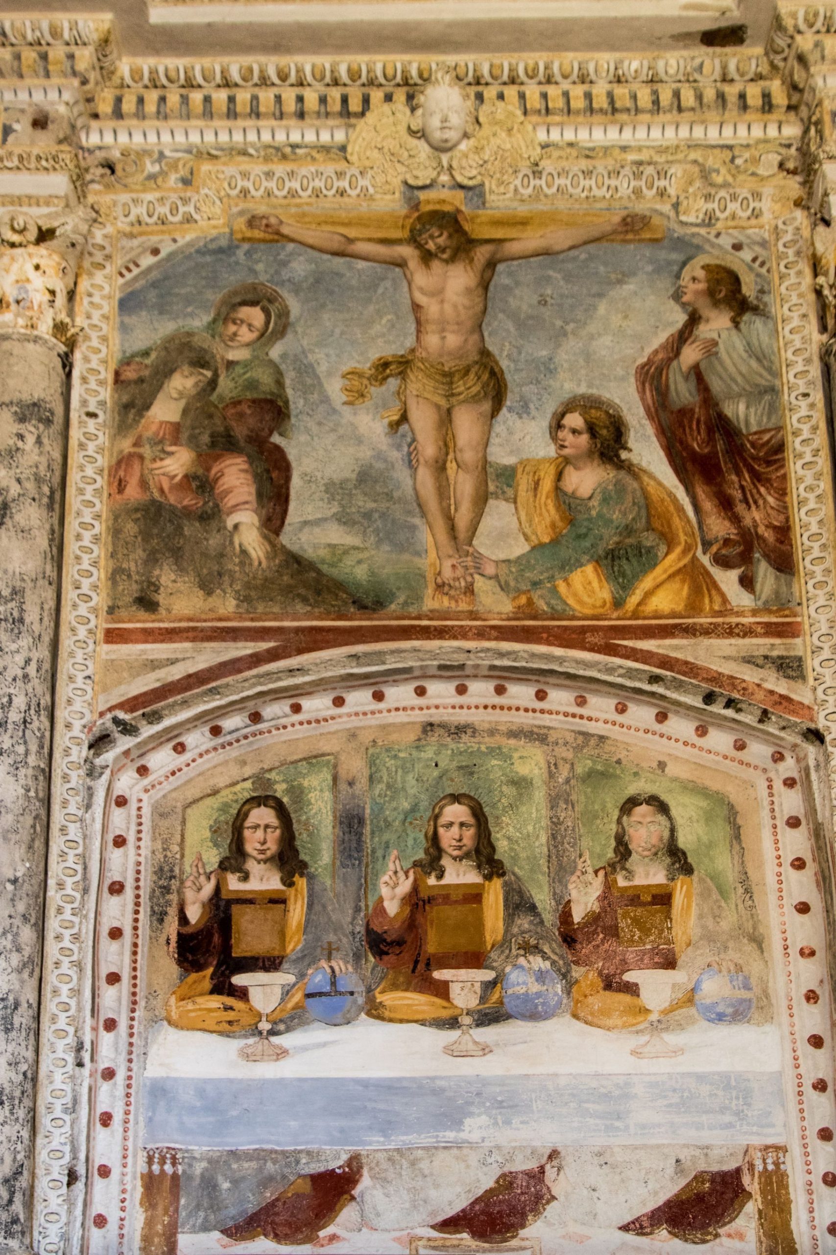
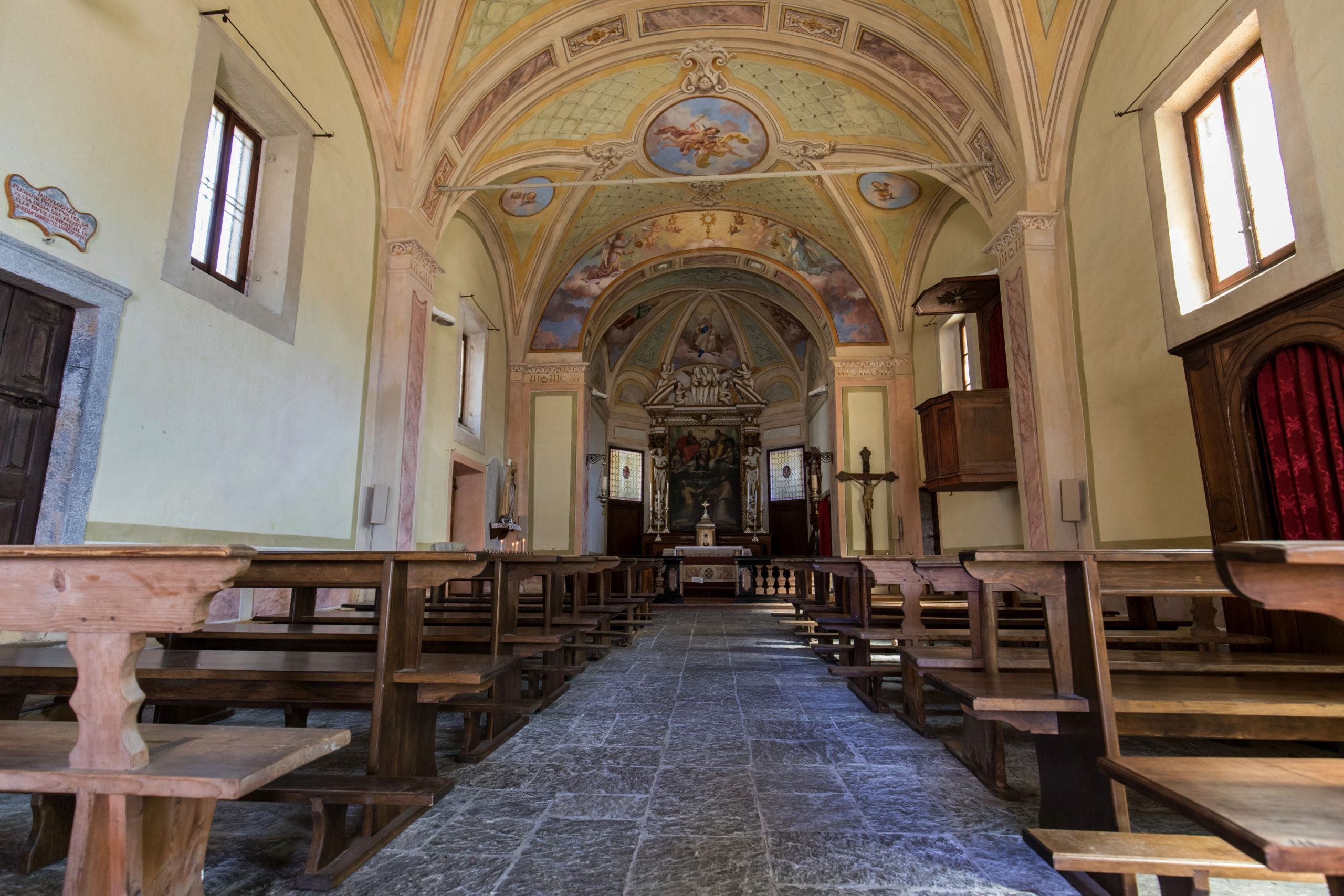
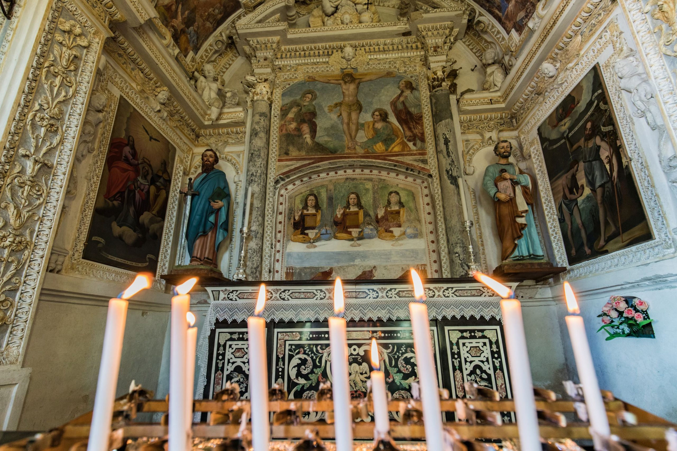
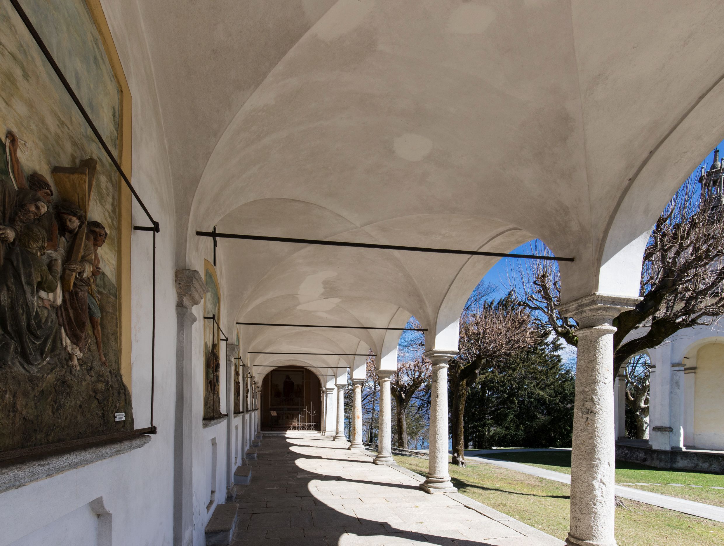
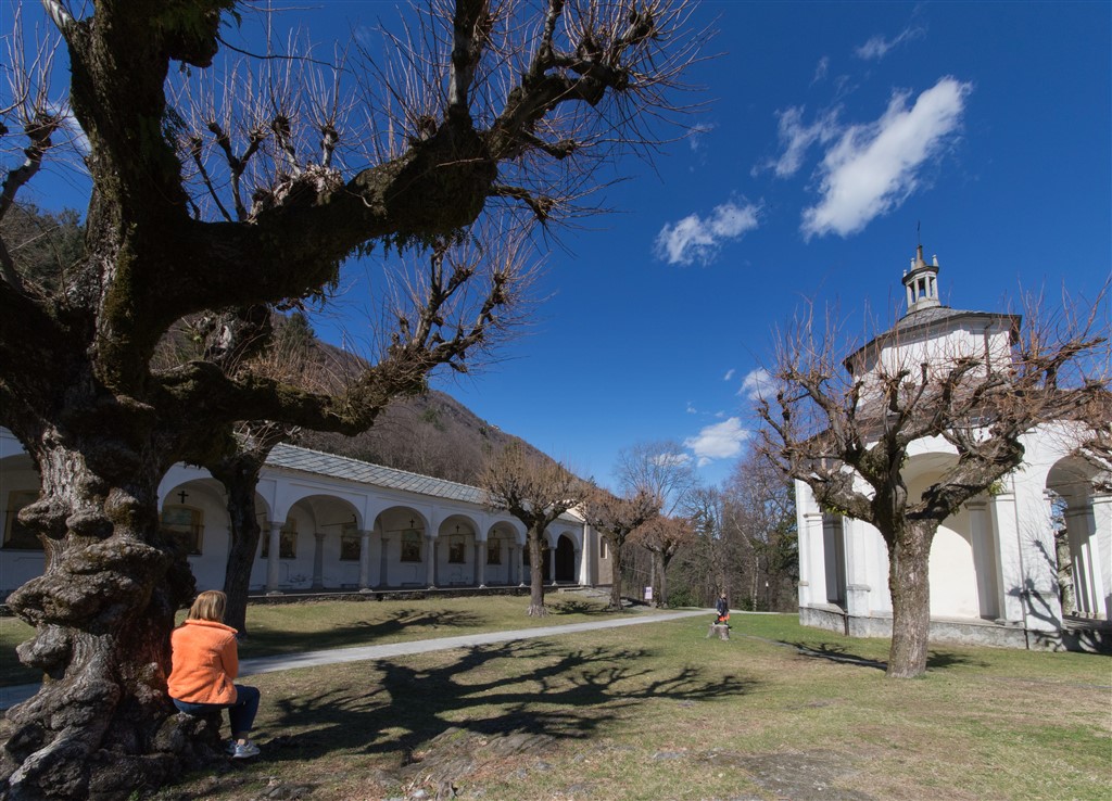
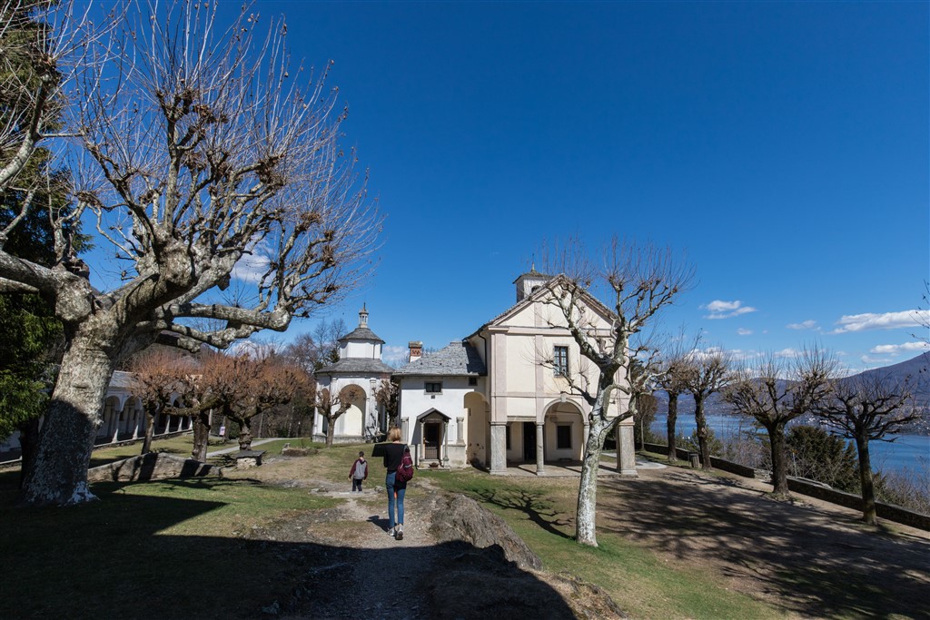
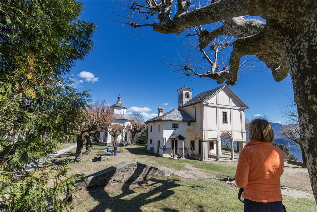
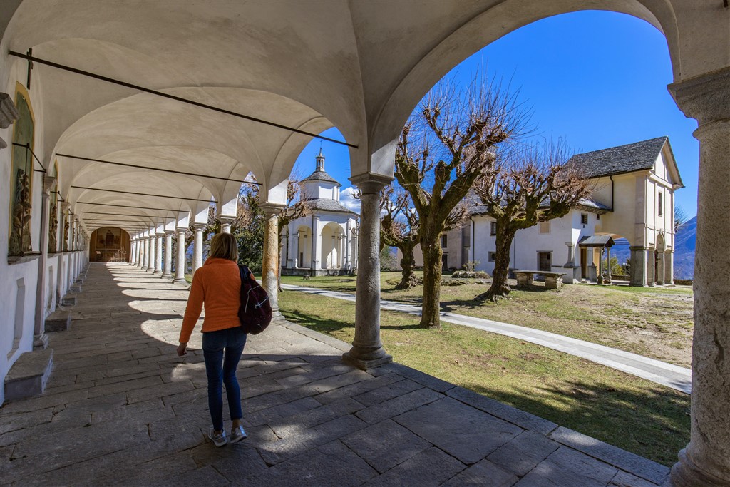
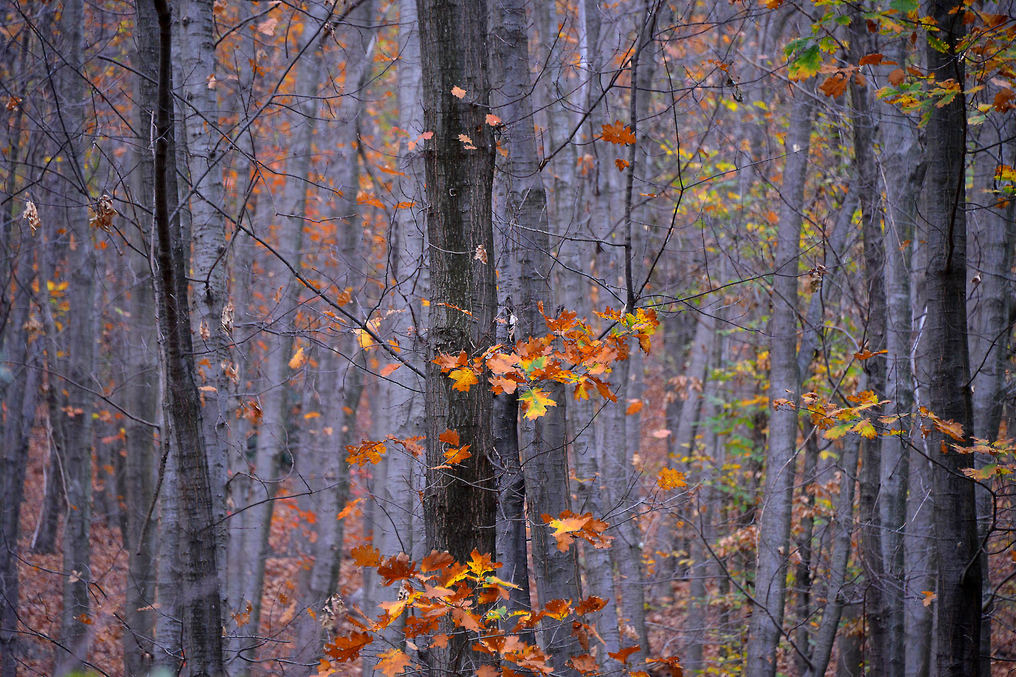
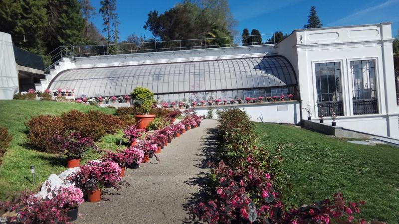
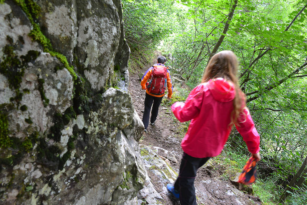
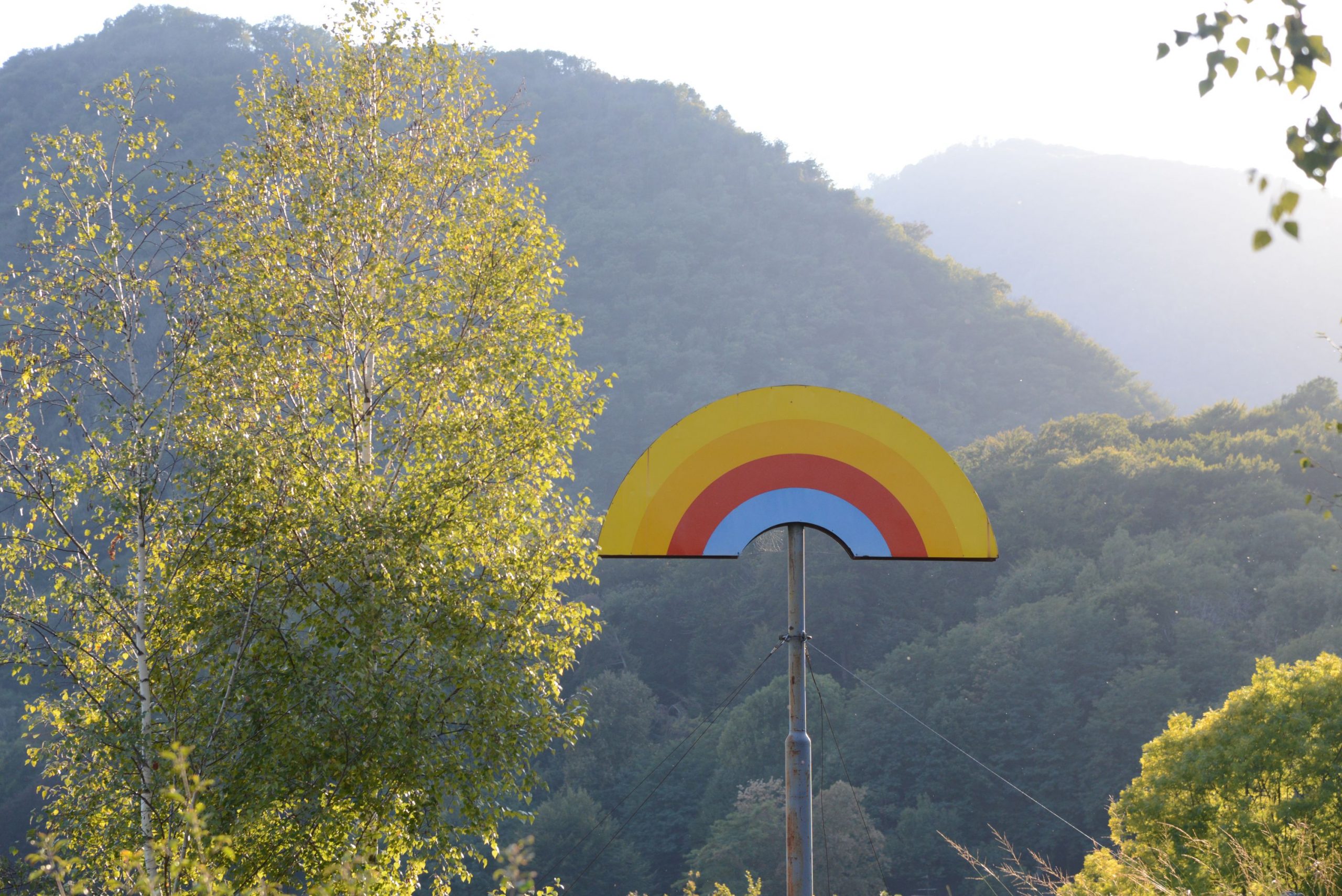
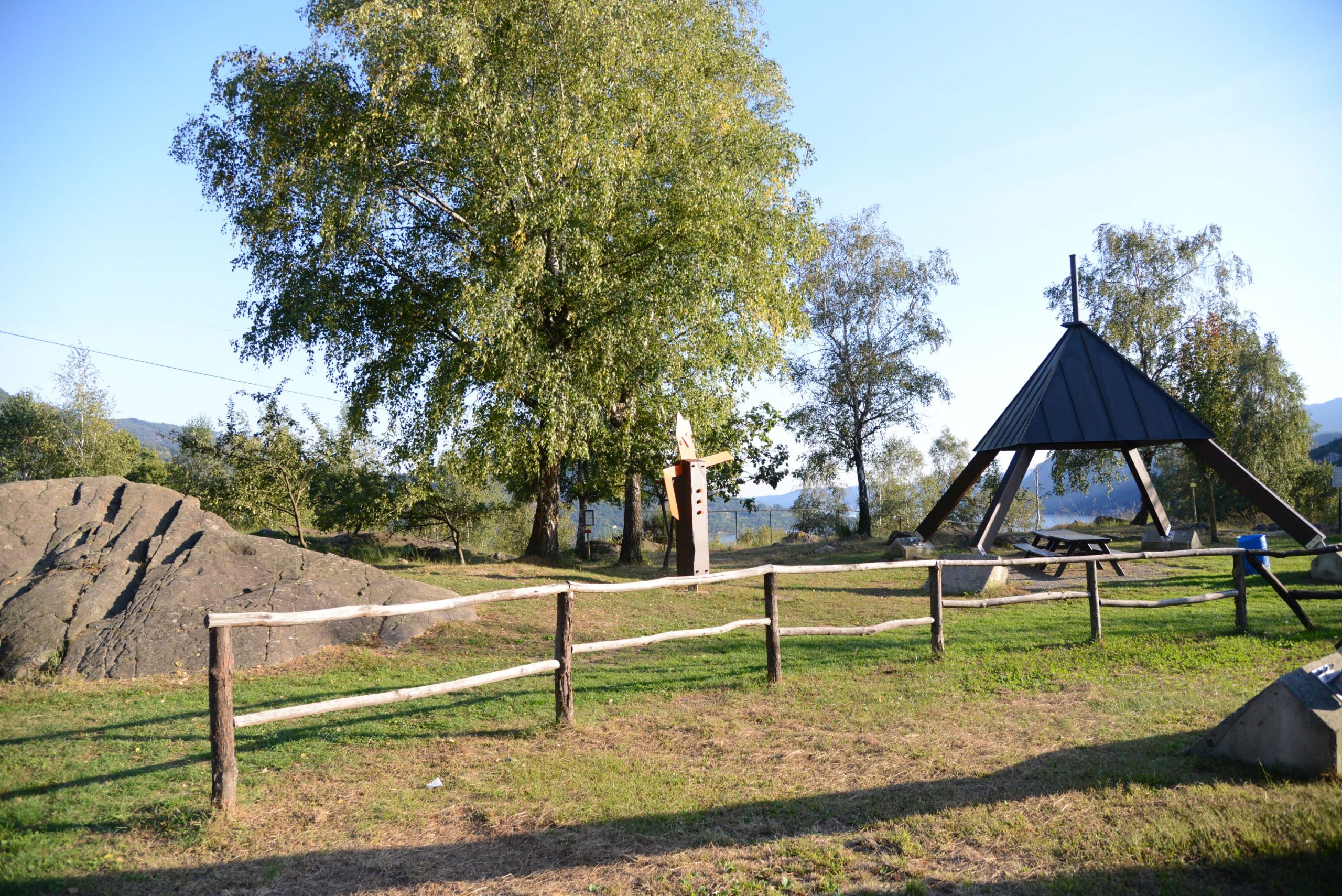
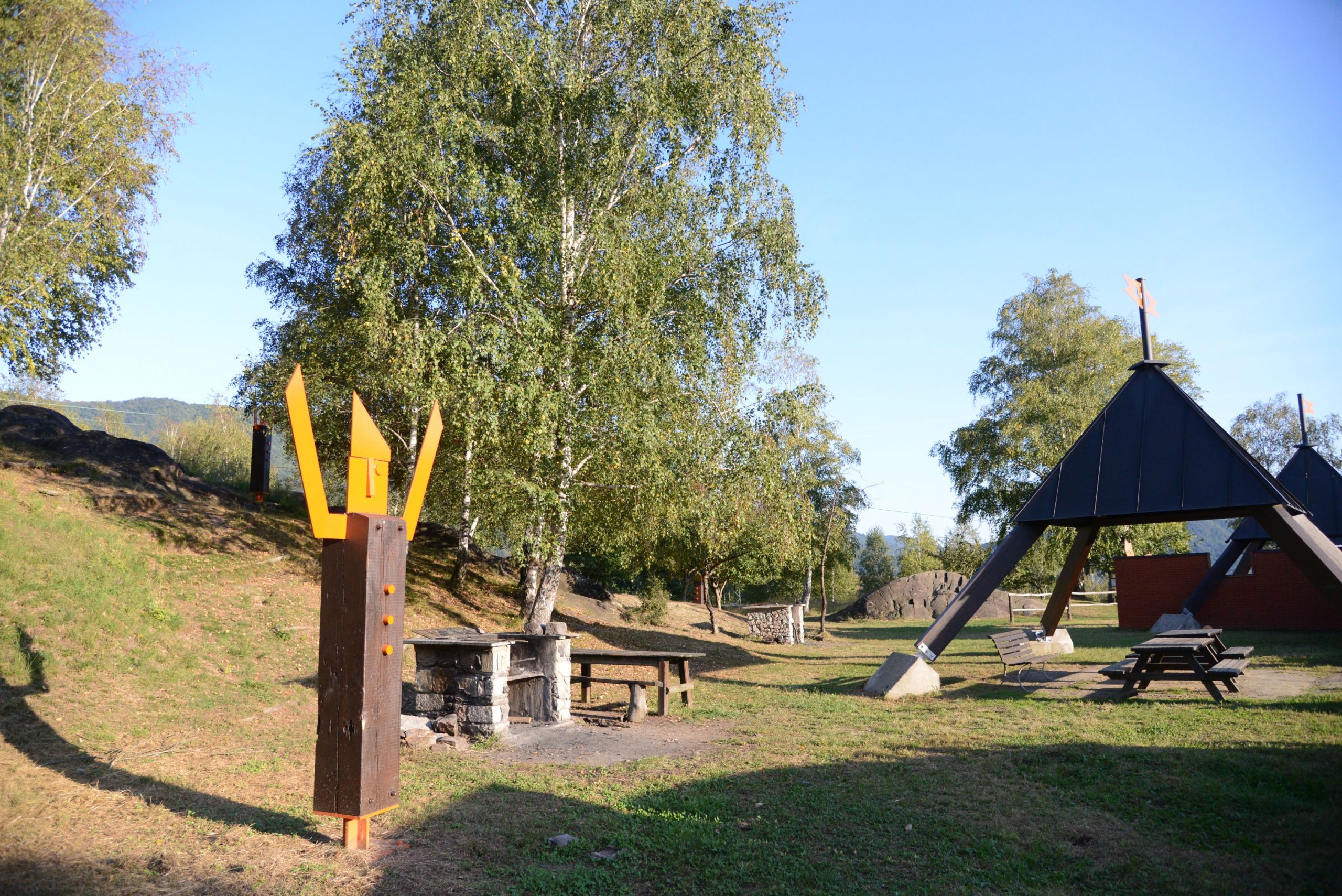
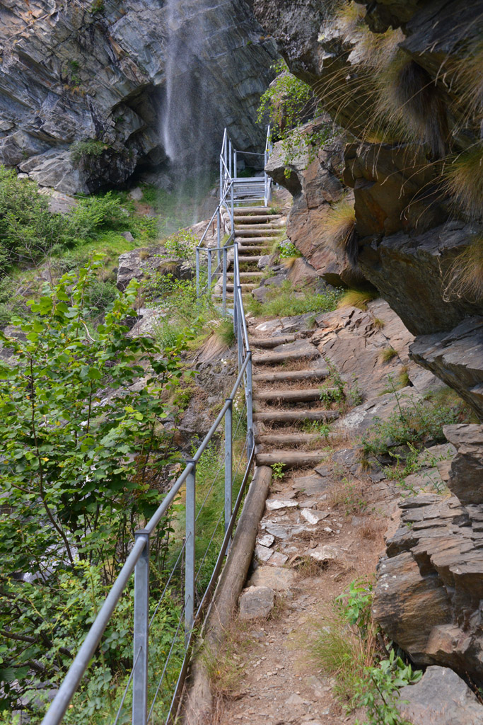
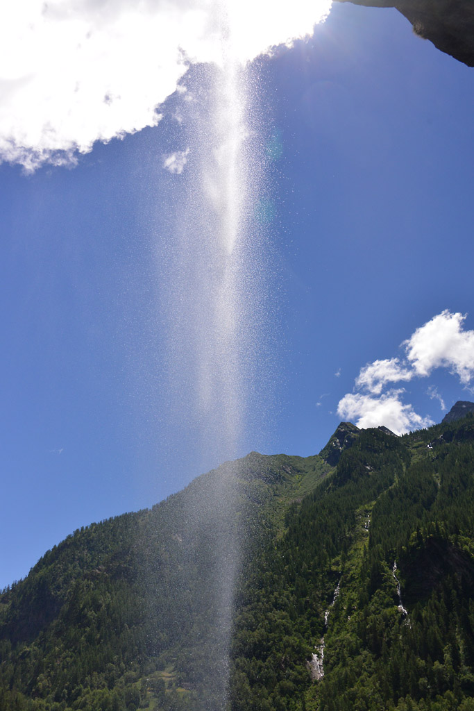
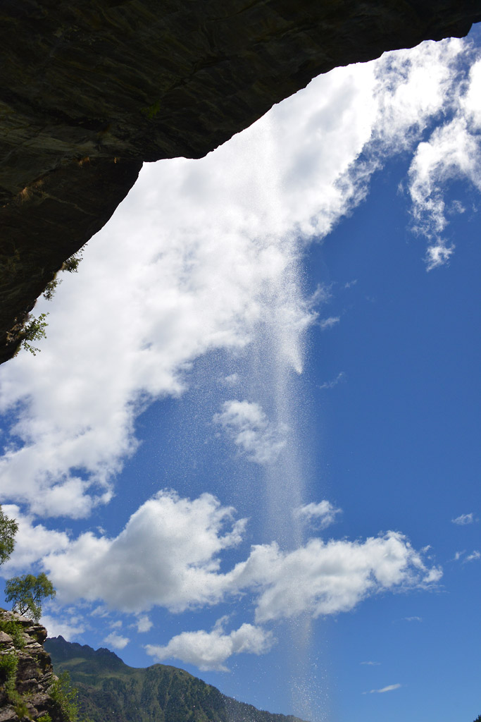
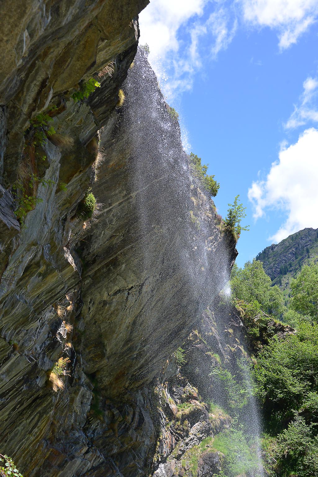
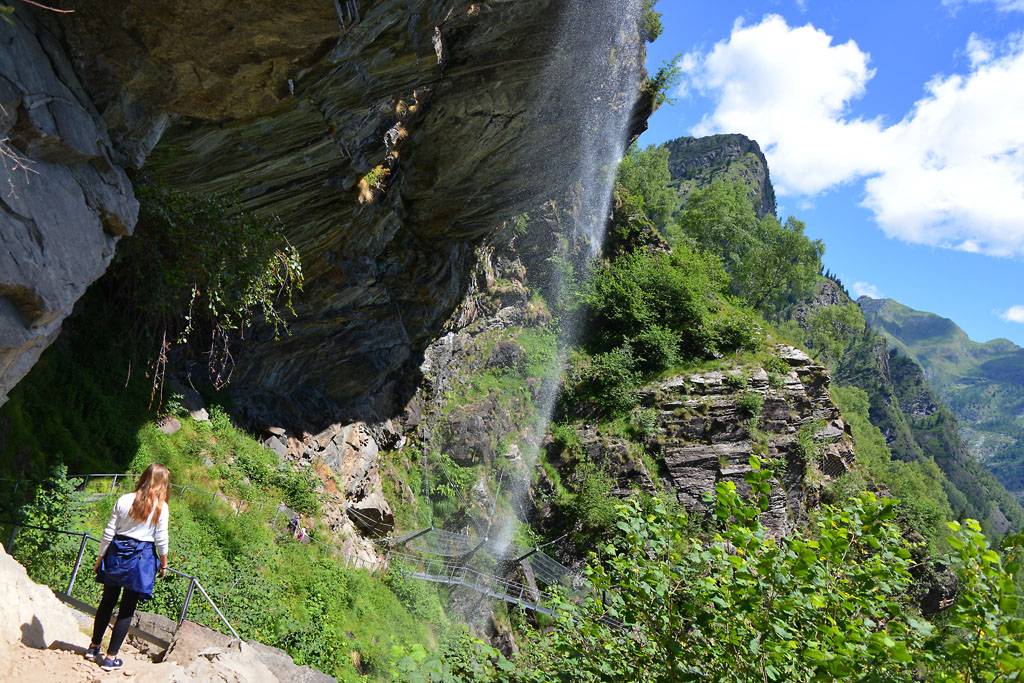
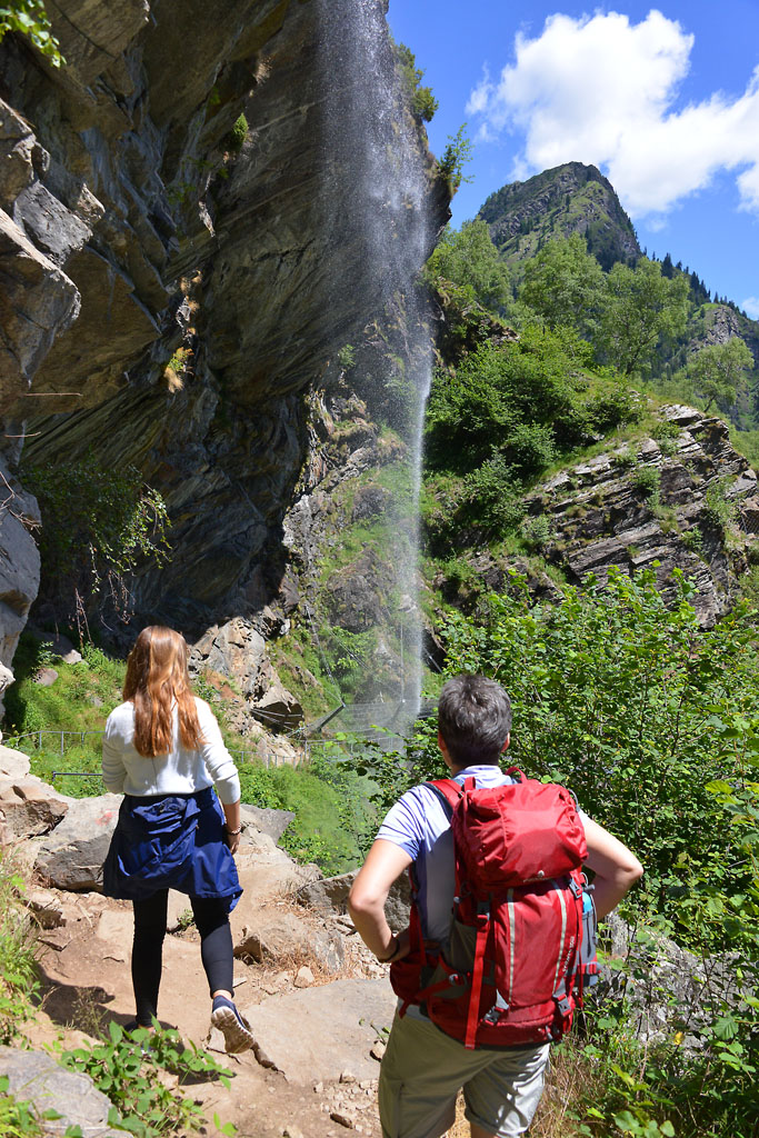
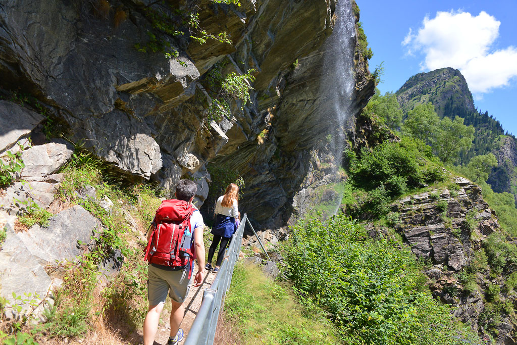
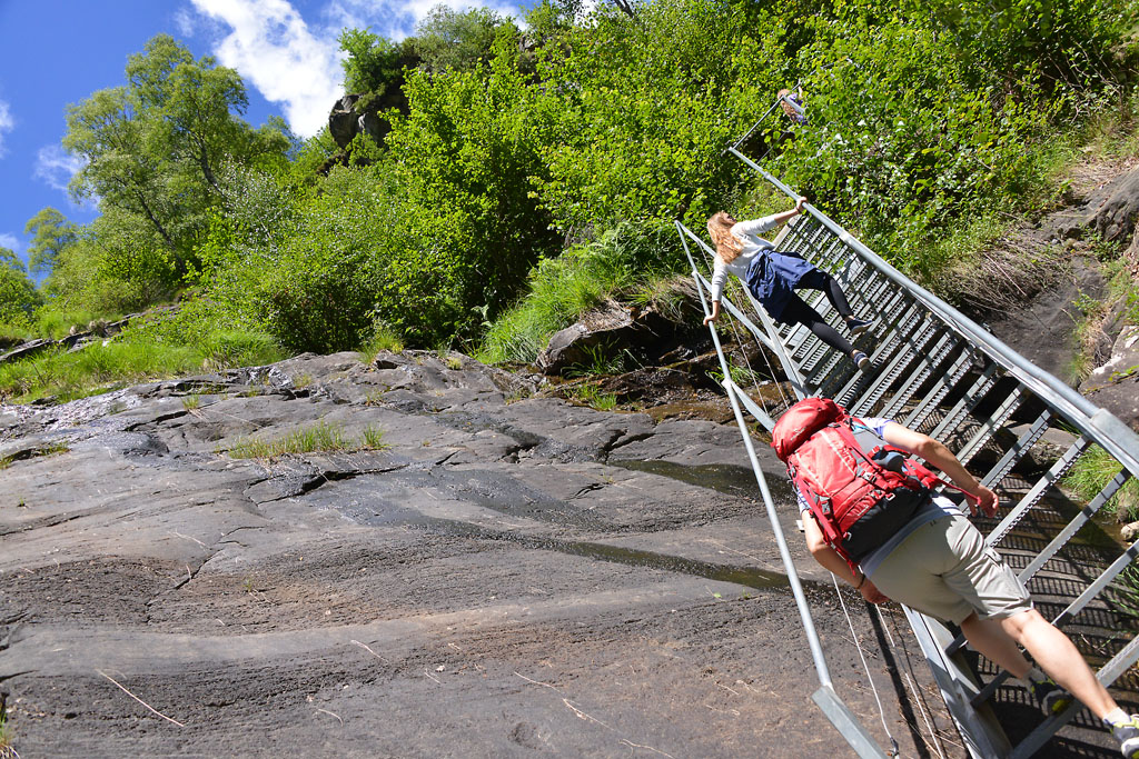
When you are almost at the base of the hill, you’ll see the first chapels of the Sacro Monte complex, which seem to be a little swallowed up by the city traffic. Only after the third chapel will you start to finally climb up a wide steep cobblestone road, which is closed to most traffic. This is the beginning of a journey back in time, marked by the chapels of the Sacro Monte, which were built starting in 1657. Each one is different from the others, and inside them, life-size statues portray the story of the Christ’s walk to Calvary.
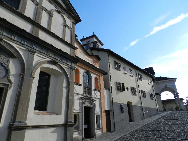
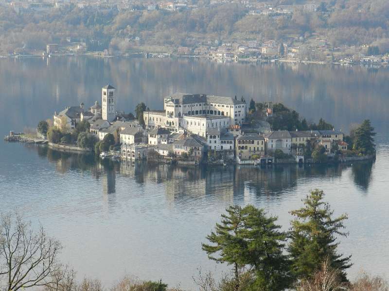
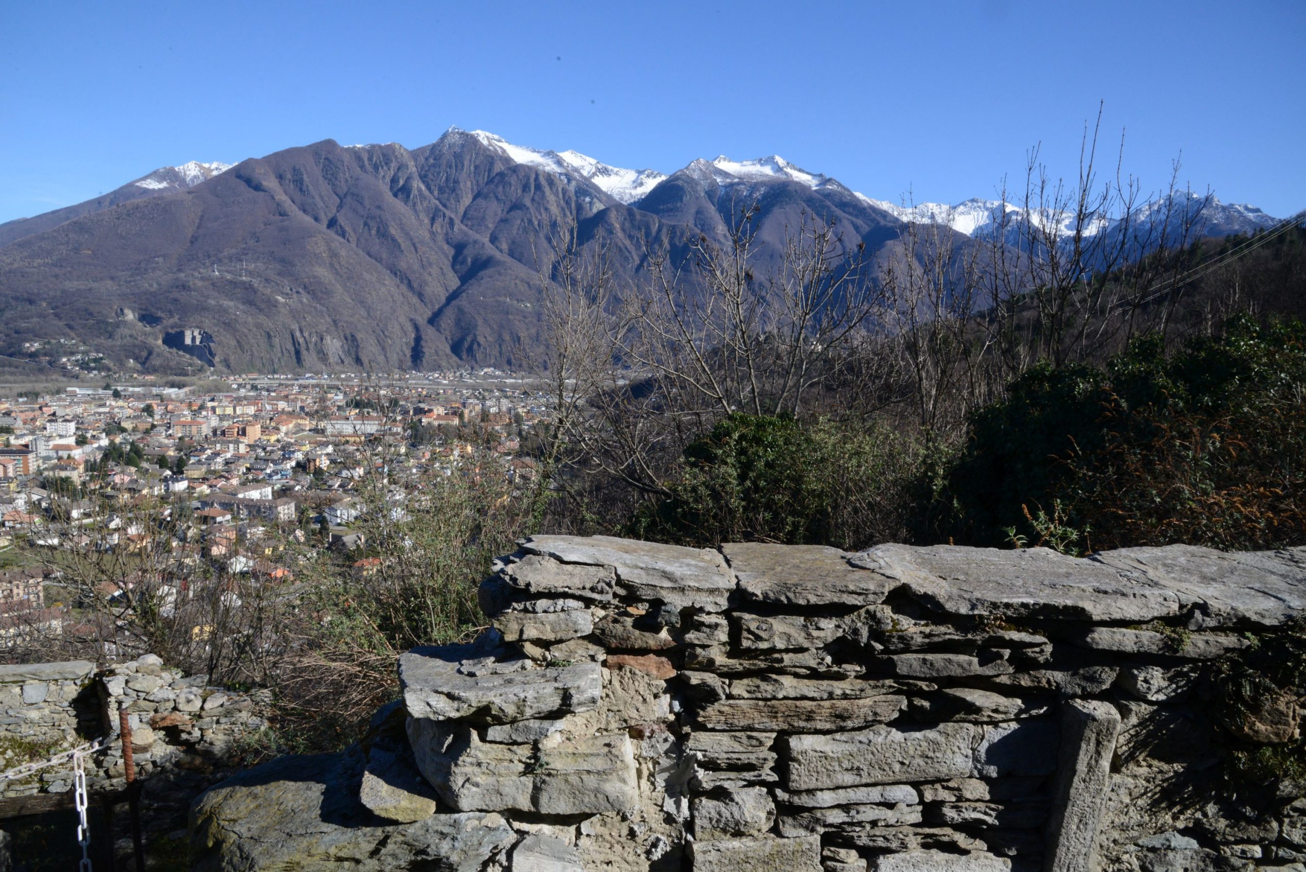
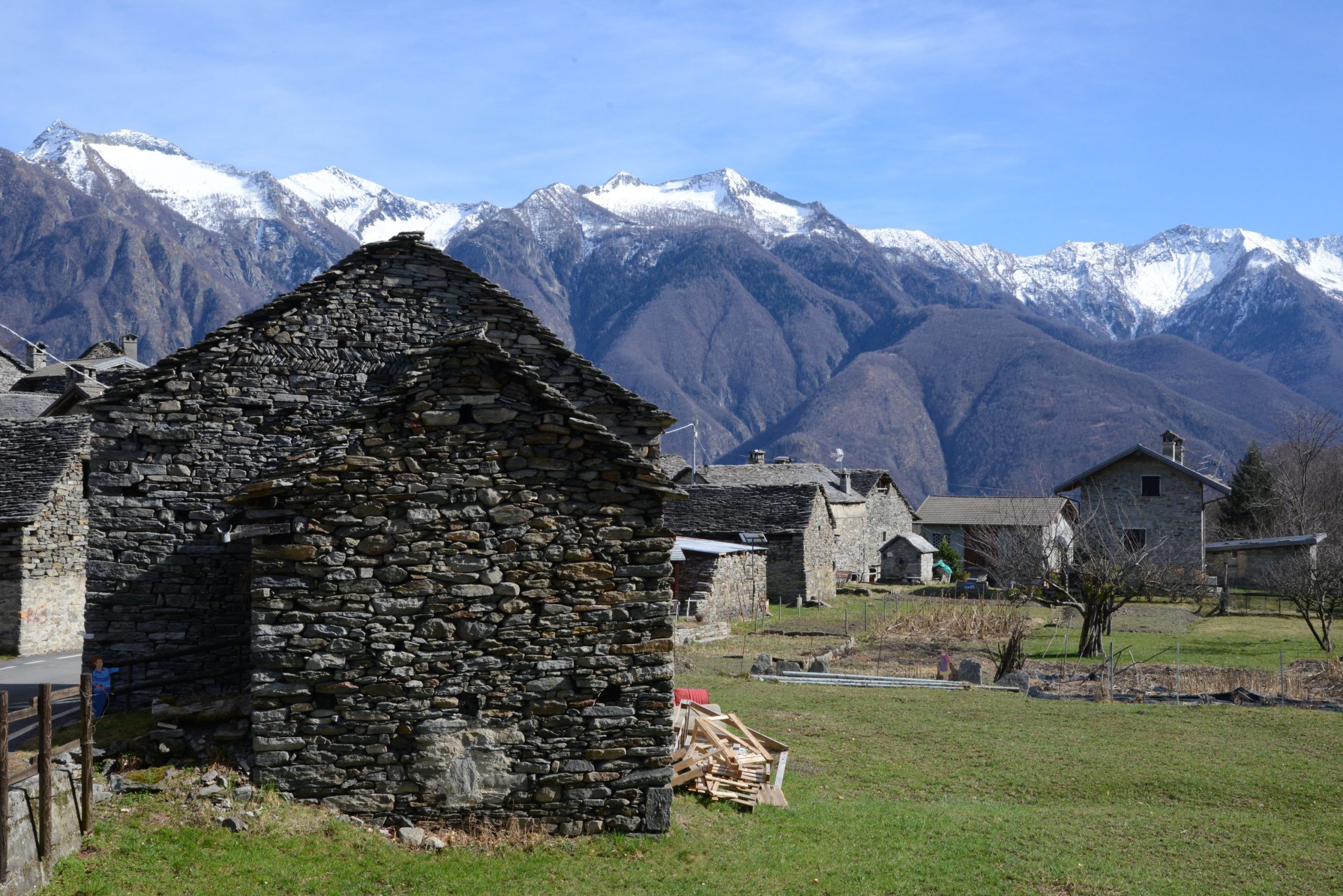
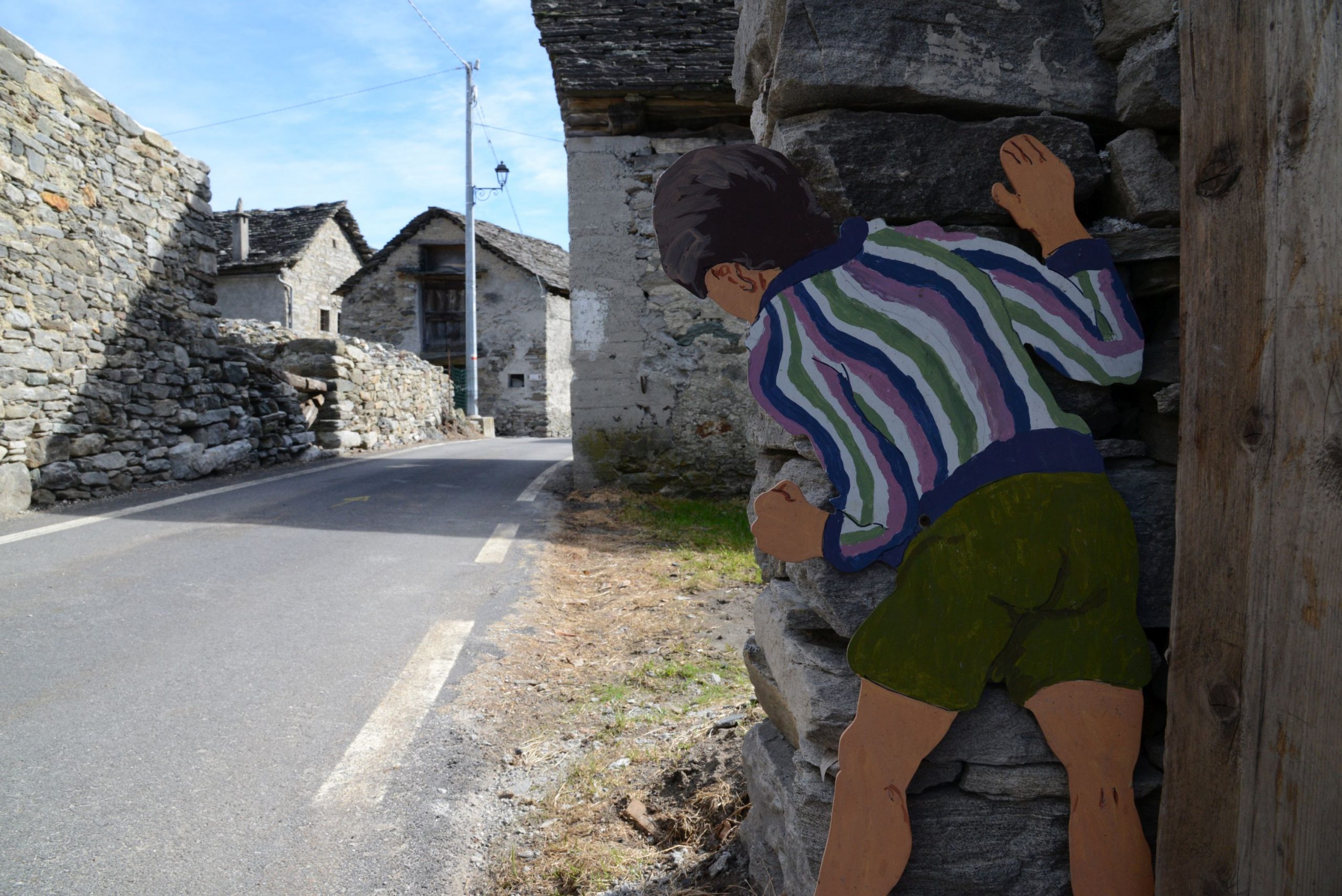
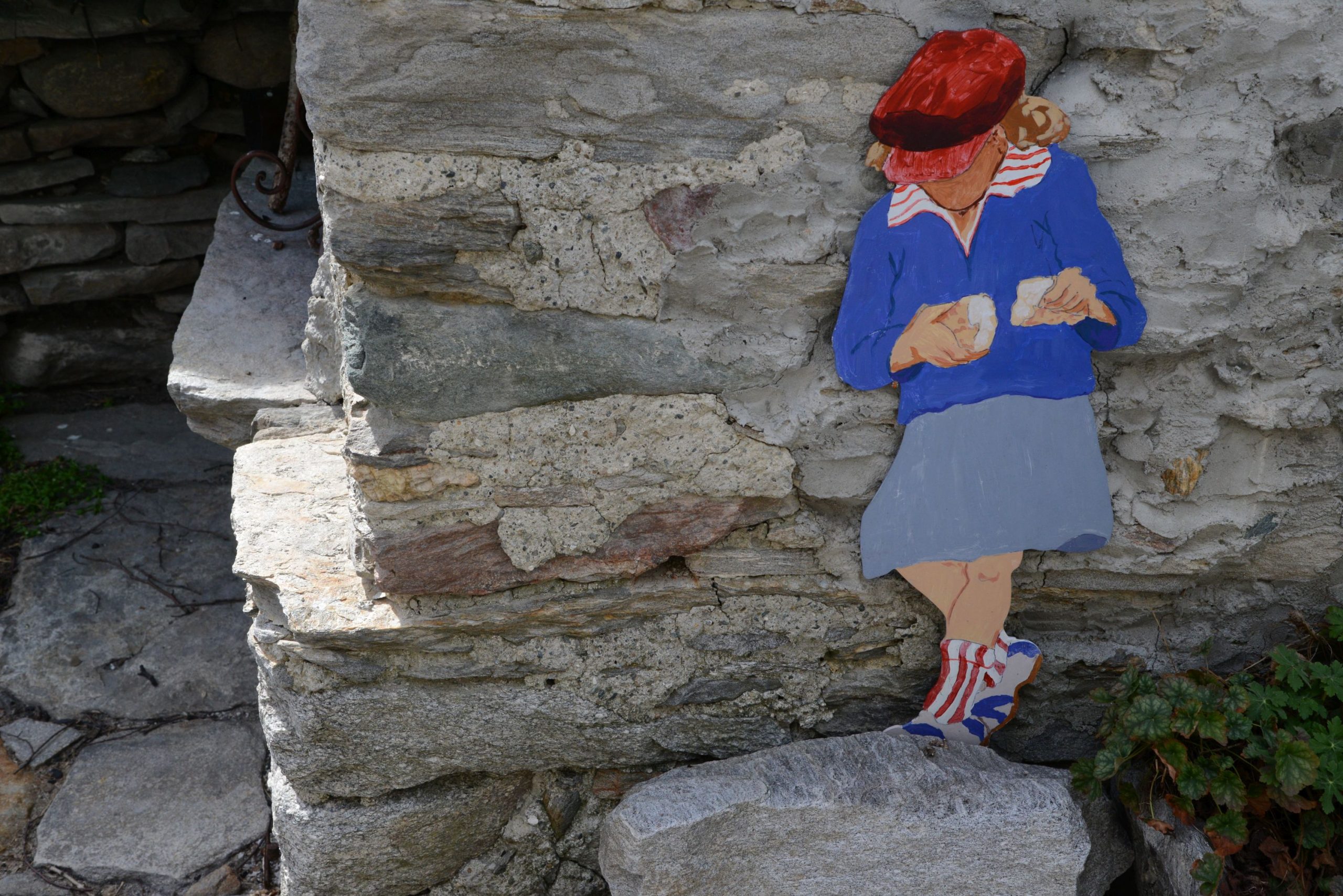
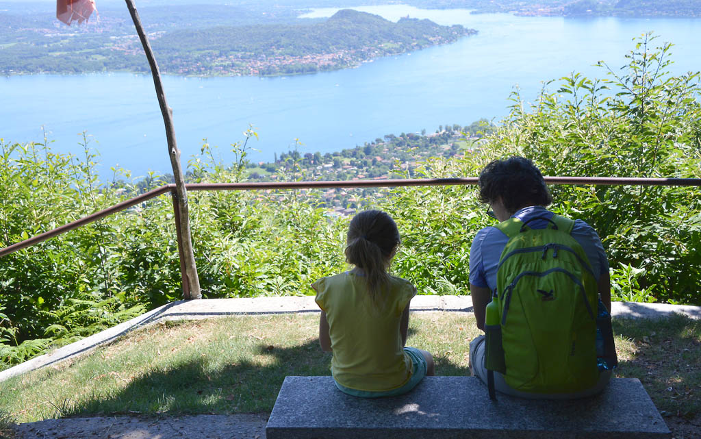
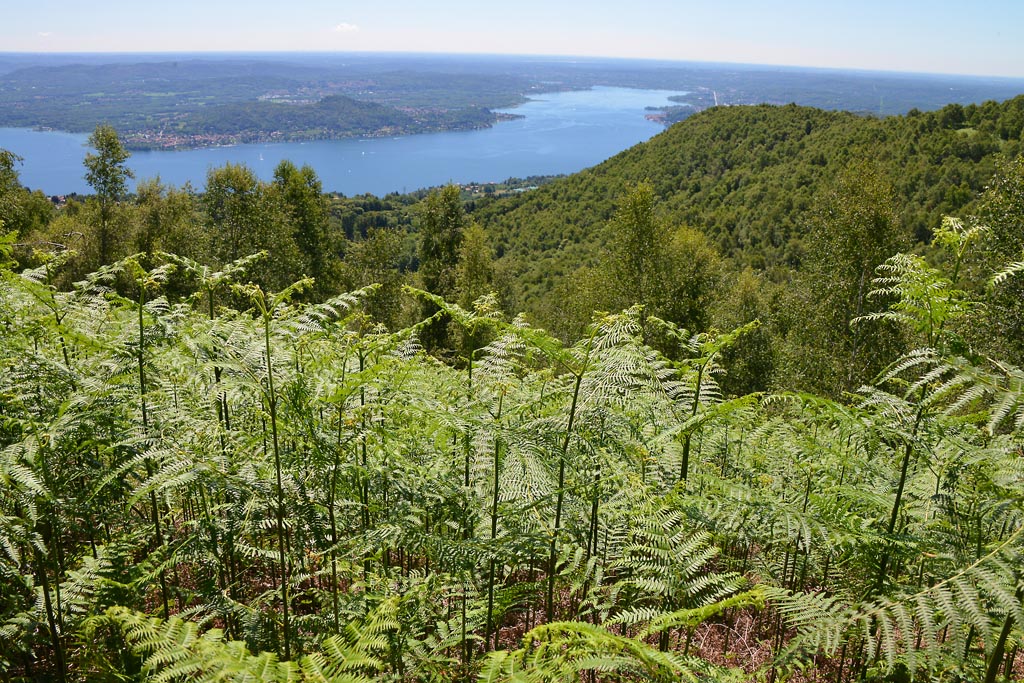
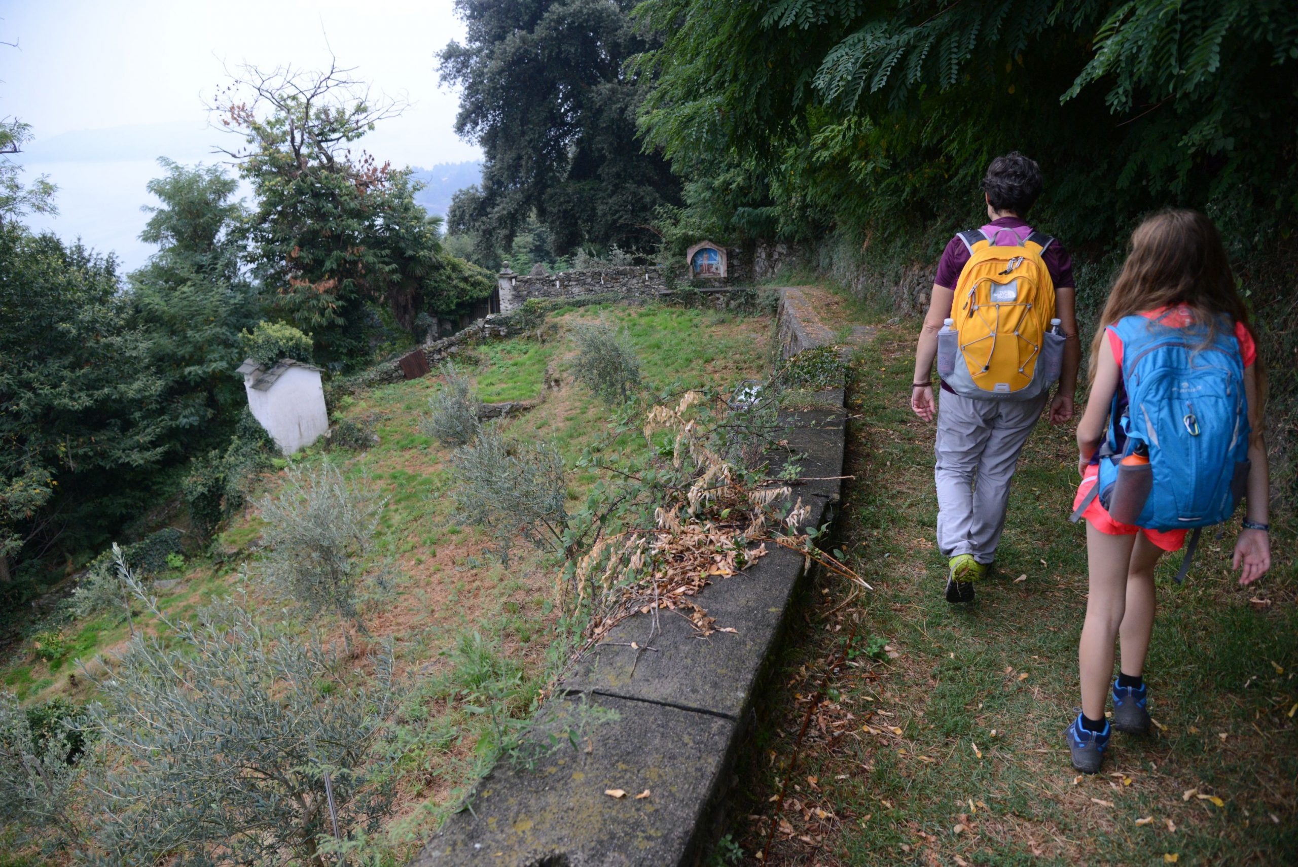
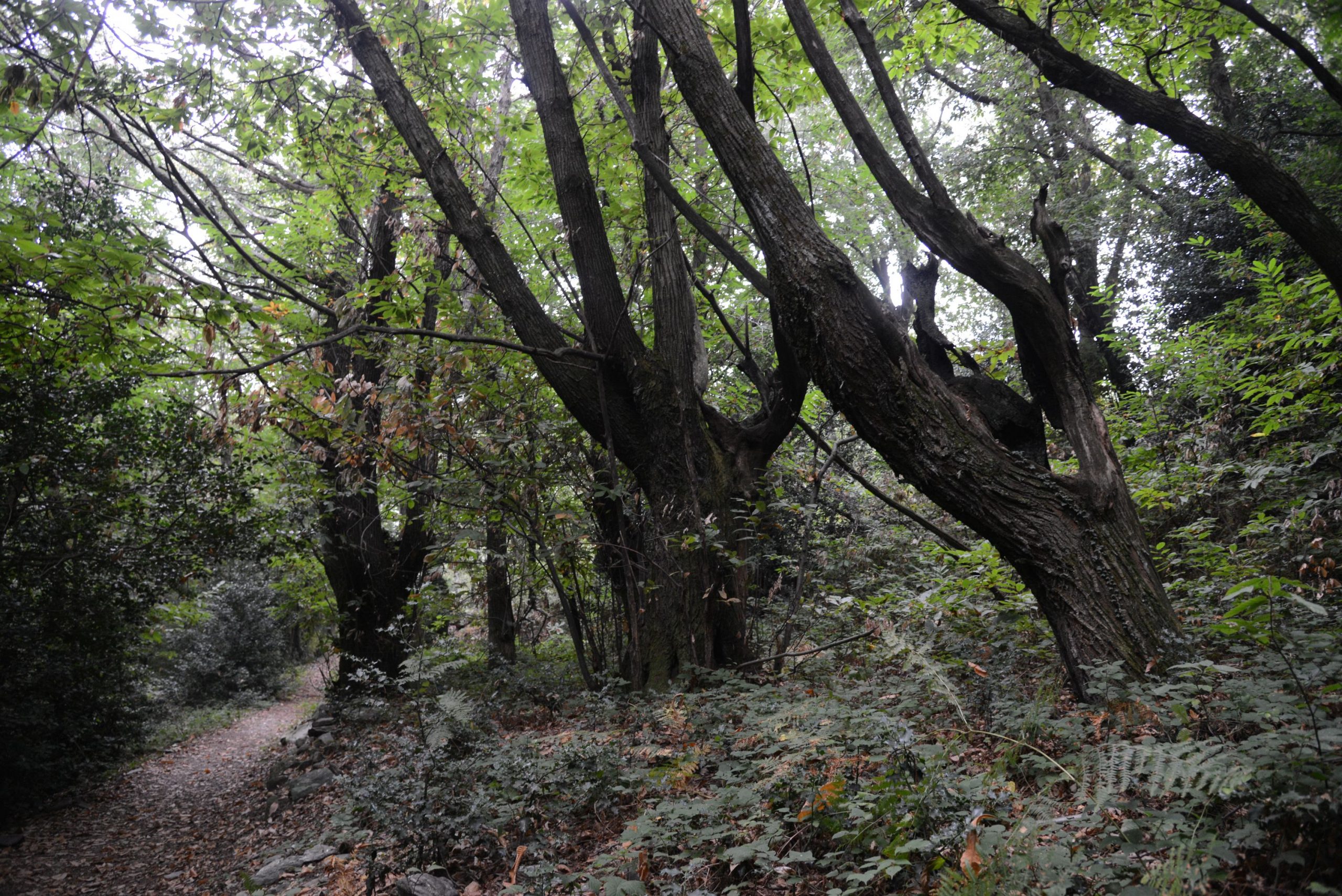
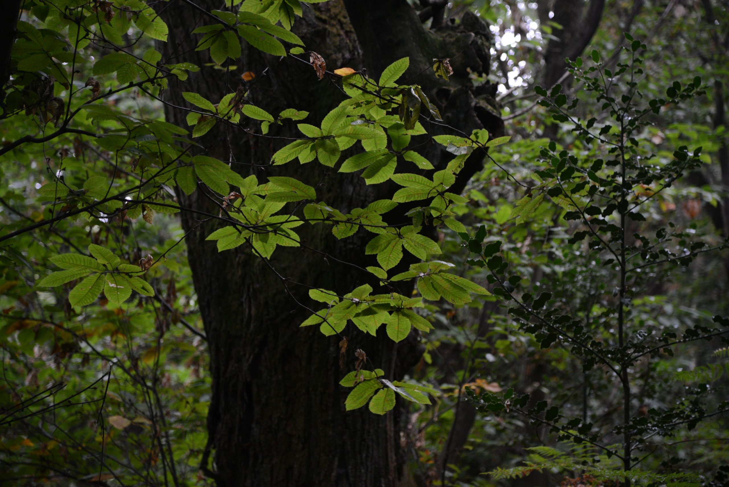
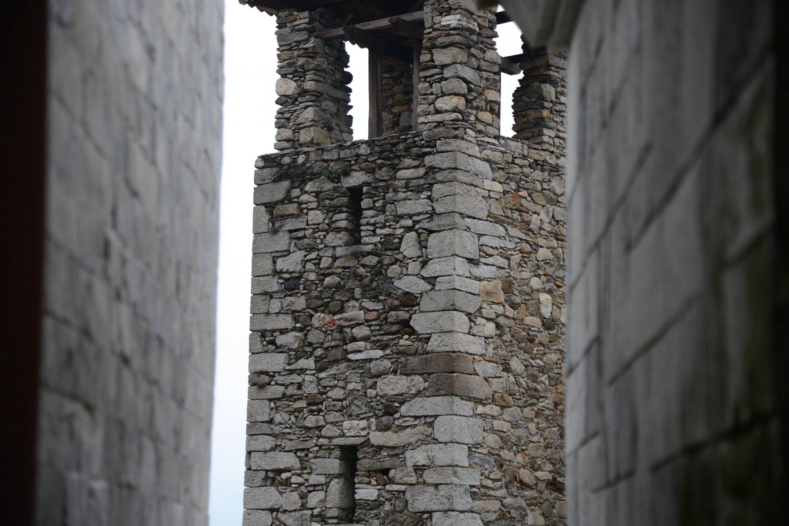
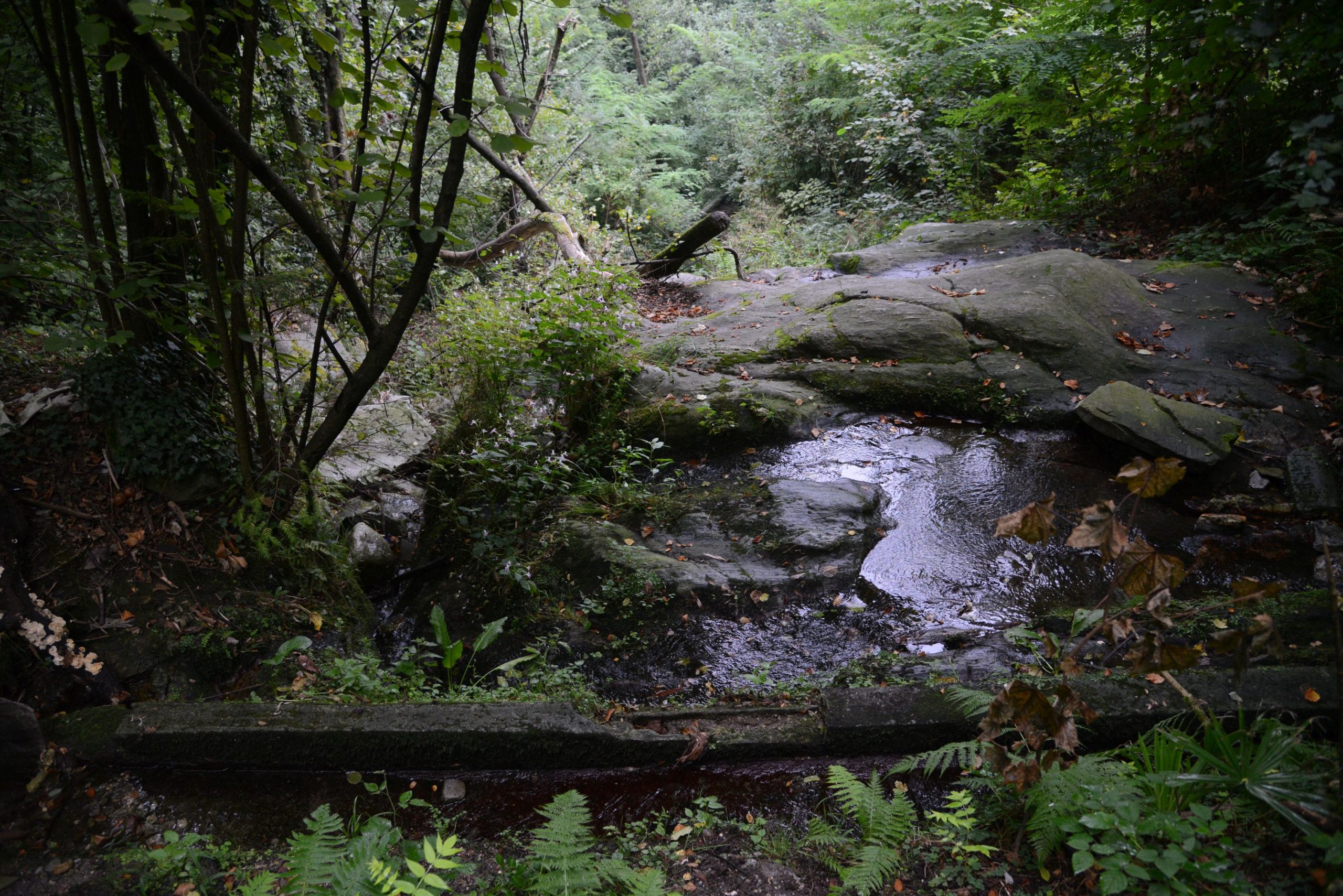
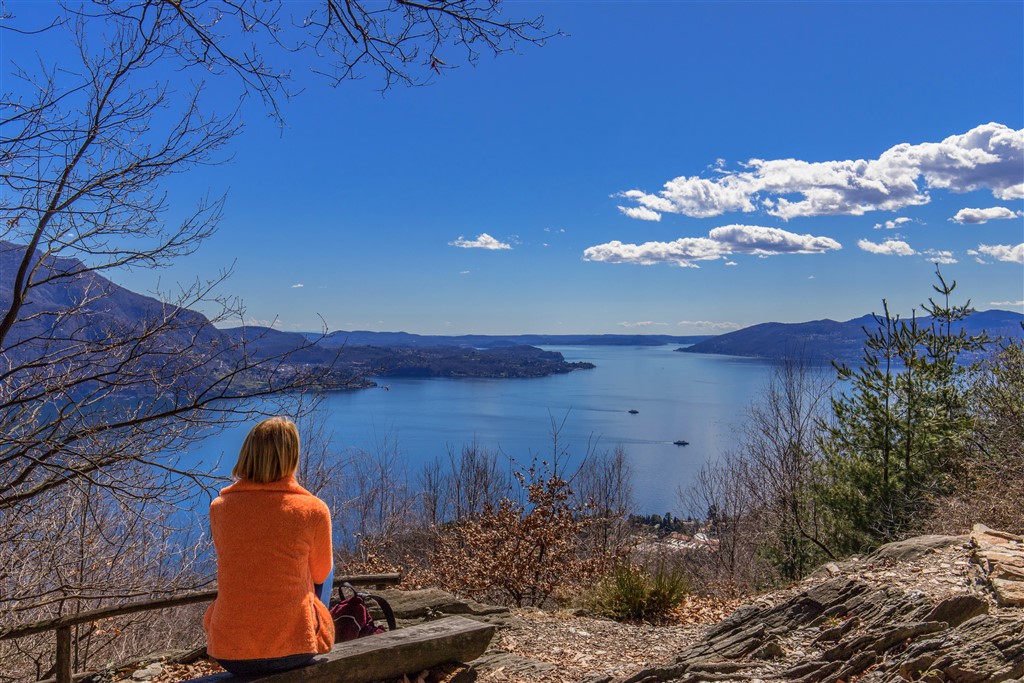
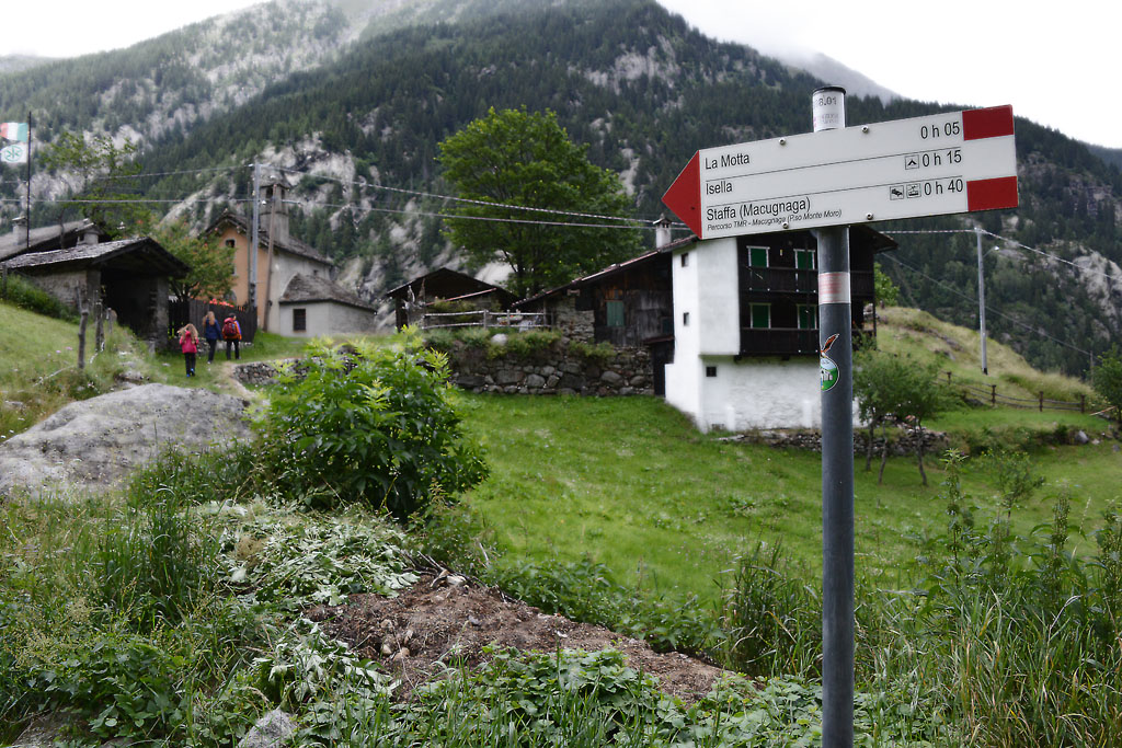
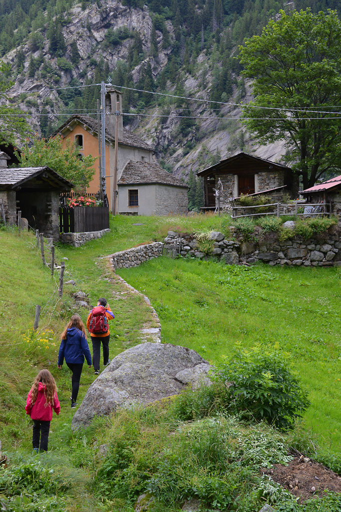
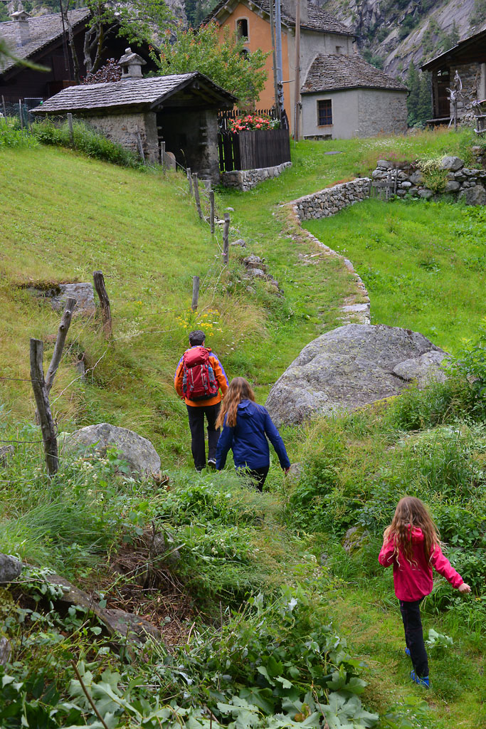
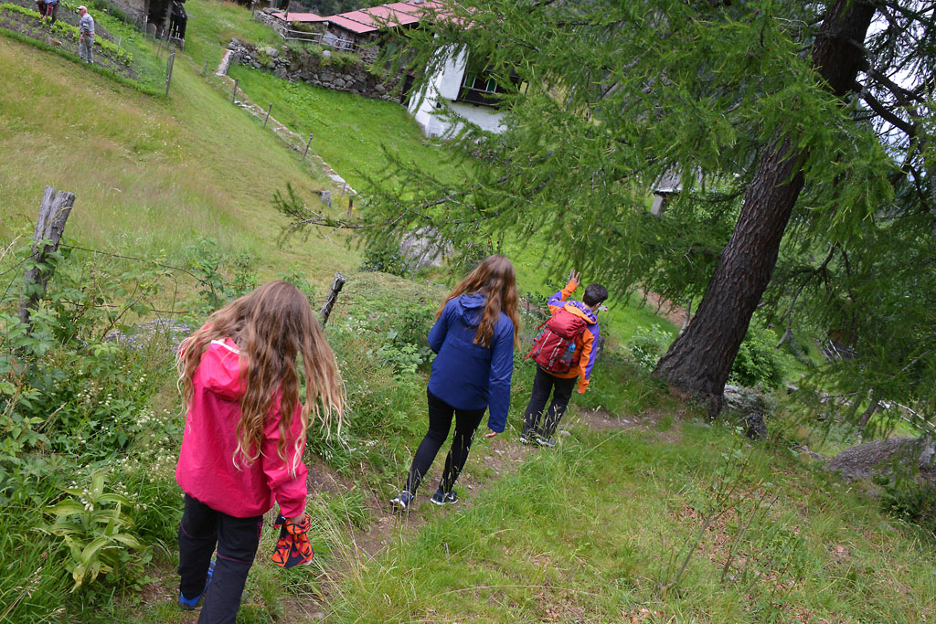
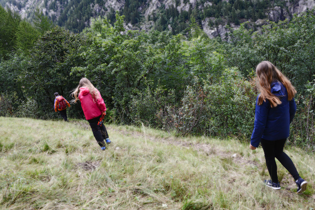
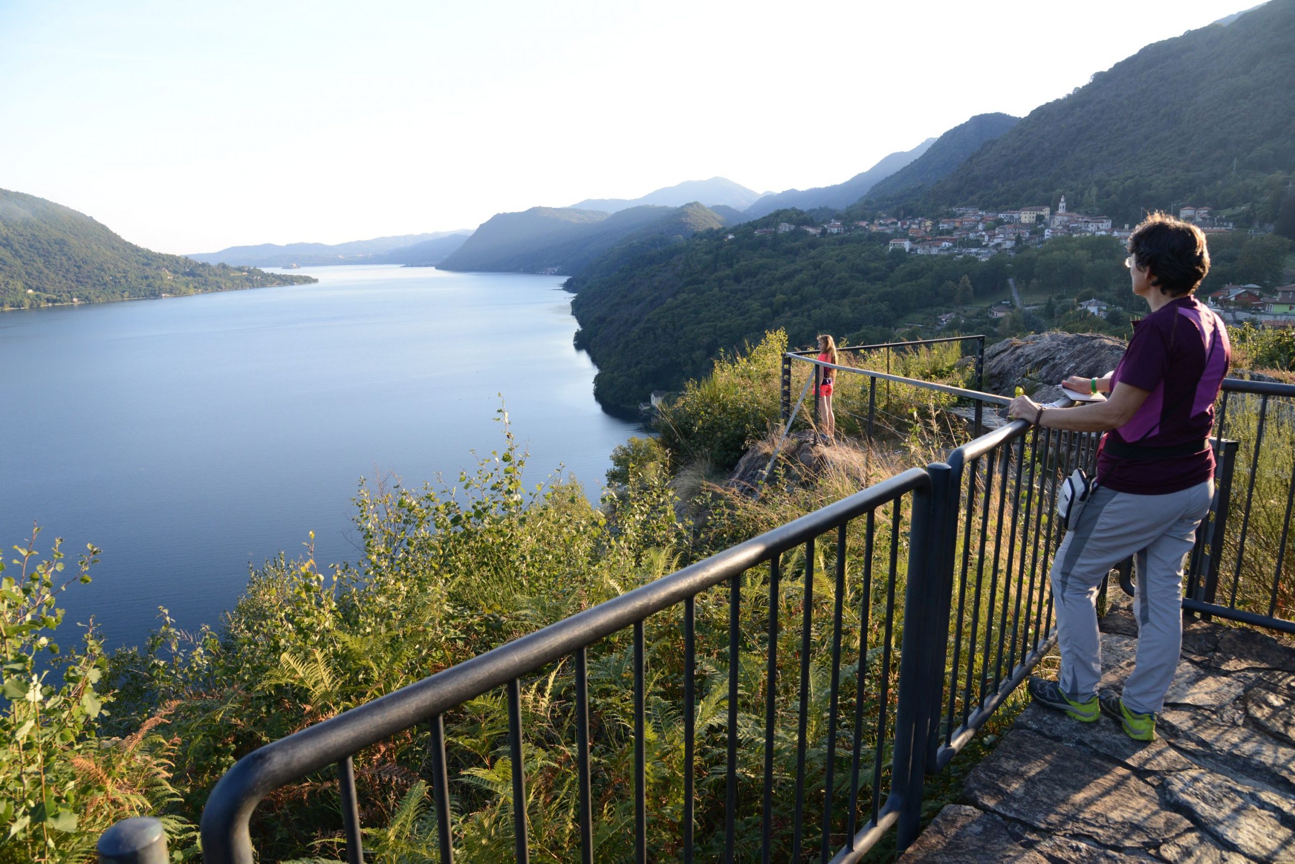
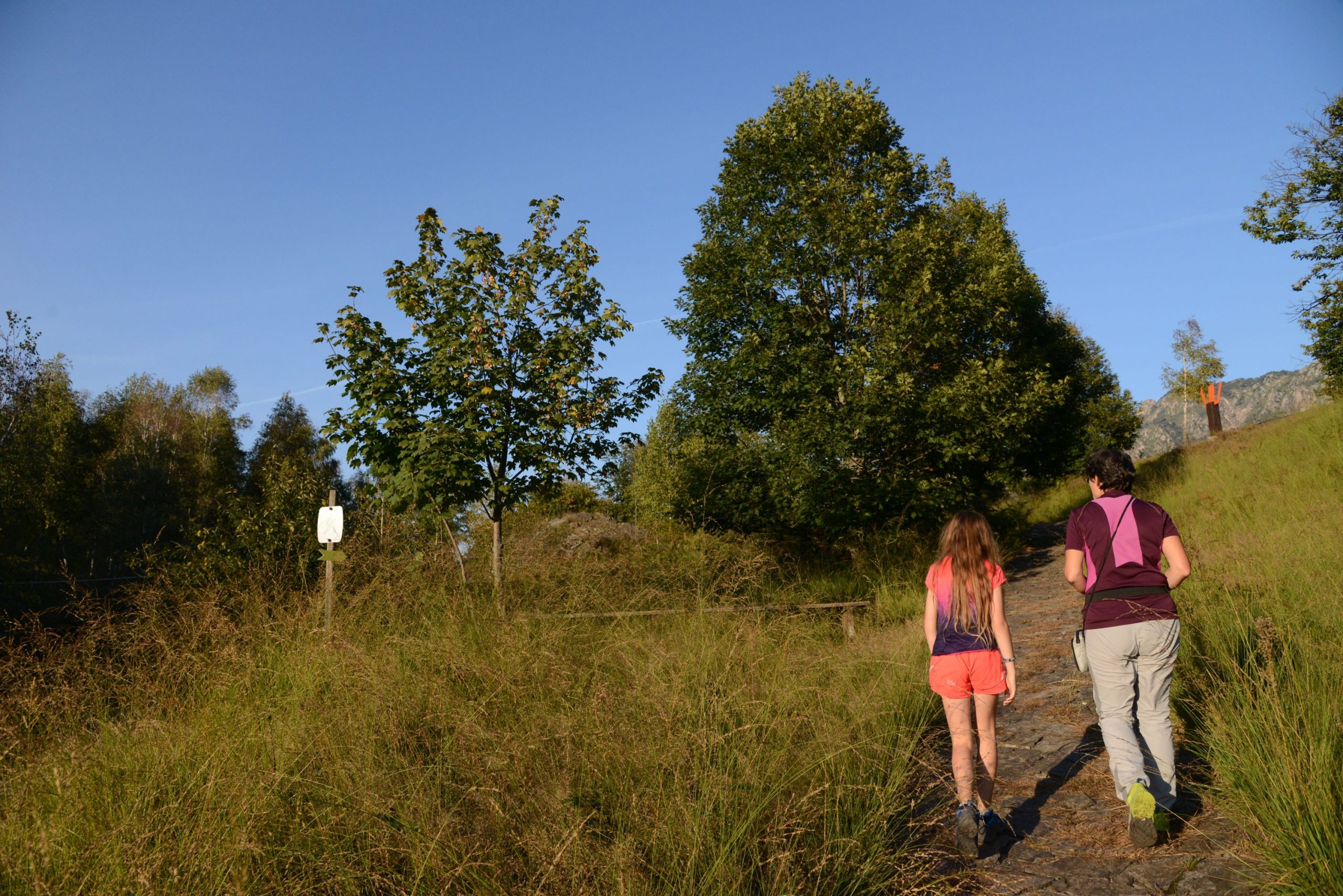
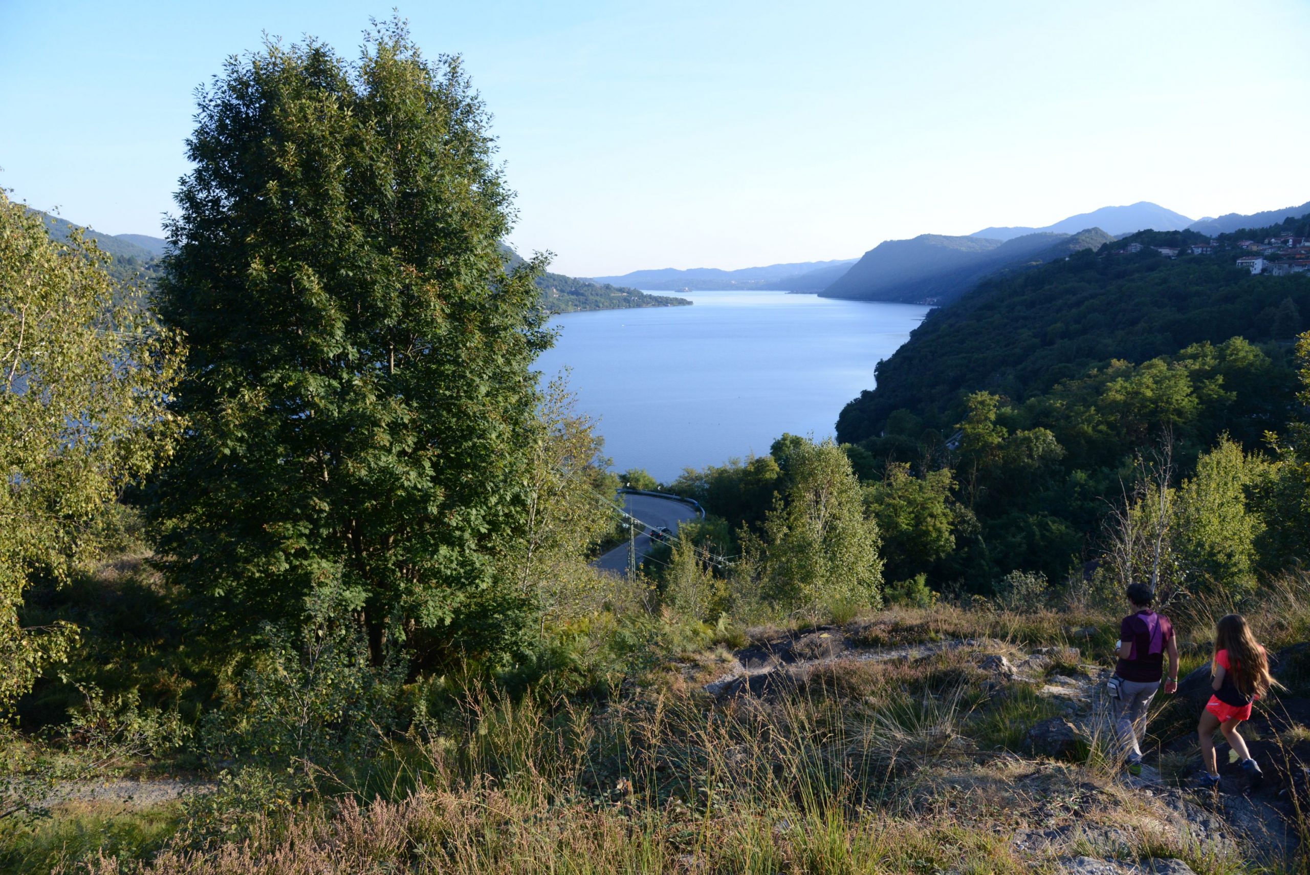
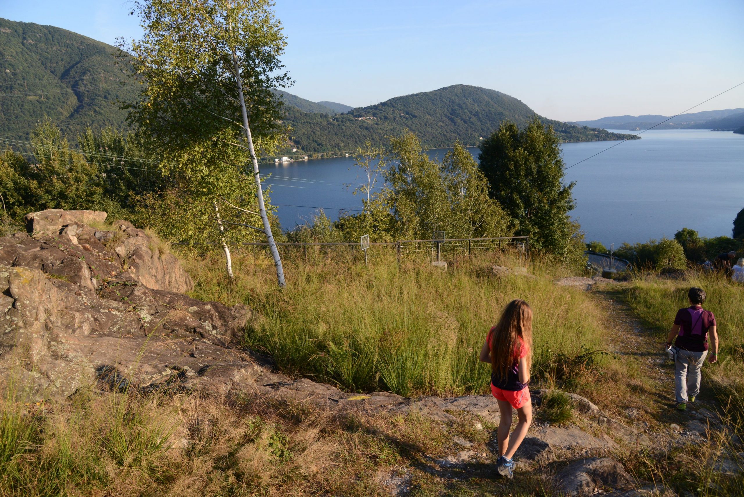
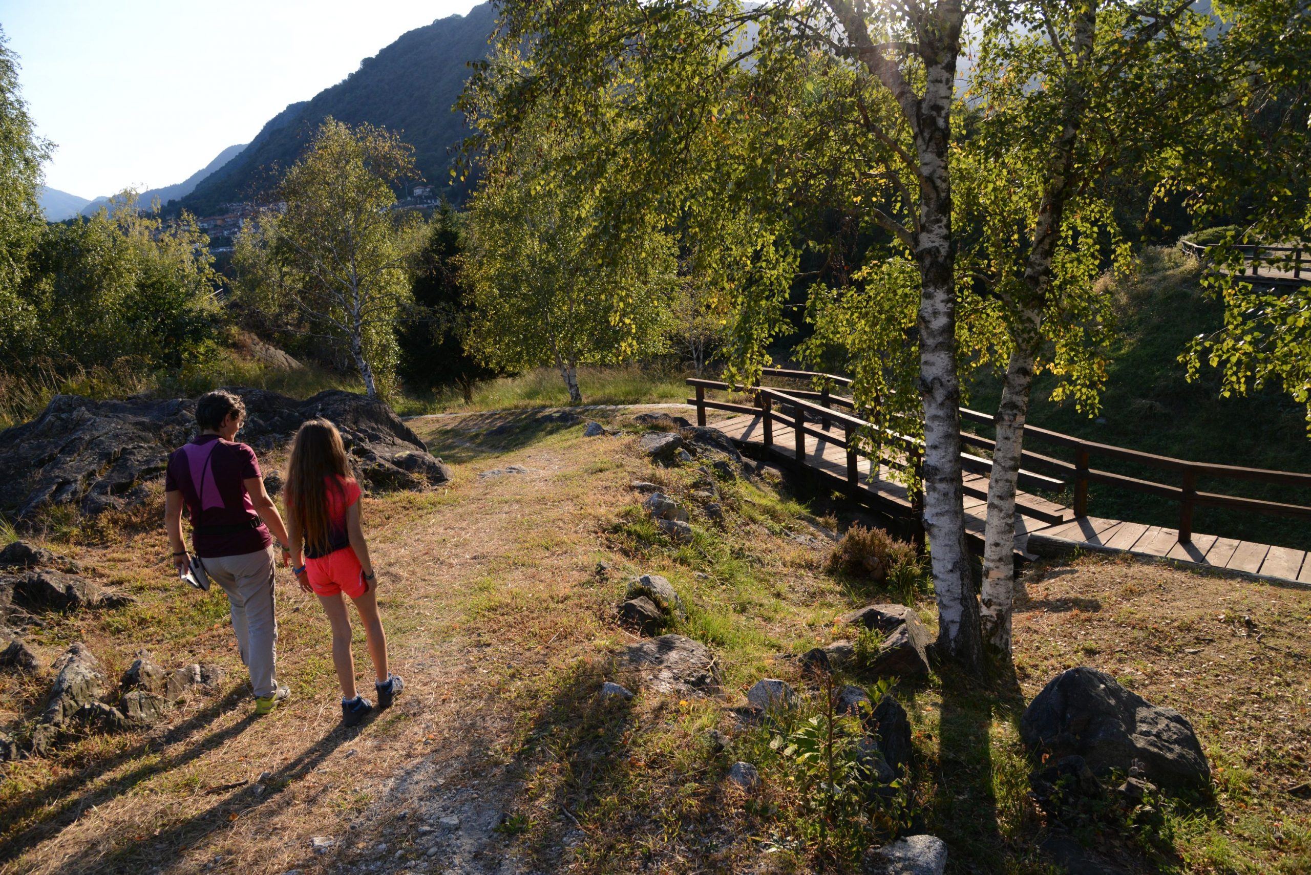
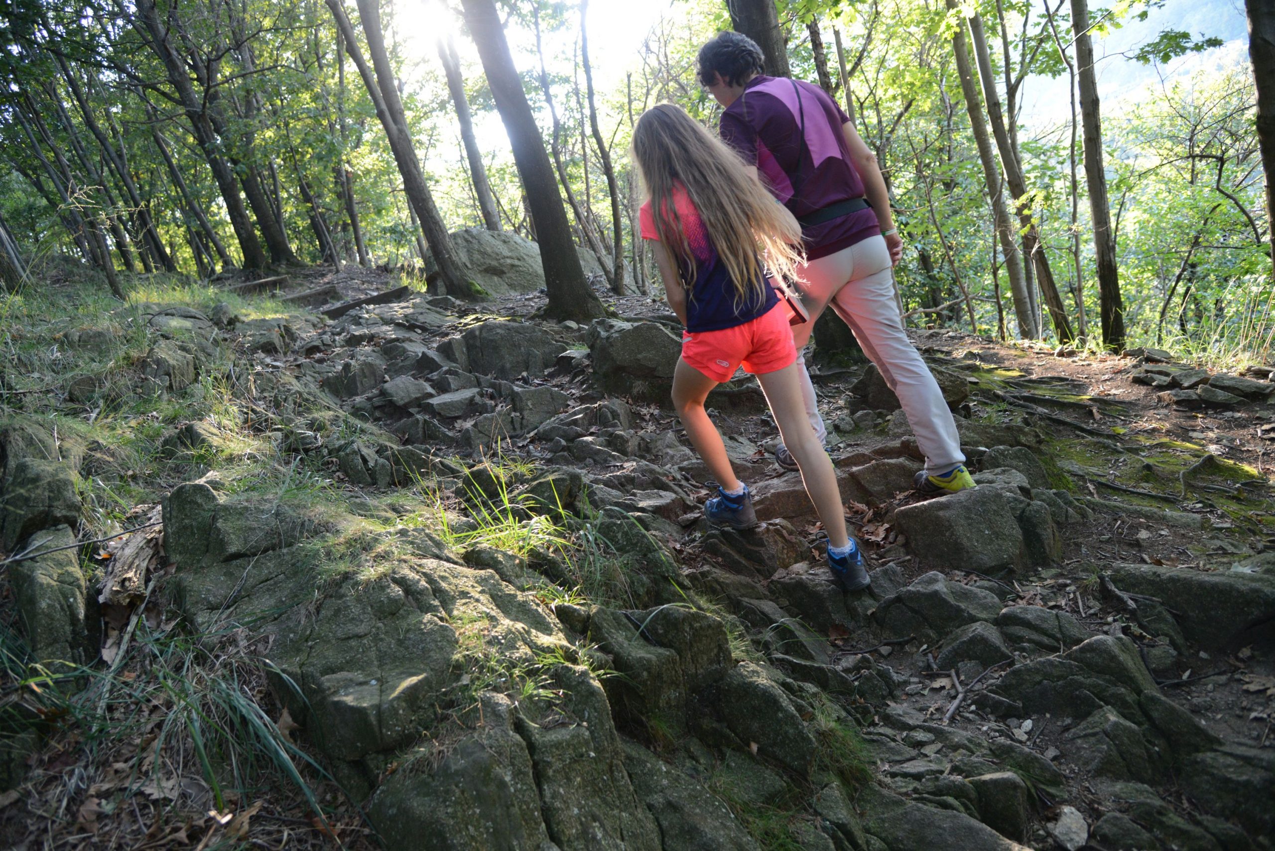
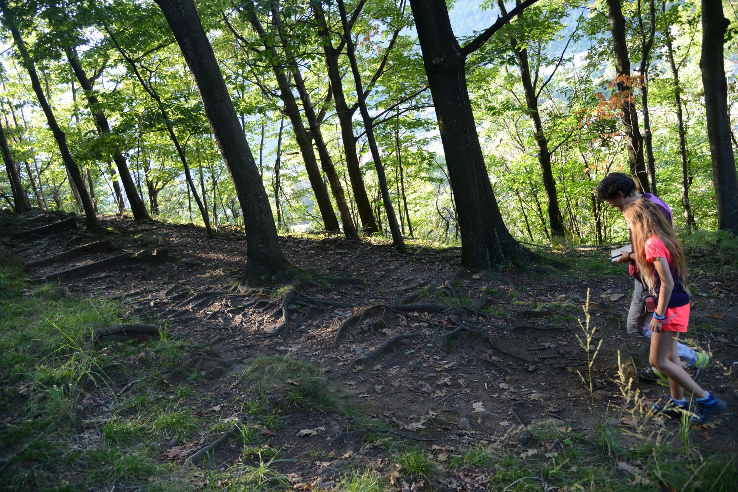
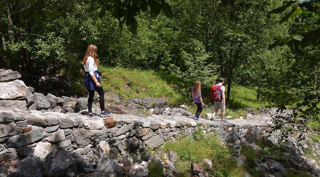
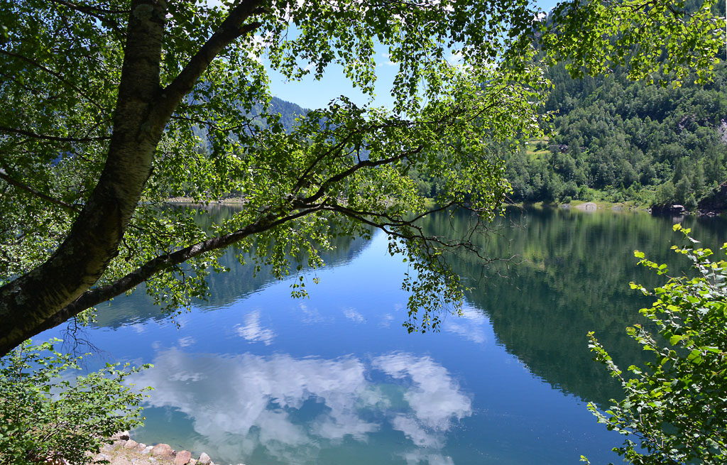
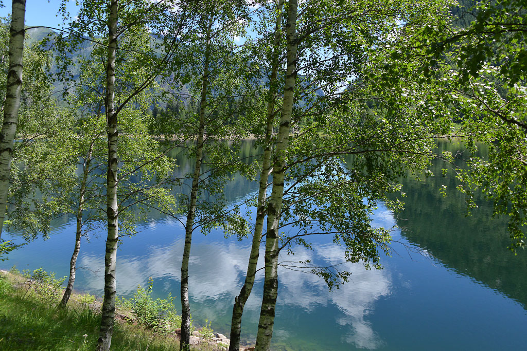
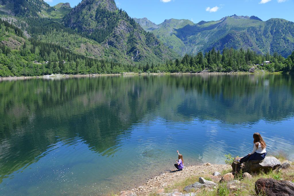
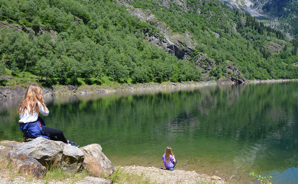
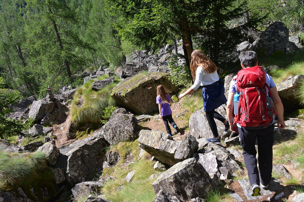
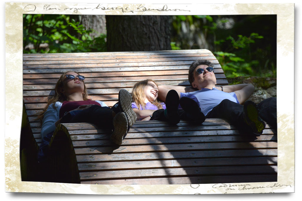
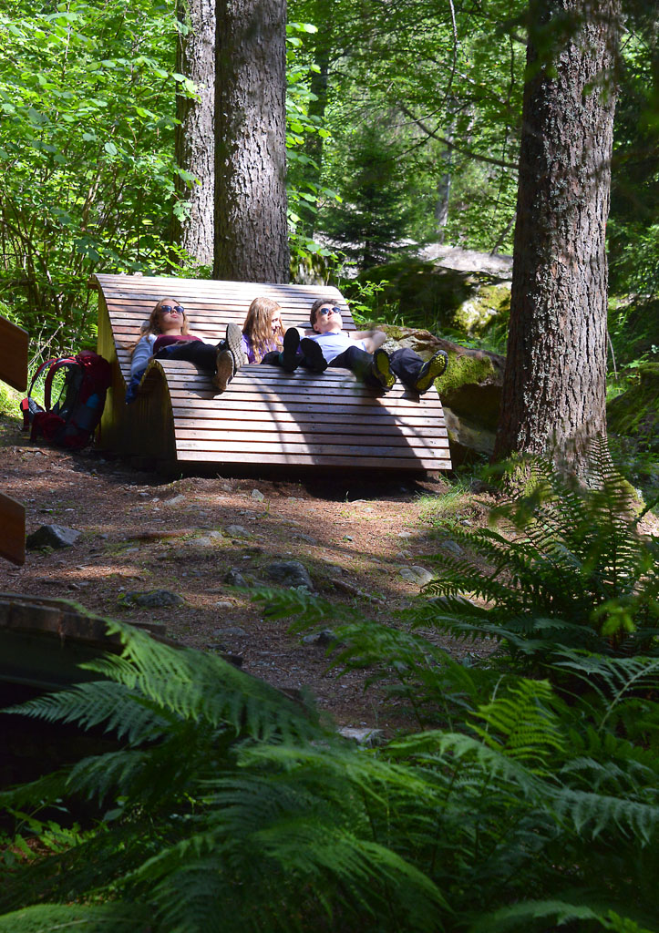
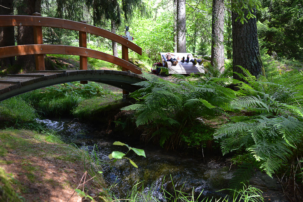
Today, this Sacro Monte complex is classified as a UNESCO World Heritage Site. At the height of the sixth chapel, you must keep to the right, and stay on the main cobblestone pavement. After you reach the Sacro Monte, turn left and enter through the gate that leads to the entrance to the Sanctuary and the Convent. You will get to a beautiful garden (with rest rooms and benches) that surrounds the tower and the ruins of the 6th century Mattarella castle, of Lombard origin, which was destroyed in the 15th century. Here, you have a bird’s eye view of Domodossola (413 m). Go back to the Sacro Monte area, enter the car park and then climb up the stairs on the left (sign for San Defendente A01a) which leads to a beautiful uphill cobblestone road. When you turn around, you can see a pleasant view of the Sacro Monte complex. When you get to an asphalt road, cross it and continue on the cobblestone road (sign for San Defendente A01a) which leads, first, to another uphill stretch and, after that, to a small bridge on the right. If you go straight on, you will enter a steep path that leads through the woods directly to the Church of San Defendente. The path is much more gradual if you go over the bridge on the right and take the asphalt road uphill. This road has wide curves, and reaches the Cappelletta di Marisch first. Then, it goes up to the white Church of San Defendente (549 m). The path you want is right in front of the building (sign for Vallesone). After a pleasant start, the trail starts climbing steeply in the middle of a beautiful beech forest. You must be careful to take the only obvious trail at the fork: go left to get to the asphalt road. Follow the asphalt road to the right, pass in front of a votive pillar and you will come shortly to the village of Vallesone. This village is quite characteristic, with a fountain (untested water) and a giant wooden press. There are also many silhouettes of children and animals peeping out from the most unlikely places. This is the highest point of the entire route (670 m). Go past the Oratory of San Gaudenzio.
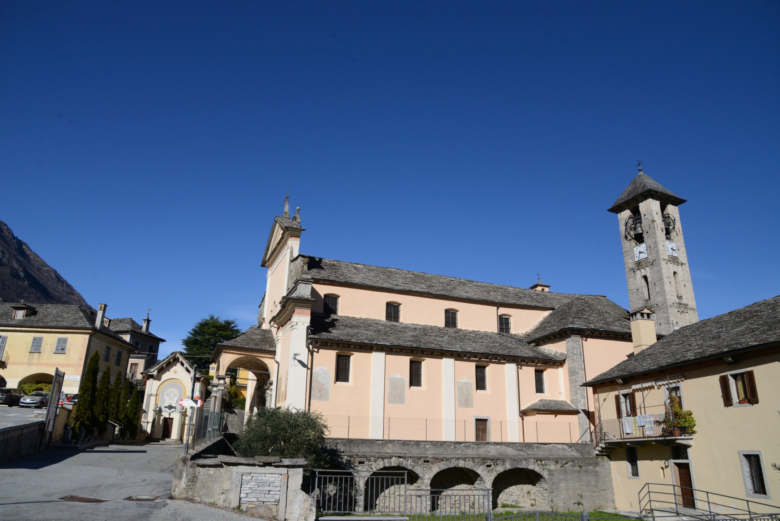
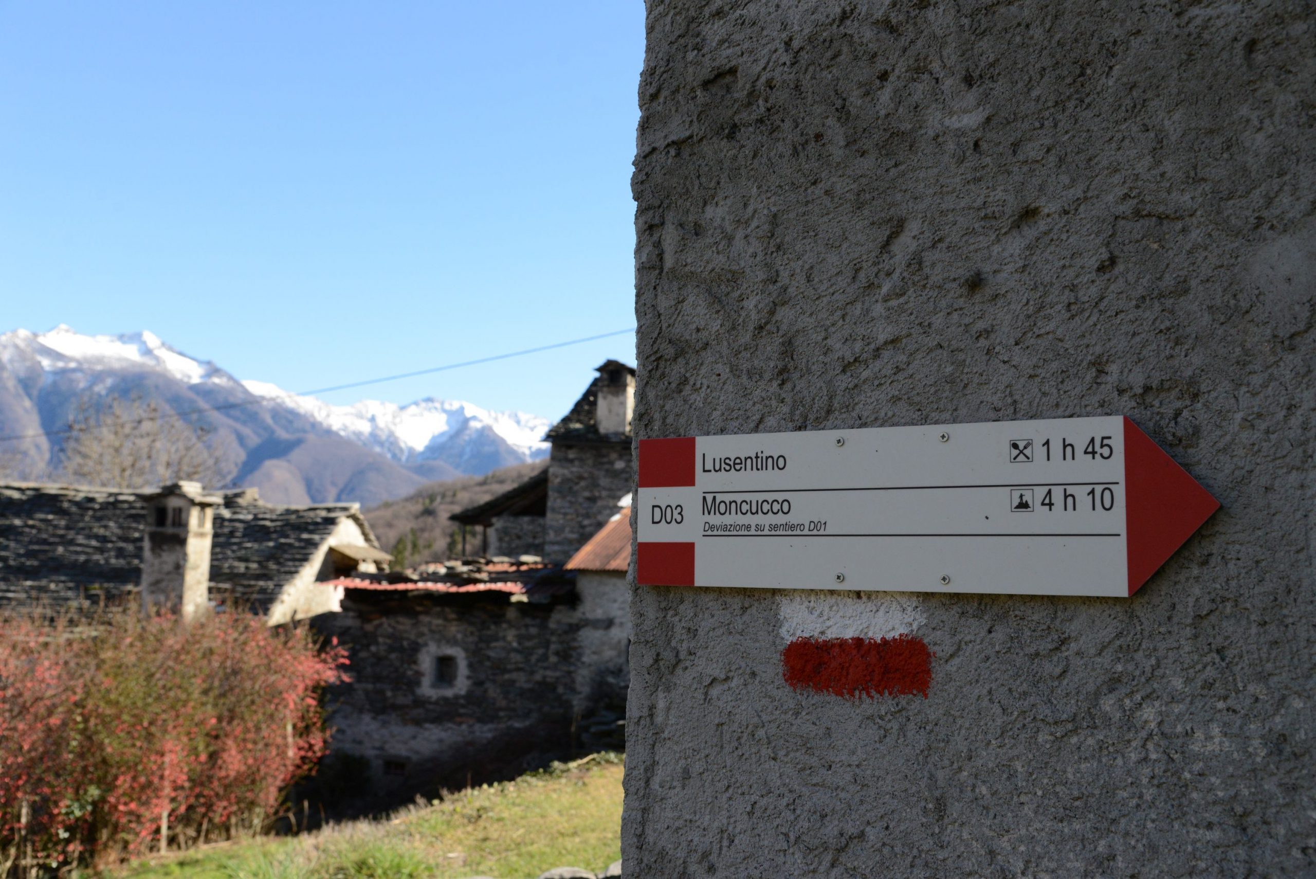
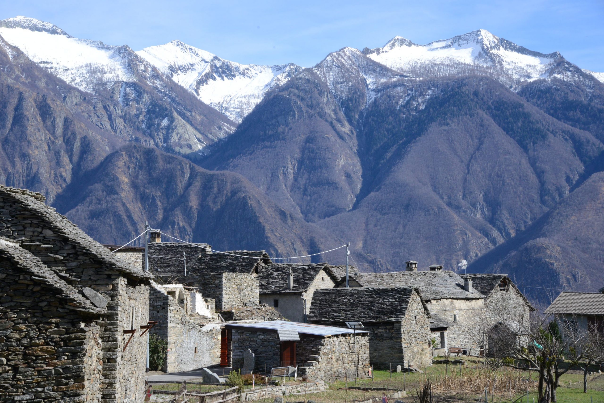
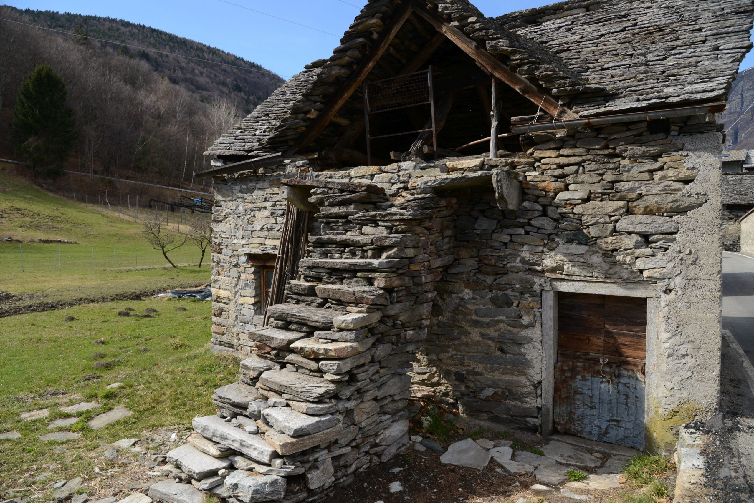
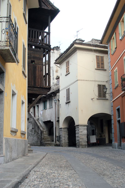
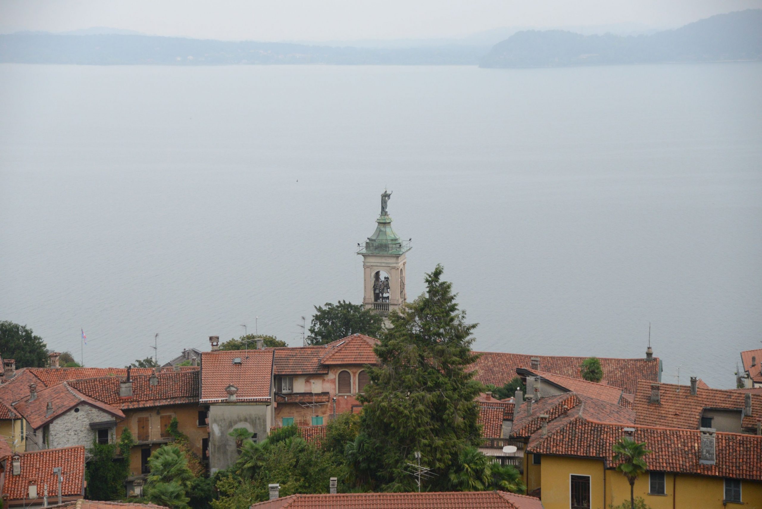
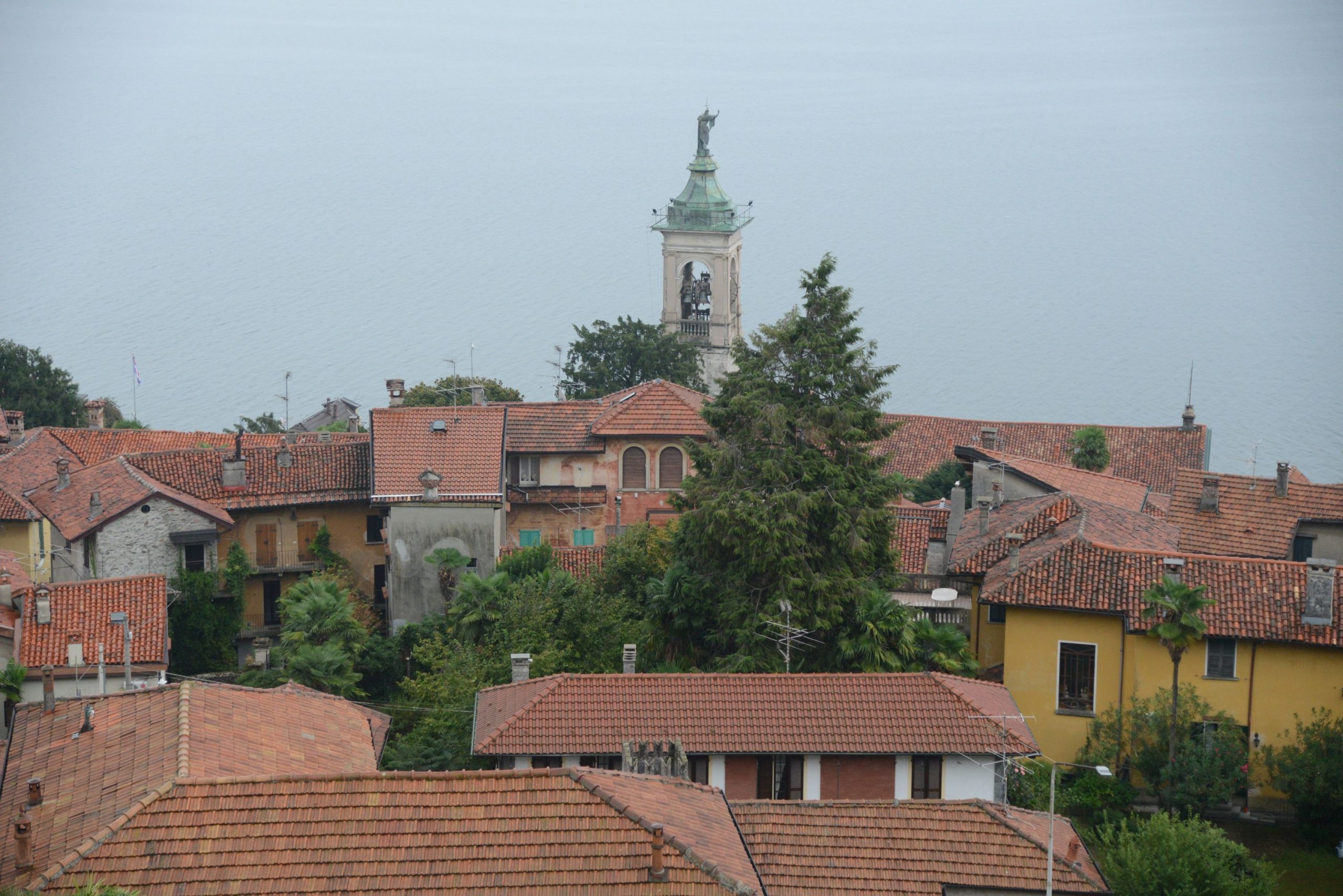
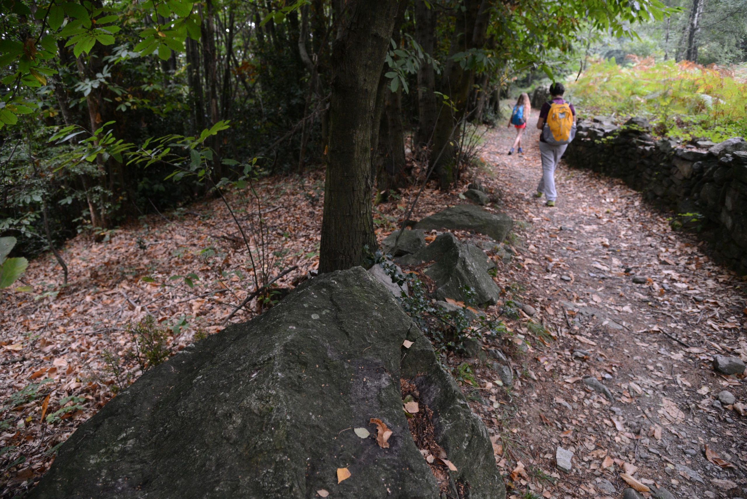
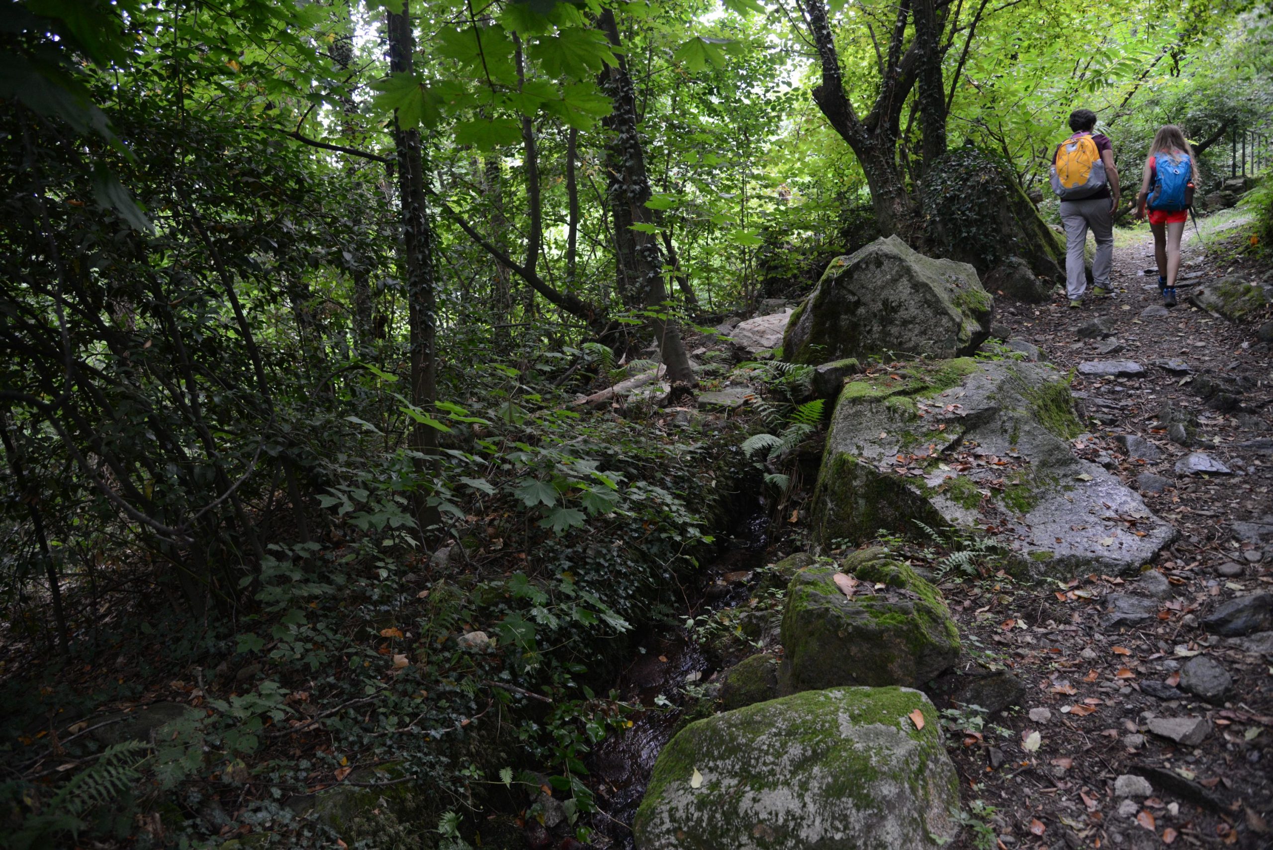
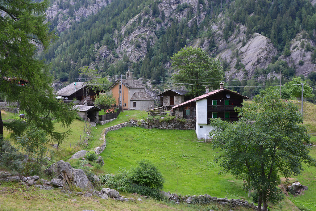
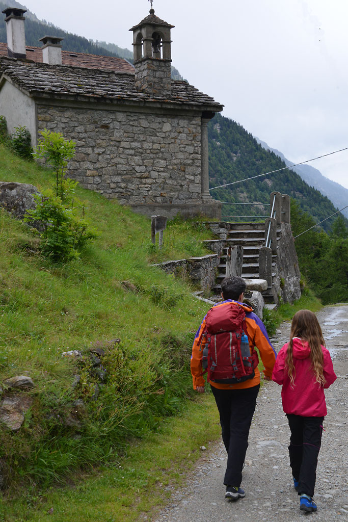
After the village, just before the intersection where the bus stop is, take a dirt road on the right and go downhill (sign for Motto). Soon, you’ll have to leave this road and take a path on the left (sign for Andosso). The following route is very pleasant and gradual, and leads to Andosso (there’s a water fountain behind the white church). Cross the village and stay on the steep downhill dirt road on the right (sign for Prata D03a). On this path, hikers will cross a beautiful forest on the side of the hill, and then ford a small stream. After this, the path becomes less steep and leads to Prata. In the middle of the village, there is a washbasin made from an old oven, and at this point be careful and go right, downhill (the sign for Vagna is slightly hidden). On this path, you will come to the church and then continue on a beautiful mule track that passes right next to it (the sign for Vagna is near the ground). Walk along the descending mule track, and pay close attention to the red/white rectangular signs and the old round red marks. This path leads to Maggianigo, the old capital of the ex-municipality of Vagna. Hikers will need to go towards the church (428 m) which can be easily seen. Pass it and take the mule track to the left (sign for Domodossola). Both the mule track and the path descend steeply with narrow zigzags, to reach the outskirts of Domodossola in Via Ceschi. Turn right on Via Chiovenda, and at the end of it turn left onto Via Vanoni.
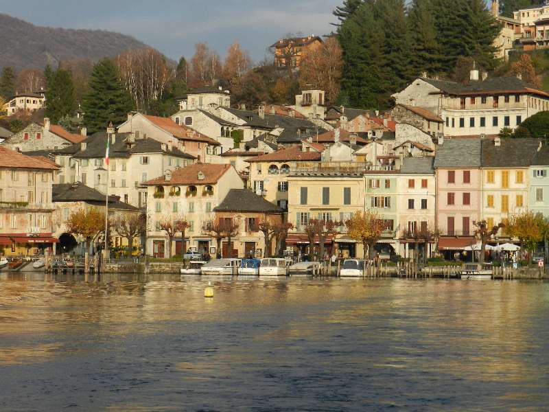
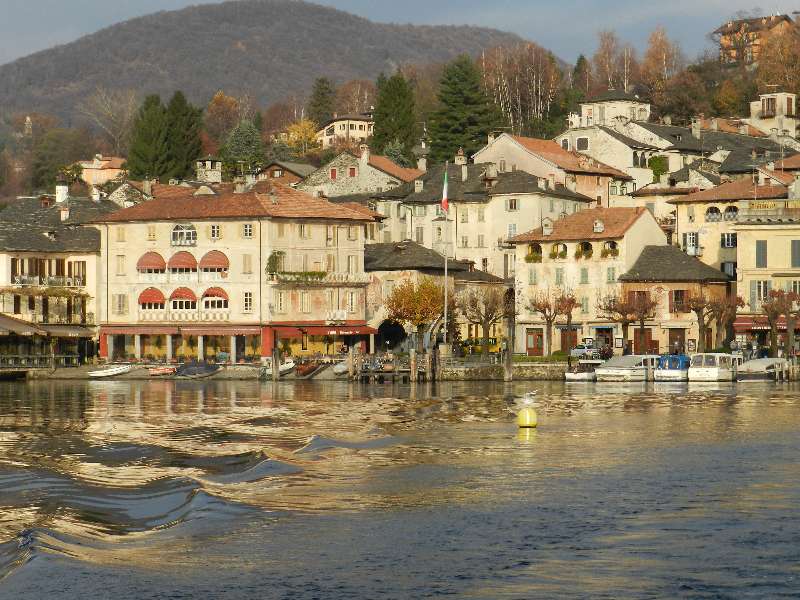
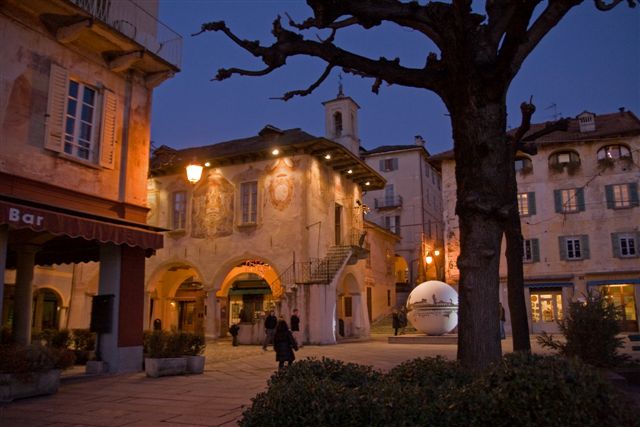
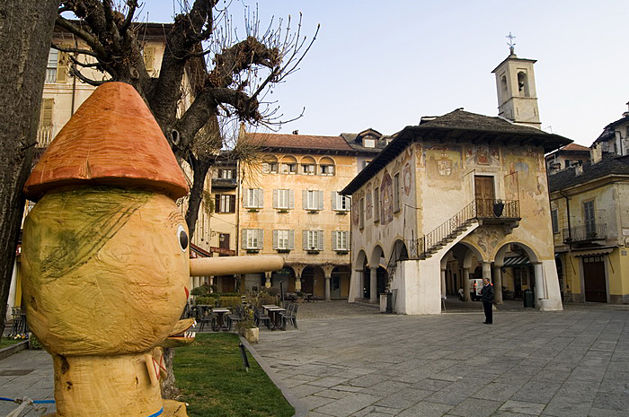
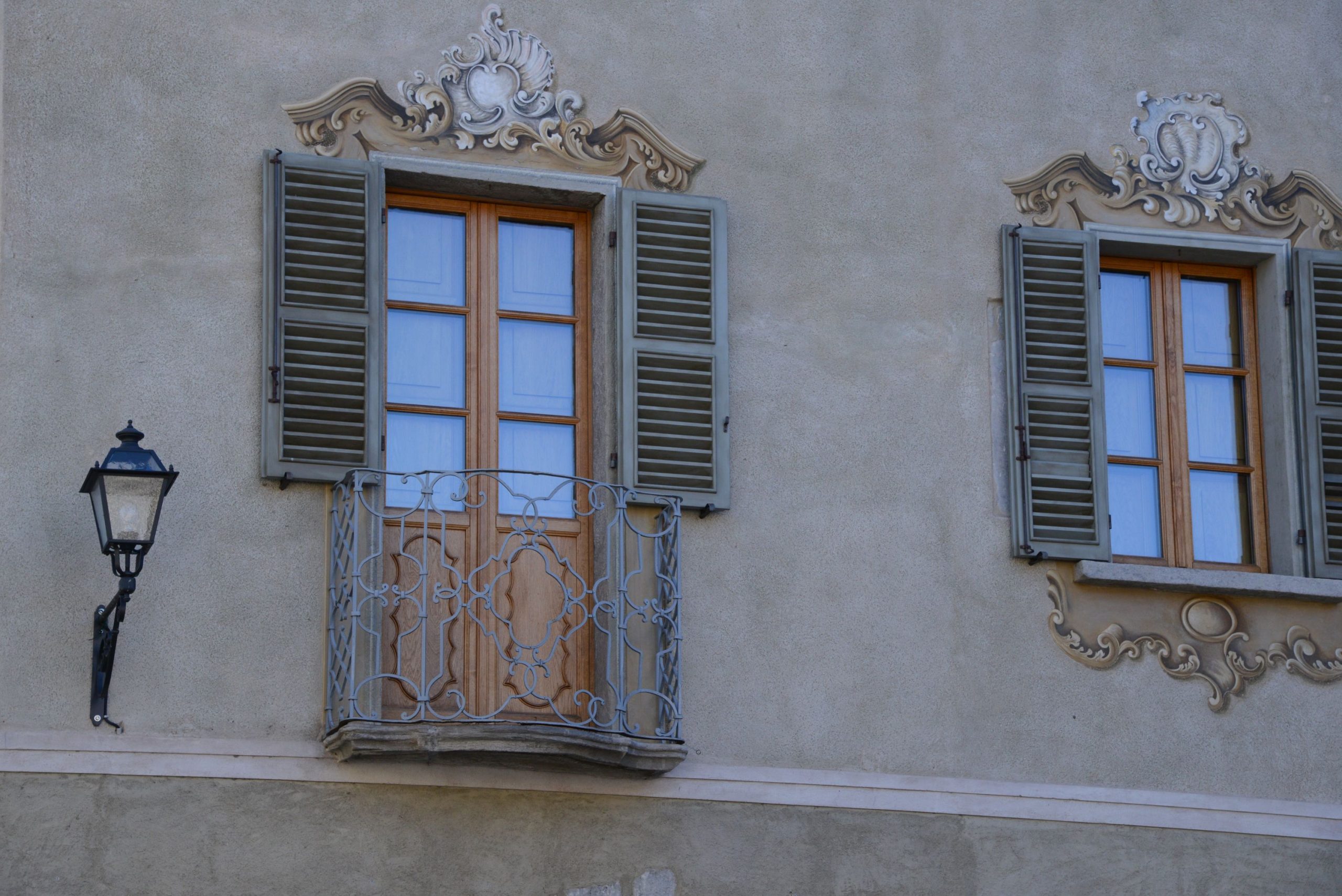
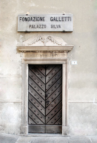
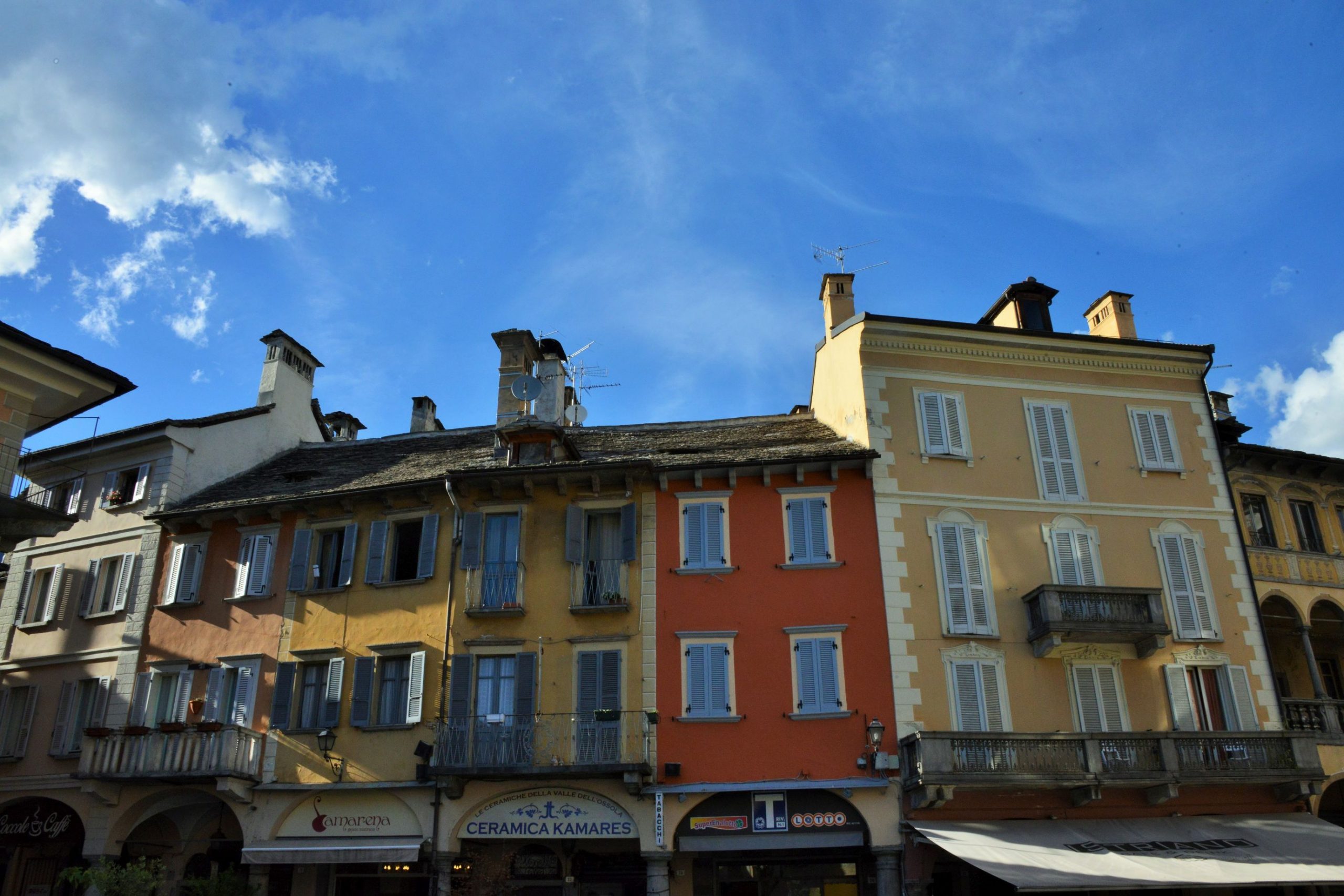
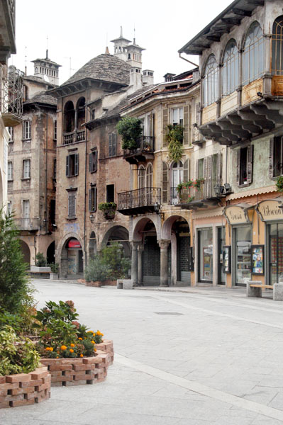
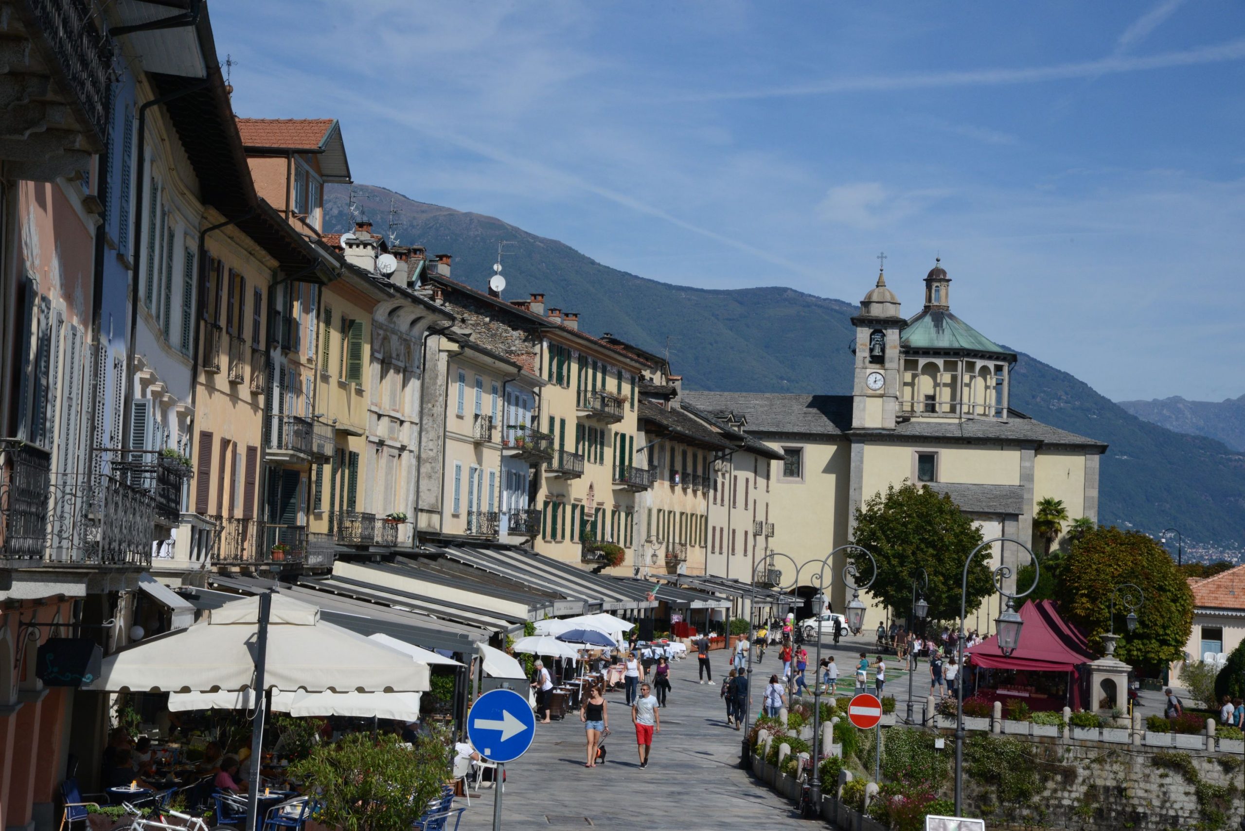
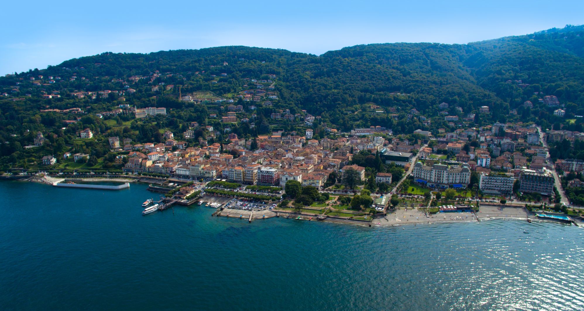
Cross Via Salvo D’Acquisto and continue along Via Vanoni until you reach Via Di Vittorio. From here, turn right towards the roundabout (be careful: there is no pavement/sidewalk!). At the roundabout, go straight on along Via Giovanni Mauro and pass in front of the hospital. At the first traffic light, turn left to enter the historic centre, then turn right. The centre of Domodossola, a pedestrian area, is a lovely example of medieval architecture made up of exquisite buildings, small squares and narrow alleys. Wander through them all to discover the main city monuments, such as the 18th century Collegiate Church of SS Gervasio and Protasio, the 15th century arcades of Piazza Mercato, and the buildings Palazzo Silva and Palazzo San Francesco. After passing through the old town centre, hikers will finish their walk by returning to the railway station.
to learn more
Vagna
Vagna was an autonomous municipality that grouped together the villages on this itinerary. In 1928, it was annexed and incorporated into the municipality of Domodossola. A piece of trivia? The “Festa dul Bambin”, literally the Feast of the Child – another name for Christmas – is celebrated in… July! It seems that this tradition dates back to the 17th century, when the heads of families were away from home during Christmastime and for this reason, they obtained permission to celebrate the birth of Jesus in the summer.
tips for young hikers
Accessible for pushchairs only from the train station to the Sacro Monte, and then in the historic centre. Fountains are located in the villages but often the water has not been tested.
Trail creators: Franco Voglino, Annalisa Porporato and Nora Voglino
Content authors: Franco Voglino and Annalisa Porporato
Back to the list of routes
A linear route that starts in Cannobio and leads through green forests and picturesque villages
LAGO MAGGIORE: THE “VIA DELLE GENTI” ROUTE FROM CANNOBIO TO CANNERO RIVIERA
Lago Maggiore
Route description
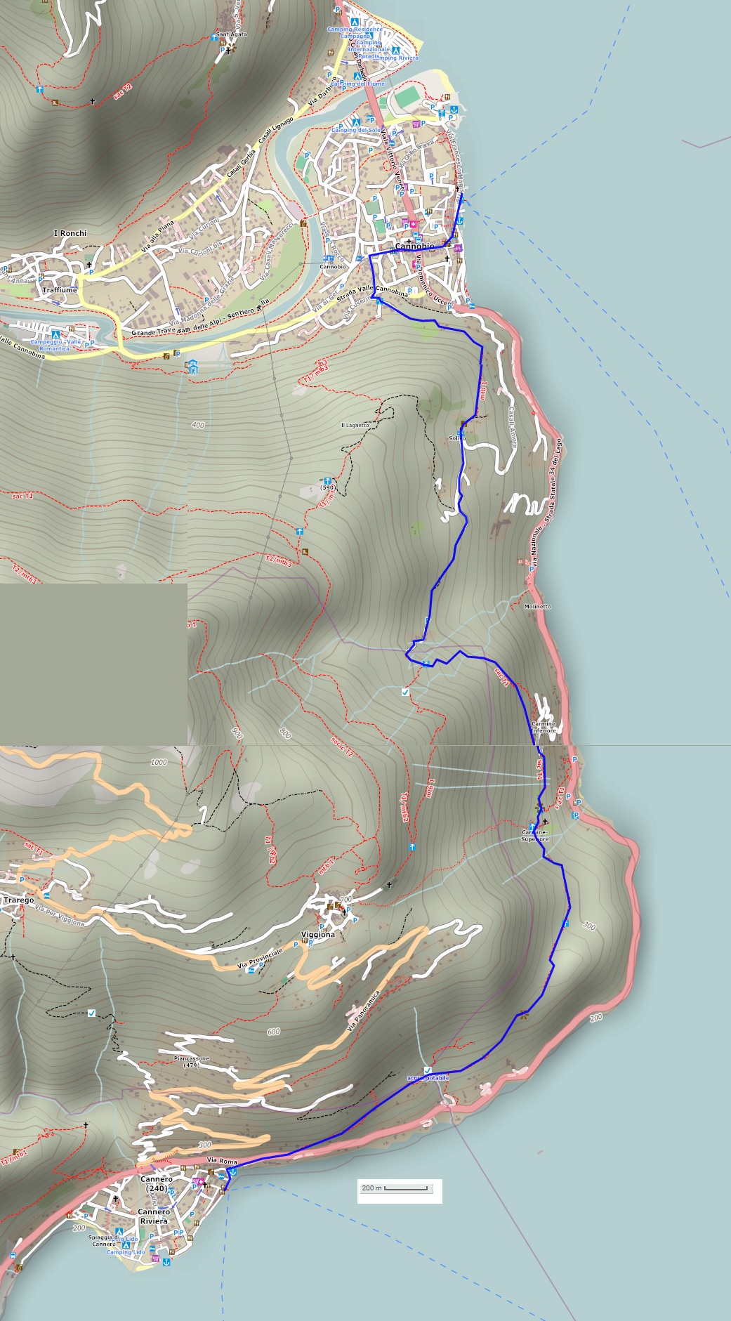
A linear route that starts in Cannobio and leads through green forests and picturesque villages along the ancient cobblestone roads once travelled every day. The return trip is on a mini-cruise boat.
Departure location: Cannobio (200 m)
Place of arrival: Cannero Riviera (200 m)
Maximum altitude: Molineggi (500 m)
Difference in altitude: 350 m approx. one way
Distance: 7.5 km one way
Walking time not counting stops: 2 hours and 30 minutes, one way
Type of route: mixed (trail, asphalt, dirt road)
Signs: yellow signs “Via delle Genti”; red/white signs “Cannero”; red/white marks
Water: fountains in towns and villages
Recommended period: all year round, without snow
How to get there: Cannobio is 26 km from Gravellona Toce. There is a large car park in Viale San Carlo Borromeo (on Sundays, there is a charge for parking). By bus: line 3 Verbania-Brissago (www.vcotrasporti.it). By boat: Arona-Locarno and Locarno-Arona lines (www.navigazionelaghi.it).
Information: Distretto Turistico dei Laghi www.distrettolaghi.it; IAT Office – Via Giovanola c/o Palazzo Parasi, Cannobio, tel. +39 0323 71212 www.procannobio.it; Municipality of Cannobio www.comune.cannobio.vb.it; Tourist Office – Via Orsi 1, Cannero Riviera, tel. +39 0323 788943 www.cannero.it; Municipality of Cannero Riviera www.comune.canneroriviera.vb.it
the itinerary
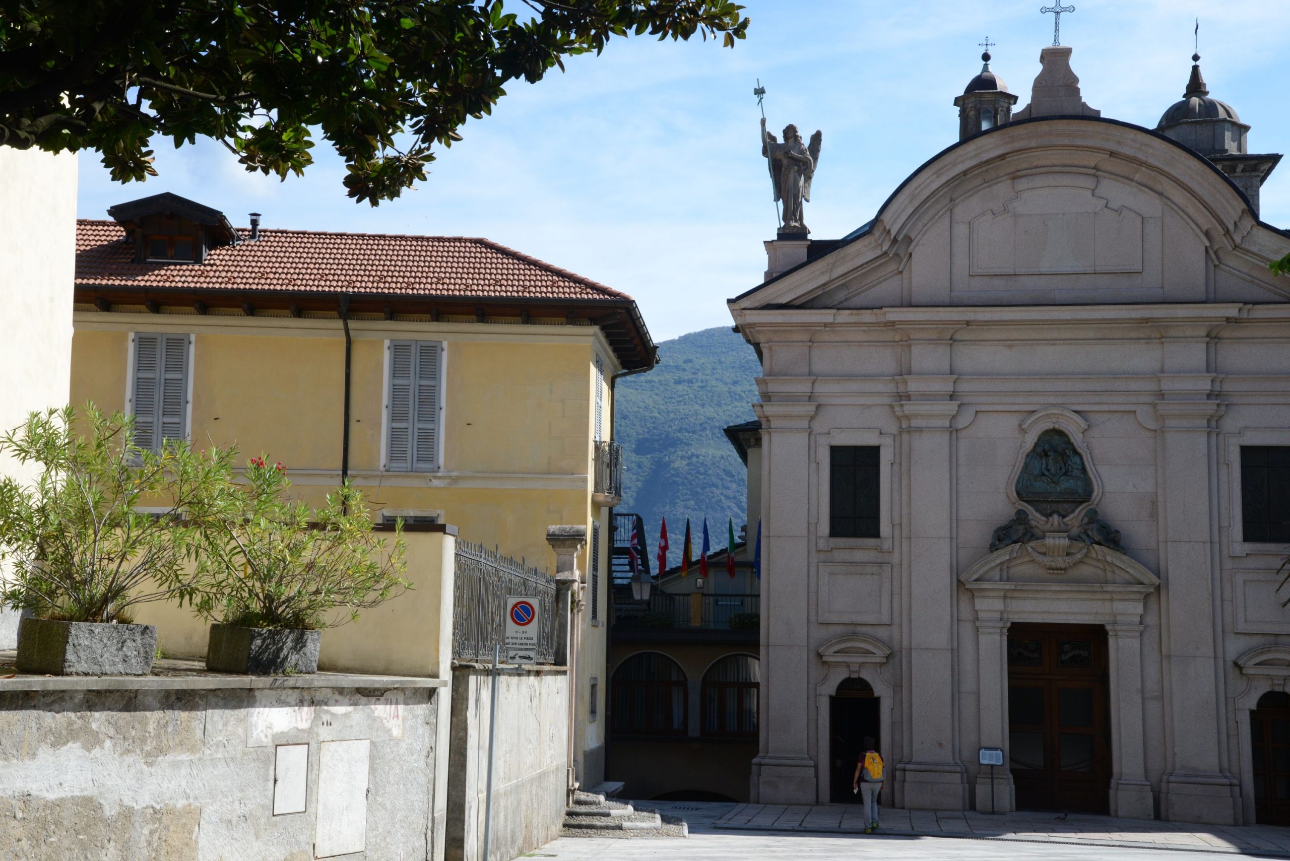
From either the car park or the landing station, you are very close to the Sanctuary of Cannobio, which is certainly worth a visit.
In 1522, the family home of Tommaso Zaccheo was located on this site, and in this home there was a small painting on parchment. The painting was of Cristo in Pietà (Christ as the Suffering Redeemer) and in that year, it began to bleed. The first chapel was created in the upper rooms of that house, where St Charles Borromeo celebrated his last mass. It was St. Charles himself who asked for the construction of the Sanctuary, built between 1575 and 1614.
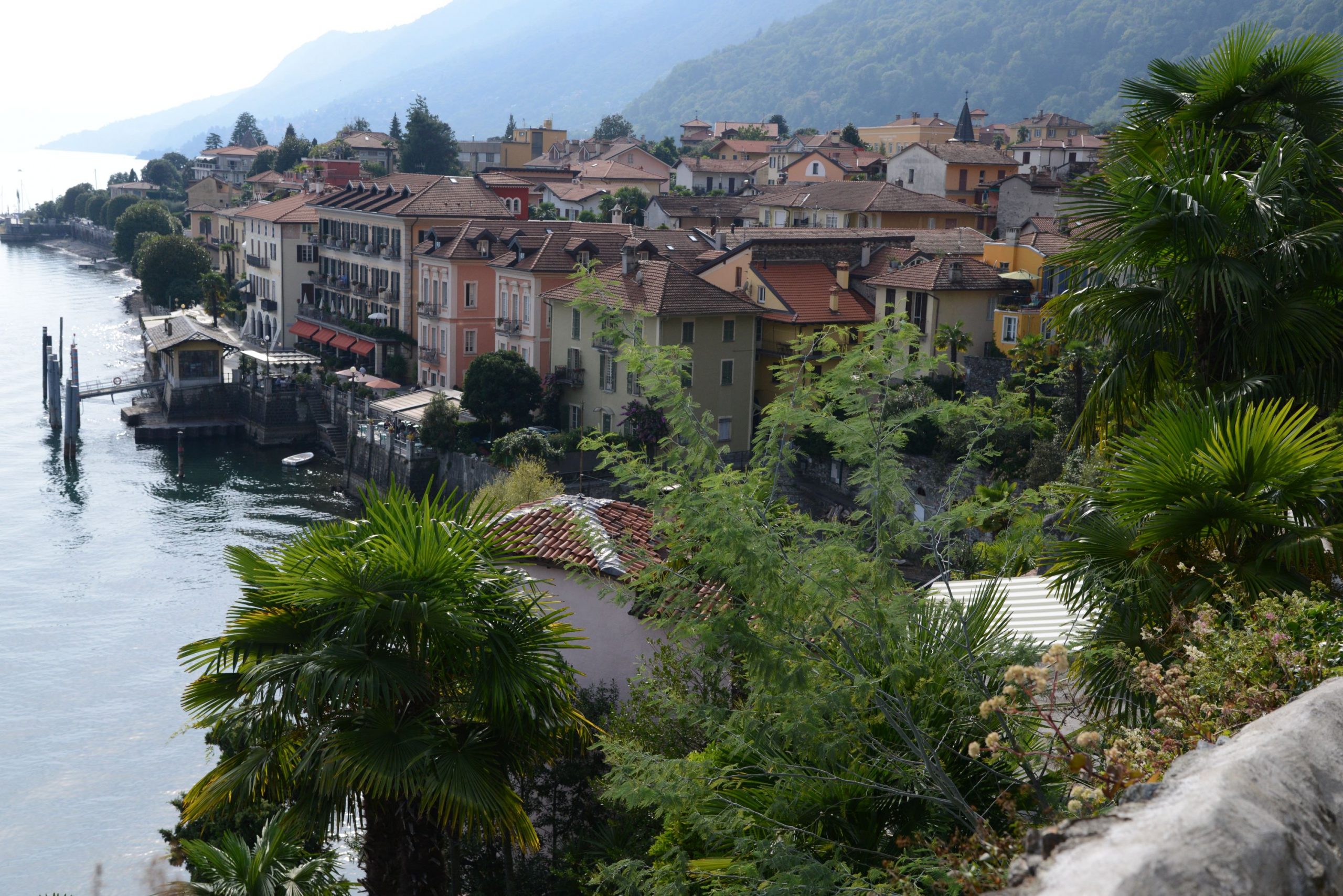
A short staircase leads from the Sanctuary down to the lakeside promenade, full of coffee shops and restaurants, a stone’s throw from the landing station (water fountain). Hikers can go along the wide, pleasant lakeside promenade of Piazza Indipendenza and then take Via Marconi uphill (signs for “Centro Storico”). At the crossroads with Via Umberto I, there is a fountain and frescoes under the left portico of the 16th century Palazzo Pironi. Turning right on Via Umberto I, which is still a pleasant pedestrian street lined with shops and restaurants, hikers will cross a street open to traffic and arrive at the beautiful Palazzo Parasio, built in 1291 (water fountain). Behind this building stands the Romanesque bell tower of San Vittore, at the base of which is the Tourist Office. Continue straight along Via Antonio Giovanola, a road that is open to traffic but not very busy.
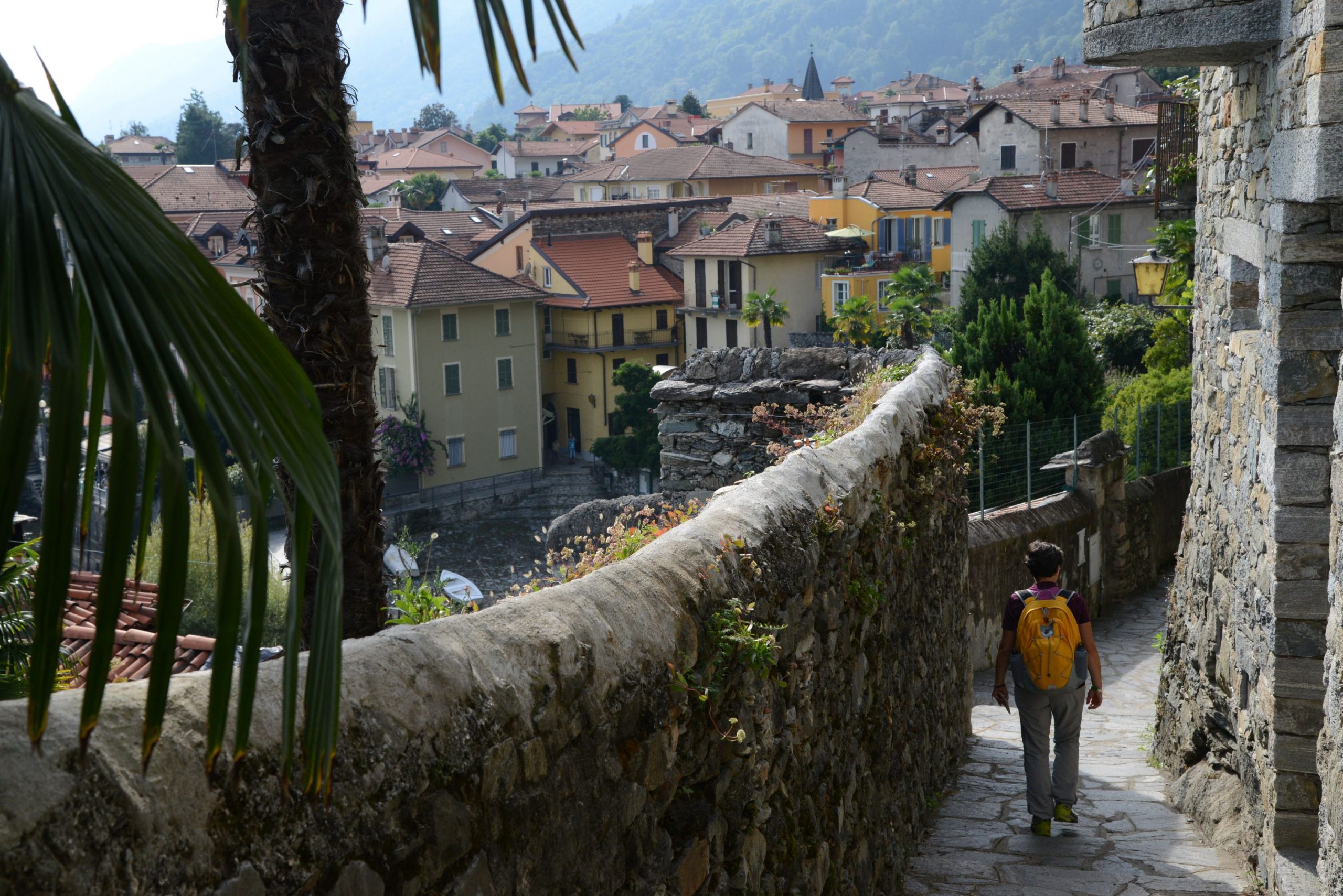
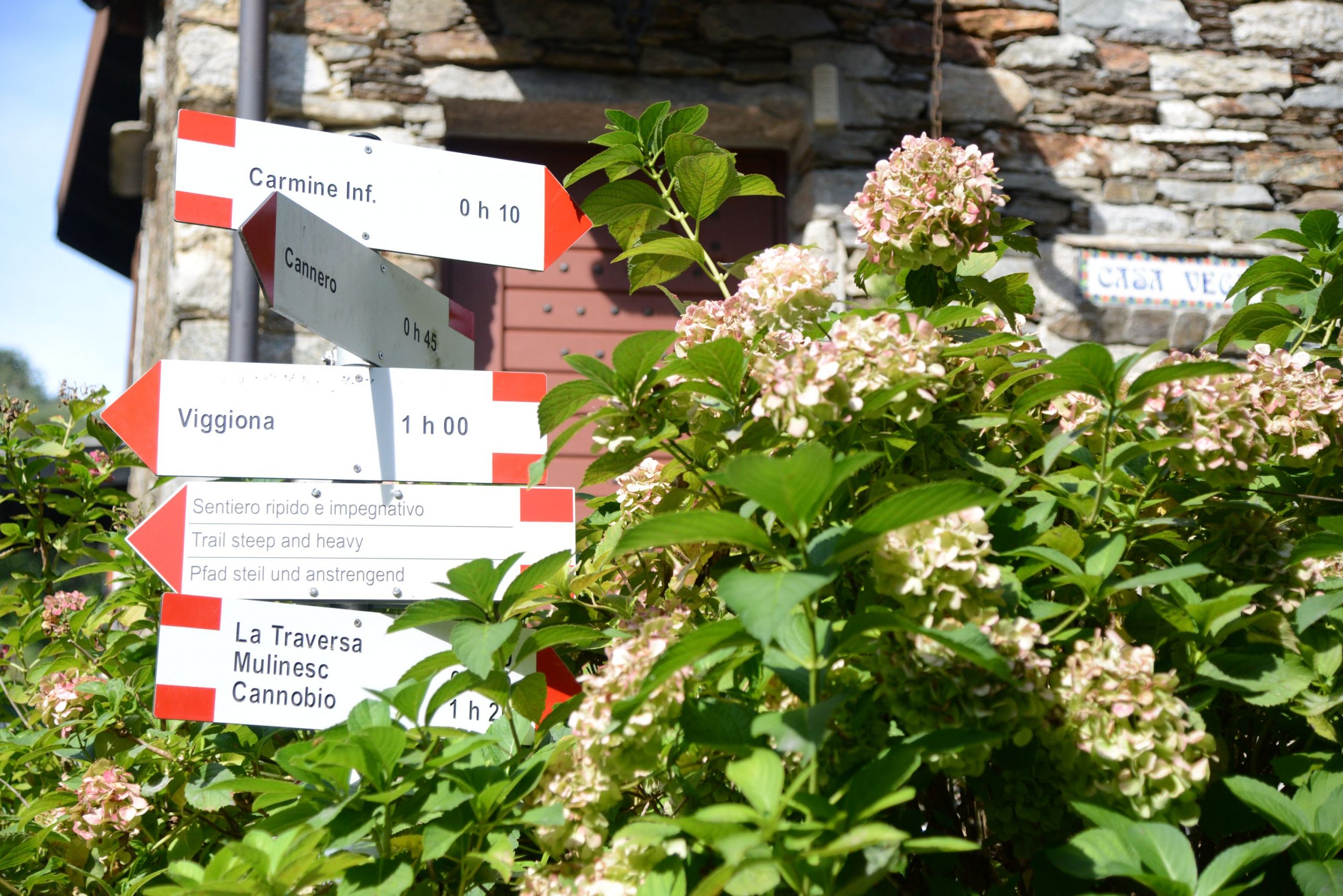
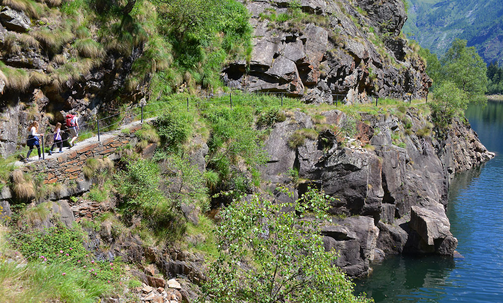
Turn left into the narrow cobblestone street Via G. M. Giovanola, which passes near a large square wash-house. After crossing an asphalt road, go straight on for a few more steps and you will come to a fork. Take the uphill road on the right (white signs for “Casali Bagnara” and “Casali Roccolo”, red/white marks) until you reach a new intersection with signs indicating this trail. Now, hikers will turn left (red/white sign for “Cannero” and yellow sign for “Via delle Genti”). The asphalt road becomes narrow and climbs steeply uphill to an open space that serves as a small parking lot. From here, it becomes a path and then turns into a beautiful cobblestone road that continues to climb rather decisively beyond an old votive stone pylon. The road passes close to the fences of a few houses, and then finally becomes more gradual before it enters into a beautiful forest of chestnut trees. The trail continues to climb progressively, but at times, the tree branches open up to reveal a view of Cannobio. Amid oaks and chestnut trees, hikers will come to a larger and more regular cobblestone pavement that should be followed to the right, uphill. This road leads to the houses of the village, Solivo (water fountain). When you reach an asphalt road, take it to the right, always uphill (white sign for “Viggione”). Follow the asphalt for about 250 meters and take the cobblestone road on the left (sign for “Cannero” and yellow sign for “Via delle Genti”). This road joins with a wider cobblestone path, continuing to the left uphill steadily and gradually until it reaches Molineggi. A tiny church is the first building you will see of this village, and afterwards a large mill. The town is dotted with many metal sculptures made mostly from old agricultural tools. After crossing a lovely stone bridge, you enter a beautiful stretch of the trail, delimited on one side by a wooden handrail and on the other by interesting rocks through which magical-looking chestnut trees have grown over time.
A little further on, hikers will reach the maximum altitude of the entire route and leave the dirt road for the path on the left, which finally goes downhill (sign for “Cannero”). Descending amid the chestnut trees in a clear and decisive way, the path crosses a picturesque stream with rocks and waterfalls. The very steep descent leads you to the houses of Carmine Inferiore. Do not enter the town, but instead go to the right (sign for “Cannero”) along a gradual stretch that crosses several small streams. A staircase takes you up a bit in altitude and brings you closer to Carmine Superiore and its Sanctuary.
The village, dating back to the year 1000, was used as a stronghold: the population would take refuge there in case of danger. Little by little, it became inhabited, and the Church of San Gottardo was built during the 14th century. Inside, it houses 15th and 16th century frescoes which can be seen from the window, but if you make a small donation, you can turn on the inside lights to see it. This artwork is definitely worth seeing! During the 17th century, the village was hit by the plague and the frescoes were covered with lime to disinfect the church, which was used as a “lazaretto”, a quarantine station. They were uncovered again during the 1932 restoration.
The place is magnificent, suspended on the rock and with a superb view from the terrace that extends next to the church. Now, hikers have to cross the village (water fountain) through the narrow stone alleys, following the round red/white marks but paying attention to the signs because you have to keep to the left (signs for “Cannero”). When you leave the village, the road will go downhill initially, but then you will encounter alternating stretches of uphill and downhill road, always immersed in the thick forest. At times, you will see beautiful stone ruins surrounded by vegetation. The chestnut trees here are very beautiful and evocative: it is easy to imagine exciting stories about witches, elves, gnomes and strange fantastic animals! Gradually, you’ll reach a more open and terraced area from which you can enjoy the view of the lake and the Castles of Cannero.
The castles look like ships floating on the water. Built between the 13th and 14th centuries, they were known with the name “Malpaga” because they had been built at the expense of the local population. The five Mazzardi brothers, called the Mazzarditi, took refuge in these castles and dominated the surrounding areas with an iron fist. Finally, the Duke of Milan Filippo Maria Visconti put an end to their cruelty and raids. His army besieged the castles in 1414 and then razed them to the ground. The Borromeo family later bought these islands and built Rocca Vitaliana in 1519. They used the property to control traffic with nearby Switzerland. These constructions were abandoned over time, but they are still owned by the Borromeo family.
Since 2025, after years of restoration, the Castelli di Cannero have been open to visitors (www.terreborromeo.it).
Hikers must cross the small village of Cheggio (281 m) following the rudimentary signs for “Cannero” and then descend to the state road and cross it carefully.
WARNING: this crossing is DANGEROUS! Use the pedestrian stripes that are slightly to the right, and BE VERY CAREFUL because the cars travel fast and can take you by surprise from behind the curve.
After crossing, immediately take the pedestrian road on the left that goes downhill towards Cannero Riviera, then turn left at a sign for “Cannobio” (backwards). You will arrive at the small harbour, lakeside promenade and landing station from which you can take the boat back.
tips for young hikers
An excursion through charming woods that culminates with the village of Carmine Superiore, a real trip back in time. Not suitable for pushchairs.
Trail creators: Franco Voglino, Annalisa Porporato and Nora Voglino
Content authors: Franco Voglino and Annalisa Porporato
Back to the list of routes
A cool walk through the woods that leads to a lovely location with a view
VERGANTE HILLS: SASS DEL PIZZ
Lago Maggiore
Route description
A cool walk through the woods that leads to a lovely location with a view suspended above the Lake Maggiore, with interesting benches and trees with a zen personality to play among.
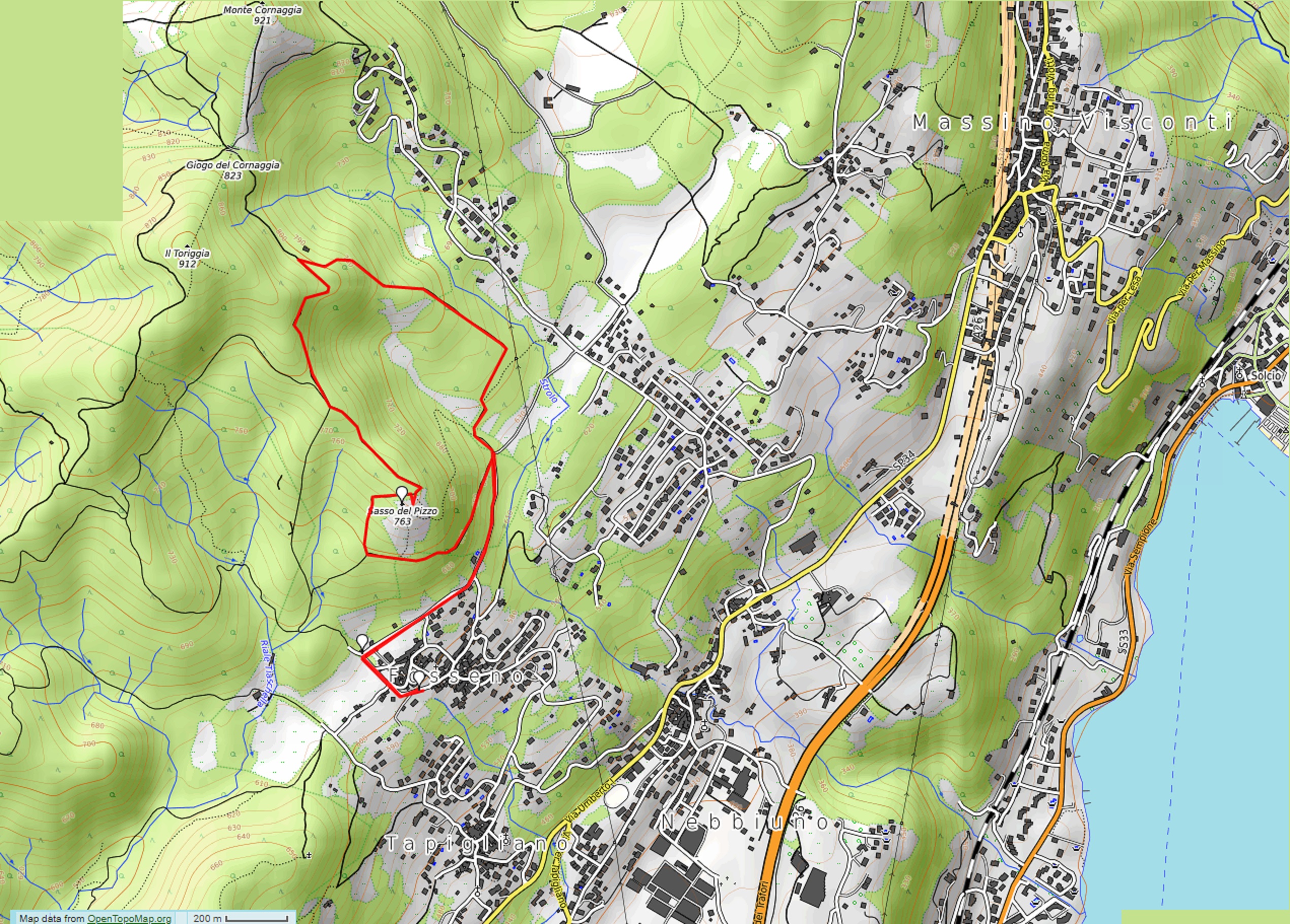
Departure location: Fosseno (600 m)
Place of arrival: Sass del Pizz (763 m)
Maximum altitude: About 800 m
Difference in altitude: About 200 m
Distance: 5 km
Walking time not counting stops: 2 hours
Type of route: mixed (trail, asphalt, dirt road)
Signs: green/white and yellow signs, red/white marks
Water: fountains in Fosseno
Recommended period: all year round, without snow
How to get there: it is 12 km from Arona. From the A26 exit Meina, start out following the blue signs for “Meina”, then follow the blue signs for “Massino Visconti” and “Nebbiuno”. After getting to Nebbiuno, watch to the left for blue signs indicating “Fosseno”. Parking areas in Piazza Sant’Agata and along via Bertoletti. By bus: Arona-Massino Visconti-Gignese line, stop Nebbiuno at about 2 km (www.pirazzi.it).
Information: Distretto Turistico dei Laghi – www.distrettolaghi.it; IAT Office – Piazza Caduti di Nassirya 6, Nebbiuno – tel. +39 (0)322.060202; Municipality of Nebbiuno – www.comune.nebbiuno.no.it
the itinerary
In Piazza Sant’Agata, where you can park, there is an unusual monument dedicated to stone masons and a playground area just behind it. After a well-deserved break, turn your back to the monument and play area, and take the asphalt road to the left uphill (careful: there is no side walk). Always walk uphill on this road, and ignore the different junctions, until you get to the ancient laundry house immersed in the shade of the trees (fountain and stone benches). Continue to the right on the asphalt road (still no side walk) that winds on an almost level grade between the last houses of the hamlet and the first slopes on the wooded mountain. When you begins to descend, you will come to a stop sign, and then continues to the left along the road, which is initially asphalted. Almost immediately, it becomes a dirt road and enters into the shady woods, to come to a clearing.
If you like, you can also park here. It would save you about 1km in distance and 70 meters in altitude, but you would miss stopping at the playground area and the fountains.
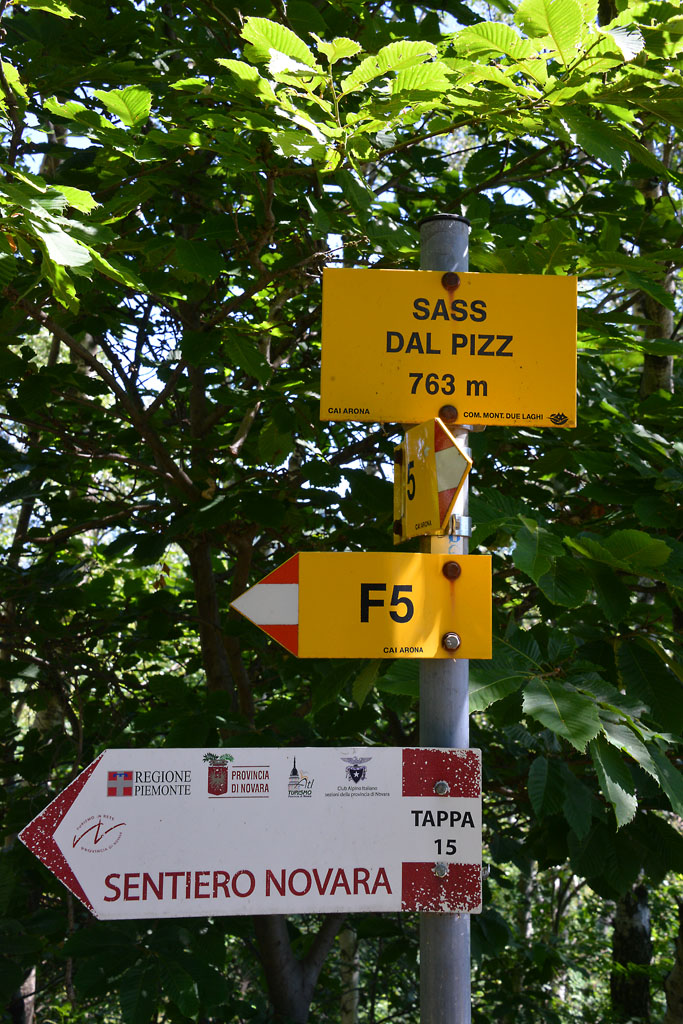
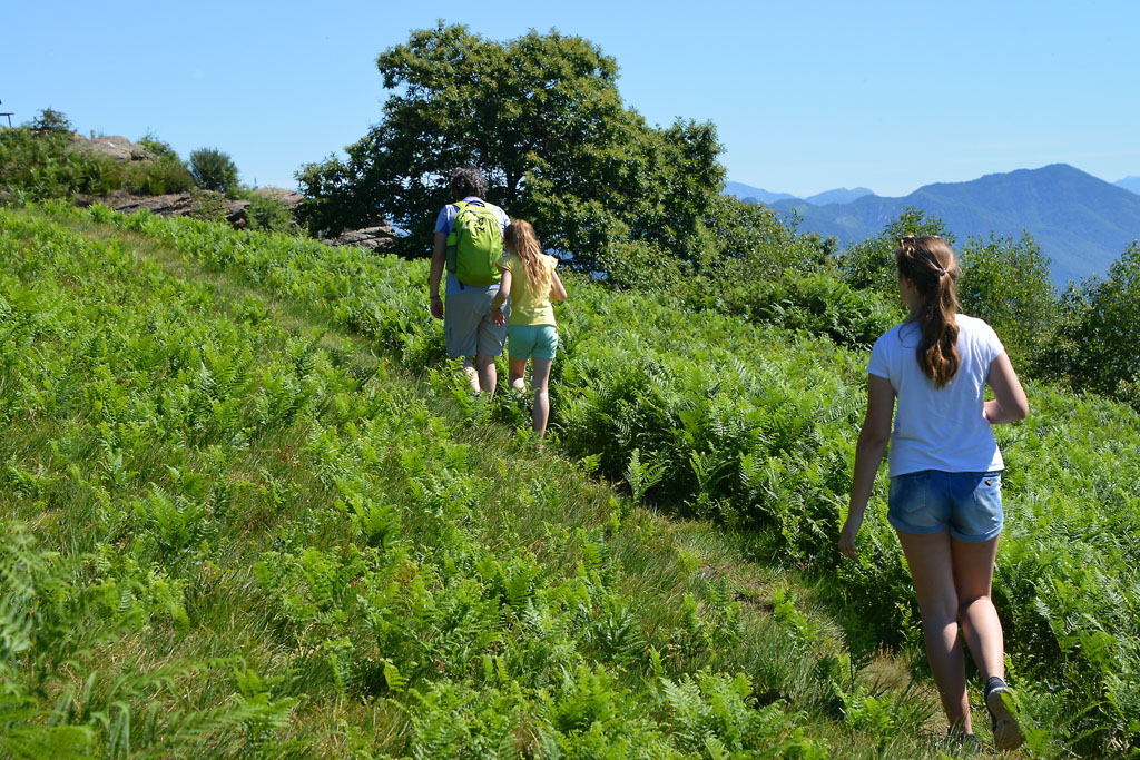
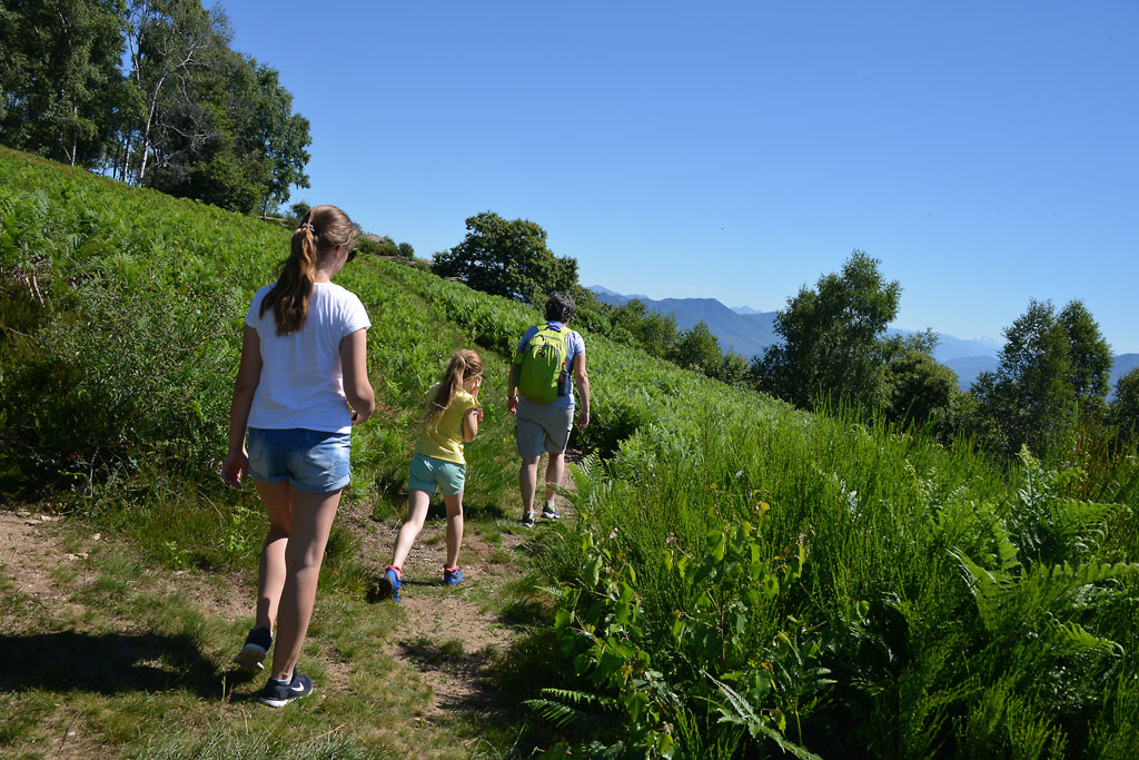
The open space has numerous junctions. You must take the road on the far left (the sign says “Sass del Piz F6”), but keep in mind the dirt road in front of you (“F7” sign), because the proposed ring path ends there. The path climbs gradually in the woods and alternates between a more shaded initial stretch with a more open stretch later on.
In one of these open stretches, you will find a path on the right through a meadow, and if you look up, you will see a windsock. If you like, it is a short cut to the top, but it is very steep. We suggest that you follow the track, which is longer but much more gradual.
The path drops slightly and you arrive at a fork; take the right path uphill, which is steep at the start and then becomes more gradual, leading up to the summit.
If you like, you can also reach this point from the trail that arrives from the left and starts from the ancient laundry house, but this slope is very steep. You’ll get a taste of that in the final stretch to the summit.
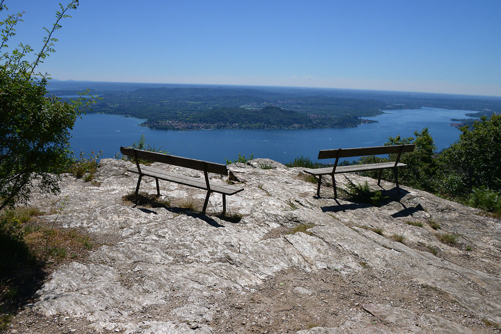
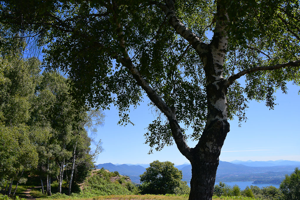
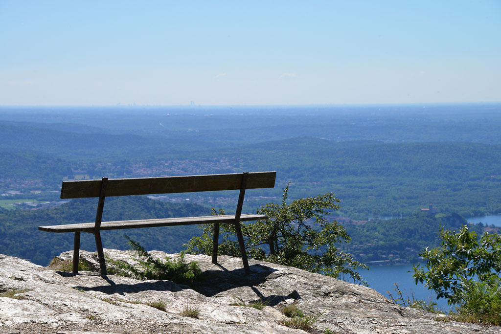
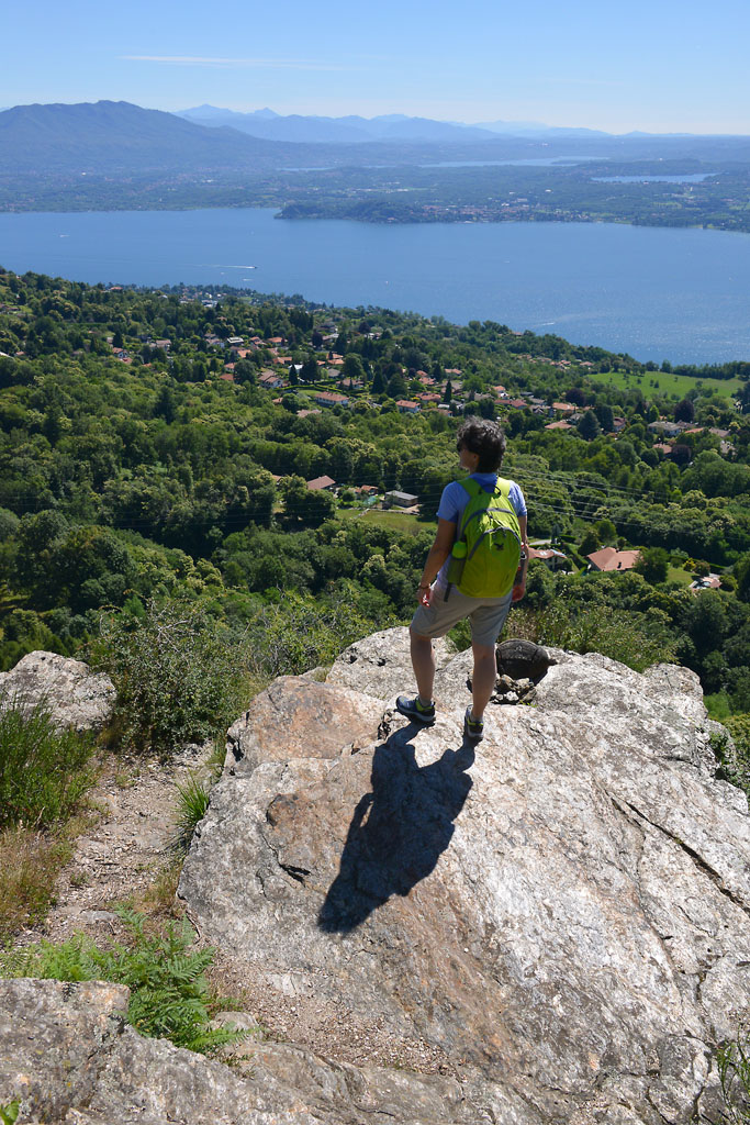
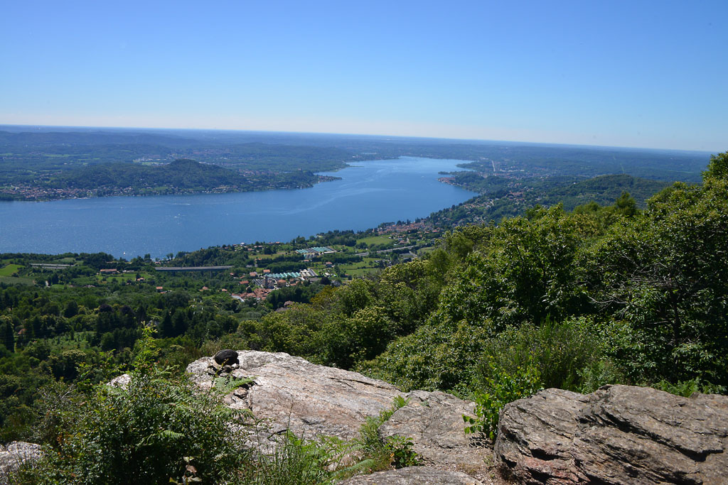
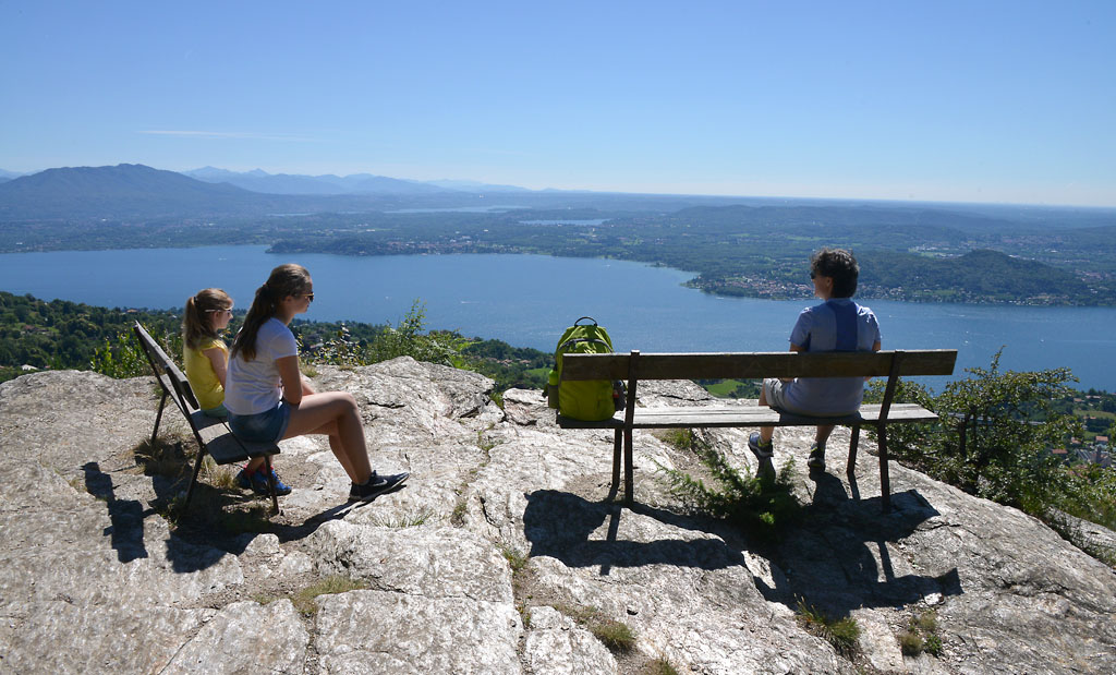
When you get to the summit, you’ll find several wooden tables under the shade trees, mainly birches, and a lovely view of Lake Maggiore. A bit more to the right, you’ll see a large cross, and on the left there is a smooth rock with two relaxing benches, where you can sit and meditate before the majestic panorama that extends over the southern part of Lake Maggiore and the lakes of Monate, Comabbio and Varese.
The trees at the picnic area are perfect for playing hide-and-seek and obstacle races, which make the break pleasant even without “artificial” playground equipment. After having rested for the right amount of time, you can resume your walk to go around the ring. At the altitude of the rock with the benches, take the “F5” trail that proceeds slightly uphill, then flattens out and then goes up again to a junction where you turn right (“F5” sign and then “Sentiero Novara” sign). Proceed along the gently sloping trail, a very pleasant stretch amid ferns and birches where you can see the lake. You will reach another fork where you take a right again (“F5” and “F7” signs). Now, the trail begins to descend constantly along stretches of old cobblestone pavement and enters into an enchanting forest of chestnut trees. The last junction takes you off the “F5” path. Follow the “F7” trail to the right, which is a steep descent, partially on cobblestones, until you close the circle and arrive in the clearing that you started the hike from. At this point, you can retrace the road you took at the beginning of the trip.
to learn more
Nebbiuno
Fosseno, the location from which the excursion starts, is one of the hamlets (frazioni) in the Municipality of Nebbiuno (the others are Tapigliano and Corciago). From the car park, you can see the main church of Fosseno: Sant’Agata. In the early 18th century, there was already a sacred building in this area, but it was “poorly made, obscure, humid and too low. Let the people think of making a new one in a more decent site and in a more venerable form” (4 June 1618, during the visit of the Bishop of Novara Mons. Ferdinando Taverna). They had to wait until 1680 for construction to begin on the new church and, according to the contracts, in addition to the offerings of money, every family also had to provide an unskilled worker to help with the work, and it could be a man or woman.
The Vergante
This name means “that descends downwards”, and it is used to define the hills that separate Verbano (Lake Maggiore) from Cusio (Lake Orta). The highest peak is the Mottarone (1492 m).
The Strawberry Festival
Yes, up until the Sixties, Fosseno produced over fifteen hundred quintals of strawberries per year. Today, production has fallen considerably, but not quality. If you love strawberries, you won’t want to miss the traditional festival that takes place every second Sunday of June with a dedicated market, lunches and dinners, dances and activities.
tips for young hikers
This path is not suitable for prams, but it is very simple and suitable for all small hikers that can walk!
Slow trekkers: Franco Voglino, Annalisa Porporato and Nora Voglino
Authors of texts: Franco Voglino and Annalisa Porporato
Back to the list of routes
A linear route following ancient mule tracks that connected Stresa to Belgirate
LAKE MAGGIORE: THE “SENTIERO DEI CASTAGNI” ROUTE FROM STRESA TO BELGIRATE
Lago Maggiore
Route description
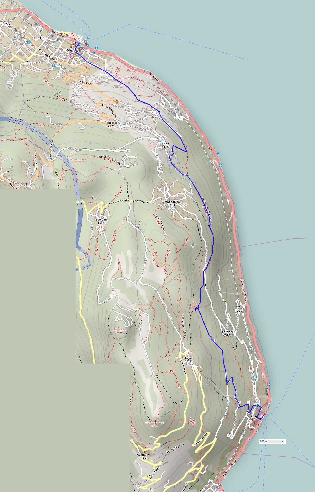
A linear route following ancient mule tracks that connected Stresa to Belgirate, combined with a charming return boat ride.
Departure location: Stresa (200 m)
Place of arrival: Belgirate (200 m)
Maximum altitude: Church of San Paolo (480 m)
Difference in altitude: approx. 400 m, one way (not continuous)
Distance: 8 km one way
Walking time not counting stops: 2 hours and 30 minutes, one way
Type of route: mixed (asphalt, cobblestones, trail, dirt road)
Signs: red/white signs, signs for “Sentiero dei Castagni” and “L2 Stresa-Belgirate”
Water: fountains in towns and villages
Recommended period: from spring to autumn, if you return by boat or by bus; all year round, in the absence of snow, if you return on foot along the same route.
How to get there: Stresa is located along the western side of Lake Maggiore. It is 7.5 km from the A26 exit of Carpugnino. Car parking is available near the landing station (for a fee), and at the railway station.
By bus: Verbania-Stresa-Arona line (www.safduemila.com); Novara-Domodossola line (www.stnnet.it). By train: Milan-Domodossola line, Stresa stop (www.trenitalia.com). By boat: Arona-Locarno and Locarno-Arona lines (www.navigazionelaghi.it).
Information: Distretto Turistico dei Laghi www.distrettolaghi.it; IAT Office – Piazza Marconi 16, Stresa, tel. +39 0323 30150, www.stresaturismo.it; Municipality of Stresa www.comune.stresa.vb.it; Tourist Office – Via G. Mazzini 12/14 at the landing station, Belgirate, tel. +39 331 2324425; Municipality of Belgirate www.comune.belgirate.vb.it
the itinerary
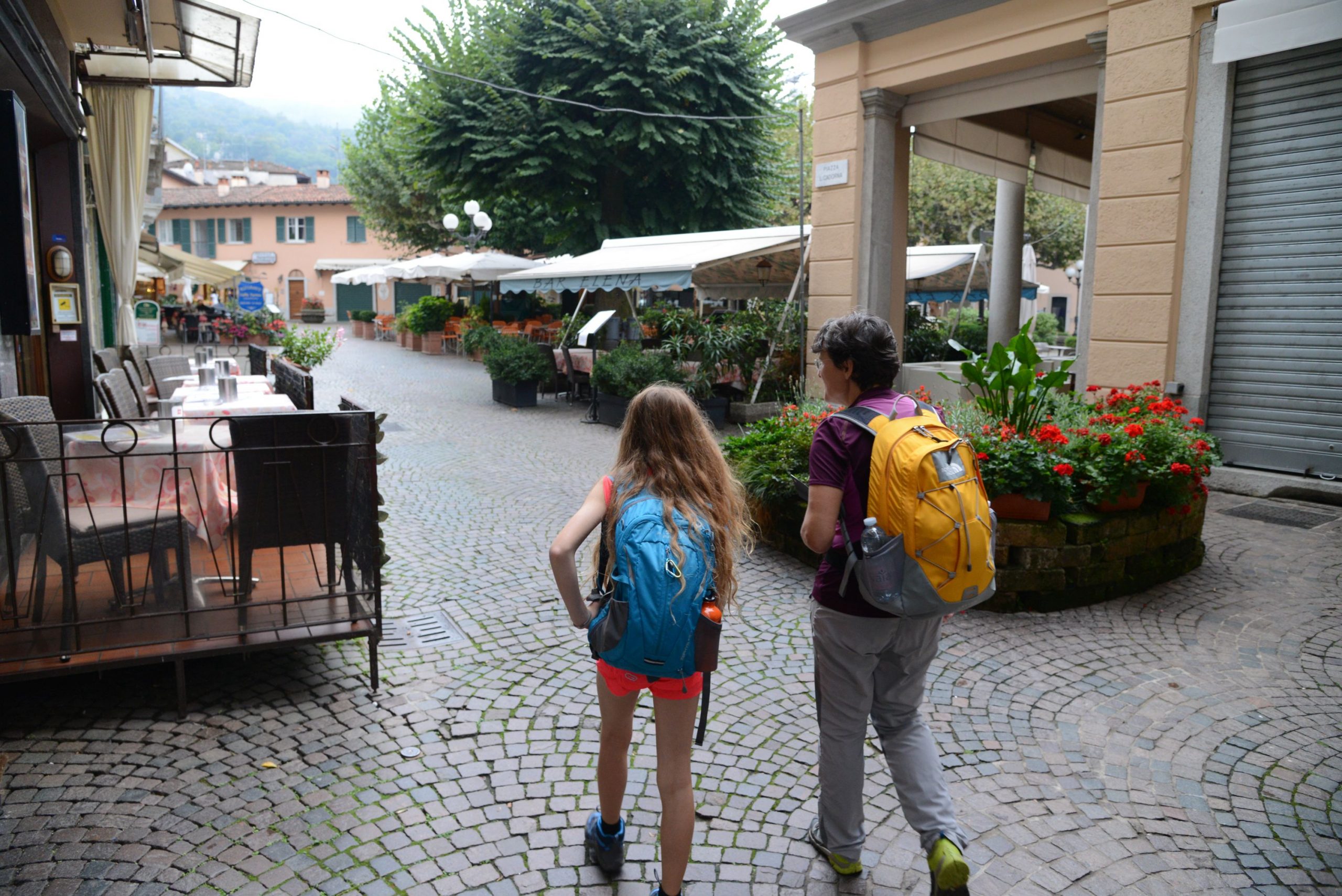
From the landing station, head towards the centre, taking one of the pedestrian streets (Via Tomasi or Via Mazzini) that lead to Piazza Cadorna. From here, turn left on Via De Vit, which leads to Via Manzoni (signs for “Sentiero dei Castagni” and “L2 Stresa-Belgirate”). This street leads to the monument dedicated to the friendship between the writer Alessandro Manzoni and the philosopher Antonio Rosmini.
Rosmini and Manzoni met in 1826 and, afterwards, they would see each other often in Milan and, above all, in Stresa where Rosmini lived. Manzoni spent his summer holidays in the nearby town of Lesa starting in 1839. Their friendship lasted until Rosmini died in 1855. He is buried in the church of the boarding school, located just uphill from the school itself.
Continue the path uphill, you’ll come to the secondary gate of Parco Pallavicino.
Villa Pallavicino was built by Ruggero Borghi, a friend of Manzoni and Rosmini. In 1862 the ownership was transferred to the noble Genoese Pallavicino family who enlarged the estate and transformed the marvellous garden into a wildlife musesum open to the public. Today, Villa and Parco Pallavicino are part of the Terre Borromeo tourist circuit. The Parco Pallavicino is an
oasis of peace for visitators, but above all for the 60 species of mammals and birds that live here, together with a number of wild specimens, which have been rescued by the wildlife protection wardens.
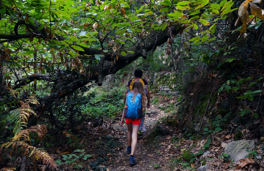
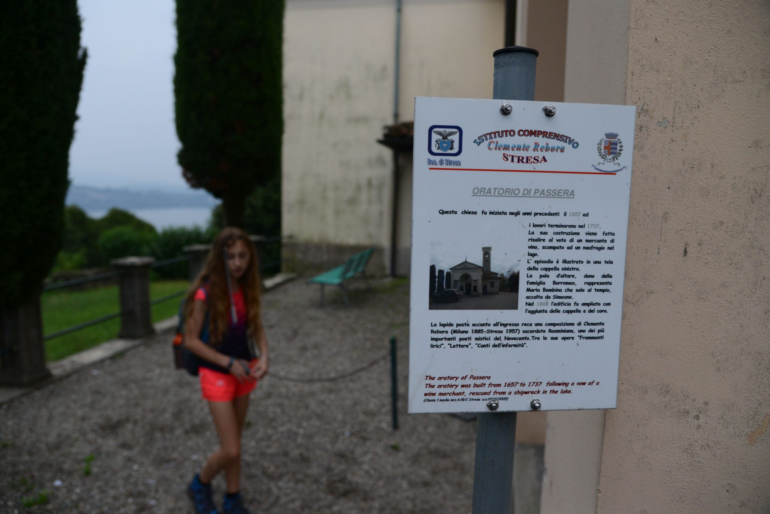
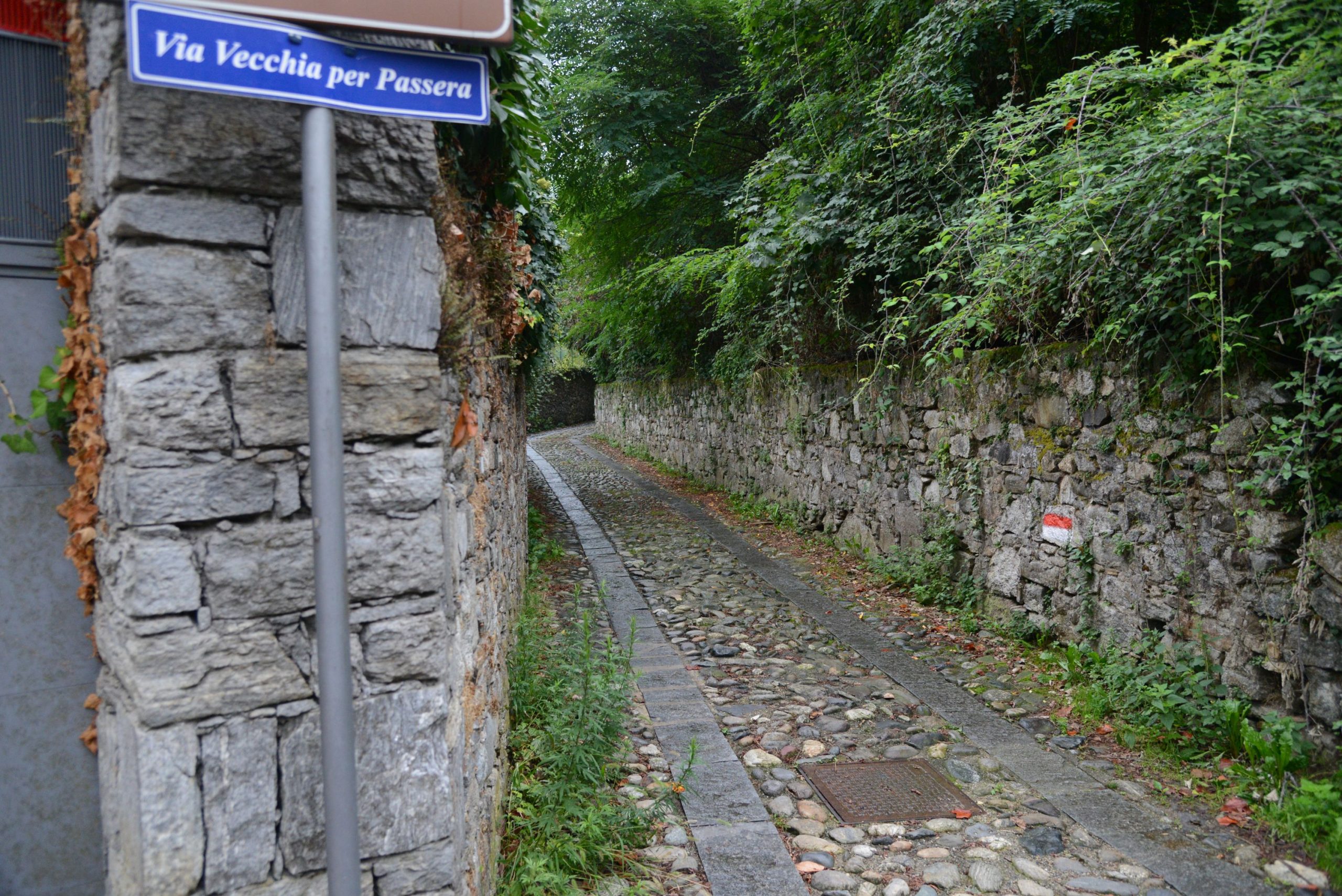
A little further on, when you reach a votive pillar at the crossroads of three streets, take the cobblestone road in the centre (brown sign for “Sentiero storico pedonale”) which, with a gradual climb, passes close to the borders of Parco Pallavicino. Just before a gate, turn left (red and white marks). The cobblestone pavement becomes damaged here, turning into more of a dirt road. This is where you enter a beautiful stretch of woodland, with lots of chestnut trees. When you encounter an asphalted road, cross it and continue along the path that soon leads to the Oratory of Passera.
Built between 1657 and 1737, it is the smallest sanctuary in Stresa, and it is believed to have been built as the result of a vow made by a wine merchant who escaped a shipwreck.
Continue along the now asphalted road that passes next to the oratory and crosses the village until, after leaving the houses, it becomes a dirt road again arriving at a junction. A wooden sign for “Sentiero dei Castagni” indicates to the left but the route is better if you go straight on and follow the very visible red and white signs for “Sentiero Stresa-Belgirate L2“.
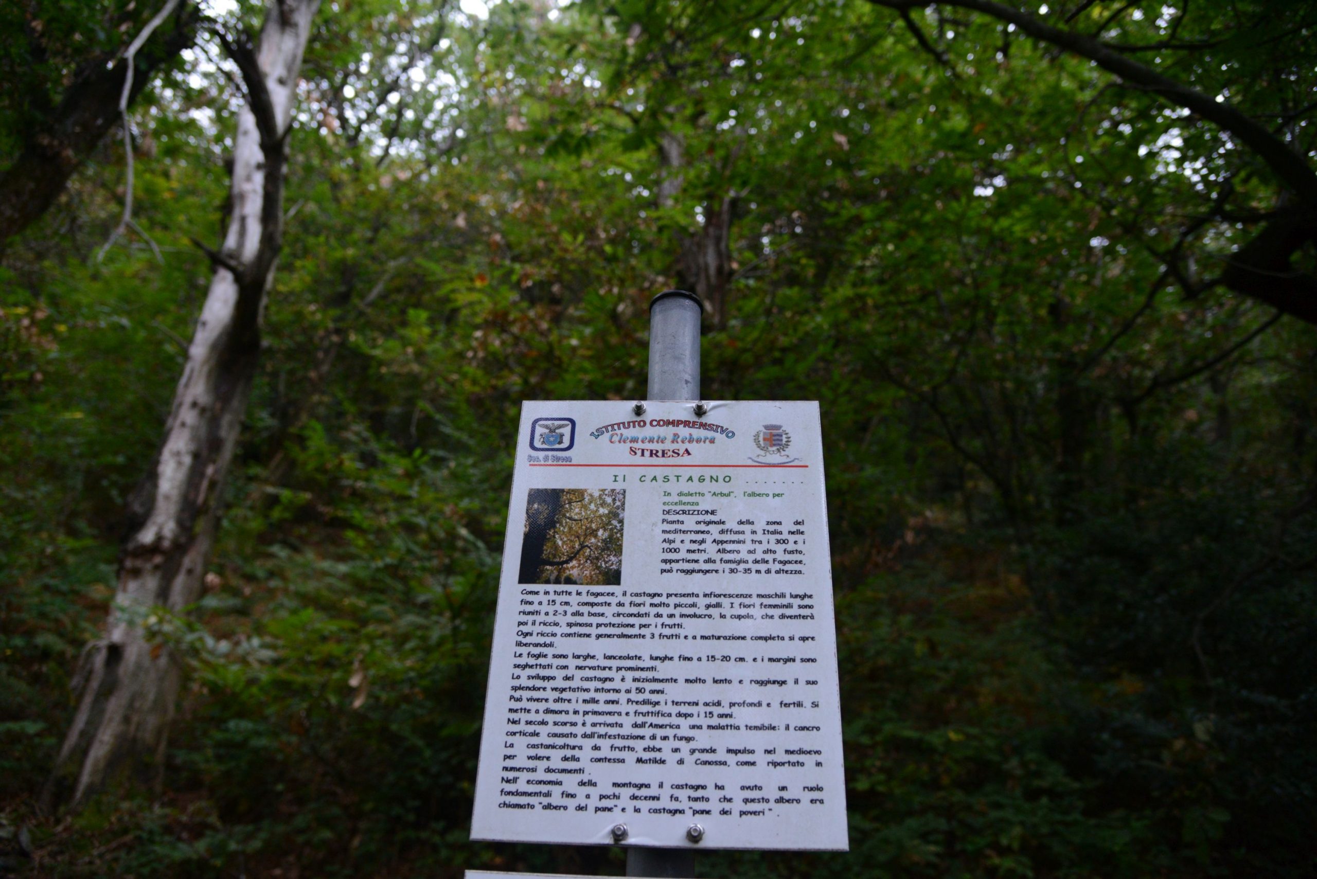
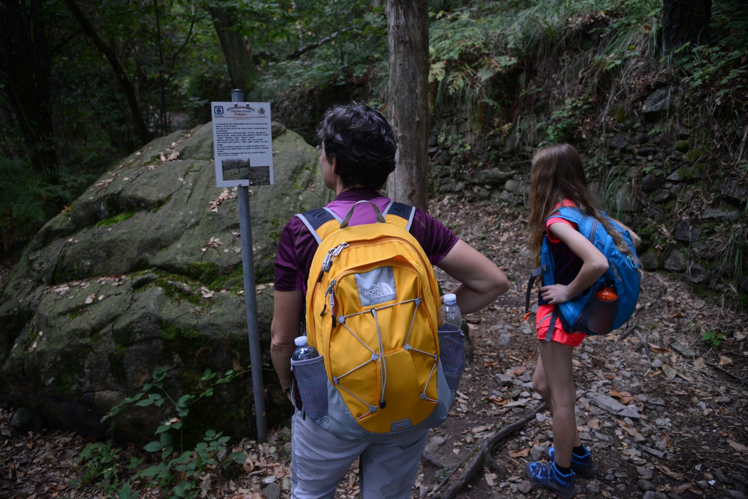
A beautiful uphill cobblestone pavement leads to the site of the “Mulin de la Stria” in Passera, whose history is told on a panel on site. Unfortunately, the remains of the mill are invisible, devoured by the vegetation, but reading the legend about the “witch“, immersed in the chestnut forest, will render this place unforgettable. The beautiful cobblestone road continues uphill, and reaches the village of Brisino and another asphalt road. First go left and then immediately right. Along the way, you’ll pass in front of a panel that tells about Celtic finds made in the area, and then the football field. Then you’ll get to the cemetery where the Church of Sant’Albino (built in 1151) is located.
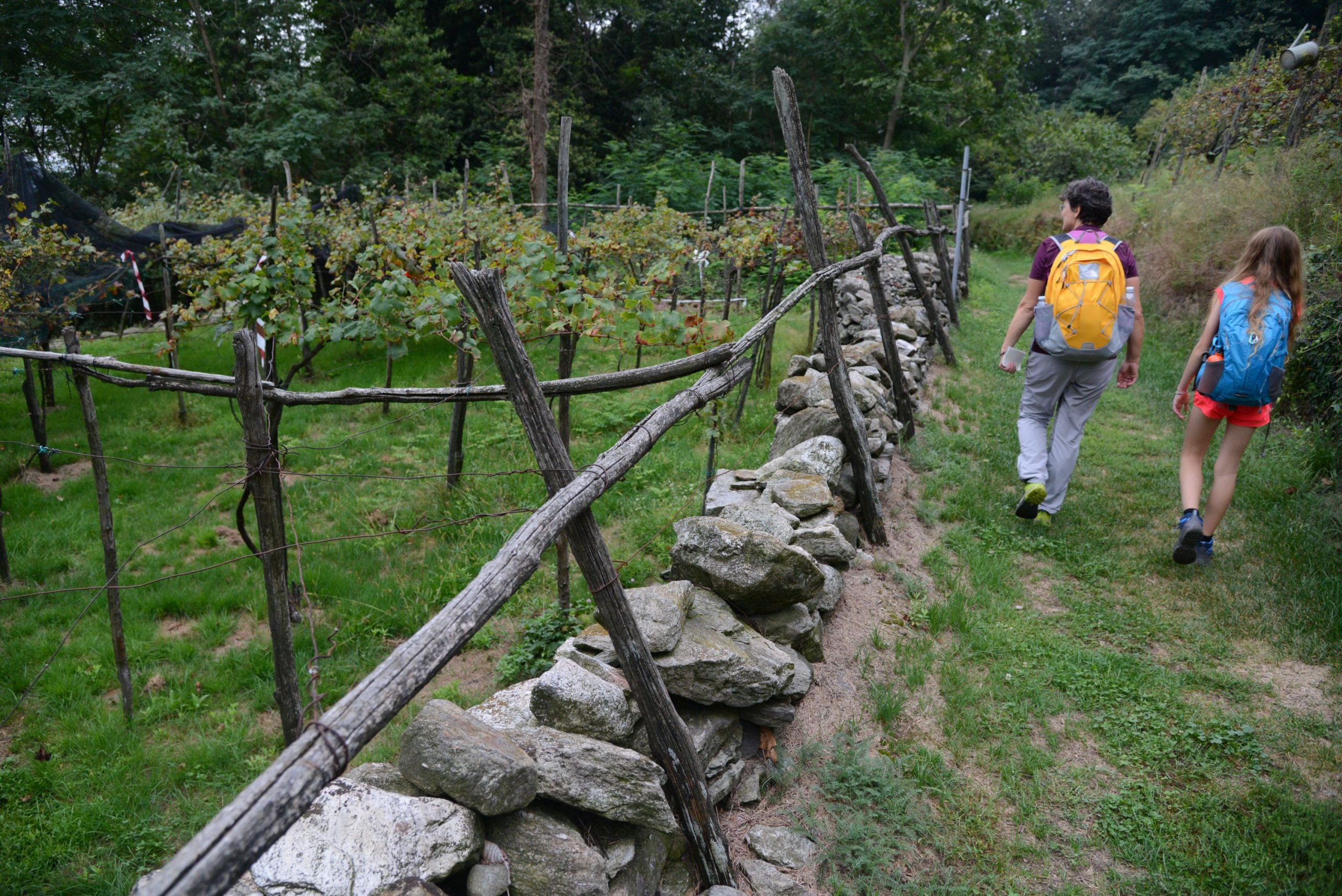
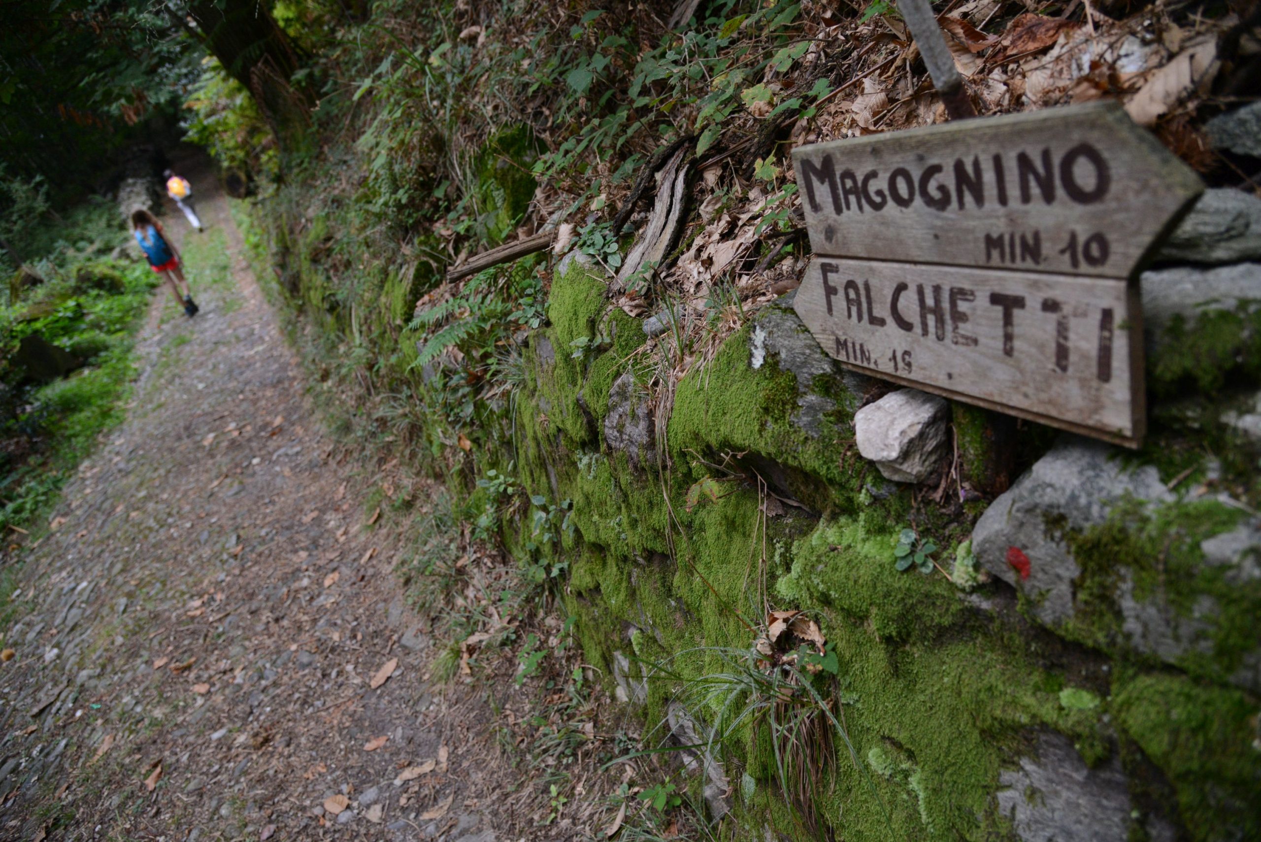
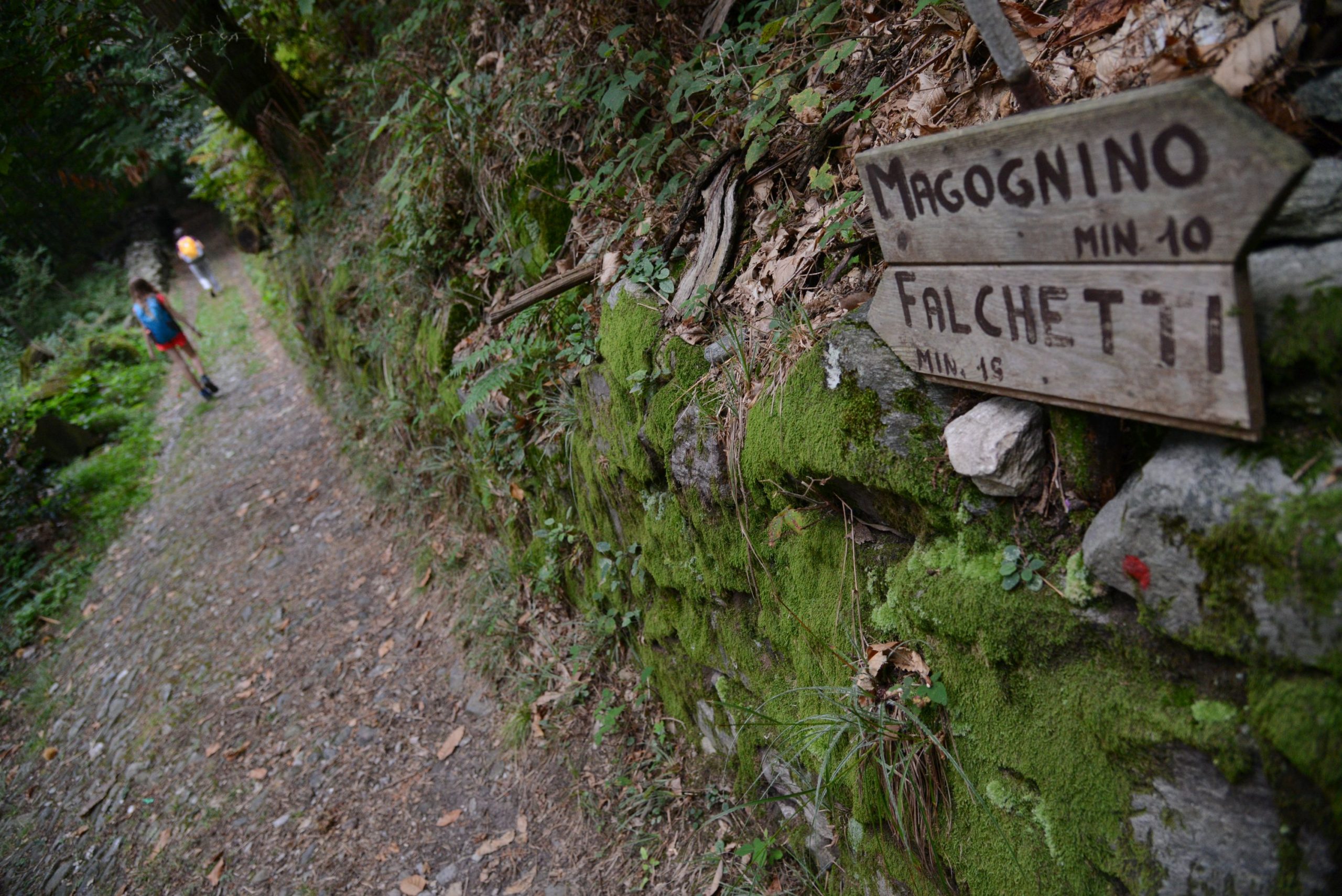
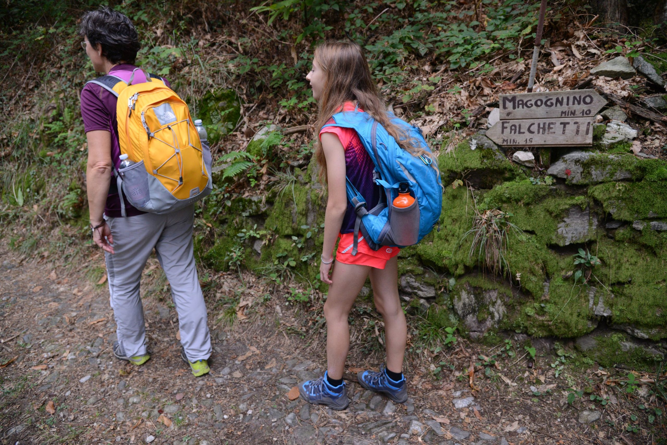
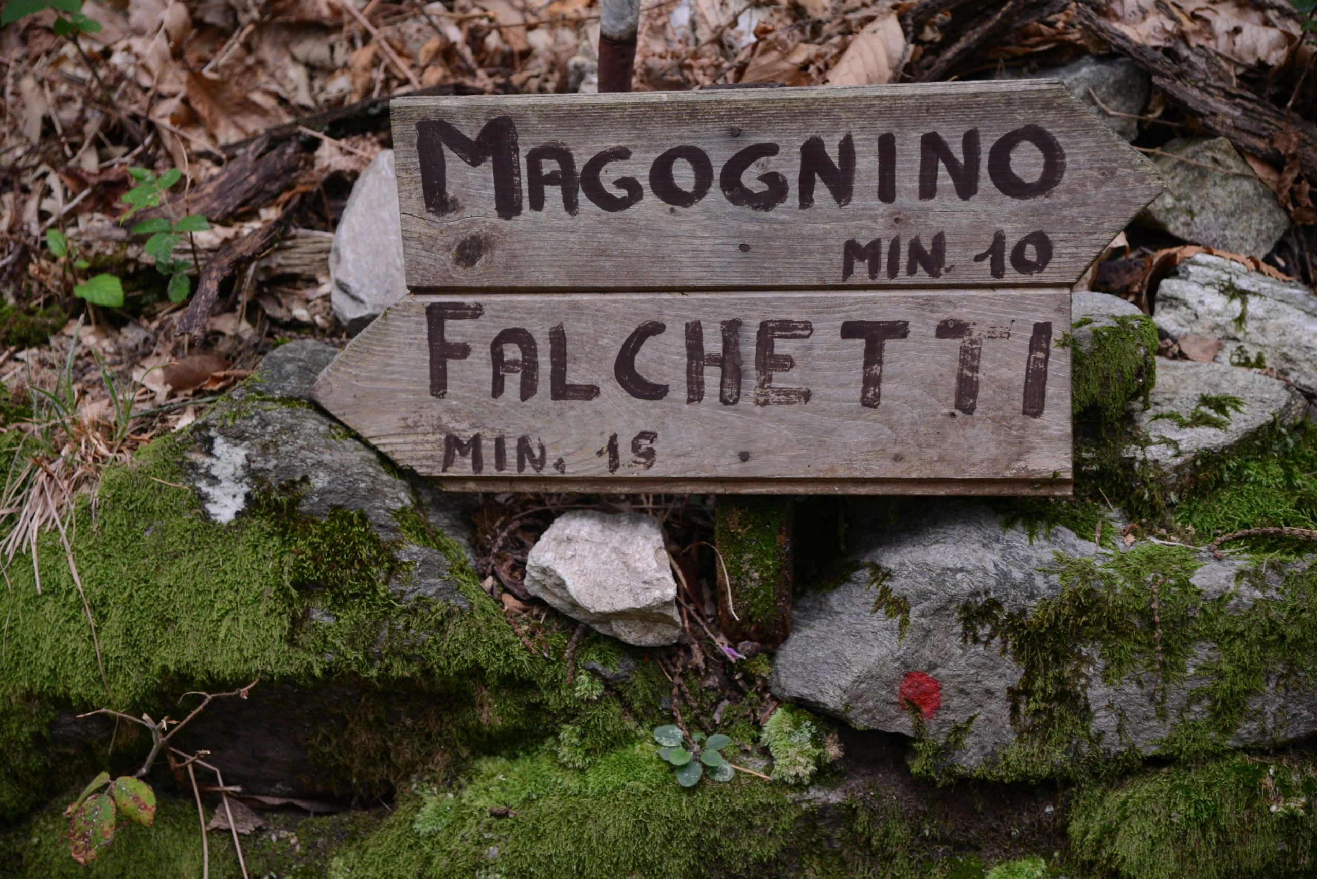
It houses a 15th century fresco. Passing by the cemetery (sign for “Belgirate L2”), you’ll enter a beautiful uphill path under impressive chestnut trees, and then you’ll come to the cobblestone pavement that comes from Magognino. Follow it to the left, towards Falchetti, along a pleasant gradual stretch. After passing an unusual vineyard surrounded by thick woods, turn right onto a slightly uphill path. Once you have reached the asphalt again, cross it and walk into the village of Falchetti (water fountain). Beyond the village, return to the forest to make the last climb in our itinerary. At a well-defined fork, take the path on the left. It will descend quickly after a short gradual stretch. A very short detour to the right leads to the Church of San Paolo, near which there are some ancient cup-and-ring marks. You’ll pass some houses, and then take the asphalt road to the left, downhill.
Note: It is also possible to go right, slightly uphill, and then take a path on the left that connects to the same asphalt road a bit further down. However, if you compare the two routes, you have to cover the same distance on asphalt, and it’s a bit steeper, so you might as well just follow the road on the left, as recommended.
After 500 metres on this road, go down a staircase on the left that literally “falls” to Belgirate arriving at the Old Church of Santa Maria. From there, you can admire the view of the town’s rooftops. Now, take the small pedestrian street right next to the church leading to a railway underpass. Cross the road and take the pedestrian street flanked by the Via Crucis chapels, and then take Via Conelli. Be careful to take the second alley on the left, Scalone Cairoli, which leads you out near the parish church, and therefore on the lakeside. Once on the lakeside, turn left to reach the Tourist Office. Beyond that, there is an interesting statue of a toad and, even further on, a small playground. The landing station is located in front of the tourist office. This is where you take the boat back to Stresa, by way of the Hermitage of Santa Caterina del Sasso on the opposite bank of the lake.
tips for young hikers
Not accessible to pushchairs due to the variety of terrain on this route.
If you wish, it is also possible to return by the same route. If you opt for the boat ride, before stopping in Stresa, you’ll be able to admire the wonderful Hermitage of Santa Caterina del Sasso and thus enjoy a short cruise on the lake.
Trail creators: Franco Voglino, Annalisa Porporato and Nora Voglino
Content authors: Franco Voglino and Annalisa Porporato
Back to the list of routes
Like the ancient pilgrims, we walk along the mule track that climbs from the lake shores up to one of the Sacri Monti of Piedmont and Lombardy
LAGO MAGGIORE: SACRED MOUNT OF GHIFFA
Lago Maggiore
Route description
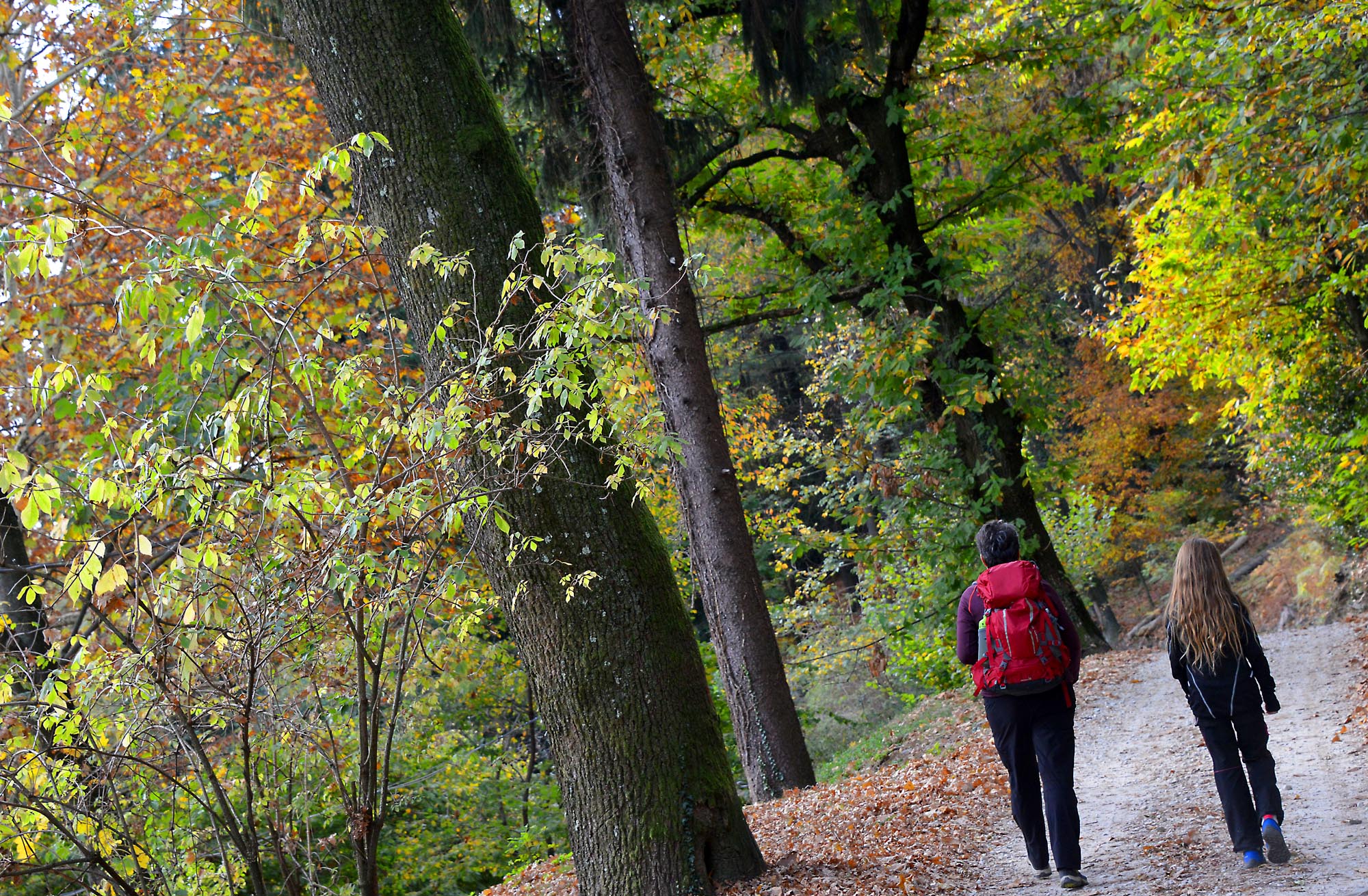
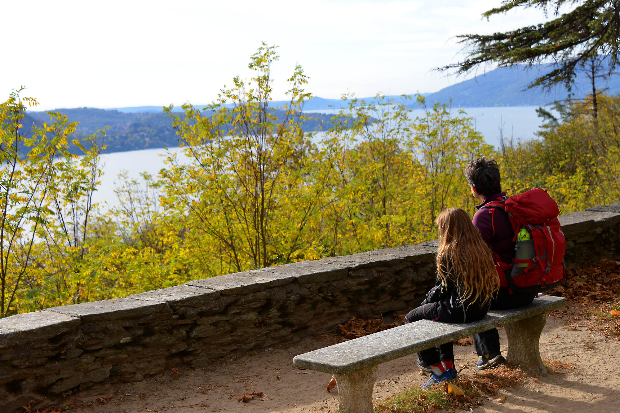
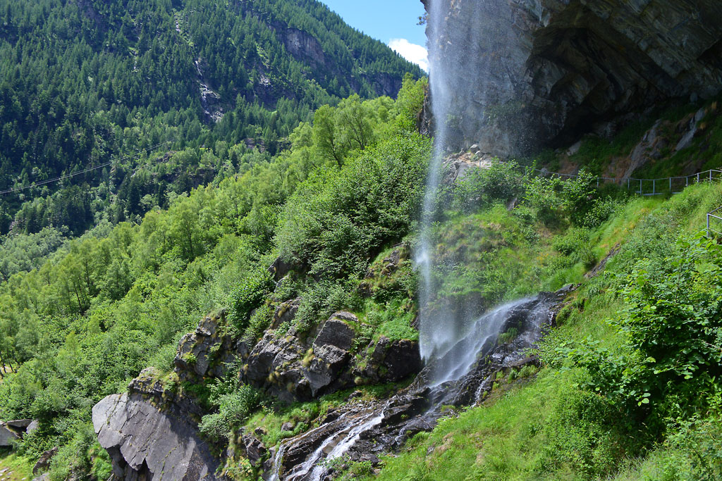
Like the ancient pilgrims, we walk along the mule track that climbs from the lake shores up to one of the Sacri Monti of Piedmont and Lombardy, UNESCO World Heritage Site since 2003, from the glittering water to the thick chestnut forests.
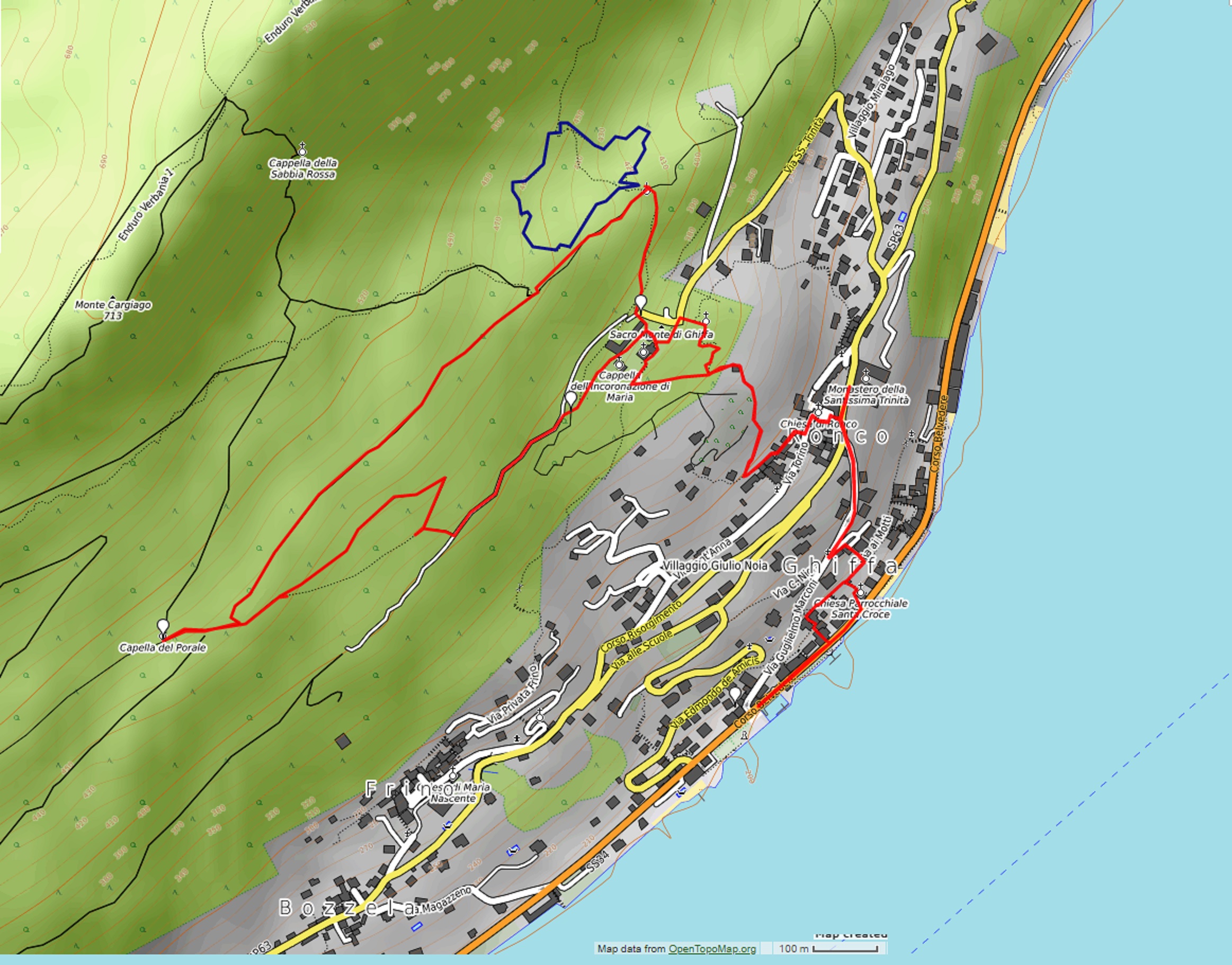
Departure location: Ghiffa, landing stage (200 m)
Place of arrival: Sacred Mount (360 m)
Maximum altitude: Cappella del Porale (470 m)
Difference in altitude: about 300 m
Distance: 5,5 km
Walking time not counting stops: 2 hours
Type of route: mixed (trail, asphalt, dirt road)
Signs: signs, red/white marks
Water: fountains at Ghiffa and Sacro Monte
Recommended period: all year round, without snow
How to get there: 6 km from Verbania. In the direction for Locarno, along the lake. Parking area near the landing stage with parking disc (60 min.). Free parking at 650 meters from the Town Hall. By bus: line 3 Verbania-Cannobio-Brissago, stop Ghiffa; line 8 Intra-Ghiffa-Oggebbio, stop Ronco (www.vcotrasporti.it).
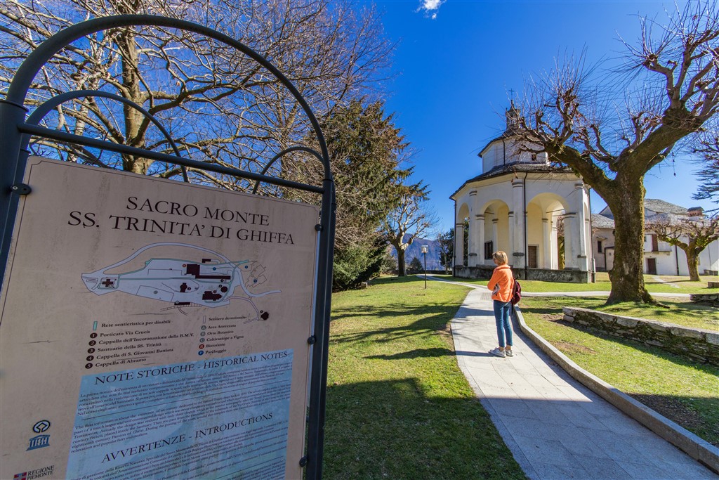
Information: Distretto Turistico dei Laghi – www.distrettolaghi.it; Tourist Office, Corso Belvedere 94 c/o Imbarcadero tel. +39 339 6330959; Municipality of Ghiffa – www.comune.ghiffa.vb.it; Ente Gestione dei Sacri Monti – www.sacrimonti.org; Riseva Naturale Speciale del Sacro Monte SS. Trinità di Ghiffa – www.parks.it/riserva.sacro.monte.ghiffa
the itinerary
From the landing stage, walk along the lakeside for a stretch, with the water to your right, until you are in front of the Santa Croce church. Climbing up the stairs to the right, you will arrive at a playground area with tables and benches. On the left, instead, the trail climbs in Via Ai Motti and following it to the right, you come to an intersection of three roads.
If you leave your car in the free parking, just take the staircase at the beginning of the parking area and that leads to a small oratory. Then it in the alleyway and you will arrive at the same intersection.
Go up the hill (to the left for those arriving from the landing station and to the right for those coming from the parking lot) along the narrow Via Nigra until you arrive on the asphalt road Via Marconi. Go to the right, uphill.
This road is very narrow, and traffic runs one way uphill. You must be careful of possible passing cars.
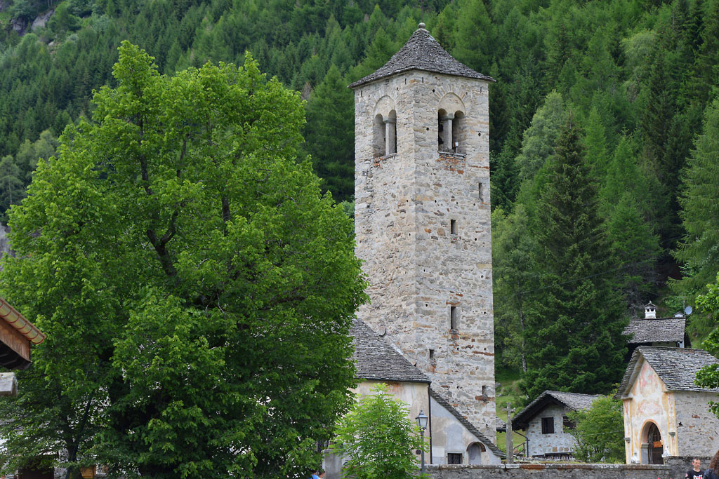
It meets a wider road, Via Risorgimento, in the hamlet of Ronco. The journey continues along the staircase located a little later, on the left, but before getting there, we recommend going forward a few meters to admire the little church with the stone façade that is part of the nearby convent.
Since 1906, the Monastery of the Most Holy Trinity has hosted around fifty Benedictine Sisters of Perpetual Adoration of the Most Holy Sacrament. If you enter the church, be respectful: at all times during the day and night, at least one nun is present and busy praying.
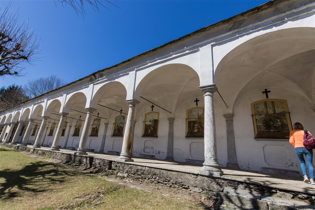
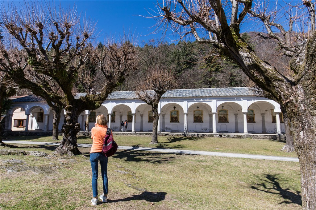
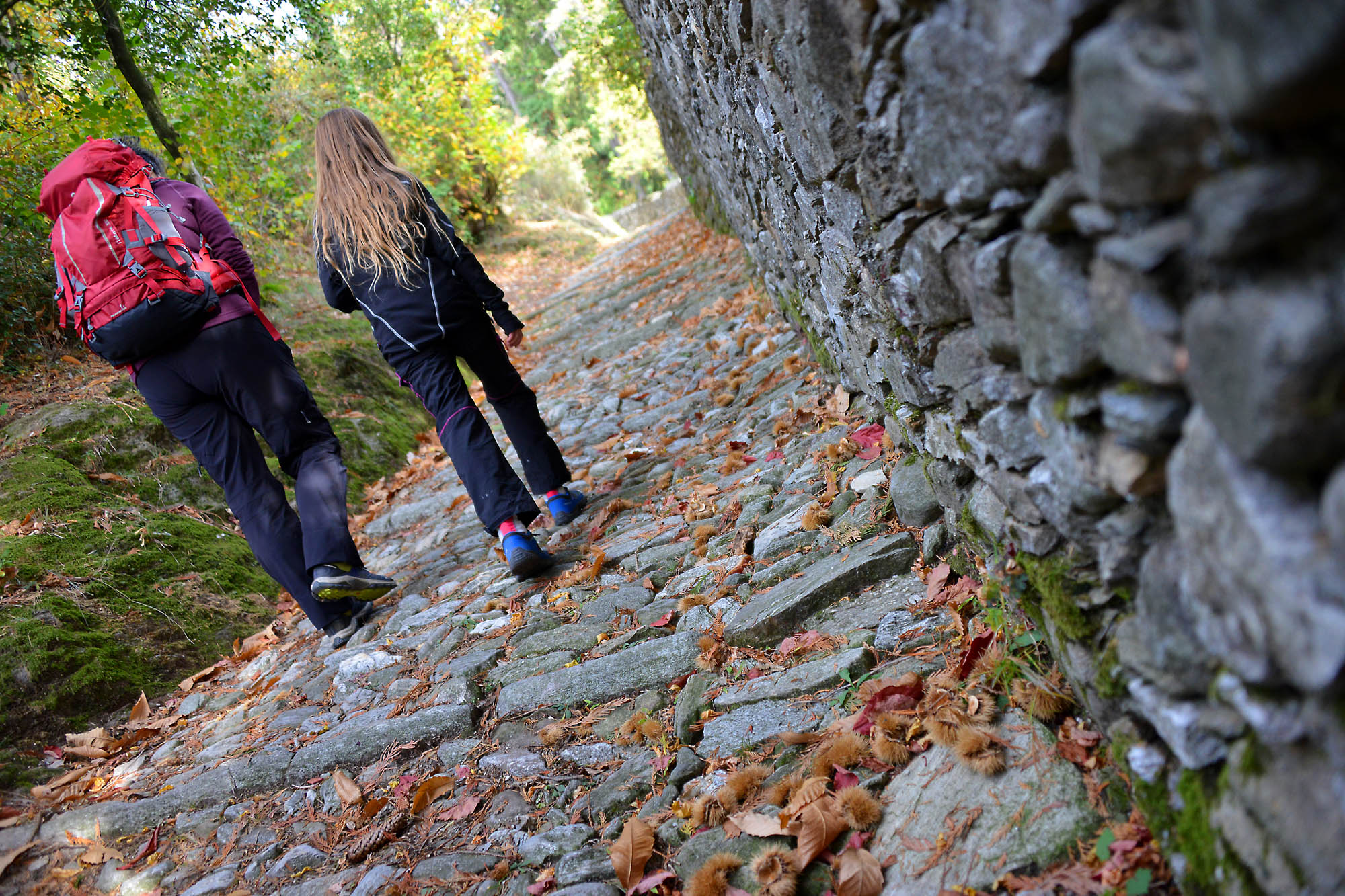
From the church, go back to the uphill path along the staircase that leads to the church of Ronco and Piazza Fontane. You will pass near the sacred building and at the T-crossing behind you on the left, take Via Torino (an old half faded sign says “Al Santuario”) and then immediately after that, take Via Careghetta on the right. The road is very narrow, and climbs to another T-junction. Here, take the wider cobblestone road to the right, which finally goes into the woods. Once you are in the woods, you will find another junction. Memorise this point, since both tracks are correct. We suggest that you continue straight. You will come back on the path on the right. Therefore, continues on the cobblestone road (slippery in the event of rain) climbing rapidly until you arrive at a new cobblestone pavement. Follow it to the right to ascend to the buildings of the Sacro Monte.
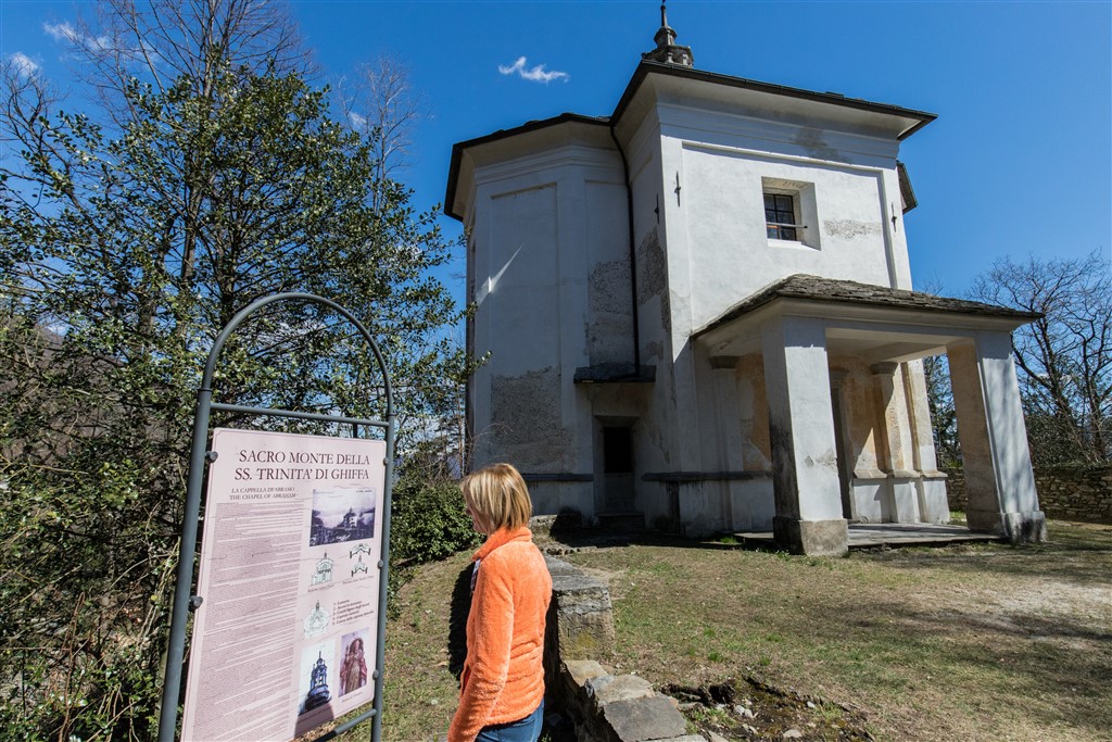
Already in ancient times, there was an oratory here, built in the 12th and 13th century and dedicated to the Holy Trinity. In 1591, this building is mentioned and you can see it still today inside the nave of the present church, on the left. There, you will find the fresco depicting the figure of Christ three times (a symbol of the Trinity: three persons, equal but different). Between the 16th and 17th centuries, the site was extended with the creation of the Sacro Monte, formed by the church of the Holy Trinity (1617) and the chapels of the Coronation of the Virgin (1647), St. John the Baptist (1659) and Abraham (1703), in addition to a portico which shelters a Via Crucis of 1752, closed on one side by a small chapel.
Now, follow the path for disabled visitors that passes in front of the portico of the Via Crucis and leads to covered picnic area with tables and a fountain. The open space around the sacred buildings lends itself to free play of children (but careful to not make too much noise!) and there are no dangerous elements.
The forest above the Sacro Monte has been a Special Natural Reserve since 1987.
After your well-deserved snack or lunch break, continue along the trail marked by didactic panels (white signs say “Cappella del Porale e Caronio”) and in the first part, you are still on the trail for the disabled next to the dirt road. Then you abandon that trail and take the dirt road on the right uphill (signs for “Pollino”). You can travel the entire dirt road or, alternatively, take a steep “short cut” on the left. Both routes converge at the same point just before the junction to return to the Sacro Monte. Before you continue, however, we invite you to go a few more meters in the direction of “Pollino” to reach the small chapel, the Cappella del Porale (1797), immersed in the cool forest. Then, go back to the crossroads previously mentioned in the description, and take the wide track that winds into the beautiful forest of chestnut trees. It is practically flat and, a little further back, is the road you took at the beginning. You will meet a single junction, but it is sufficient to keep on wider flat track to arrive, after a slight downhill segment, at a small power plant.
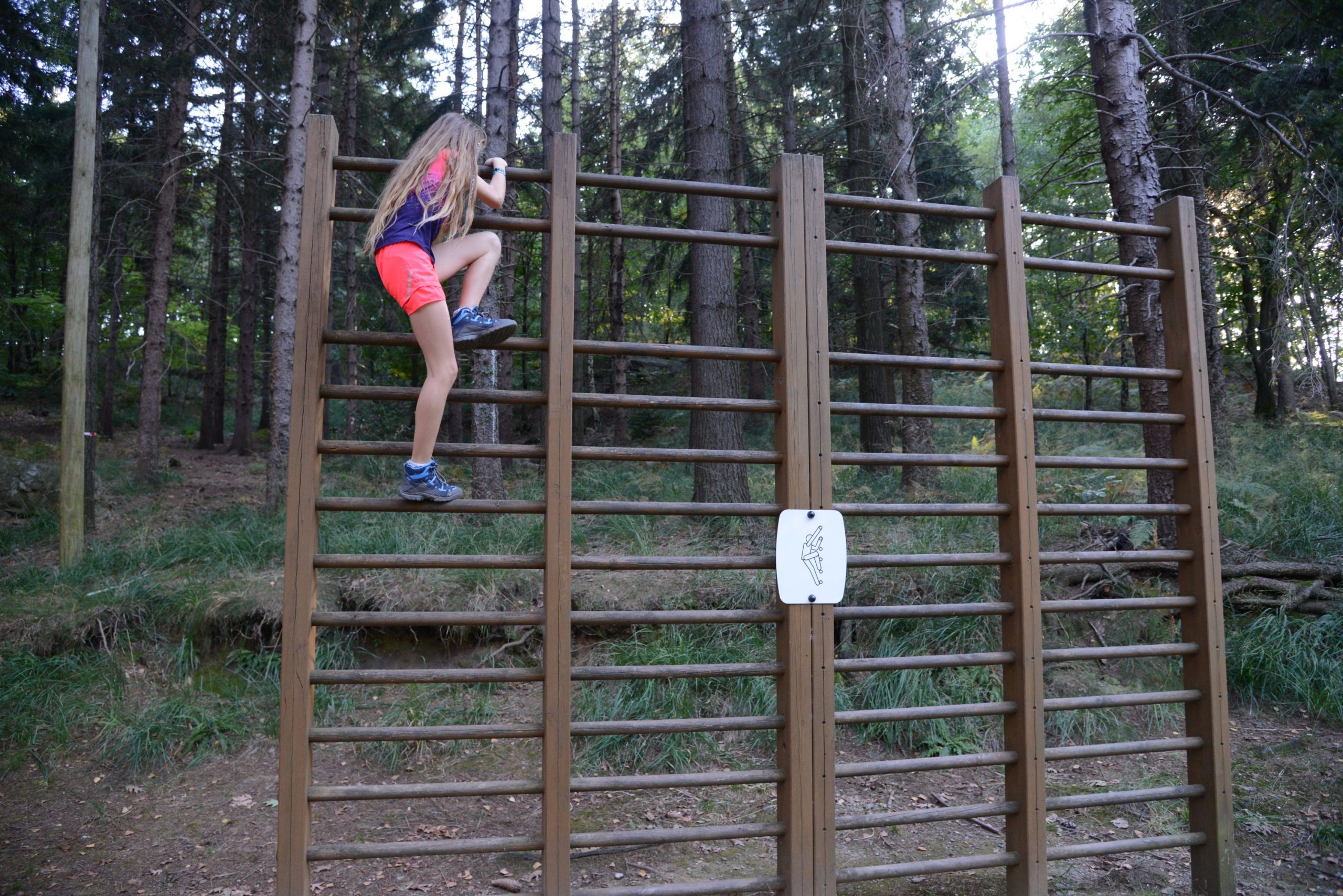
Here, on the left, you will find the beginning of a path, “Percorso Vita”, less than a kilometre in length, that leads to eighteen physical exercises to perform with equipment or just your own body weight.
Continue on the right, passing next to the power plant building, and then steep footpath with steps leading back down to the Sacro Monte (signs for SS. Trinità and red/white marks). You will once again pass next to the Portico of the Via Crucis and the chapel of Saint John the Baptist, and take the trail on the left (signs for “Cappella di Abramo” that lead you to descend along a path that touches the asphalted road and then leads to the chapel of the Patriarch Abraham, which is slightly farther away with respect to other buildings of Sacro Monte. Continues beyond the chapel to take the cobblestone trail (signs for “Ghiffa”) which soon leads to the junction you already passed on the way up. From here, descend along the path travelled at the start and if you can, stop to explore the characteristic narrow winding streets that form the old centre of Ghiffa, and that unfold behind the church, such as Via Ai Motti, Via Alessandro Volta, Via Soccorso and Via Taccioli.
to learn more
Hat Museum
From 1881 to 1981, the town of Ghiffa was the location of a thriving hat factory called Panizza, which made felt hats, and still produces hats even though it has moved to Tuscany (www.panizza1879.com). Today, the factory building has been transformed into a residence but two rooms house a museum that presents the art of hat making, with machinery on display along with photographs, period prints and videos (www.museodellartedelcappello.com).
tips for young hikers
A simple excursion that presents no difficulties. If you have children in strollers, you drive up to the Sacro Monte and take the path for disabled visitors. The playground area behind is the parish church of Ghiffa, while the Sacro Monte area offers stones to climb and trees to hide behind, and the “Percorso Vita” exercise trail offers new ideas for letting small hikers work off extra energy.
Slow trekkers: Franco Voglino, Annalisa Porporato and Nora Voglino
Authors of texts: Franco Voglino and Annalisa Porporato
Back to the list of routes
From Arona to Suna
Along Lake Maggiore, from San Carlone to the Borromeo Gulf
Lago Maggiore
Route description
Itinerary Description
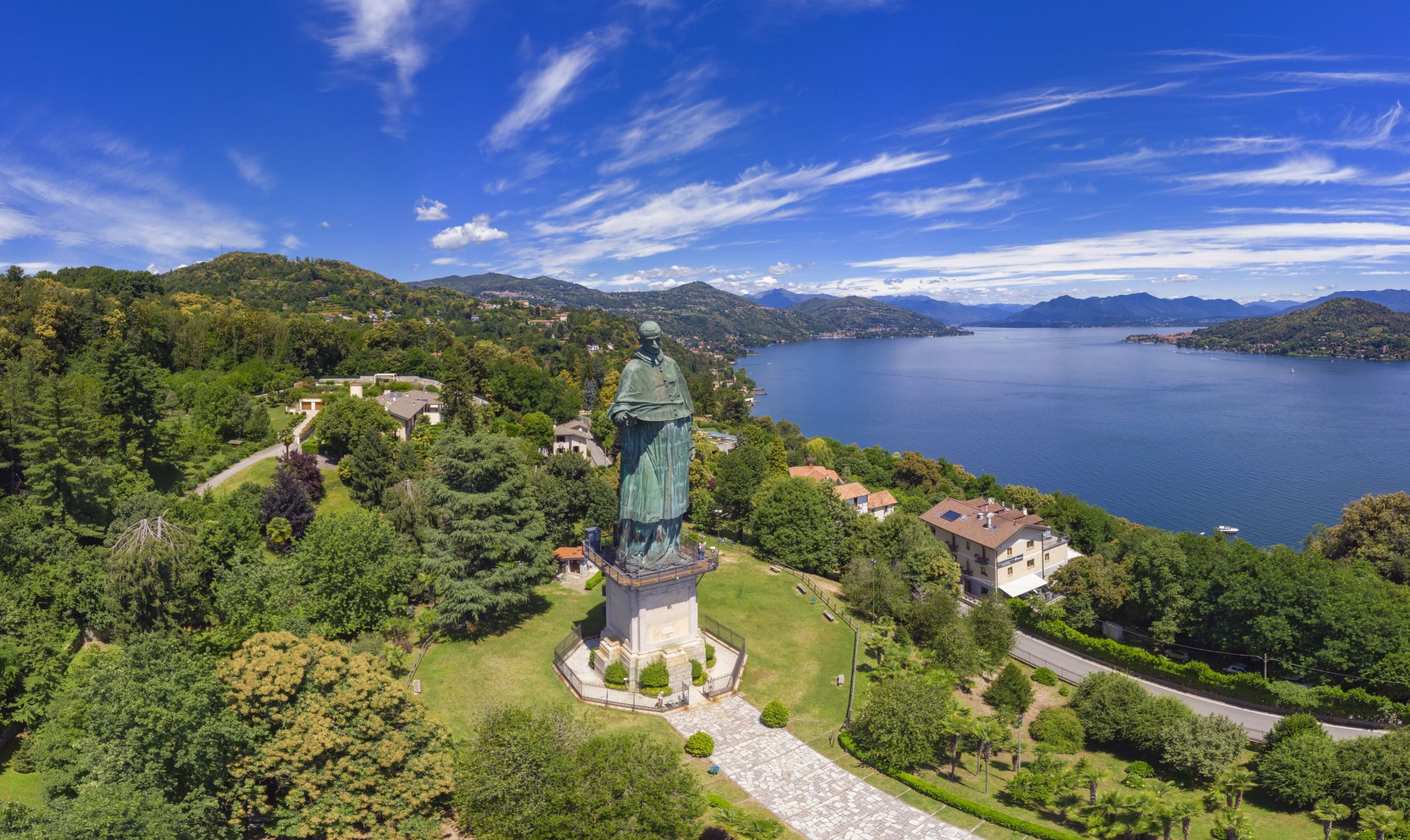
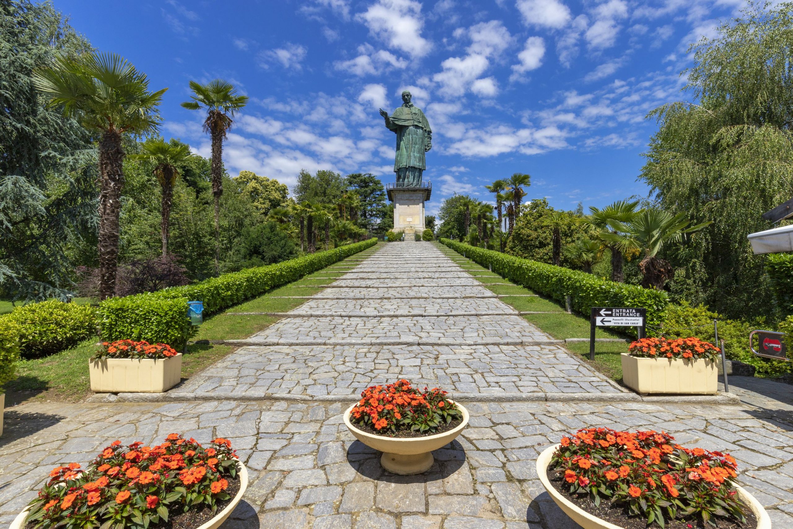
Before embarking on this journey, it is worth a visit to the centre of Arona, with the churches and the Archaeological and Mineralogical Museum, and its immediate surroundings: in particular the Rocca Borromea and the Sacro Monte di San Carlo, which although it has this name, it is not included in the group of UNESCO Sacro Monte sites.
From the colossal statue of San Carlo, more commonly known as “San Carlone”, we leave in the direction of Dagnente, and then to Meina, walking mostly on paved roads that pass through residential areas. We must pay particular attention to road traffic, because most of these roads do not have sidewalks or spaces for pedestrian transit.
In Meina, it may be worth a deviation from the centre to visit the Museum of Meina, housed in the historic Villa Faraggiana
By alternating woodlands with short glimpses of the lake, we quickly come to Lesa, where the trail gains a bit of elevation, and begins to offer hikers a wider scenic view, alternating with historical villas built in the nineteenth century. And here also, we recommend a deviation to visit to the Manzoni Museum.
The trail continues through residential areas and some agricultural areas, until it reaches Belgirate, with the majestic Old Church or the Church of Santa Maria, dating back to the ninth century. From here, we see a wide panorama of the lower Verbano.
Quickly, we climb in elevation to then continue high above the lake to Stresa and its surrounding villages. At the limit of a glade, we come to the small oratory of St. Paul, near which a few coins from the Roman imperial age were found in addition to a rock with holes in it, evidence that the area was populated in ancient times. The mule track continues up to Magognino, and then descends to the small cemetery where the Church of Sant’Albino is located, another medieval structure, with a small characteristic bell tower not unlike other parish churches of that time.
Now, the trail begins to descend slightly, always on paths and mule tracks, toward Passera and then Stresa, passing behind Villa Pallavicino, which houses a botanical park with local fauna that we can visit.
At Stresa, the itinerary runs along the lake, but a visit to the city centre is recommended, and also a boat ride (public or private) to the Borromean Islands (Isola Bella, Isola dei Pescatori and Isola Madre). After passing the big luxury hotels of the Stresa Riviera, it is a short walk up the Sempione State Road to the Hotel Villa Aminta, where the trail rises rapidly and we are immersed in a rural world that strongly contrasts with the lake’s touristic luxury image.
The trail seems level, and going through fields and woods, we reach the hamlet of Baveno and Roncaro, and then descend to the lakeshore.
The itinerary touches the city’s tourist-cultural heart, with the Church of SS. Gervasio and Protasio, the Baptistery and the Granum Museum, dedicated to Baveno’s pink granite and the work of masons. Then we continue towards the hamlet of Oltrefiume, which stands at the foot of the quarries of fine granite.
We continue northwards, gradually turning away from the inhabited area and starting a short climb towards the hill that is home to the Tower of Feriolo, a medieval watchtower over the lake and the outlet of Ossola. We then descend to Feriolo, and along the bicycle-pedestrian path, we enter the Natural Reserve of Fondotoce, skirting the area of the reed bed, of considerable naturalistic importance and a place of nesting and passage of numerous species of birds. After leaving the reservation, the trail rises rapidly to the village of Cavandone, with its ancient yew tree, and then on a comfortable mule track we descend to the shore of Lake Maggiore, in the village of Suna.
POINTS OF INTEREST
Arona
Chiesa dei SS Martiri (Chiesa di San Graziano)
Collegiata della Natività di Maria Vergine
Chiesa di Santa Maria di Loreto (Chiesa di Santa Marta)
Colosso di San Carlo
Parco dei Lagoni di Mercurago
Civico Museo Archeologico
Civico Museo Mineralogico
Rocca borromea
Piazza del Popolo
Meina
Museo Meina
Chiesa Santa Margherita
Chiesa La Madonnina
Villa Bonomi
Villa De Savoiroux
Villa Eden
Villa Faraggiana
Villa Faraone
Villa Kitzerow
Villa Paradiso
Villa La Favorita
Lesa
Chiesa San Giorgio
Chiesa San Rocco
Chiesa San Giovanni Battista
Chiesa San Sebastiano
Chiesa San Martino
Santuario Madonna di Campagna
Museo Manzoniano
Palazzo Stampa
Villa Cavallini
Belgirate
Chiesa Santa Maria e San Carlo
Chiesa Vecchia
Oratorio di San Paolo
Casa De Fichard
Casa Martelli
Villa Conelli
Villa Serafini
Villa Principessa Matilde
Stresa
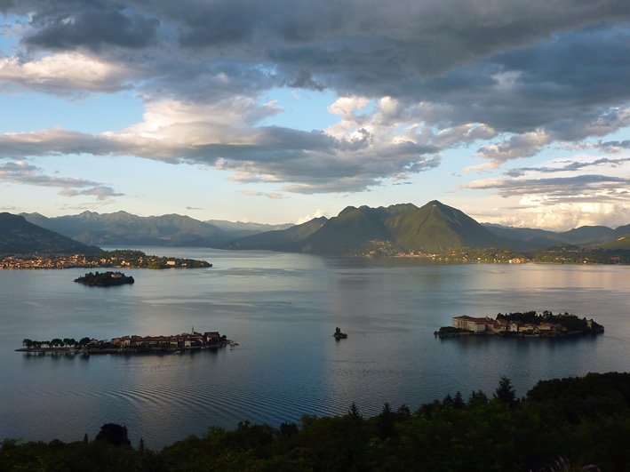
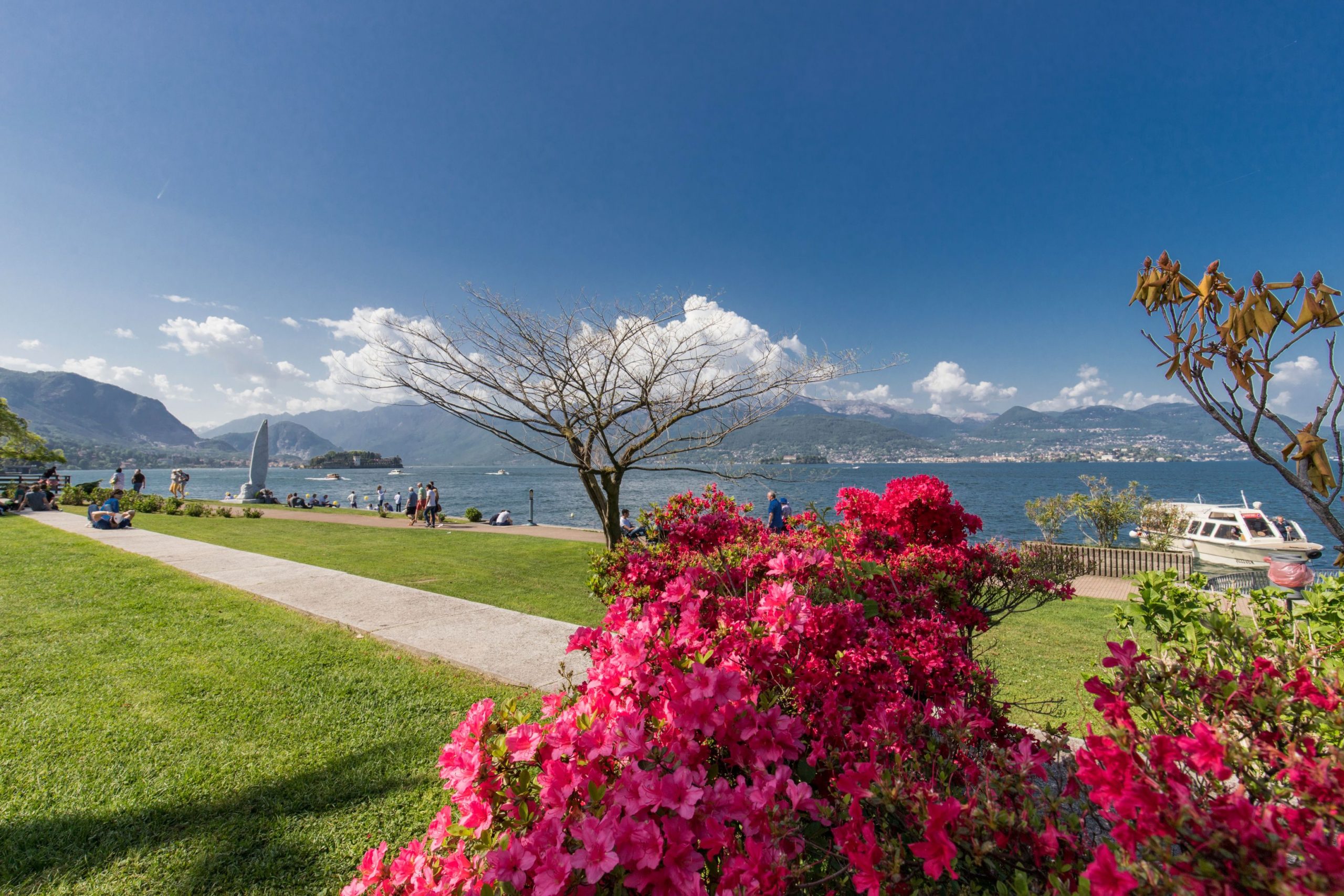
Isole Borromee
Villa Pallavicino
Villa Ducale
Baveno
Chiesa SS. Gervaso e Protasio
Battistero
Museo Granum
Oltrefiume
Torre di Feriolo
Feriolo
Suna
Chiesa di Santa Lucia
Oratorio della Beata Vergine del Buon Rimedio
Torraccia medievale
Cappelle devozionali lungo i Sentieri del Monterosso
Cavandone
Chiesa Parrocchiale della Natività di Maria
FACILITIES
STRUTTURE RICETTIVE
TECHNICAL NOTES
LEGS: the journey is recommended in three legs: from Arona to Belgirate (10 km), from Belgirate to Baveno (10 km), and from Baveno to Suna (13 km)
DIFFERENCE IN ELEVATION: minimum elevation of the itinerary: 204 m a.s.l.; maximum elevation 450 m a.s.l. See the map.
DURATION: from 3 to 6 hours for each leg
TYPE OF PATH: Hiking – MOSTLY DIRT roads but long stretches on asphalt
FOR MORE DETAILS
http://www.distrettolaghi.it
http://www.statuasancarlo.it
http://www.comune.meina.no.it/ComGuidaTuristica.asp
http://www.comune.lesa.no.it/ComGuidaTuristica.asp
http://www.comune.belgirate.vb.it/ComGuidaTuristica.asp
http://www.stresaturismo.it/default.asp
http://www.bavenoturismo.it
Back to the list of routes
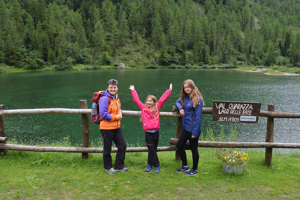
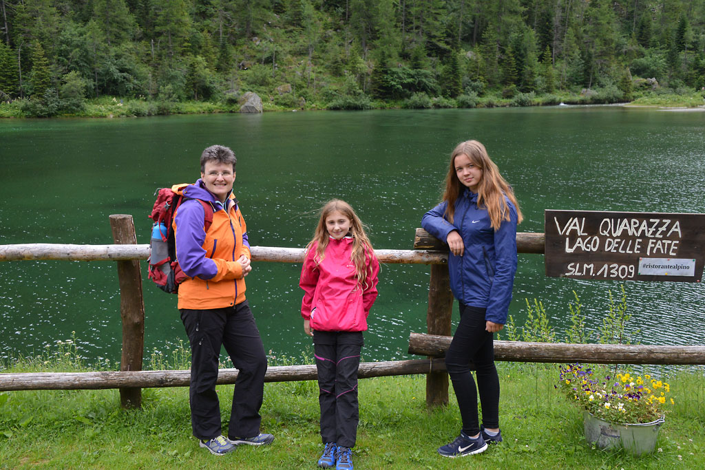
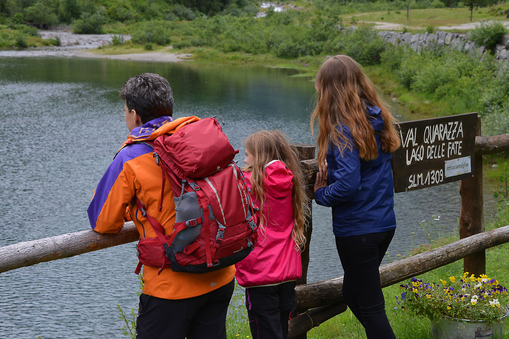
A semicircular walk that leads through a lovely green alpine world, up to the mysterious Lago delle Fate
LAGO DELLE FATE
Valle Anzasca
Route description
A semicircular walk that leads through a lovely green alpine world, up to the mysterious Lago delle Fate.
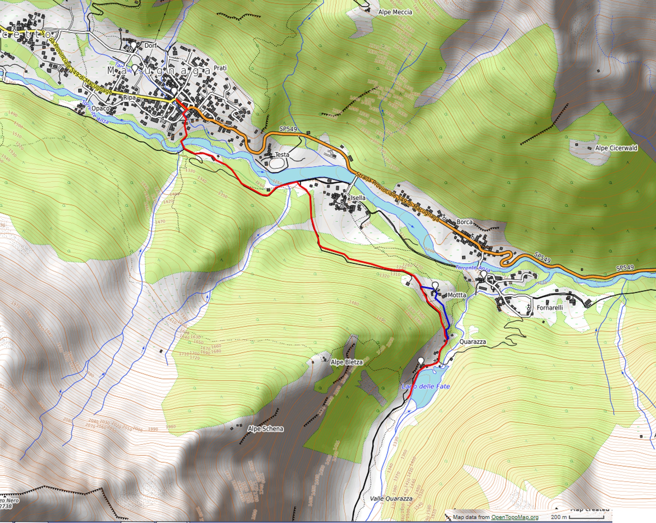
Departure location: Macugnaga, Piazza Municipio (1310 m)
Place of arrival: Lago delle Fate (1330 m)
Minimum altitude: 1245 m approximately
Difference in altitude: -55 m + 85 m approximately, one way
Distance: 3 km one way
Walking time not counting stops: 1 hour one way
Type of route: dirt road
Signs: red/white road signs
Water: fountains in Macugnaga
Recommended period: from April to October
How to get there: 40 km away from Domodossola. Along the SS33, 12 km south of Domodossola, exit at Piedimulera, then follow the blue signs for “Macugnaga”. Parking in Piazza Municipio. By bus: Domodossola-Macugnaga line, stop Macugnaga-Staffa (www.comazzibus.com).
Information: Distretto Turistico dei Laghi – www.distrettolaghi.it; IAT office – Piazza Municipio 6, Macugnaga – tel. +39 (0)324.65119; Municipality of Macugnaga – www.comune.macugnaga.vb.it; Unione Montana Valli dell’Ossola – www.umvo.vb.it; Tourist information – www.macugnaga-monterosa.it
the itinerary
Keep the pleasant town hall square, surrounded by houses of wood and stone with a beautiful fountain flush in the centre, on your left, and walk along a short stretch of state road. You will turn almost immediately to the right on via Ludovico Jacchetti. A few steps along this street and then you will go almost immediately to the left along a little asphalted alley (brown sign for “Lago delle Fate – Percorso Vita”) that descends continuously to a bridge over the Anza stream.
Macugnaga is an ancient village founded in 1256 by Walsers, a population of Germanic origin from Wallis, which colonised several valleys around Monte Rosa. The buildings underscore this origin precisely, because they are built with the typical Walser blockbaum technique, in stone and wood. There is a spectacular view of the east side of Monte Rosa and the “four Sisters”: Punta Gnifetti (4554 m), Punta Zumstein (4563 m), Punta Dufour (4634 m) and Punta Nordend (4609 m).
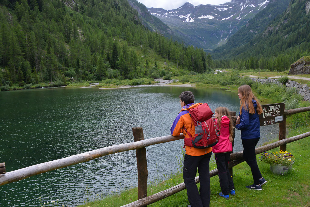
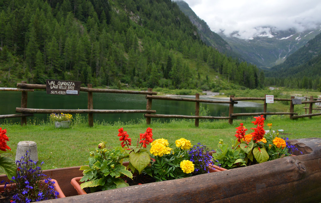
After crossing the bridge, keep left on the dirt road that runs beside the torrent (yellow signs for “Lago delle Fate 50 min.”) always keeping left and walking on a pleasant level road. After passing a barrier bar, take the dirt road on the right, uphill (yellow signs) and stay on the main street to climb gradually and constantly to Quarazza (1309 m), where you will find two bar-restaurants, a small church, a fountain and the Lago delle Fate.
We are located at the entrance to Quarazza Valley, which ends with Passo del Turlo (2738 m), a connecting road between Macugnaga and Alagna, which for centuries was an important through route between the valleys of Monte Rosa. Today, a mule track of the early 20th century runs along this route, and it is the passage of the Tour of Monte Rosa. At one time, the village of Quarazza was much larger, but part of the hamlet was submerged by the waters of the lake. The water level rose after the dam was built in 1952.
The shores of the lake are very pleasant for taking a break, with small beaches that you can stay on, and immediately after, there are wide and flat meadows. All elements that will make you want to end your trip here with your little hikers.
If you like, you can continue along the dirt road until you reach the village of Crocette, also called the “Città Morta” (the dead city) (1400 m), which was a village of miners. Today, you can see the remains of buildings linked to the ancient gold mining operations (another 1.6 km, +100m one way).
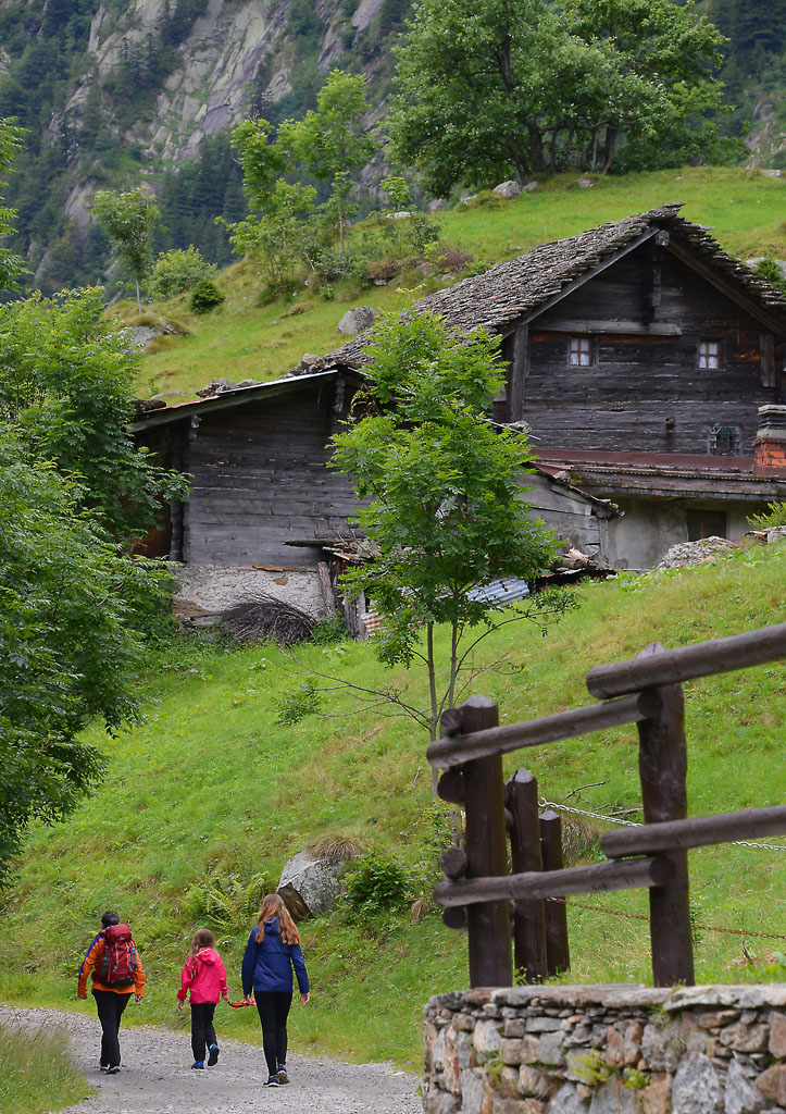
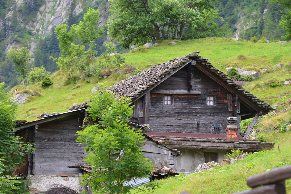
You return by going back the way you came, but we strongly recommend a short detour that passes through the characteristic village of La Motta. After leaving the lake behind you, shortly after the bar-restaurant, take the steep trail down to the right (sign for “La Motta 0h20”). Just beyond this, keep left and go along a more gradual stretch that leads to the lovely village of La Motta (1280 m) with a 13th century oratory where an anonymous artist has created imaginative forms of wood. A short uphill trail then returns you to the dirt road you were on at the start, you can retrace your steps to return to your departure point.
Variant: if you travel the complete downhill path, (sign for “Borca”), you will come to a very steep descending staircase and then to the village of Borca, where the Guia Gold Mine is located.
to learn more
Staffa – The Old Linden Tree
Via Chiesa Vecchia starts from Piazza del Municipio, and at the end of the road there stands the ancient church that the street is named after (documented in the 14th century, but certainly even older) with its adjacent cemetery and, most importantly, what many consider to be the true symbol of Macugnaga: a monumental tree that is estimated to be about 800 years old. Legend has it that it was plated when Macugnaga was founded, and the most important meetings in the community were held around its trunk.
The Museum of the Mountain and Smuggling
The Museum of the Mountain and Smuggling is situated in the village of Staffa, in an 18th century building that was once a barn. It tells the story of the first alpine guides, of climbing Monte Rosa and the story of the “spalloni” who smuggled all sorts of goods over the border. The museum features photos, videos, and objects on display.
Guia Gold Mine
Situated in the locality of Fornarelli, this place can boast of being the first gold mine in the Alps open to the public, and the first Italian mining museum. It is a journey back through the history of gold extraction in the valley, because it seems that the mines were already open during Roman times. After a maximum peak in the 1940s (in 1948 they extracted 580 kg of pure gold!), foreign competition and ageing machinery lead to its closure in 1961. The visit is fully accessible to people with motor disabilities (www.minieradoro.it).
The Walser Museum
The museum is located in the village of Borca, inside the original parish church house built in the 17th century. Since 1982, it has seven rooms where furniture and objects of the Walser lifestyle are on display (www.museowalser.com).
tips for young hikers
The path (excluding the variant for La Motta) is accessible to pushchairs since it is all on dirt roads.
Slow trekkers: Franco Voglino, Annalisa Porporato and Nora Voglino
Authors of texts: Franco Voglino and Annalisa Porporato
Back to the list of routes

An easy circular path through a city park
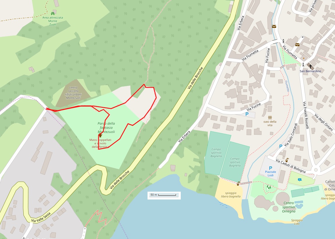
LAGO D’ORTA: OMEGNA – MONTE ZUOLI
Lago d’Orta
Route description
An easy circular path through a city park that offers the possibility to exercise in a wooded environment, or to unleash your imagination in wild games thanks to the “Torta in Cielo”.
Departure location: Omegna, Via delle Brocche (326 m)
Place of arrival: “La Torta in Cielo” (410 m)
Difference in altitude: approx. 100 m total
Distance: 2 km total
Walking time not counting stops: 45 minutes total
Type of route: mixed (trail, dirt road)
Signs: yellow “Percorso Vita” arrows
Water: fountain at destination
Recommended period: all year round, even with snow, if you take the path for pushchairs/strollers. Perfect in warmer months because the path is always in the shade.
How to get there: 7 km from Gravellona Toce. Located at the northern end of Lake Orta. Some parking in the adjacent streets. Parking can also be found along Via Erbera following the signs for “Area Camper” and “Centro Sportivo” where there are many spaces along the road and in Piazzale Lodi, near the Lido. From here, visitors will need to walk a maximum of 1 km 50 metre difference in altitude one way. By bus: Novara-Borgomanero-Omegna-Domodossola line (www.comazzibus.com). By train: Novara-Domodossola line, Omegna station (www.trenitalia.com). By boat: Orta-Omegna line (www.navigazionelagodorta.it)
Information: Distretto Turistico dei Laghi www.distrettolaghi.it; Tourist Office – Piazza XXIV Aprile 19, Omegna, tel. +39 0323 61930 www.visitomegna.it; Municipality of Omegna www.comune.omegna.vb.it; Parco della Fantasia Gianni Rodari www.rodariparcofantasia.it
the itinerary
The entrance to the Monte Zuoli park is located on the SP46 road, almost at Via Erbera. After going through the gate, take a short stretch of asphalt road uphill and then continue on a path to the right, indicated by a yellow arrow that leads to a “Percorso Vita” station and a slide for young hikers. Continue following the yellow arrows (not the red ones that indicate the mountain bike route), and gradually climb from station to station, always staying under the thick canopy of trees in the cool shade. Benches are located along the path if you need to rest.
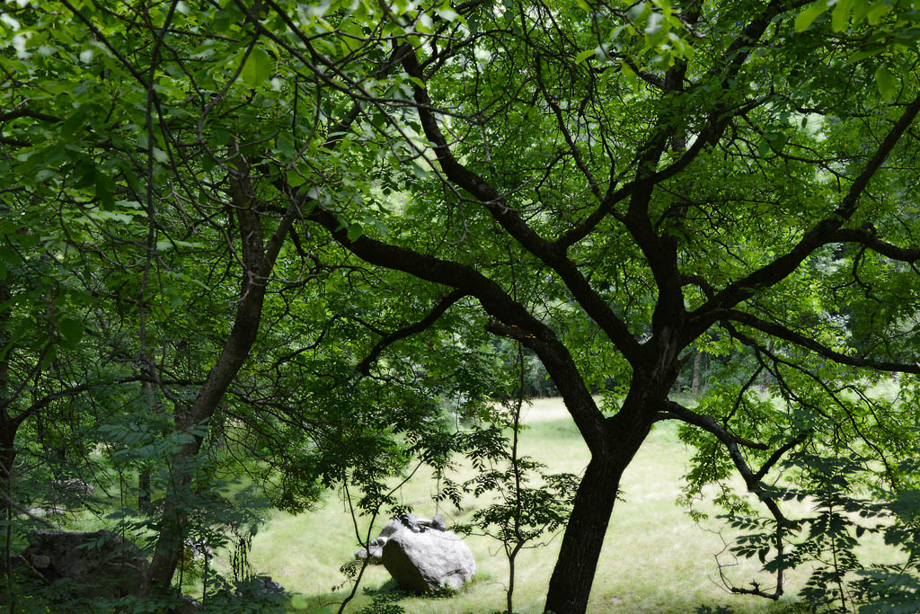
A beautiful birch grove is right before the destination: a large clearing where you can find the installations of the park “La Torta in Cielo“, dedicated to the writer Gianni Rodari. Here, you will see colourful walls where kids can play hide-and-seek, a panoramic amphitheatre, a very long pulley and several covered tables. Rest rooms and a water fountain are also available. Wooden silhouettes indicate the direction that you should take, or point to interesting things to see. From the amphitheatre, take the downhill path (yellow arrows) and you can see boulders with cup-and-ring marks, a rock-slide and the panoramic point. Then, the path descends quickly until it joins the asphalt road that you came into the park on, which leads back to the entrance gate.
to learn more
Gianni Rodari
Born in Omegna in 1920, Gianni Rodari was a children’s book writer, the only Italian to win the prestigious Hans Christian Andersen Award (the “little Nobel prize” for children’s literature). His works include “Filastrocche in cielo e in terra”, “Favole al telefono”, “C’era due volte il Barone Lamberto” and “La Freccia Azzurra”, which inspired a movie with the same title. (www.museorodari.it)
tips for young hikers
Almost always in the shade, this excursion is in an easy but “real” mountain path, perfect for the first trekking experiences of children. The path in the park is not suitable for pushchairs/strollers, and therefore we suggest the variant that starts from the car park in Via Varallo: it’s true that the parking lot is really located very close the Rodari park, but there are many playgrounds that you can drive to. Why not make the little ones walk a bit? The surprise arrival at the pulley will make them say “wow”!
Trail creators: Franco Voglino, Annalisa Porporato and Nora Voglino
Content authors: Franco Voglino and Annalisa Porporato
Back to the list of routes
This excursion leads to the discovery of the remains of a great landslide of the past
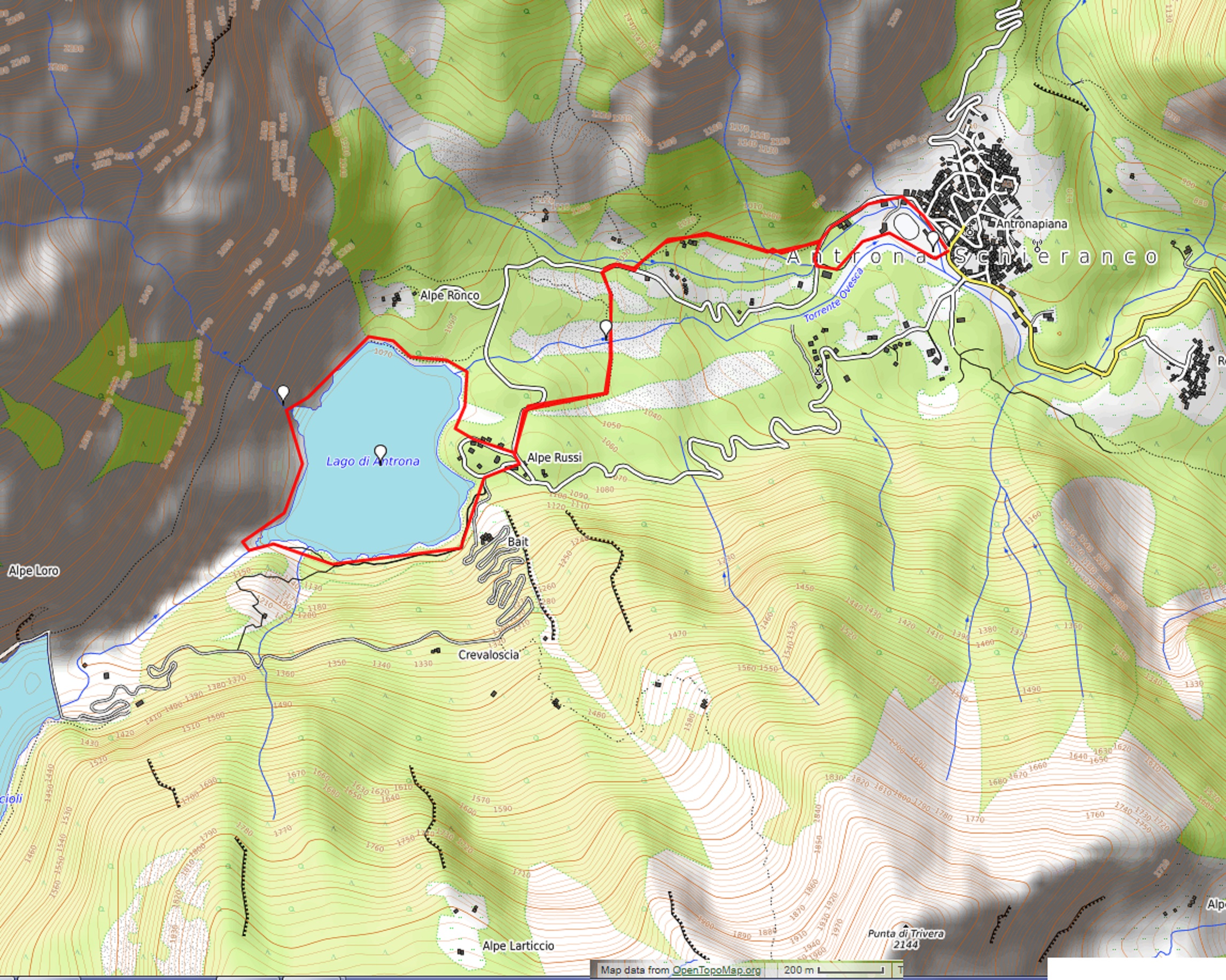
LAKE ANTRONA
Valle Antrona
Route description
This excursion leads to the discovery of the remains of a great landslide of the past and, after a spectacular relaxing lakeside journey, it rewards hikers with an exciting passage “inside” a waterfall, like in classic adventure films!
Departure location: Antronapiana (908 m)
Place of arrival: Lake Antrona (1105 m)
Maximum altitude: Sajont waterfall (1145 m approximately)
Difference in altitude: About 250 m
Distance: 6,5 km
Walking time not counting stops: 2 hours and 30 minutes
Type of route: mixed (trail, asphalt, dirt road)
Signs: red/white road signs
Water: fountains in Antronapiana, at the lake and along the path
Recommended period: from May to October
How to get there: located 22 kilometres from Domodossola. Along the SS33, 6 km south of Domodossola, take the Villadossola exit, then follow the blue signs for “Antrona”. Parking areas along Via Provinciale. By bus: Domodossola-Antrona line, stop Antronapiana (www.comazzibus.com).
Information: Distretto Turistico dei Laghi – www.distrettolaghi.it; Municipality of Antrona Schieranco – www.comune.antronaschieranco.vb.it; Unione Montana Valli dell’Ossola – www.umvo.vb.it; Parco Naturale Alta Valle Antrona – www.areeprotetteossola.it
the itinerary
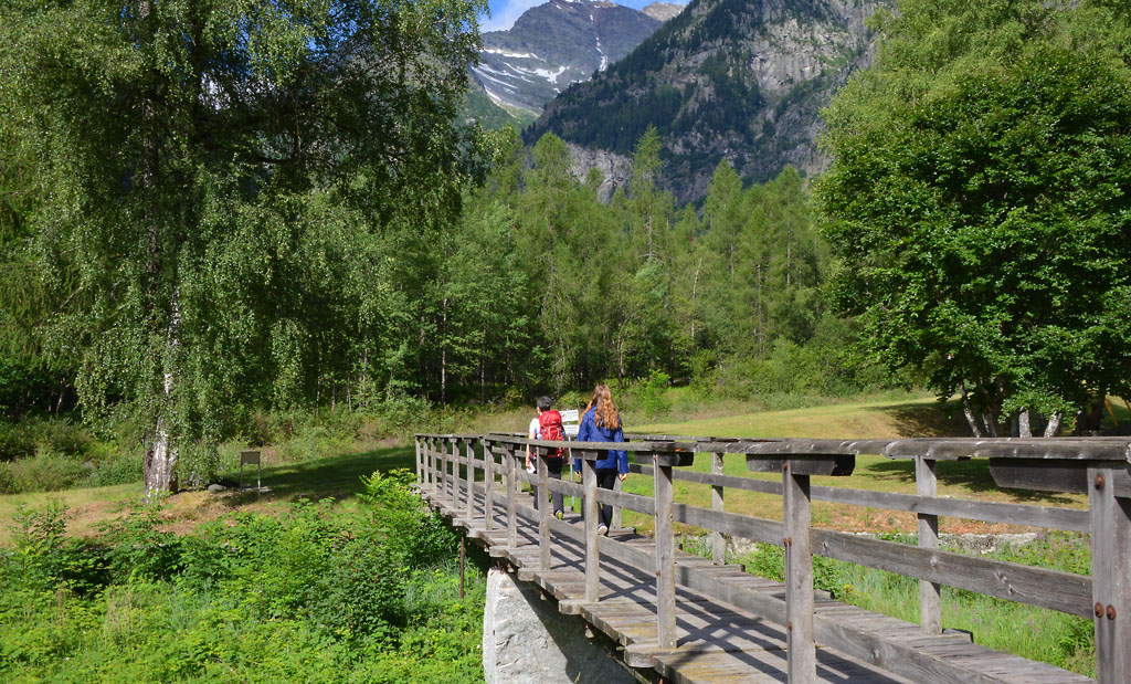
After seeing in the centre of Antronapiana, dominated by the large church of San Lorenzo, built in the 17th century to replace the 13th century parish church was destroyed in the landslide, head towards the provincial road to take the pedestrian walkway that is located right next to the bus stop. You will arrive at an embankment between a canal and the Ovesca torrent, where there is a pleasant picnic area with a play area for children (fountain). After this mandatory stop, take the small path on the roadbed and keep the Ovesca torrent on your left until you get to the skating rink. From here, continue along the dirt road in the direction of a farmhouse, with the village behind you, thus arriving on asphalt. From here, go right for a short stretch, and then take the mule track on the left (road signs for “Antrona Lago 0h40”). The cobblestone path climbs decisively but pleasantly, and always in the shade, until it reaches the small village of Cimallegra (1014 m), formed completely of stone houses immersed in the quiet of the woods. Another short climb leads to another asphalt road where there is a house (and a strange fountain with the head of a monster!). Go along a stretch of asphalt until after the curve, where you need to be careful to find a path on the left that is a bit hidden (sign for “Antrona Lago”). The path descends fairly steeply between the stones (red/white marks), and when it flattens out, you are in the middle of a forest, with an idyllic wooden bridge and a relaxing meditation bench where you can stop and reflect for some time while listening to the pleasant sounds of nature, such as the calm flowing of the bubbling brook. When you resumes your walk, with an irregular course, you will find yourself on an interesting trail among the remains of an ancient landslide (red/white marks and stone statues) until you get back to the asphalt road. Now, continue on the asphalt road to the left coming to the bar-restaurant before Antrona Lake, and then you will walk around the body of water.
The lake of Antrona is a natural lake, but it was created by a colossal landslide that took place on 27 July 1642. From the top of Pozzuoli, 12 million cubic meters of rocks detached and covered the bottom of the valley for more than 2 kilometres, arriving up to the doors of Antronapiana, and burying some forty houses and unfortunately around a hundred inhabitants.
The tour around the lake is possible in both directions but we suggest going clockwise, since the first half is on a quiet dirt road that is wide, flat and easy to travel.
Along the lake, there are also wooden tables but count on them being unoccupied on Sundays when the weather is beautiful. This is a classic summer destination and finding a free one could be rather difficult. It is better to start out with the idea of stopping on stones closest to the water, which you can reach with a very brief deviation from the dirt road.
Pass behind the bar-restaurant and take the road to the left. Then, leave that road and take a dirt road to the right, closer to the shores of lake (signs for “Giro del Lago”).
From the bar at the end of the lake, you’ll follow a stretch of the Strada Antronesca, an ancient road that goes through the mountain pass Passo di Saas (also called Antronapasss 2839 m), which connected the Ossola area with Saastal in Switzerland. Used perhaps as early as Roman times, the road was damaged by the landslide which created the lake, and it permanently lost importance when the Napoleonic road of Sempione was built.
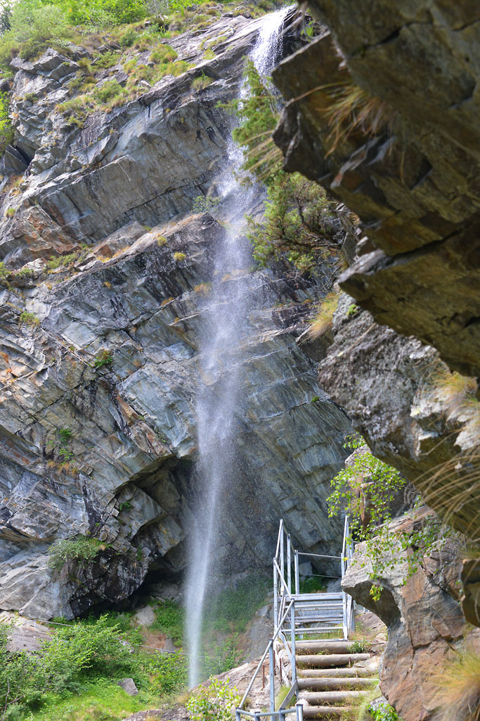
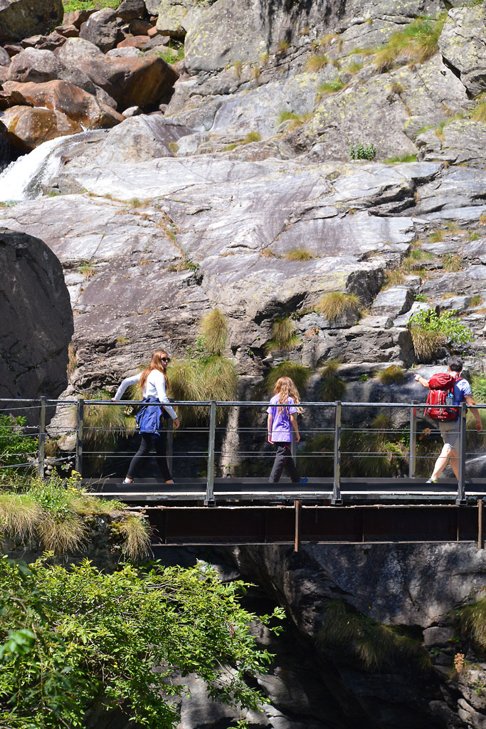
Continue along the lake shore until you get to a bridge that marks the end of the lake and allows you to cross the picturesque Troncone torrent, as it winds through the rocks. The path becomes narrower and soon comes to a steep metal ladder which then becomes a suspended gangway and allows visitors to experience an evocative passage inside the Sajont waterfall, to give them an unusual “point of view”. Don’t miss this adventure!
Warning: it is better not go along this stretch when there are heavy rains and storms that could suddenly swell the waterfall. Also, do not go in winter due to ice.
After getting off the metal footbridge, continue on the trail that fluctuates in regularity. It starts downhill, then slightly uphill and then descends sharply after the first fork, which you should take to the right. The decisive descent leads again to a point near the water, and then continues flat along the shore passing between boulders and arriving behind the bar-restaurant. You can return by going back the way you came.
to learn more
The Municipality
Antrona Schieranco is the name of the municipality where this walk is located. It was formed in 1928 from the merger of two towns, Antrona Piana and Schieranco.
Balancing Ibex
Who has never seen the incredible images of the ibex balanced precariously on the steep walls of a dam? The daring ungulates climb on the steep walls by taking advantage of every ledge, perfectly balanced to lick the saltpetre that they love and need for their well being. Few people know that the dam in question is called Cingino and is located right in the area of Antrona. Dams have been increasing in number since the 1920s in this territory, and are used to produce electricity (long excursion: a difference in altitude of about 1200 meters and 8 km one way from the lake of Antrona).
Viganella
This village is situated along the provincial road that from Villadossola rises toward Antrona. We mention it because of its unique characteristics: tired of not ever seeing the sun for three winter months, the inhabitants built a mirror of 40 square metres on the mountain in front of the town to reflect the sunlight into the village square.
tips for young hikers
With strollers, you can go from Antronapiana up to the lake by only using the asphalt road (to be avoided on Sundays in high season). However, it is not possible to go completely around the lake. You can only reach the bridge over the Troncone torrent. Hikers with baby carrier backpacks will have no difficulties, but front baby carriers are not recommended for the part with the metal walkways.
Slow trekkers: Franco Voglino, Annalisa Porporato and Nora Voglino
Authors of texts: Franco Voglino and Annalisa Porporato
Back to the list of routes
SLOW TREK ALONG THE SOUTHERN COAST of the second largest lake in Piedmont
Lake Orta: PELLA- ORTA SAN GIULIO
Lago d’Orta
Route description
A demanding hike, but worth the effort to see the charming landscape around the entire southern side of Lake Orta, the second largest lake in Piedmont. A long walk that offers magnificent views of the lake and unites all of the peculiar aspects of the Cusio area: it is an environmentally friendly way to get to Orta San Giulio, and a pleasant and relaxing “cruise” back by boat, the perfect conclusion of a beautiful nature walk.
Departure location: Pella (300 m)
Place of arrival: Orta San Giulio (295 m)
Maximum altitude: 410 m
Difference in altitude: About 300 m total (non-continuous)
Distance: 16 km
Walking time not counting stops: 6 hours total (excluding the return by boat). Consider taking one whole day.
Type of route: mixed (trail, asphalt, dirt road)
Signs: “Anello Azzurro” blue ring signs and red/white marks
Water: fountains in towns and along the path
Recommended period: all year round, but keep in mind that during winter, the path is long enough that it would be dark when you get back. We definitely do not recommend that!
How to get there: 15 km from Borgomanero and 21 km from Gravellona Toce. Located along the western side of Lake Orta. From A26 Borgomanero exit, go towards “Gravellona Toce”, after Borgomanero follow the blue signs for “Pella”. Parking is available on Via Lungolago and Via Don Gaetano Zanotti. By bus: Borgomanero-Alzo-Omegna line, stop Via Don Zanotti (www.comazzibus.com). By boat: Pella-San Filiberto-Lagna-Isola-Orta line (www.navigazionelagodorta.it)
Information: Distretto Turistico dei Laghi – www.distrettolaghi.it; IAT Office – via Bossi 11, Orta – tel. +39 0322 905163; Municipality of Pella – www.comune.pella.no.it; Municipality of San Maurizio d’Opaglio – www.comune.sanmauriziodopaglio.no.it; Municipality of Gozzano – www.comune.gozzano.no.it; Municipality of Bolzano Novarese – www.comune.bolzanonovarese.no.it; Municipality of Orta San Giulio – www.comune.ortasangiulio.no.it; Ecomuseum of Lake Orta and Mottarone – www.lagodorta.net
the itinerary
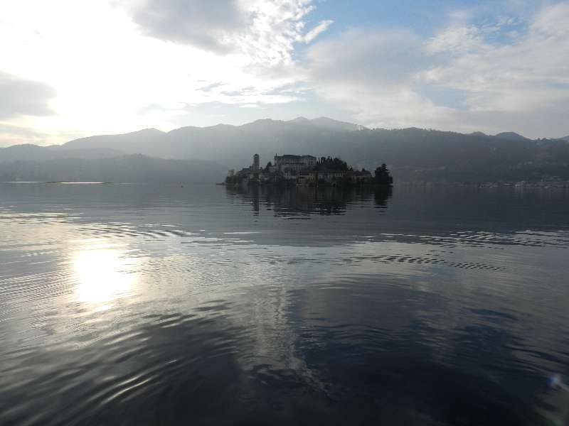
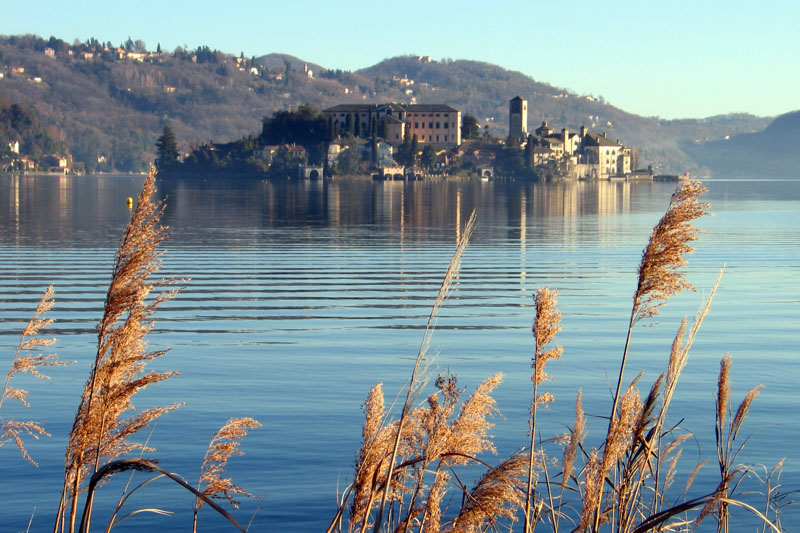
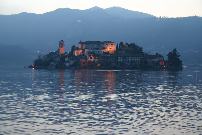
The “imbarcadero”, or landing stage, in Pella is not very wide, but there are shade trees and benches, a play area and many businesses. With your back to the lake, go left towards the medieval tower, the only remnant of the ancient fortifications, then take a right on via Roma, cross the main road, via Zanotti, and then arrive at the 16th century parish church of Sant’Albino.
If you parked in one of the car parks on via Zanotti, keep your eyes on the uniquely shaped bell tower, built in 1936. Once in front of the church, it is advisable to make a short detour to the right, towards the cemetery, to admire the beautiful stone humpback bridge, built in 1578 across the Pellino torrent. If you look up instead, you will see the impressive 18th century church, Santuario di Madonna del Sasso, built at 638 meters above the lake. It is the point of origin of a unique scenic route, known as the “balcony of Cusio”.
Take the alley and leave the parish church on your right (the sign says “San Filiberto”), and you will pass a car park to get to via Vignaccia. The asphalt gives way to a dirt road, and then morphs into a trail. Looking toward the left, at times you will be able to see the lake, and especially on the beautiful island of San Giulio. You will come to a votive pillar with benches around it, and then immediately afterwards, to a small wooden bridge where you can admire the waterfalls of the Rio Plesina, a very cool and pleasant place. The trail, paved with stones, climbs and then descends again (red/white sign “San Filiberto”) and then a trail leads between the houses. At the first clear junction, continue straight on and on the same level (red/white signs). However, be careful: the road right after this junction leads to a private gate. Of course, you must not go into this gate, but instead take the narrow passage to the left that leads around the perimeter of the home. Keep going straight along the gently sloping road to get to the cemetery parking area and then the asphalt road. Walk carefully along the asphalted curve toward the left, downhill and, as soon as possible, take the passage in the direction of the church of San Filiberto, which you should already be able to see. This is the most ancient chapel in the western shore of the lake, dating back to the 11th century. The magnificent Romanesque bell tower was built from 1075-1110, and the votive pillars that surround it date back to 1794. Cross the street and go to the right, passing next to the San Filiberto landing stage, and continuing on the side walk in the direction of Lagna. Unfortunately, the protected side walk ends, and you must cross on the cross walk and continue in the same direction on a more narrow side walk. After a parking area, you have to walk about 400 meters on asphalt, devoid of a side walk, and you must pay particular attention to traffic. Immediately after the tanks of a purifier that can be glimpsed among the trees, turn left along a narrow street and cross the bridge (or, if there is not much water, cross at the nearby ford). The path leads between the houses. You will go right at a T-junction to go towards the 17th century oratory of San Rocco. Just beyond the sacred building, take a left on via F.lli di Dio and walk among the lovely villas. Always stay on the main street until it turns into two streets: take the left street and stay on the smooth cement (red/white signs) that descends slightly as it passes between high hedges. You will come to the lake shore, on the Prarolo beach, the lido area of Lagna. Walk along the lake shore on this stretch of beach, with a entire along Lake, in this stretch beach with a wharf and a lovely view of the island of San Giulio. Continue on a pleasant dirt road in the woods, alternating with scattered houses, until you get back onto the asphalt near a bar-restaurant.
Three hundred meters before you get to the asphalt, on the right, is a path. After 0.5km with a difference in altitude of 60 meters, you will come to the small chapel of San Giulio situated in Opagliolo (a locality in the municipality of San Maurizio d’Opaglio). This is a charming little 16th century chapel surrounded by woods. A spring originates from this place, and it was believed to be miraculous (it could bring rain in times of drought). Legend has it that Saint Julius prayed here before embarking on his journey to the island which bears his name today. And he made that journey sailing on board … his cloak! The deviation is not long, but keep in mind that the hike is already very demanding. Therefore, be aware of how tired you and your little travellers are, and don’t tire yourselves out!
Now, continue on the asphalt, taking care to take a left along via Beltrami (watch for a fountain) with a slight and constant descent until it becomes a dirt road again.
Near a group of houses, you will fined another deviation, this time to the Church of the Madonna of Luzzara, a 12th century building that was altered during the 15th century, and with frescoes from the 16th century. The deviation is 1.2km long with a difference in altitude of 50 meters, but consider the same suggestion we provided for the oratory of San Giulio: carefully assess your strength because it’s a long walk!
A pleasantly level path through the reeds and woods leads to the Lido of Buccione.
The route continues to the right, before getting to the Lido, along the grassy Via Francisca, but take the time to go to the Lido to find fountains, bar and restaurants, in addition to the small church of SS. Angeli Custodi, built in 1611 and Palazzo del Vescovo (the Bishop’s Palace) with frescoed coats of arms on the façade dating back to the 17th century.
The pleasant Via Francisca is partly grassy and partly paved. It leads first to the asphalt road Via Marangoni and then to the busy thoroughfare SP229. Take this road for about 150 meters in the direction of the centre of Gozzano, before you can turn left on Via Mario Motta (blue signs for “Bolzano N.”).
Be very careful when you are on the provincial road, and also on Via Mario Motta, because there is no side walk!
Note: If you realize that your small hikers are too tired, you can, at this point, take the bus line Borgomanero-Alzo-Omegna (Ventraggia-Pella stop) back to your destination. In this case, go along the provincial road entering in Borgomanero, following the blue signs for San Maurizio d’Opaglio, until you arrive at the Albergo Italia stop in via Beltrami (1.7 km). Attention: there is almost no side walk on the side of the road. Otherwise, you can ride to Orta on the bus line Borgomanero-Gozzano-Orta-Omegna, and get off at the Bolzano Novarese, via Vittoria stop (1.6 km). Attention: here is almost no side walk on the side of the road. Or you can take the railway line Gozzano-Orta Miasino (2 km).
Now, follow the asphalt road that passes in front of the monument commemorating the death of engineer Mario Motta, a strong supporter of the partisans after whom the street is named, and then enter Bolzano Novarese and keep going until you can see the railway crossing. Take a left on via Artogno, which is initially asphalt and then dirt as it winds through the cool woods where we find the Bersanella Fountain. The dirt road ends when it runs into an asphalt road. Follow that to the right for a short distance until you reach the bridge over the railway line.
On the left just before the bridge, the trail starts that leads to the Tower of Buccione, which rises above the forest (a deviation of 1.2 km, difference in altitude 75 meters). Visible already from the beginning of the excursion, it stands at an altitude of 410 m and has dominated a good part of the lake since at least the 13th century when it was part of a castle that could accommodate five hundred soldiers. Today, it is located in the Special Nature Reserve Colle della Torre di Buccione. The deviation is not very long, but keep in mind that the hike is already very demanding. Once again, be aware of how tired you and your little travellers are.
Before the railway bridge, take the trail on the left downhill (brown signs for “Orta”) that passes along the railway ballast, following signs red/white signs that say “Anello Azzurro” and the brown signs that say “passeggiata”. When you get back on the asphalt, follow it for a short stretch to then enter in the characteristic village of Corconio (367 m), with its narrow cobblestone streets and some 18th century buildings. Climb towards the 18th century church of St. Stephen, and take the cobblestone street that starts at the oratory, go over the bridge over the railway line and continue along the road overlooking the lake. Go down the asphalt road to get to Legro. When you get to the rail road, crosses through the underpass and go towards the sports facilities. Continue on the trail to Via Marconi, near the roundabout where the impressive Villa Crespi is located.
If for some reason it is not possible to take this path, just walk with the railway line to your right until you pass the station and reach Via Marconi. Here, go left and descend to the roundabout mentioned above, or take the smaller street Via D. Giovanni Bosco that runs parallel to this street and has no traffic.
At the roundabout, Villa Crespi appears in all of its splendour. Today, it houses a hotel and restaurant, and boasts a famous television chef. You are now in Orta, one of the “Most Beautiful Villages in Italy” (www.borghipiubelliditalia.it). Turn right alongside the villa and take Via Fava, which will shortly lead along the lake shore until you arrive in Piazza Mario Motta, where there are several businesses and the boat landing stage. An interesting building with frescoes and a staircase stands on one end: this is “Palazzo della Comunità”, built in 1582 (it was the seat of the government of the state-feud of the Riviera di San Giulio, and is also known as “Palazzotto”). Orta unfolds in a maze of intricate streets, which are only apparently chaotic. In fact, it is sufficient to stay on via Olina, which continues behind the “Palazzotto” to explore the more typical alleys and gardens. You can also go up to the right in via Caire Albertoletti, also called “Salita della Motta”, to admire some of the oldest buildings, such as Casa Marangoni (14th century) also known as the Casa dei Nani (home of the dwarves) due to its small windows on the top supported by a long wooden lintel and decorated with frescoes. The return trip to Pella is by boat.
The boat stops at St. Julius Island (Isola di San Giulio), and if you have the time, it is certainly worth a visit to see its narrow alleys, staircases and stone arches that recreate an enchanting medieval scenario. Most of the buildings were built on the remains of an ancient castle, perhaps of Longobard construction, but the most spectacular is certainly the Basilica of San Giulio, with its pure Romanesque style exterior. The original church was built in the 4th century, apparently by the saint in person. It was rebuilt for the first time in the IX century as a fortified church by the Longobards, and then underwent further changes during the 10th and 11th centuries. Inside stands a precious 12th century pulpit that, despite the bronze colour, is completely made of stone and has interesting bas-reliefs. One of the most interesting is a mysterious human figure, traditionally identified as Guglielmo da Volpiano (962-1031, a Benedictine monk and abbot in Dijon, who was apparently born here during the siege of 962). Other significant artwork includes the frescos, done from the 14th to the 16th centuries, some by the school of the painter and sculptor Gaudenzio Ferrari (1475/80-1546). Inside the sacristy is a fossil vertebra, which is presumed to have been discovered in a cave on the Orta peninsula. Could it be the remains of one of the dragons hunted by St. Julius? Another very impressive is the Seminary, built in 1844 on the ruins of the ancient castle. Today, it is the Abbey Mater Ecclesiae and since 1973 has hosted a group of Benedictine cloistered nuns devoted to restoring textiles and tapestries.
to learn more
Orta – Sacro Monte
At the cemetery and the ancient church of San Quirico, one of the paths leading to the church of San Nicolao begins. This church is believed to have been founded in the 10th century. This is where the Sacro Monte path begins. Since 2003, the site has been a UNESCO World Heritage Site, since it is part of the Sacri Monti of Piedmont and Lombardy. Inside twenty chapels immersed in the natural landscape, there are 176 life-sized sculptures in hand painted terracotta, and 900 frescoes telling the story of Saint Francis of Assisi. Construction began in 1590 and finished in the 17th century, and it is very evident when we observe the evolution of artistic styles, which start with descriptive depictions and turn into spectacular baroque works and finally triumphant rococo. The Sacro Monte is part of the Special Natural Reserve of the same name, created with the purpose to protect, preserve and enhance the historical, religious and forestry assets of the Monte. The site is well suited for peaceful relaxing moments and offers picnic tables and toilets (www.sacromonti.org).
Orta – Villa Crespi
The curious shape of the building, with its clear Arabian style and even a minaret, was decided by the industrial entrepreneur Cristoforo Benigno Crespi, enchanted by the beauty of Baghdad where he went to buy cotton. Built in 1880, the home housed poets, industrial businessmen and rulers in the 1930s, and today it is a “Relais & Chateaux” hotel managed by the famous television chef Antonio Cannavacciuolo. Many films have featured landscapes of Orta. Among the many to choose from, we would like to point out an old movie from 1914 with the exotic title “Jvna, the Pearl of the Ganges” which portrayed mysterious India was carefully recreated right here at Villa Crespi.
The legend
In 390, Saint Julius was on the run with his brother Giuliano to escape from persecution in Greece. They came to the shores of lake and were fascinated by the island, which was infested by ferocious dragons and snakes. The two brothers obtained permission from Emperor Theodosius I to demolish the pagan temples and replace them with Christian churches and, while Giuliano was beginning to erect the 99th church in Gozzano, Julius decided to go to the island. Since he could not find a boat, the saint spread his own mantle over the water and sailed to island on it. He banished the ferocious beasts that lived there my merely speaking, and then built the 100th church.
Literature
Many forms of literature have mentioned the lake. We would like to mention only one work, for the sake of brevity, the novel: “C’era due volte il Barone Lamberto, ovvero i misteri dell’Isola di San Giulio”, and the story “Il ragionier Pesce del Cusio”, both by Gianni Rodari (1920-1980, originally from Omegna).
tips for young hikers
This is a very long excursion, absolutely recommended for its beautiful scenery, suitable only for older children who are already accustomed to walking without (too much) complaining. There are several places to stop and rest, but consider that it will probably take longer than the hours scheduled. Also consider taking the time to enjoy a delicious and well-deserved home-made ice cream in Orta!
Slow trekkers: Franco Voglino, Annalisa Porporato and Nora Voglino
Authors of texts: Franco Voglino and Annalisa Porporato
Back to the list of routes