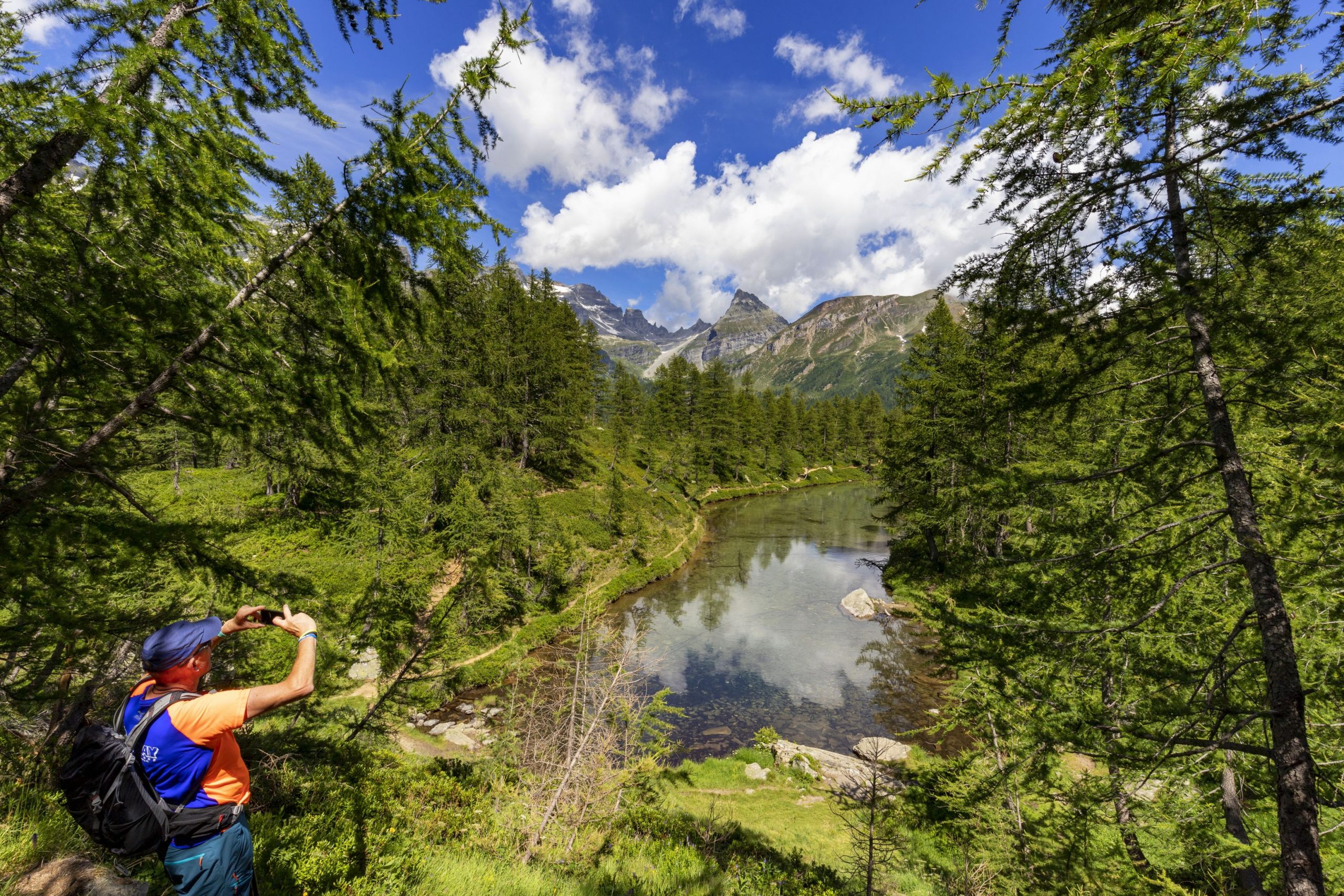
A TOUR BETWEEN LAKE, RIVER AND HILLS WITH THE CULMINATION TO THE HISTORIC PASS WHICH CONNECTS LAKE ORTA TO VALSESIA
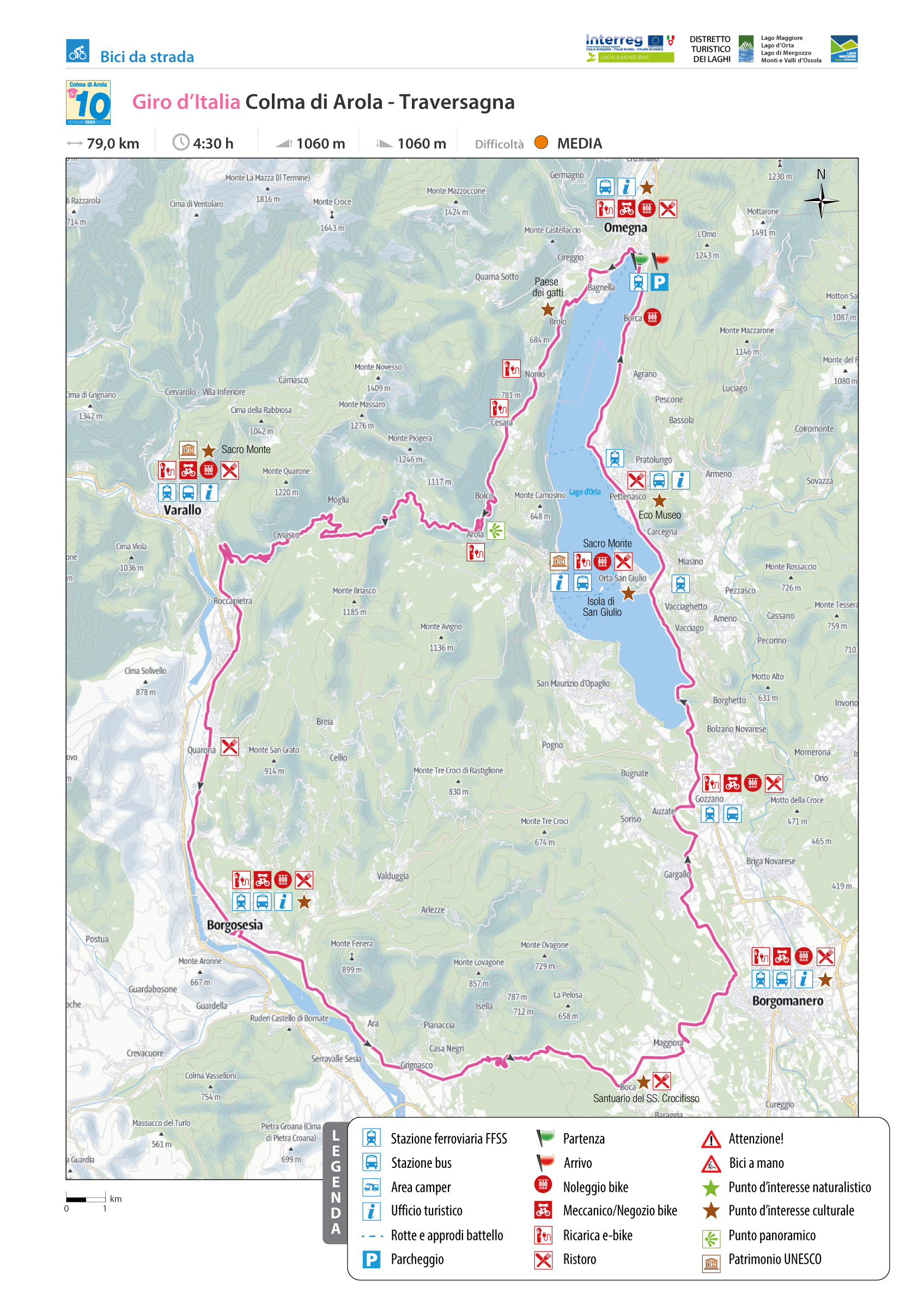
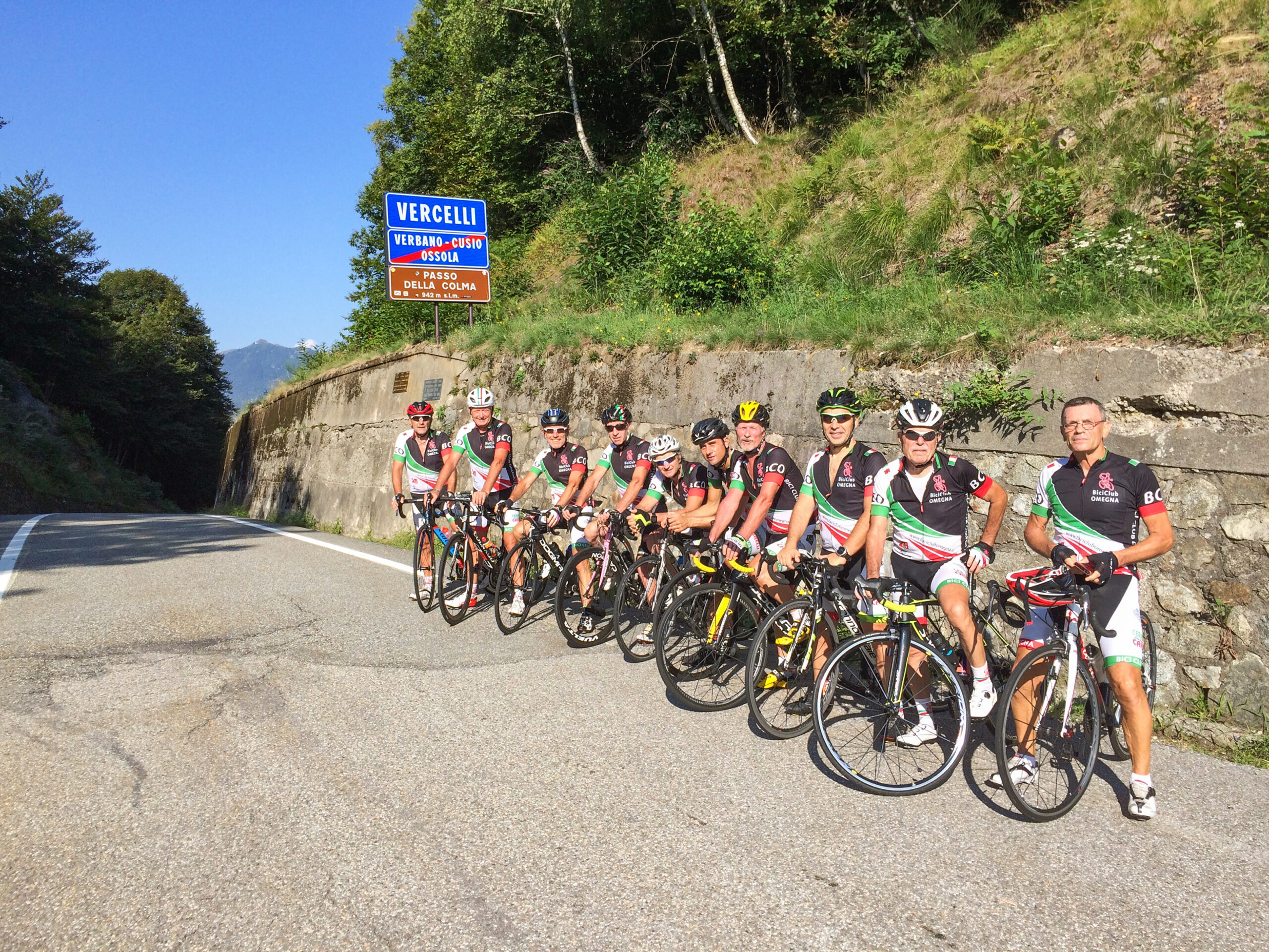
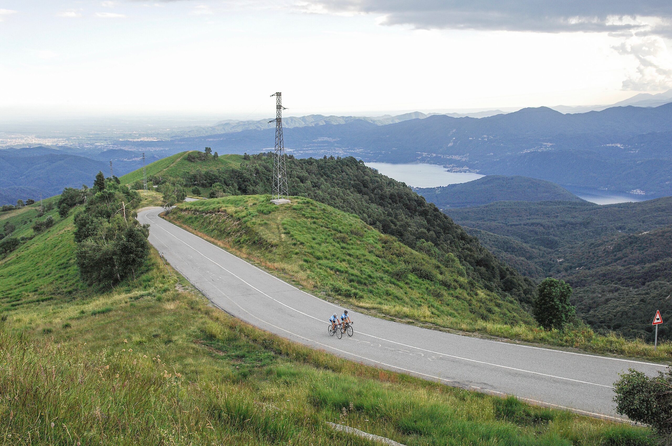
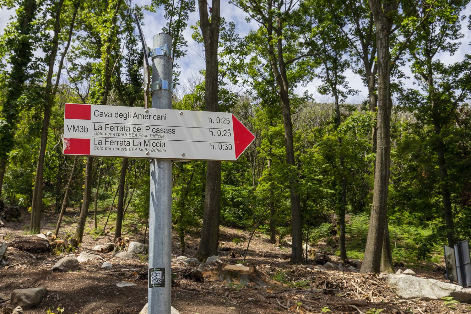
GIRO D’ITALIA: COLMA DI AROLA
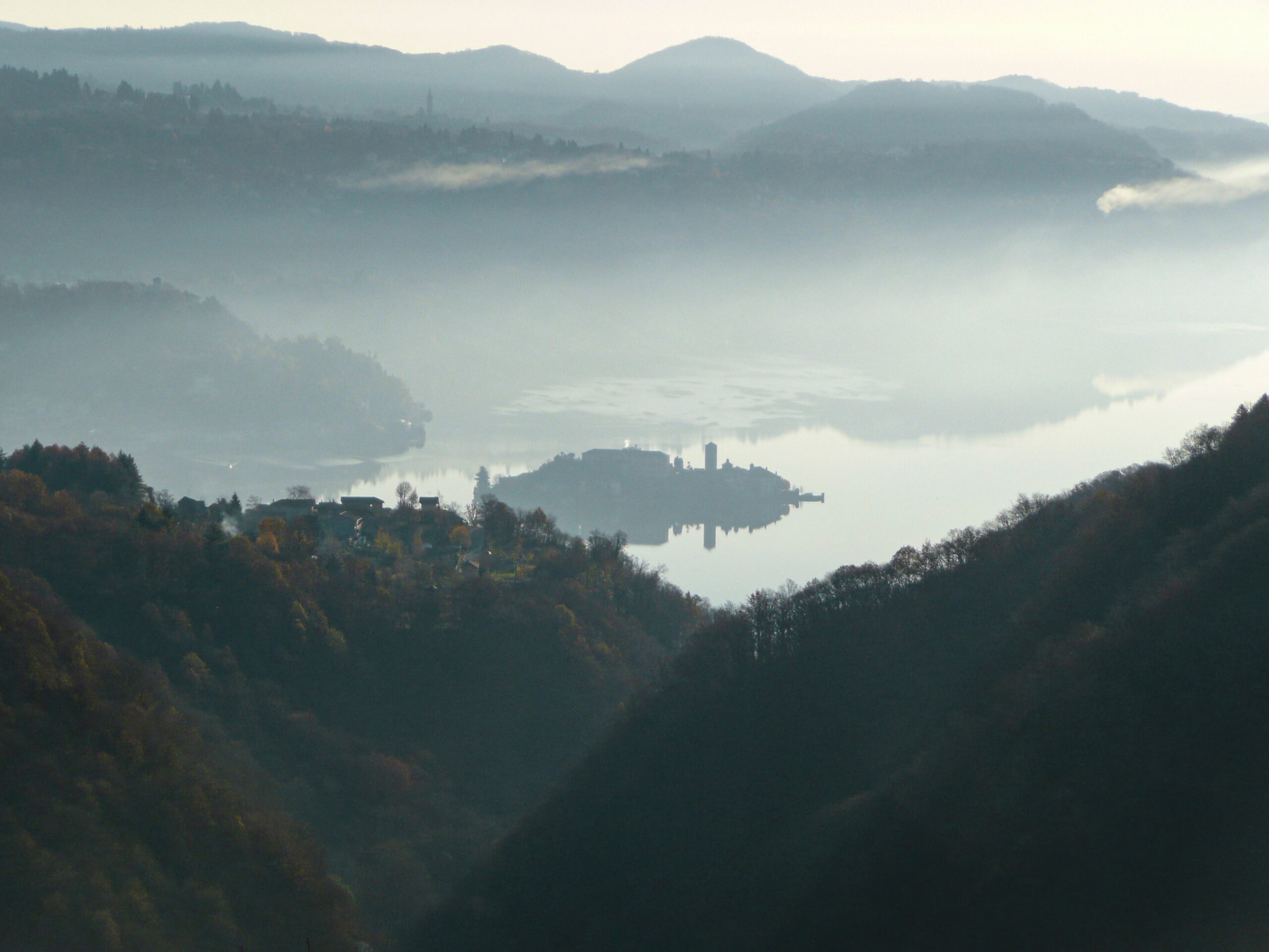
Lago d’Orta
Route description
A tour between lake, river, and hills with the culmination of the historic Colma di Arola Pass, which connects Lake Orta to Valsesia, risen to cycling honors with the passage of the 19th stage of the 104th Giro d’Italia on May 28, 2021.
We start from Omegna, climbing along the western slope of Lake Orta, passing under the rainbows of the Garden of the Pie in the Sky (Rodari-inspired) first, then through Brolo, Nonio, and Cesara. After the “décolletage” of Cesara (a town of peace in name and in fact), a short descent leads to the fork on the right to Arola and its Colma.
It is a scant 8 kilometers of climbing, with its most challenging part at the exit of Arola, with gradients approaching 16 %. It’s all condensed into a couple of kilometers, and then we are back to breathing easy until the Colma Pass at 942 m.a.s.l.
Back to the list of routes
A VILLAGE THAT DESERVES TO BE VISITED
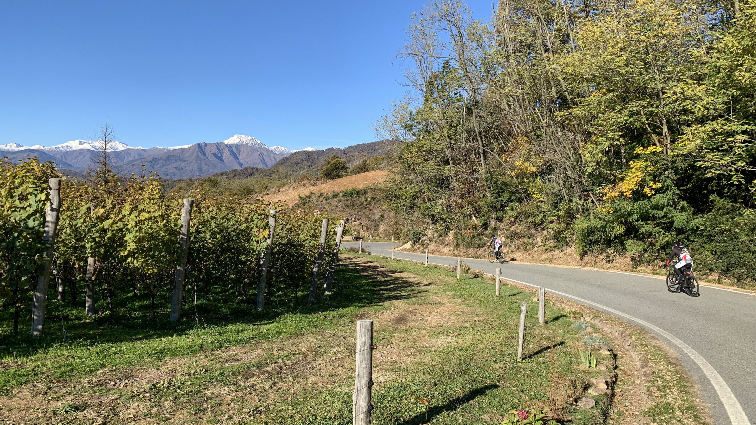
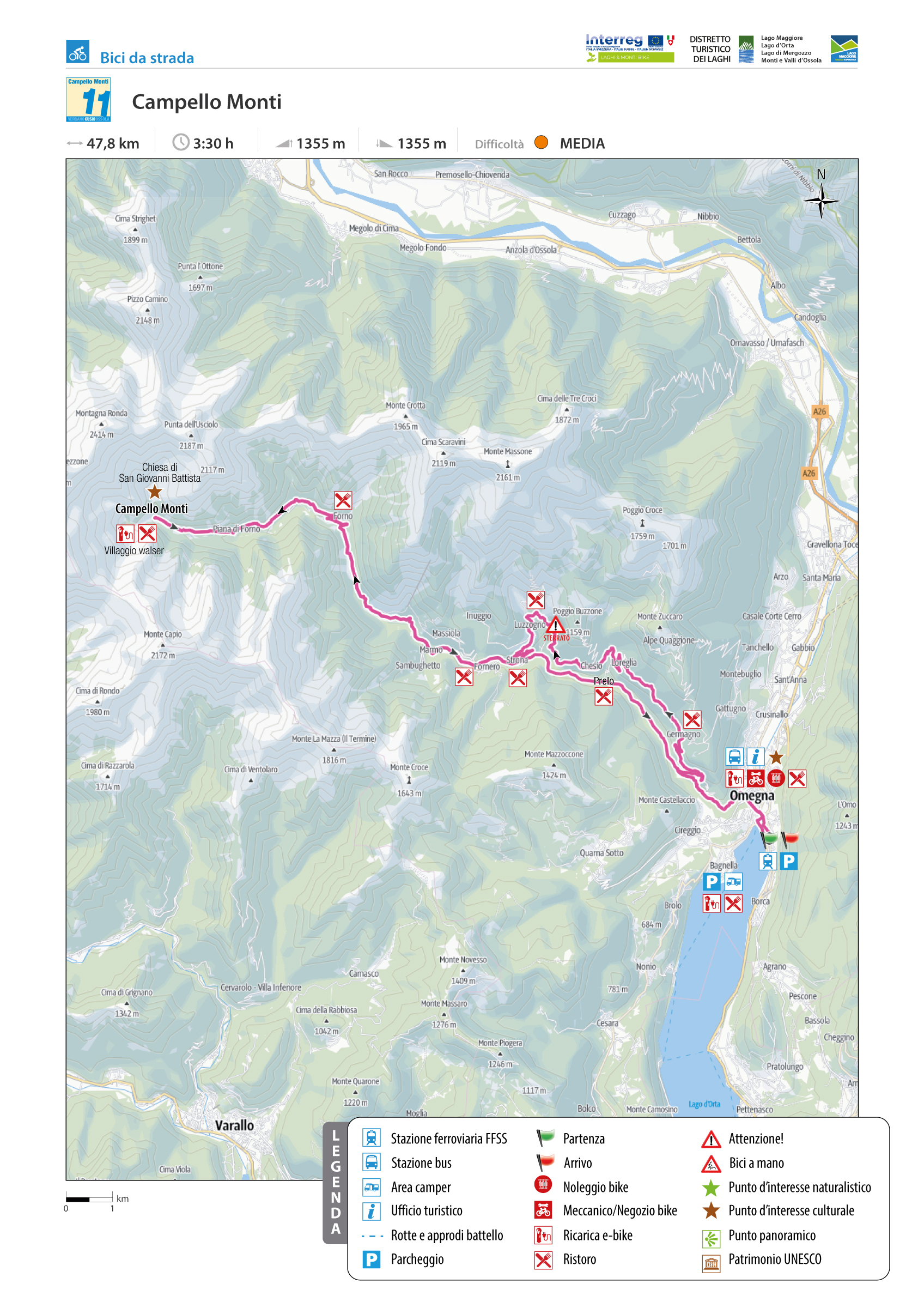
CAMPELLO MONTI
Lago d’Orta
Route description
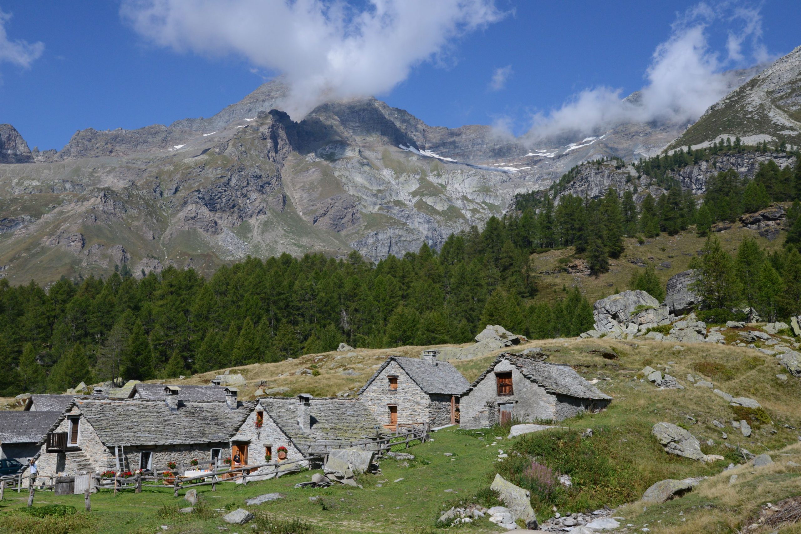
Campello Monti is a village that deserves to be visited and experienced for its ancient Walser roots, history, stately homes, and the many hiking opportunities it offers.
The Strona Valley morphologically begins just after the “Fabbricone” bridge at the end of De Angeli Street in Omegna. A series of blind bends between a rock and the Strona stream lead to Canova del Vescovo, near the junction for Germagno.
Back to the list of routes
One of the most renowned and popular cycling destinations for fans of the “specialissima”
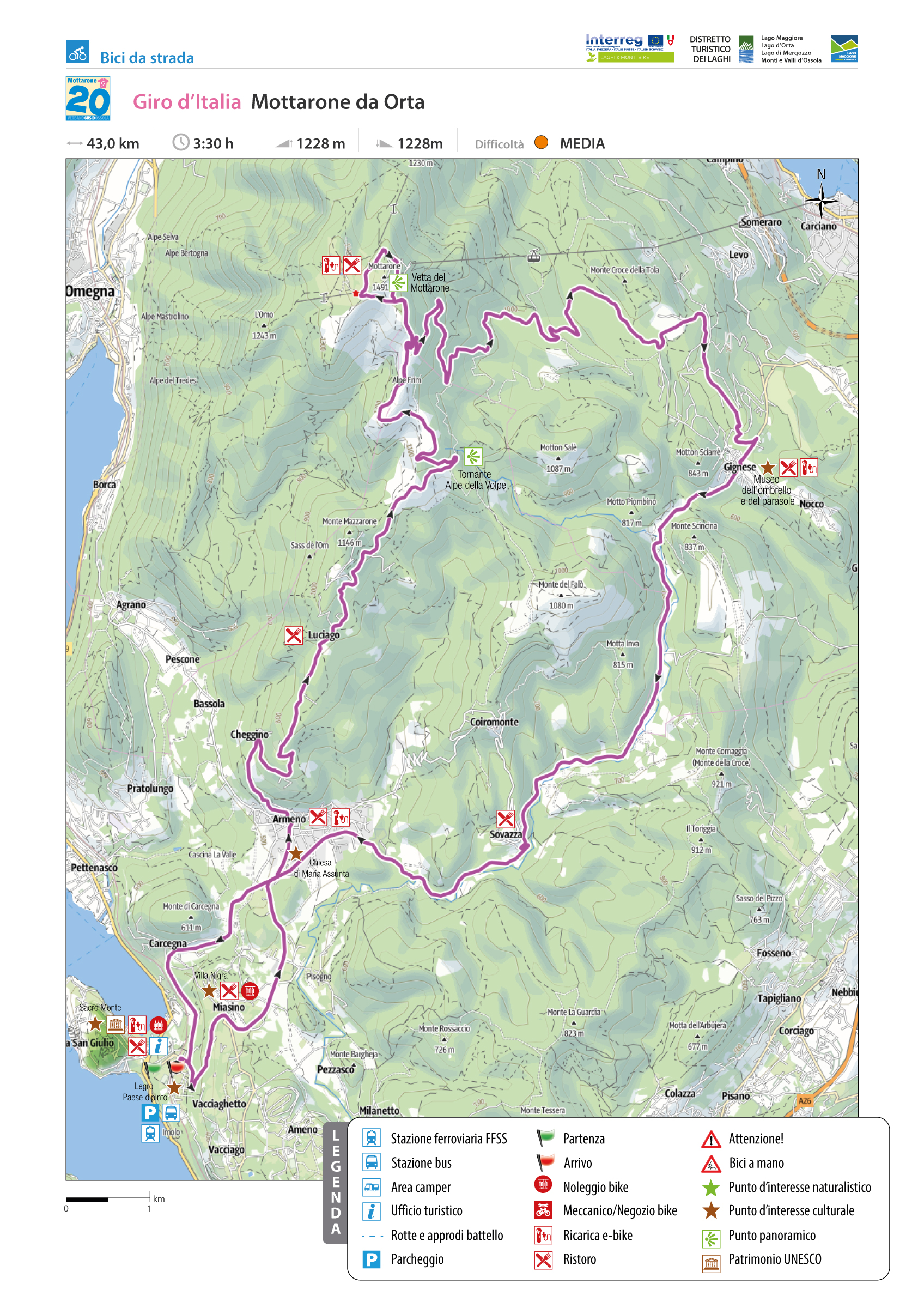
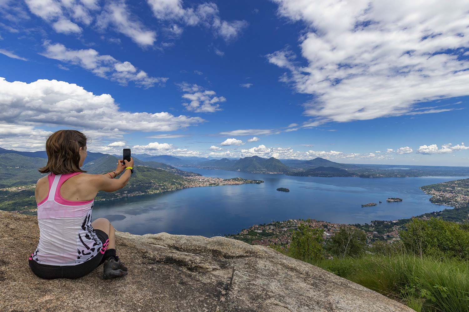
GIRO D’ITALIA: MOTTARONE FROM ORTA SAN GIULIO
Lago d’Orta
Route description
One of the most renowned and popular cycling destinations for fans of the “specialissima” is Mottarone, either because the Giro d’Italia has passed through it several times or because it is the ideal climb with its rugged, but never prohibitive, gradients and increasingly rewarding surroundings as we climb.
Two roads lead to the summit of Mottarone: the private Borromean road up from Lake Maggiore and the Due Riviere SP 39 up from Lake Orta, and it is this one that we are going to propose.
The starting place is the Orta San Giulio Railway Station in the hamlet of Legro (the famous painted village), which offers both the possibility of getting there by train and ample parking.
Back to the list of routes

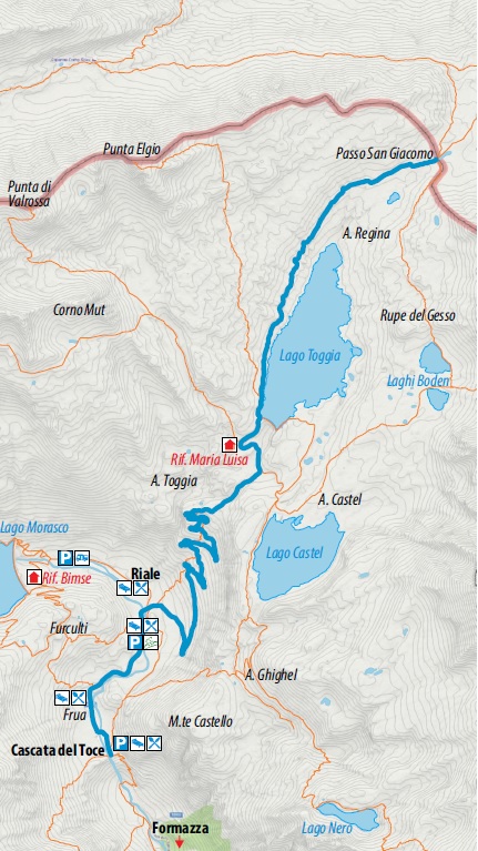
From the Toce Waterfall Toce to S. Giacomo pass
HISTORIC MOUNTAIN ROADS
Valle Formazza
Route description
Built starting from 1929 to realise the dams of Lago Castel and Lago Toggia in Alta Val Formazza, in the extreme north of Piedmont, the road unites the famous Cascata del Toce to Passo San Giacomo, passing through the hamlet of Riale and connecting Italy with Ticino Switzerland. The first section of the route which starts from Cascata del Toce (1685 m asl) and arrives at the hamlet of Riale below, covers a long, asphateded section on State Road 659.
Shortly before reaching the hamlet of Riale (1740 m asl) the road branches off and the dirt road begins, which leads to the Maria Luisa mountain hut (2160 m asl), then continues to Lago Toggia and reaches Passo San Giacomo (2313 m asl). It is in this section that the route becomes a true masterpiece with gentle gradients and perfect hairpin bends, flanked by dry stone walls and arches from which unique photos can be taken of the Riale plain and the peaks of Alta Formazza.
Once this first uphill section is over, the road continues on a false plain crossing the Alpe Toggia basin, reaching the Maria Luisa mountain hut and along the dam of Lago Toggia. Continuing slightly uphill, the road leads to Passo San Giacomo from which there is a beautiful view over Val Bedretto (Switzerland).
As early as 1885, there was already a small Swiss hut at Passo San Giacomo, which housed the telegraphists who transmitted the situation of the Alta Val Formazza to the Fort of Airolo (Switzerland). Following the construction of the road for the Italian side of Passo San Giacomo, new fortifications were built in the 1930s in Val Bedretto which became the heart of the defence system of this pass: the artillery fort “Grandinagia” and the armoured fortress “San Giacomo”; machine gun stations and artillery camps, shelters and cableways for logistics and supply of the main forts.
Today, the road is passable on foot and by mountain bike, and in winter with snowshoes and alpine skis (always check the avalanche bulletin).
Points of interest
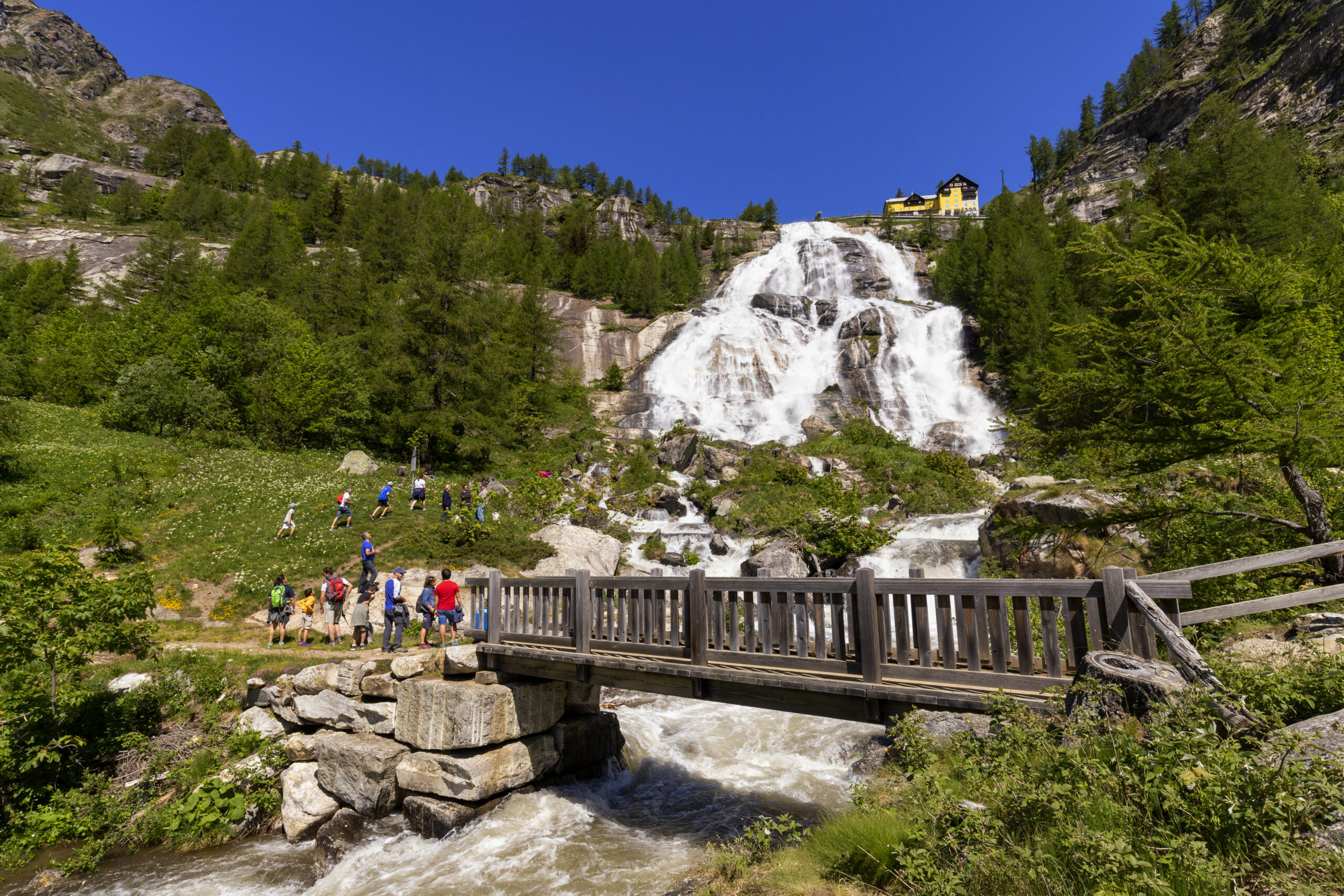
The symbol of Val Formazza is the Cascata del Toce, which is known as “the most beautiful and majestic of all Alpine waterfalls” thanks to a drop of 143 m. A visit to the village of Formazza is well worth it for its hamlets with the characteristic name of Titsch (local Walser language) in which to soak up the Walser atmosphere. Numerous routes depart from Cascata del Toce and from Riale for trekking and MTB enthusiasts. There is also the natural and tourist attraction of Premia Terme, which is a modern spa centre with internal/external pools with hot water and wellness area (www.premiaterme.com).
Back to the list of routes
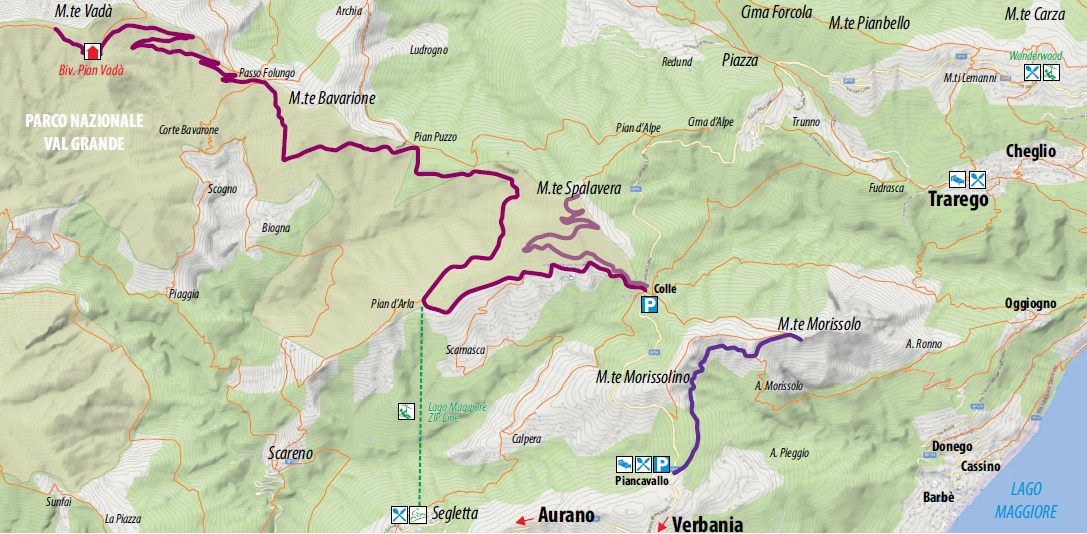
From Colle to Pian Vada’
HISTORIC MOUNTAIN ROADS: LA LINEA CADORNA
Alto Verbano
Route description
The Cadorna Line is the defence system that was built near the Swiss border during World War I at the behest of General Luigi Cadorna, the then Chief of Staff of the Italian Army, who feared a German-Austrian invasion through neutral Switzerland.
The immense defence structure, built between the summer of 1915 and the spring of 1918, stretched from Ossola to Verbano and into Lombardy, becoming a dense network of military roads and mule tracks, trenches, artillery positions, lookout posts, camp hospitals and logistical facilities, barracks and outposts.
The work was carried out by local bricklayers and stonemasons and women also played a fundamental role in the construction of the defence line, particularly in transporting material and supplies to the work sites.
The Cadorna Line was never used for war purposes and today this military road is a historical heritage site that allows the community to learn about a historical moment of the 20th century.
It is also a natural heritage of trails for trekking and mountain-biking enthusiasts, offering routes that can be travelled almost all year round. Be careful in the event of recent snowfall.
Highlights and tour details
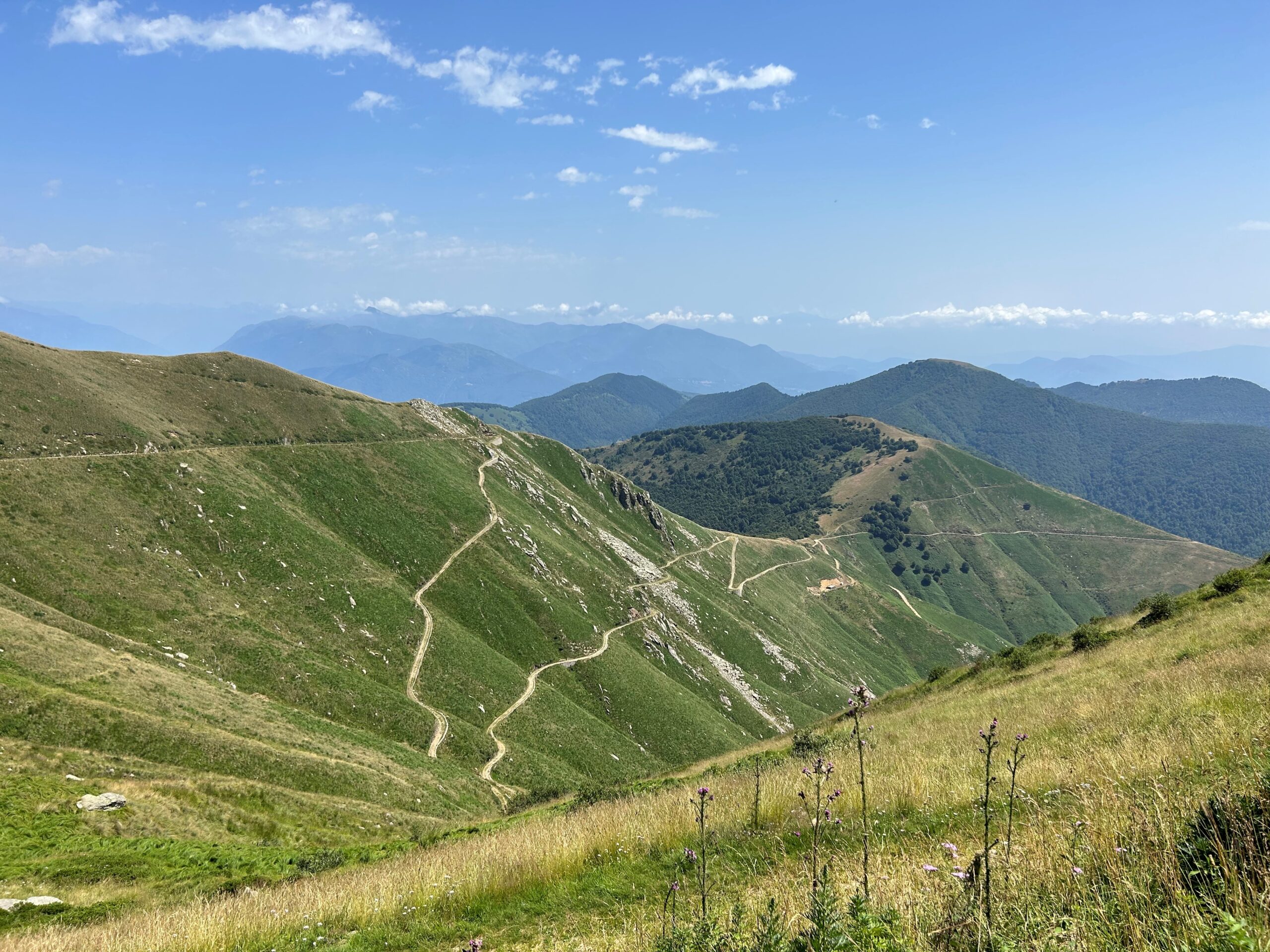
The section of the Cadorna Line between Colle – Monte Spalavera – Passo Folungo – Rifugio Pian Vada’ begins in Colle (1238 m asl), a hamlet of Oggebbio.
There is a convenient car park where you can leave your car and begin the first climb to Monte Spalavera (1534 m asl, an elevation gain of approximately 300 m and a route length of 2.7 km). The route follows a wide dirt road that then becomes an easy grassy path with no particular difficulties. The view ahead is truly spectacular, from the lakes to the peaks of the Val Grande National Park to the Monte Rosa group and the Swiss Alps. On reaching the summit cross, a panel shows the outline of the Alps with the names of their peaks, and here it is possible to admire well-preserved trenches.
Once back in Colle, take the Cadorna Line, now following the signs for Passo Folungo. Strada Cadorna is a dirt road and stretches for about 13 km. Along the way, you can admire the construction of a hospital camp and reach Passo Folungo (1369 m asl), where Strada Cadorna begins to climb with hairpin bends up to Rifugio Pian Vada’ (1711 m asl, approx. 6 km – elevation gain approx. 340 m).
From here, there is a wonderful view of Lake Maggiore, Valle Intrasca, the peaks of the Val Grande National Park and those of Ossola.
POSSIBLE RISKS: The road is without protection in certain sections. Always pay attention in case of recent snowfalls.
Points of interest
Scenic view of Upper Lake Maggiore and the Peaks of the Val grande National Park and the Peaks of the Ossola Valleys. Trenches and military constructions.
Possibility to visit the fortifications at Monte Bavarione (1505 m asl) and Monte Carza (1116 m asl).
Along the Strada Cadorna, between colle and Passo Folungo, you pass by Pian d’Ada, the departure point of the Lake Maggiore Zipline, the 1850 m long steel cable which allows you to try the experience of an adrenaline-packed flight of 1 and a half minutes at over 120 km/hr (www.lagomaggiorezipline.it – possibility to rent e-bikes at Alpe Segletta – Aurano).
A few kilometres away, at Monte Carza, an easy path leads you to the Big Bench of the Lake, with a breathtaking view over Alto Verbano and the Wonderwood Adventure Park (Trarego Viggiona) www.wonderwood.it.
Back to the list of routes
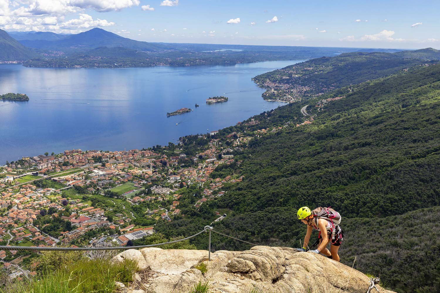
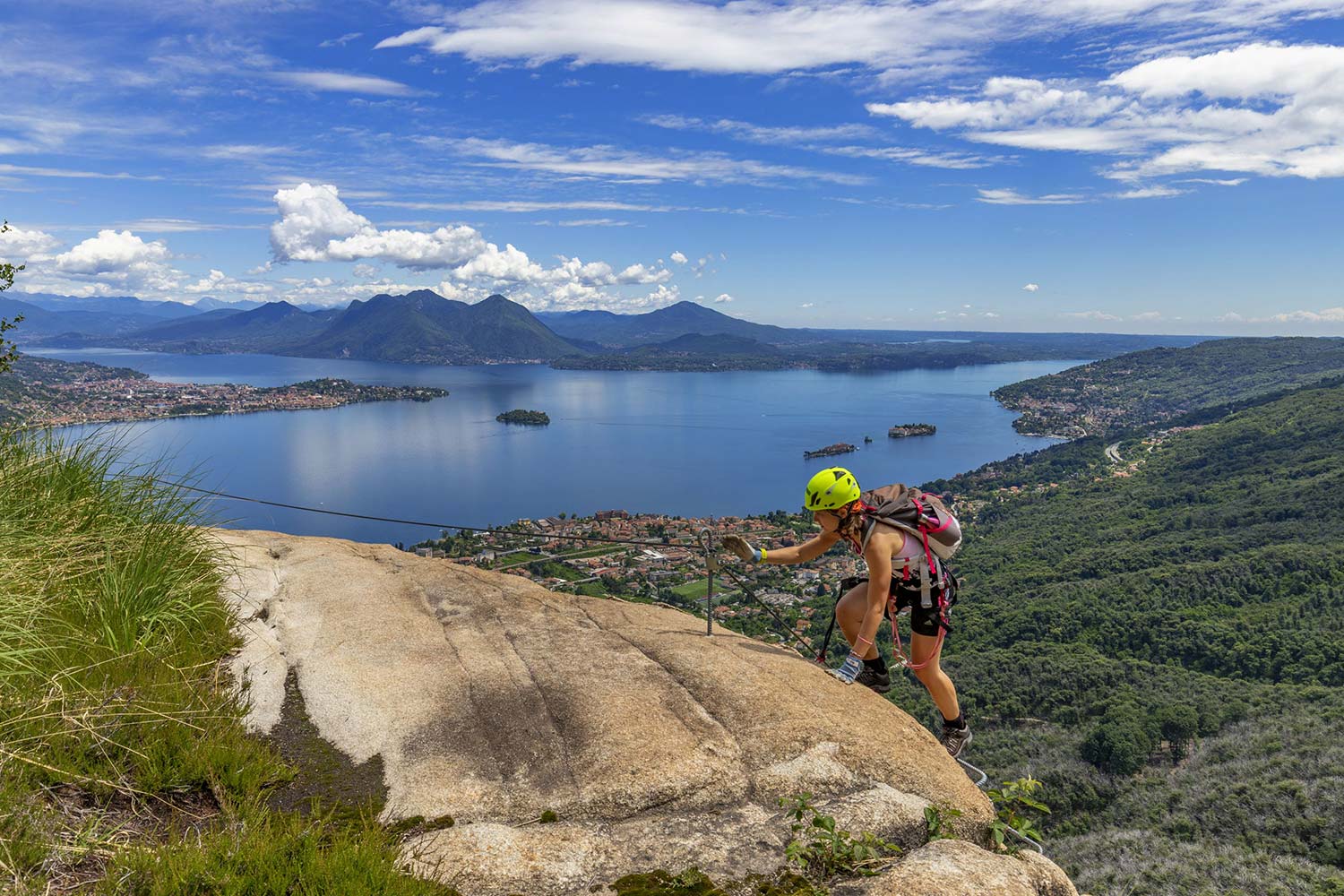
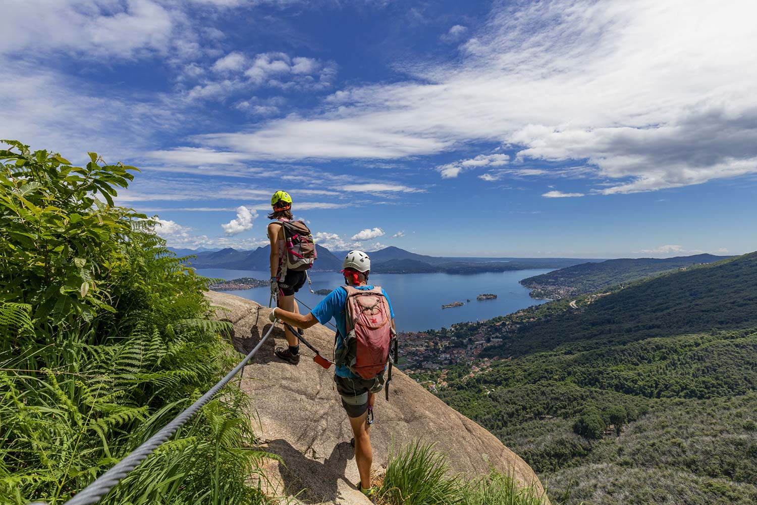
From Pra’ Michelaccio to Cima Montorfano
HISTORIC MOUNTAIN ROADS: LINEA CADORNA, MERGOZZO
Lago Maggiore
Route description
The Cadorna Line is the defence system that was built near the Swiss border during World War I at the behest of General Luigi Cadorna, the then Chief of Staff of the Italian Army, who feared a German-Austrian invasion through neutral Switzerland.
The immense defence structure, built between the summer of 1915 and the spring of 1918, stretched from Ossola to Verbano and into Lombardy, becoming a dense network of military roads and mule tracks, trenches, artillery positions, lookout posts, camp hospitals and logistical facilities, barracks and outposts.
The work was carried out by local bricklayers and stonemasons and women also played a fundamental role in the construction of the defence line, particularly in transporting material and supplies to the work sites.
The Cadorna Line was never used for war purposes and today this military road is a historical heritage site that allows the community to learn about a historical moment of the 20th century.
It is also a natural heritage of trails for trekking and mountain-biking enthusiasts, offering routes that can be travelled almost all year round (be careful in the event of recent snowfall).
Highlights and tour details
Because of its isolated position, Mont’Orfano or Montorfano was considered an important strategic place from which to dominate the entire surrounding area, from Lake Maggiore to Lake Orta to Bassa Ossola.
Various military constructions were built on the slopes of the mount that are still visible and can be reached thanks to Strada Cadorna, a 4 km long and 4 metre wide dirt road.
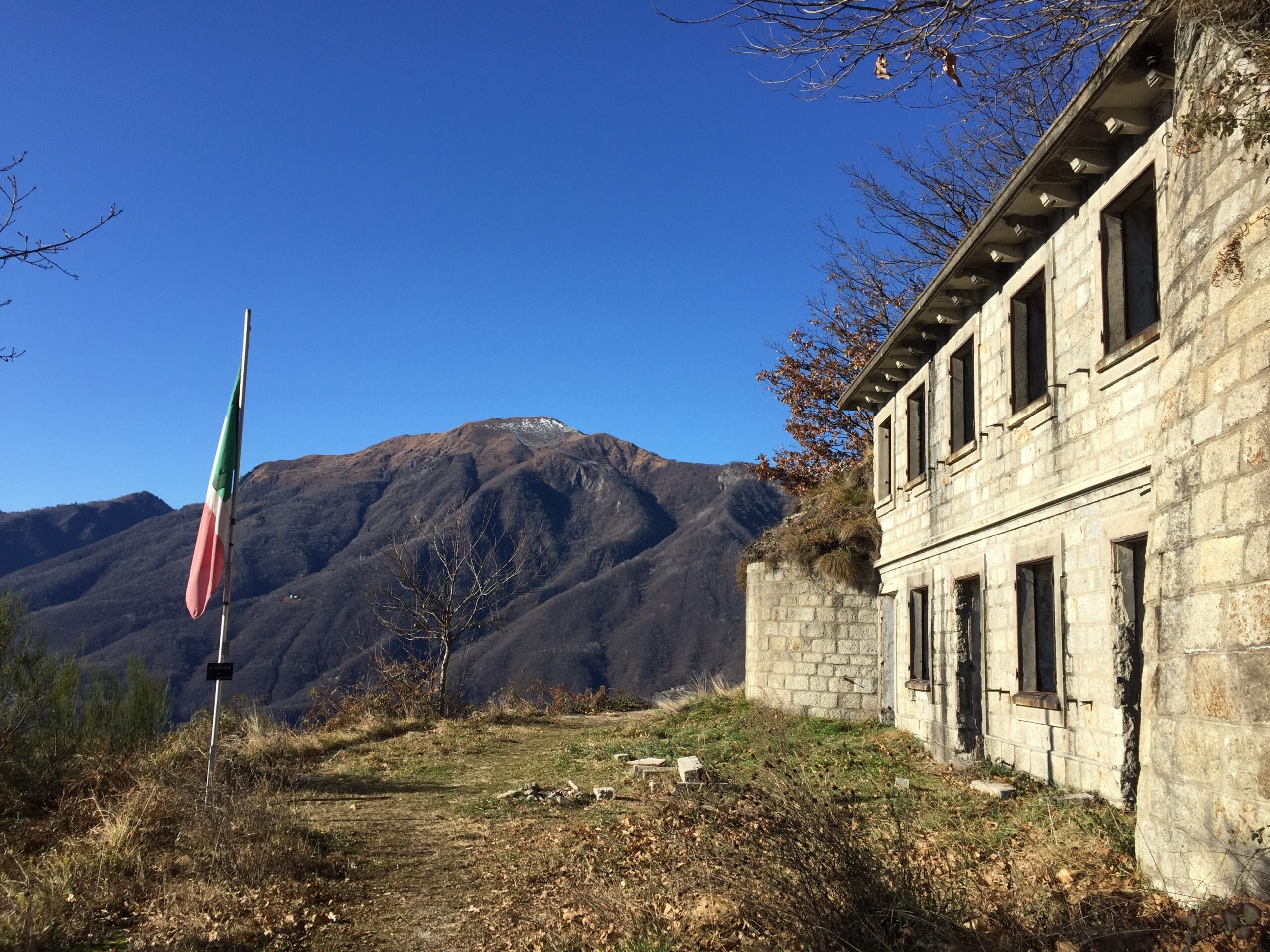
The route along this section of the Cadorna Line begins in Mergozzo, in the hamlet of Pra’ Michelaccio (204 m asl), following the signs for the military fortifications.
The military road, asphalted only in the first short section, becomes a beautiful dirt road that climbs steadily for 4 km, with beautiful stone hairpin bends leading to the first “Casermetta” (small barracks). Continuing with a succession of beautiful military artefacts (retaining walls and water channels), the road reaches the second Casermetta and the “Polveriera” (magazine). The panoramic view from up here is truly stunning.
From the Polveriera you can continue as far as Cima del Montorfano (794 m asl – about 2 km). The dirt road becomes a mule track that later becomes a grassy path and in about 45 minutes reaches other military works (shelters and barracks), whose construction involved the use of local natural resources including granite extracted from the nearby Cava Verde quarry at the foot of Montorfano.
Points of interest
Panoramic views over Lake Maggiore, Lake Orta, Mergozzo and Bassa Ossola.
Remarkably beautiful military artefacts.
Suitable for the whole family is the Sentiero Azzurro, a beautiful paved path that connects the village of Mergozzo to one of Montorfano, from which there is a panoramic view over Lake Mergozzo and Lake Maggiore.
For adrenaline seekers, along the Strada Cadorna is the access to the Via Ferrata Montorfano, a route with Tibetan bridges and exposed passages (Difficult level; a route to be followed only with suitable equipment).
(https://www.comune.mergozzo.vb.it/it-it/vivere-il-comune/cosa-vedere/fer… )
From Pra’ Michelaccio, along the banks of the River Toce, the homonymous Ciclovia del Toce (Toce Cycle Route) passes, which from Alta Val Formazza continues to Lake Maggiore.
For lovers of local history, the Montorfano Granite Ecomuseum and the Archaeological Civic Museum with a display of artefacts from Prehistoric to Medieval times can also be visited in the village of Mergozzo. www.ecomuseogranitomontorfano.it
(Progetto è promosso dalla legge regionale 19 maggio 2021 n. 9, “Interventi per la valorizzazione delle strade storiche di montagna di interesse turistico” che riconosce e valorizza le strade storiche di montagna di interesse turistico al fine di favorire lo sviluppo del turismo all’aria aperta)
Back to the list of routes
Da Pra’ Michelaccio alla Cima Montorfano
VIE STORICHE DI MONTAGNA: LA LINEA CADORNA
Lago Maggiore
Route description
La Linea Cadorna è il sistema difensivo che venne costruito vicino alla frontiera svizzera durante la Prima Guerra Mondiale per volere del Generale Luigi Cadorna, l’allora Capo di Stato Maggiore dell’Esercito, il quale temeva un’invasione austro-tedesca, attraverso la neutrale Svizzera.
L’immensa struttura difensiva, costruita tra l’estate del 1915 e la primavera del 1918, si estendeva dall’Ossola al Verbano fino alla Lombardia, divenendo un fitto reticolo di strade e mulattiere militari, trincee, postazioni d’artiglieria, luoghi di avvistamento, ospedaletti e strutture logistiche, casermette e punti di avvistamento.
I lavori furono eseguiti da muratori e scalpellini locali ed anche le donne ebbero un ruolo fondamentale nella realizzazione della linea difensiva, in particolare nel trasporto di materiale e rifornimento nei cantieri.
La Linea Cadorna non venne mai utilizzata per scopi bellici ed oggigiorno questa strada militare è un patrimonio storico che permette alla comunità di conoscere un momento di storia del Novecento.
E’ però anche un patrimonio naturalistico di sentieri per gli amanti di trekking e della mountain-bike offrendo percorsi percorribili quasi tutto l’anno (prestare attenzione in caso di recenti nevicate).
DESCRIZIONE DEL PERCORSO
Il Mont’Orfano o Montorfano, grazie alla sua posizione isolata, venne considerato un importante luogo strategico da cui dominare a 360° il territorio circostante, dal Lago Maggiore al Lago d’Orta alla Bassa Ossola.
Alle pendici del monte vennero realizzate varie costruzioni militari ancora visibili e raggiungibili grazie alla strada Cadorna, un percorso sterrato camionabile lungo 4 km e largo ben 4 metri.
Il percorso in questo tratto di Linea Cadorna inizia a Mergozzo, nella Loc. Pra’ Michelaccio (204 m slm), seguendo le indicazioni per le fortificazioni militari.
La strada militare, asfaltata solo nel primo breve tratto, diventa una bella sterrata che sale per 4 km con pendenza costante e con bei tornanti in pietra che conducono alla prima Casermetta. Proseguendo con un susseguirsi di manufatti militari di notevole bellezza (muri di contenimento e canali idraulici), la strada giunge alla seconda Caserma e alla Polveriera. La vista panoramica che si ha da quassù è davvero suggestiva.
Dalla Polveriera si può proseguire fino alla Cima del Montorfano (794 m slm – circa 2 km). La sterrata lascia posto ad una mulattiera che poi diventa sentiero erboso ed in circa 45 minuti raggiunge altre opere militari (ricoveri e baraccamenti), la cui edificazione ha visto l’impiego di risorse naturali locali tra cui il granito estratto dalla vicina Cava Verde, ai piedi del Montorfano.
Attenzione: La strada in alcuni punti è priva di protezioni. Prestare attenzione in caso di recenti nevicate.
PUNTI D’INTERESSE
Vista panoramica sul Lago Maggiore, Lago d’Orta, di Mergozzo e Bassa Ossola.
Manufatti militari di notevole bellezza.
Adatto a tutta la famiglia è il Sentiero Azzurro, un bellissimo percorso lastricato che collega il paese di Mergozzo all’abitato di Montorfano, da cui si ha una vista panoramica su Lago di Mergozzo e Lago Maggiore.
Per chi cerca adrenalina, lungo la Strada Cadorna, si incontra invece l’accesso alla Via Ferrata Montorfano, percorso con ponti tibetani e passaggi esposti (livello Difficile; via da percorrere solo muniti di idonea attrezzatura).
(https://www.comune.mergozzo.vb.it/it-it/vivere-il-comune/cosa-vedere/fer… )
Da Pra’ Michelaccio, lungo le rive del fiume Toce, passa l’omonima Ciclovia del Toce che proveniente dall’Alta Val Formazza, prosegue sino al Lago Maggiore. https://lagomaggiorexperience.it/percorso/ciclovia-del-toce-in-bici-tra-…
Per gli amanti di storia locale, a Mergozzo paese, si possono inoltre visitate l’Ecomuseo del Granito di Montorfano e il Museo Civico Archeologico con l’esposizione di reperti dalla Preistoria all’Età Medievale. www.ecomuseogranitomontorfano.it
(Progetto è promosso dalla legge regionale 19 maggio 2021 n. 9, “Interventi per la valorizzazione delle strade storiche di montagna di interesse turistico” che riconosce e valorizza le strade storiche di montagna di interesse turistico al fine di favorire lo sviluppo del turismo all’aria aperta)
Back to the list of routes
From Punta di Migiandone to Forte di Bara
HISTORIC MOUNTAIN ROADS: LINEA CADORNA
Piana del Toce
Route description
The Cadorna Line is the defence system that was built near the Swiss border during World War I at the behest of General Luigi Cadorna, the then Chief of Staff of the Italian Army, who feared a German-Austrian invasion through neutral Switzerland.
The immense defence structure, built between the summer of 1915 and the spring of 1918, stretched from Ossola to Verbano and into Lombardy, becoming a dense network of military roads and mule tracks, trenches, artillery positions, lookout posts, camp hospitals and logistical facilities, barracks and outposts.
The work was carried out by local bricklayers and stonemasons and women also played a fundamental role in the construction of the defence line, particularly in transporting material and supplies to the work sites.
The Cadorna Line was never used for war purposes and today this military road is a historical heritage site that allows the community to learn about a historical moment of the 20th century.
It is also a natural heritage of trails for trekking and mountain-biking enthusiasts, offering routes that can be travelled almost all year round (be careful in the event of recent snowfall).
HIGHLIGHTS AND TOUR DETAILS
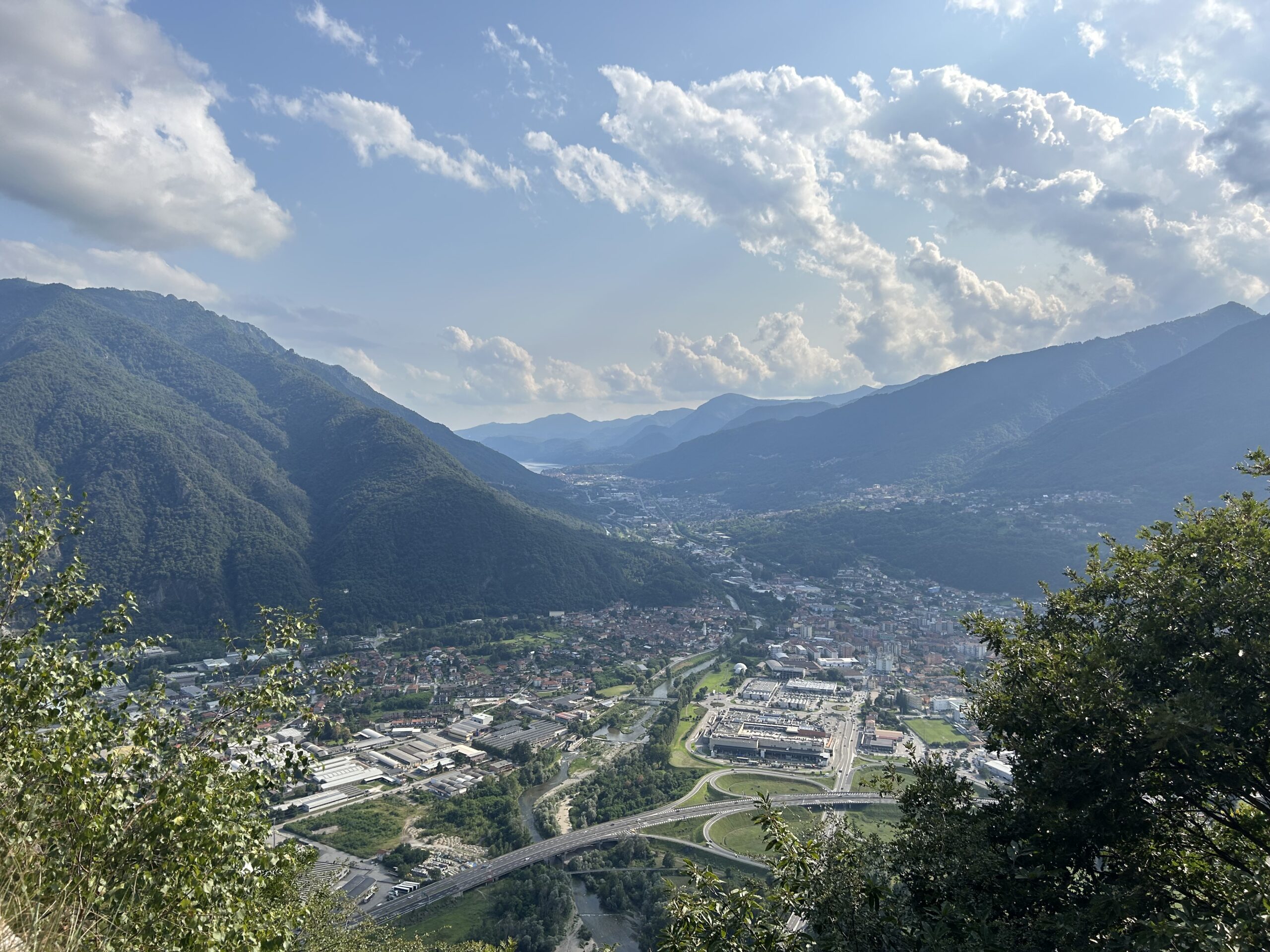
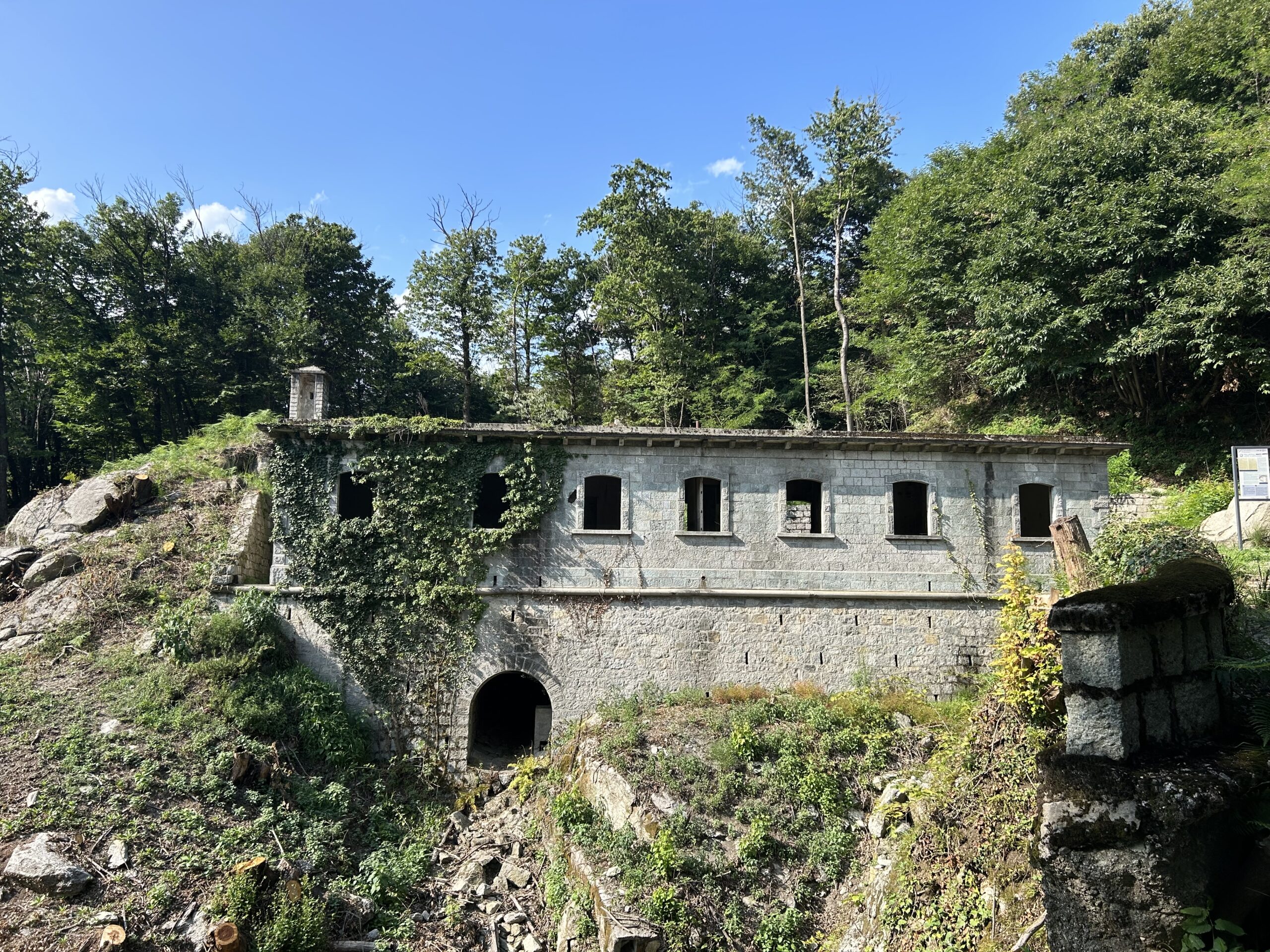
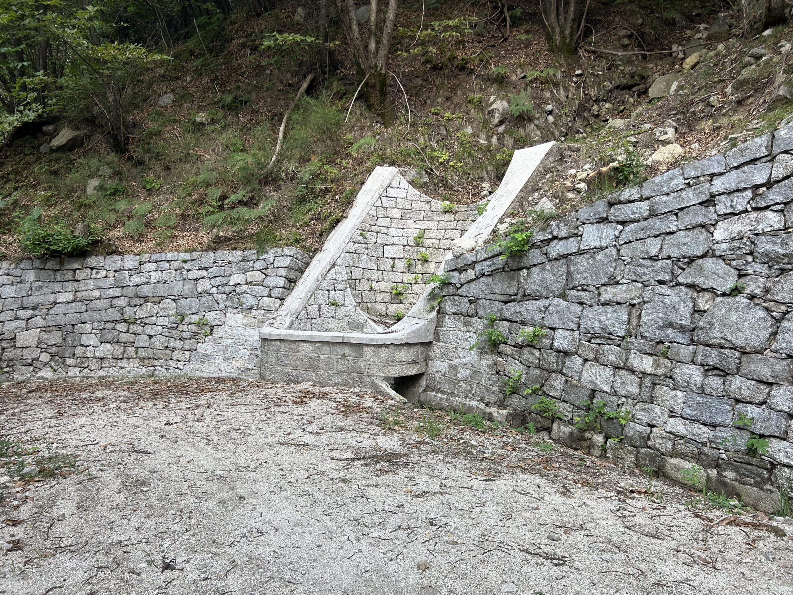
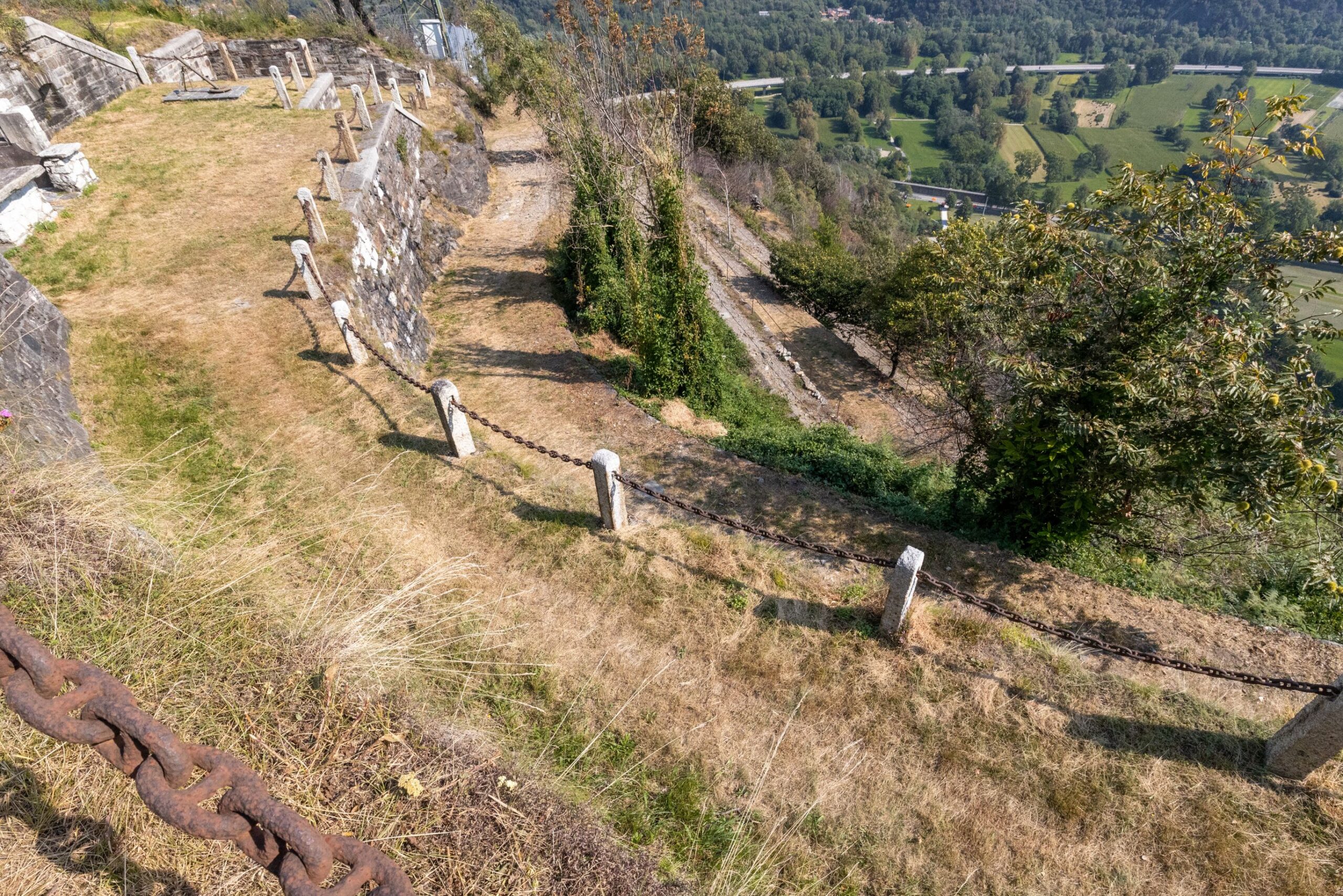
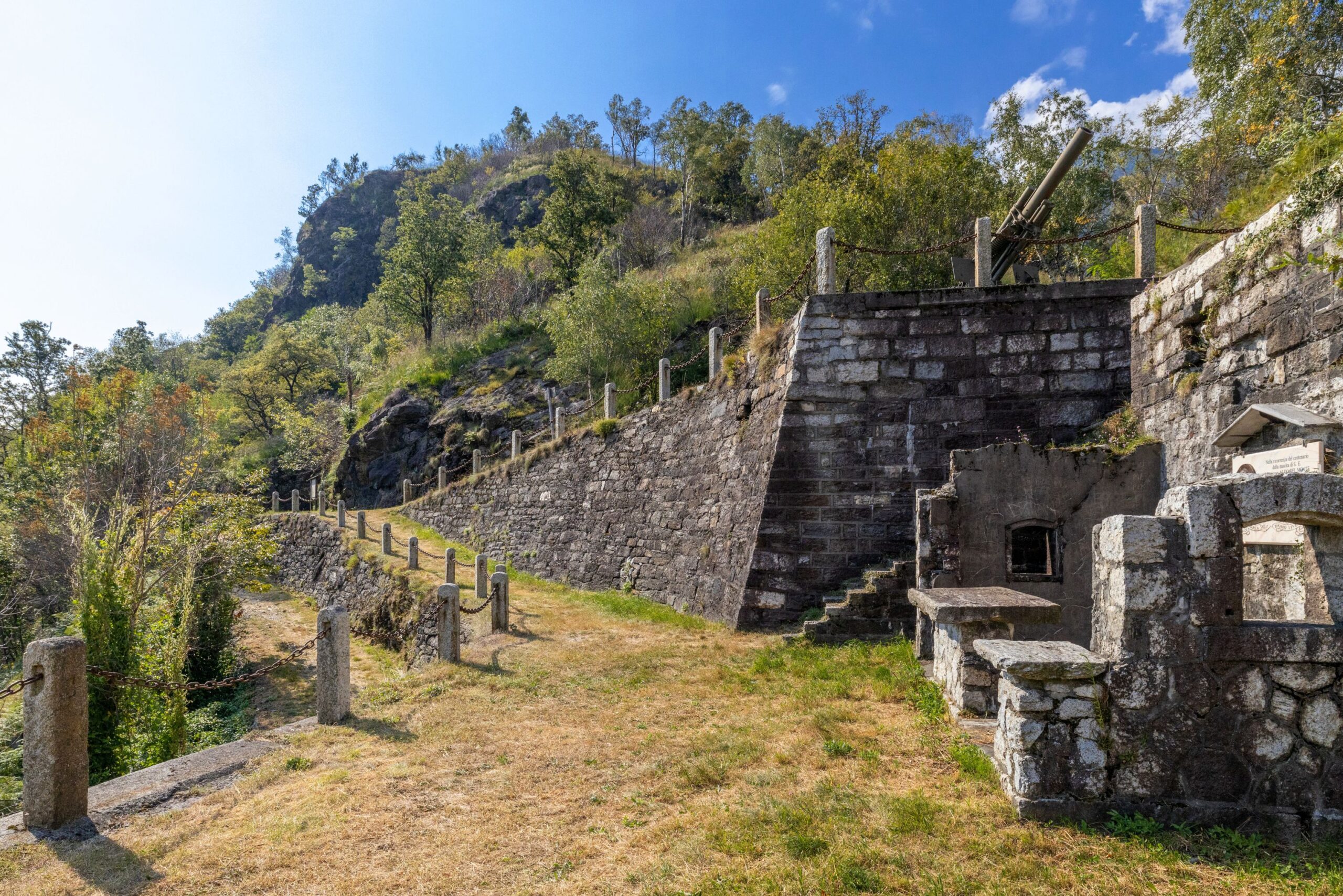
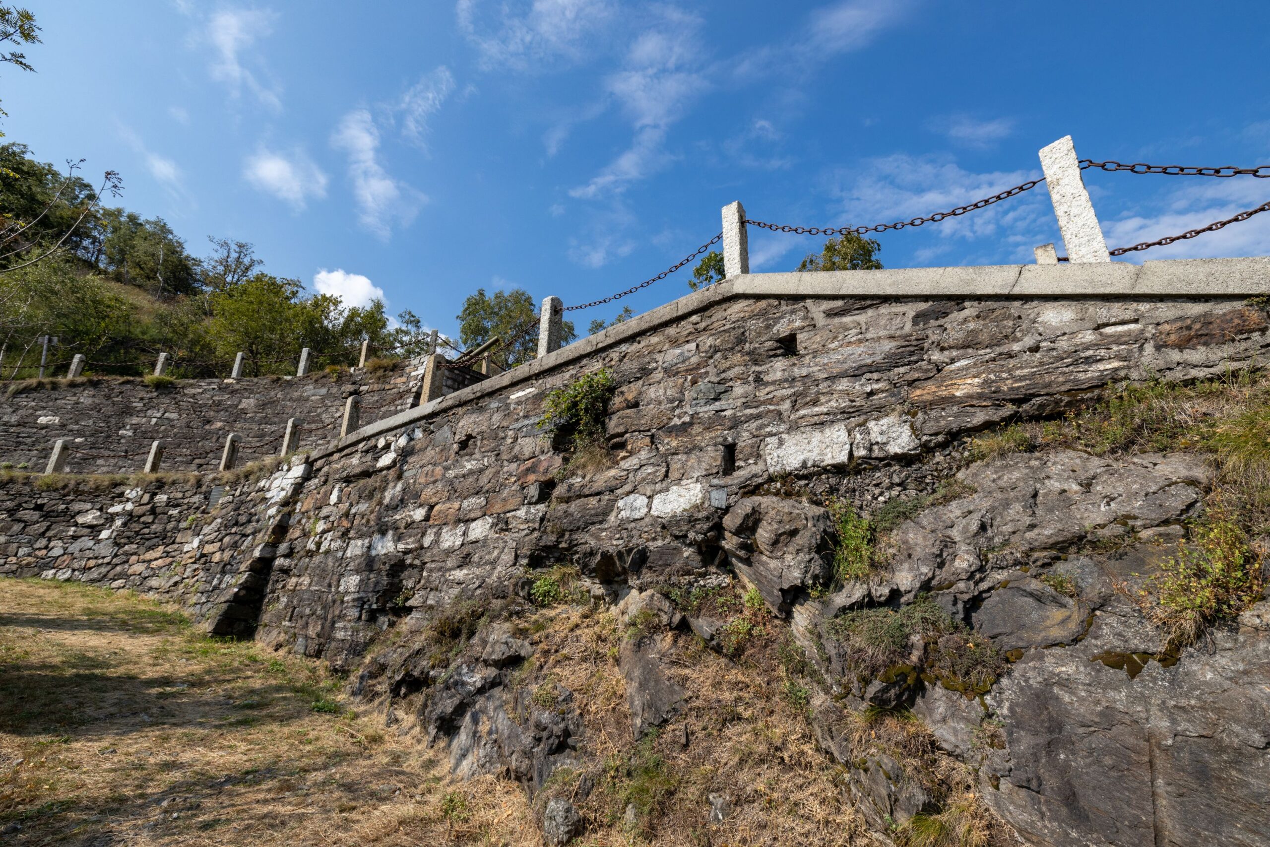
The route along this section of the Cadorna Line begins in Ornavasso in Bassa Ossola at the car park of Punta di Migiandone (210 m asl), where the well-preserved mule track winds its way with regularly sloping hairpin bends and stone walls towards Forte di Bara. You will encounter tunnels carved into the rock, trenches, walkways and machine gun emplacements along the route (it is useful to have a torch with you).
This mountain ridge was the ideal place to control the passage between Bassa Ossola and Lakes Maggiore and Mergozzo, at the narrowest point of the plain of the River Toce, known precisely as the “Stretta di Bara”.
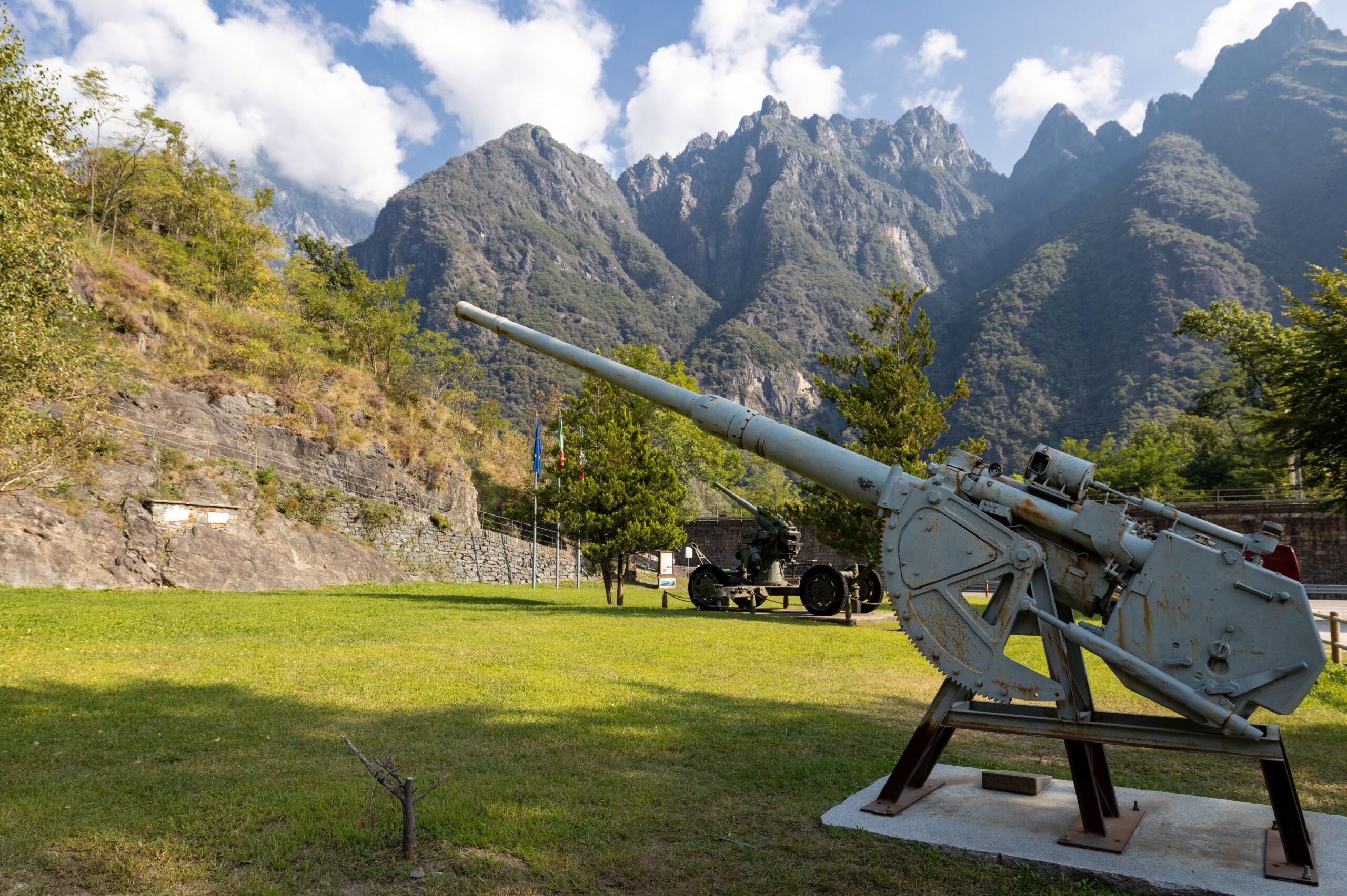
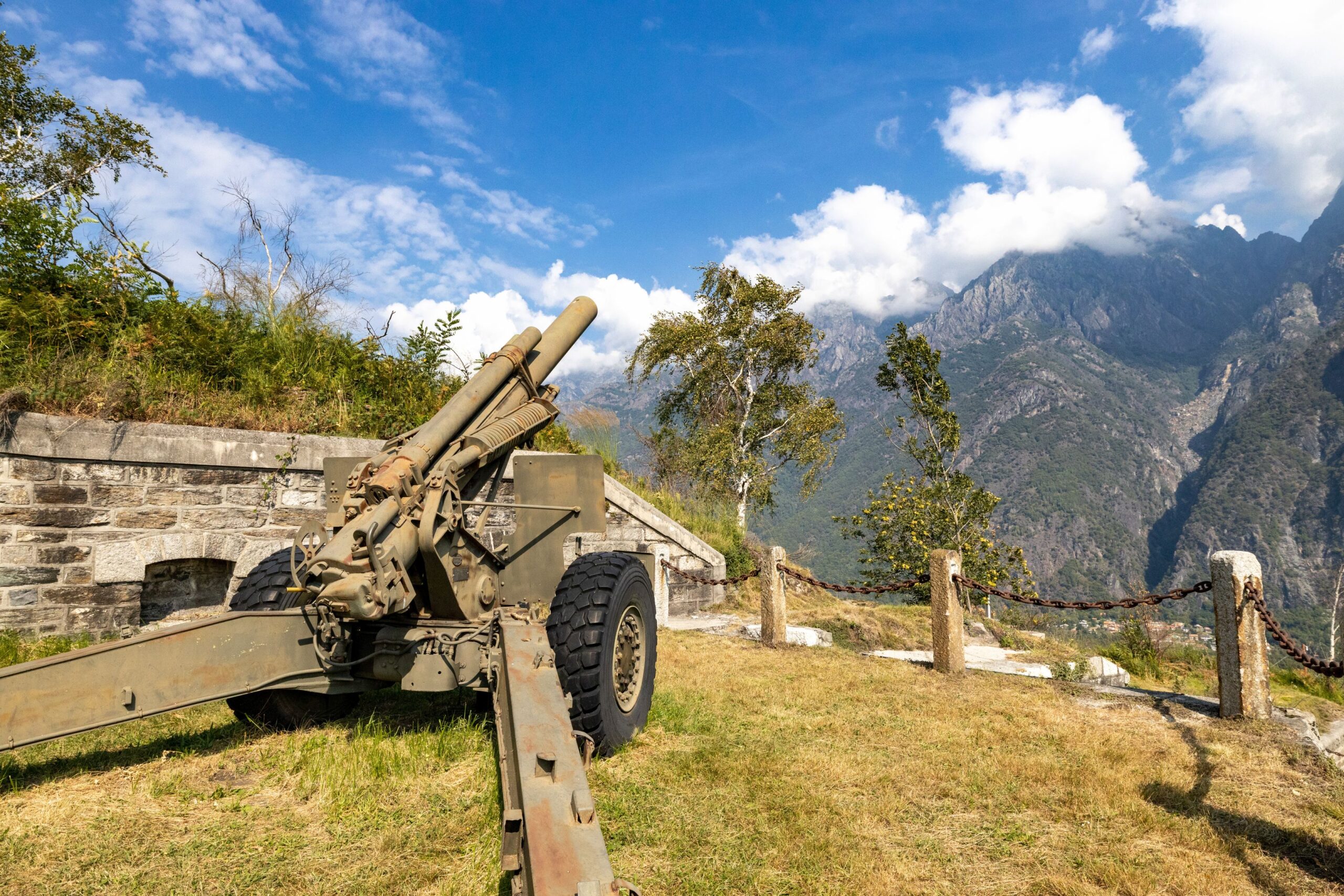
Arriving at Forte di Bara (410 m asl), the multi-level fortified emplacement can be admired, consisting of several embankments supported by square stone walls that were intended to house barracks and long-range cannons to protect the Ornavasso and Migiandone trench system. Cannons and mortars make this visit even more evocative.
A plaque commemorates the Battle of Ornavasso that was fought in October 1944 by the Italian Alpine soldiers and Partisans of the ‘Valtoce’ formation against the Germans to defend the Ossola Partisan Republic.
Risks: There is no protection in some parts of the road.
POINT OF INTEREST
Panoramic views of Lake Maggiore and Mergozzo, the peaks of Bassa Ossola and the Corni di Nibbio.
Still well-preserved and remarkably beautiful military artefacts.
From Punta di Migiandone you can rejoin the Ciclovia del Toce (Toce Cycle Route), which, coming from Alta Val Formazza, continues to Lake Maggiore, skirting the famous watercourse.
For lovers of local history, you can also visit the Enrico Bianchetti Archaeological Section of the Museo del Paesaggio (Landscape Museum) in Ornavasso village, with a large display of artefacts from the 8th century BC to the 4th century AD.
https://www.museodelpaesaggio.it/collezioni/archeologia/
and the Museo Partigiano (Partisan Museum) www.museopartigiano.it
From Forte di Bara, you can continue along the dirt road on flat ground to the Old Marble Quarry.
The Sanctuary of the Madonna del Boden and the Sanctuary of the Madonna della Guardia are also worth visiting.
(The project is promoted by Regional Law No. 9 of 19 May 2021, “Interventions for the valorisation of historic mountain roads of tourist interest”, which recognises and valorises historic mountain roads of tourist interest in order to promote the development of open-air tourism)
Back to the list of routes
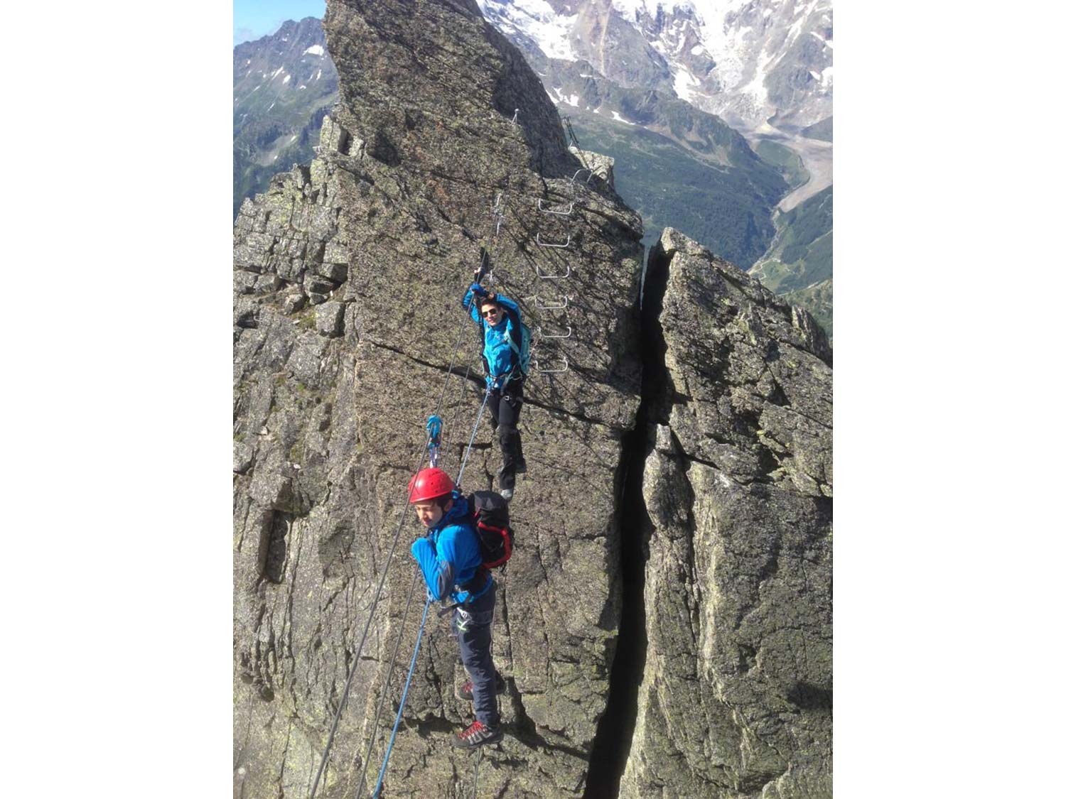
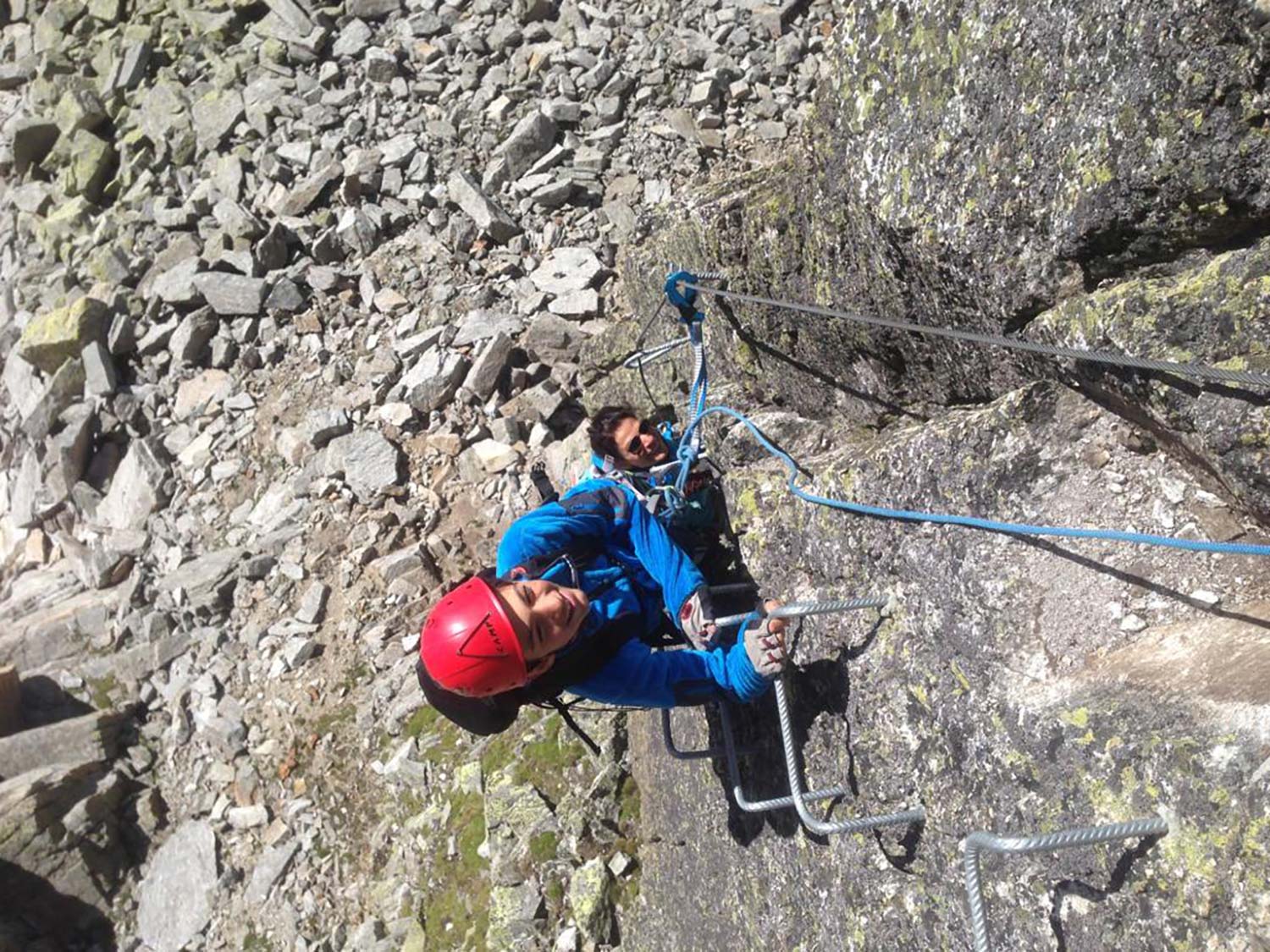
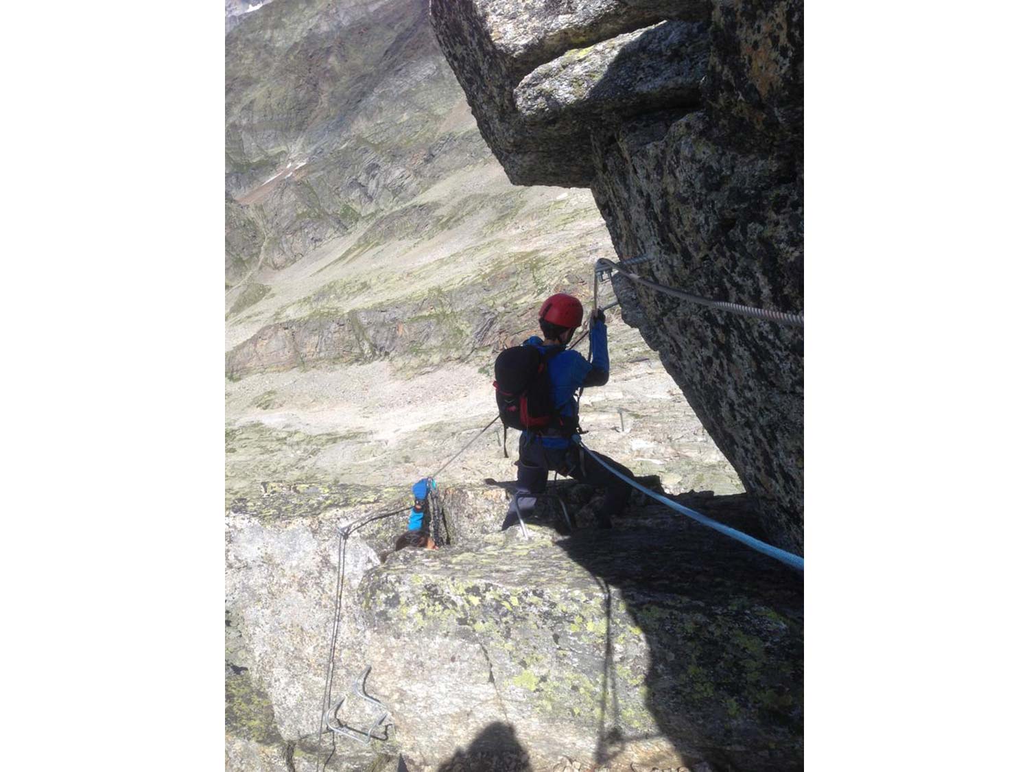
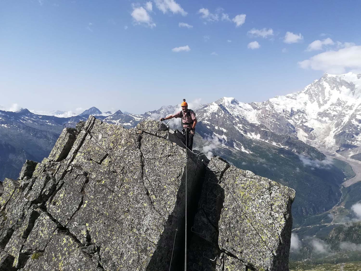
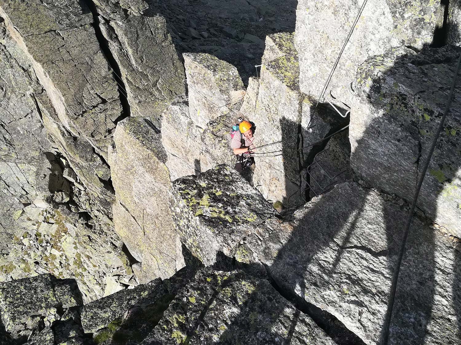
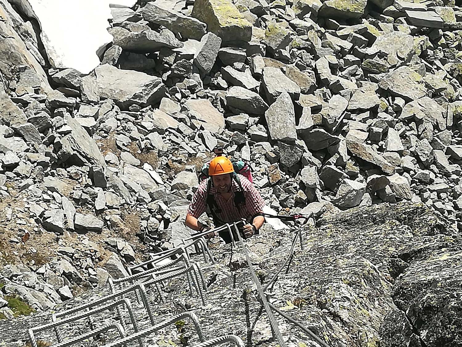
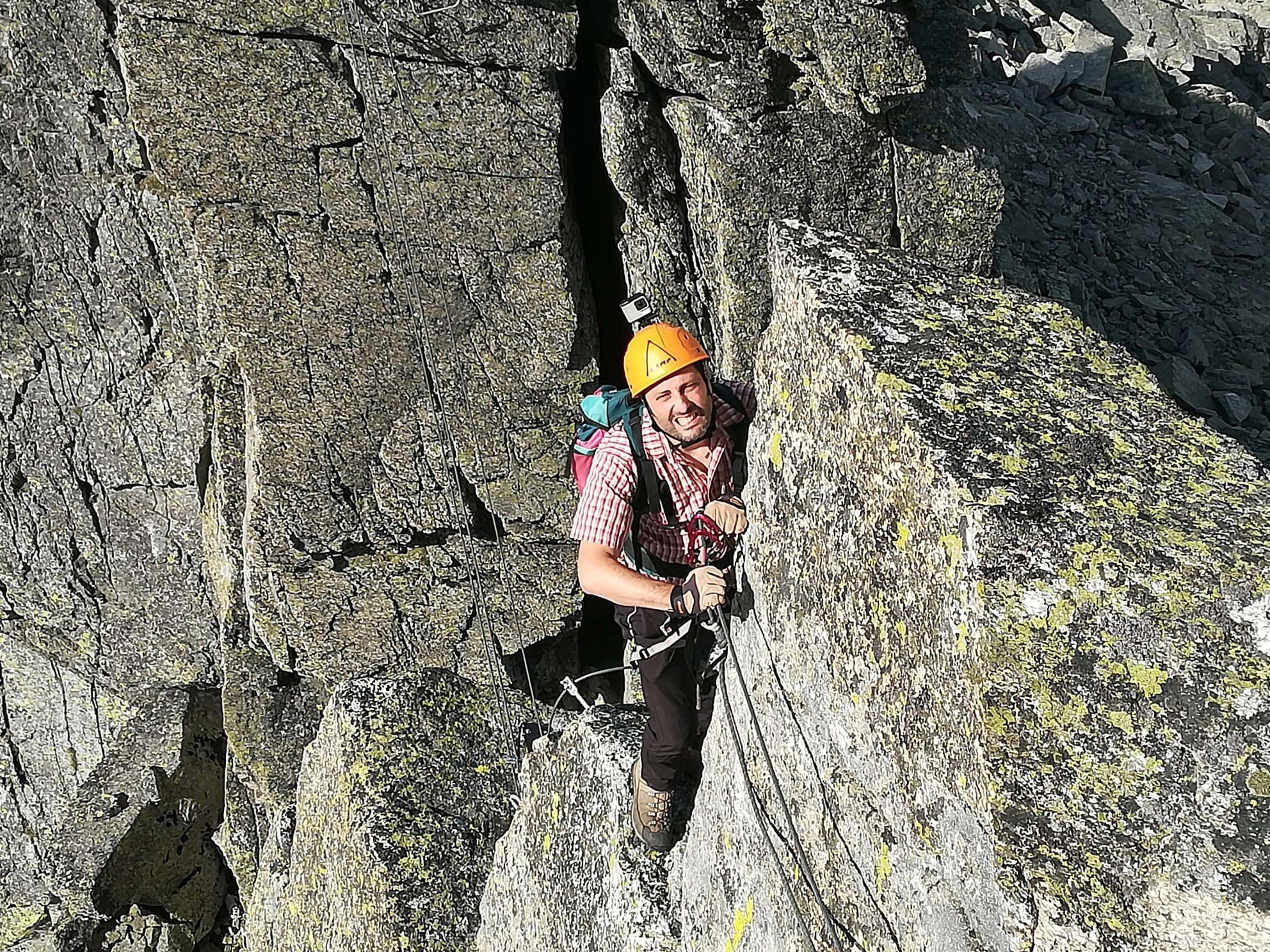
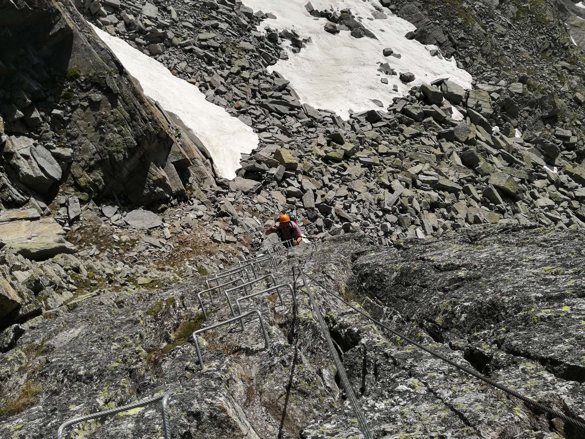
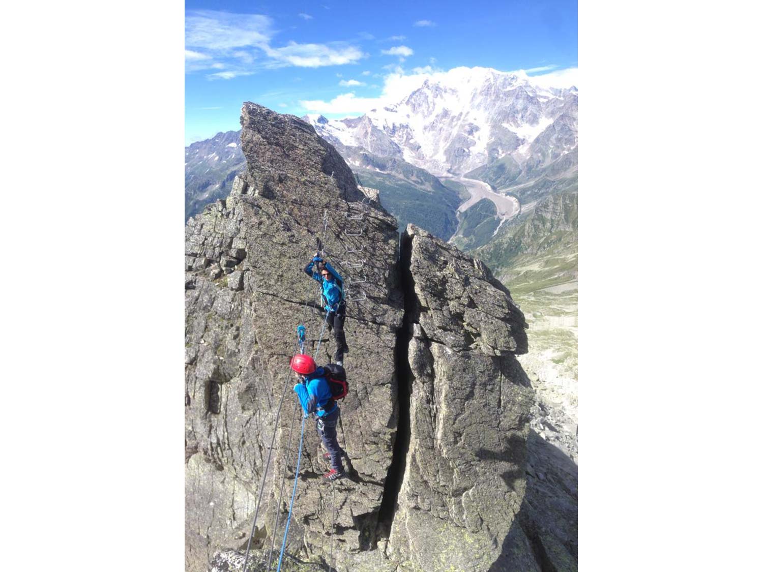
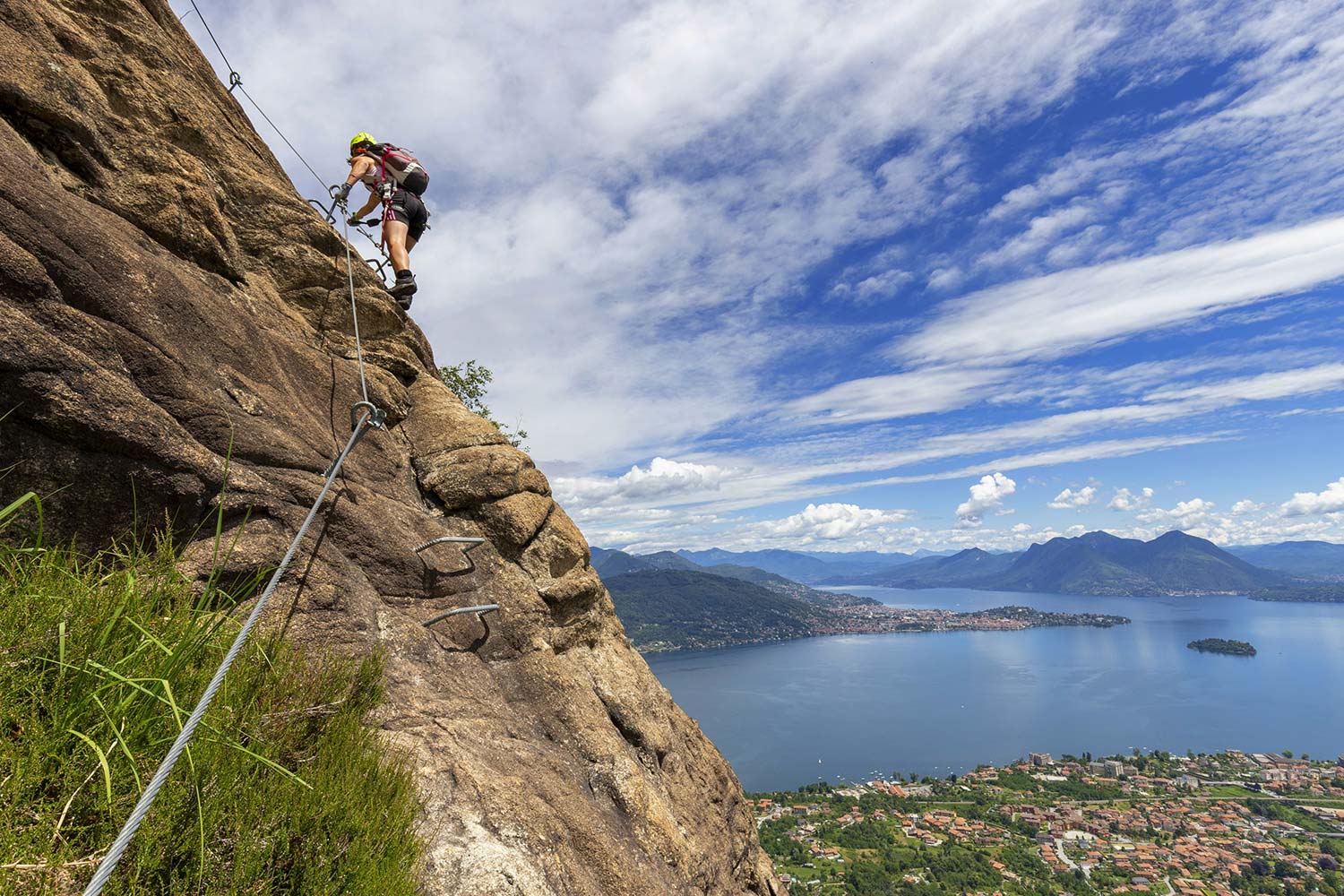
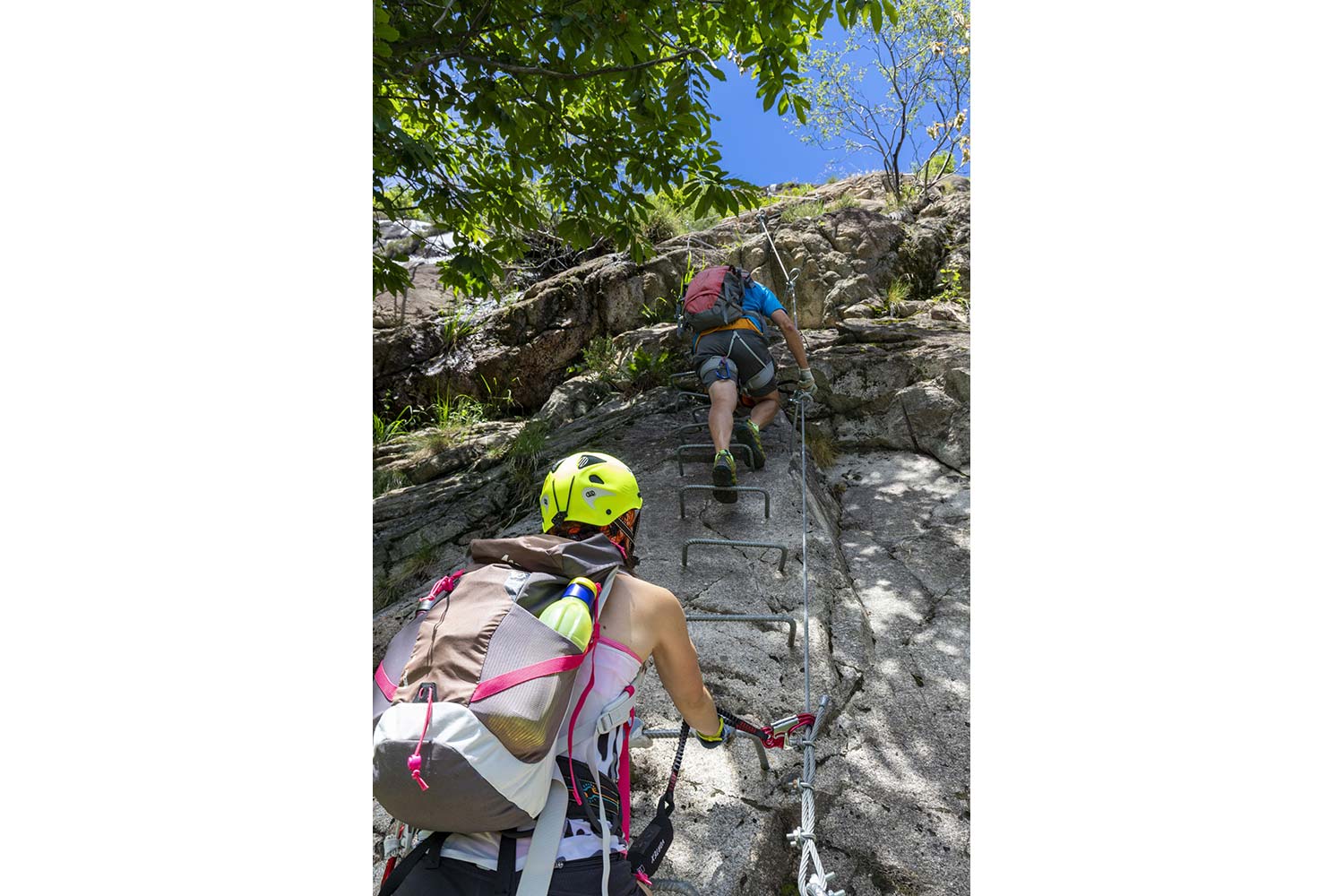
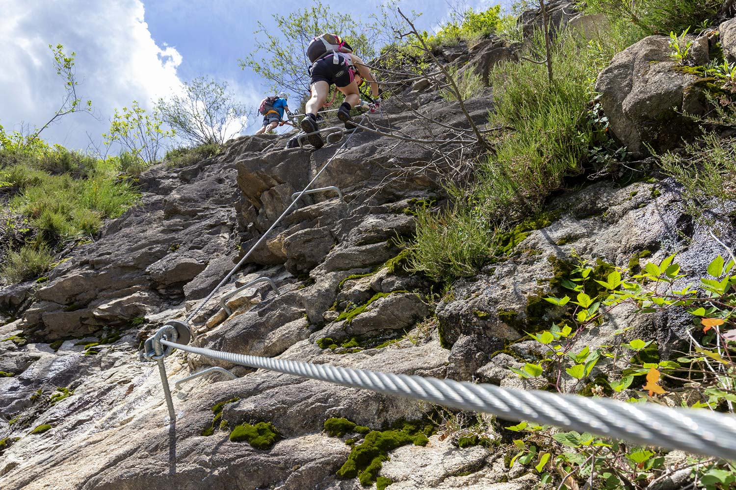
Along the crest of San Pietro
THE VIA FERRATA OF THE “MORO” PASS: A HIGH ALTITUDE ITINERARY
Valle Anzasca
Route description
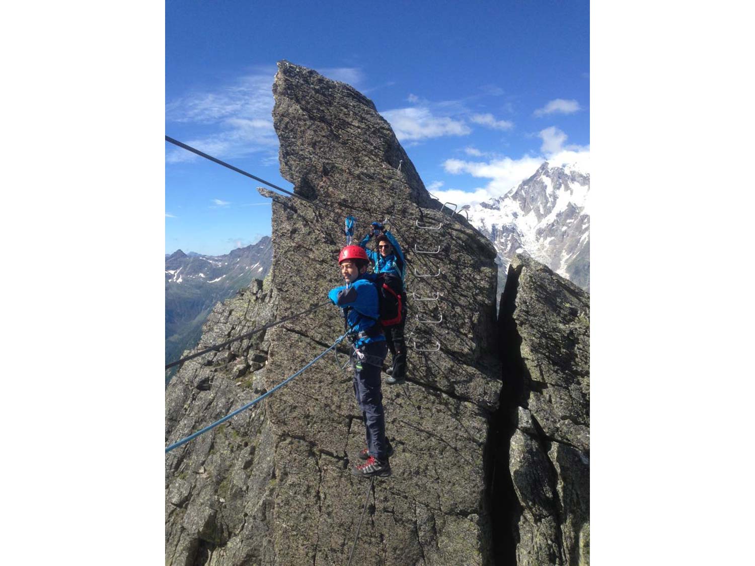
The Via Ferrata of the Guide di Macugnaga is a recent one. It was built at a high altitude, and it runs from the Monte Moro Pass along the San Pietro mountain ridge. It is a mountain ridge Ferrata, aerial and short. It is not particularly challenging from a technical point of view, even if it is very exposed and located at a high altitude.
Starting location:
The itinerary’s starting location is the mountain station upstream of the cable railway that connects Staffa (Verbania province) to the Monte Moro Pass. To reach Staffa, the most common route is through the A26 motorway up to Gravellona Toce on the western side of Lake Maggiore. Proceed passing through Anzola d’Ossola and then turn and take former state road SS549 now SR549 Macugnaga that climbs up the Valley until it reaches the village of Staffa where you will find a parking lot near the cable railway.
Approach:
From the station upstream of the cable railway, head down towards the Oberto Maroli mountain hut. From the hut, continue towards the San Pietro mountain ridge. You will reach a ski lift. Follow the sign to go around the peak from the left bank. Follow the tracks under the rock until reaching the starting point of the via Ferrata (30 minutes travel from the cable railway station).
Via Ferrata:
The via Ferrata of the Guide di Macugnaga starts immediately with a vertical wall featuring plenty of supports for the feet. When you reach the top of this wall, turn right, and follow the ridge. Initially, there is a short climbing-back stretch, exposed yet not difficult. Beyond this stretch, the mountain ridge ascent begins with short climbs on rocks. The first of these rocks is a slight overhang. Then you reach an aerial and thrilling suspended monkey bridge. After crossing the bridge, you must cover a traverse to the right and climb a short wall. Continue along the path marked by the equipment, climbing up for a short stretch, then start the descent. The trail is equipped; however, this stretch is less challenging and reaches the end of the via Ferrata (1h from the starting point).
At this point, you can head back to the cable railway (20 minutes from the end of the via Ferrata – 2h total).
An alternative is to continue in the direction of Joderhorn, a rocky prominence not far from the via Ferrata. From the end of the via Ferrata, go left following the stone figurines that will guide you on the steep climb up to the summit ridge (3036 m). From here, you can descend to the summit cross, where the signature book is located. Follow the trail that led you to the summit and descend to the Monte Moro Pass through a short, equipped stretch and head to the cable railway (45 minutes from Joderhorn).
Descent:
From the end of the via Ferrata, follow the trail that leads to the cable railway in approximately 20 minutes (2h total).
Notes:
This short via Ferrata is a classic ridge Ferrata where exposure plays a significant role. The technical difficulties are low. The height difference is not significant and is mostly found at the first vertical wall. Subsequently, an aerial ridge is crossed through a bridge that makes it even more exposed. Always keep in mind that the location is at a high altitude, approximately 3000 m a.s.l. and, thus, pay due attention to the equipment and weather forecast.
Back to the list of routes
Quick Info:
Approach: 0:30 hour
Via Ferrata: 1:00 hour
Itinerary: 2:00 hours
Difference in altitude: 120 m
Difference in height of the itinerary: 250 m
Maximum altitude: 2905 m
Length: 6 km
Along the crest of San Pietro
THE VIA FERRATA OF THE “MORO” PASS: A HIGH ALTITUDE ITINERARY
Lago Maggiore
Route description
The Via Ferrata of the Guide di Macugnaga is a recent one. It was built at a high altitude, and it runs from the Monte Moro Pass along the San Pietro mountain ridge. It is a mountain ridge Ferrata, aerial and short. It is not particularly challenging from a technical point of view, even if it is very exposed and located at a high altitude.
Starting location:
The itinerary’s starting location is the mountain station upstream of the cable railway that connects Staffa (Verbania province) to the Monte Moro Pass. To reach Staffa, the most common route is through the A26 motorway up to Gravellona Toce on the western side of Lake Maggiore. Proceed passing through Anzola d’Ossola and then turn and take former state road SS549 now SR549 Macugnaga that climbs up the Valley until it reaches the village of Staffa where you will find a parking lot near the cable railway.
Approach:
From the station upstream of the cable railway, head down towards the Oberto Maroli mountain hut. From the hut, continue towards the San Pietro mountain ridge. You will reach a ski lift. Follow the sign to go around the peak from the left bank. Follow the tracks under the rock until reaching the starting point of the via Ferrata (30 minutes travel from the cable railway station).
Via Ferrata:
The via Ferrata of the Guide di Macugnaga starts immediately with a vertical wall featuring plenty of supports for the feet. When you reach the top of this wall, turn right, and follow the ridge. Initially, there is a short climbing-back stretch, exposed yet not difficult. Beyond this stretch, the mountain ridge ascent begins with short climbs on rocks. The first of these rocks is a slight overhang. Then you reach an aerial and thrilling suspended monkey bridge. After crossing the bridge, you must cover a traverse to the right and climb a short wall. Continue along the path marked by the equipment, climbing up for a short stretch, then start the descent. The trail is equipped; however, this stretch is less challenging and reaches the end of the via Ferrata (1h from the starting point).
At this point, you can head back to the cable railway (20 minutes from the end of the via Ferrata – 2h total).
An alternative is to continue in the direction of Joderhorn, a rocky prominence not far from the via Ferrata. From the end of the via Ferrata, go left following the stone figurines that will guide you on the steep climb up to the summit ridge (3036 m). From here, you can descend to the summit cross, where the signature book is located. Follow the trail that led you to the summit and descend to the Monte Moro Pass through a short, equipped stretch and head to the cable railway (45 minutes from Joderhorn).
Descent:
From the end of the via Ferrata, follow the trail that leads to the cable railway in approximately 20 minutes (2h total).
Notes:
This short via Ferrata is a classic ridge Ferrata where exposure plays a significant role. The technical difficulties are low. The height difference is not significant and is mostly found at the first vertical wall. Subsequently, an aerial ridge is crossed through a bridge that makes it even more exposed. Always keep in mind that the location is at a high altitude, approximately 3000 m a.s.l. and, thus, pay due attention to the equipment and weather forecast.
Back to the list of routes
Quick Info:
Approach: 0:30 hour
Via Ferrata: 1:00 hour
Itinerary: 2:00 hours
Difference in altitude: 120 m
Difference in height of the itinerary: 250 m
Maximum altitude: 2905 m
Length: 6 km
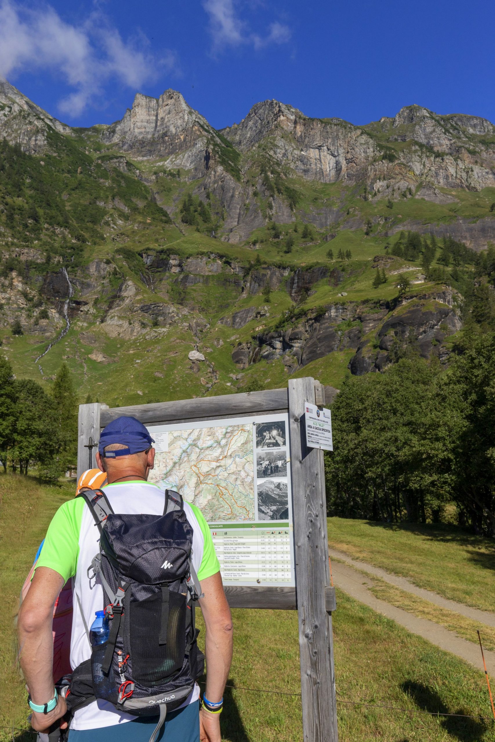
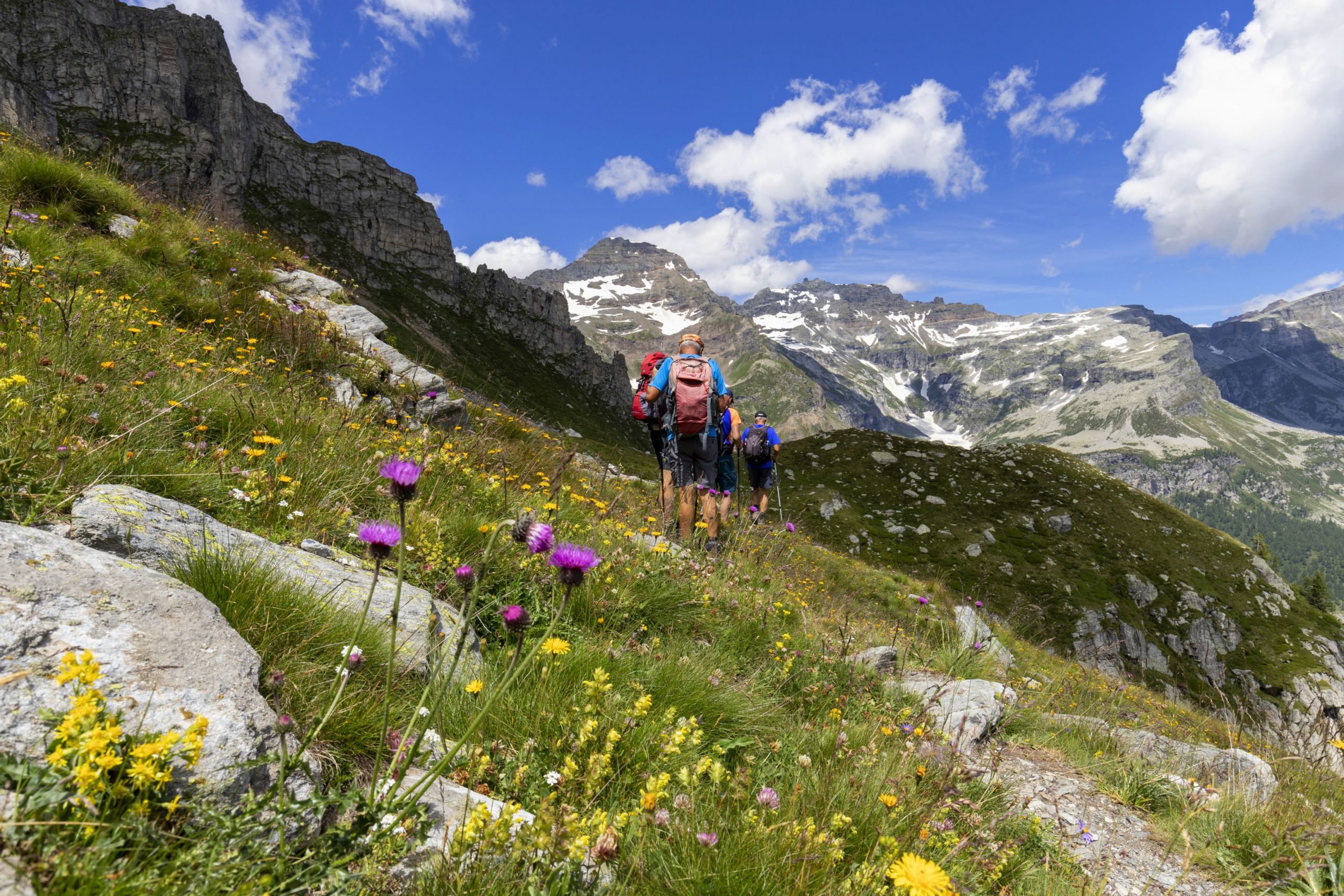
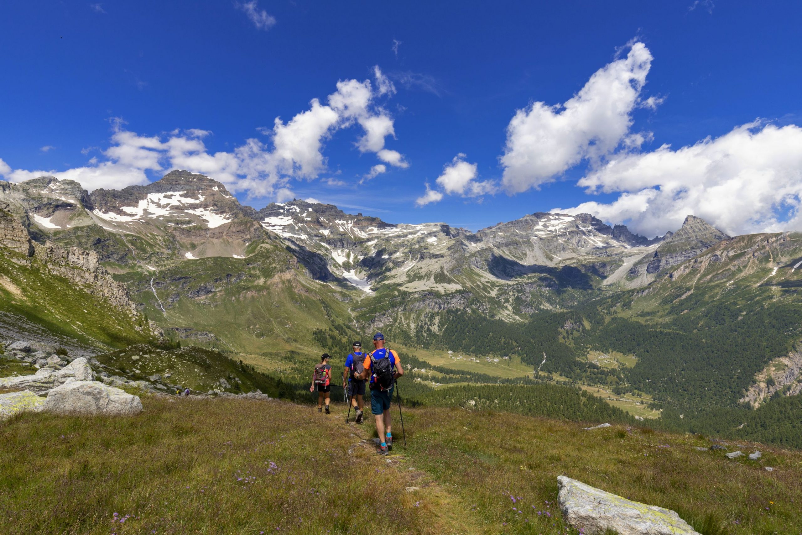
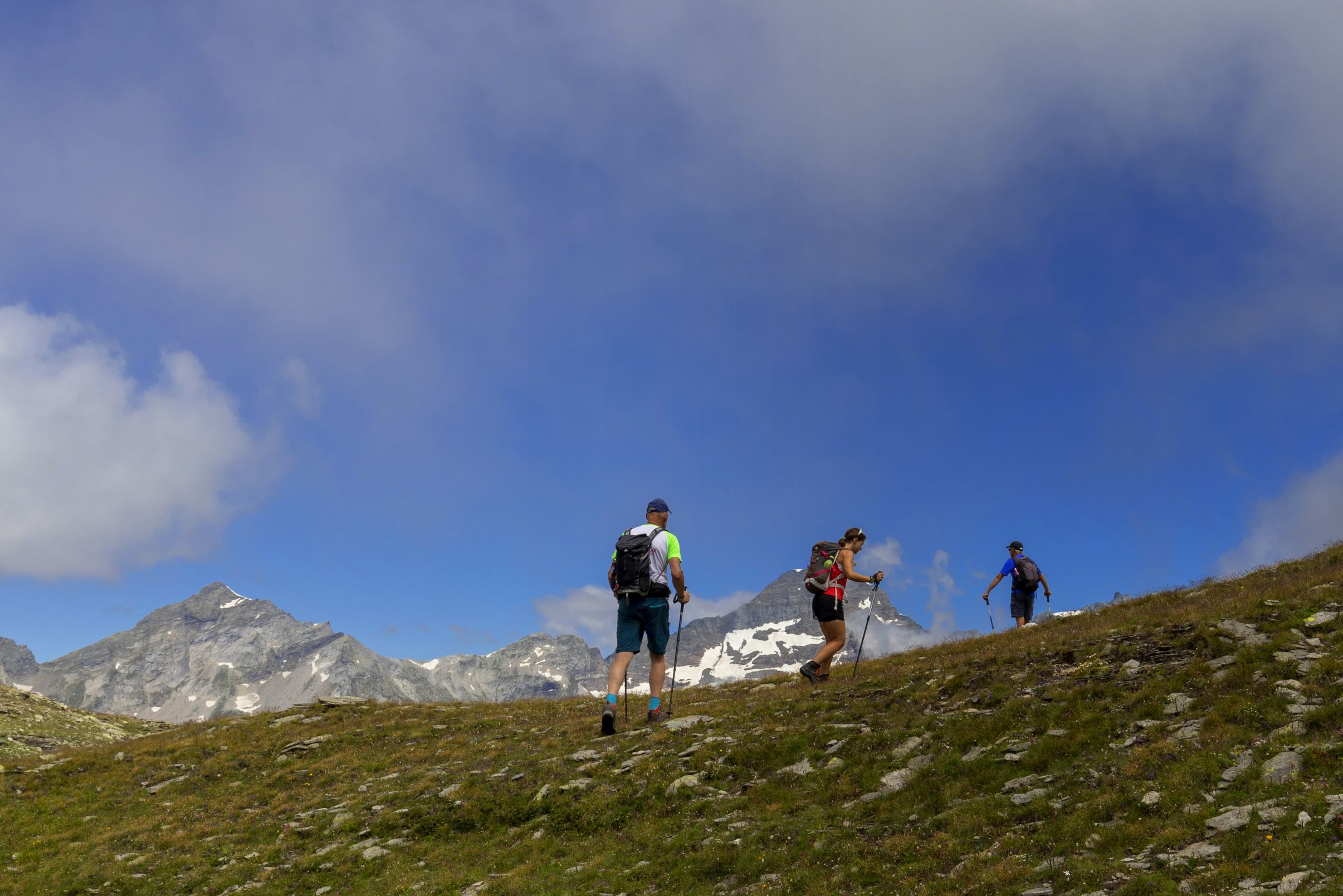
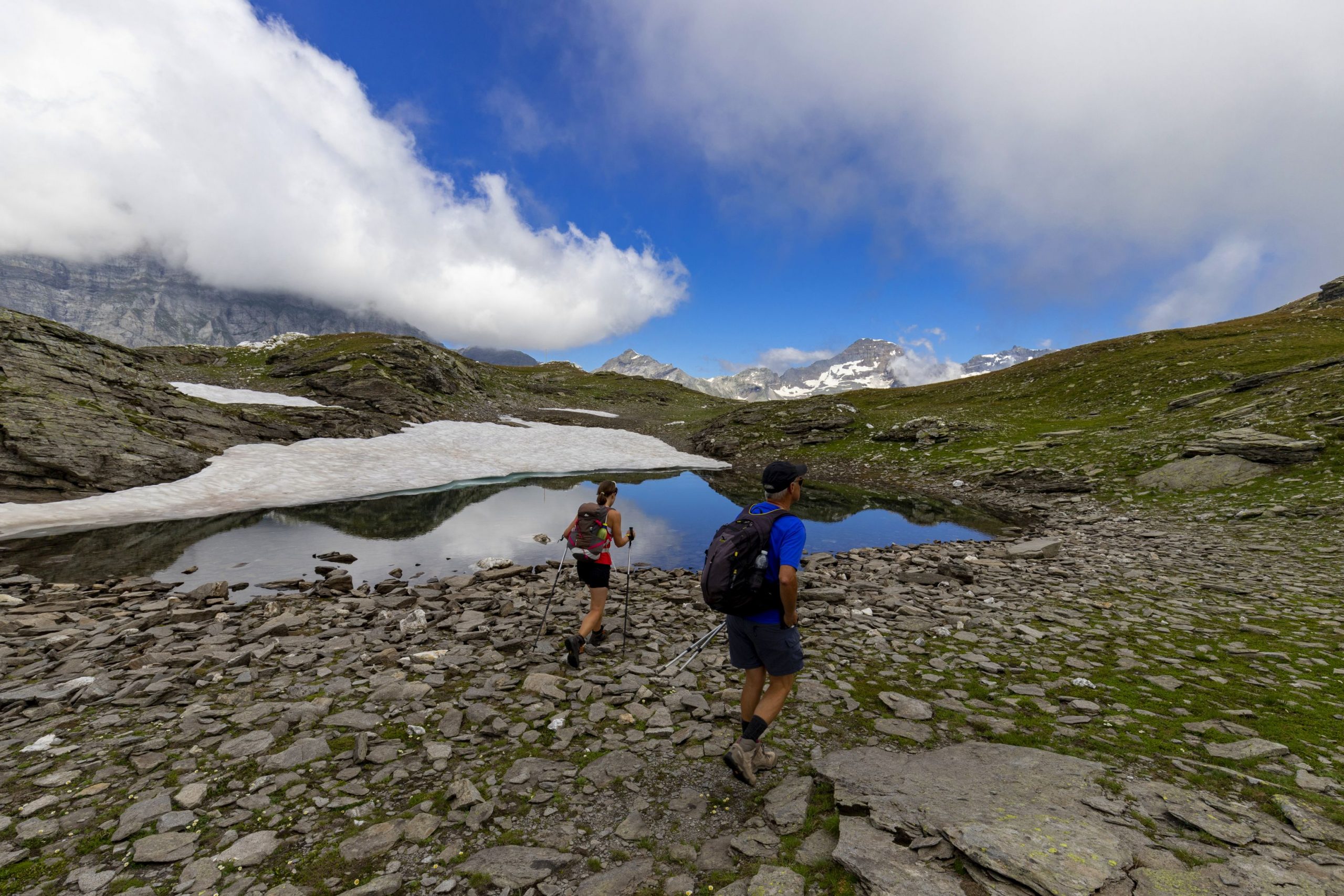
One of the two central attractions of the Alpe Veglia-Devero Natural Park
ALPE VEGLIA – DEVERO NATURAL PARK: ALPE VEGLIA
Alpi Veglia-Devero
Route description
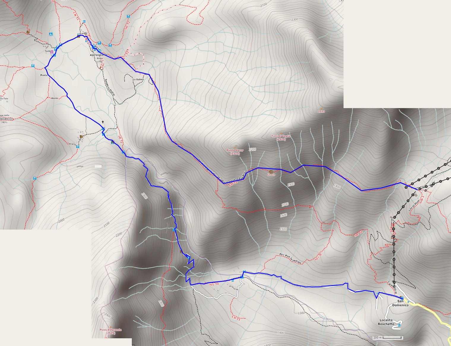
Departure location: Alpe Ciamporino (1936 m)
Place of arrival: San Domenico (1420 m)
Maximum altitude: 2060 m
Difference in altitude: 200 m uphill, -700 m downhill
Distance: 12 km total
Walking time not counting stops: 2 hours and 30 minutes from Alpe Ciamporino to Alpe Veglia; 2 hours and 30 minutes from Alpe Veglia to San Domenico.
Type of route: mixed (trail, dirt road, cobblestones, asphalt)
Signs: signs for “Alpe Veglia F50” and red/white marks
Water: fountains at San Domenico and Alpe Veglia
Recommended period: spring through autumn, without snow
How to get there: 26 km north of Domodossola. Take the SS33 towards “Sempione” and “Confine di Stato”; after the “Varzo Sud” exit, follow blue signs for “Varzo” and immediately after that, follow the brown signs for “San Domenico”. The last 11 km of this road are rather narrow and winding. Since this is a ski station, there are several outdoor and indoor car parks. By bus: line Domodossola-Varzo FS (www.comazzibus.com), then ProntoBus Varzo-Trasquera-San Domenico service (www.unionemontanaaltaossola.it). By train: Domodossola-Briga line, Varzo station (www.trenitalia.com). Lift facilities www.san-domenico.com
Information: Distretto Turistico dei Laghi www.distrettolaghi.it; Ente Gestione Aree Protette dell’Ossola www.areeprotetteossola.it; Consorzio Alpe Veglia www.consorzioalpeveglia.it; Municipality of Varzo www.comune.varzo.vb.it ; San Domenico Ski www.san-domenico.com; Unione Montana Alta Ossola www.unionemontanaaltaossola.it
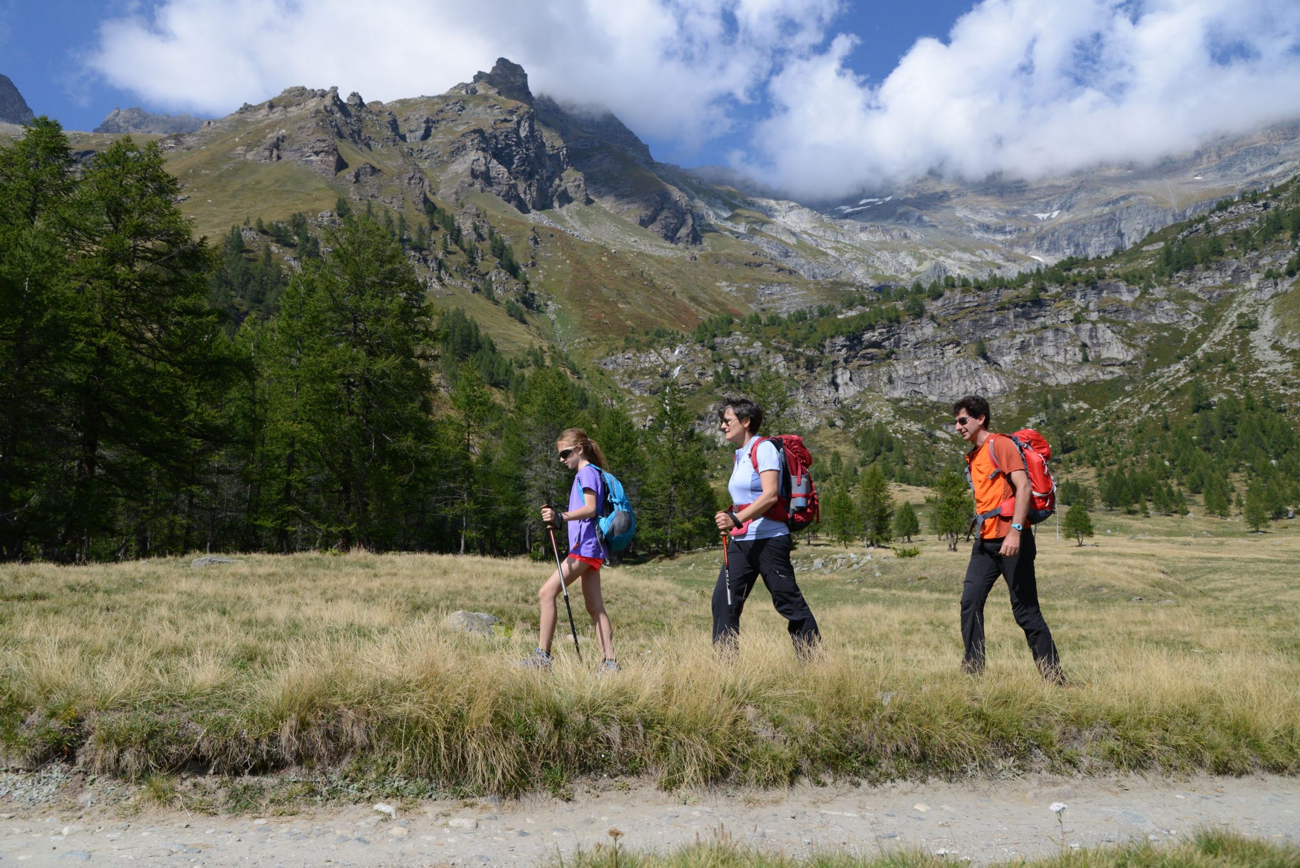
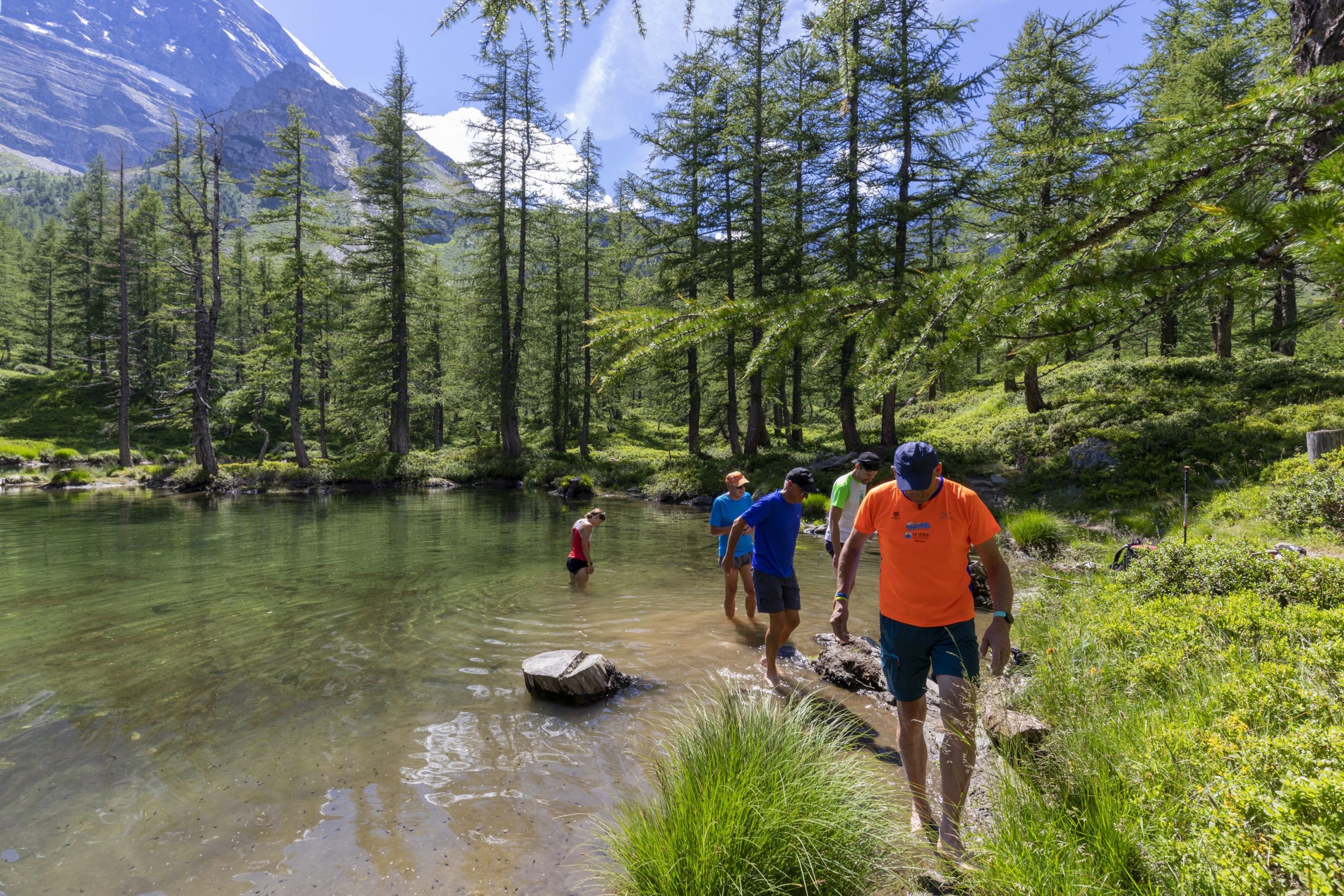
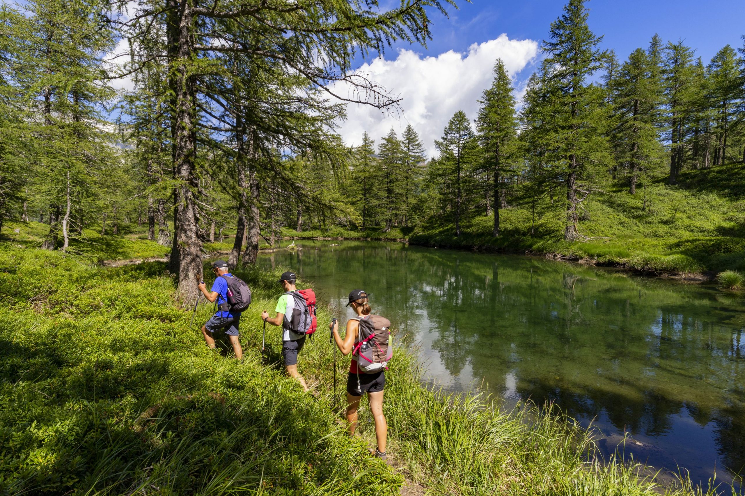
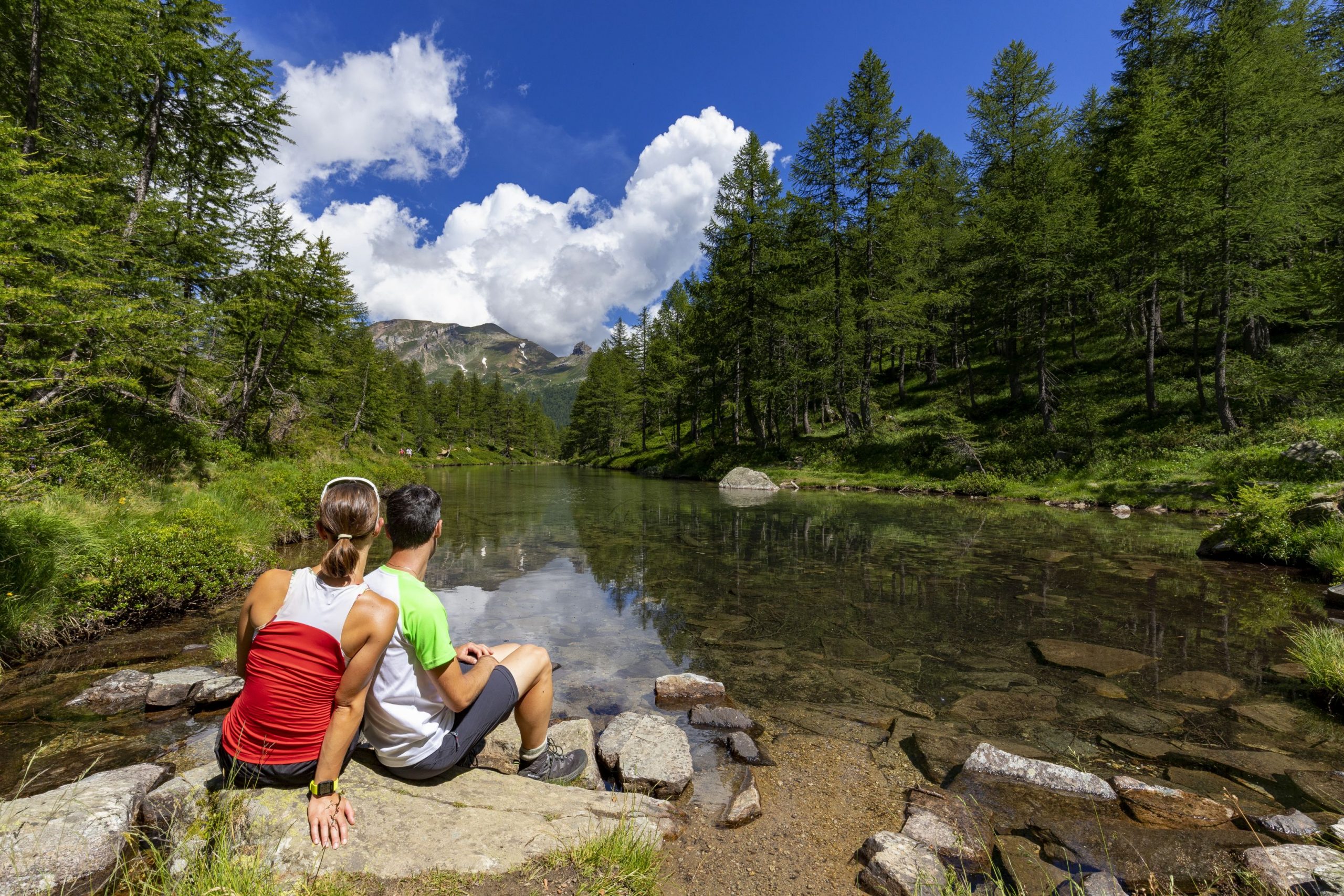
The itinerary
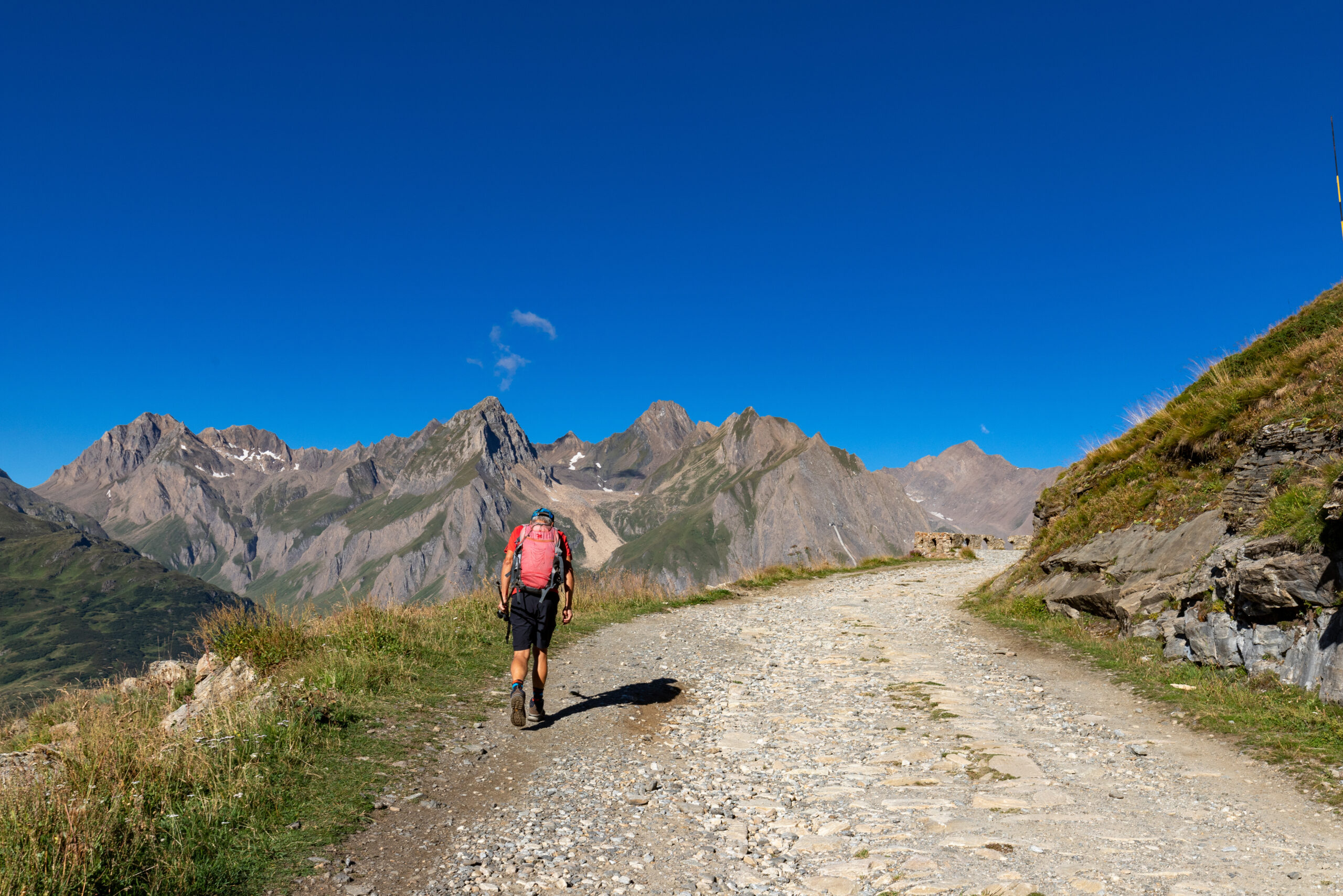
The walk starts from the hamlet San Domenico di Varzo (1420 m). Here, hikers will take the gondola that goes up to 1936 meters above sea level to Alpe Ciamporino, where the actual hike begins. After you get off the gondola, walk towards the next lift and, just before getting to it, take the trail on the left that crosses the meadow (there’s a white marker stone for reference), pass under the cables of a chairlift and take the path that is now clearly visible (red/white sign for “Alpe Veglia”).
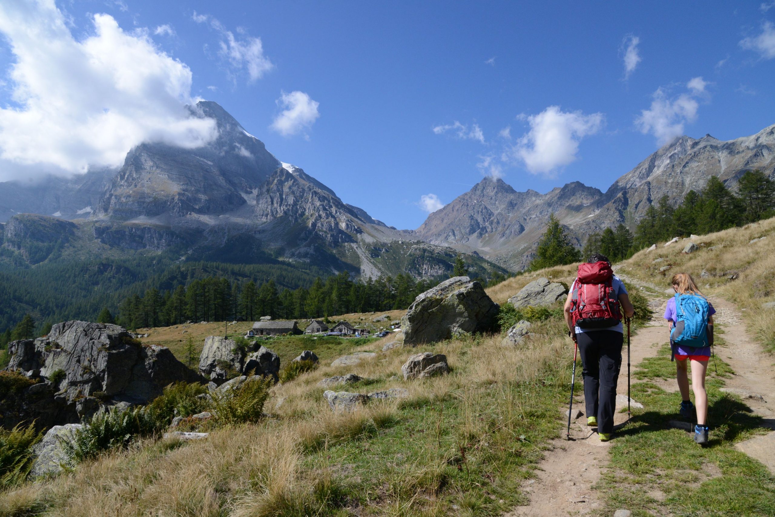
Initially, the path descends a bit and then alternates between uphill sections and flat sections with a scenic view, like a balcony overlooking the Val Cairasca below. At this point, you can clearly see the road that you will follow downhill later. The path has some sections that are not very exposed, and never really dangerous, but parents should watch exuberant little hikers carefully. There are some chains, even though they are not strictly necessary in dry weather. After a gradual start, with the path rising and falling, it becomes steeper as it passes through the rocks to overtake the first rock formation, which is also the highest point of the trail. The trail flattens out again, and then goes up again with a last stretch that leads to a view of an easily accessible hilltop with a cross planted on it. Here, you’ll enjoy the widest and most beautiful view, with Mount Leone (3552 m) in front, on the border with Switzerland. Accompanied by some panels illustrating the flora visible in the park, hikers follow a stretch of the “Sentiero dei Fiori” (Flower Trail). The path initially winds its way up and down short hills and then dives into the woods quite steeply.
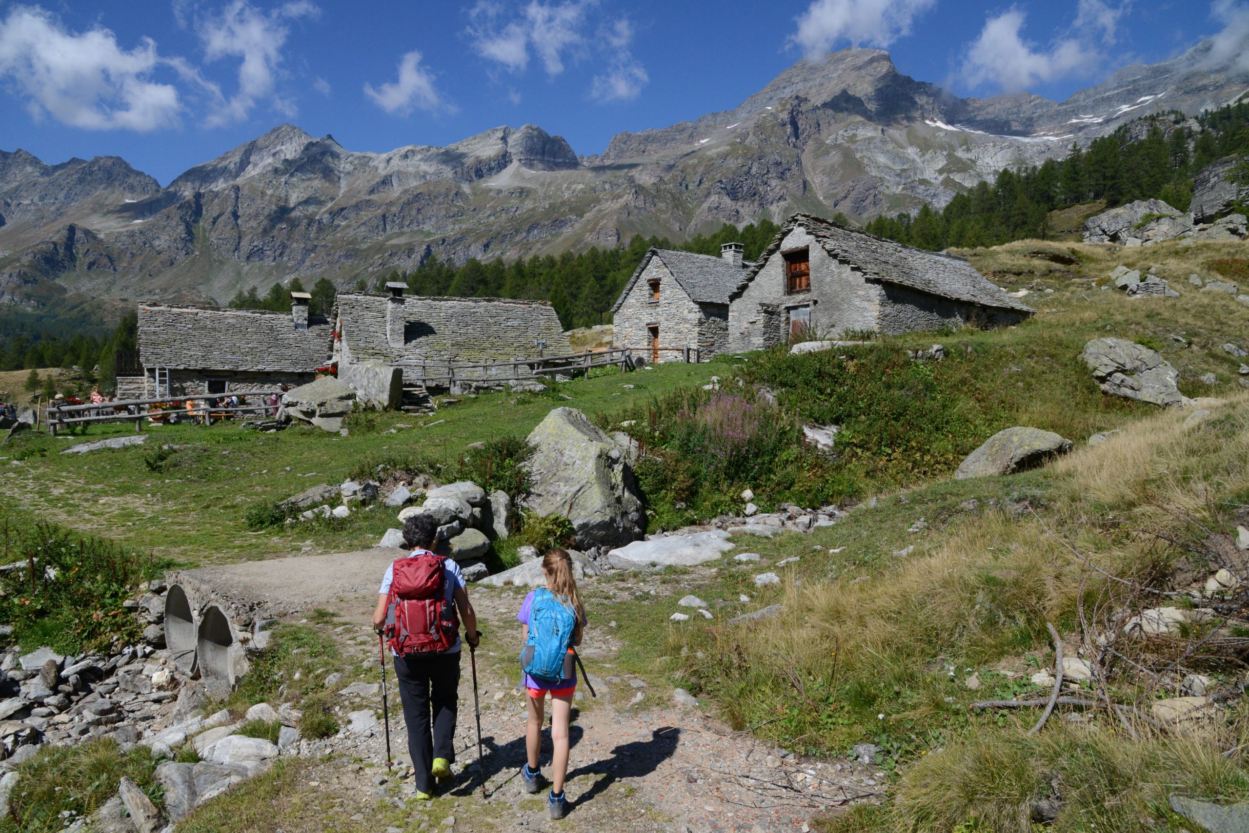
This leads to the first of the villages of Alpe Veglia: La Balma, with its beautiful houses scattered all over the meadows. After passing the ford on the Rio La Balma and the first group of houses, keep right and leave the dirt road (sign for “Alpe Veglia”). Follow the path on the right that leads through a lovely wooded stretch. Cross the Rio Frua on the wooden bridge, over a picturesque gorge, just upstream from the waterfall. You’ll reach Alpe Veglia very quickly, and come out near the CAI Refuge. A little further on, you’ll come to a hotel in Cornù (1755 m), and then descend on the dirt road below and continue to the right towards the next village (water fountain).
Always stay on the dirt road, which makes a wide curve to the left as it starts across a large, relaxing plateau, passing the Rio Mottiscia and just below the Isola mountain pasture. After crossing the Cairasca stream near the village of Ponte, it bends decisively to the left along the pleasant plateau just below the Aione mountain pasture. Just after the wide Rio delle Streghe stream, near an imposing isolated larch, there is an archaeological area. Since 1986, excavations have brought to light the remains of a nomadic camp from the Mesolithic Era (VIII-VII millennium BC) which contained artefacts in crystal and flint, such as scrapers and burins. The site is not very evident because this is a protected area and pasture land; after each excavation campaign, the original clods of earth were replaced carefully to avoid altering the landscape. Hikers will pass the pasture of Cianciavero, near the Oratory of San Giacomo, and after crossing the Rio Cianciavero, the path enters the woods again.
After having passed a farm that grows local products, the road starts to descend decisively and continuously. The view of the impressive gorge below makes the walk more pleasant. Especially after the Chapel of Groppallo (16th century), the road descends steeply with a few hairpin bends. Once you are almost on flat ground, you can shorten the route by taking the path to the left just after the barrier that limits access to the dirt road. It is marked by a sign, and cuts across the wide curve, leading directly to Ponte Campo, the bridge over the Cairasca stream. A final stretch on asphalt, uphill, brings you back to San Domenico, and concludes this itinerary.
Tips for young hikers
This is a fairly long hike, recommended for its beautiful landscape, but only suitable for older children because of the slightly exposed stretches after Alpe Ciamporino.
It is unsuitable for backpack child carriers.
Trail creators: Franco Voglino, Annalisa Porporato and Nora Voglino
Content authors: Franco Voglino and Annalisa Porporato
Back to the list of routes