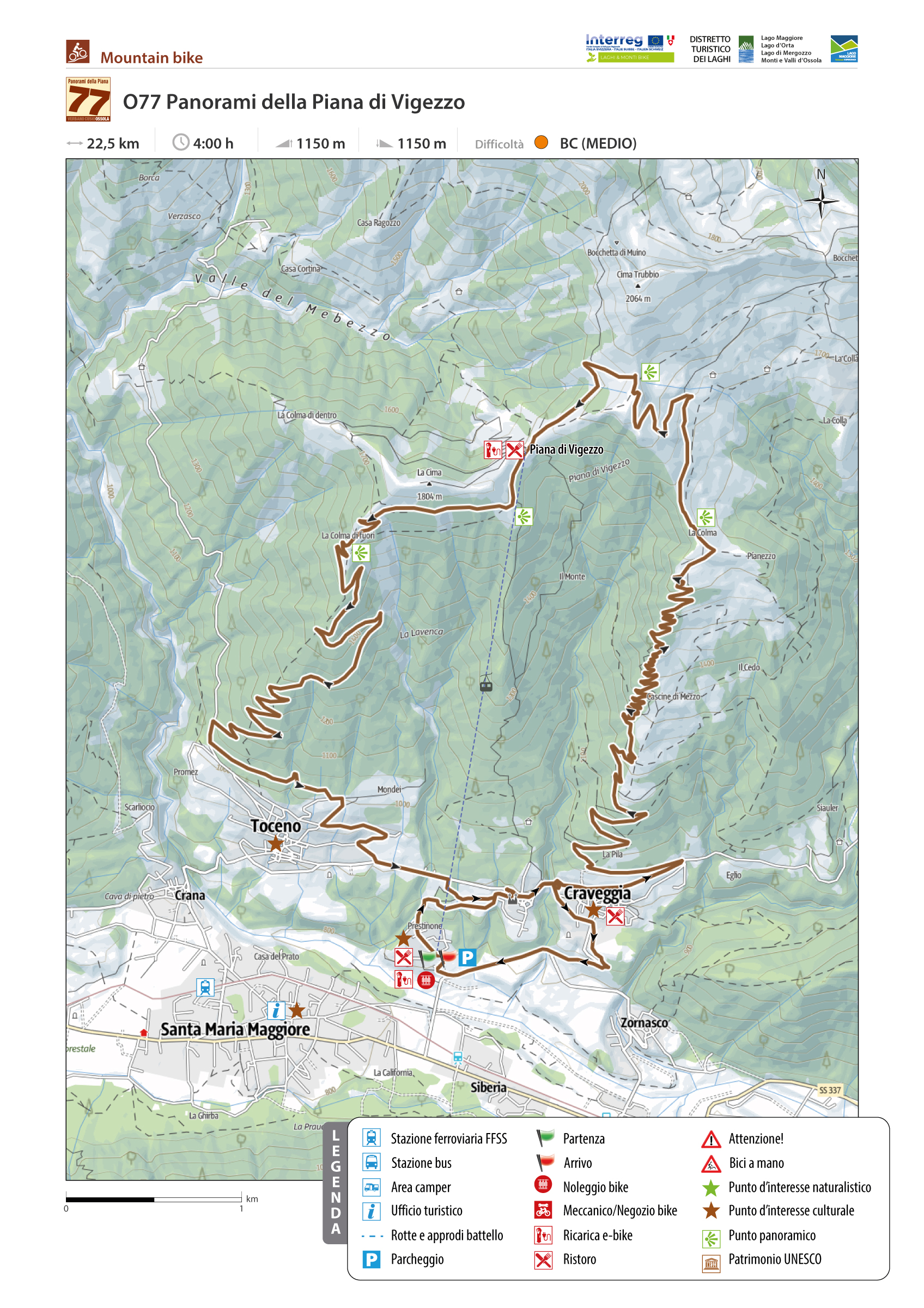
PANORAMAS OF PIANA DI VIGEZZO
Valle Vigezzo
Route description
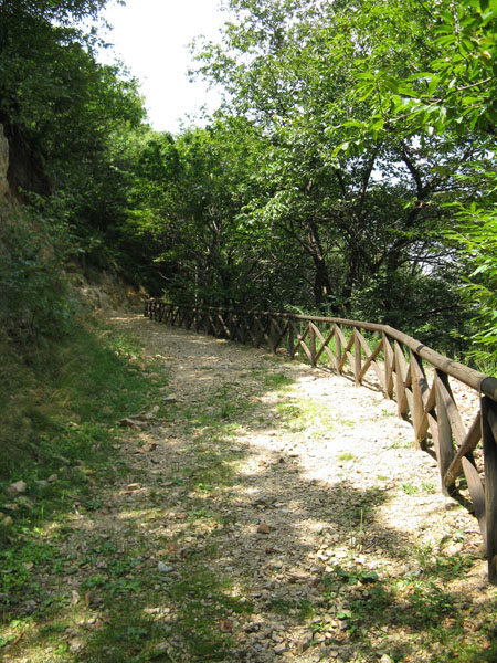
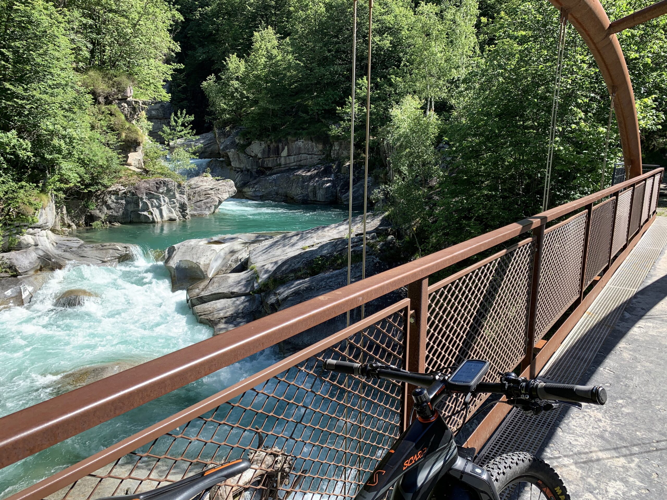
Two dirt roads that connect the municipalities of Toceno and Craveggia to the Piana di Vigezzo allow for a ring of more than 20 km unique and unmissable for its fantastic landscapes and views.
Starting point of the route is the Piana di Vigezzo cable car station in Prestinone, which is equipped with parking, toilets, and an e-bike rental point.
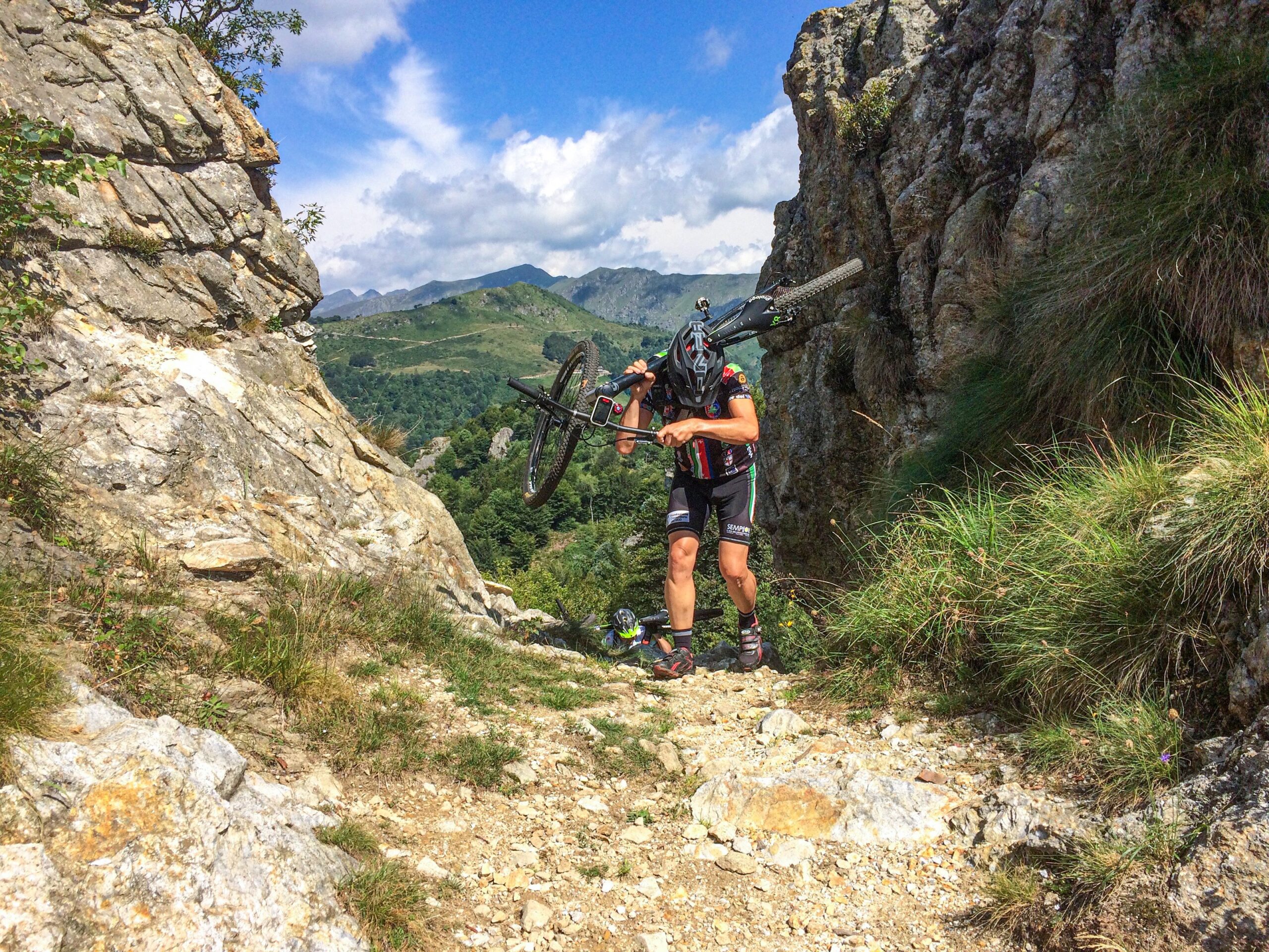
Back to the list of routes
VAL GRANDE NATIONAL PARK. ALPE PARPINASCA
Valle Vigezzo
Route description
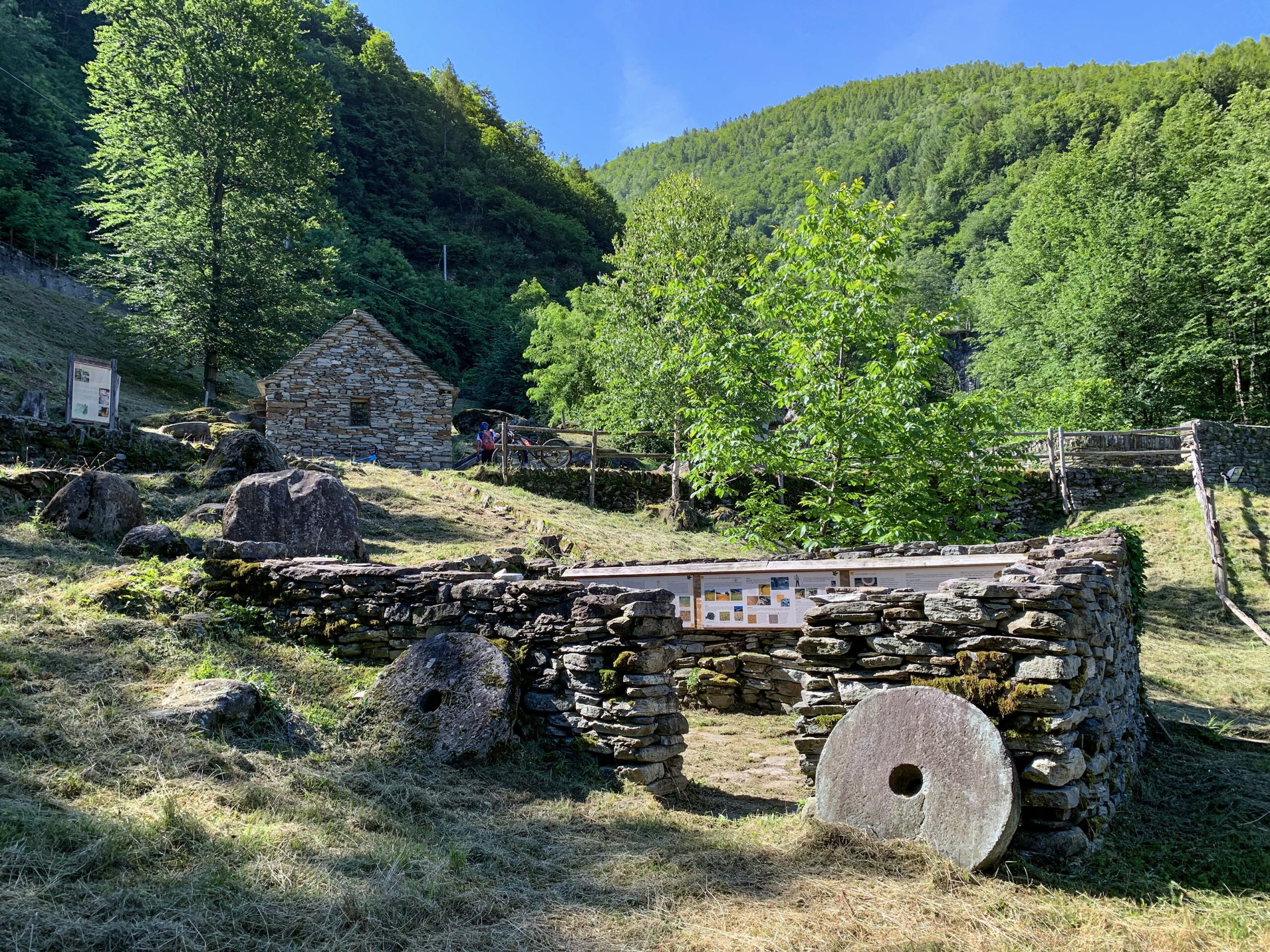
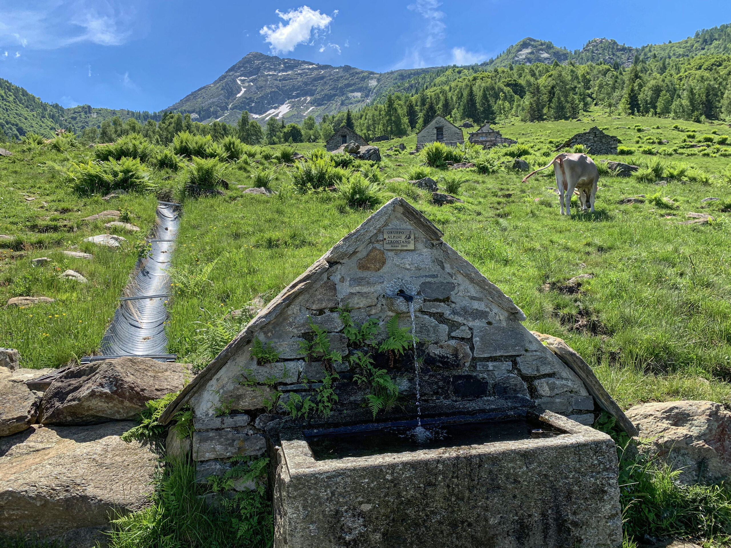
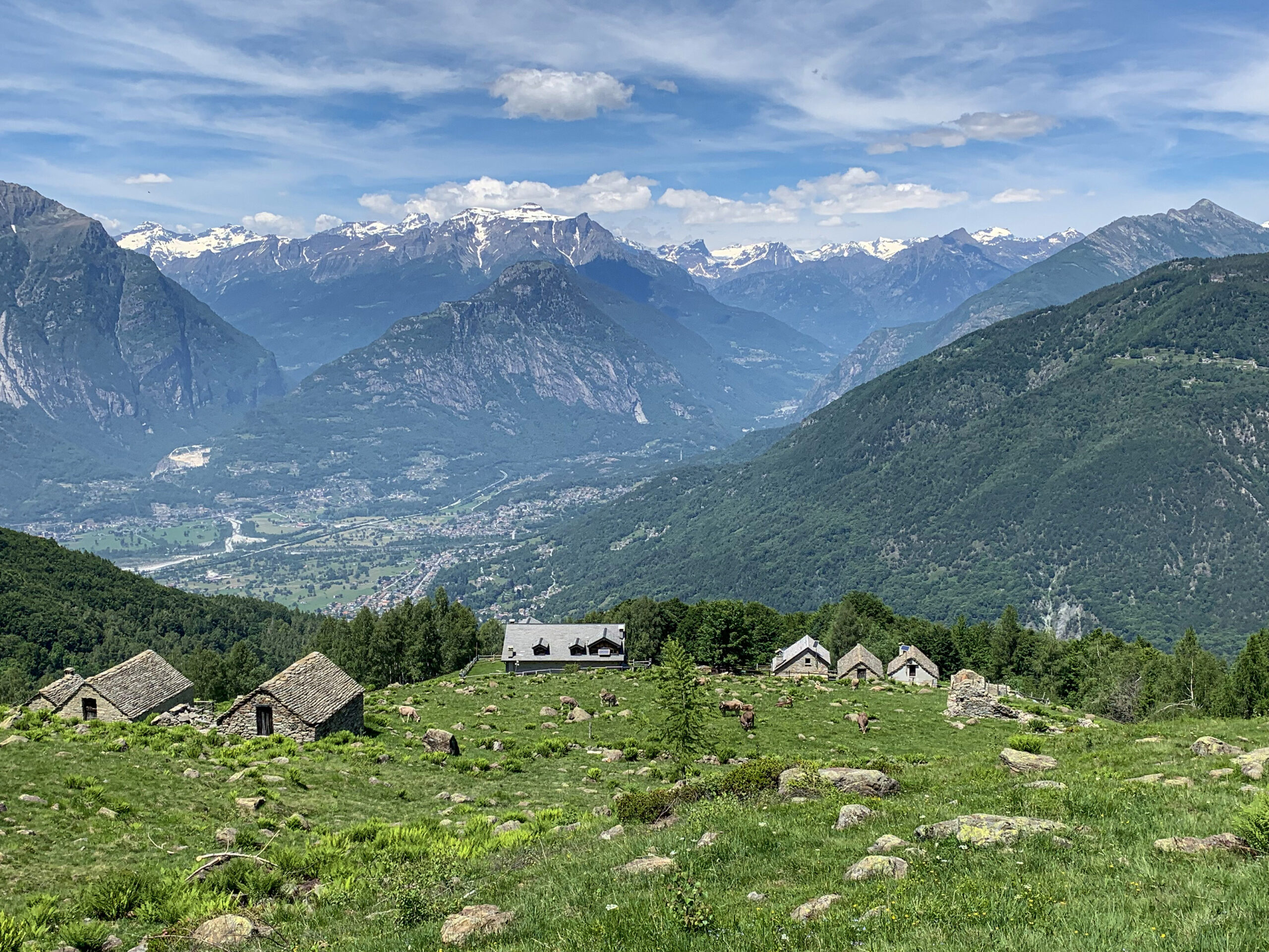
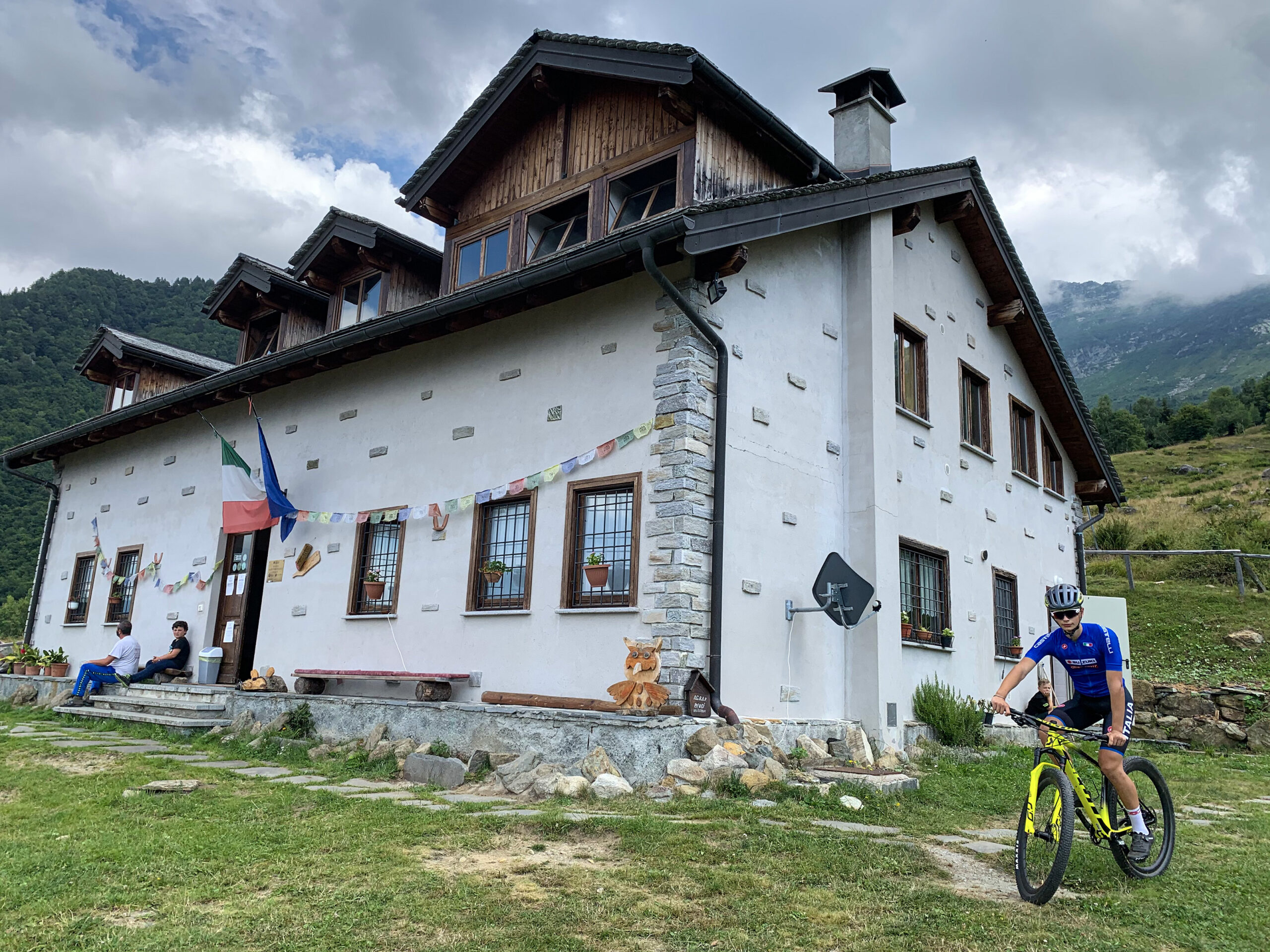
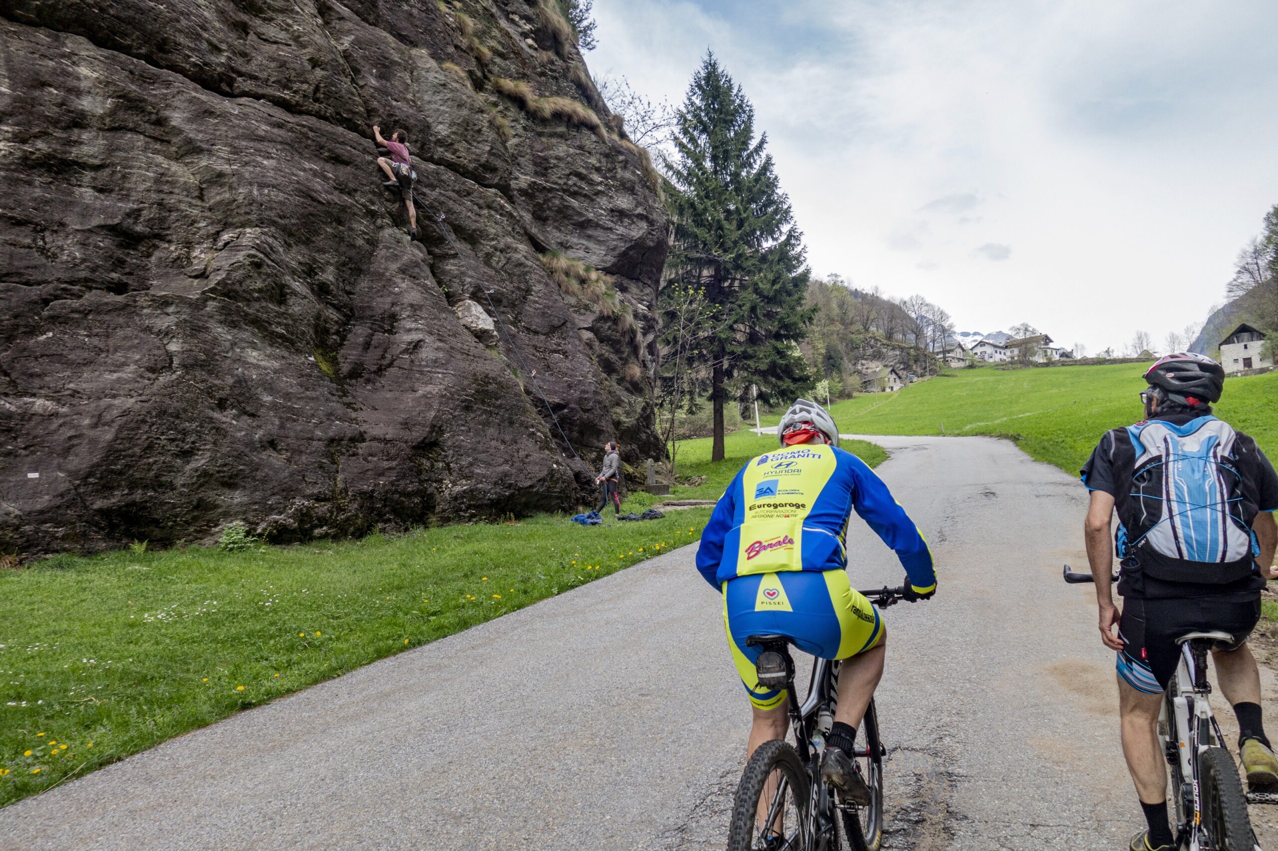
Pedaling through vineyards and mills, it is the classic out-of-town trip. This is how one can define the route from Domodossola to Alpe Parpinasca, where the refuge of the same name owned by the Val Grande National Park is located.
Back to the list of routes
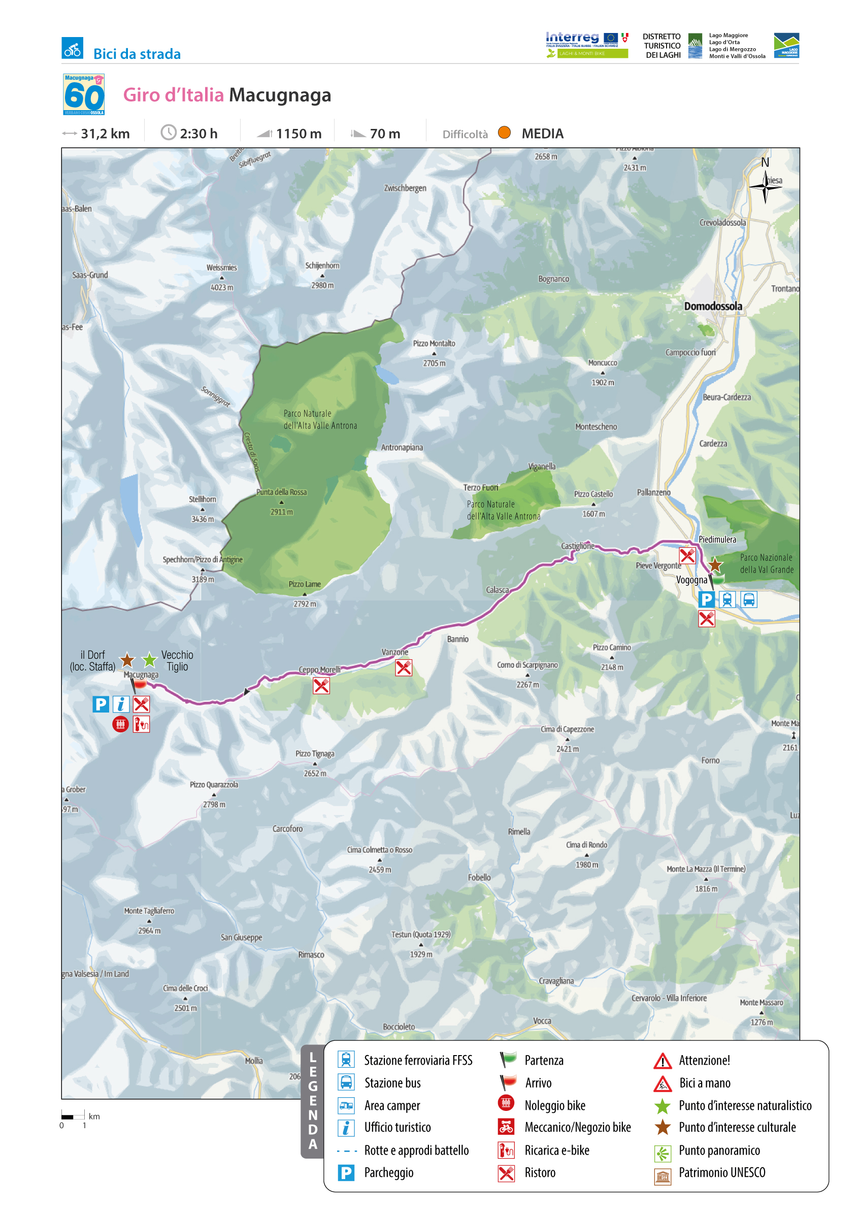
GIRO D’ITALIA: MACUGNAGA
Valle Anzasca
Route description
The ascent to the foot of His Majesty Monte Rosa begins in Vogogna, the ancient capital of the Ossola Inferiore overlooked by the Visconti castle and where the Val Grande National Park Authority is headquartered.
Shortly after departing from the Vogogna Town Hall, one encounters an interesting historical relic: a rock and a stele complete with an eagle that testifies to the presence of a Roman tombstone from 196 AD and the memory of Geo Chavez, the first transfer of the Alps.
Next, there is a double-curve railway underpass with a left turn onto the Masone Bridge over the Toce River, dated 1810.
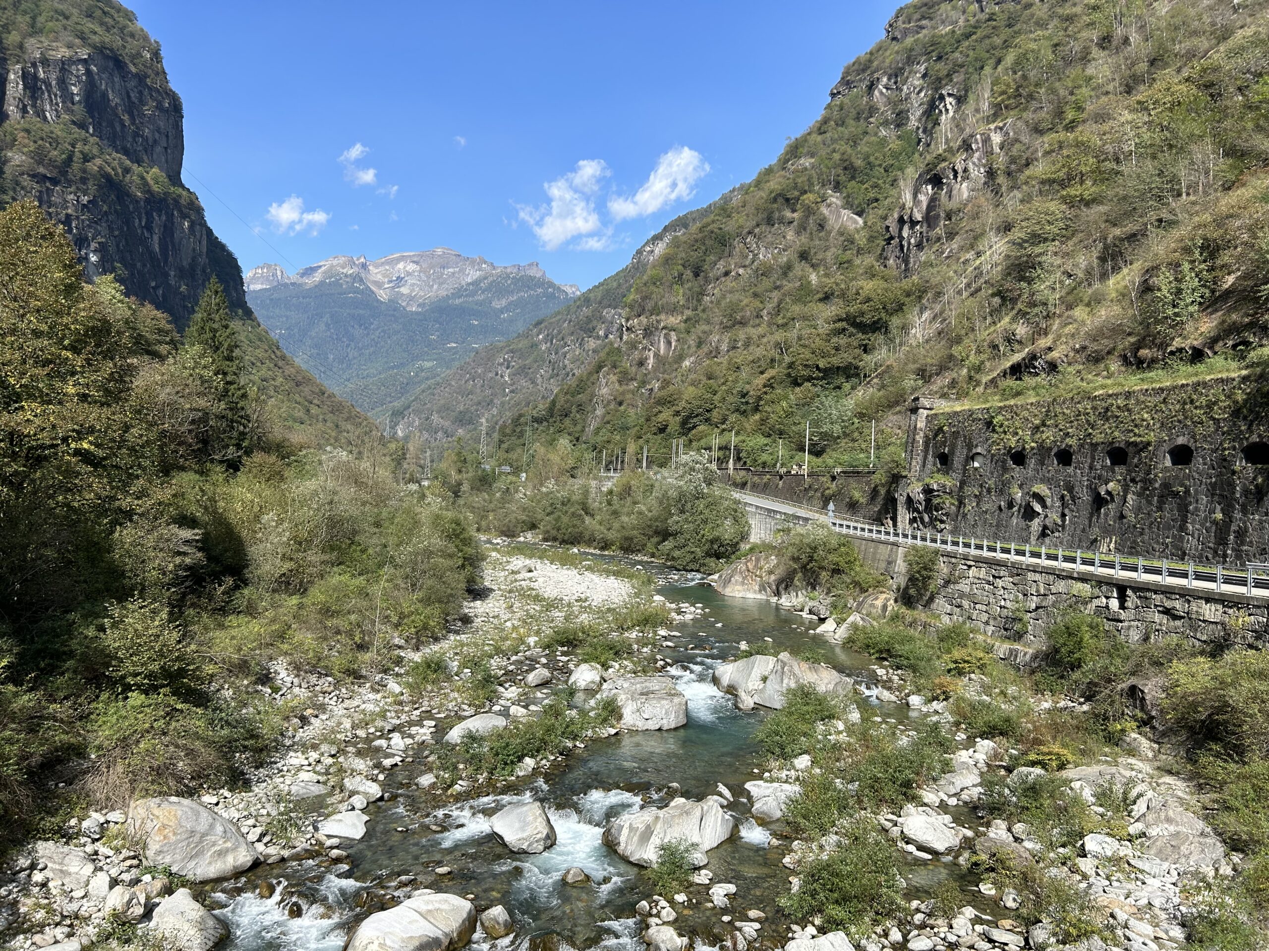
Highway underpass, traffic circle, second exit towards Piedimulera, another traffic circle, then straight ahead following the course of the Anza stream, which gives its name to the Anzasca Valley, until you reach the foot of the climb proper, reaching Macugnaga, the “Pearl of Monte Rosa”.
Back to the list of routes
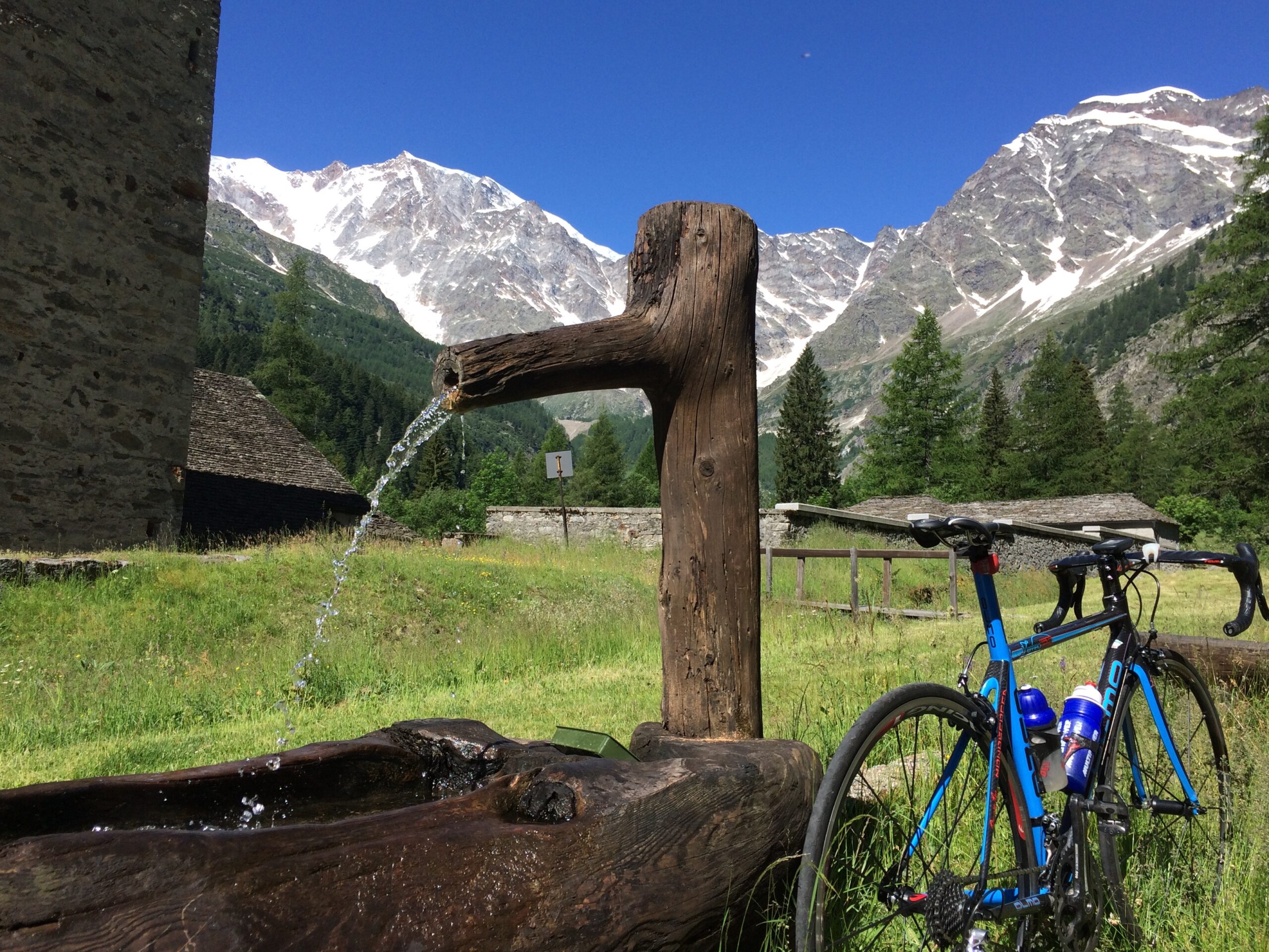
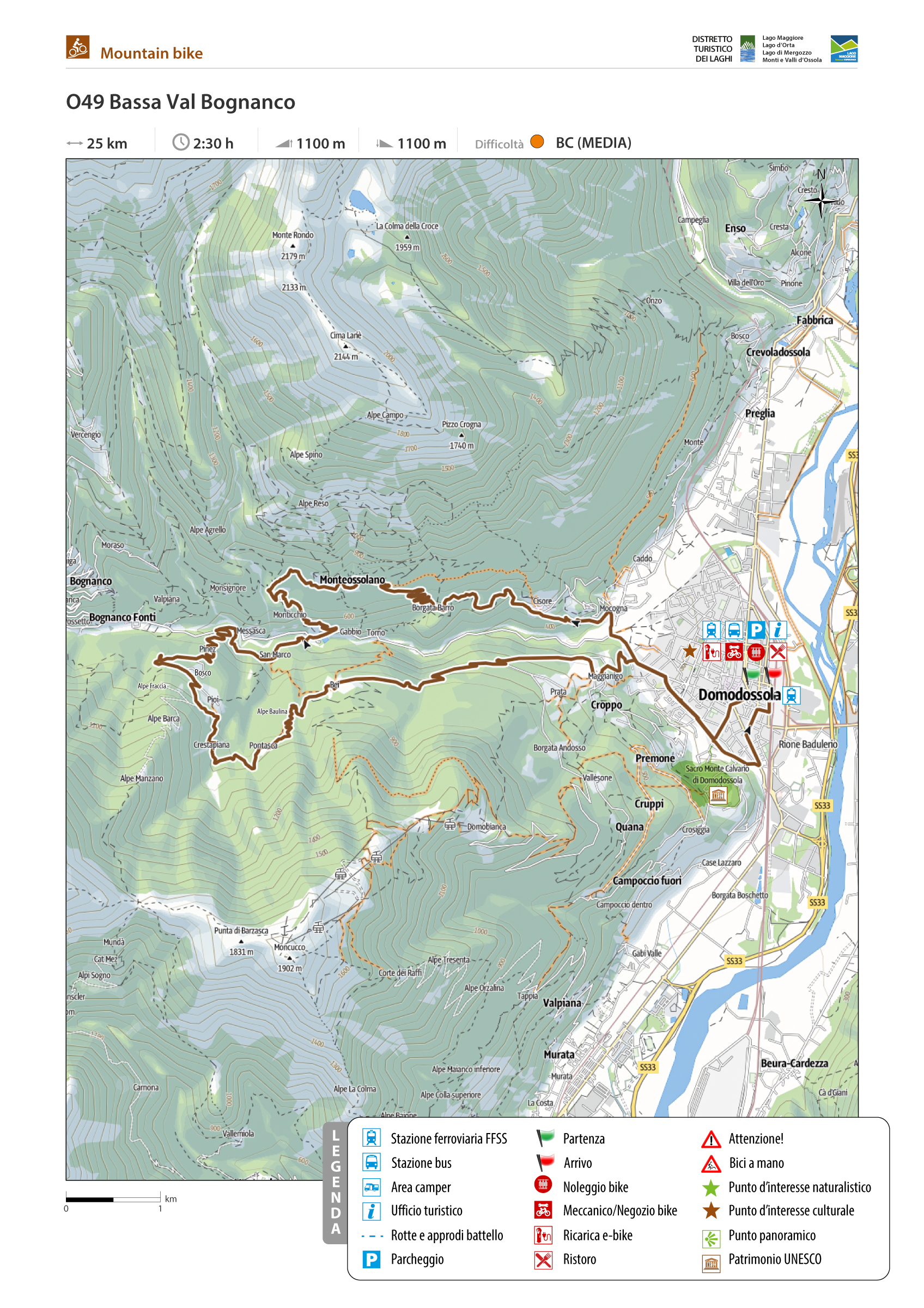
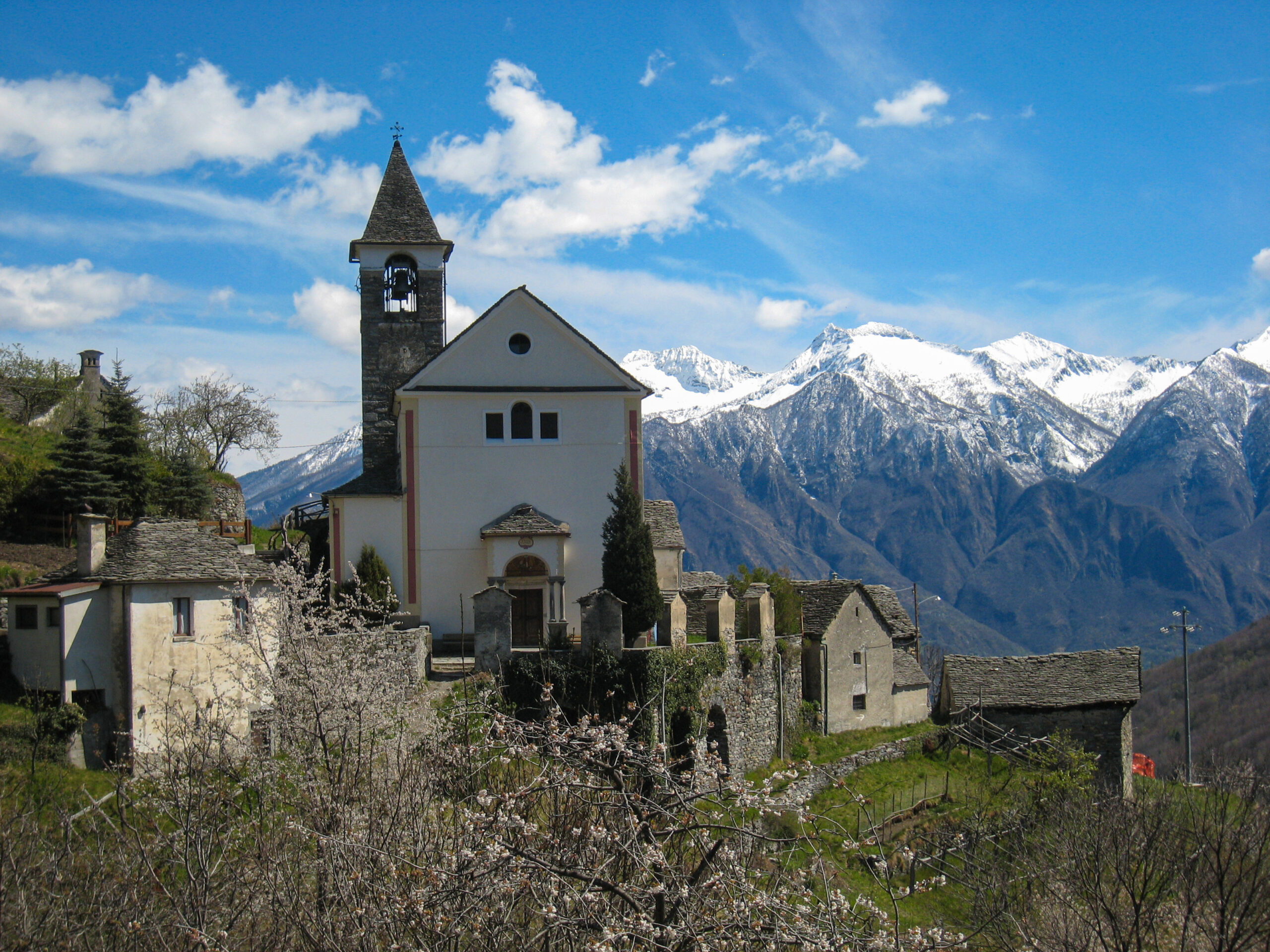
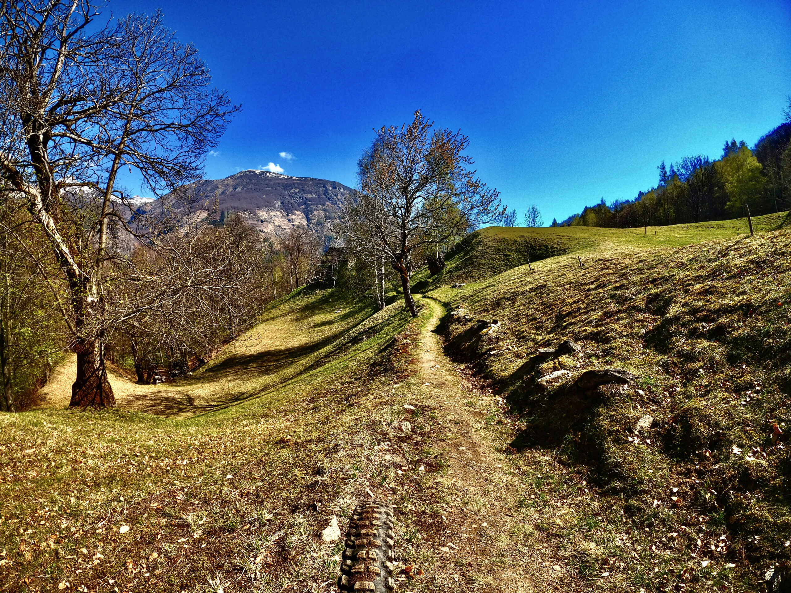
BASSA VAL BOGNANCO
Valle Bognanco
Route description
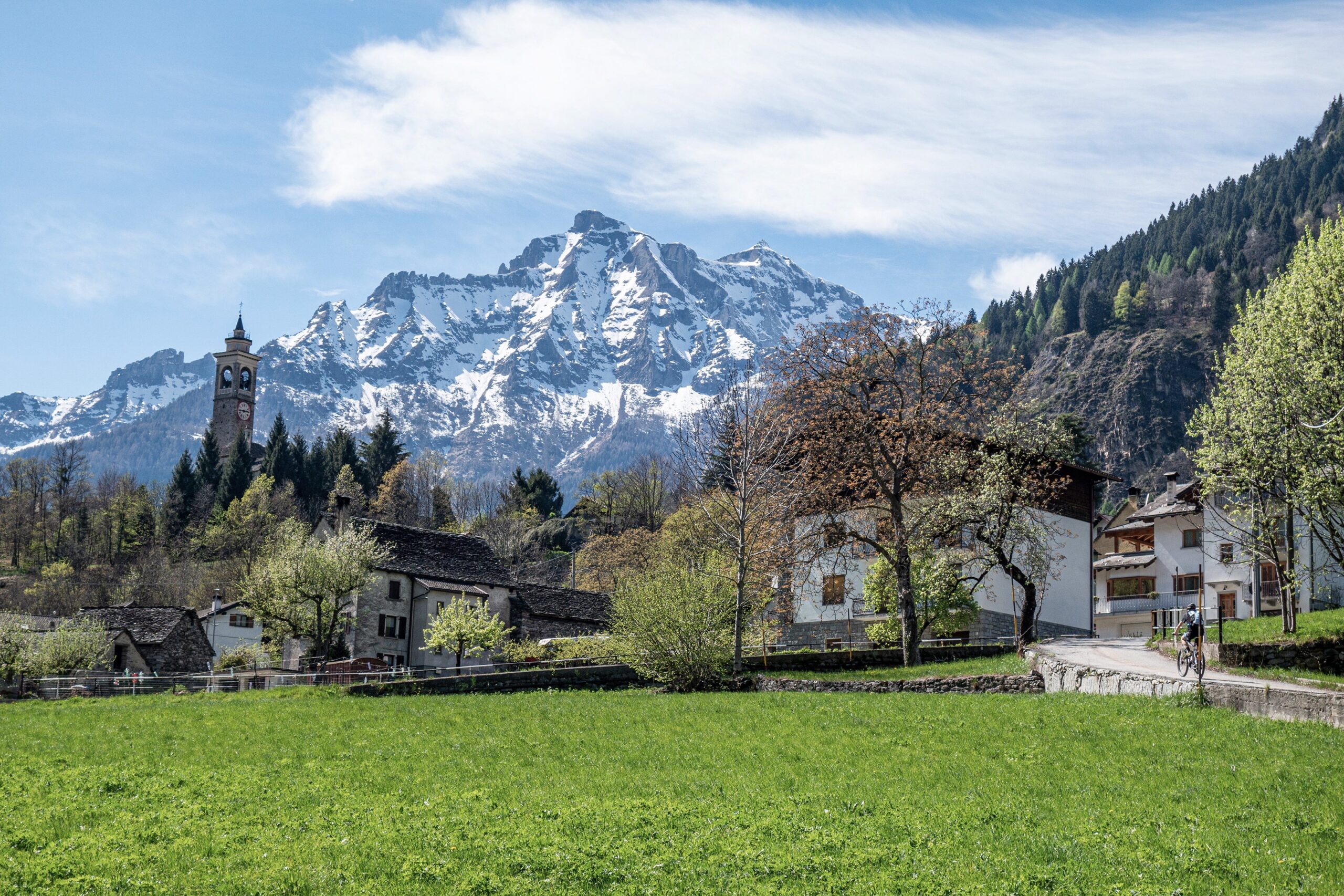
The loop itinerary starts from Domodossola and includes discovering the rural hamlets of the lower Bognanco Valley. The history of human settlements on the Piedmont strip tells the collective adventure of small rural communities constantly engaged in an arduous struggle against the roughness and harshness of the mountains. It is a fascinating story because it is so far removed from us, and it skilfully shapes the land by creating possibilities for life in an environment dominated by vertical coordinates.
Back to the list of routes
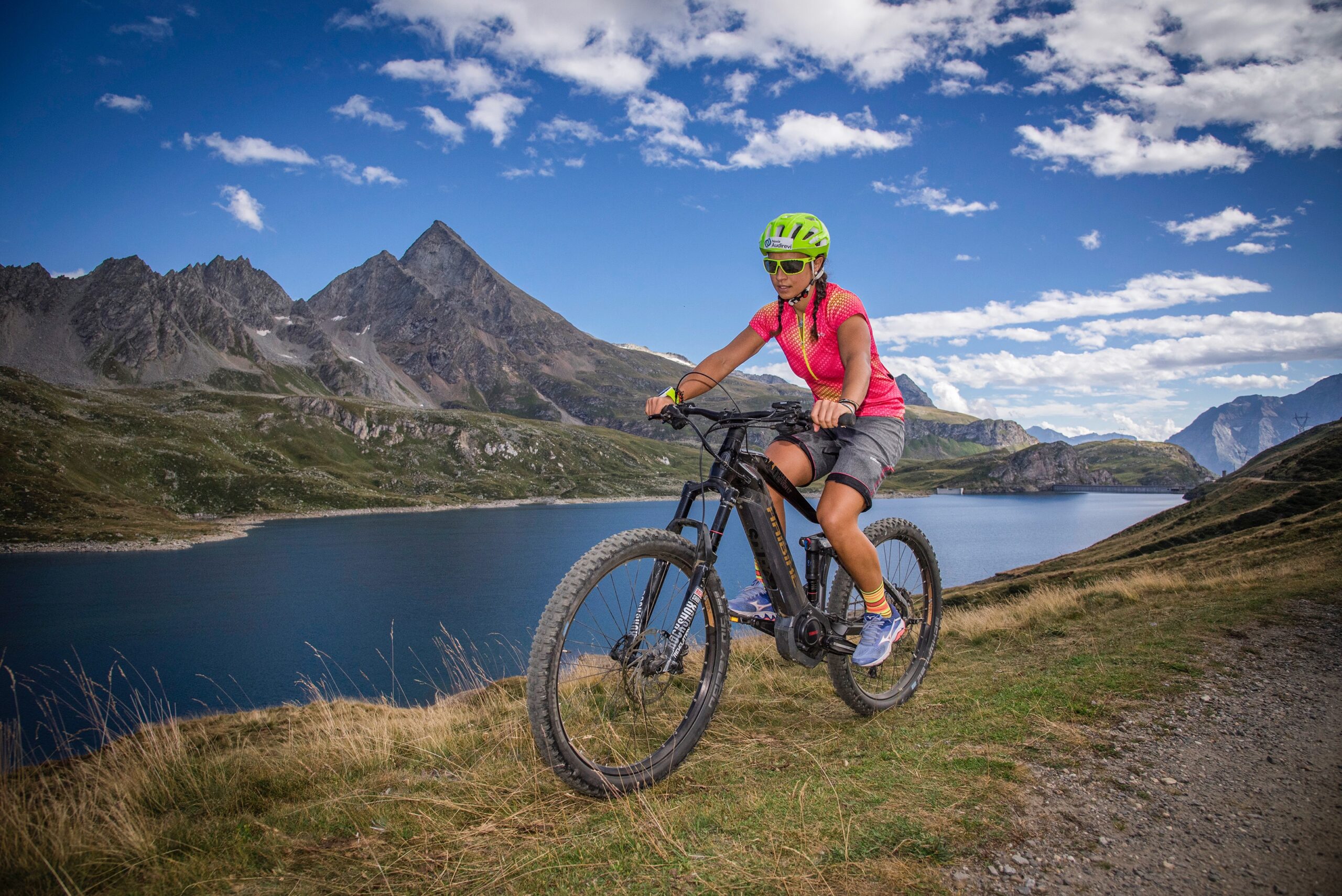
The climb made famous by Women Cyclists
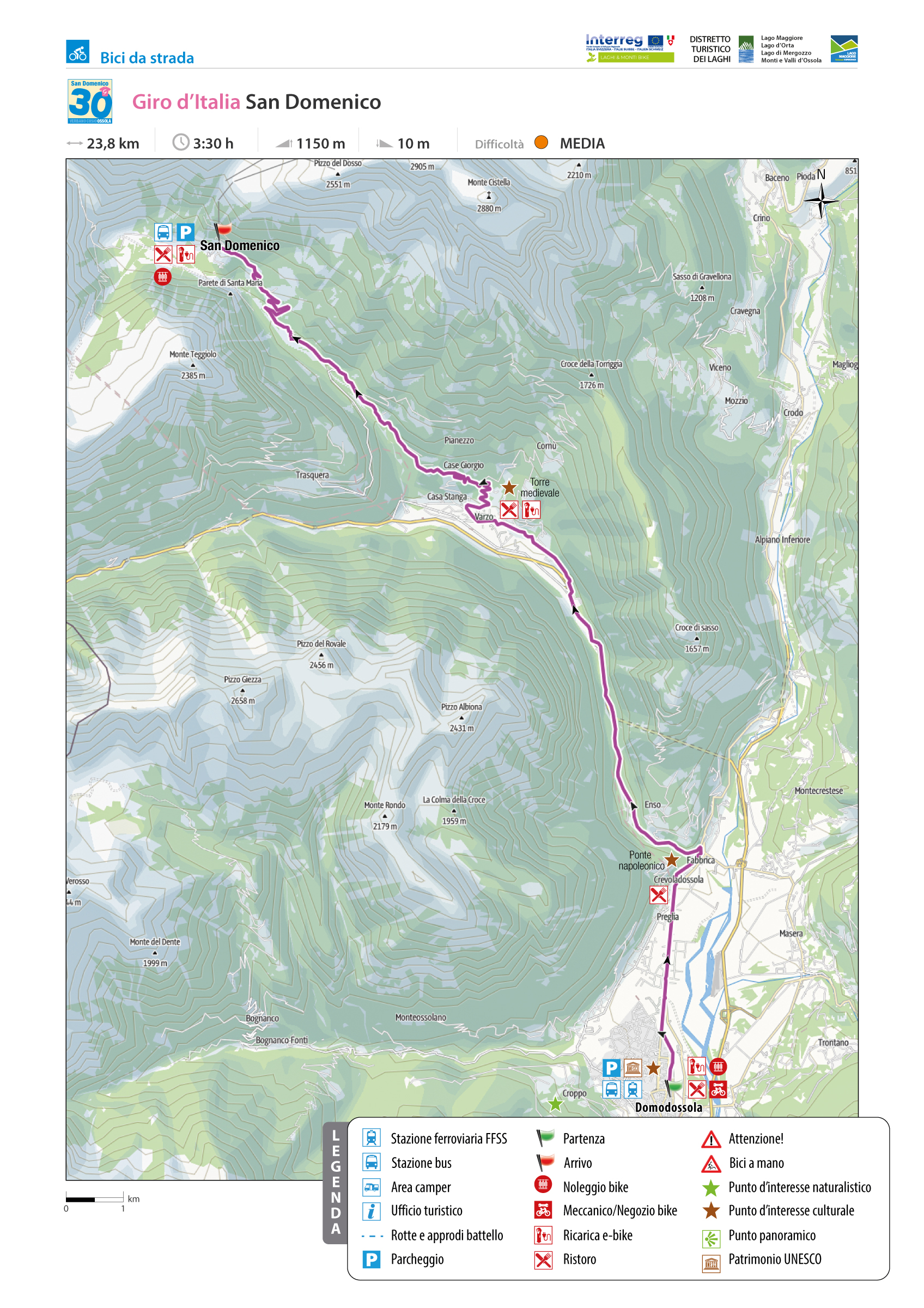
GIRO D’ITALIA: SAN DOMENICO
Valle Divedro
Route description
Thanks to the stage finish in no less than 4 editions of the women’s Giro d’Italia (2013, 2014, 2015 and 2019), this climb has risen to international headlines.
San Domenico, thanks in part to the nearby Simplon Pass (at an elevation of 2005 m.a.s.l.) and its excellent hotel infrastructure, has for the past few years become a coveted training site for some of the world’s top professional cyclists.
Between Domodossola and Varzo there is the first section up to the Napoleonic bridge at Crevoladossola and leading to the junction between the Divedro Valley and the Antigorio Valley: difficult, but not prohibitive. The same is true from the exit of the old SS 33 until the arrival in Varzo.
The real climb, however, is the one starting from the Divedro Valley capital, which should not be underestimated, despite the fact that the elevation gain appears to be not excessive.
Back to the list of routes
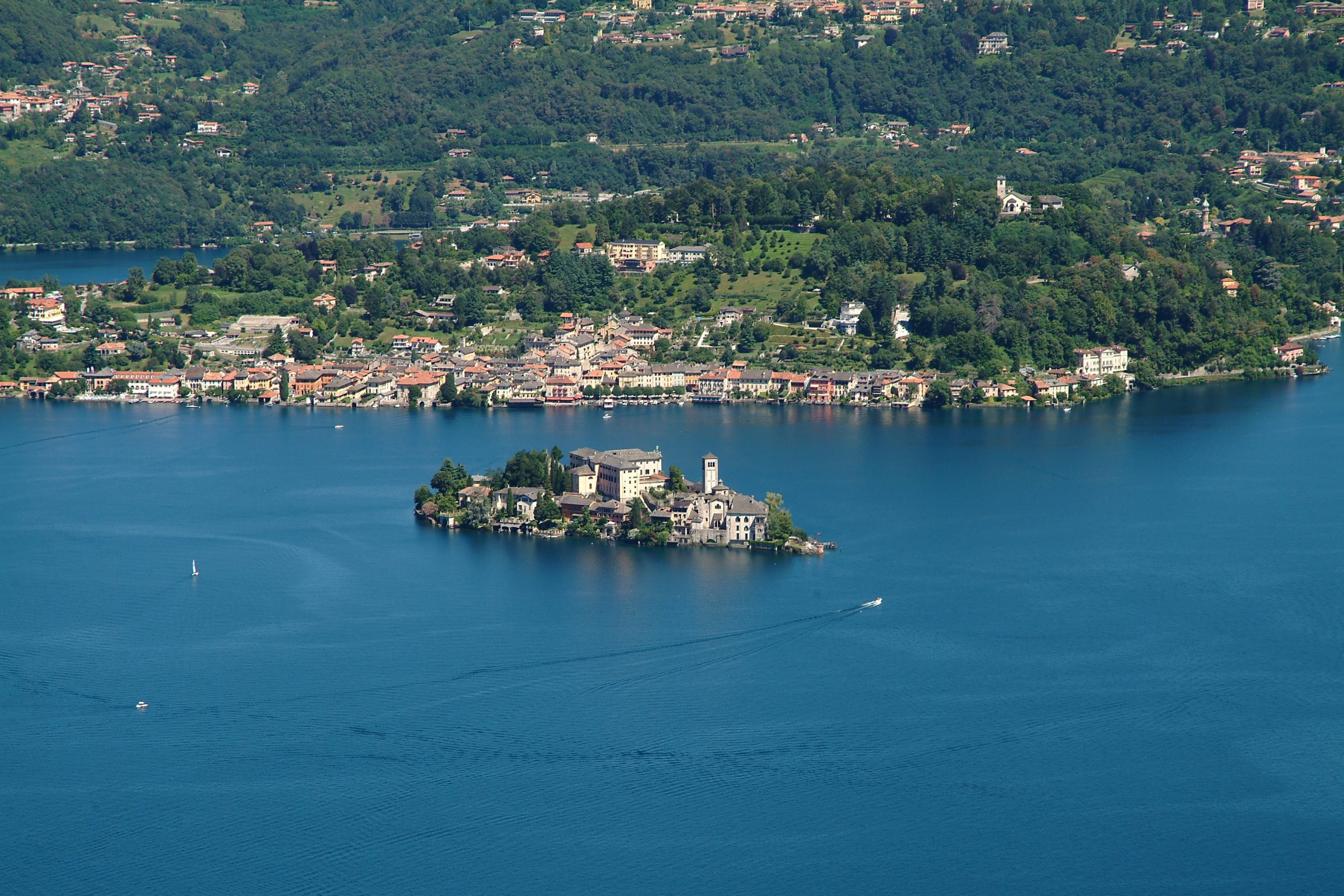
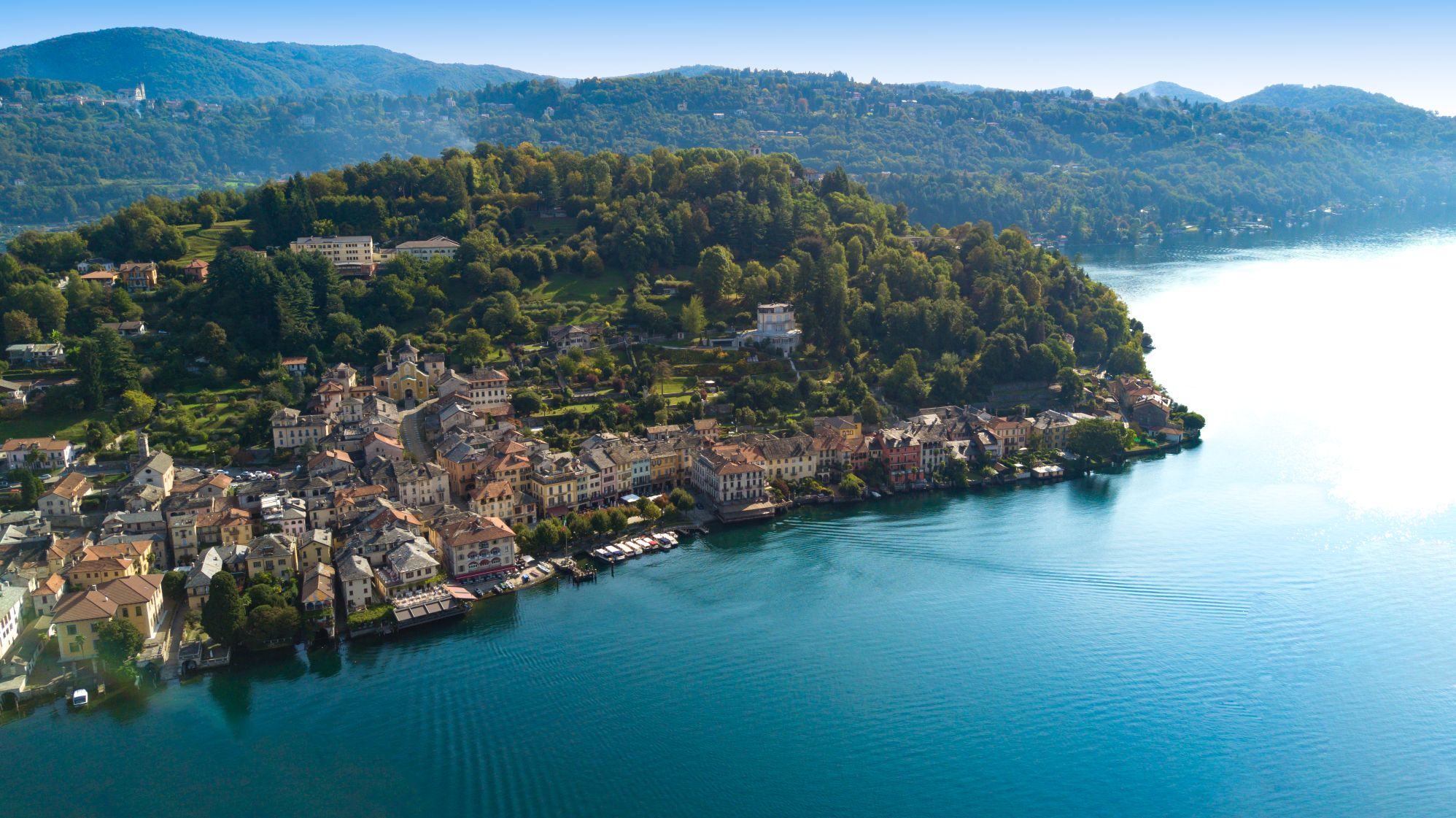
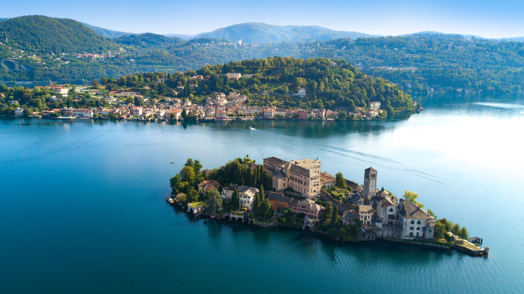
ALONG THE LAKE THAT INSPIRED GIANNI RODARI AND PIERO CHIARA
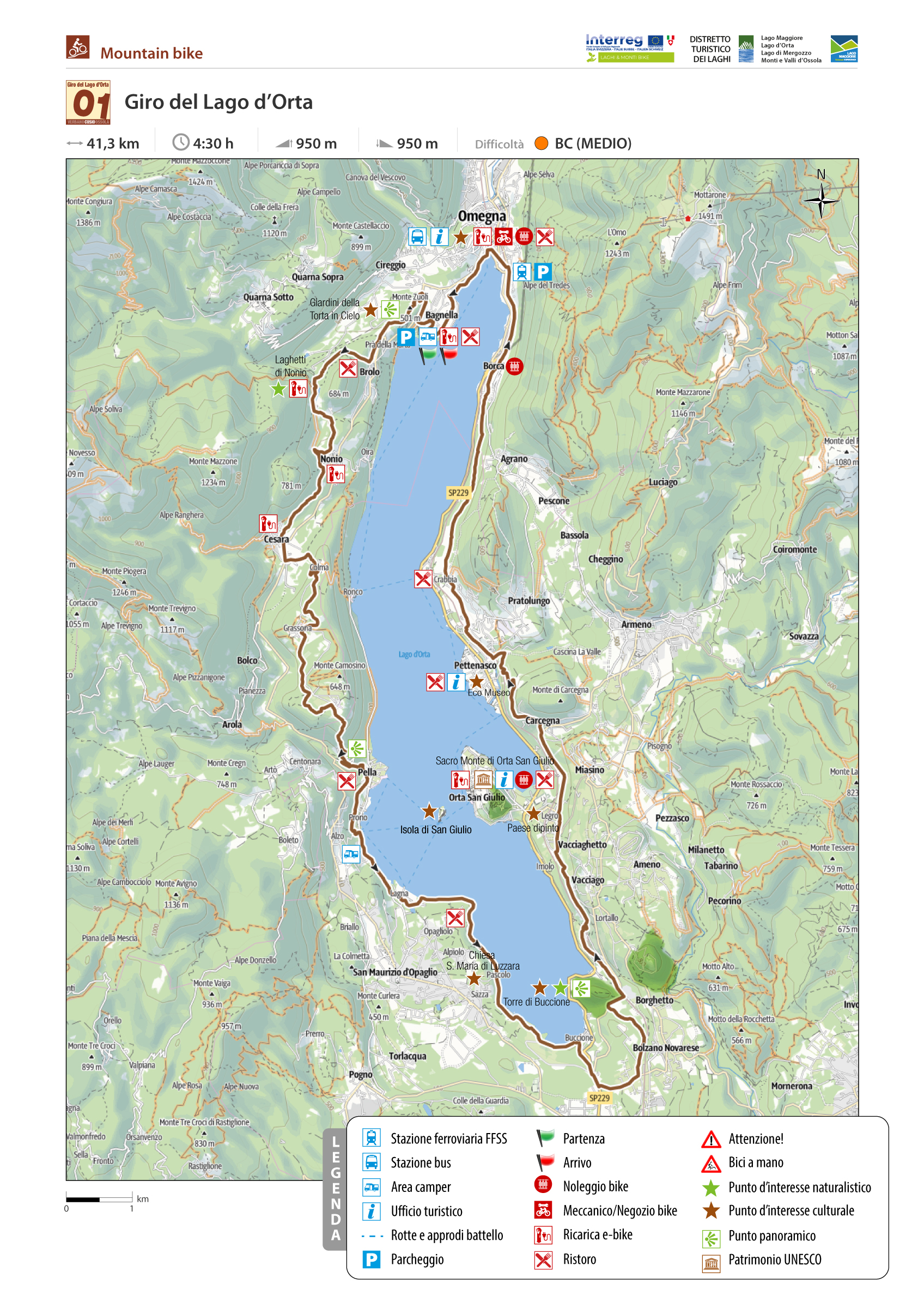
CIRCLE ROUTE OF LAKE ORTA MTB
Lago d’Orta
Route description
Besides the famous hiking “blue ring,” Lake Orta boasts a “green ring” for mountain bikers, muscle, and assisted. It is a year-round trail without snow (an increasingly rare natural element!). In every season, it presents a unique and striking appearance.
The direction is anti-clockwise, from north to southwest, which is less challenging.
Back to the list of routes
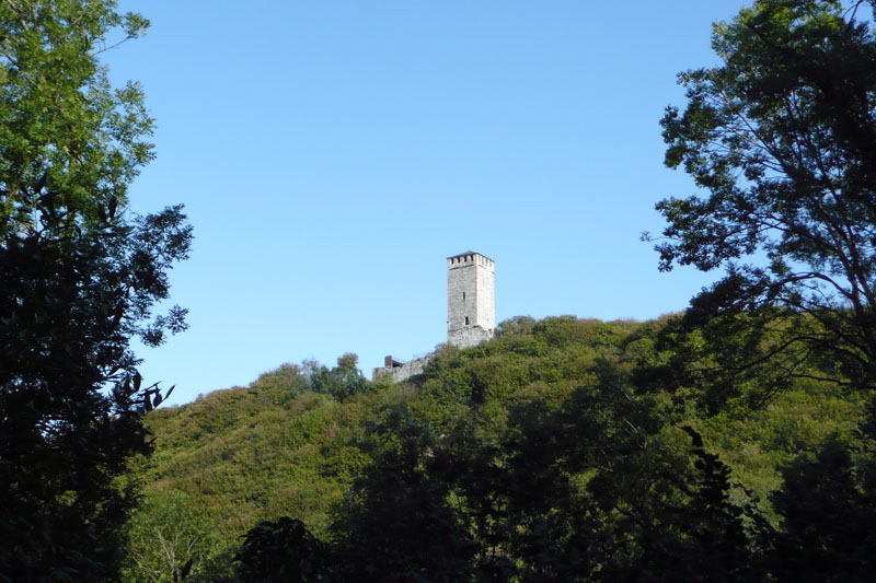
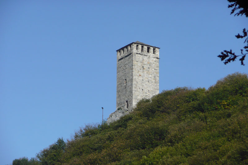
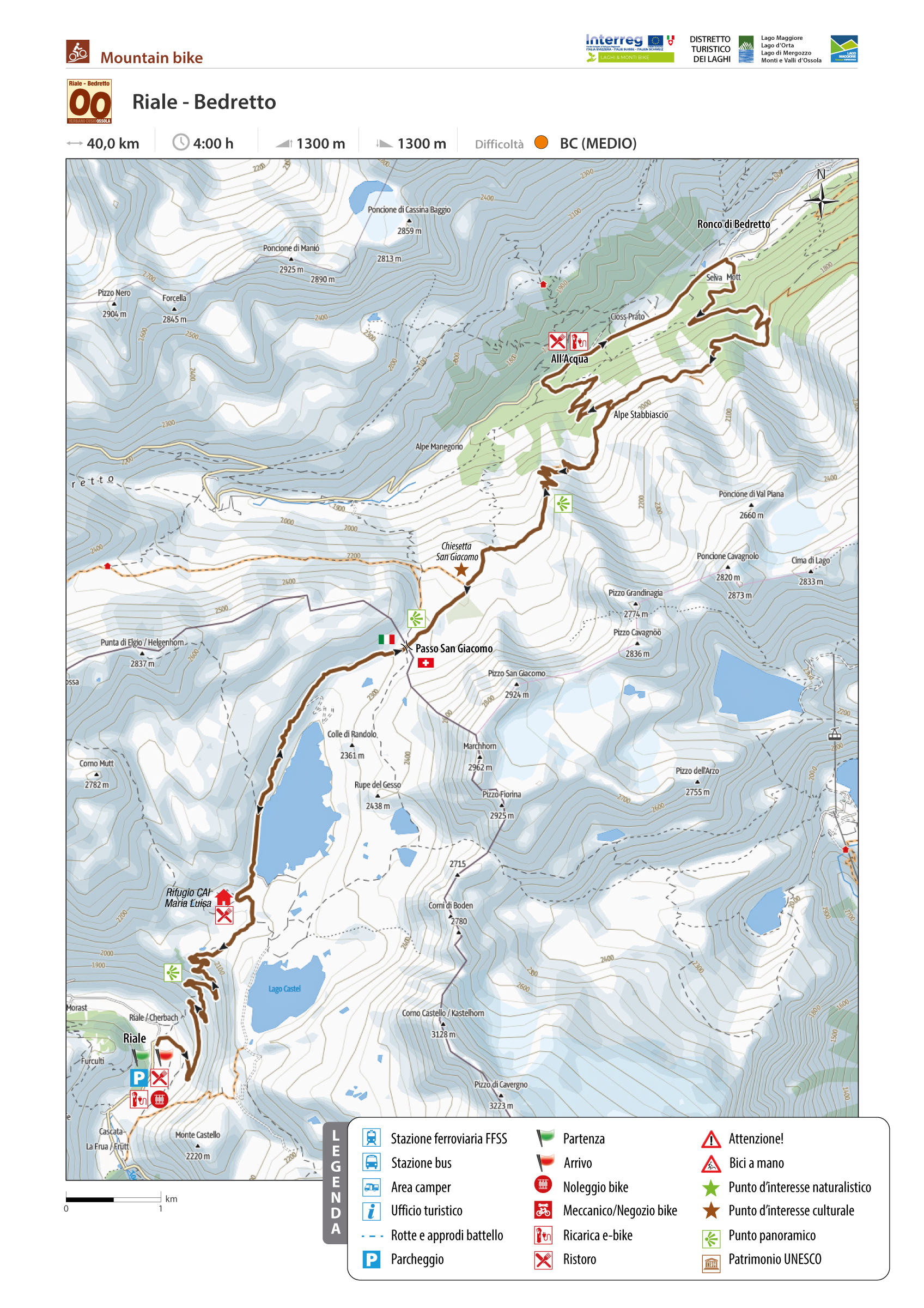
BEAUTIFUL HIKE BETWEEN FORMAZZA VALLEY AND BEDRETTO VALLEY
RIALE – PASSO SAN GIACOMO – BEDRETTO (CH)
Valle Formazza
Route description
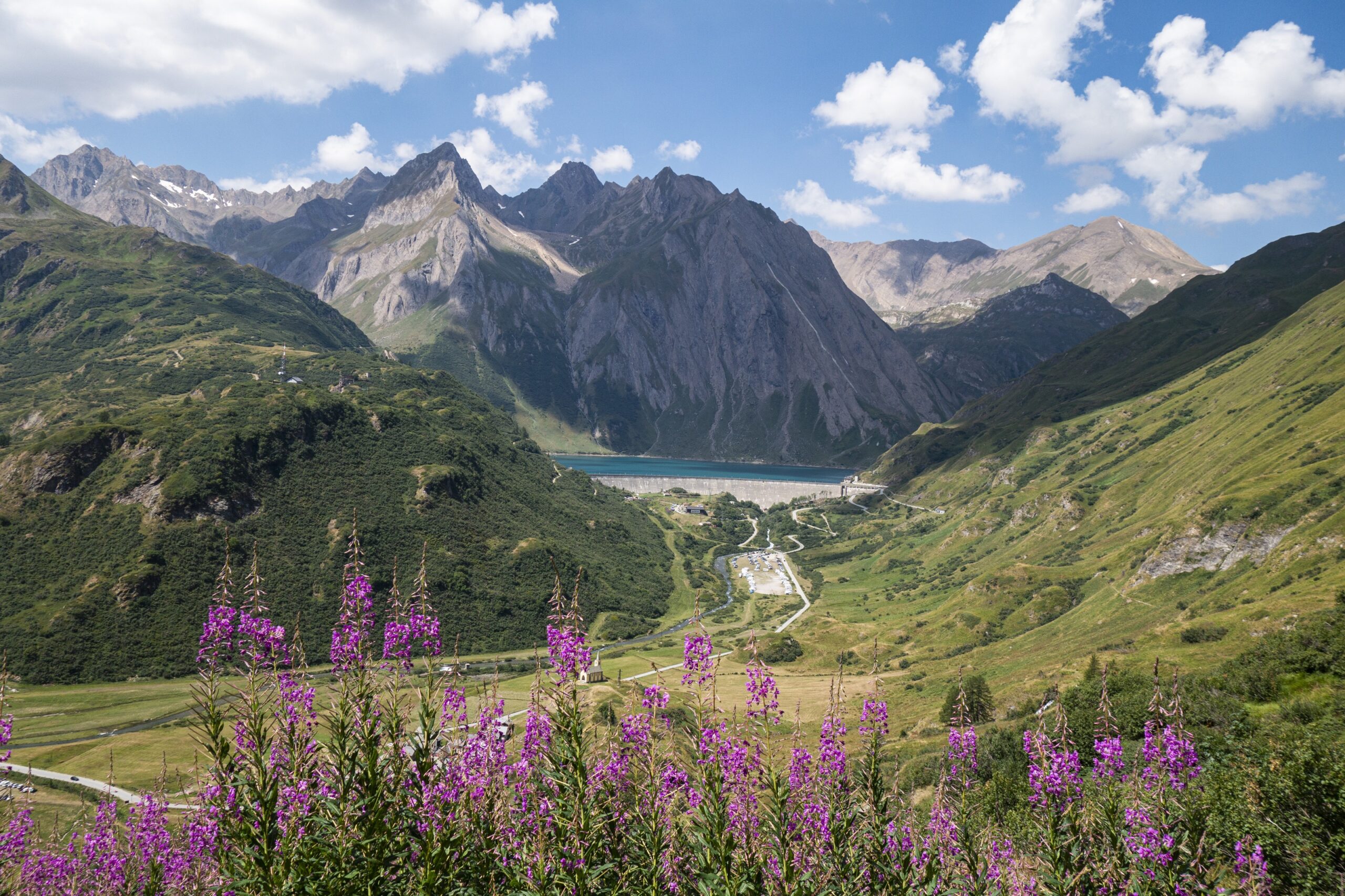
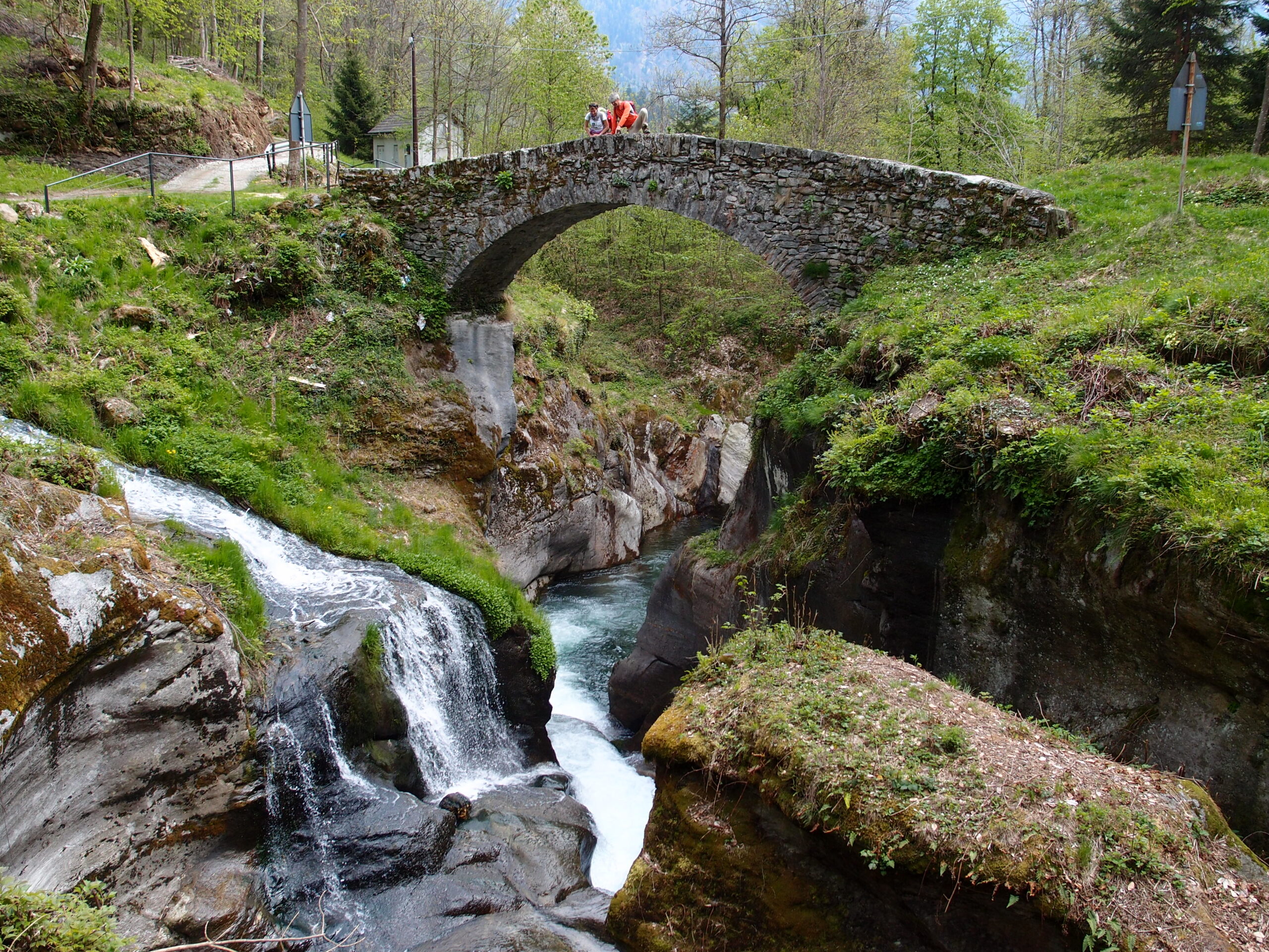
Beautiful hike straddling the border between Val Formazza and Val Bedretto across the San Giacomo Pass, the ancient “Mountain of Valdolgia,” which, because of its easy access, was a crucial direct trade route between Milan, Gotthard, and the Grisons for centuries.
The route begins in Riale, in the upper Formazza Valley, at the Centro del Fondo (Aalts Dorf hotel). We cross the Toce River on the small bridge and begin to climb along the beautiful dirt road of the San Giacomo Pass, built in the 1920s to serve the construction of the Toggia and Castel dams: the road is a true masterpiece, with low gradients and hairpin bends with perfect lines. At the end of the hairpin turns and the uphill section, the Maria Luisa Refuge is reached, then the Toggia Lake Dam. From here, the road continues at a very weak gradient, skirting the entire lake on a midslope. Ignoring the fork for Alpe Regina, where Bettelmatt cheese is produced, we continue until reaching Passo San Giacomo, where the dirt road ends. Another hundred meters or so uphill, and we reach the cross from which we can look out over the Bedretto Valley and the Gotthard area.
Back to the list of routes
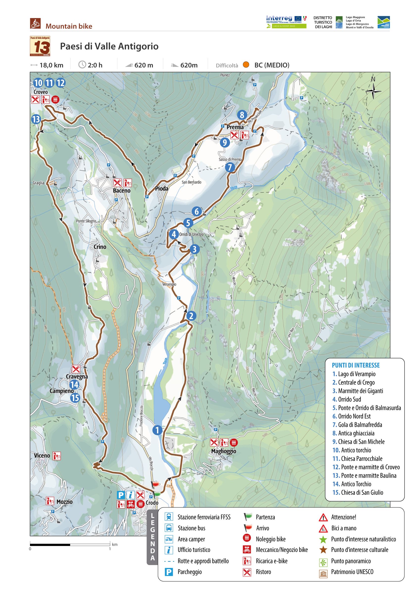
DISCOVERING BACENO, CRODO AND PREMIA
THE VILLAGES OF ANTIGORIO VALLEY
Valle Antigorio
Route description
Loop itinerary on beautiful mule tracks, trails, and stretches of low-traffic paved roads to discover the three villages of the Antigorio Valley: Baceno, Crodo, and Premia, with their hamlets. It also crosses the entire fascinating area of the “Glacial Garden of the Orridi di Uriezzo” consisting of gorges and potholes carved out by the ancient system of streams that flowed at the bottom of the glacier that anciently crossed the Antigorio Valley.
Back to the list of routes
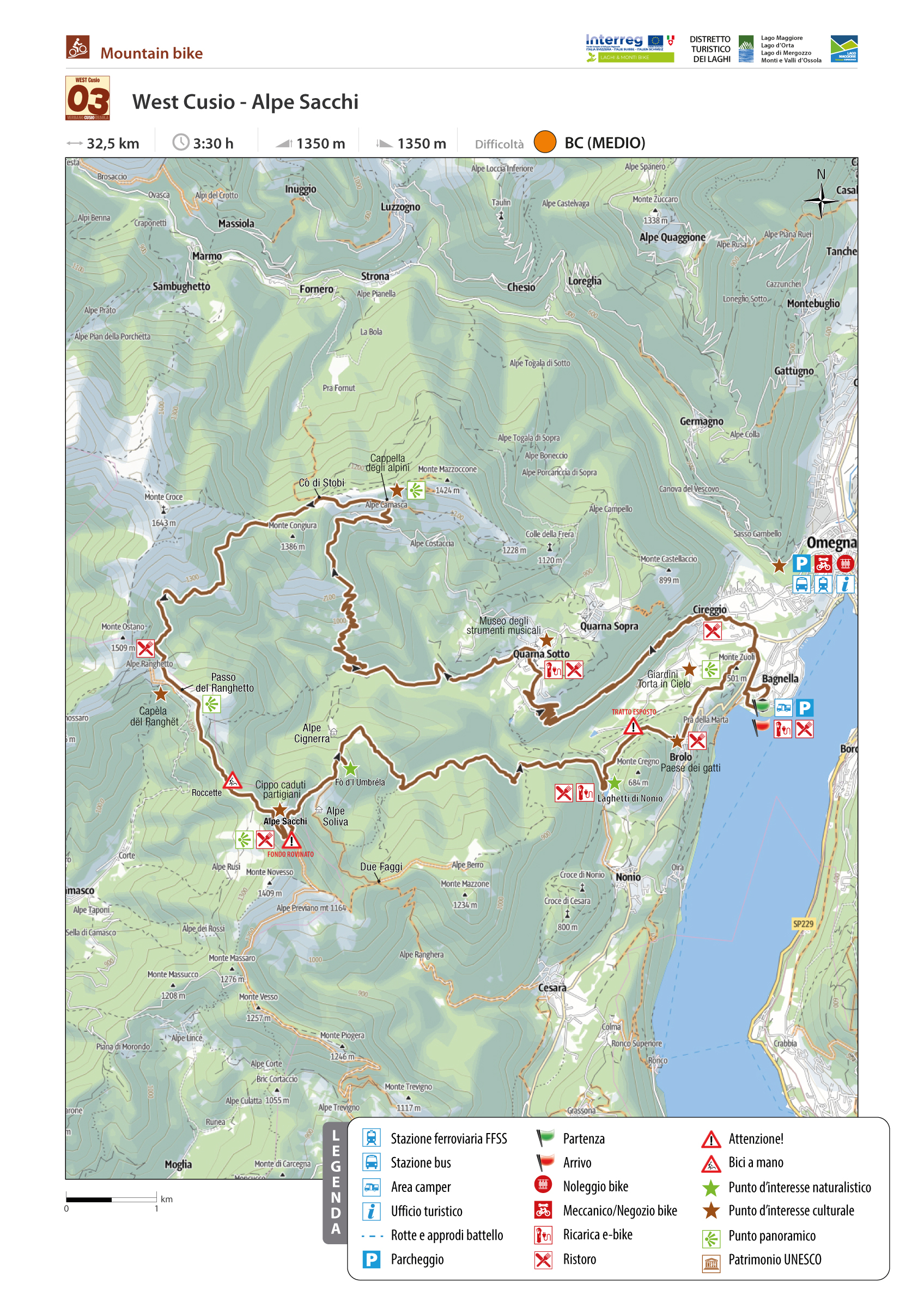
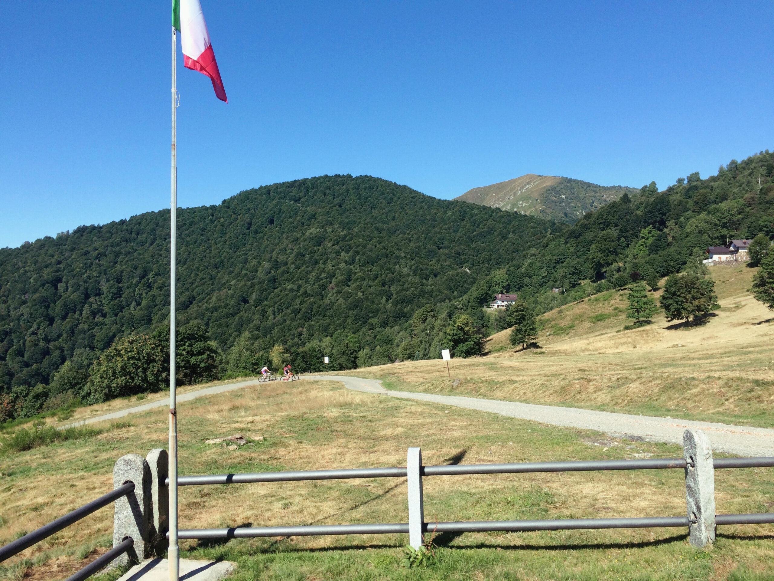
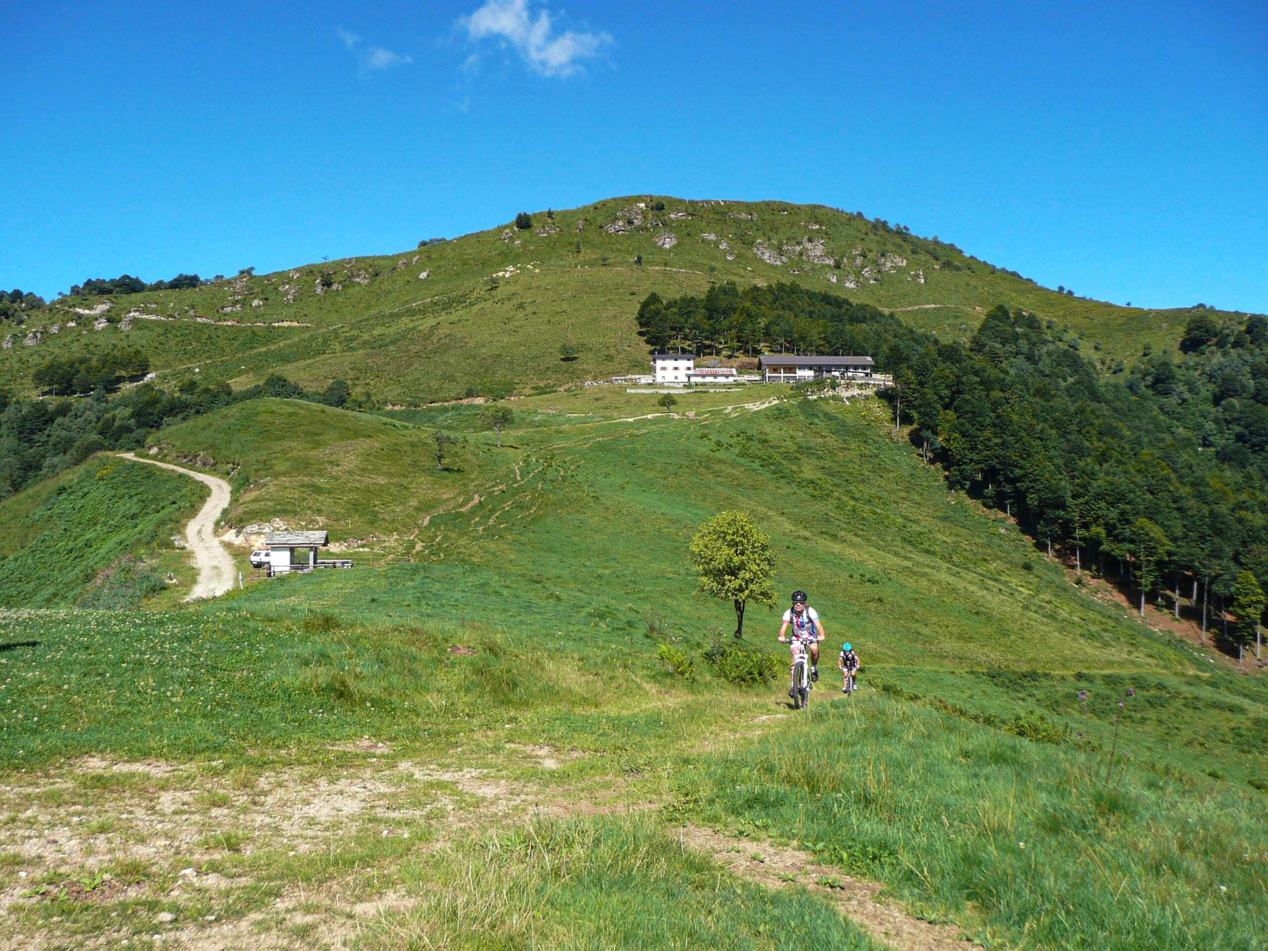
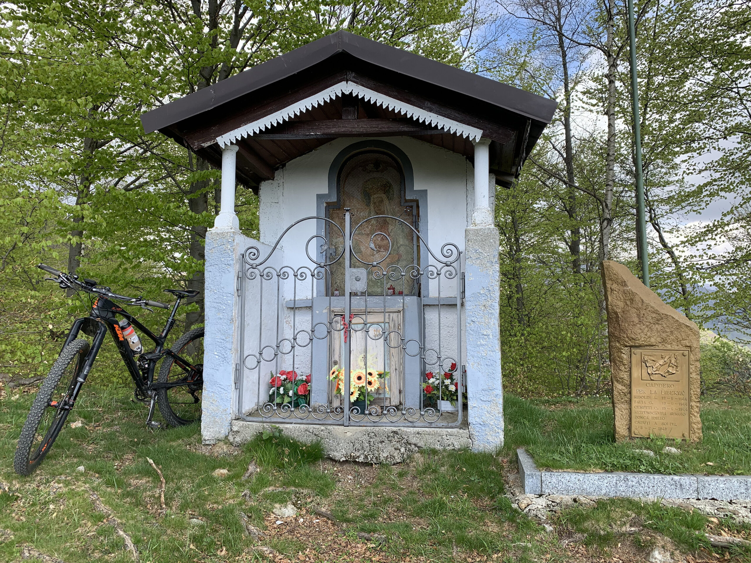
ON THE WESTERN SHORE OF LAKE ORTA BETWEEN CUSIO AND VALSESIA
WEST CUSIO – ALPE SACCHI
Lago d’Orta
Route description
Since the advent of MTB, this tour between Cusio and Valsesia has always been one of the most popular, both for its accessibility (mostly along well-maintained forest roads) and its scenic, historical, cultural, and natural “offerings.”
Back to the list of routes
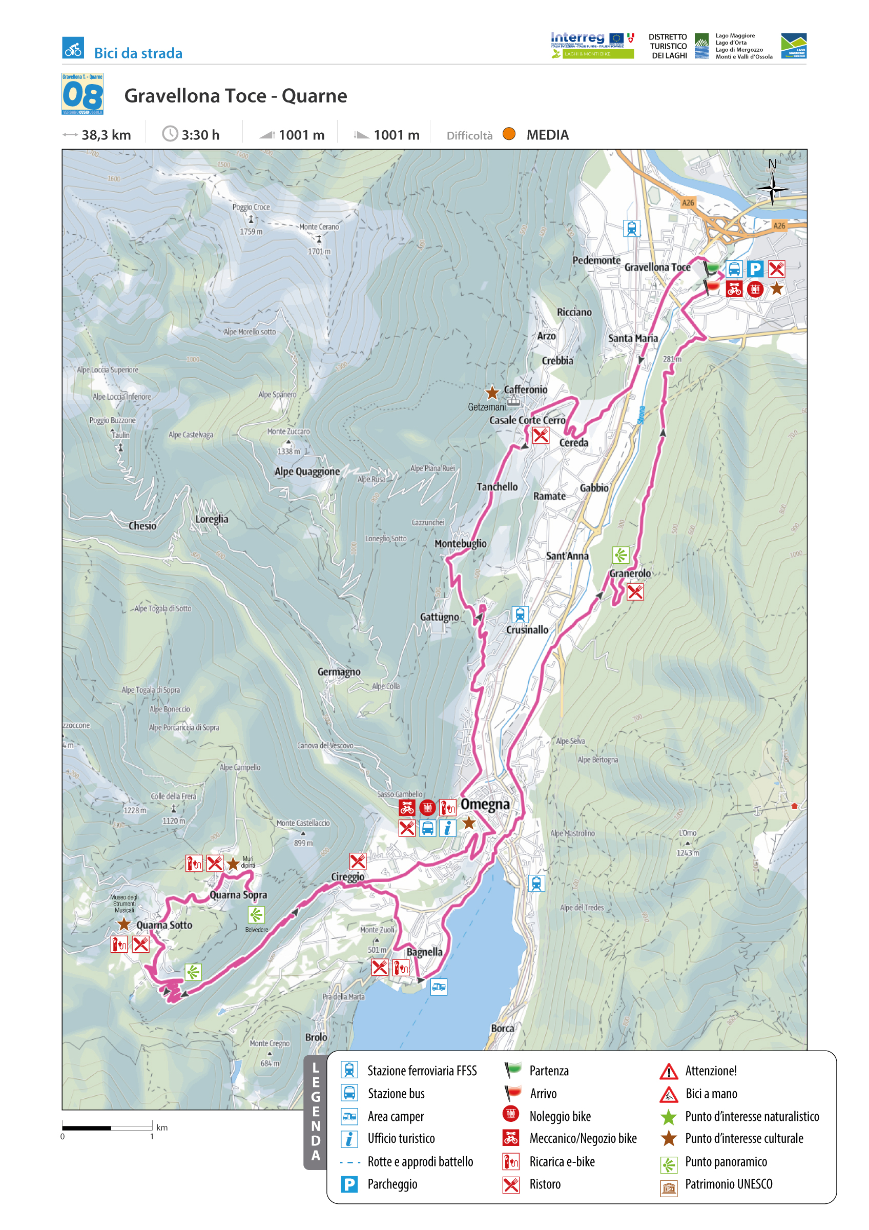
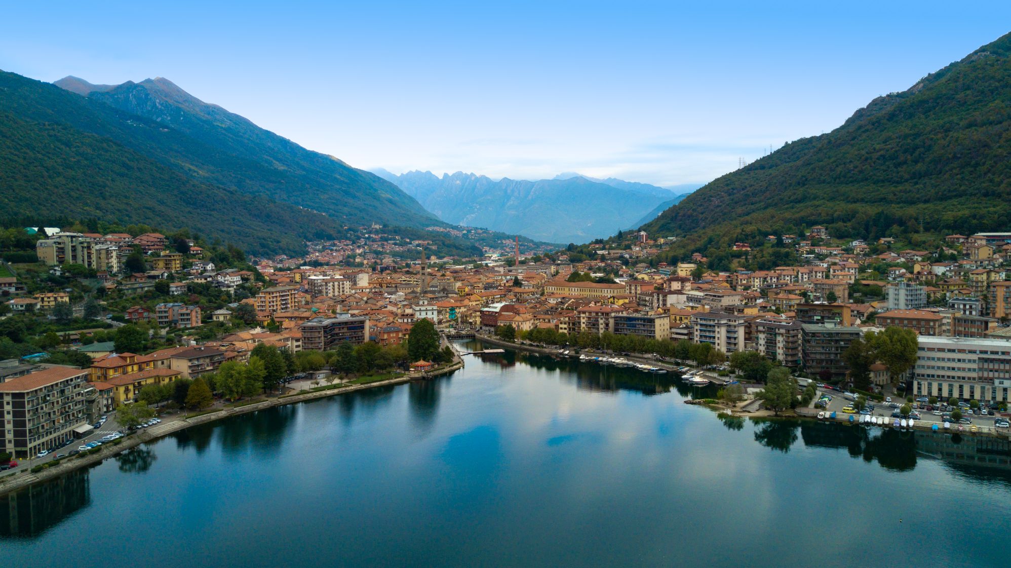
THROUGH THE CORCERA VALLEY AND QUARNE
GRAVELLONA TOCE – LE QUARNE
Lago d’Orta
Route description
We start in Gravellona Toce, near the confluence of the Strona stream into the Toce River, once the site of an ancient Roman river port and now an extensive commercial center.
After the obligatory passage from the four roundabouts along SP229 in the direction of Lake Orta, at the fourth one (the one at the top of the Santa Maria climb), we turn right for Casale Corte Cerro, from where we begin to have a view over the Corcera Valley, the one that connects Lake Orta to Lake Maggiore.
Back to the list of routes