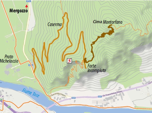
From Pra’ Michelaccio to Cima Montorfano
HISTORIC MOUNTAIN ROADS: LINEA CADORNA, MERGOZZO
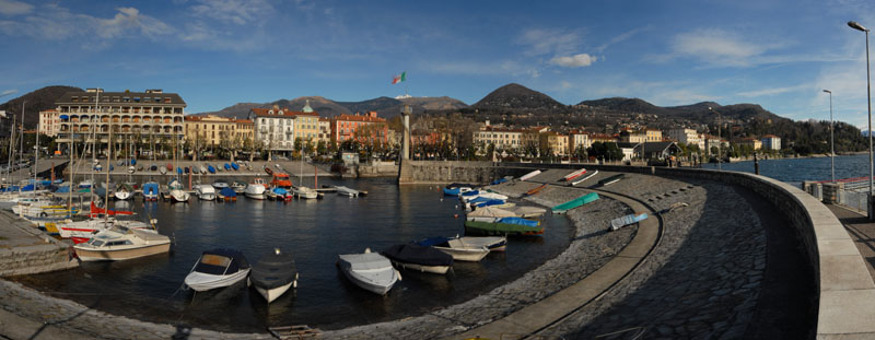
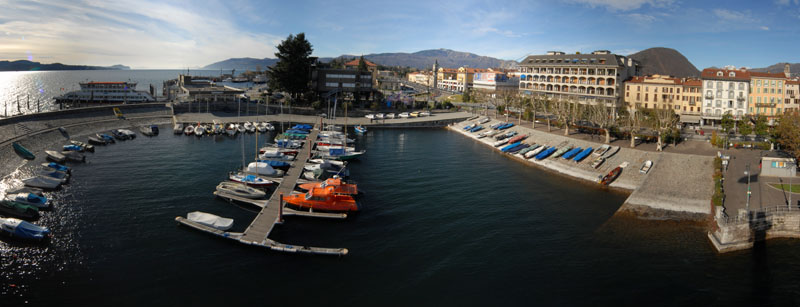
Lago Maggiore
Route description
The Cadorna Line is the defence system that was built near the Swiss border during World War I at the behest of General Luigi Cadorna, the then Chief of Staff of the Italian Army, who feared a German-Austrian invasion through neutral Switzerland.
The immense defence structure, built between the summer of 1915 and the spring of 1918, stretched from Ossola to Verbano and into Lombardy, becoming a dense network of military roads and mule tracks, trenches, artillery positions, lookout posts, camp hospitals and logistical facilities, barracks and outposts.
The work was carried out by local bricklayers and stonemasons and women also played a fundamental role in the construction of the defence line, particularly in transporting material and supplies to the work sites.
The Cadorna Line was never used for war purposes and today this military road is a historical heritage site that allows the community to learn about a historical moment of the 20th century.
It is also a natural heritage of trails for trekking and mountain-biking enthusiasts, offering routes that can be travelled almost all year round (be careful in the event of recent snowfall).
Highlights and tour details
Because of its isolated position, Mont’Orfano or Montorfano was considered an important strategic place from which to dominate the entire surrounding area, from Lake Maggiore to Lake Orta to Bassa Ossola.
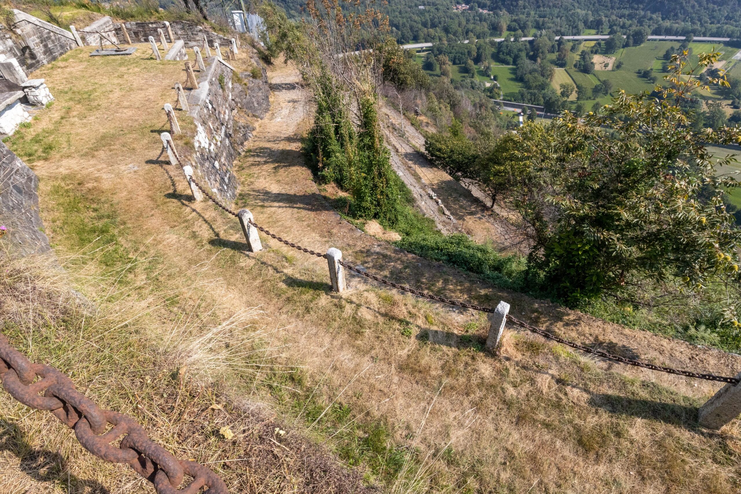
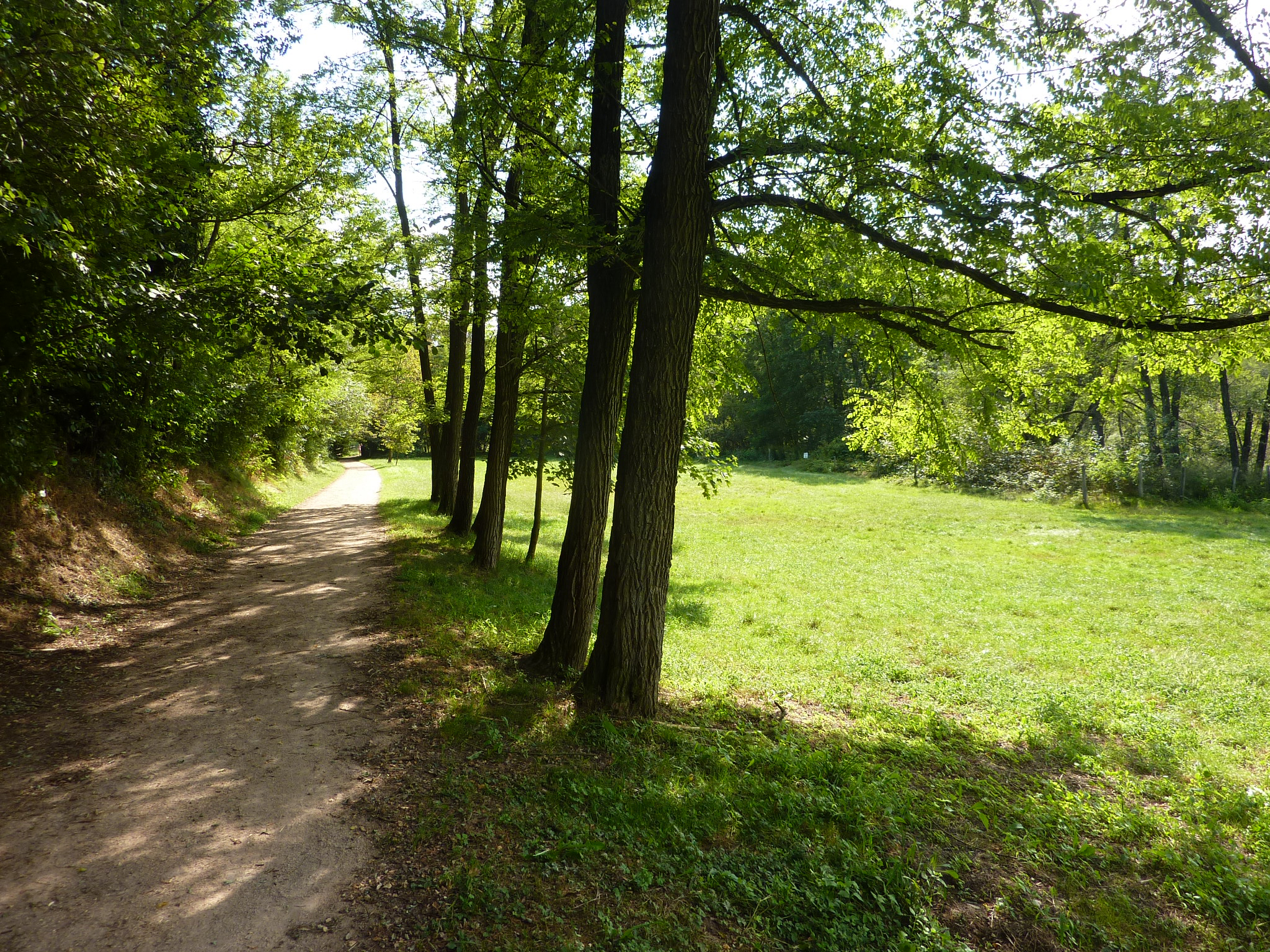
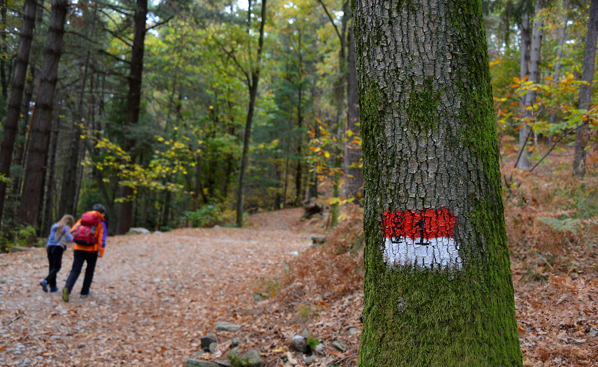
Various military constructions were built on the slopes of the mount that are still visible and can be reached thanks to Strada Cadorna, a 4 km long and 4 metre wide dirt road.
The route along this section of the Cadorna Line begins in Mergozzo, in the hamlet of Pra’ Michelaccio (204 m asl), following the signs for the military fortifications.
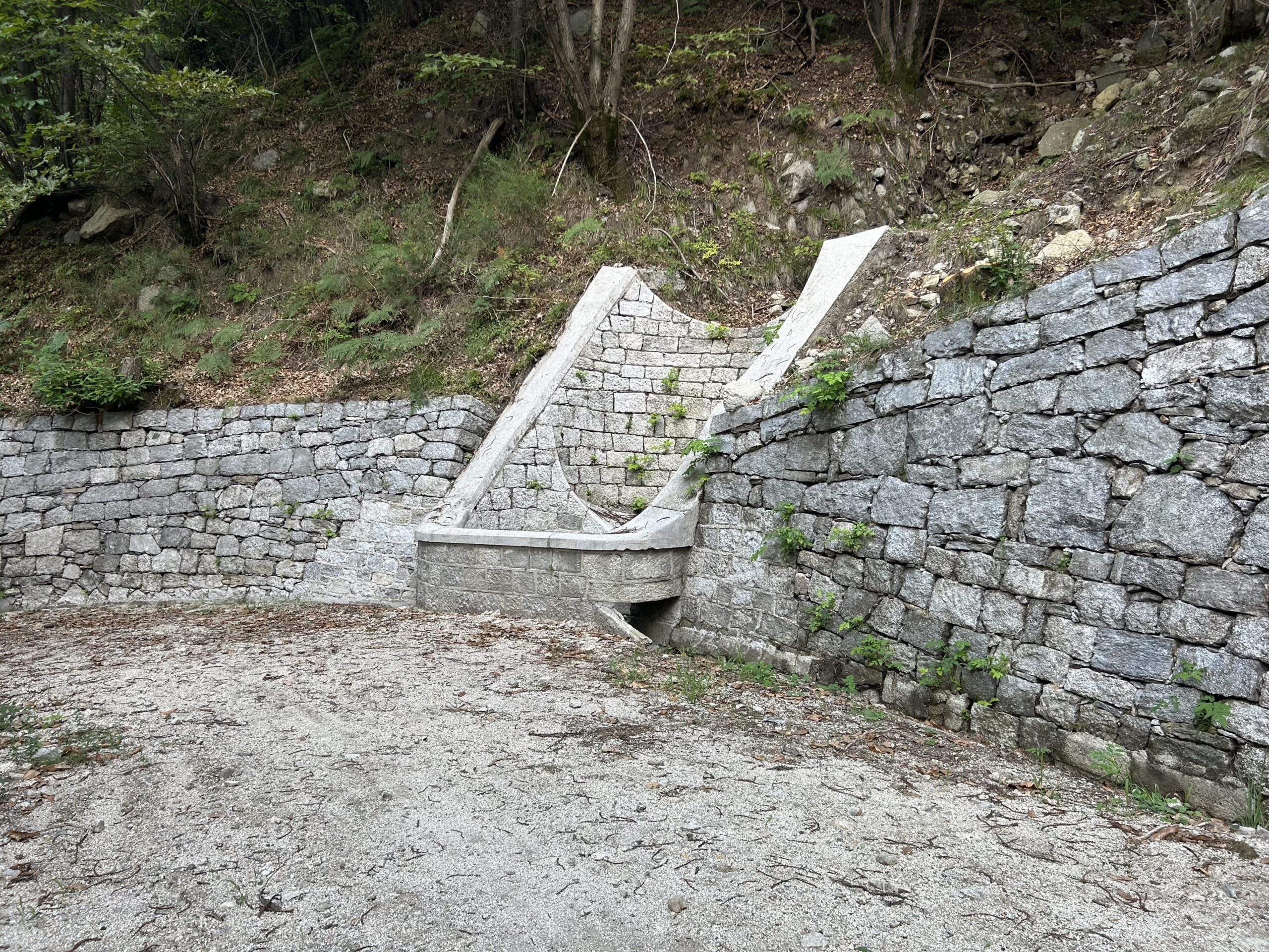
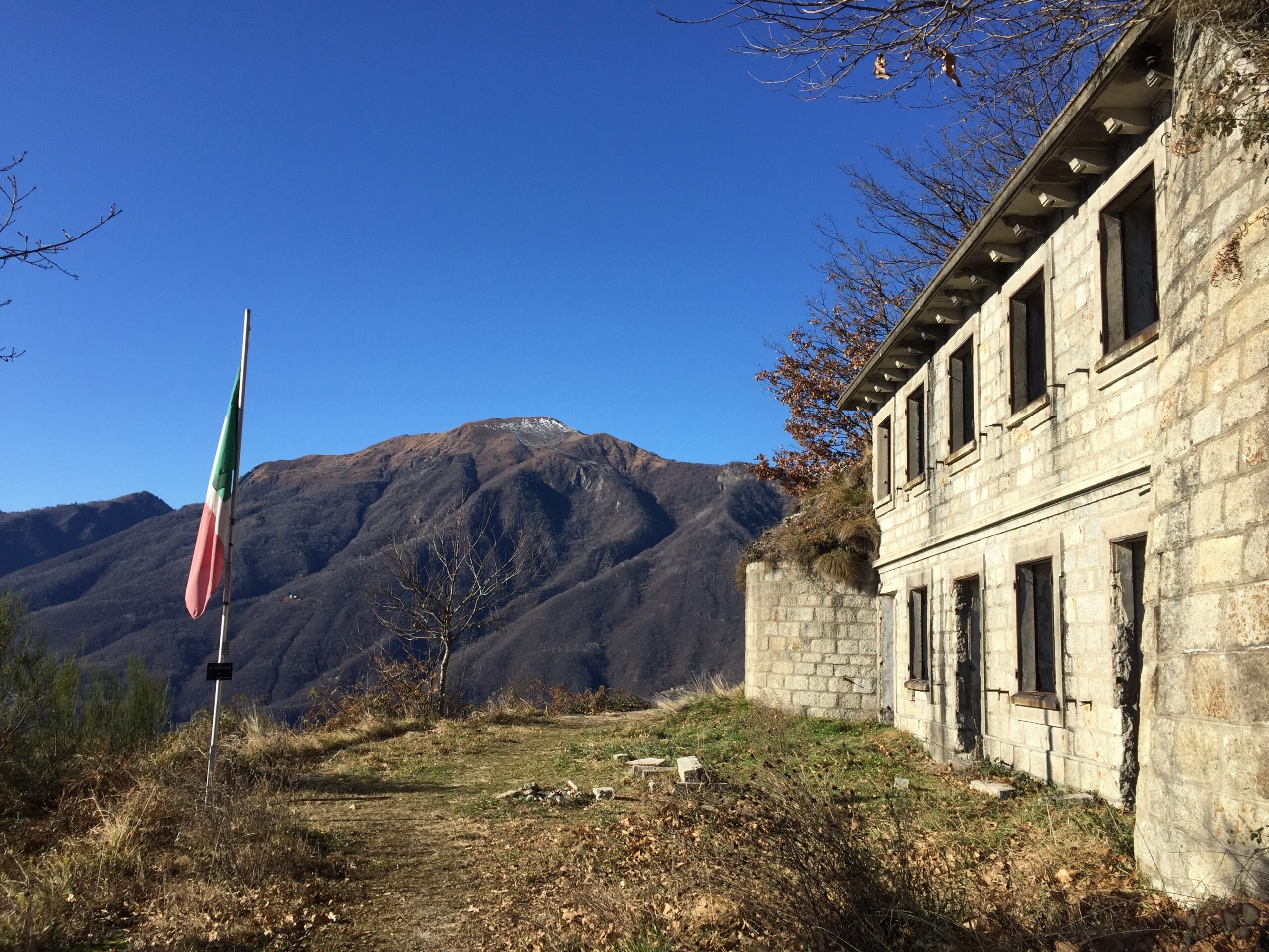
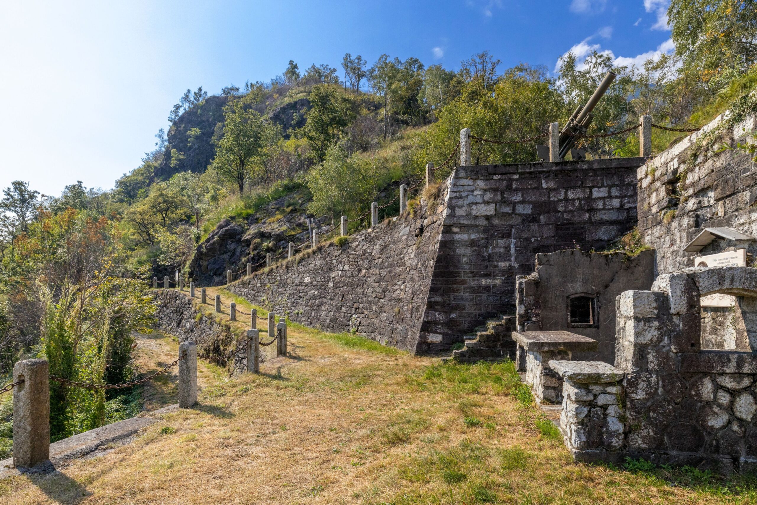
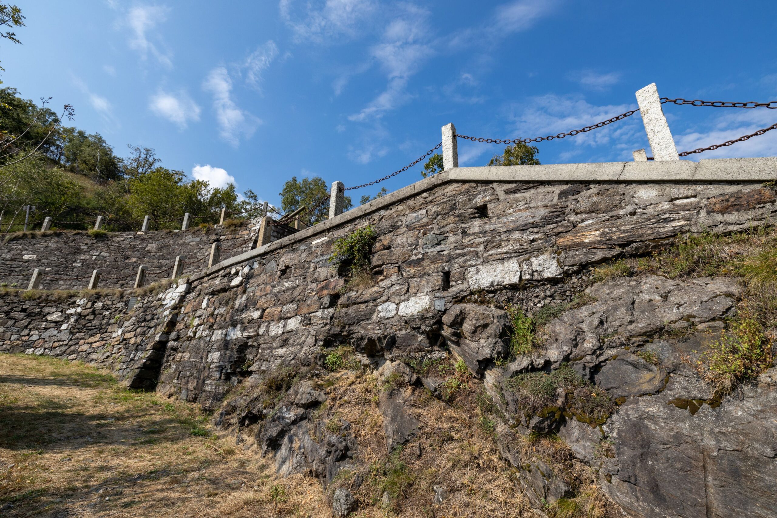
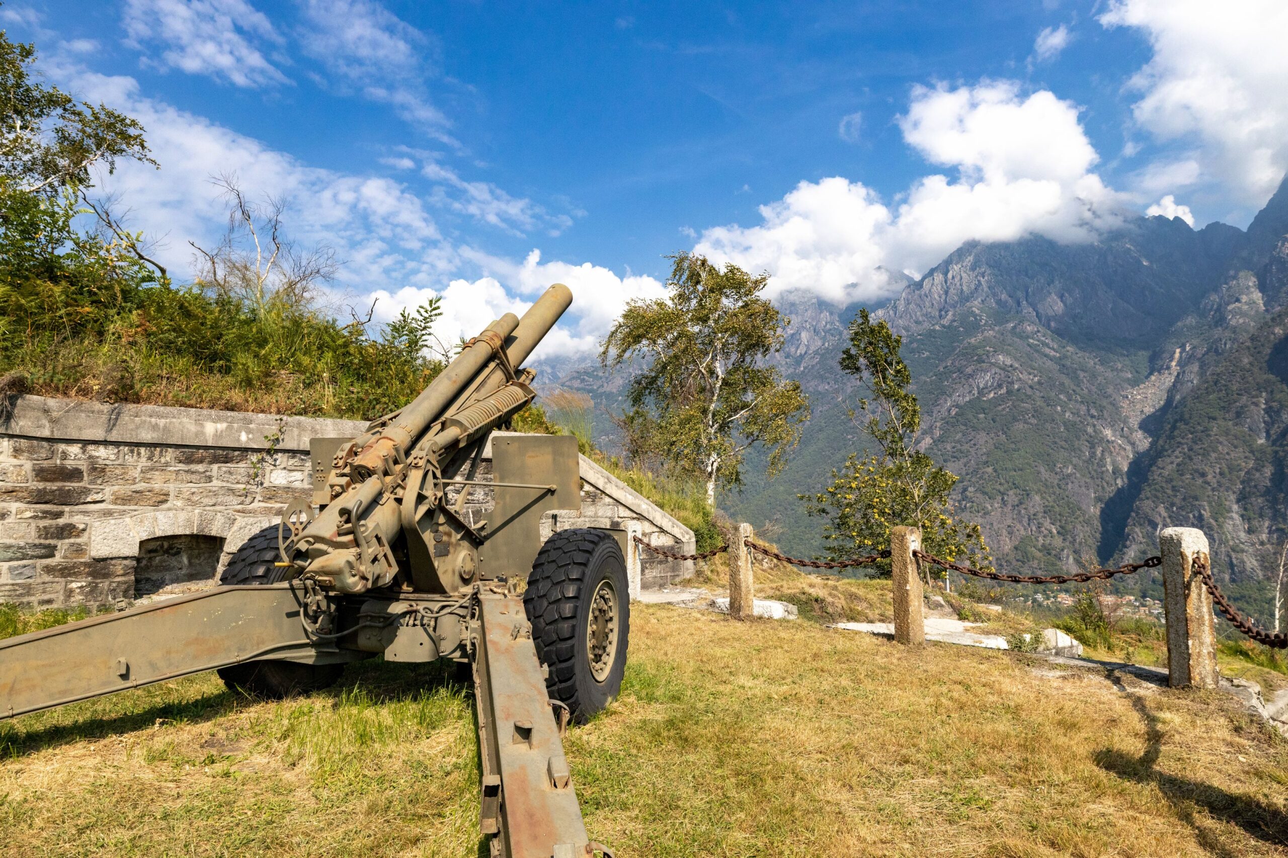
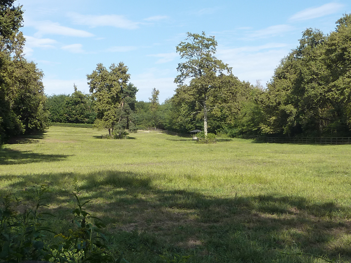
The military road, asphalted only in the first short section, becomes a beautiful dirt road that climbs steadily for 4 km, with beautiful stone hairpin bends leading to the first “Casermetta” (small barracks). Continuing with a succession of beautiful military artefacts (retaining walls and water channels), the road reaches the second Casermetta and the “Polveriera” (magazine). The panoramic view from up here is truly stunning.
From the Polveriera you can continue as far as Cima del Montorfano (794 m asl – about 2 km). The dirt road becomes a mule track that later becomes a grassy path and in about 45 minutes reaches other military works (shelters and barracks), whose construction involved the use of local natural resources including granite extracted from the nearby Cava Verde quarry at the foot of Montorfano.
Points of interest
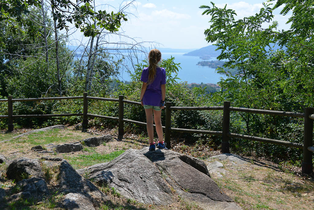
Panoramic views over Lake Maggiore, Lake Orta, Mergozzo and Bassa Ossola.
Remarkably beautiful military artefacts.
Suitable for the whole family is the Sentiero Azzurro, a beautiful paved path that connects the village of Mergozzo to one of Montorfano, from which there is a panoramic view over Lake Mergozzo and Lake Maggiore.
For adrenaline seekers, along the Strada Cadorna is the access to the Via Ferrata Montorfano, a route with Tibetan bridges and exposed passages (Difficult level; a route to be followed only with suitable equipment).
(https://www.comune.mergozzo.vb.it/it-it/vivere-il-comune/cosa-vedere/fer… )
From Pra’ Michelaccio, along the banks of the River Toce, the homonymous Ciclovia del Toce (Toce Cycle Route) passes, which from Alta Val Formazza continues to Lake Maggiore.
For lovers of local history, the Montorfano Granite Ecomuseum and the Archaeological Civic Museum with a display of artefacts from Prehistoric to Medieval times can also be visited in the village of Mergozzo. www.ecomuseogranitomontorfano.it
(Progetto è promosso dalla legge regionale 19 maggio 2021 n. 9, “Interventi per la valorizzazione delle strade storiche di montagna di interesse turistico” che riconosce e valorizza le strade storiche di montagna di interesse turistico al fine di favorire lo sviluppo del turismo all’aria aperta)
Back to the list of routes
Da Pra’ Michelaccio alla Cima Montorfano
VIE STORICHE DI MONTAGNA: LA LINEA CADORNA
Lago Maggiore
Route description
La Linea Cadorna è il sistema difensivo che venne costruito vicino alla frontiera svizzera durante la Prima Guerra Mondiale per volere del Generale Luigi Cadorna, l’allora Capo di Stato Maggiore dell’Esercito, il quale temeva un’invasione austro-tedesca, attraverso la neutrale Svizzera.
L’immensa struttura difensiva, costruita tra l’estate del 1915 e la primavera del 1918, si estendeva dall’Ossola al Verbano fino alla Lombardia, divenendo un fitto reticolo di strade e mulattiere militari, trincee, postazioni d’artiglieria, luoghi di avvistamento, ospedaletti e strutture logistiche, casermette e punti di avvistamento.
I lavori furono eseguiti da muratori e scalpellini locali ed anche le donne ebbero un ruolo fondamentale nella realizzazione della linea difensiva, in particolare nel trasporto di materiale e rifornimento nei cantieri.
La Linea Cadorna non venne mai utilizzata per scopi bellici ed oggigiorno questa strada militare è un patrimonio storico che permette alla comunità di conoscere un momento di storia del Novecento.
E’ però anche un patrimonio naturalistico di sentieri per gli amanti di trekking e della mountain-bike offrendo percorsi percorribili quasi tutto l’anno (prestare attenzione in caso di recenti nevicate).
DESCRIZIONE DEL PERCORSO
Il Mont’Orfano o Montorfano, grazie alla sua posizione isolata, venne considerato un importante luogo strategico da cui dominare a 360° il territorio circostante, dal Lago Maggiore al Lago d’Orta alla Bassa Ossola.
Alle pendici del monte vennero realizzate varie costruzioni militari ancora visibili e raggiungibili grazie alla strada Cadorna, un percorso sterrato camionabile lungo 4 km e largo ben 4 metri.
Il percorso in questo tratto di Linea Cadorna inizia a Mergozzo, nella Loc. Pra’ Michelaccio (204 m slm), seguendo le indicazioni per le fortificazioni militari.
La strada militare, asfaltata solo nel primo breve tratto, diventa una bella sterrata che sale per 4 km con pendenza costante e con bei tornanti in pietra che conducono alla prima Casermetta. Proseguendo con un susseguirsi di manufatti militari di notevole bellezza (muri di contenimento e canali idraulici), la strada giunge alla seconda Caserma e alla Polveriera. La vista panoramica che si ha da quassù è davvero suggestiva.
Dalla Polveriera si può proseguire fino alla Cima del Montorfano (794 m slm – circa 2 km). La sterrata lascia posto ad una mulattiera che poi diventa sentiero erboso ed in circa 45 minuti raggiunge altre opere militari (ricoveri e baraccamenti), la cui edificazione ha visto l’impiego di risorse naturali locali tra cui il granito estratto dalla vicina Cava Verde, ai piedi del Montorfano.
Attenzione: La strada in alcuni punti è priva di protezioni. Prestare attenzione in caso di recenti nevicate.
PUNTI D’INTERESSE
Vista panoramica sul Lago Maggiore, Lago d’Orta, di Mergozzo e Bassa Ossola.
Manufatti militari di notevole bellezza.
Adatto a tutta la famiglia è il Sentiero Azzurro, un bellissimo percorso lastricato che collega il paese di Mergozzo all’abitato di Montorfano, da cui si ha una vista panoramica su Lago di Mergozzo e Lago Maggiore.
Per chi cerca adrenalina, lungo la Strada Cadorna, si incontra invece l’accesso alla Via Ferrata Montorfano, percorso con ponti tibetani e passaggi esposti (livello Difficile; via da percorrere solo muniti di idonea attrezzatura).
(https://www.comune.mergozzo.vb.it/it-it/vivere-il-comune/cosa-vedere/fer… )
Da Pra’ Michelaccio, lungo le rive del fiume Toce, passa l’omonima Ciclovia del Toce che proveniente dall’Alta Val Formazza, prosegue sino al Lago Maggiore. https://lagomaggiorexperience.it/percorso/ciclovia-del-toce-in-bici-tra-…
Per gli amanti di storia locale, a Mergozzo paese, si possono inoltre visitate l’Ecomuseo del Granito di Montorfano e il Museo Civico Archeologico con l’esposizione di reperti dalla Preistoria all’Età Medievale. www.ecomuseogranitomontorfano.it
(Progetto è promosso dalla legge regionale 19 maggio 2021 n. 9, “Interventi per la valorizzazione delle strade storiche di montagna di interesse turistico” che riconosce e valorizza le strade storiche di montagna di interesse turistico al fine di favorire lo sviluppo del turismo all’aria aperta)
Back to the list of routes
From Punta di Migiandone to Forte di Bara
HISTORIC MOUNTAIN ROADS: LINEA CADORNA
Piana del Toce
Route description
The Cadorna Line is the defence system that was built near the Swiss border during World War I at the behest of General Luigi Cadorna, the then Chief of Staff of the Italian Army, who feared a German-Austrian invasion through neutral Switzerland.
The immense defence structure, built between the summer of 1915 and the spring of 1918, stretched from Ossola to Verbano and into Lombardy, becoming a dense network of military roads and mule tracks, trenches, artillery positions, lookout posts, camp hospitals and logistical facilities, barracks and outposts.
The work was carried out by local bricklayers and stonemasons and women also played a fundamental role in the construction of the defence line, particularly in transporting material and supplies to the work sites.
The Cadorna Line was never used for war purposes and today this military road is a historical heritage site that allows the community to learn about a historical moment of the 20th century.
It is also a natural heritage of trails for trekking and mountain-biking enthusiasts, offering routes that can be travelled almost all year round (be careful in the event of recent snowfall).
HIGHLIGHTS AND TOUR DETAILS
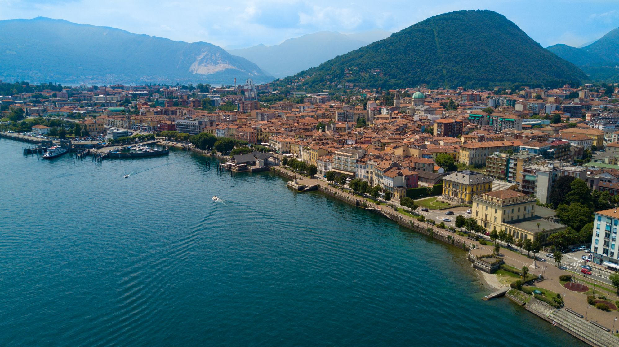
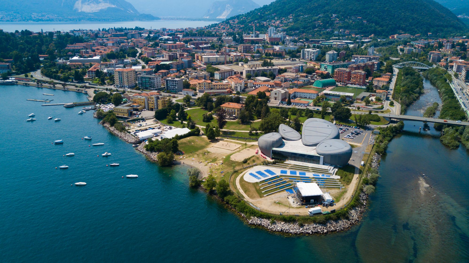
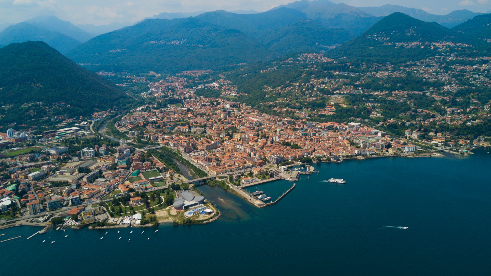
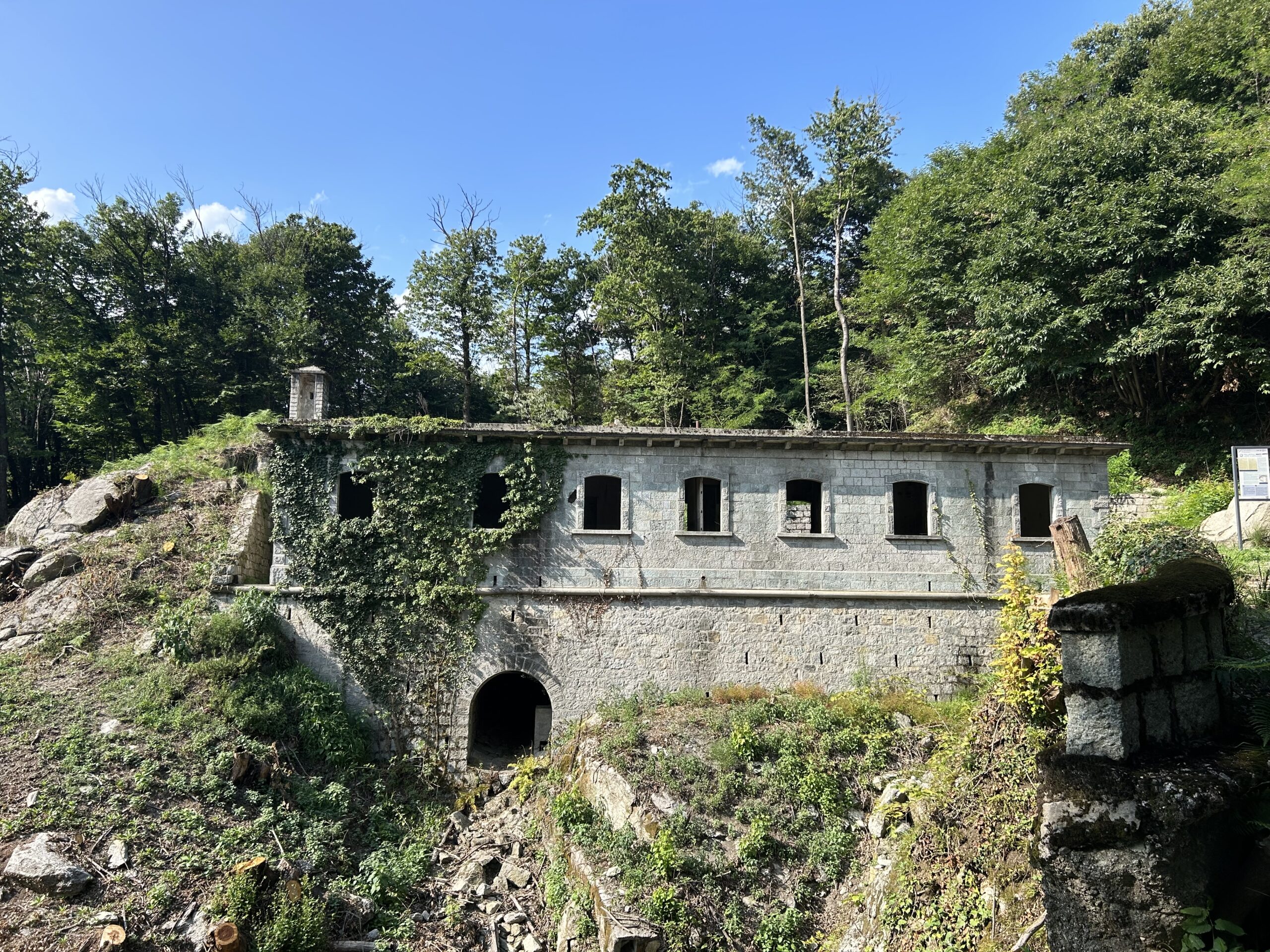
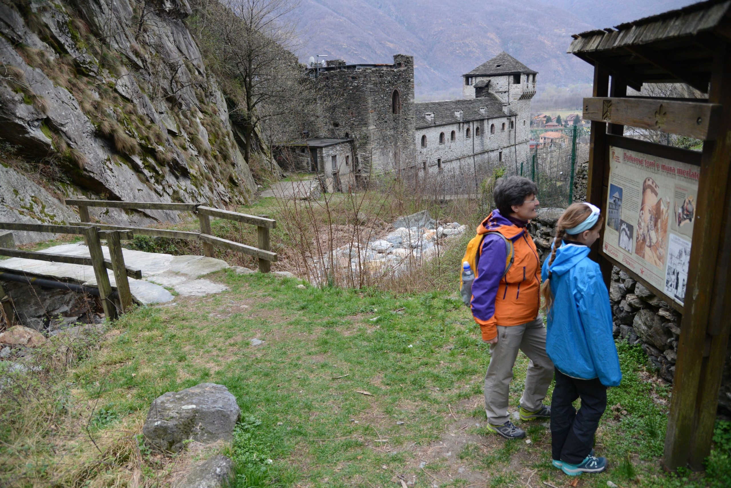
The route along this section of the Cadorna Line begins in Ornavasso in Bassa Ossola at the car park of Punta di Migiandone (210 m asl), where the well-preserved mule track winds its way with regularly sloping hairpin bends and stone walls towards Forte di Bara. You will encounter tunnels carved into the rock, trenches, walkways and machine gun emplacements along the route (it is useful to have a torch with you).
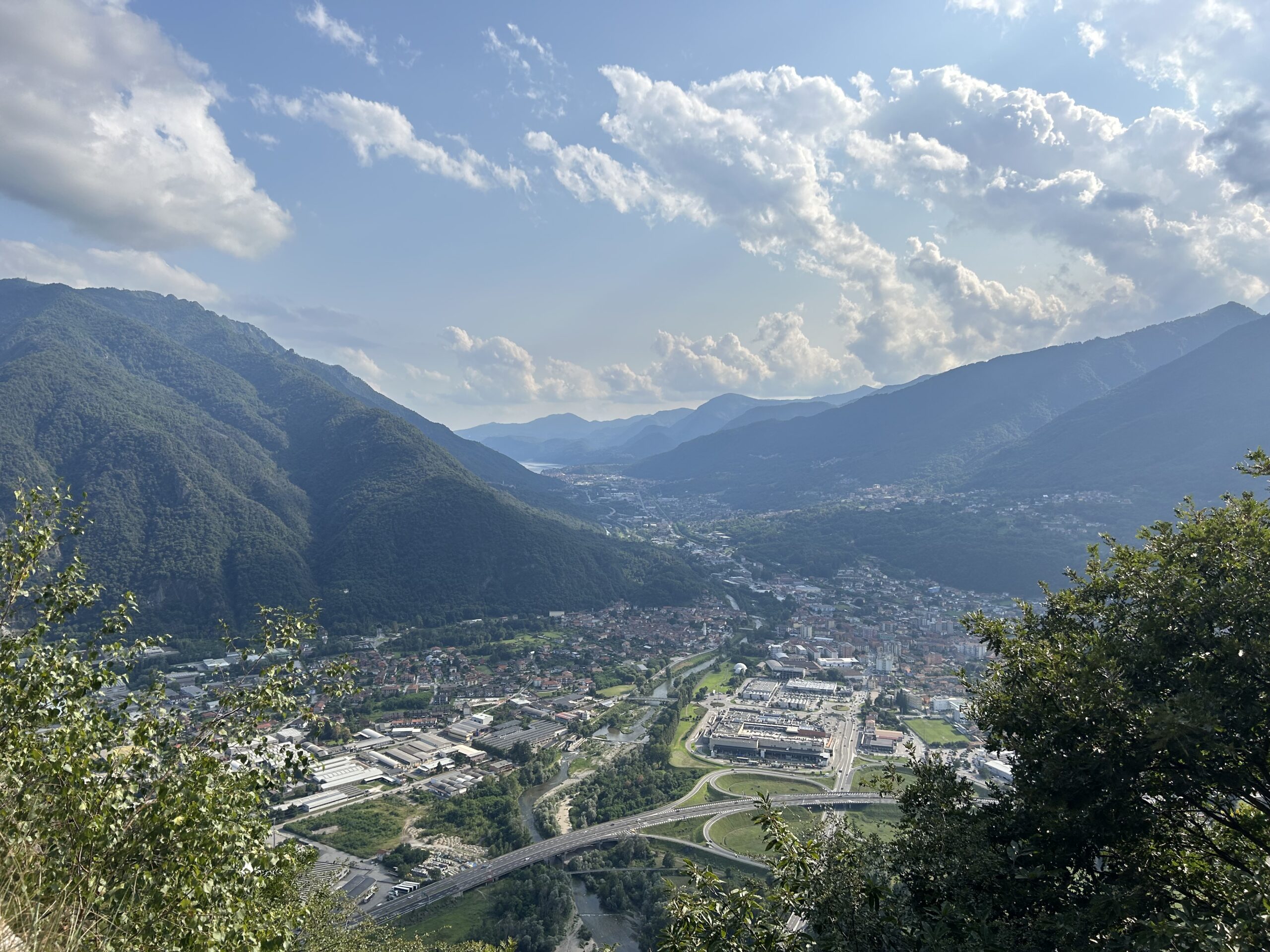
This mountain ridge was the ideal place to control the passage between Bassa Ossola and Lakes Maggiore and Mergozzo, at the narrowest point of the plain of the River Toce, known precisely as the “Stretta di Bara”.
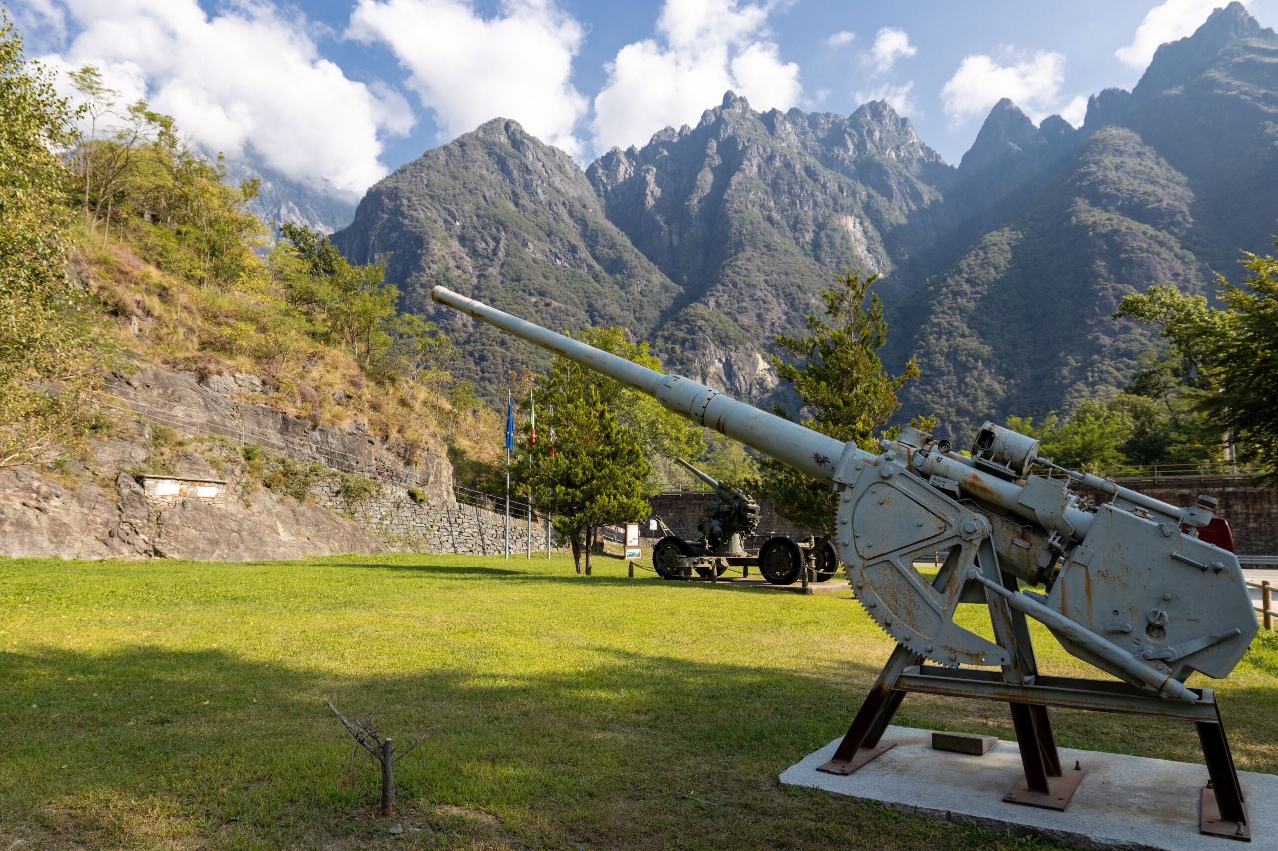
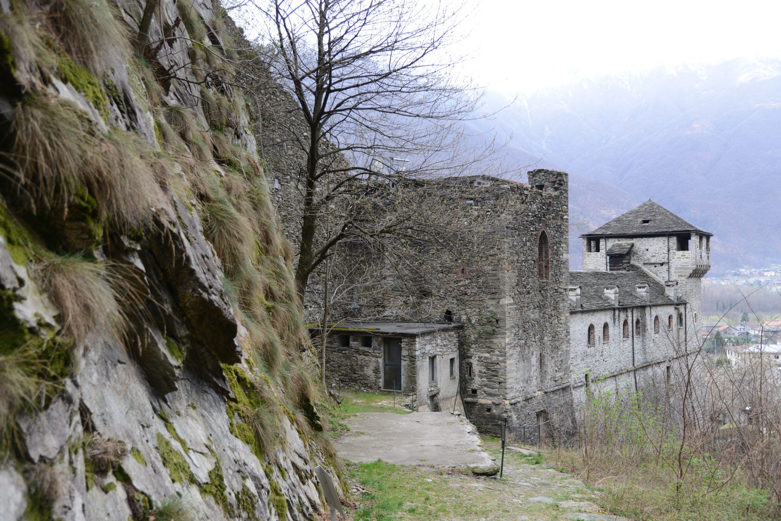
Arriving at Forte di Bara (410 m asl), the multi-level fortified emplacement can be admired, consisting of several embankments supported by square stone walls that were intended to house barracks and long-range cannons to protect the Ornavasso and Migiandone trench system. Cannons and mortars make this visit even more evocative.
A plaque commemorates the Battle of Ornavasso that was fought in October 1944 by the Italian Alpine soldiers and Partisans of the ‘Valtoce’ formation against the Germans to defend the Ossola Partisan Republic.
Risks: There is no protection in some parts of the road.
POINT OF INTEREST
Panoramic views of Lake Maggiore and Mergozzo, the peaks of Bassa Ossola and the Corni di Nibbio.
Still well-preserved and remarkably beautiful military artefacts.
From Punta di Migiandone you can rejoin the Ciclovia del Toce (Toce Cycle Route), which, coming from Alta Val Formazza, continues to Lake Maggiore, skirting the famous watercourse.
For lovers of local history, you can also visit the Enrico Bianchetti Archaeological Section of the Museo del Paesaggio (Landscape Museum) in Ornavasso village, with a large display of artefacts from the 8th century BC to the 4th century AD.
https://www.museodelpaesaggio.it/collezioni/archeologia/
and the Museo Partigiano (Partisan Museum) www.museopartigiano.it
From Forte di Bara, you can continue along the dirt road on flat ground to the Old Marble Quarry.
The Sanctuary of the Madonna del Boden and the Sanctuary of the Madonna della Guardia are also worth visiting.
(The project is promoted by Regional Law No. 9 of 19 May 2021, “Interventions for the valorisation of historic mountain roads of tourist interest”, which recognises and valorises historic mountain roads of tourist interest in order to promote the development of open-air tourism)
Back to the list of routes
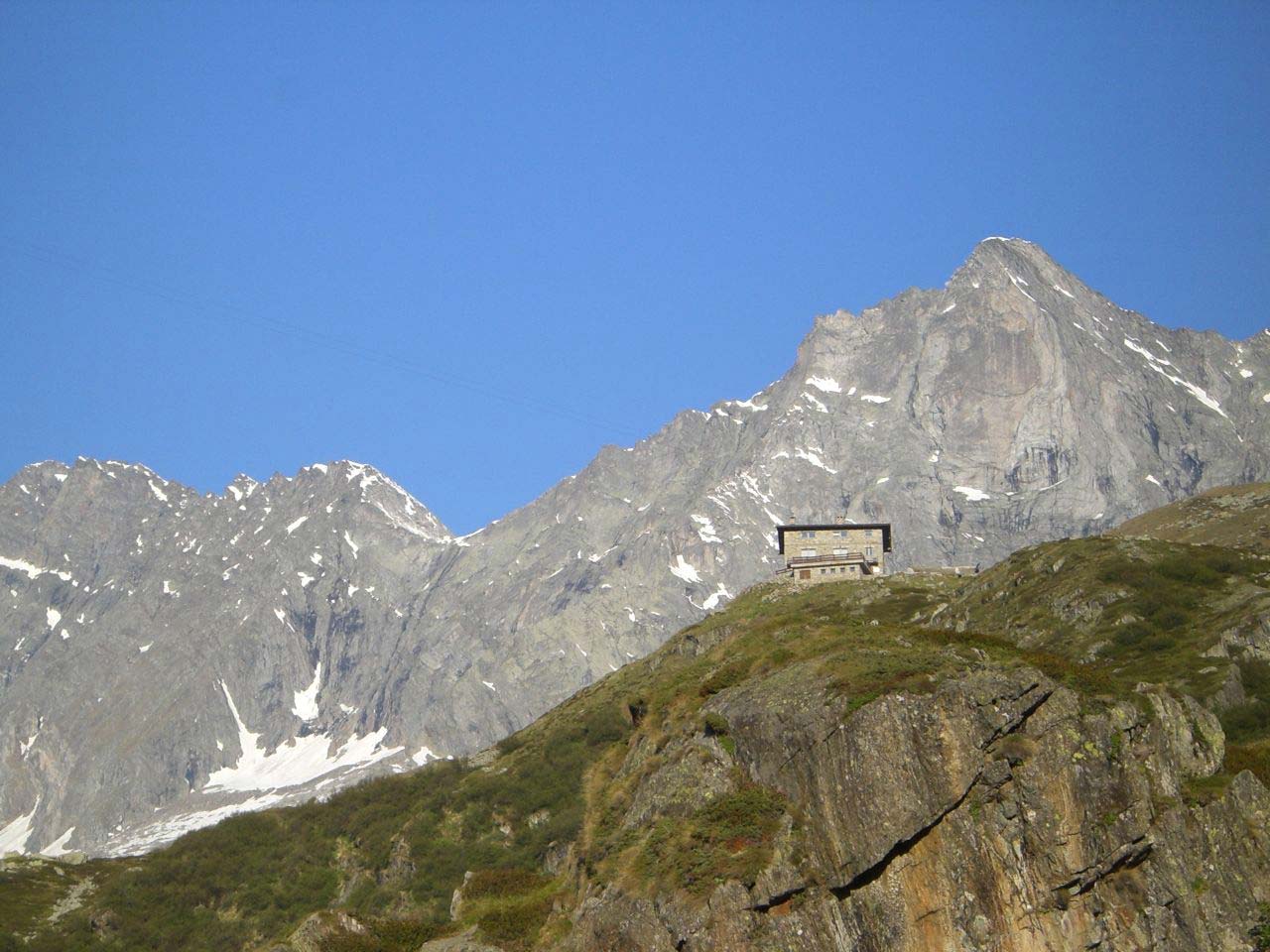
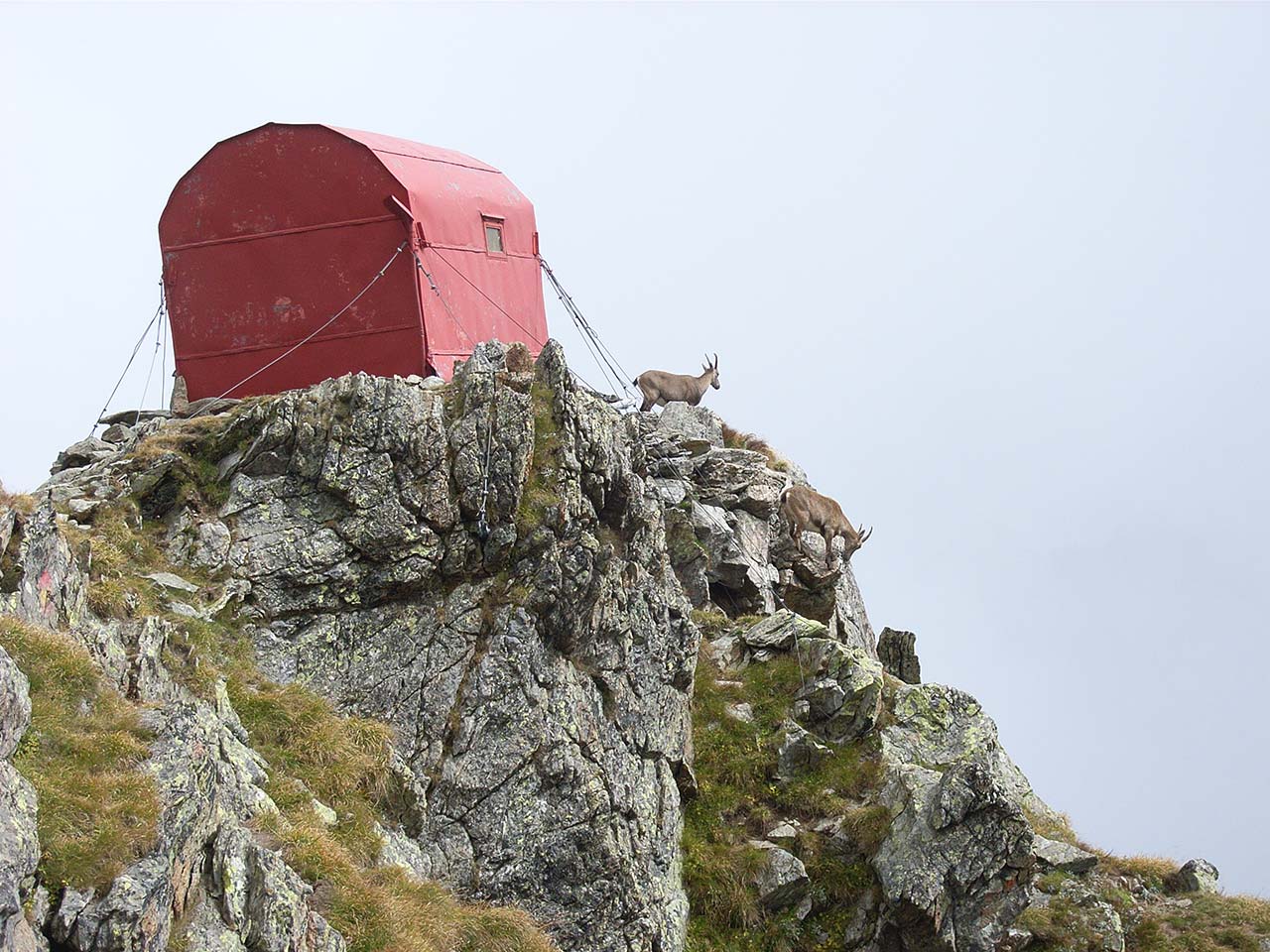
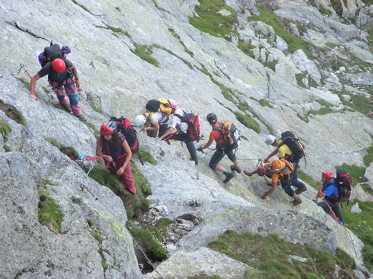
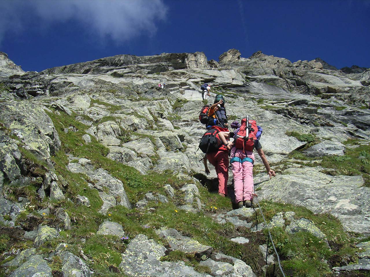
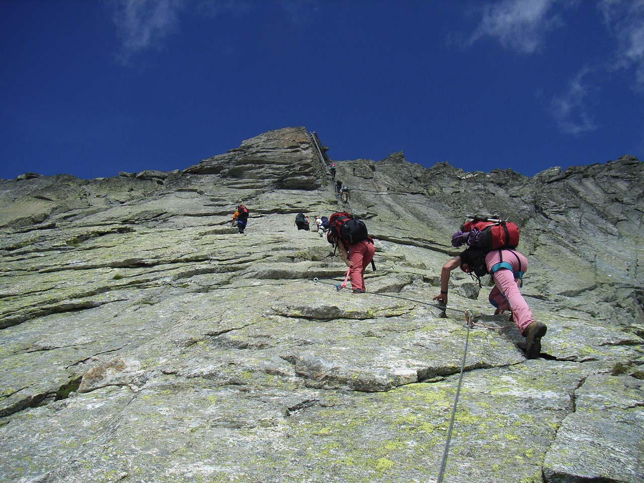
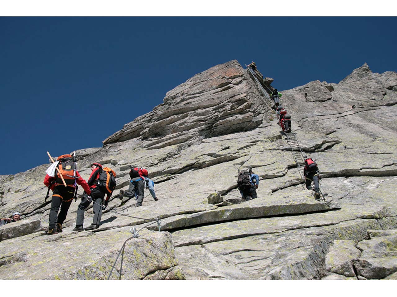
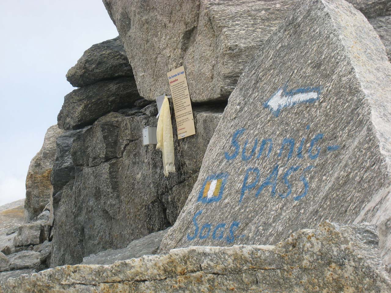
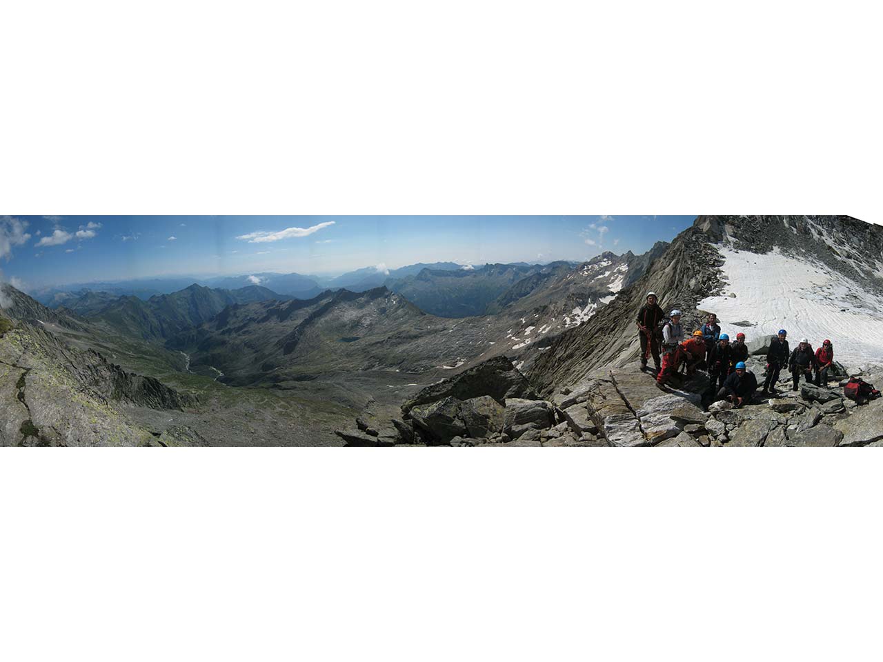
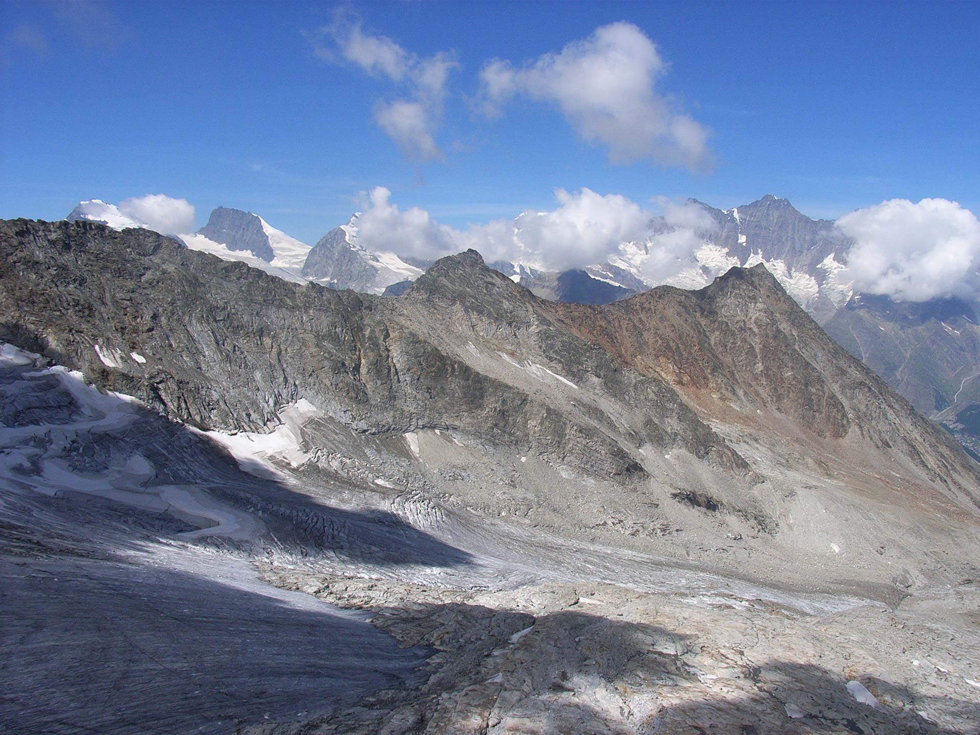
The “Pizzo Andolla” tour
“FERRATA DEL LAGO”, AN ENCHANTING LANDSCAPE BETWEEN ITALY AND SWITZERLAND
Valle Antrona
Route description
Origins of the Via Ferrata of the Lake
On March 26, 2002, at the Casa Alpina owned by the Italian Alpine Club of Villadossola, mountain guides Beat Burgener and André Zurbriggen; Diana Zurbriggen, Chairperson of Saas Valley’s SAC; Italian mountain guides Franco Farioli and Tabarini; Sergio Rossi, Chairperson of Villadossola’s CAI; Renato Boschi, Hiking Manager, and Alpine rescuer Giulio Frangioni met to review the possibility to create a via Ferrata that would lead to the Bottarello Pass. The goal of the initiative was to join the two Andolla mountain huts on the Italian side and the Almagellerhutte one on the Swiss side to improve the occupancy of the huts and grow the friendship between the mountain regions of Italy and Switzerland and enjoy the enchanting and characteristic landscape.
The “project” was born and discussed to find the best way to implement it, respecting all the bureaucratic and safety requirements.
On April 29, 2002, a permit request was filed at the municipality of Antrona for the laying of the via Ferrata. The authorization was granted on May 16, 2002.
On May 28, 2002, the documentation was submitted to the headquarters of the Italian Alpine Club for the request for insurance coverage.
Everything was ready to install the anchoring devices and cable, which took place in July 2002.
The “Ferrata of the Lake” was inaugurated on July 5 and 6, 2003, to celebrate the 50th anniversary of the Andolla hut.
A large group of Swiss and Italians met on July 5 at the Andolla hut for the evening celebration. On the morning of July 6, they headed to enjoy the Ferrata. At the Bottarello Pass, they attended the Mass and blessing of the route. The event took place in an atmosphere of extraordinary camaraderie.
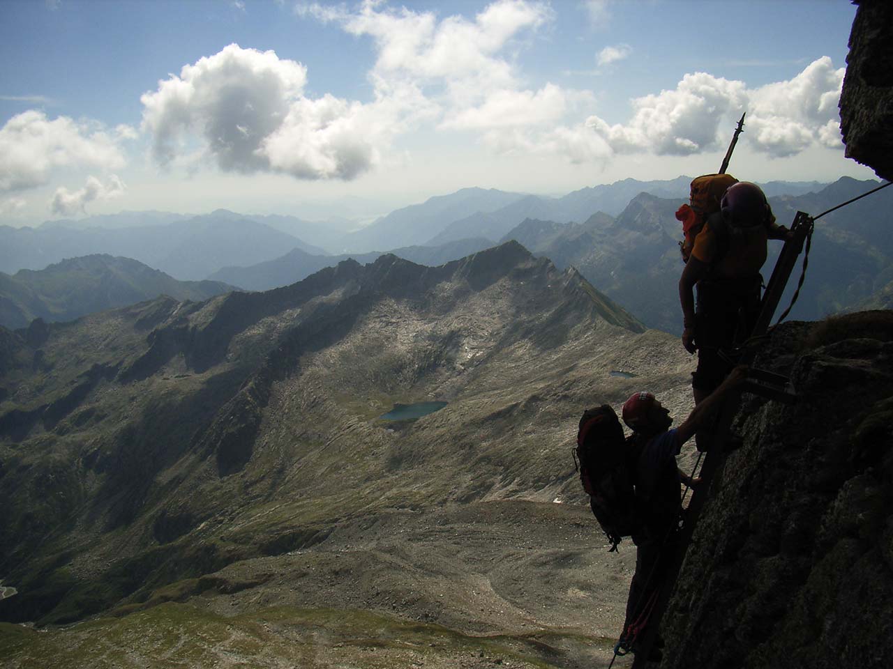
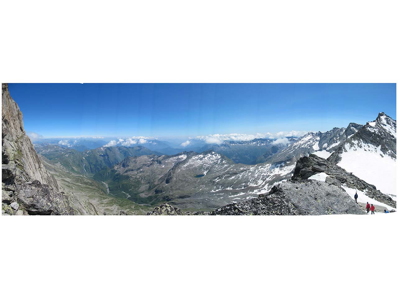
In the evening, the celebrations continued at the Almagellerhutte hut with wine and cheese before saying goodbye to the fellow climbers who were descending to Saas Almagell. Since then, the Via Ferrata has been a success among the Swiss. It has already passed the test of four winters and underwent a series of small maintenance operations. It has become a pleasant route to admire the rugged mountains and the distant Lake Maggiore from which it took its name.
“Via Ferrata of the Lake”
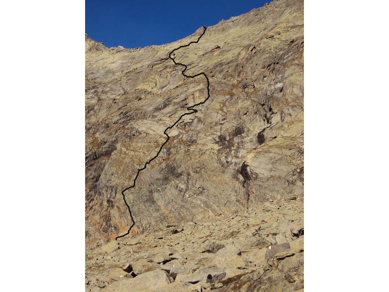
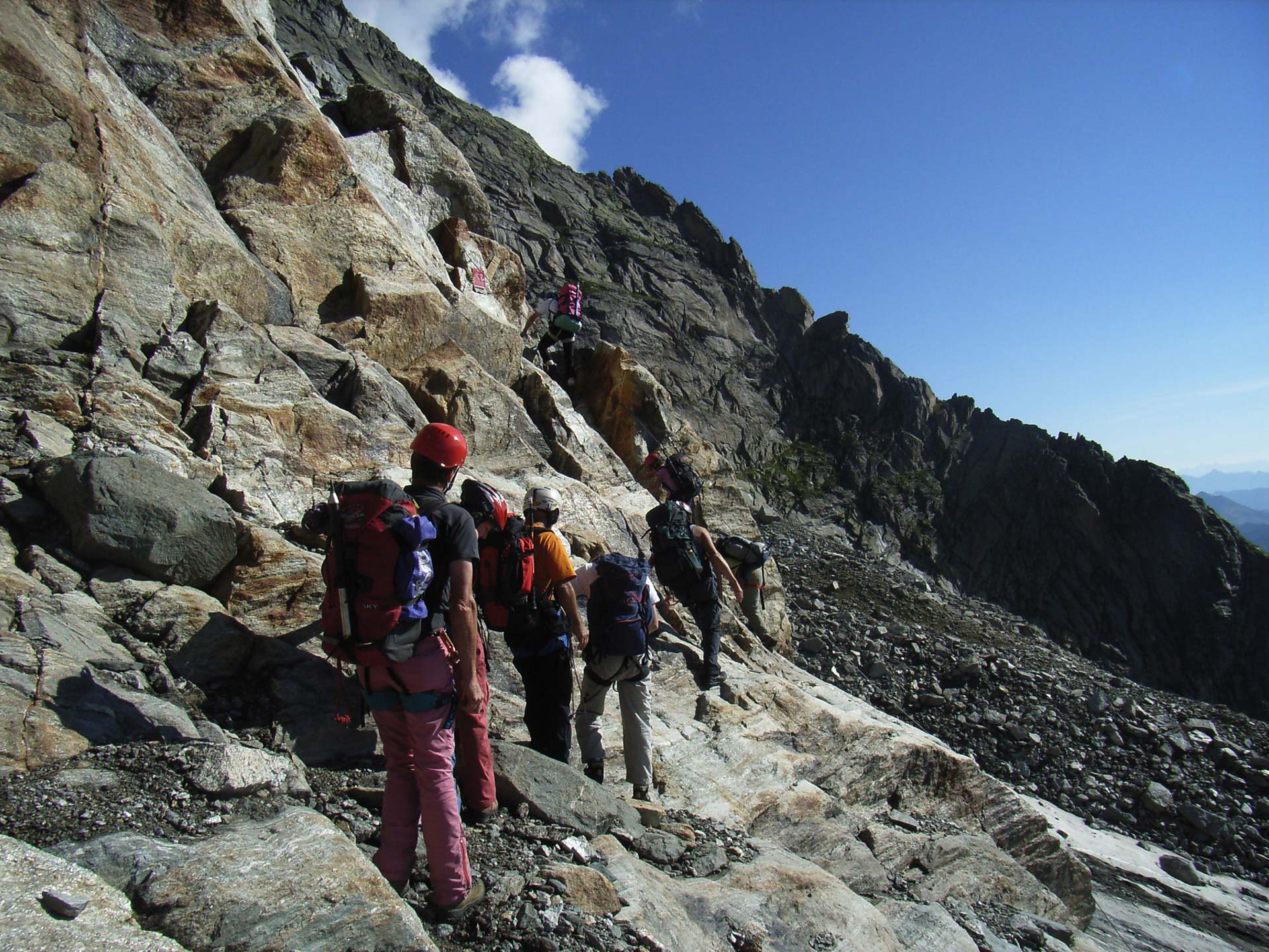
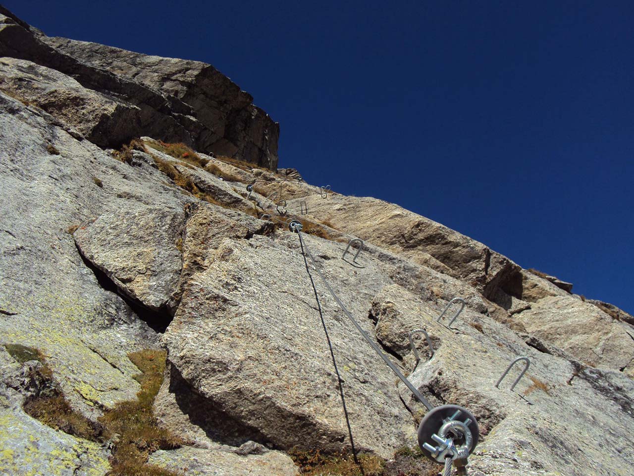
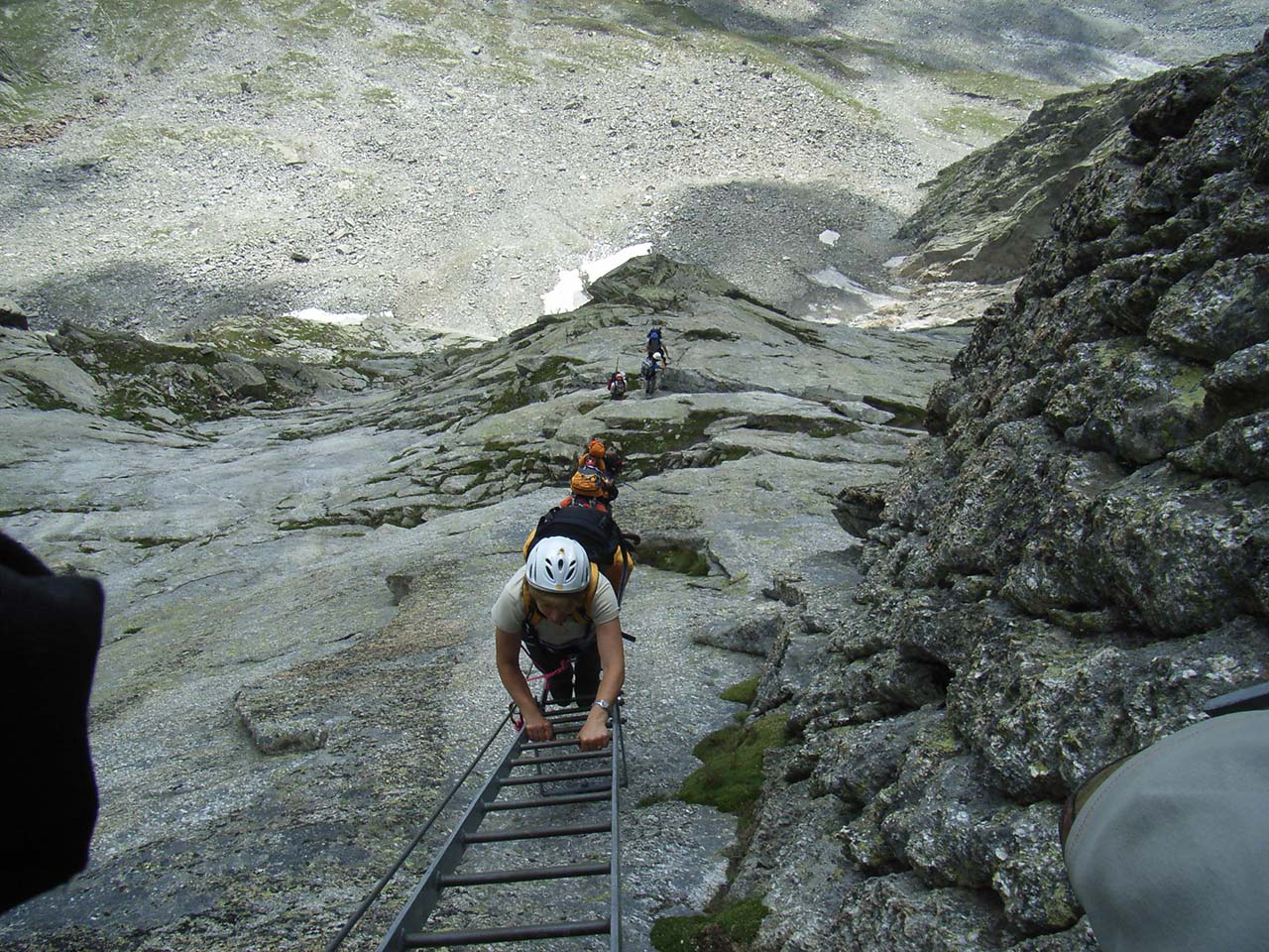
A Via Ferrata is a mountain climbing route set on a rocky path fully equipped with ropes, pegs, and steel ladders to allow very experienced mountaineers to test themselves on a vertical wall. Please note that the difference between a via Ferrata and an equipped path is substantial: an equipped path facilitates a dangerous and exposed section of a hiking trail but not to go past stretches of wall. The “Via Ferrata of the Lake” was created to facilitate the connection between the huts of Andolla, on the Italian side, and Almagellerhutte on the Swiss side, thus allowing touring the entire Pizzo Andolla. No international code of difficulty has been set yet regarding via Ferrata routes, but the number of routes available and the quantity of information being created is leading to a definition of difficulty. According to the “Sicuri in Ferrata” booklet published by the Lombardy chapter of the C.N.S.A.S. the “Ferrata of the Lake” falls within the definition of the PD level (not too difficult) – a rather articulated route, with channels and chimneys, vertical stretches, and exposed sections; generally equipped with a cable or chain, pegs and/or fixed metal ladders. Note – Additional key variables that can affect the difficulty level are bad weather, rain, snow, wind, and hail. These weather events can make even not difficult routes extreme. It is also necessary to keep in mind the time required to face the route, since time may increase general fatigue risk.
To face the via Ferrata, it is mandatory to wear:
Climbing helmet
Climbing harness equipped with thighs
Ferrata set containing: an energy absorbers, two pieces of rope with a 0.5 cm diameter and 3.5 m and 1.5 m long respectively, two snap hooks with a wide base and snap ring with clip.
Climbing gloves
Adequate shoes and clothing
Recommendations
Avoid thunderstorms – In the evening, before the trip, pay close attention to the weather forecast.
Avoid traveling in pairs on the same stretch.
Avoid dropping rocks
Always proceed safely using the two snap-hooks with care
Be aware that the highest degree of safety is achieved not only by the equipment and its proper use but also by paying close attention to what you do and what others do
Back to the list of routes
Quick info
Departure altitude: 2850 m
Coordinates UTM/Wgs84:
32 T 045650 5103736Arrival altitude (Bocc.del Bottarello):
3147 mCoordinates UTM/Wgs84:
32 T 0424951 5103615Difference in altitude: m 297
Development: m 400 of which 30 m of ladders
An easy route that follows the “Raggio d’Oro”
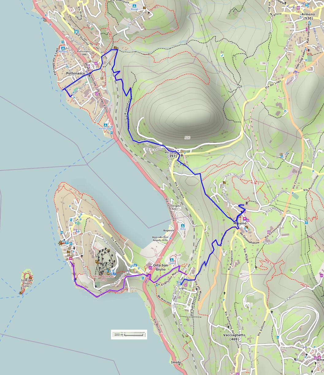
LAKE ORTA: FROM PETTENASCO TO LEGRO
Lago d’Orta
Route description
An easy route that partly follows the “Raggio d’Oro” (Golden Ray) one and leads from the village of Pettenasco to Legro, a “painted village“, through the fascinating historic hamlet of Miasino.
Departure location: Pettenasco (300 m)
Place of arrival: Legro (360 m)
Maximum altitude: Miasino (492 m)
Difference in altitude: 200 m approx. one way
Distance: 6 km one way
Walking time not counting stops: 2 hours one way
Type of route: mixed (trail, asphalt, dirt road)
Signs: red/white “VU9” signs and red/white marks
Water: fountains in towns and villages
Recommended period: all year round, without snow
How to get there: it is 20 km from the A26 motorway exit of Arona. Go towards Gozzano and follow indications for Orta San Giulio and Pettenasco, located on the eastern shore of Lake Orta. Car parks are located along the provincial road near the parish church or the landing station. Otherwise, parking is available at the Paganetto parking area. By bus: Borgomanero-Omegna line (www.comazzibus.com). By train: Novara-Domodossola line, Pettenasco station (www.trenitalia.com). By boat: Orta-Omegna line, from spring to autumn (www.navigazionelagodorta.it)
Information: Distretto Turistico dei Laghi www.distrettolaghi.it; IAT Office – Via Bossi 11, Orta San Giulio, tel. +39 0322 905163; Municipality of Orta San Giulio www.comune.ortasangiulio.no.it; Tourist Office – Via Vittorio Veneto c/o Museo dell’Arte della Tornitura del Legno, Pettenasco, tel. +39 345 9956357; Municipality of Pettenasco www.comune.pettenasco.no.it; Municipality of Miasino www.comune.miasino.no.it
the itinerary
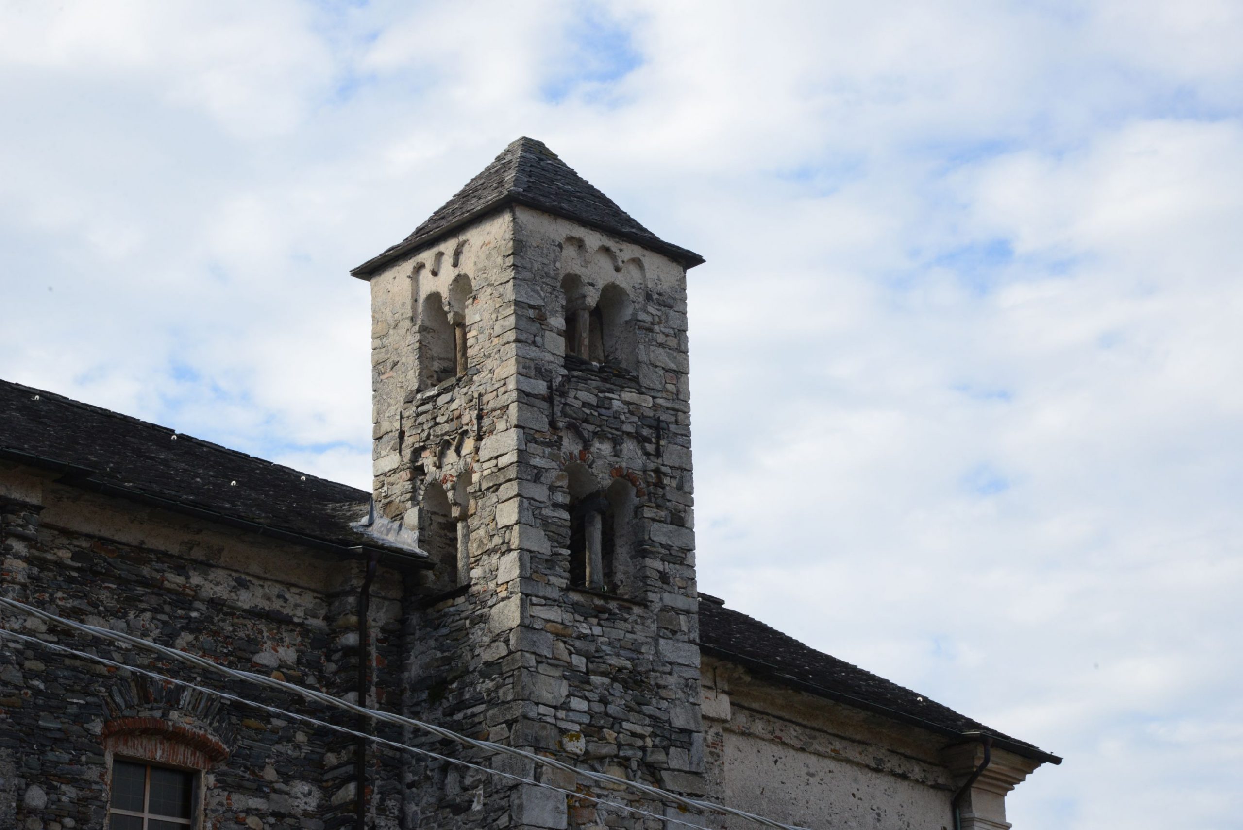
Even though it is possible to get to the Paganetto picnic area by car, we recommend that you park near the church or lakeside promenade, if possible, so that you can walk through the village of Pettenasco and admire the beautiful 11th century Romanesque bell tower, one of the oldest on the Riviera. From the church, cross the state road to take Via Vittorio Veneto (be careful, there is no pavement/sidewalk), which leads uphill first to the Museum of the Art of Wood Turning (“Museo dell’Arte della Tornitura del Legno”) and then to the intersection with a small chapel (water fountain).
Wood turning was a typical type of craftsmanship in the Cusio area. There were many businesses producing objects in turned wood until the Fifties. The museum contains a collection of tools, machinery and objects from local factories and workshops.
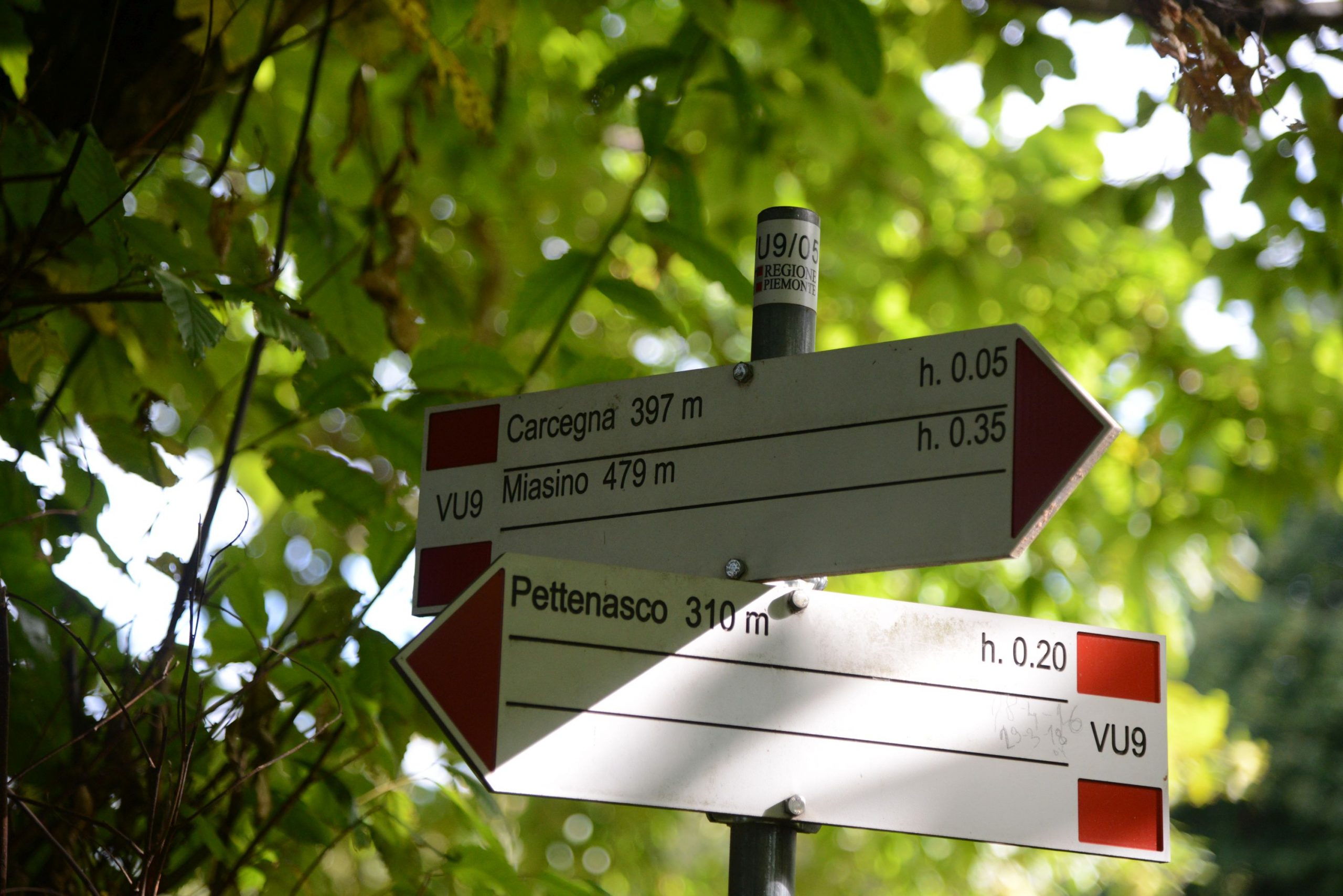
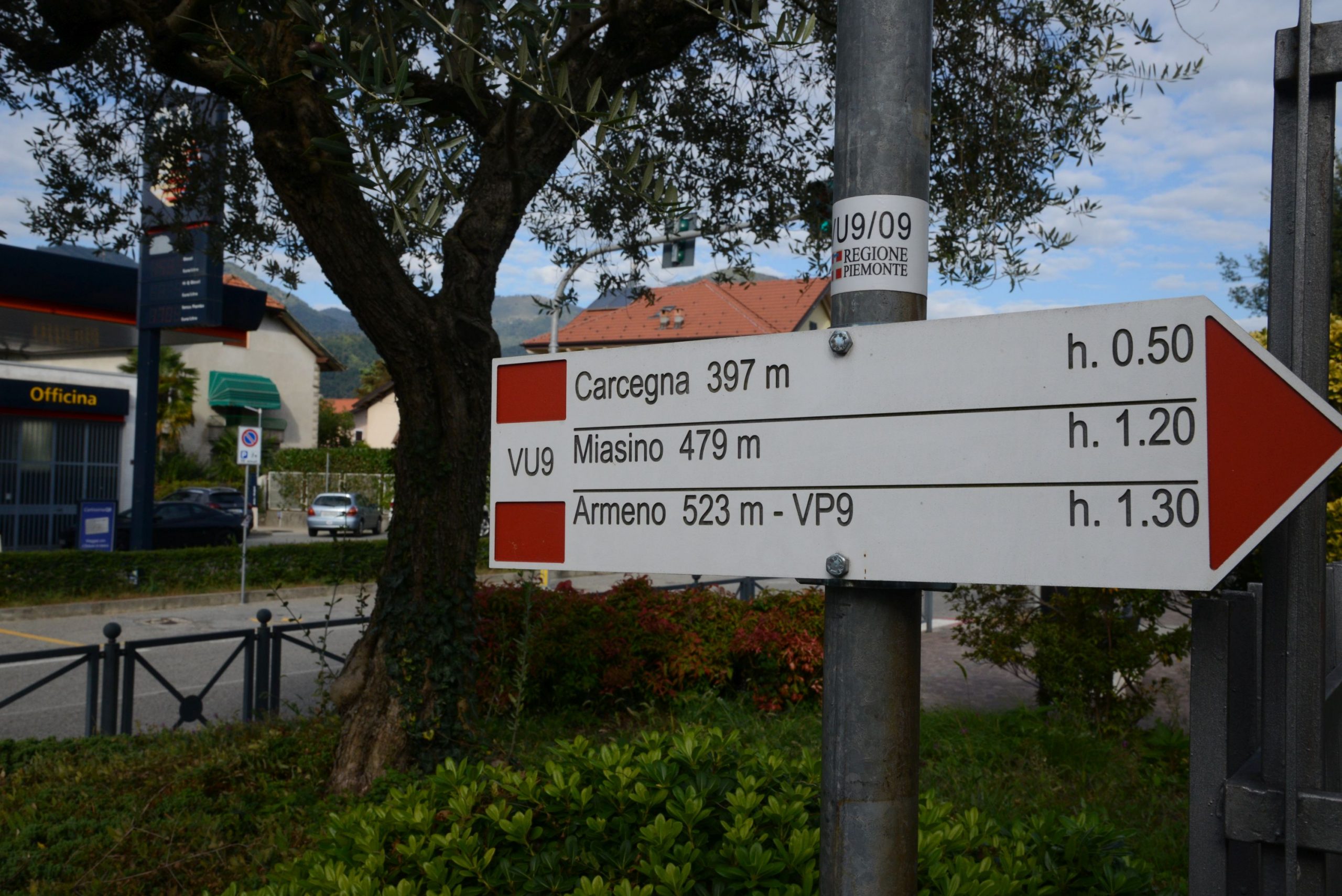
Just after taking the road on the right (brown “Paganetto picnic area” sign) go under the high railway bridge (while you pass underneath, try making noise and listen to the echo!). Stay on the asphalt road, and you’ll come to the picnic area, right before an old bridge covered with ivy. A short detour takes you up the stairs to the left and leads to the base of the bridge, near the bank of the stream, with an old fountain and a statue of the Blessed Virgin. Just after the bridge, you need to take the dirt road on the right (VU9 sign for Carcegna-Miasino) which climbs gradually until it touches the railway line. Continuing on after this point, some cobblestone sections become visible. When you come to a gate, the road bends decisively to the left and proceeds uphill more sharply until it joins a wider dirt road that continues to the right, now more gradual. You enter between the houses of Carcegna along Via Roma. Stay on Via Roma and ignore the signs of various colours. Shortly, you will come to a crossroads near the Church of San Pietro Apostolo. Cross the intersection to reach the church. There is a small playground behind it. Then, follow a short stretch of asphalt road and almost immediately go left (sign for “Miasino-Legro”). After a building that houses the workers’ club you have to watch the path carefully and go right on the smaller grassy road (Be careful! If you go straight, you will enter a private property!) that crosses a meadow and then gets to a bridge over a small stream. Then, you’ll climb a staircase. Once at the top, take the dirt road to the left, which after a short while becomes asphalted. This road is always angled slightly uphill. From this point, go straight on. To the right, there is a view of the lake and the Orta San Giulio peninsula. This way you can reach the village of Miasino by entering under an archway that leads to the cobbled streets.
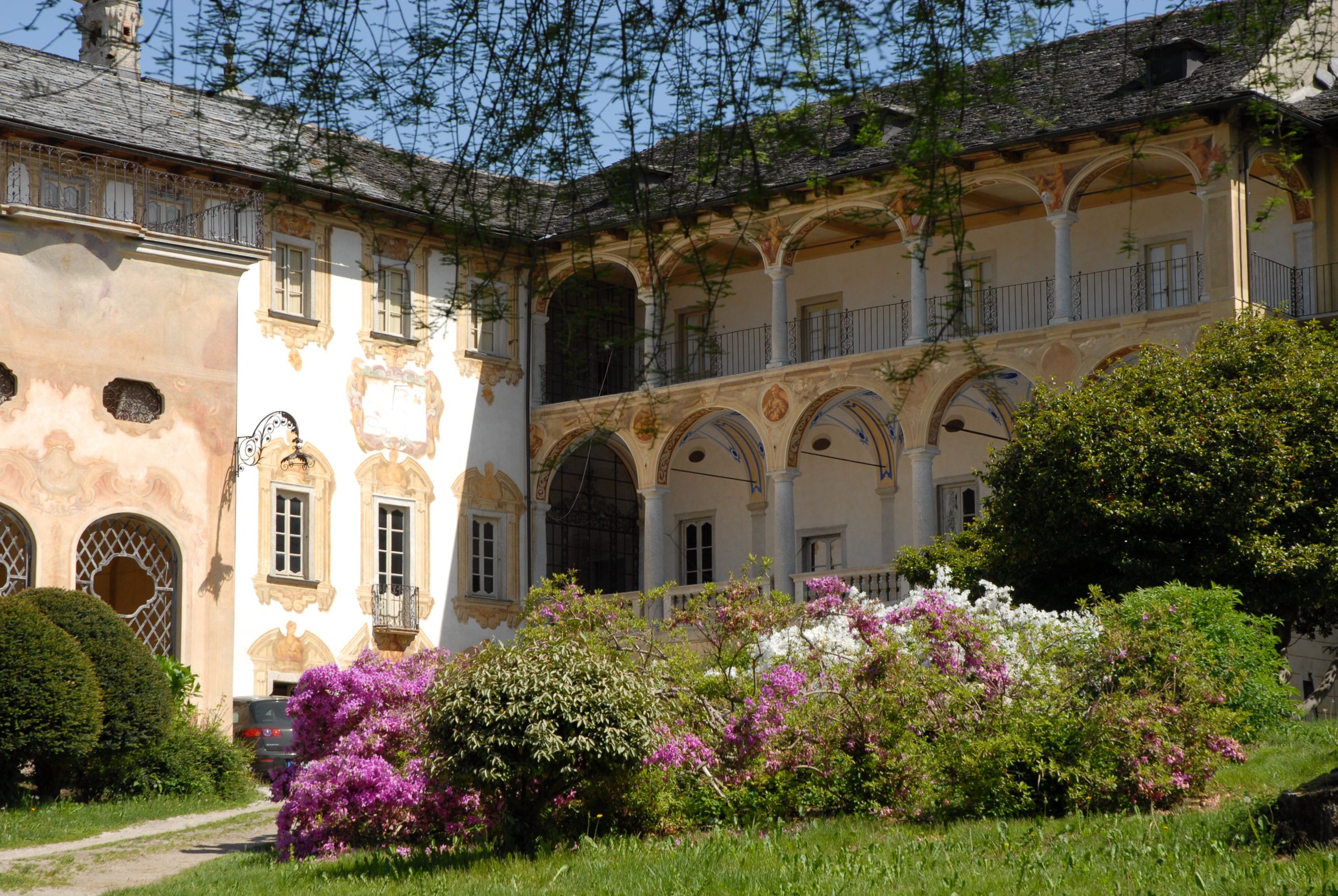
Variant: the route continues to the right, but we recommend a detour to the left through the village streets. You will pass Villa Nigra, a marvellous aristocratic country manor with wings built in various periods, from the 16th to the 18th centuries. Now under municipal management, it hosts events, exhibitions and concerts. From here, follow the signs for the Church of San Rocco, a magnificent building situated slightly higher than the village. Grassy “steps” lead up to the church (benches and water fountain). This is the highest point of the entire route. In the immediate vicinity, you’ll find the “Giardino dei Semplici”, a sort of botanical garden with a collection of plants mentioned in the Bible, and just behind the bell tower, there is a football pitch and a volleyball court.
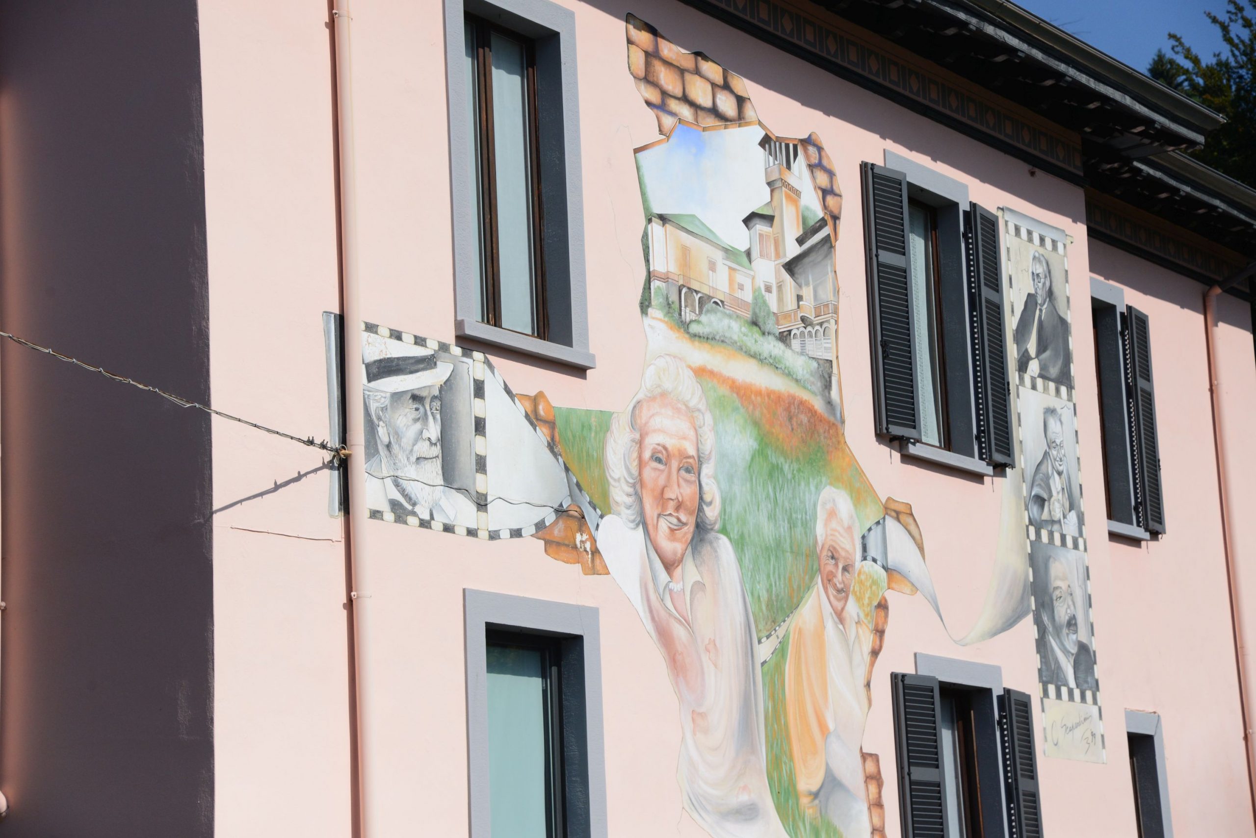
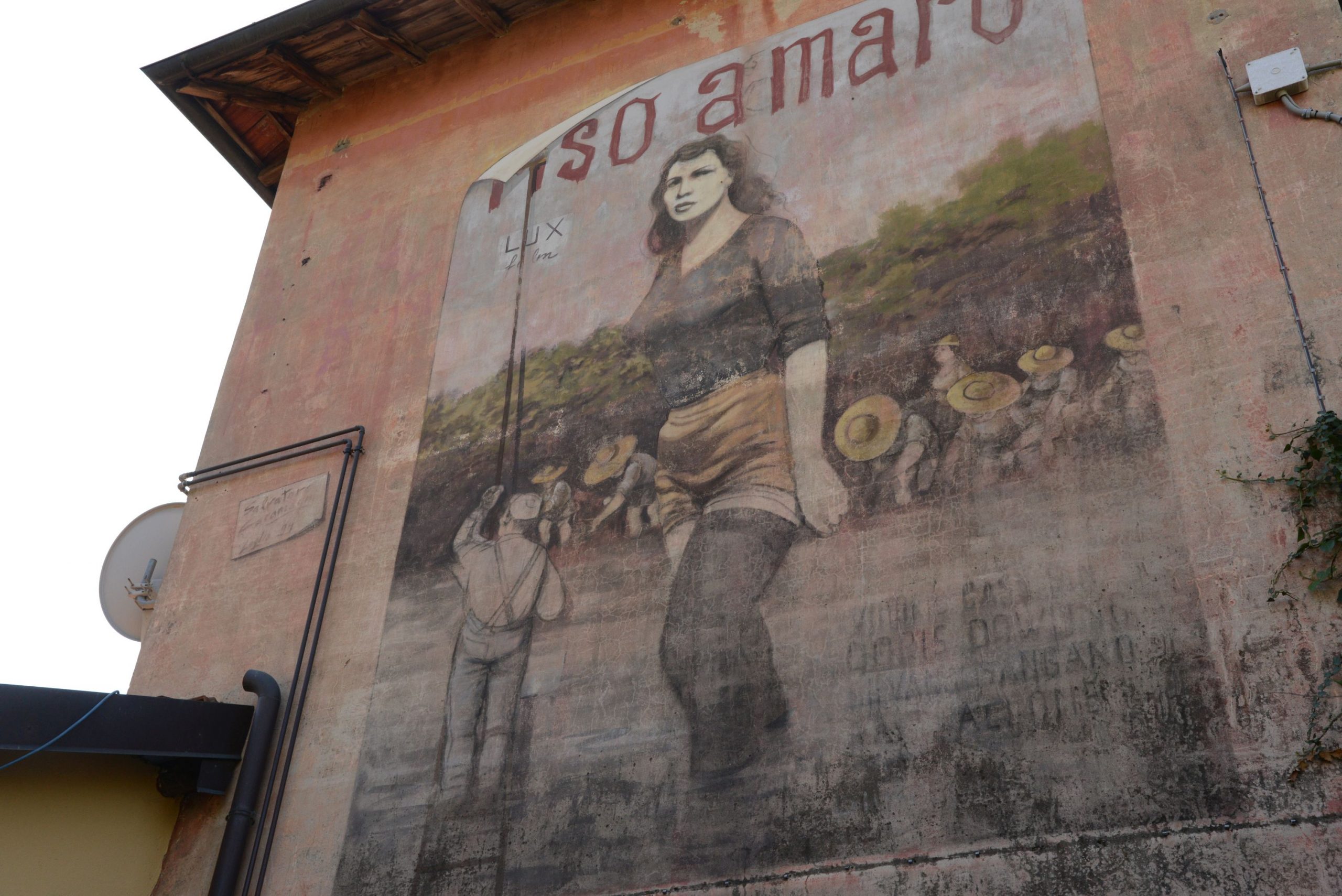
From the fork in the road, continue on the cobblestone street until you reach an intersection. You have to turn right along a stretch of asphalt (be careful, there is no pavement/sidewalk!). After 300 metres, take a dirt road on the right (sign for “Legro-Orta”) which leads down through a wooded stretch. The dirt road becomes asphalt and at its end, you turn left. Go through the intersection, and head towards the two gates in front of you: between the two is where Via Vecchia Stazione begins, and you will see the first film-themed murals. You have arrived in the town of Legro, known as “the painted village” because there are many murals throughout the town on the façades of the houses and through the streets. All of them depict films shot on Lake Orta, and you should wander through the village to see them.
There are various ways to return to the starting point.
You can simply go back they way you came.
You can take the Novara-Domodossola line train from the Orta-Miasino railway station (which is actually in Legro!).
Finally, we really recommend walking on to Orta San Giulio (see the description below) and, from there, returning to Pettenasco with the boat that travels towards Omegna (not during winter).
Towards Orta San Giulio
Difference in altitude: -100 meters downhill one way
Distance: 2 km one way
Walking time not counting stops: 45 minutes one way
When you get to the rail road, cross through the underpass and go towards the sport facilities. Continue on the trail to Via Marconi, near the roundabout where the impressive Villa Crespi is located.
If for some reason it is not possible to take this path, just walk with the railway line to your right until you pass the station and reach Via Marconi. Here, go left and descend to the roundabout mentioned above, or take the smaller street Via Don Giovanni Bosco that runs parallel to this street and has no traffic.
At the roundabout, Villa Crespi appears in all of its splendour. Today, it houses a luxury hotel and a restaurant owned by a famous Italian chef. You are now in Orta San Giulio, one of the most beautiful villages in Italy – “Borghi più belli d’Italia” (www.borghipiubelliditalia.it). Turn right alongside the villa and take Via Fava, which will quickly lead to the lake shore and end in Piazza Mario Motta, where there are several businesses and the boat landing stage. At one end there is an interesting frescoed building with a staircase: the “Palazzo della Comunità”. Built in 1582, it was the government seat of the feudal state of the “Riviera di San Giulio”, and is now also known as “Broletto” or “Palazzotto”. Orta unfolds in a maze of intricate streets, which are only apparently chaotic. Just stay on Via Olina, which continues behind the Palazzo della Comunità, to explore the town’s most typical alleys and gardens, or start walking up Via Caire Albertoletti, also known as the “salita della Motta”, to admire some of the oldest buildings. Casa Marangoni (14th century), for example, is also called “Casa dei Nani” because of the small windows that adorn its upper part, supported by a long wooden lintel and decorated with frescoes.
to learn more
a special visit
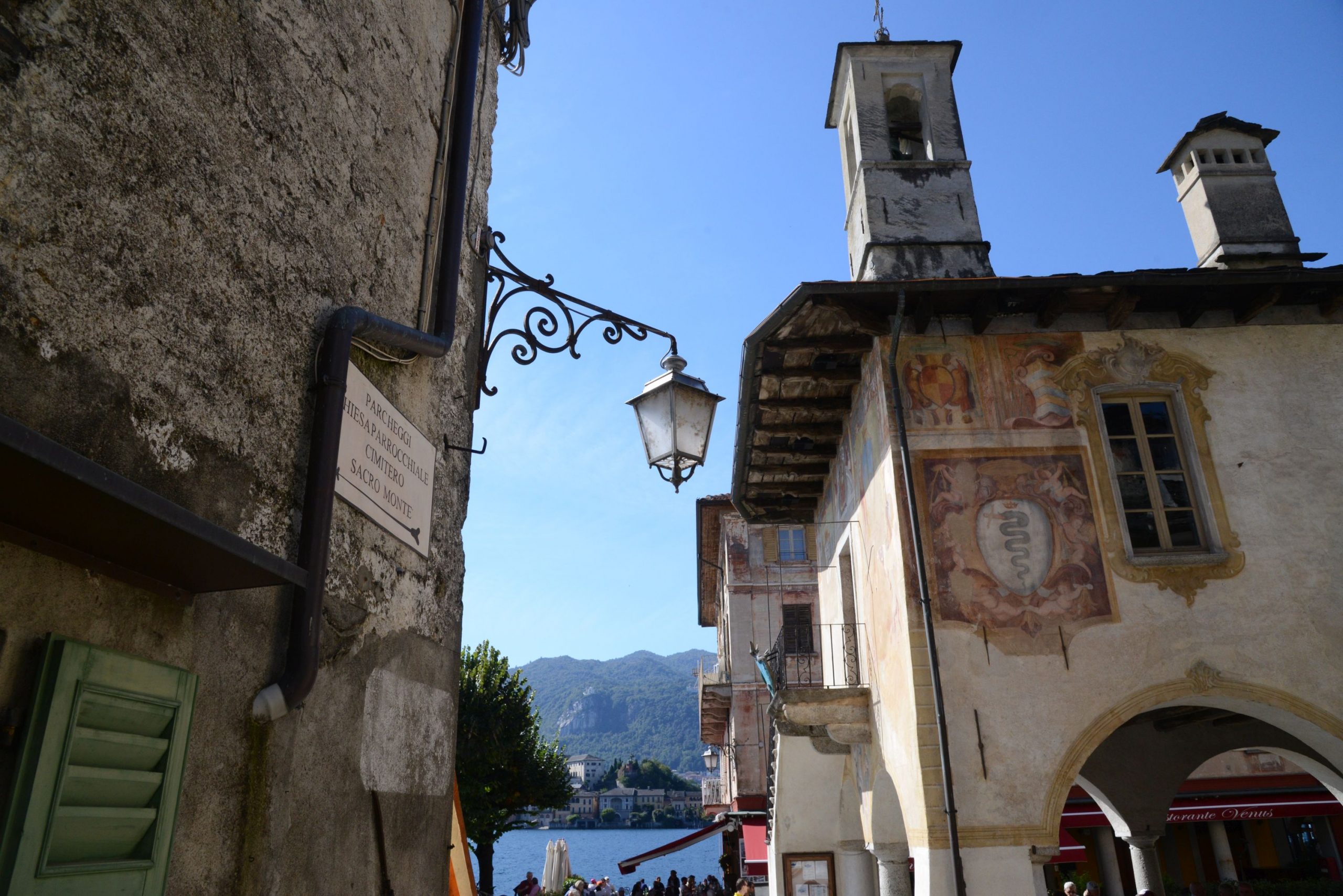
Several boats sail from Orta to the Island of San Giulio, which is certainly worth a visit. Its narrow alleys, staircases and stone arches create a truly evocative setting. Most of its buildings were erected on the remains of an ancient castle, perhaps of Longobard construction, but the most spectacular is certainly the Basilica of San Giulio, with its pure Romanesque style exterior. The original church was built in the 4th century, apparently by the saint in person. It was rebuilt for the first time in the 9th century, and then underwent further changes during the 10th and 11th centuries. Inside, visitors can see a fine stone pulpit in Oira serpentine stone (12th century), with interesting bas-reliefs including a mysterious human figure. According to tradition, it is Guglielmo di Volpiano (962-1031), a Benedictine monk and abbot of Dijon, who was born here on the island. Other significant artwork includes the frescos, done from the 14th to the 16th centuries, some by students of the painter and sculptor Gaudenzio Ferrari (1475/80-1546). Inside the sacristy is a fossil vertebra, which is presumed to have been discovered in a cave on the Orta peninsula. Could it be the remains of one of the dragons that San Giulio banished? Another very important building is the Mater Ecclesiae Abbey. Since 1973, a large group of Benedictine cloistered nuns has lived there and dedicated their time to restoring precious fabrics and tapestries.
tips for young hikers
This hike can be done by (almost) everyone but it is not accessible to pushchairs. If you can, continue walking to Orta. Children will appreciate a nice ice cream while resting on the shores of the lake!
Trail creators: Franco Voglino, Annalisa Porporato and Nora Voglino
Content authors: Franco Voglino and Annalisa Porporato
Back to the list of routes
A glimpse of life in the Middle Ages
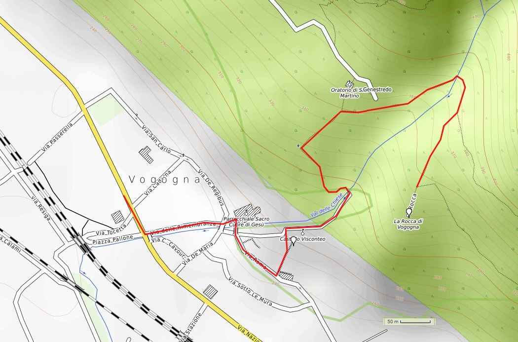
THE HISTORICAL PATH OF VOGOGNA
Piana del Toce
Route description
A walk through history in the characteristic streets of Vogogna and then up to the fortress ruins, to get a glimpse of life in the Middle Ages.
Departure location: Vogogna Town Hall (222 m)
Place of arrival: la Rocca (323 m)
Maximum altitude: 392 m
Difference in altitude: 180 m one way
Distance: 1.5 km one way
Walking time not counting stops: 45 minutes one way
Type of route: mixed (trail, asphalt, cobblestones, dirt road)
Signs: road signs and red/white marks
Water: fountains in Vogogna and picnic area
Recommended period: all year round, without snow
How to get there: by car 15 km from Domodossola, large parking lots in front of the town hall and near the theatre. By bus: various lines, “Vogogna bivio FS” stop (www.comazzibus.com). By train: Vogogna FS railway station (www.trenitalia.com)
Information: Distretto Turistico dei Laghi www.distrettolaghi.it; Municipality of Vogogna www.comune.vogogna.vb.it
the itinerary
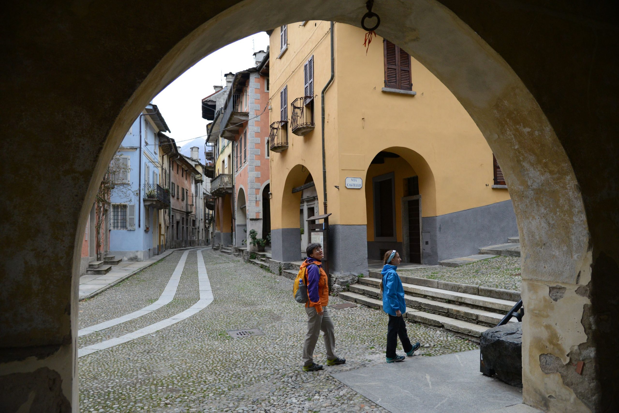
From the car park, keep the town hall to your right and follow a short stretch of road until you reach the cobblestones of Via Rimembranza, which climbs easily up to the neo-Gothic Church Sacro Cuore di Gesù, built in the late 19th century (nearby, you’ll find a fountain and one of many educational panels installed along this trail). Next to the building, there is a large space similar to a theatre. This was the site of the old parish church that collapsed in 1975.
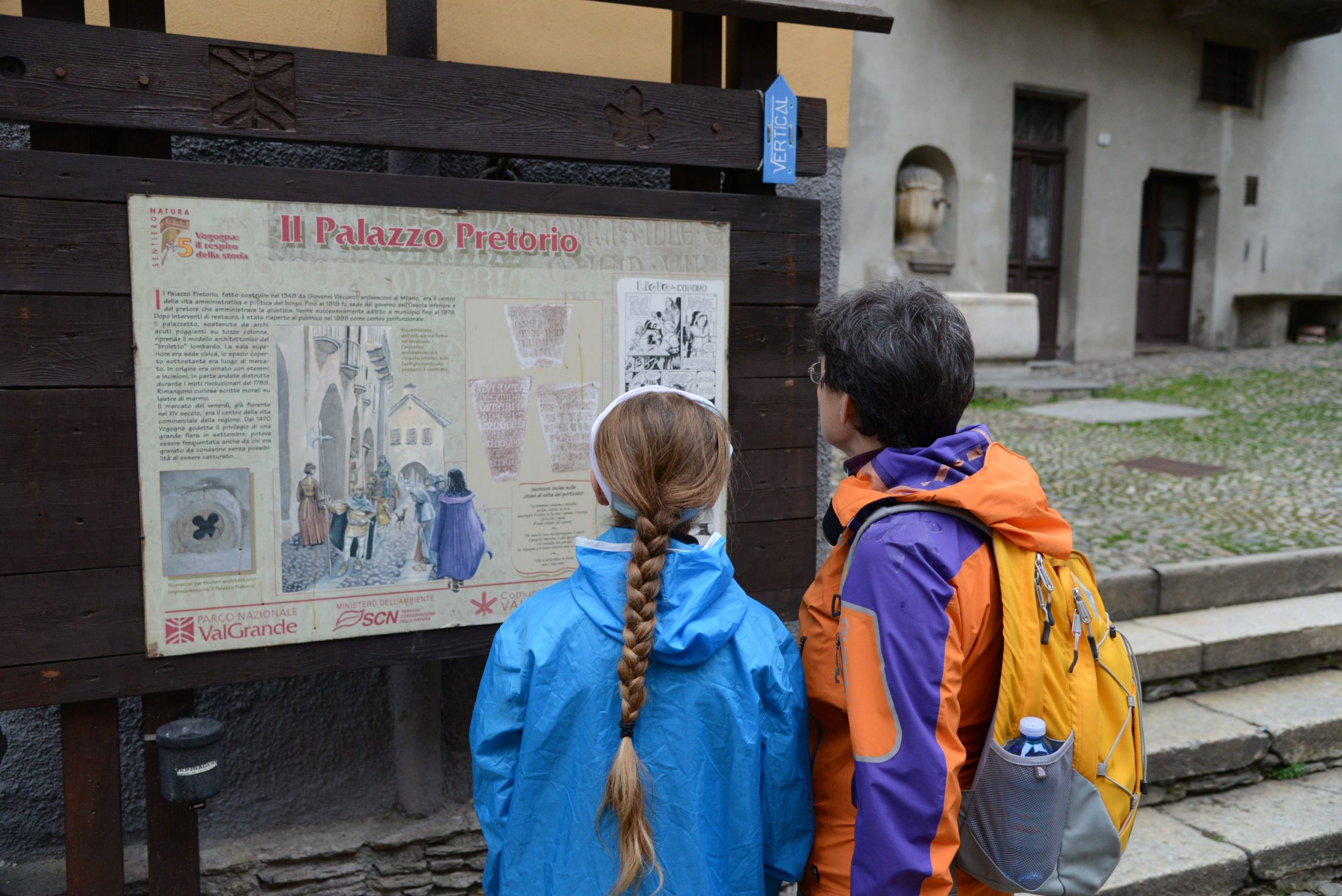
Only the portal of it remains, and has been incorporated into the new bell tower. From the church, pass over the bridge where the village gates once stood. Take Via Roma (wooden sign for “Sentiero Natura” La Rocca) to admire the historical buildings with 18th century balconies and medieval arcades, such as the one where the tax collector lived (the “gabelliere”, who collected tariffs on goods). The streets throughout the town are paved with river stones. This road takes you to “Palazzo Pretorio”, built in 1348 in the style of Lombard “broletti”, or raised public spaces.
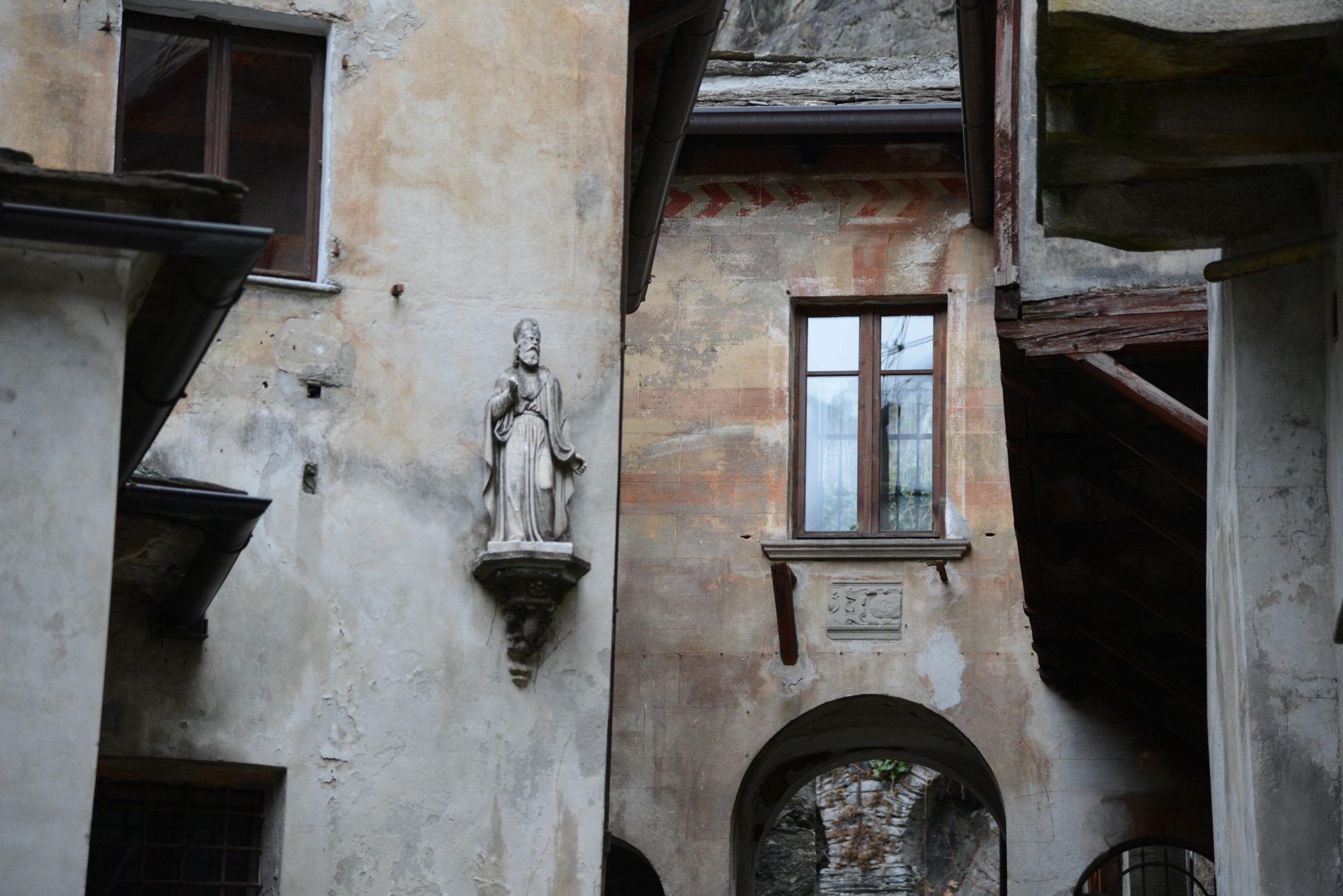
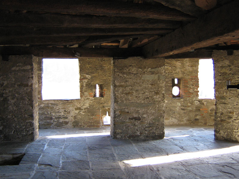
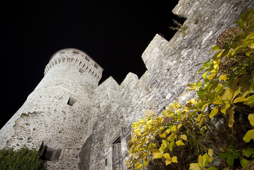
In fact, the building was used as a shelter on rainy days for the market, where goods and information were exchanged. Until 1819, it was the seat of government of the lower Ossola area. Beautiful mansions are all around, such as Villa Biraghi (1650), which now houses the administrative offices of the National Park Val Grande. If you wish, you can continue on a bit until you reach the square that indicates the place where the second entrance to the village stood. Here, you can admire the back of Casa Marchesa, the oldest building in Vogogna, dating back to 1350. Then, go right along the narrow Via Sotto le Mura, which passes along the perimeter of the ancient defensive walls. Walk to the right along Via Teatro or Via della Motta, or go to the end of Via Sotto le Mura, and take Via Roma back to Palazzo Pretorio. From here, go left up the steps that lead to the Visconti Castle, already visible with its mighty tower that dominates the entire town (www.castellodivogogna.it).
Dating back to 1348, after having been the military and administrative centre of lower Ossola region, and also a prison (until 1914), today it is a museum and a place for meetings and cultural events. Go around the castle and pass close to the boundary wall that rises to your right, and you’ll get to a bridge. Then take the mule track to the right, uphill. Once you have reached an isolated building, the mule track starts to climb steeply, with a magnificent view of the castle. This brings you to the hamlet of Genestredo (354 m), passing by an interesting lavoir that is almost level with the road. When you reach the centre of the village, there is a canopy and a fountain (not drinkable). Turn right (sign for La Rocca A34a) along a gradual dirt road that leads to a ford.
After you pass the ford, a staircase climbs quickly up and then levels out, leading pleasantly to a picnic area with tables, a fountain and grilling areas, and then to the tower of the ancient Longobard fortress, known as the “Rocca”. Devastated in 1514, only the ruins of the tower remain (a sign warns visitors to not get too close due to possible falling stones). The access path is inviting, but not worth the trouble, because you are already on the most beautiful side of the building.
to learn more
the brand “I Borghi più Belli d’Italia”
Do not forget that Vogogna is officially among the “Most Beautiful Villages in Italy” (www.borghipiubelliditalia.it) for its precious historical and artistic heritage as well as the excellent preservation of its monuments.
the Celtic mask
In Dresio, slightly outside Vogogna going towards Domodossola, visitors can admire the Oratory of San Pietro, the town’s first parish church, of Longobard origin with 15th century frescoes. Next to the building, there is a fountain adorned with an interesting mask dating back to the 1st or 2nd century BC, called the “Celtic mask”. It is a copy; the original is kept inside Palazzo Pretorio.
tips for young hikers
Accessible to pushchairs/strollers only inside the village. Use the panoramic lift to get up to the castle (only during opening hours). Large playground in front of the town hall.
Trail creators: Franco Voglino, Annalisa Porporato and Nora Voglino
Content authors: Franco Voglino and Annalisa Porporato
Back to the list of routes
A circular excursion to see the wet lowland forest of this natural park, included in the UNESCO World Heritage
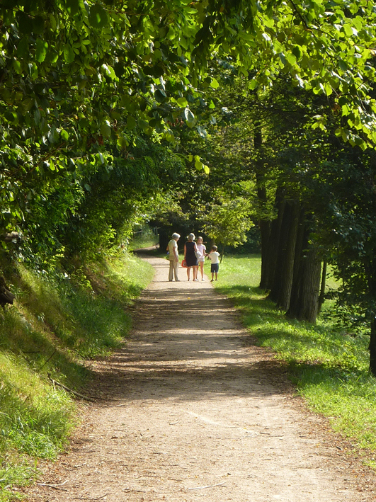
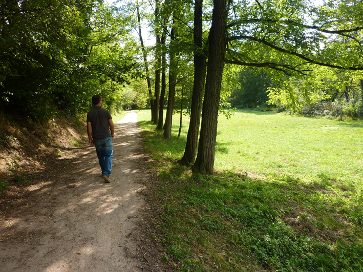
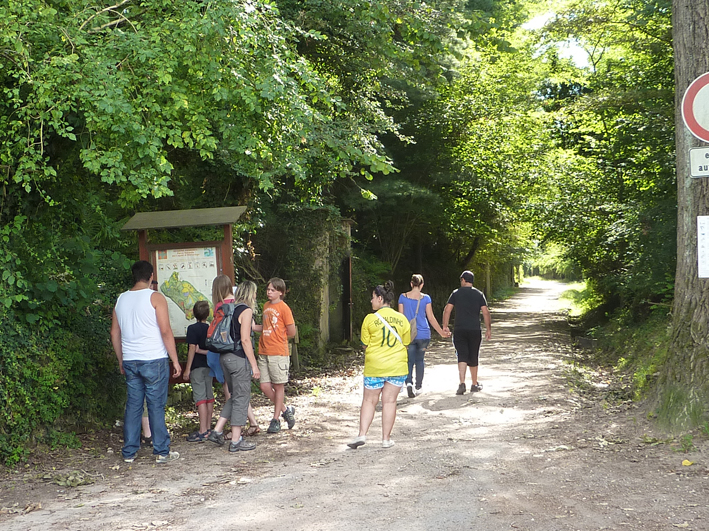
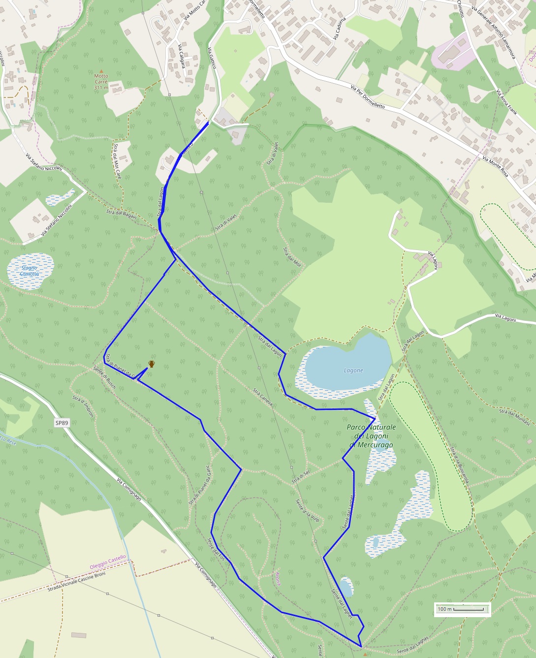
LAKE MAGGIORE: NATURE PARK LAGONI DI MERCURAGO
Lago Maggiore
Route description
A circular excursion to see the wet lowland forest of this natural park, included in the UNESCO World Heritage since 2011 due to important archaeological finds and its history as a pile-dwelling site.
Departure and arrival location: parking area in Via Gattico (270 m)
Maximum altitude: necropolis of the Golasecca Civilization (320 m)
Difference in altitude: Approx. 150 m total (not continuous)
Distance: 5 km total
Walking time not counting stops: 2 hours total
Type of route: dirt road and trail
Signs: arrows and signs with trail names
Water: fountain at the parking lot
Recommended period: all year round, but avoid walking with rain and fog and on hot, steamy summer days.
How to get there: the official entrance is 3 km from Arona. It is located at the southern end of Lake Maggiore, in Via Gattico 6 in Arona (brown signs). Car parks are near the park headquarters. By bus: Arona is served by several lines (www.comazzibus.com, www.stnnet.it, www.safduemila.com). By train: Arona station on the Milan-Domodossola and Arona-Novara lines (www.trenitalia.com). By boat: Arona-Locarno and Locarno-Arona lines (www.navigazionelaghi.it)
Information: Distretto Turistico dei Laghi www.distrettolaghi.it; IAT Office – Largo Duca d’Aosta, Arona, tel. +39 0322 243601 www.visitarona.it; Municipality of Arona www.comune.arona.no.it; Ente Gestione Aree Protette del Ticino e del Lago Maggiore www.parcoticinolagomaggiore.com
the itinerary
The park organisation offers various possible routes marked by arrows and different colours, all available on maps that you can get at the park headquarters.
Our route partly follows the Archaeological Route (purple), and starts along Strà di Pianèl da Gatic (number 1). At the fork with the votive pillar, turn right and follow route number 1, but then leave it and go straight towards Strà di Lagon (number 2). The path is flat and leads near the Lagone, the largest wetland area in the park, where the remains of a pile-dwelling village have been found on its banks.
The site, found by chance during peat extraction works, dates back to the 18th-13th centuries BC. Several well-preserved objects have been found here, such as pottery, weapons, metal ornaments and flint tools. The most interesting finds were three wooden wheels and casts of two dugout pirogues (similar to canoes). At present, most these finds are kept at the “Museo delle Antichità” (Museum of Antiquities) in Turin.
It is not possible to get close to the banks of the lake because it is a protected area and the vegetation is quite dense. Nevertheless, the view is breath-taking. Continuing further on, you’ll come to a T-junction. Turn right towards Strà di Sèl (number 15), and almost immediately, go left towards Senté dal Laghèt (number 11). The path winds its way through a dense area of peat bogs to climb towards the Motto Caneva. At a crossroads with several streets, turn right on Senté dal Custòn (number 16), which passes near the area where the remains of a Roman necropolis were found, consisting of about ten tombs.
A short detour to the left puts you on a path leading to the top of the hill, surrounded by white pines. If you go straight on, you’ll pass next to a second Roman necropolis from the I-II century AD. Immediately after that, bear left and take the Senté dal Fòs (number 17) which is going to rejoin the Strà di Sèl (number 15), which you should take to the left. After a few more metres, you’ll be on the Strà di Pianèl da Gatic (number 1) that leads to the vicinity of the Iron Age necropolis of Golasecca (VI-V century BC). It is located on a nearby hill, which can be reached by a short detour to the right.
The so-called Golasecca Culture lived in this area from the 9th to the 4th century BC, and expanded throughout the territory between the rivers Po, Serio, Sesia and Ticino. It takes its name from the town in the province of Varese located on the Ticino, about ten kilometres from here, where the first discoveries were made (fifty tombs with ceramics and metals).
From this point, continue on path number 1, which goes around the Motto dei Lagoni and brings you back to the starting point near the votive pillar.
to learn more
the “Sancarlone”
Arona has a unique monument: a large statue of St. Charles Borromeo (1538-1584) known as the “Sancarlone”, an affectionate name for this local monument that is considered to be a close relative of the Statue of Liberty, the famous American monument. Opened in 1698, after 84 years of work, the colossal statue stands 23.4 m high but rests on a pedestal of 11.7 m, which gives it a total height of 35.1 m. The technique used was so futuristic that it inspired the construction of Lady Liberty. After its size, the most impressive aspect of this statue is the possibility for visitors to go inside and climb up to the saint’s head on a narrow staircase (not suitable people with claustrophobia). Visitors can admire the view of the lake from the statue’s eyes (www.statuasancarlo.it).
the Archaeological Museum in Arona
This museum contains a collection of archaeological treasures from the city and the lower Verbano area including Neolithic finds up to post-Renaissance pottery and glass. Here, visitors will be able to see some of the finds unearthed at the Park Lagoni di Mercurago, such as the cast of a wheel and the funeral objects from the Golasecca Civilization (www.archeomuseo.it).
tips for young hikers
This walk is very easy and completely in the shade, but it should be avoided during the most humid summer days. The indicated route is only partially accessible to pushchairs.
Trail creators: Franco Voglino, Annalisa Porporato and Nora Voglino
Content authors: Franco Voglino and Annalisa Porporato
Back to the list of routes
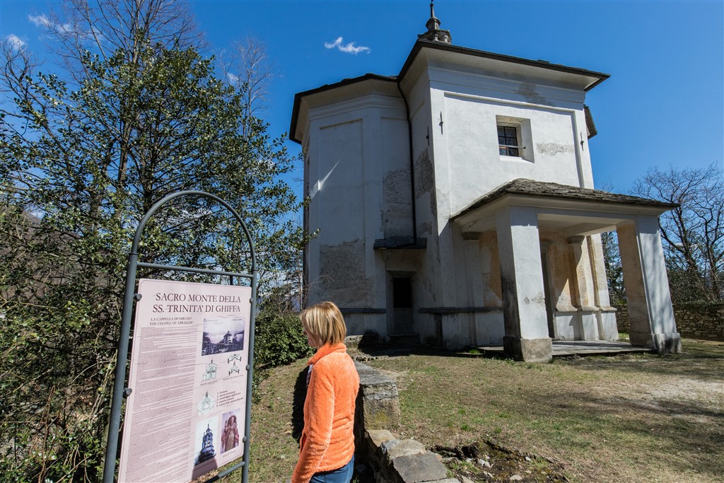
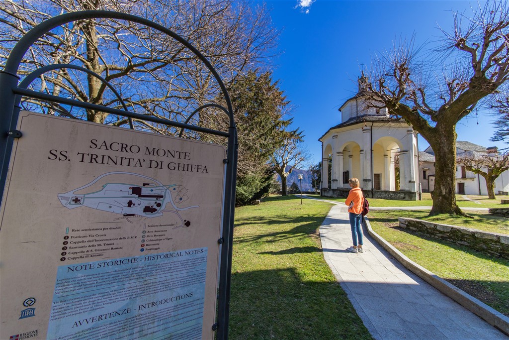
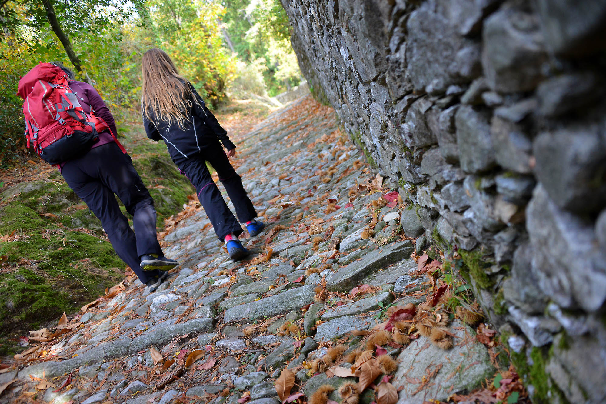
Like the ancient pilgrims, we walk along the mule track that climbs from the lake shores up to one of the Sacri Monti of Piedmont and Lombardy
LAGO MAGGIORE: SACRED MOUNT OF GHIFFA
Lago Maggiore
Route description
Like the ancient pilgrims, we walk along the mule track that climbs from the lake shores up to one of the Sacri Monti of Piedmont and Lombardy, UNESCO World Heritage Site since 2003, from the glittering water to the thick chestnut forests.
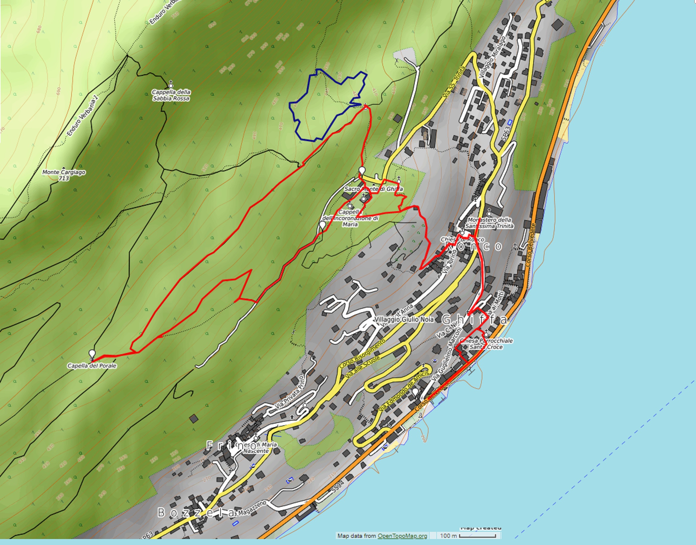
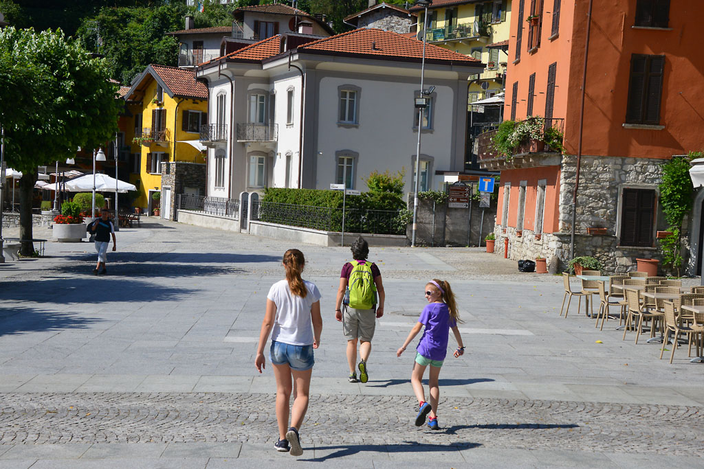
Departure location: Ghiffa, landing stage (200 m)
Place of arrival: Sacred Mount (360 m)
Maximum altitude: Cappella del Porale (470 m)
Difference in altitude: about 300 m
Distance: 5,5 km
Walking time not counting stops: 2 hours
Type of route: mixed (trail, asphalt, dirt road)
Signs: signs, red/white marks
Water: fountains at Ghiffa and Sacro Monte
Recommended period: all year round, without snow
How to get there: 6 km from Verbania. In the direction for Locarno, along the lake. Parking area near the landing stage with parking disc (60 min.). Free parking at 650 meters from the Town Hall. By bus: line 3 Verbania-Cannobio-Brissago, stop Ghiffa; line 8 Intra-Ghiffa-Oggebbio, stop Ronco (www.vcotrasporti.it).
Information: Distretto Turistico dei Laghi – www.distrettolaghi.it; Tourist Office, Corso Belvedere 94 c/o Imbarcadero tel. +39 339 6330959; Municipality of Ghiffa – www.comune.ghiffa.vb.it; Ente Gestione dei Sacri Monti – www.sacrimonti.org; Riseva Naturale Speciale del Sacro Monte SS. Trinità di Ghiffa – www.parks.it/riserva.sacro.monte.ghiffa
the itinerary
From the landing stage, walk along the lakeside for a stretch, with the water to your right, until you are in front of the Santa Croce church. Climbing up the stairs to the right, you will arrive at a playground area with tables and benches. On the left, instead, the trail climbs in Via Ai Motti and following it to the right, you come to an intersection of three roads.
If you leave your car in the free parking, just take the staircase at the beginning of the parking area and that leads to a small oratory. Then it in the alleyway and you will arrive at the same intersection.
Go up the hill (to the left for those arriving from the landing station and to the right for those coming from the parking lot) along the narrow Via Nigra until you arrive on the asphalt road Via Marconi. Go to the right, uphill.
This road is very narrow, and traffic runs one way uphill. You must be careful of possible passing cars.
It meets a wider road, Via Risorgimento, in the hamlet of Ronco. The journey continues along the staircase located a little later, on the left, but before getting there, we recommend going forward a few meters to admire the little church with the stone façade that is part of the nearby convent.
Since 1906, the Monastery of the Most Holy Trinity has hosted around fifty Benedictine Sisters of Perpetual Adoration of the Most Holy Sacrament. If you enter the church, be respectful: at all times during the day and night, at least one nun is present and busy praying.
From the church, go back to the uphill path along the staircase that leads to the church of Ronco and Piazza Fontane. You will pass near the sacred building and at the T-crossing behind you on the left, take Via Torino (an old half faded sign says “Al Santuario”) and then immediately after that, take Via Careghetta on the right. The road is very narrow, and climbs to another T-junction. Here, take the wider cobblestone road to the right, which finally goes into the woods. Once you are in the woods, you will find another junction. Memorise this point, since both tracks are correct. We suggest that you continue straight. You will come back on the path on the right. Therefore, continues on the cobblestone road (slippery in the event of rain) climbing rapidly until you arrive at a new cobblestone pavement. Follow it to the right to ascend to the buildings of the Sacro Monte.
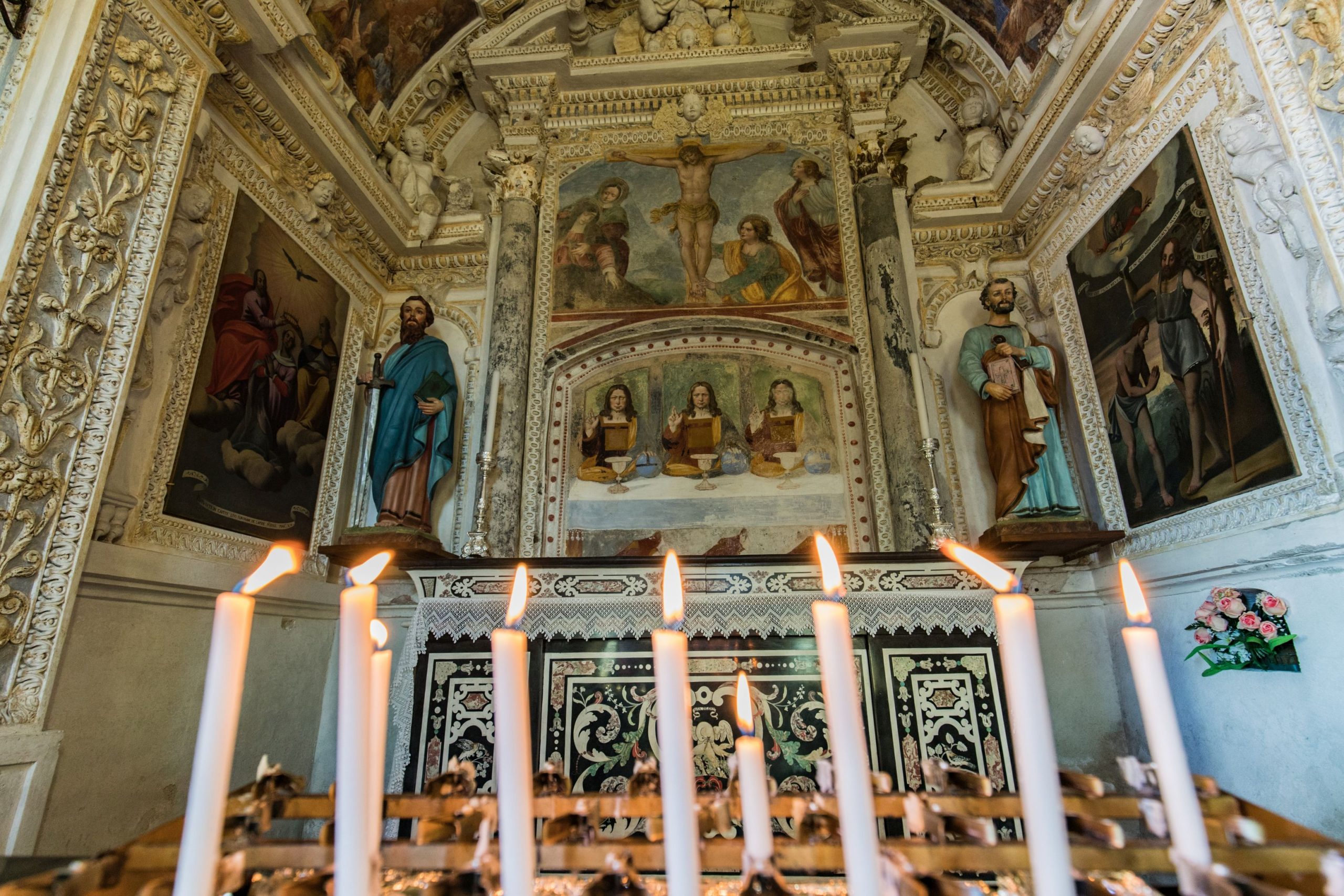
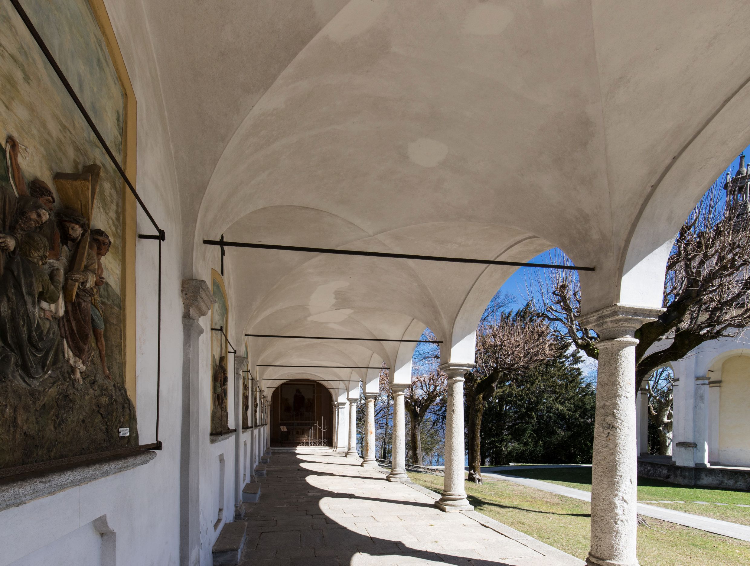
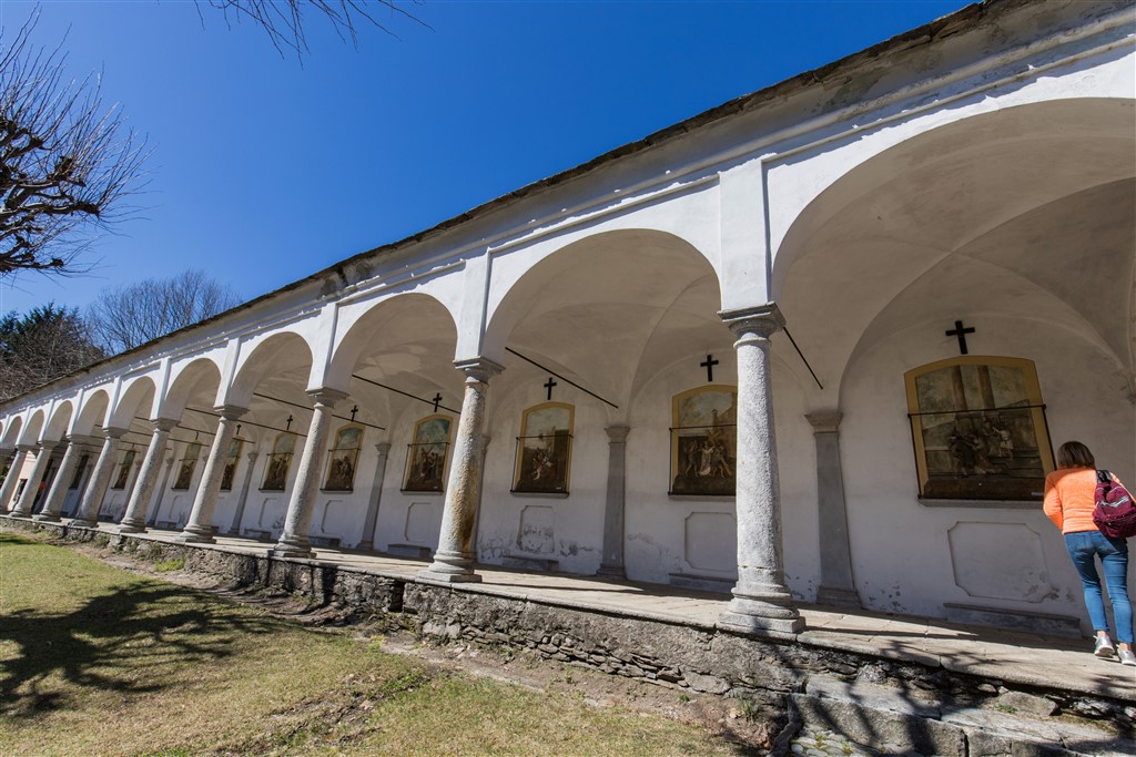
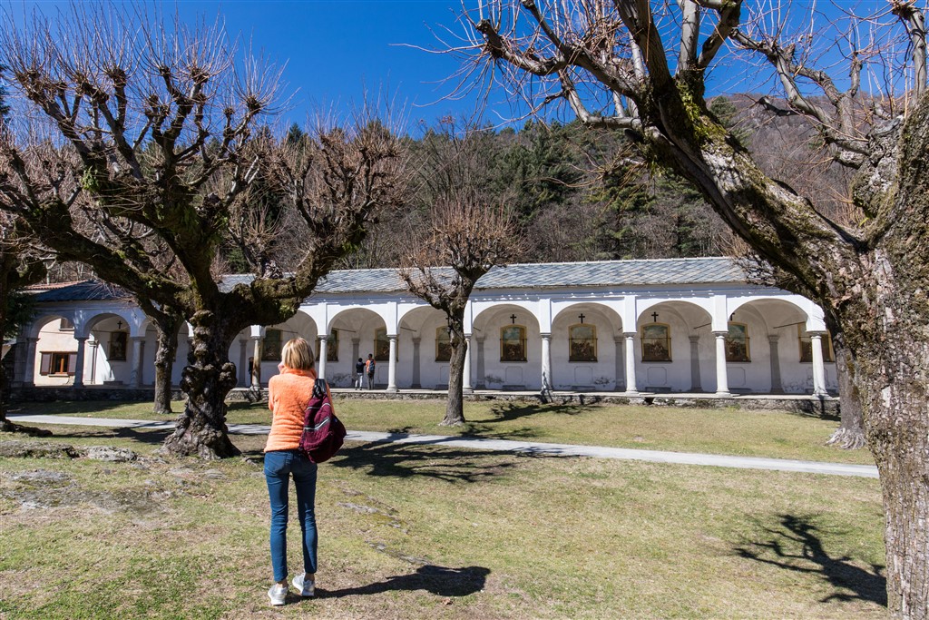
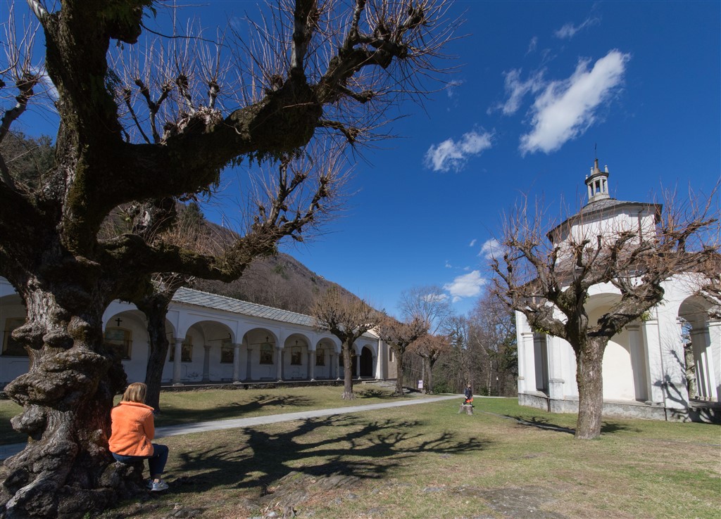
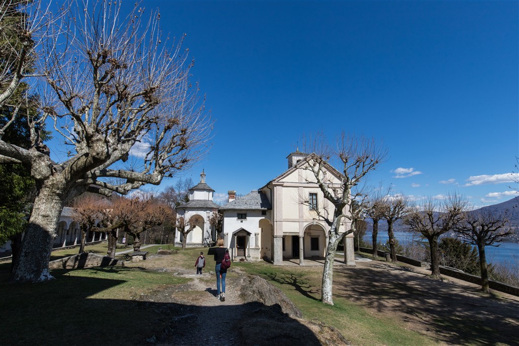
Already in ancient times, there was an oratory here, built in the 12th and 13th century and dedicated to the Holy Trinity. In 1591, this building is mentioned and you can see it still today inside the nave of the present church, on the left. There, you will find the fresco depicting the figure of Christ three times (a symbol of the Trinity: three persons, equal but different). Between the 16th and 17th centuries, the site was extended with the creation of the Sacro Monte, formed by the church of the Holy Trinity (1617) and the chapels of the Coronation of the Virgin (1647), St. John the Baptist (1659) and Abraham (1703), in addition to a portico which shelters a Via Crucis of 1752, closed on one side by a small chapel.
Now, follow the path for disabled visitors that passes in front of the portico of the Via Crucis and leads to covered picnic area with tables and a fountain. The open space around the sacred buildings lends itself to free play of children (but careful to not make too much noise!) and there are no dangerous elements.
The forest above the Sacro Monte has been a Special Natural Reserve since 1987.
After your well-deserved snack or lunch break, continue along the trail marked by didactic panels (white signs say “Cappella del Porale e Caronio”) and in the first part, you are still on the trail for the disabled next to the dirt road. Then you abandon that trail and take the dirt road on the right uphill (signs for “Pollino”). You can travel the entire dirt road or, alternatively, take a steep “short cut” on the left. Both routes converge at the same point just before the junction to return to the Sacro Monte. Before you continue, however, we invite you to go a few more meters in the direction of “Pollino” to reach the small chapel, the Cappella del Porale (1797), immersed in the cool forest. Then, go back to the crossroads previously mentioned in the description, and take the wide track that winds into the beautiful forest of chestnut trees. It is practically flat and, a little further back, is the road you took at the beginning. You will meet a single junction, but it is sufficient to keep on wider flat track to arrive, after a slight downhill segment, at a small power plant.
Here, on the left, you will find the beginning of a path, “Percorso Vita”, less than a kilometre in length, that leads to eighteen physical exercises to perform with equipment or just your own body weight.
Continue on the right, passing next to the power plant building, and then steep footpath with steps leading back down to the Sacro Monte (signs for SS. Trinità and red/white marks). You will once again pass next to the Portico of the Via Crucis and the chapel of Saint John the Baptist, and take the trail on the left (signs for “Cappella di Abramo” that lead you to descend along a path that touches the asphalted road and then leads to the chapel of the Patriarch Abraham, which is slightly farther away with respect to other buildings of Sacro Monte. Continues beyond the chapel to take the cobblestone trail (signs for “Ghiffa”) which soon leads to the junction you already passed on the way up. From here, descend along the path travelled at the start and if you can, stop to explore the characteristic narrow winding streets that form the old centre of Ghiffa, and that unfold behind the church, such as Via Ai Motti, Via Alessandro Volta, Via Soccorso and Via Taccioli.
to learn more
Hat Museum
From 1881 to 1981, the town of Ghiffa was the location of a thriving hat factory called Panizza, which made felt hats, and still produces hats even though it has moved to Tuscany (www.panizza1879.com). Today, the factory building has been transformed into a residence but two rooms house a museum that presents the art of hat making, with machinery on display along with photographs, period prints and videos (www.museodellartedelcappello.com).
tips for young hikers
A simple excursion that presents no difficulties. If you have children in strollers, you drive up to the Sacro Monte and take the path for disabled visitors. The playground area behind is the parish church of Ghiffa, while the Sacro Monte area offers stones to climb and trees to hide behind, and the “Percorso Vita” exercise trail offers new ideas for letting small hikers work off extra energy.
Slow trekkers: Franco Voglino, Annalisa Porporato and Nora Voglino
Authors of texts: Franco Voglino and Annalisa Porporato
Back to the list of routes
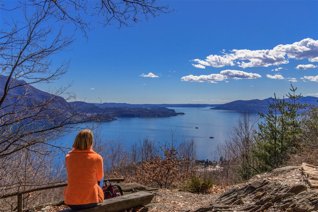
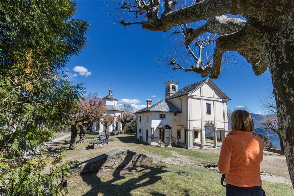
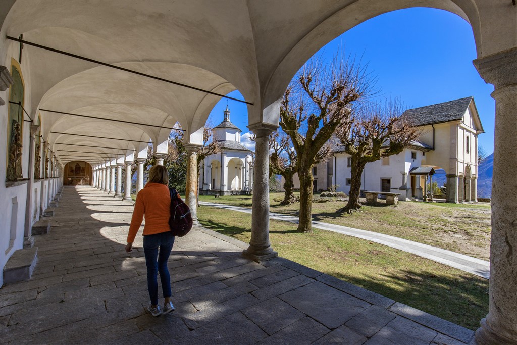
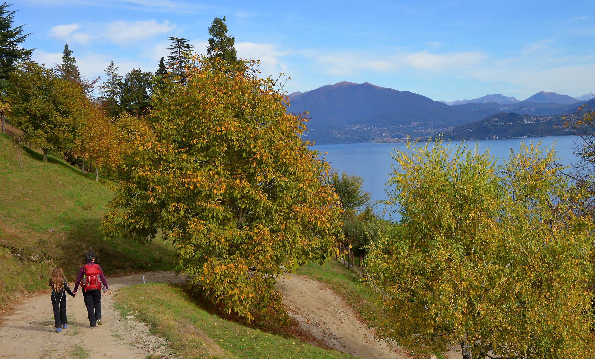
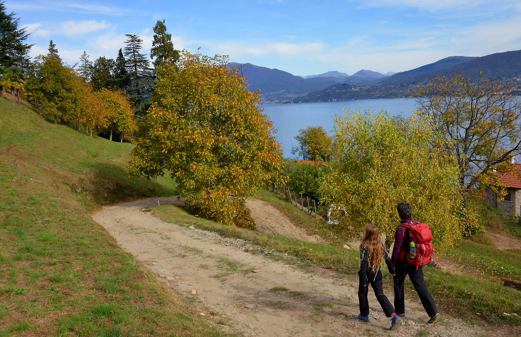
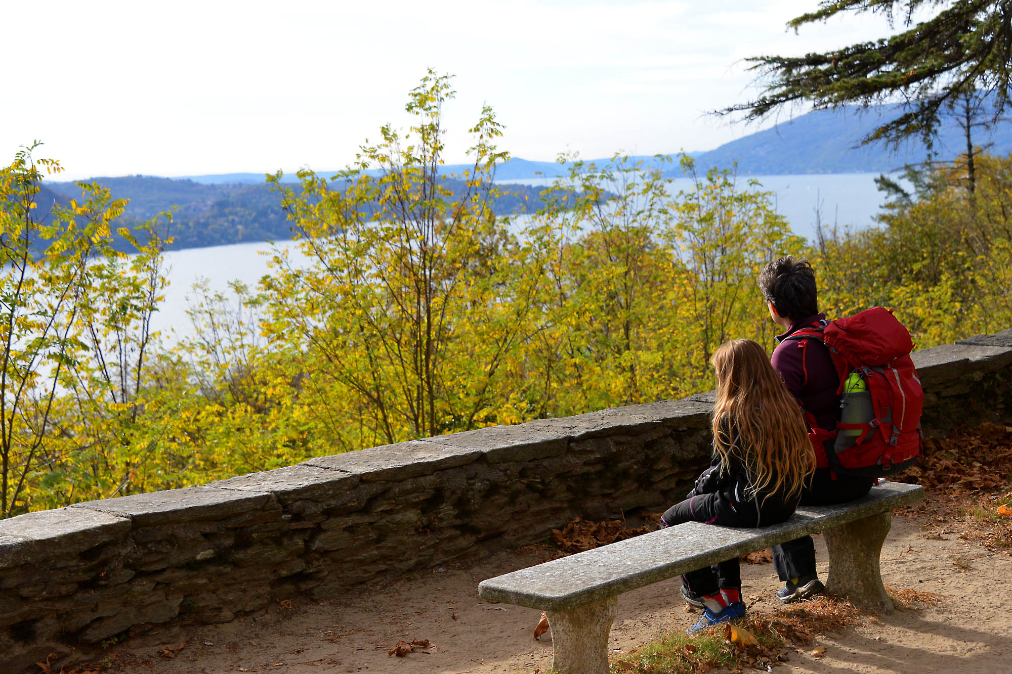
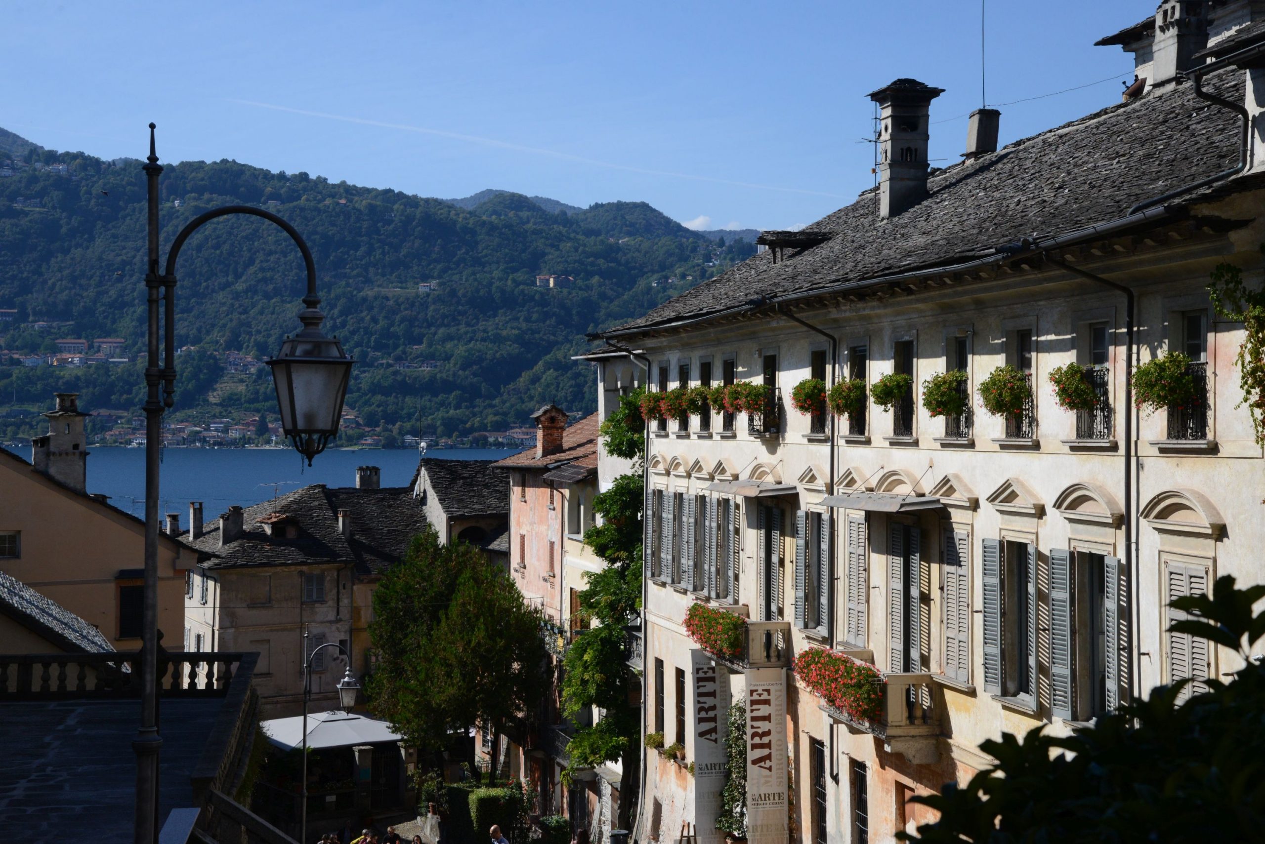
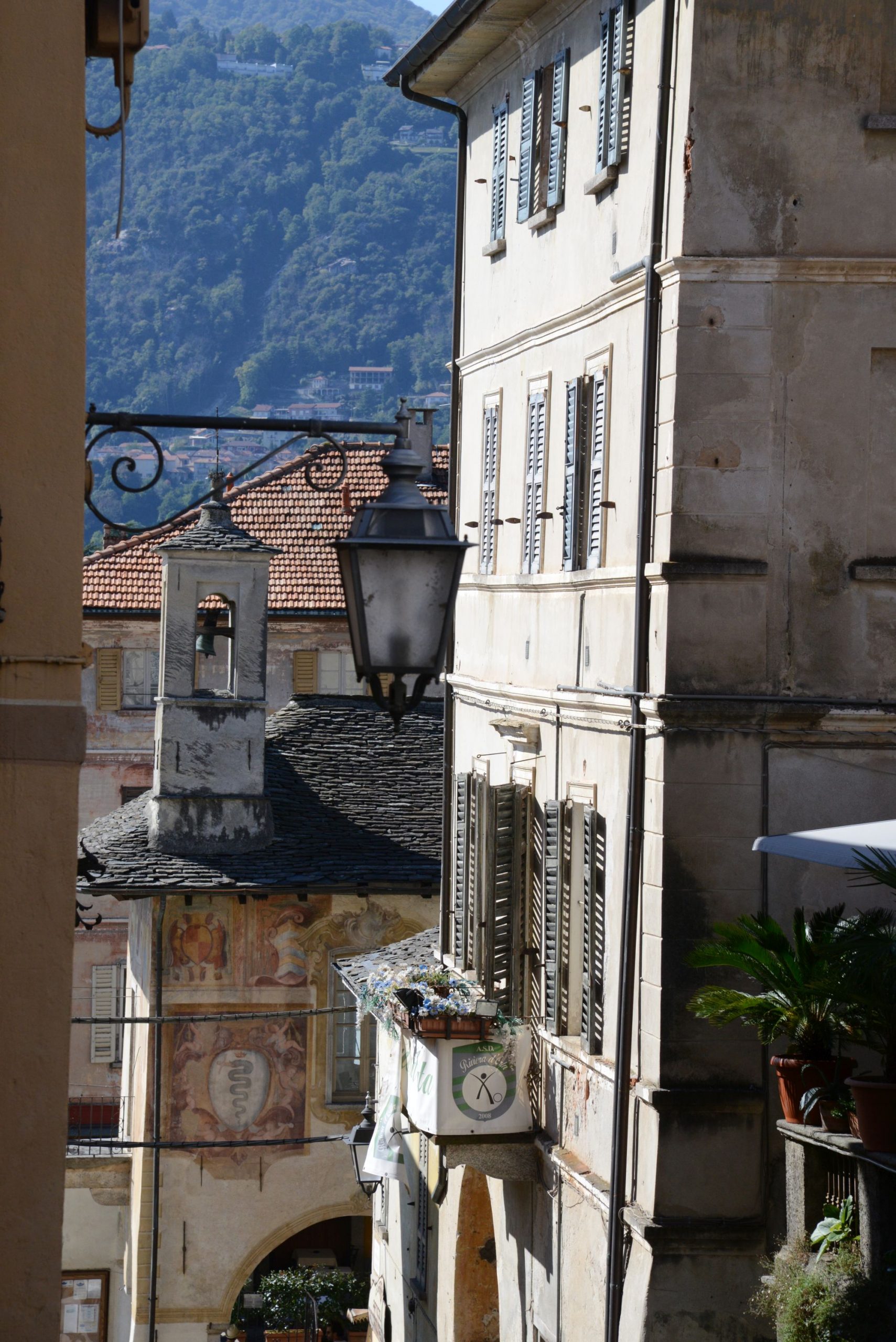
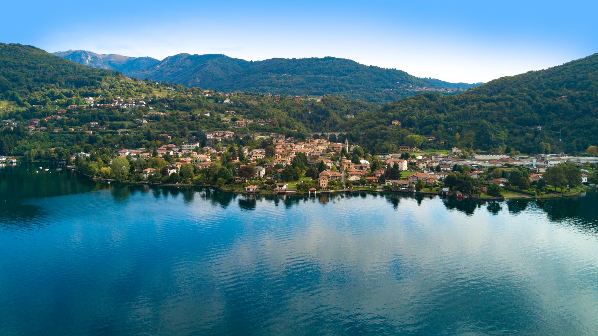
A pleasant stroll until hikers reach the precious small Romanesque church of Montorfano, with a unique panorama of Lake Maggiore
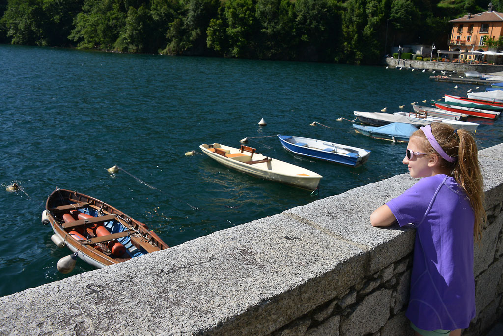
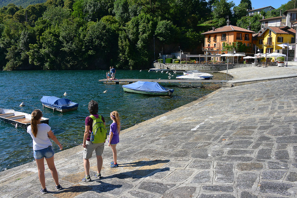
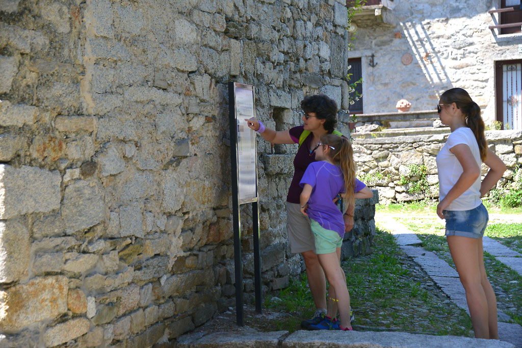
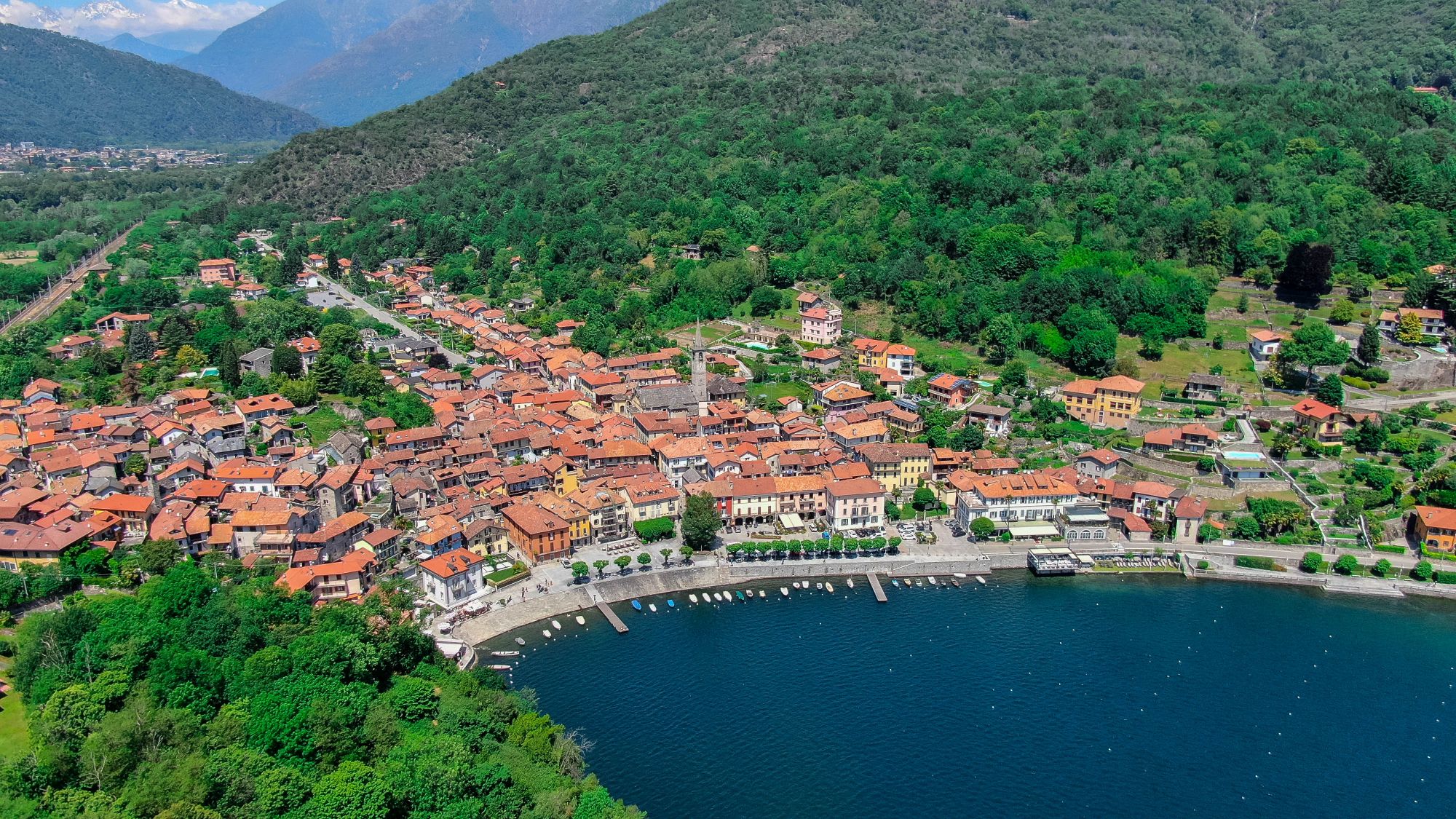
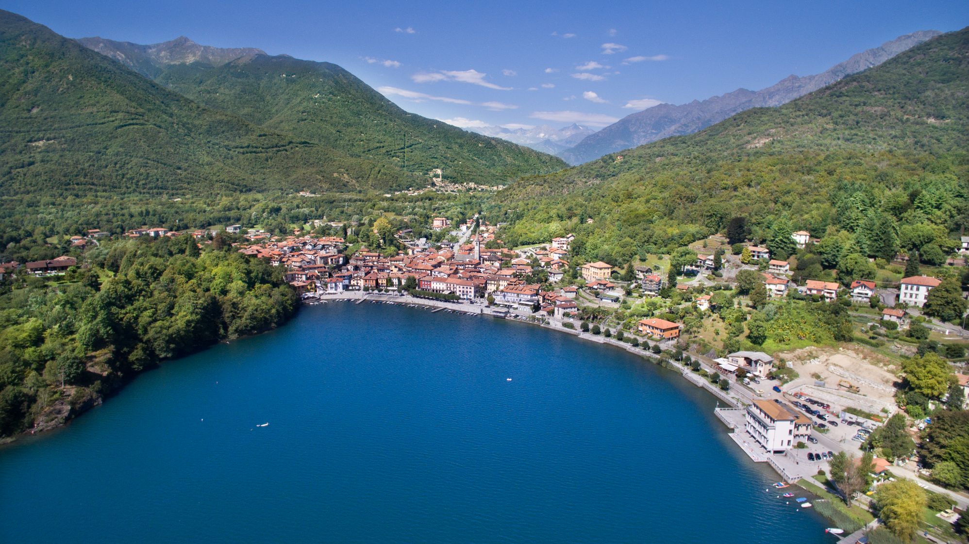
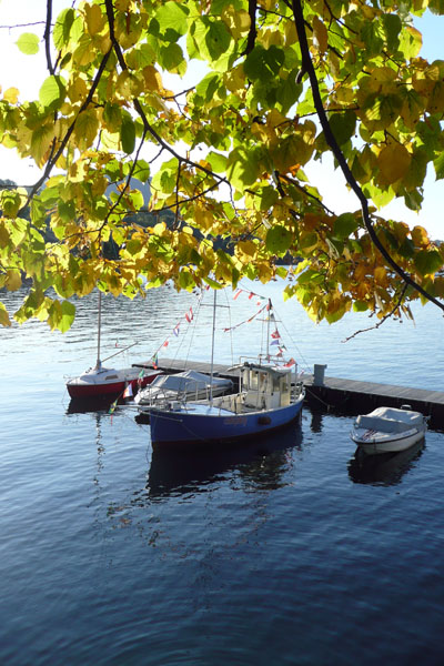
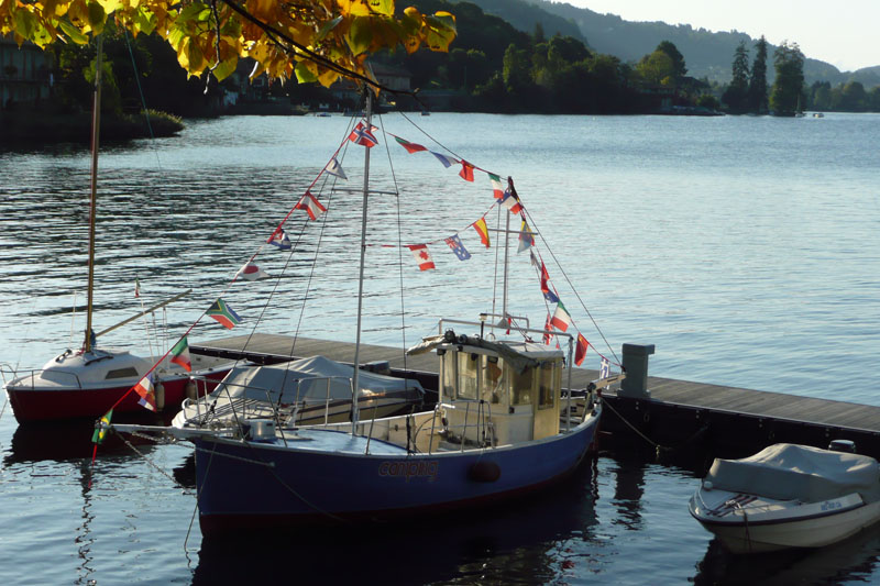
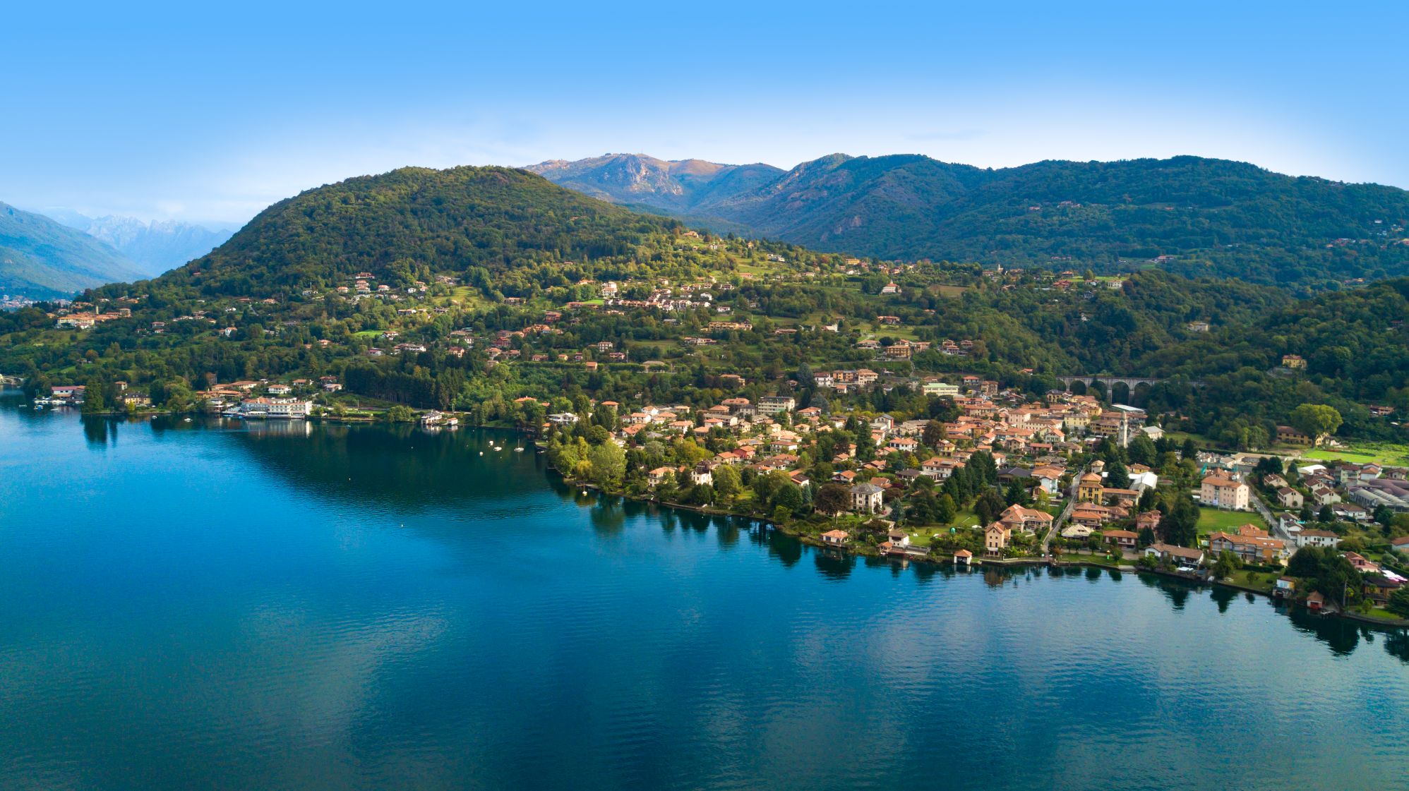
FROM MERGOZZO TO MONTORFANO
Lago di Mergozzo
Route description
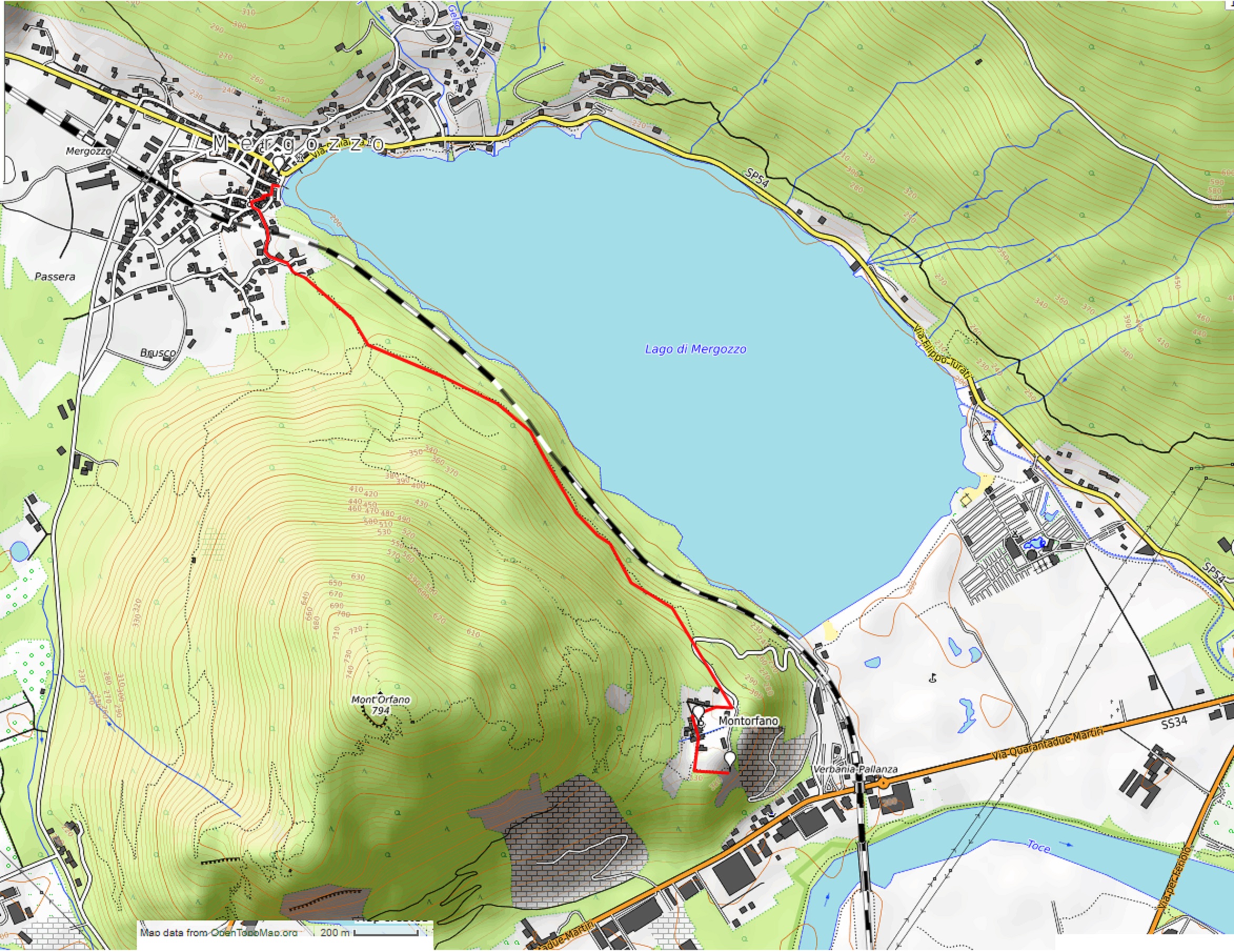
Departure location: Mergozzo lake shore (200 m)
Place of arrival: Montorfano (335 m)
Difference in altitude: About 150 m one way
Distance: 3 km one way
Walking time not counting stops: 1 hour one way
Type of route: mixed (asphalt, cobblestones)
Signs: “Sentiero Azzurro” signs
Water: fountains in Mergozzo and Montorfano
Recommended period: all year round
How to get there: 10 km from Gravellona Toce and 10 km from Verbania. In both cases, go in the direction “Fondotoce”, then “Mergozzo”. Parking along the SP54. By bus: line 5 Verbania-Domodossola, stop Mergozzo (www.vcotrasporti.it). By train: railway station of Mergozzo along the line to Domodossola (www.trenitalia.com).
Information: Distretto Turistico dei Laghi – www.distrettolaghi.it; IAT Office – Corso Roma 20, Mergozzo – tel. +39 (0)323.800935; Municipality of Mergozzo – www.comune.mergozzo.vb.it
the itinerary
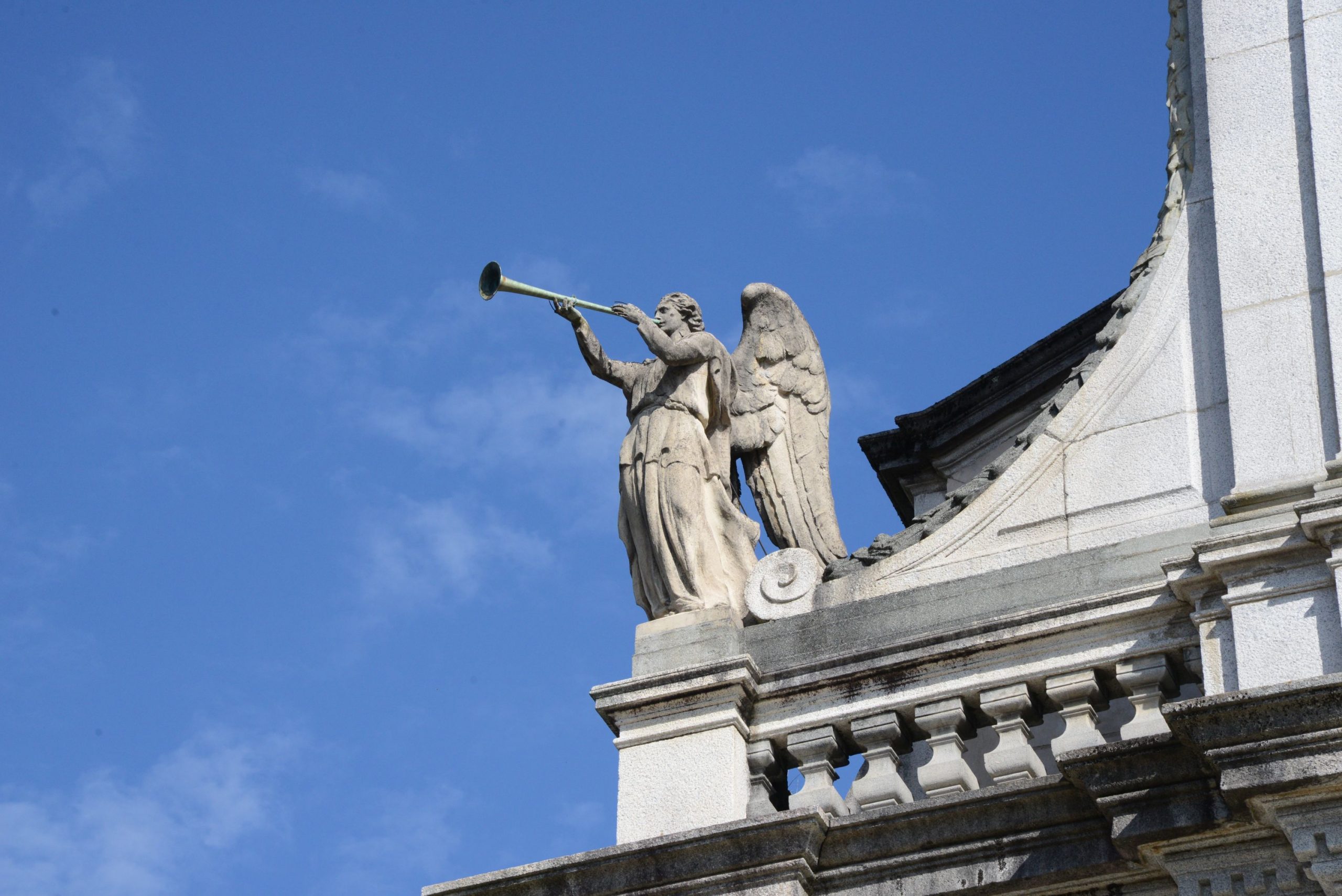
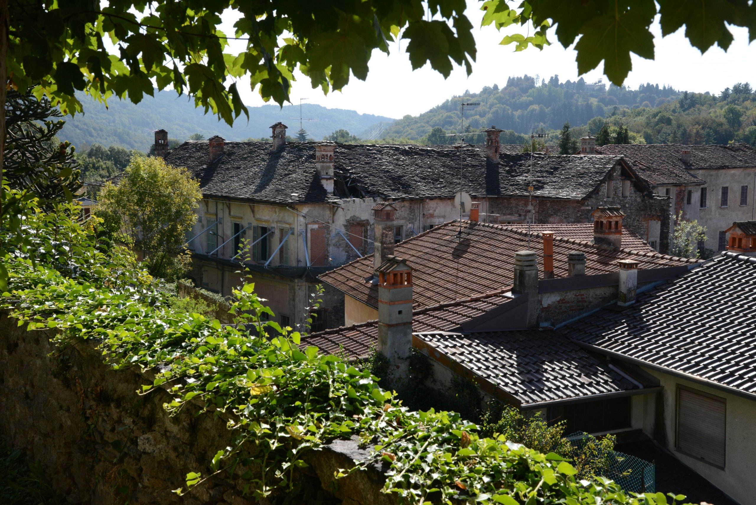
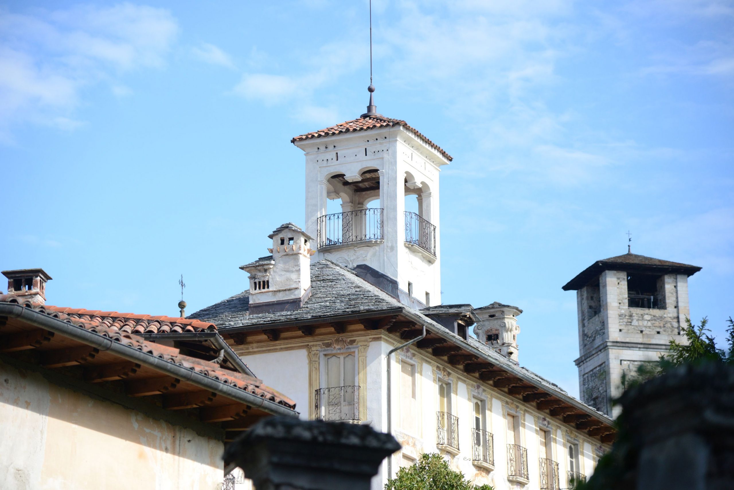
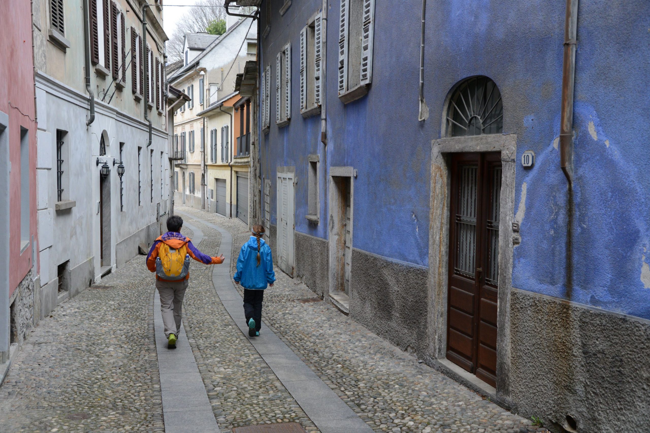
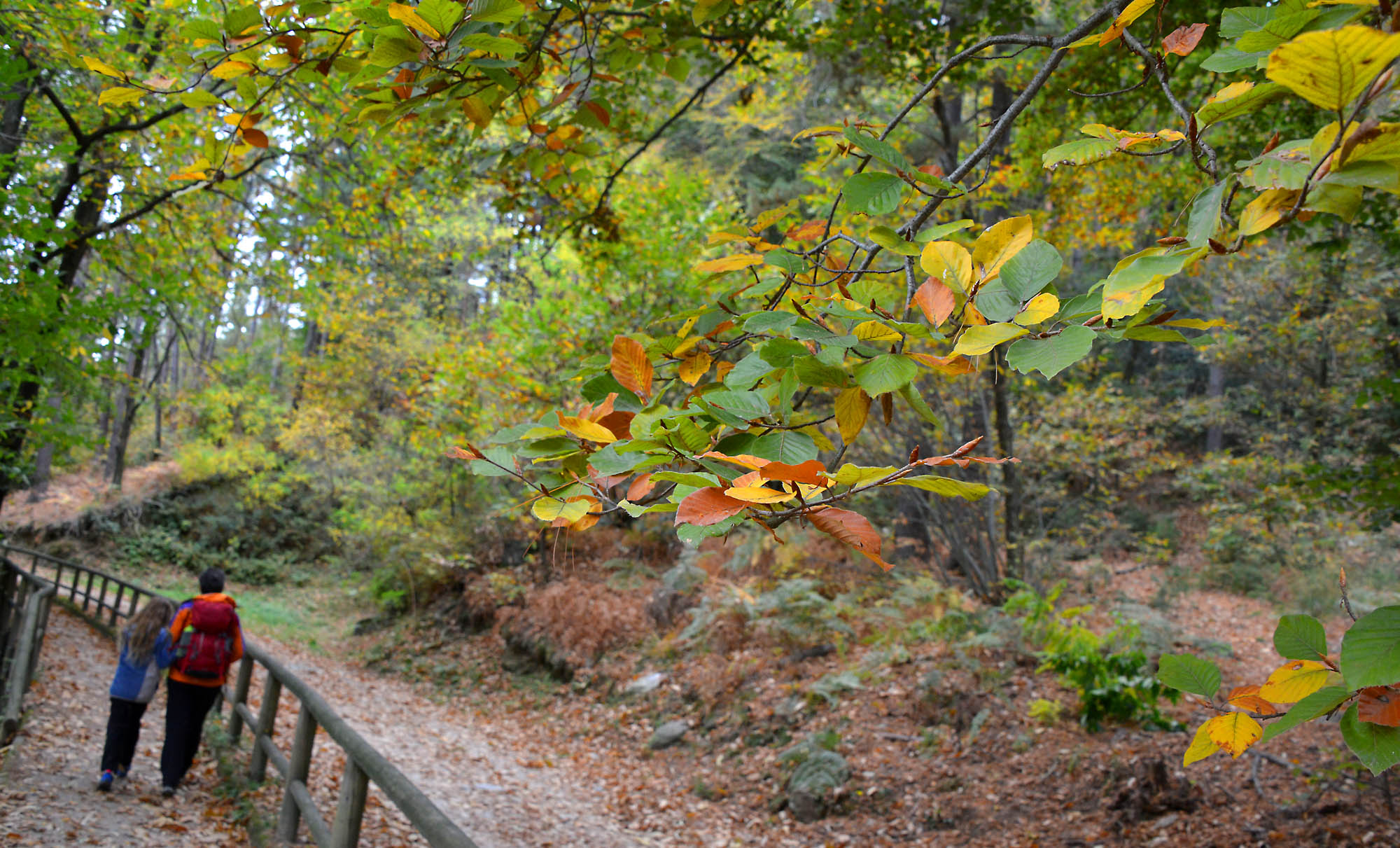
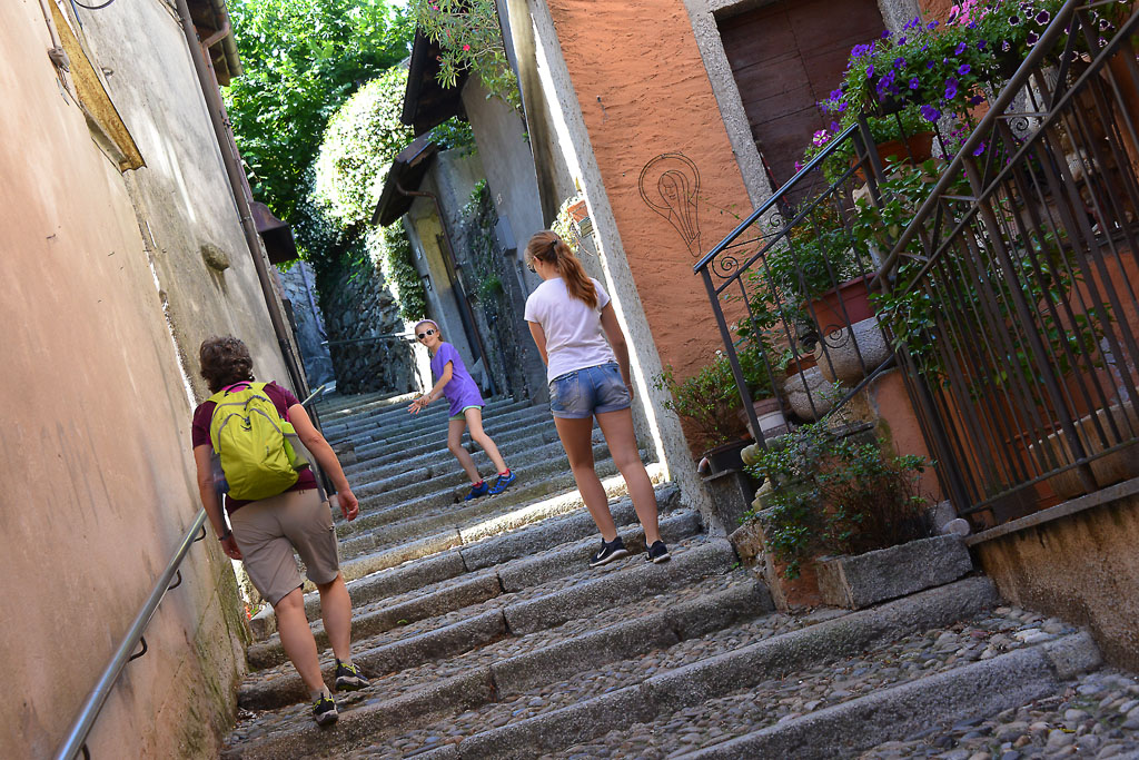
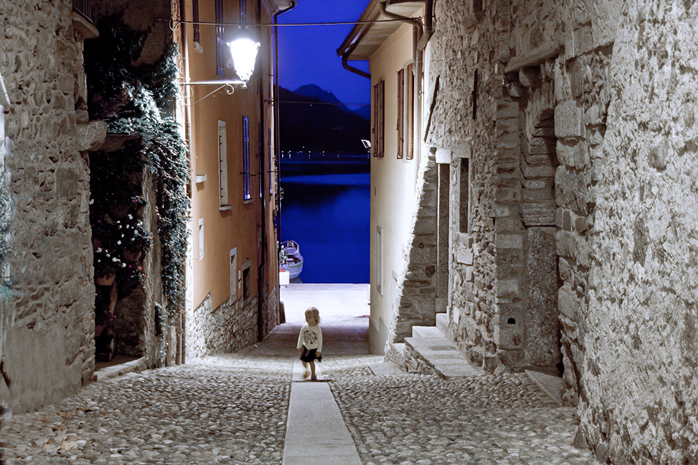
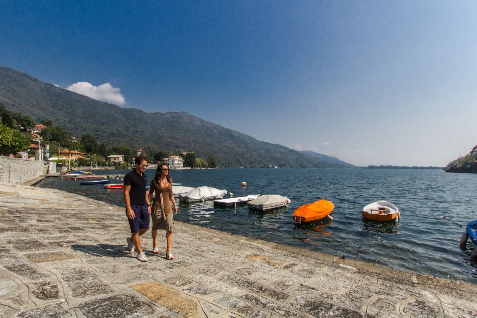
Before you start along the promenade that starts from the Lakeside, you should walk through some of the internal alleys in Mergozzo that start at the 17th century church of the Assumption. The large church seems to be wedged in between the narrow alleys, with a solemn staircase that anticipates the portico and flanked by another portico which shelters a Via Crucis from the 19th century. The beautiful church of Santa Marta is not far away, in pure Romanesque style from the 12th century (fountain), at a very short walk from the lakeside promenade area (lungolago).
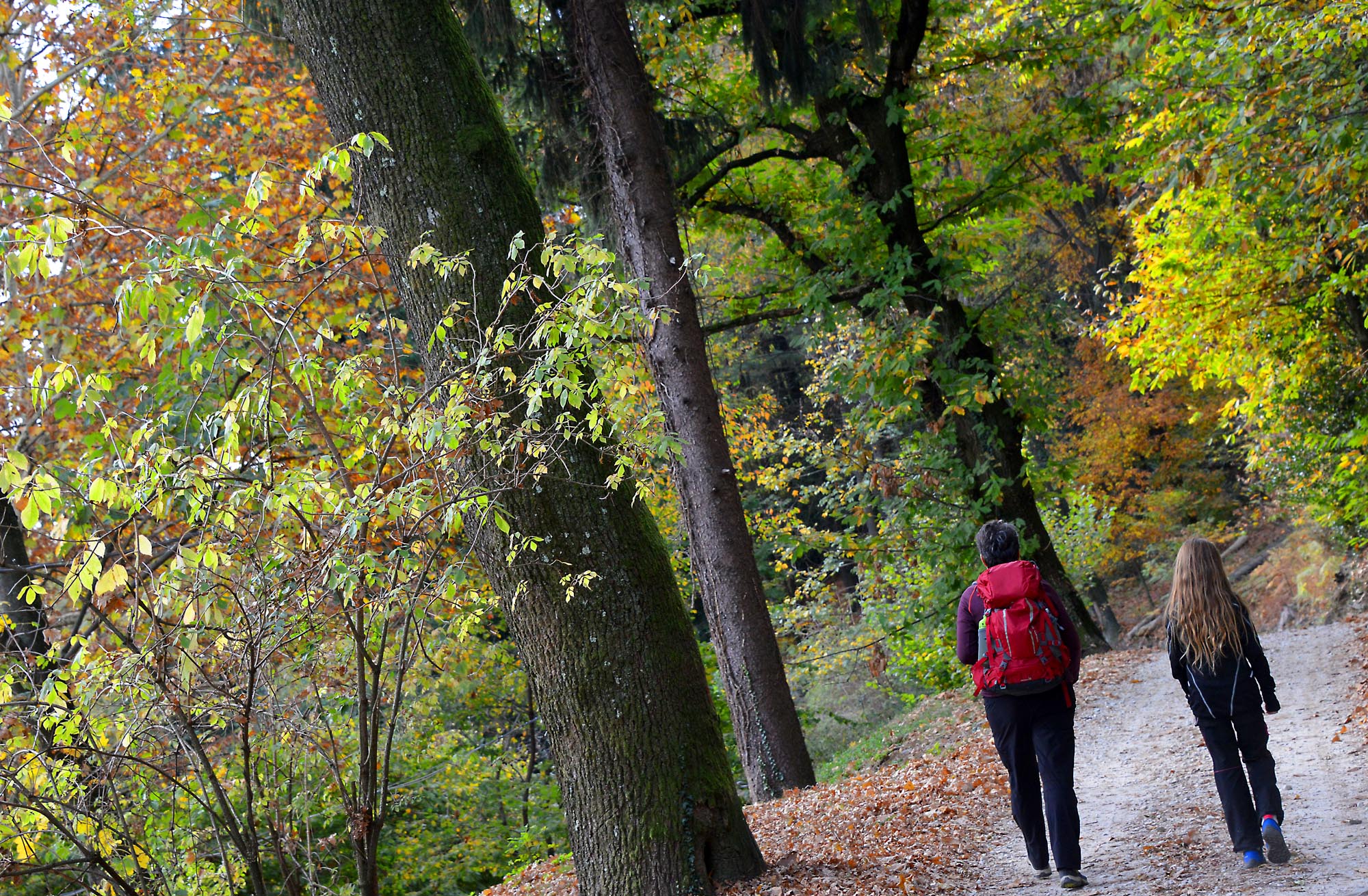
The Lakeside path has benches and ample spaces for pedestrians, and an elm tree that is estimated to about five centuries old! Stand in front of the water, go to the right until you can enter Via Borzoni (brown signs that say “Sentiero Azzurro”) and then immediately go left. Take the cobblestone staircase uphill. At the top of the staircase, go left on Via Maffioli and you will arrive at the Oratory of Saint Elizabeth, built in 1623 (fountain). Behind the oratory, take Via Nostrani on the left for a moment and then go right immediately after Via Montorfano, on a wide uphill trail with deep steps (signs for “Sentiero Azzurro”). Then, go onto asphalt and keep going uphill amid the houses. The road will become a dirt road with many different kinds of signs (road signs, red and white marks, blue bubbles, yellow arrows). When the trail finally becomes a real cobblestone road, you will have no more doubts and proceed in the shade flanked by dry-stone walls. After a hill, you will join on a slightly wider cobblestone path. Go left (follow the signs) and then right away you will go left again, slightly downhill, on a path that leads to a point overlooking Lake Mergozzo, with benches and fountains.
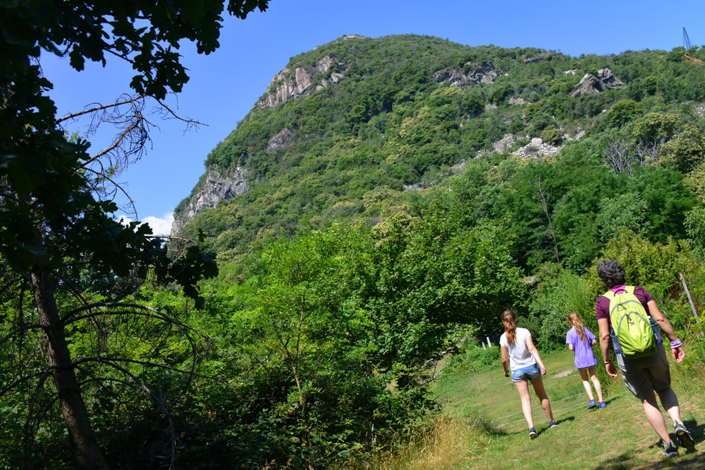
The trail runs along the northern slope of mount Montorfano, just 794 meters in altitude, but this point is a single block of white granite, which explains the presence of several quarries because this stone has been extracted for centuries in this area. White granite of Montorfano was also used for the columns of Saint Paul Outside the Walls in Rome.
The path winds pleasantly with gradual progression, and the lake is almost always visible. With a steeper climb, you will come to an asphalt road.
If you intend to go back with the train instead of walking, you must go right, downhill, to the Verbania-Pallanza railway station.
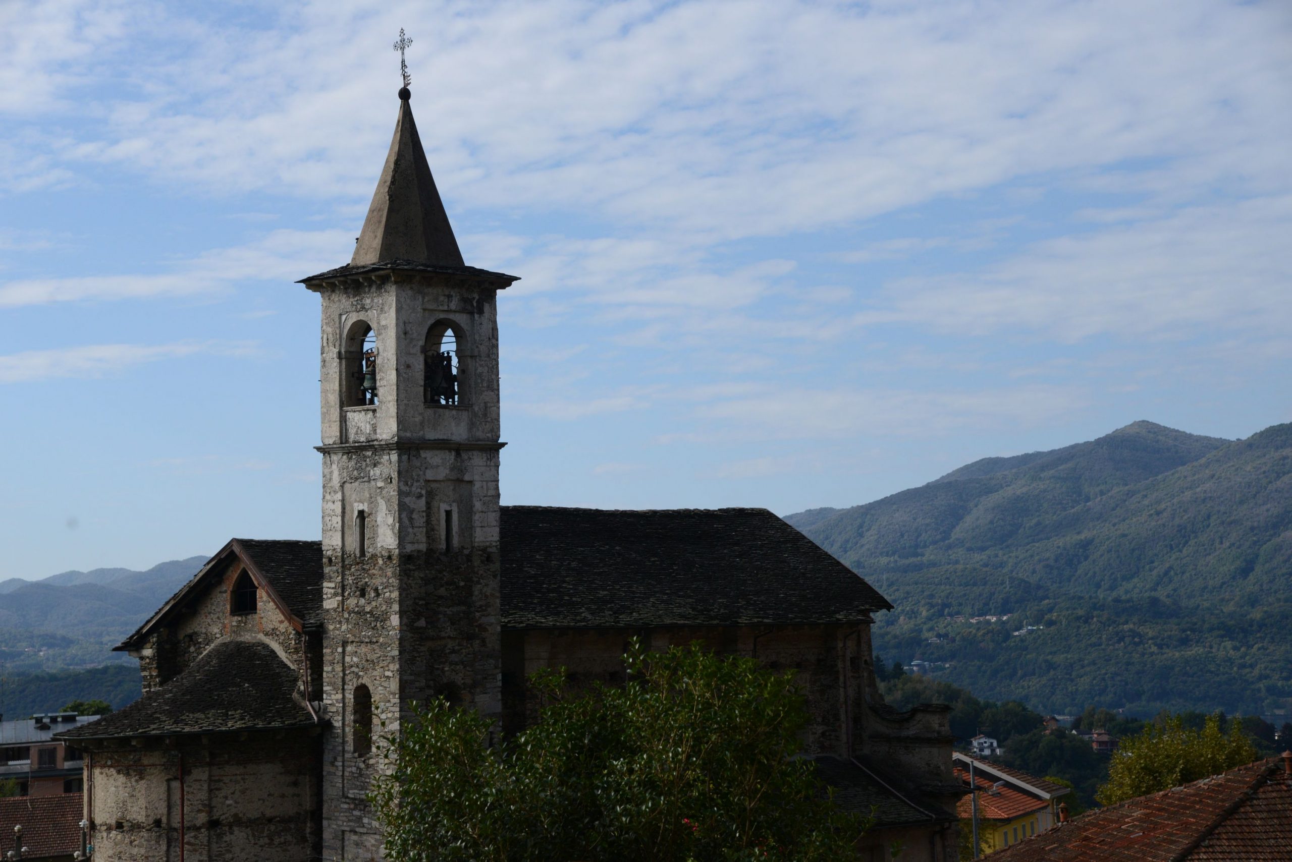
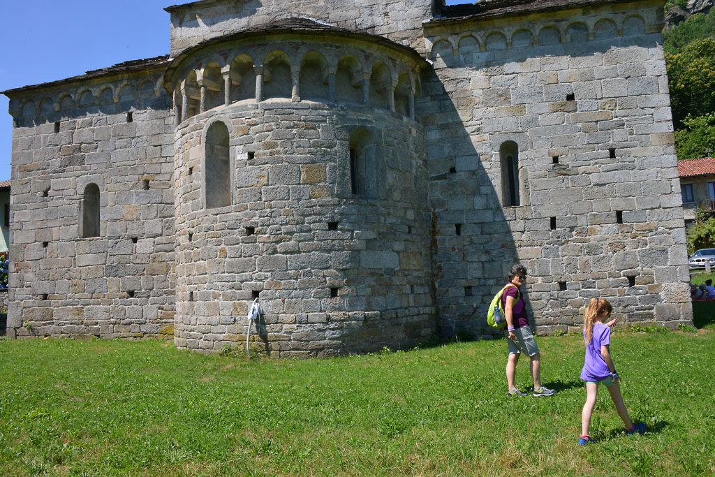
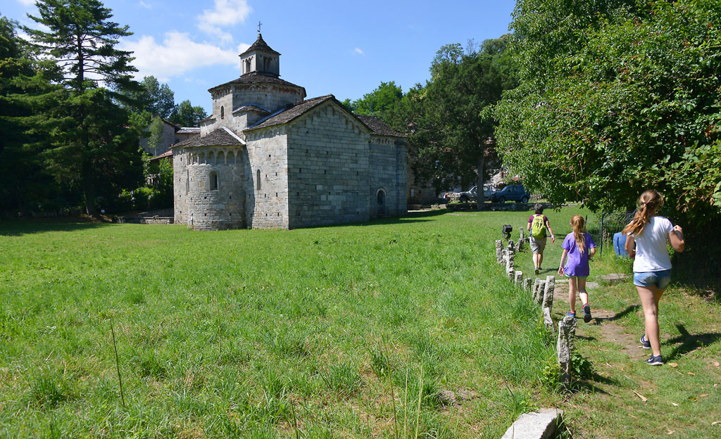
Take the asphalt road on the left, uphill, passing in front of a small cemetery and arriving at a parking lot. Follow the dirt road to the right that leads to the meadows right before the beautiful Romanesque church of San Giovanni of Montorfano (fountain and tables) that stands isolated in all its architectural purity.
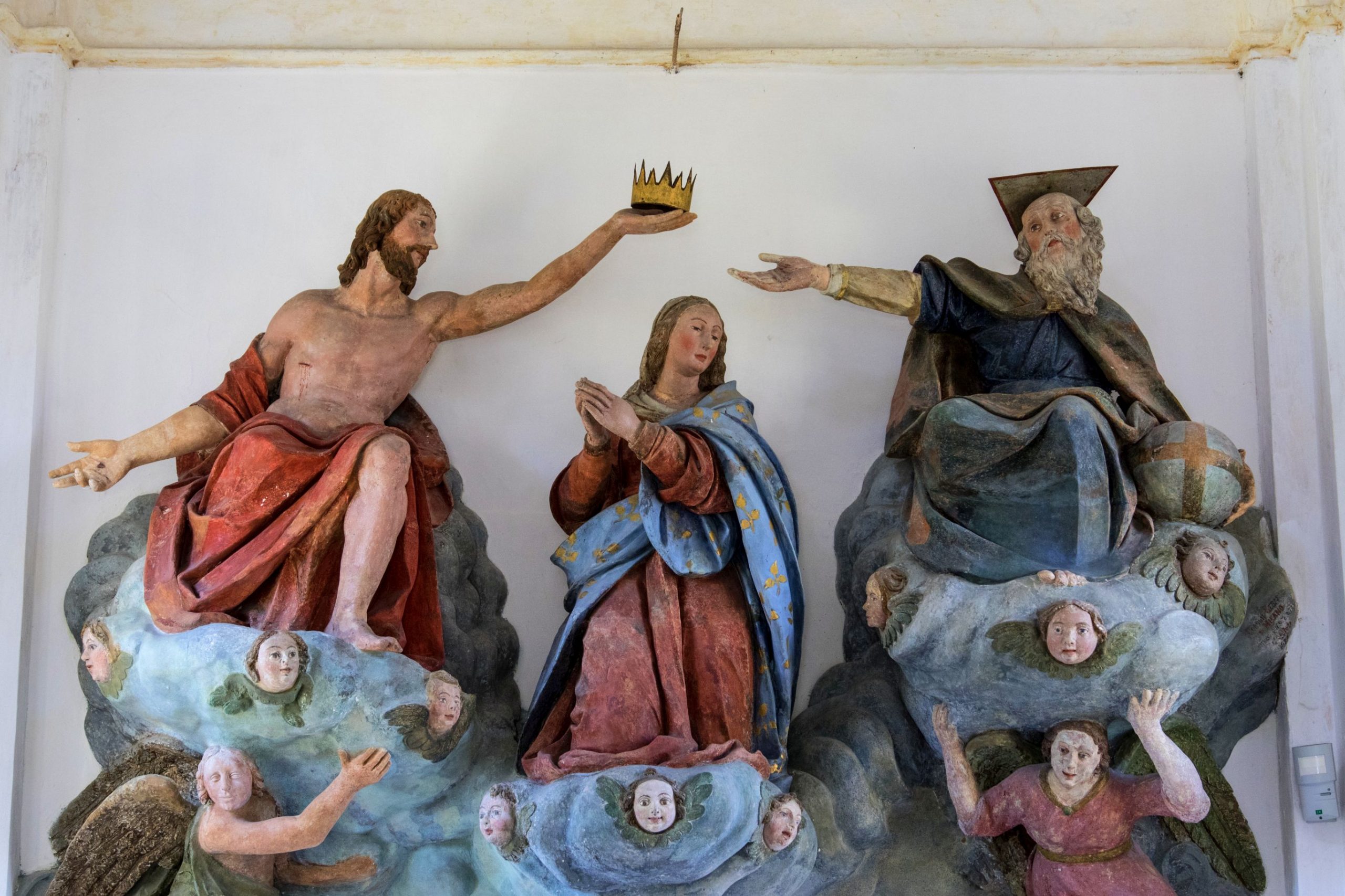
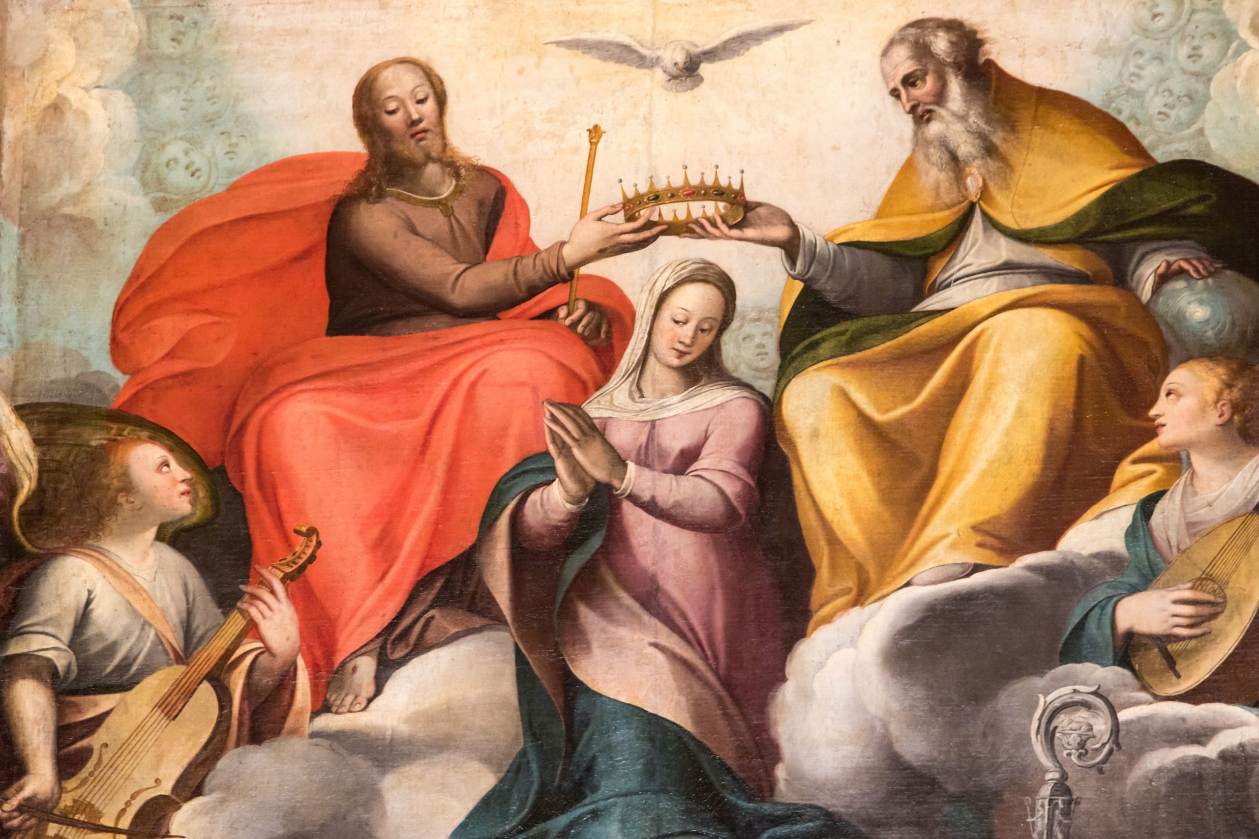
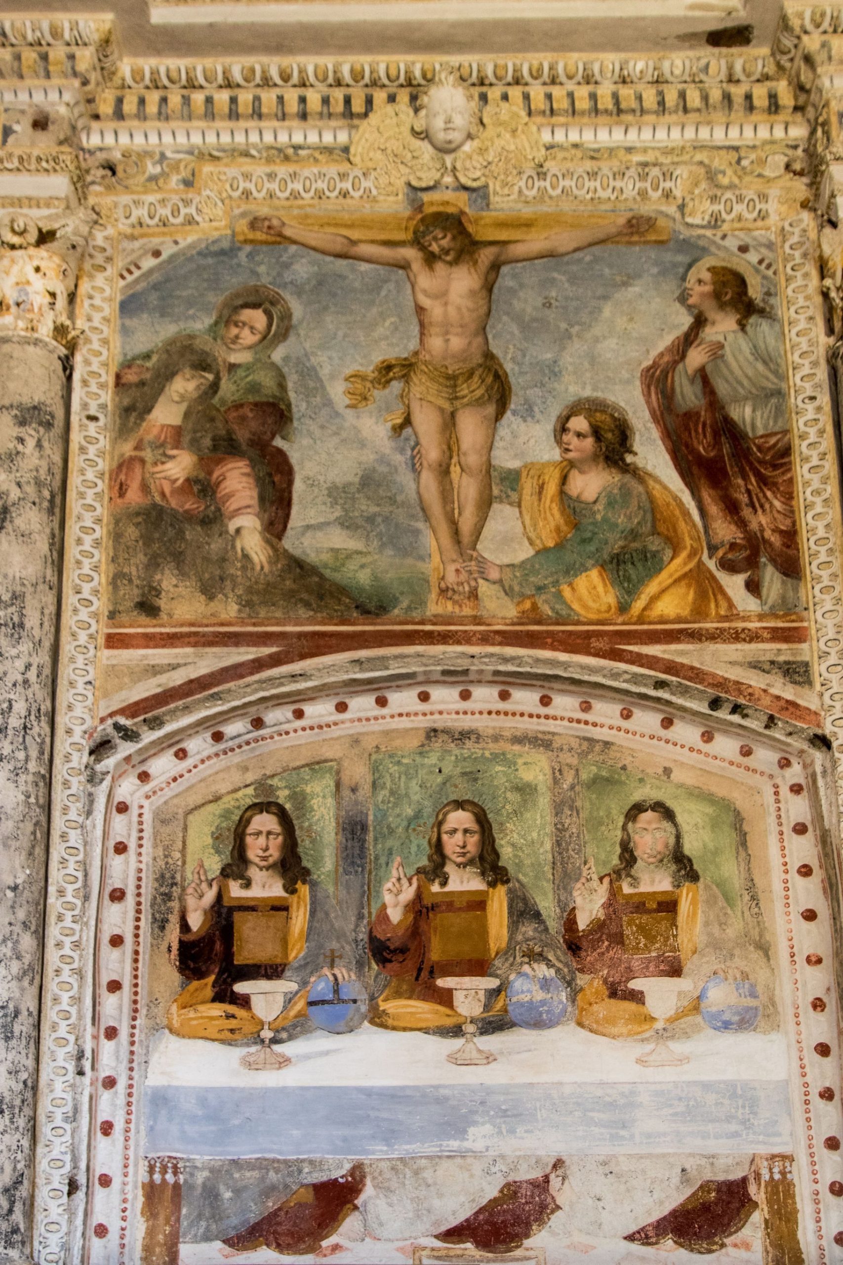
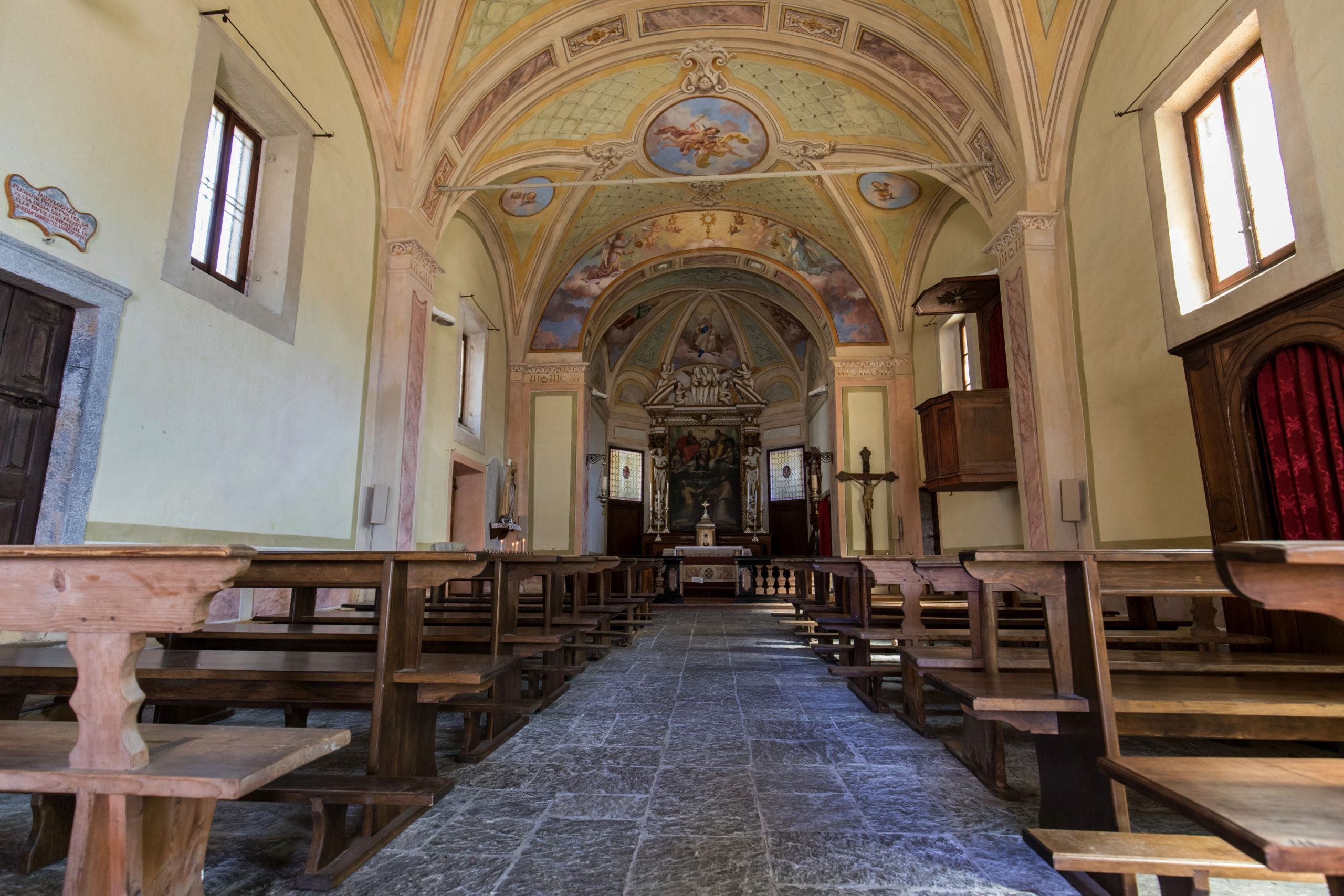
Dating back to the 11th and 12th centuries, the church stands on the remains of a religious building from the 9th century, but recent excavations have brought to light the remains of a much more ancient church, built in the 5th and 6th centuries. You will find it open when it is time for mass.
After visiting the picturesque little church, go uphill in the middle of the houses in the town until you reach a passage delimited by stones that deviates toward the grassy track on the left that climbs up to the panoramic view over Lake Maggiore (Belvedere). You can return by going back the way you came.
to learn more
Lake or gulf?
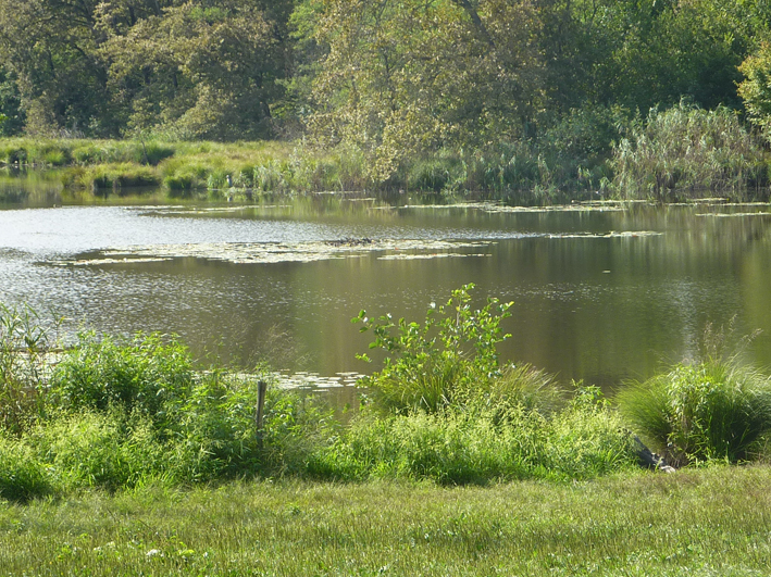
Lake Mergozzo was already inhabited in ancient times and archaeological finds date back to around 6000 b.C. But at that time, it was a gulf, forming part of Lake Maggiore. Only in the 15th century did it become an independent lake, due to the Toce River slowly bringing in enough that debris to create the barrier that today divides the two lakes.
The Archaeological Museum and the Ecomuseum of Granite
Located in Via Roma 8, in Mergozzo, the museum presents a collection of finds on two floors that offer a brief history of the area from prehistoric times to the Roman era. In one of the rooms, visitors will find descriptions of the history of granite and processing methods (www.ecomuseogranitomontorfano.it). The ancient quarry of Candoglia is a short distance away: the marble taken out of this quarry was used to build the Duomo in Milan and is still used for its maintenance.
tips for young hikers
A very simple walk but, due to the characteristics of the paths, not accessible for strollers.
Slow trekkers: Franco Voglino, Annalisa Porporato and Nora Voglino
Authors of texts: Franco Voglino and Annalisa Porporato
Back to the list of routes

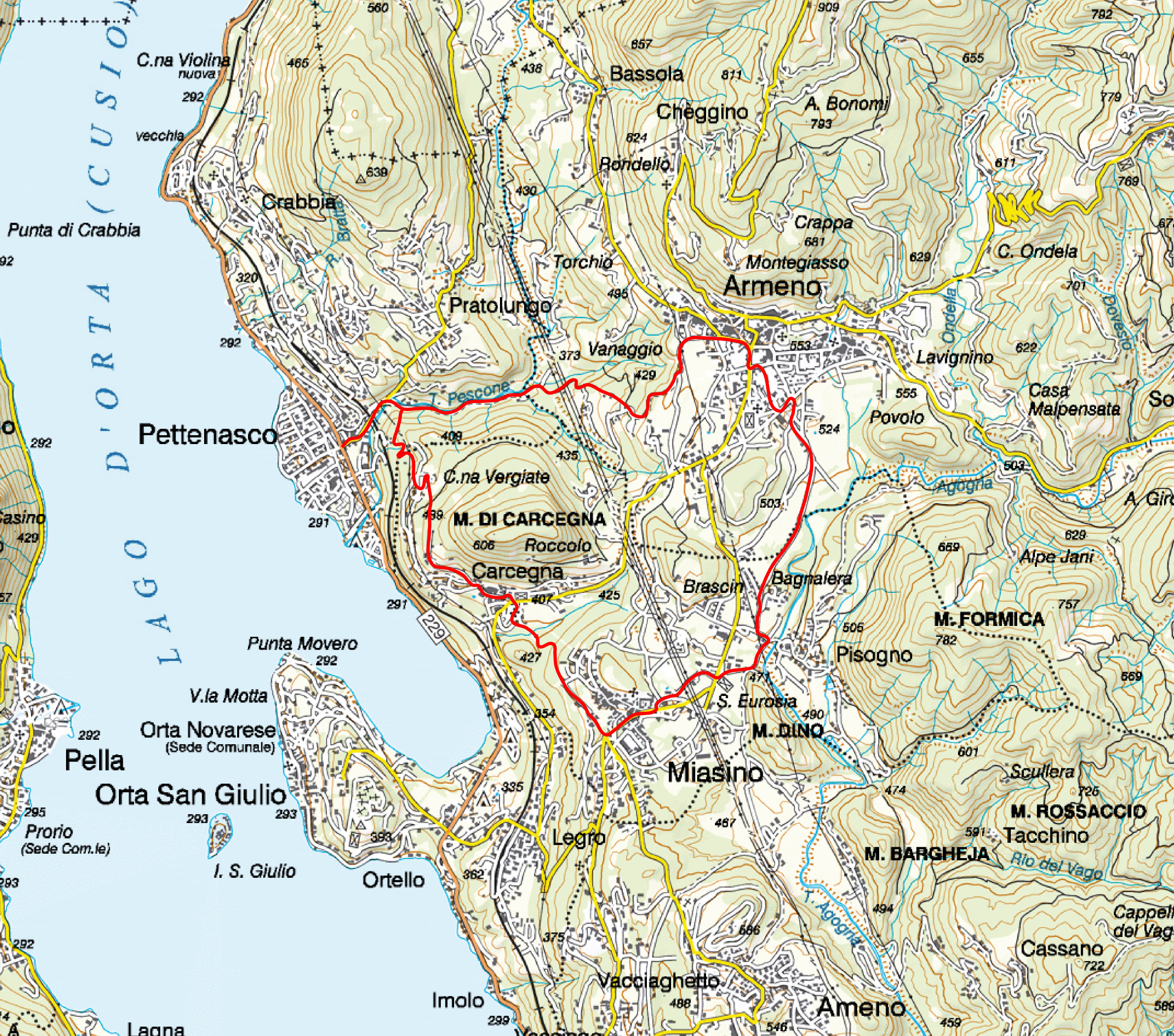
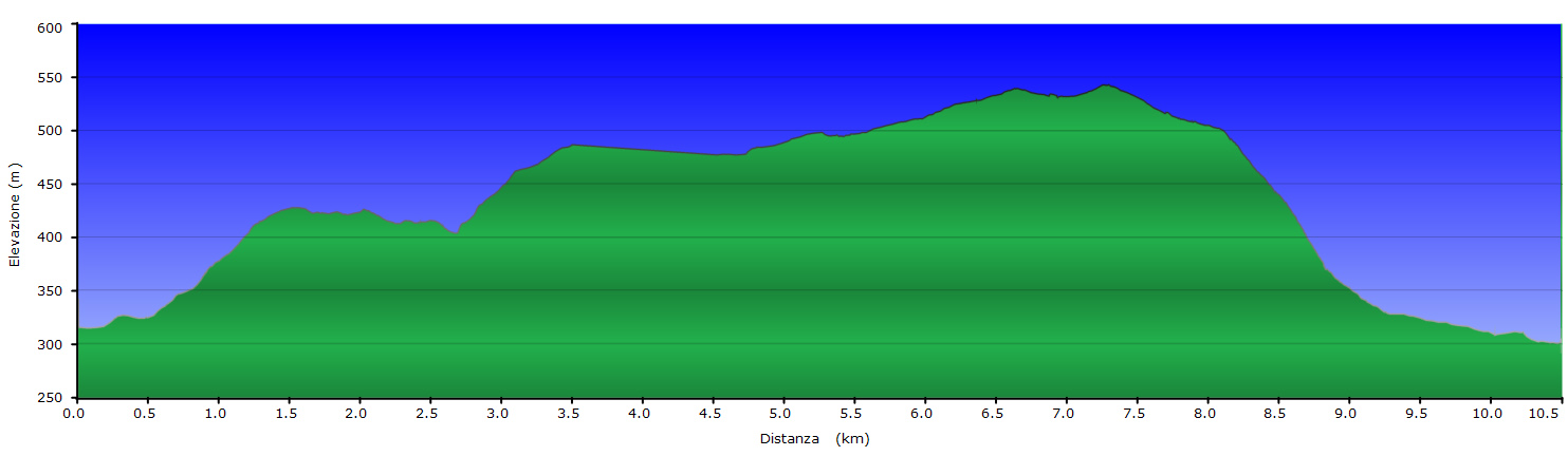
mtb route
IN THE VALLEY OF PESCONE
Lago d’Orta
Route description
The route starts from Piazza Unità d’Italia in Pettenasco near the town hall. You set off in the direction of the Novara – Domodossola railway viaduct along via Vittorio Veneto. Passing under the viaduct you come to fountain and the Paganetto picnic area where you turn right into the path following the signs for Carcegna.
The road runs for a short distance alongside the railway track and then climbs quickly into the woods. Further on you come to a junction where you can see a green gate on the right.
Here you take the path that climbs steeply to the left, then follow a hairpin bend and continue to the first houses of Carcegna.
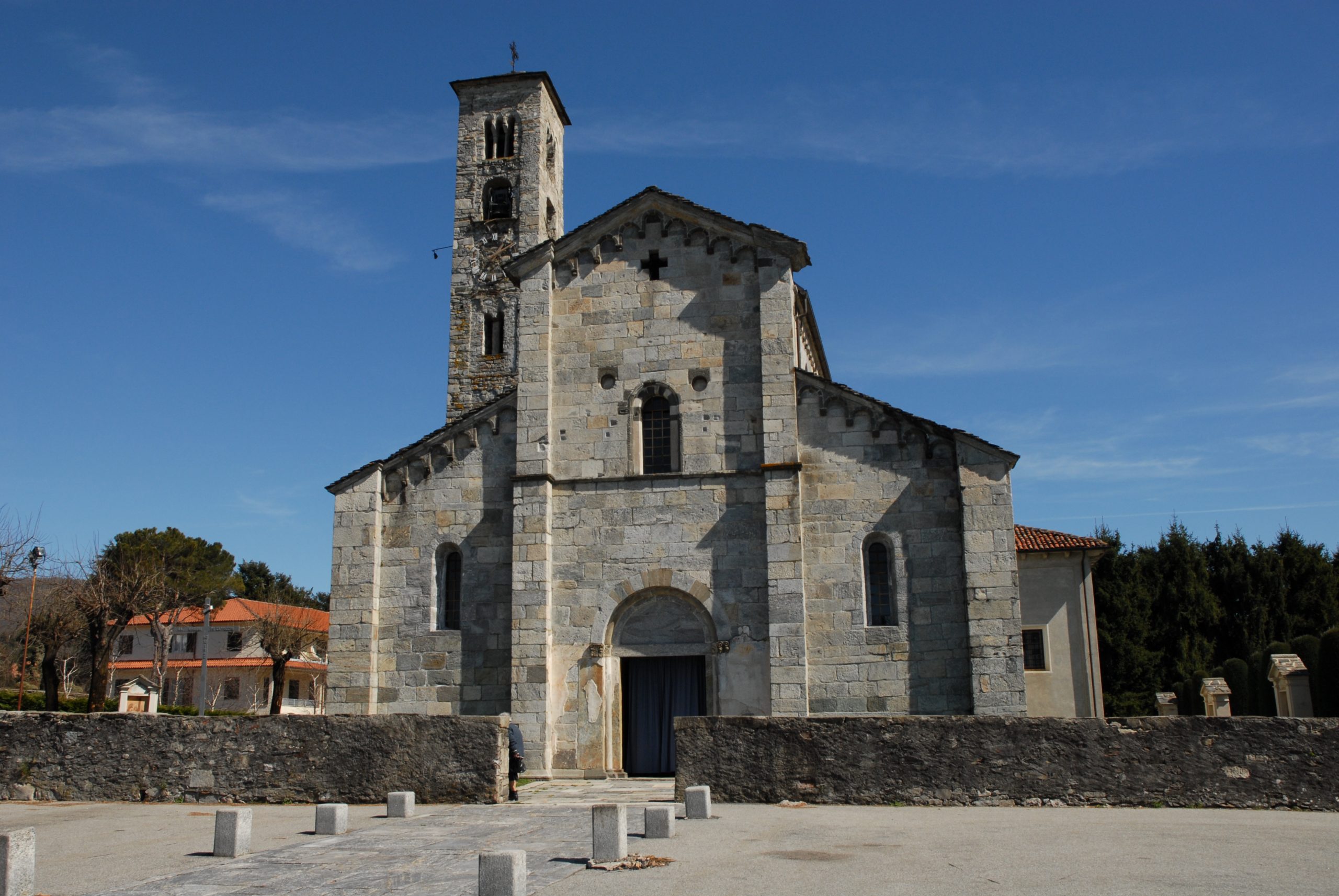
Keep going until you come to the tarmac road (via Pettenasco) and then along via Roma to the parish church of S. Pietro.
Here you continue in the direction of the club-bar of Carcegna taking via alle Scuole. After the club you descend on the right in the vicinity of a small wall, then follow the path up to the steps and climb up into the woods.
At the top of the steps turn left and continue climbing along the path in the woods which soon brings you to the first houses of Miasino in via Borsattino. Pass under an archway then turn left following the garden wall of Villa Nigra along via Solaroli.
On reaching the square go straight toward the parish church of San Rocco and then turn right along via Umberto I. At the end of the street, after passing the church of the monastery on the left, continue downhill along via per Armeno. At the crossroads near the cemetery of Pisogno, cross the road and take via Parrochiale in the direction of Pisogno.
After the outdoor swimming pool, turn left and then right into via Regione Bagnalera. you pass a chapel and a few small houses. Keep to the right continuing on through the fields up to the Strade delle Due Riviere in the vicinity of a supermarket (on the right). Cross the road and then turn immediately right along via dei Prati passing in front of the Museo degli Alberghieri (Museum of Hoteliers) of Armeno.
Now you come to the main square of Armeno, Piazza della Vittoria (if you want you can visit the Romanesque church of S. Maria Assunta (Our Lady of the Assumption) near the cemetery), continue along via Addis Abeba and then take via Don Magnone. In the vicinity of the bend on the right turn left into an unmade road and continue through the woods descending along the Valle del Pescone in the direction of Pettenasco.
You then come to fountain and the Paganetto picnic area and pass under the viaduct of the Novara – Domodossola railway line. Continue in the direction of the centre of Pettenasco and of the Museum of Art and Wood Turning and you are back at the point of departure.
To see: auf dieser Route sind das Holzkunst- und Drechselmuseum in Pettenasco, die Pfarrkirche S.Maria Assunta in Armeno und die Villa Nigra in Miasino interessant.
AUTHOR: Fabio Valeggia
Back to the list of routes
The “Pizzo Andolla” tour
“FERRATA DEL LAGO”, AN ENCHANTING LANDSCAPE BETWEEN ITALY AND SWITZERLAND
Lago Maggiore
Route description
Origins of the Via Ferrata of the Lake
On March 26, 2002, at the Casa Alpina owned by the Italian Alpine Club of Villadossola, mountain guides Beat Burgener and André Zurbriggen; Diana Zurbriggen, Chairperson of Saas Valley’s SAC; Italian mountain guides Franco Farioli and Tabarini; Sergio Rossi, Chairperson of Villadossola’s CAI; Renato Boschi, Hiking Manager, and Alpine rescuer Giulio Frangioni met to review the possibility to create a via Ferrata that would lead to the Bottarello Pass. The goal of the initiative was to join the two Andolla mountain huts on the Italian side and the Almagellerhutte one on the Swiss side to improve the occupancy of the huts and grow the friendship between the mountain regions of Italy and Switzerland and enjoy the enchanting and characteristic landscape.
The “project” was born and discussed to find the best way to implement it, respecting all the bureaucratic and safety requirements.
On April 29, 2002, a permit request was filed at the municipality of Antrona for the laying of the via Ferrata. The authorization was granted on May 16, 2002.
On May 28, 2002, the documentation was submitted to the headquarters of the Italian Alpine Club for the request for insurance coverage.
Everything was ready to install the anchoring devices and cable, which took place in July 2002.
The “Ferrata of the Lake” was inaugurated on July 5 and 6, 2003, to celebrate the 50th anniversary of the Andolla hut.
A large group of Swiss and Italians met on July 5 at the Andolla hut for the evening celebration. On the morning of July 6, they headed to enjoy the Ferrata. At the Bottarello Pass, they attended the Mass and blessing of the route. The event took place in an atmosphere of extraordinary camaraderie.
In the evening, the celebrations continued at the Almagellerhutte hut with wine and cheese before saying goodbye to the fellow climbers who were descending to Saas Almagell. Since then, the Via Ferrata has been a success among the Swiss. It has already passed the test of four winters and underwent a series of small maintenance operations. It has become a pleasant route to admire the rugged mountains and the distant Lake Maggiore from which it took its name.
“Via Ferrata of the Lake”
A Via Ferrata is a mountain climbing route set on a rocky path fully equipped with ropes, pegs, and steel ladders to allow very experienced mountaineers to test themselves on a vertical wall. Please note that the difference between a via Ferrata and an equipped path is substantial: an equipped path facilitates a dangerous and exposed section of a hiking trail but not to go past stretches of wall. The “Via Ferrata of the Lake” was created to facilitate the connection between the huts of Andolla, on the Italian side, and Almagellerhutte on the Swiss side, thus allowing touring the entire Pizzo Andolla. No international code of difficulty has been set yet regarding via Ferrata routes, but the number of routes available and the quantity of information being created is leading to a definition of difficulty. According to the “Sicuri in Ferrata” booklet published by the Lombardy chapter of the C.N.S.A.S. the “Ferrata of the Lake” falls within the definition of the PD level (not too difficult) – a rather articulated route, with channels and chimneys, vertical stretches, and exposed sections; generally equipped with a cable or chain, pegs and/or fixed metal ladders. Note – Additional key variables that can affect the difficulty level are bad weather, rain, snow, wind, and hail. These weather events can make even not difficult routes extreme. It is also necessary to keep in mind the time required to face the route, since time may increase general fatigue risk.
To face the via Ferrata, it is mandatory to wear:
Climbing helmet
Climbing harness equipped with thighs
Ferrata set containing: an energy absorbers, two pieces of rope with a 0.5 cm diameter and 3.5 m and 1.5 m long respectively, two snap hooks with a wide base and snap ring with clip.
Climbing gloves
Adequate shoes and clothing
Recommendations
Avoid thunderstorms – In the evening, before the trip, pay close attention to the weather forecast.
Avoid traveling in pairs on the same stretch.
Avoid dropping rocks
Always proceed safely using the two snap-hooks with care
Be aware that the highest degree of safety is achieved not only by the equipment and its proper use but also by paying close attention to what you do and what others do
Back to the list of routes