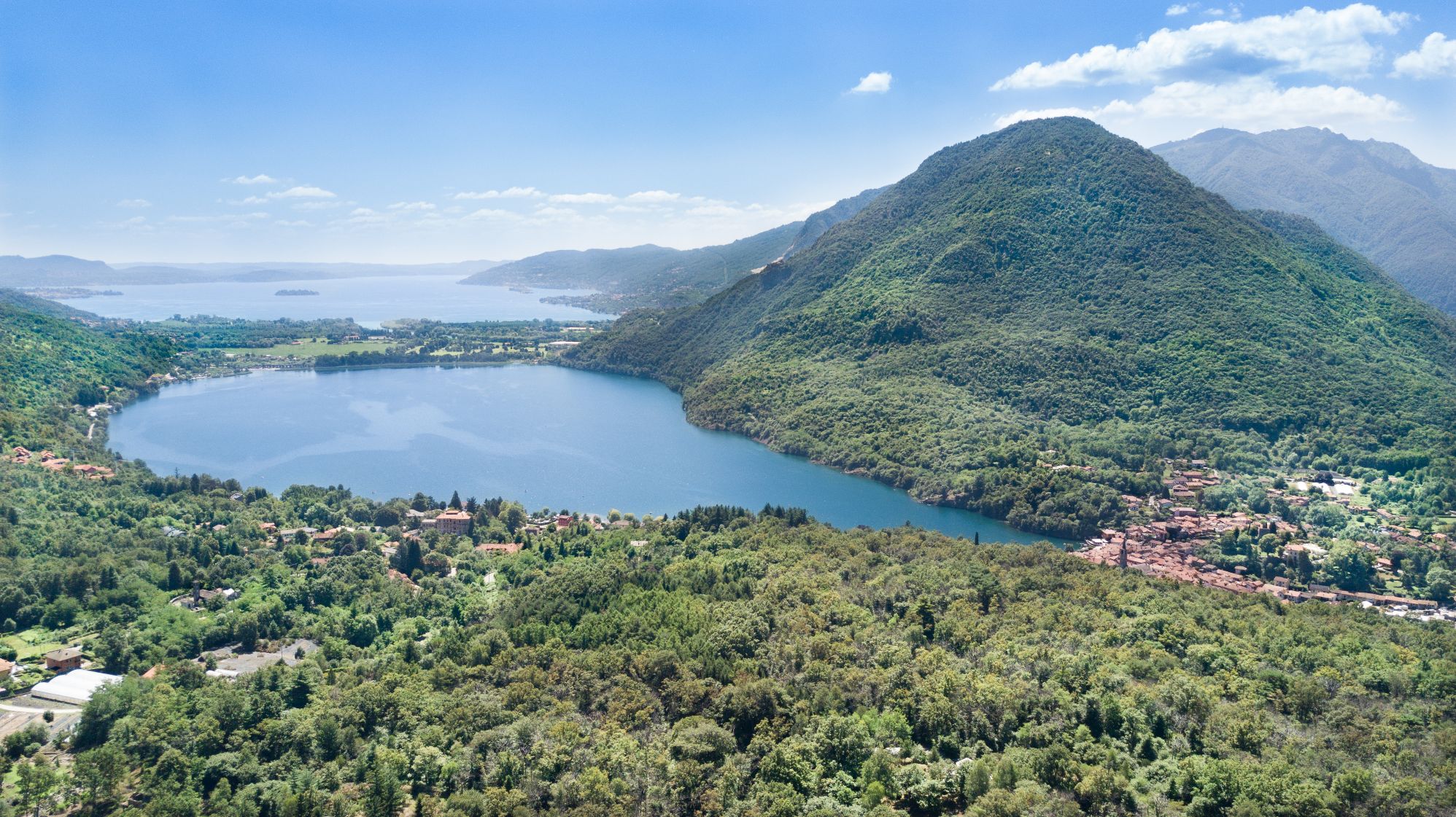
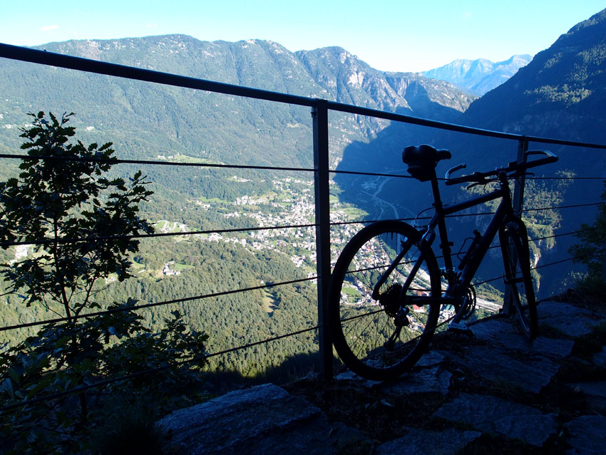
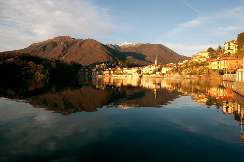
Circular route, a magnificent balcony overlooking the northern Lake Orta
LAKE ORTA: CIRCUIT OF QUARNA
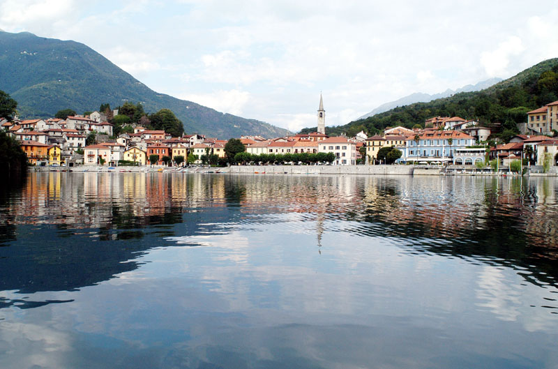
Lago d’Orta
Route description
Departure and arrival location: Piazza Capitano Beltrami, Cireggio (380 m)
Maximum altitude: Quarna Sopra (860 m)
Difference in altitude: About 500 m
Distance: 10 km
Walking time not counting stops: 4 hours
Type of route: mixed (trail, asphalt, dirt road)
Signs: red/white road signs
Water: fountains in the towns
Recommended period: all year round
How to get there: village belonging to the city of Omegna, located about 2 km west of it. Parking is available in piazza Beltrami, near the parish church, but we suggest leaving your car in the square in front of the cemetery (400 meters to the east, along via Leonardo Da Vinci). By bus: lines Domodossola-Omegna and Novara-Borgomanero-Omegna-Domodossola (www.comazzibus.com).
Information: Distretto Turistico dei Laghi – www.distrettolaghi.it; IAT office – Piazza XXIV Aprile 19, Omegna, tel. +39 0323 61930 – www.visitomegna.it; Municipality of Omegna – www.comune.omegna.vb.it; Municipality of Nonio – www.comune.nonio.vb.it; Municipality of Quarna Sotto – www.comune.quarnasotto.vb.it; Municipality of Quarna Sopra – www.comune.quarnasopra.vb.it
the itinerary
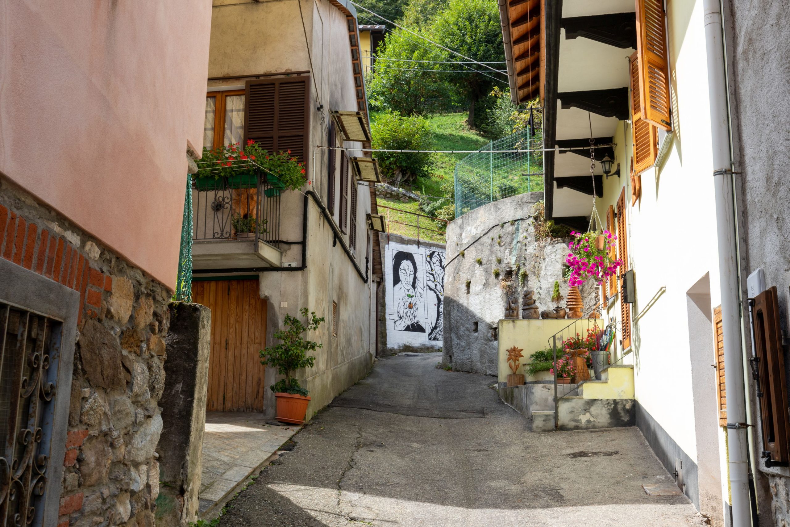
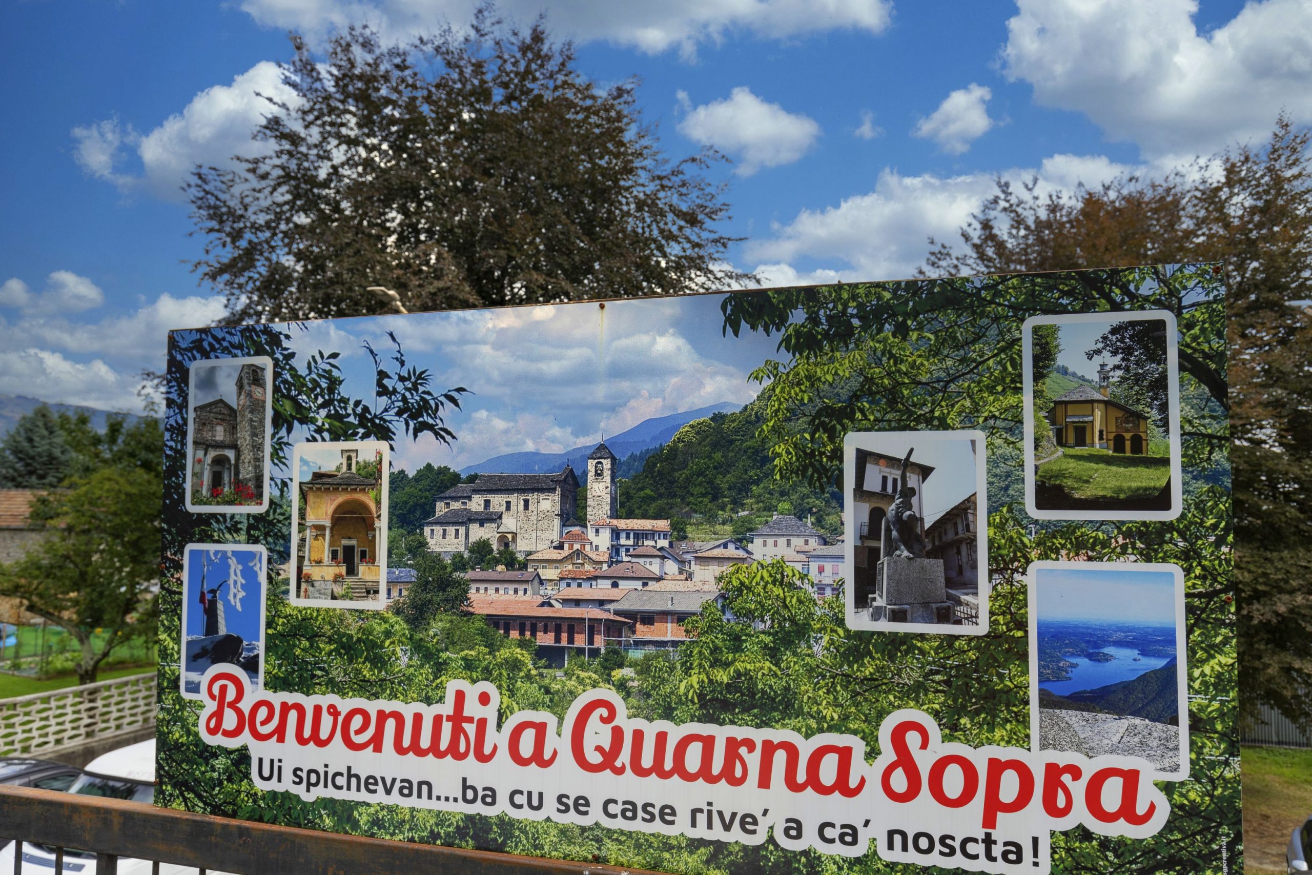
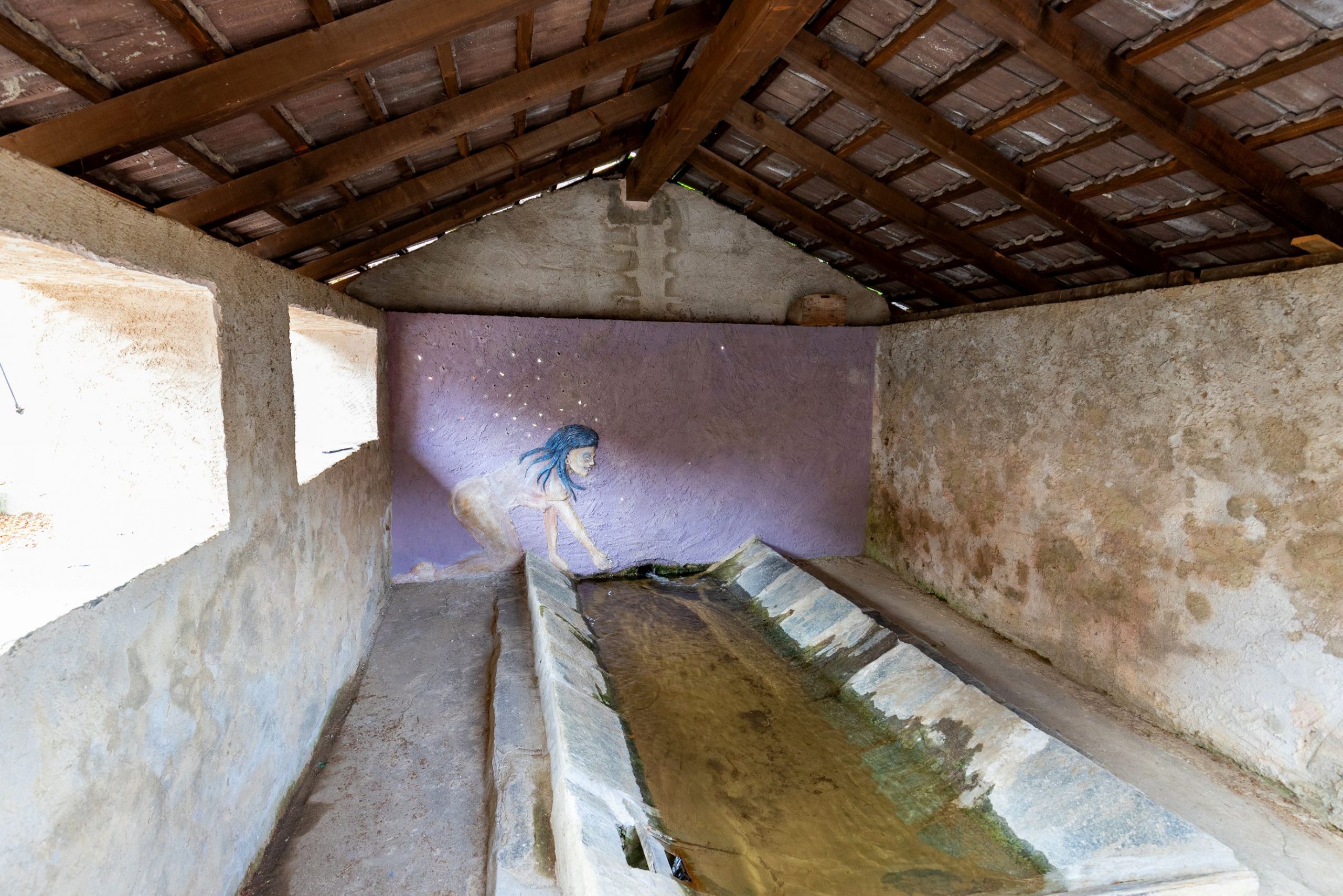
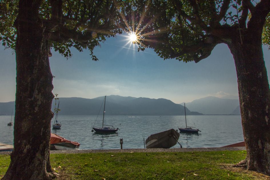
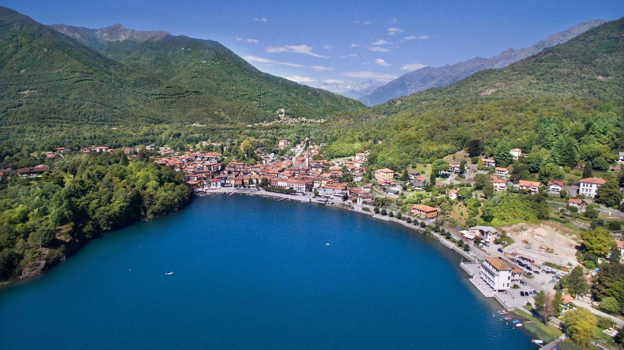
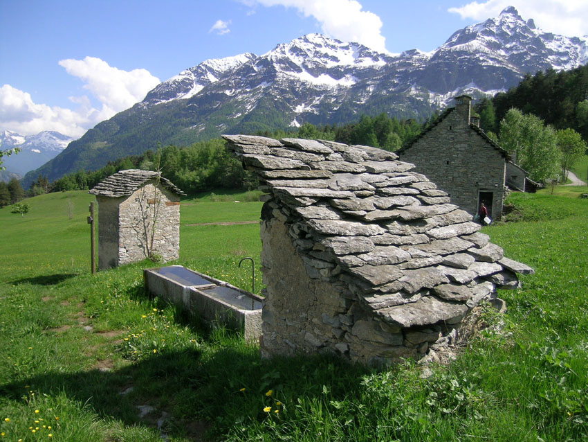
This itinerary starts from Cireggio, a locality under the jurisdiction of Omegna where partisan commander Filippo Maria Bertrami (partisan chief (1908-1944)) was born. The hike begins in the square in front of the baroque parish church, Santa Maria Assunta. With the church façade behind us, we take Via Varallo to the left. The path is slightly downhill (follow the sign for “Ponte Bria 0h30” – “Laghetti di Nonio 0h40”) and following the constant slope, you arrive at a crossroads. Take the central street (Via Varallo) and go towards the outskirts of the town until you reach the bridge, Ponte Bria. Immediately after the bridge, take a right on via Ponte Bria. The trail begins to climb very gradually and your walk will take you through a pleasant valley. A red and white sign then directs you to the left, along a stony trail that is initially parallel to the road and then climbs more precisely. Always stay on the more evident track (helpful signs are not present). When you meet a flat trail, continue on to the left and you will come to the Lakes of Nonio: two bodies of water divided by a concrete slab. Just beyond the restaurant there is a picnic area and a playground area (fountain).
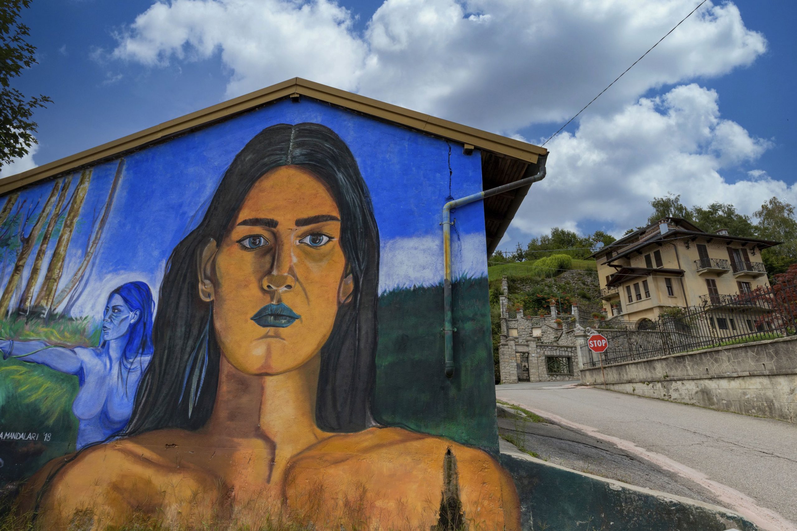
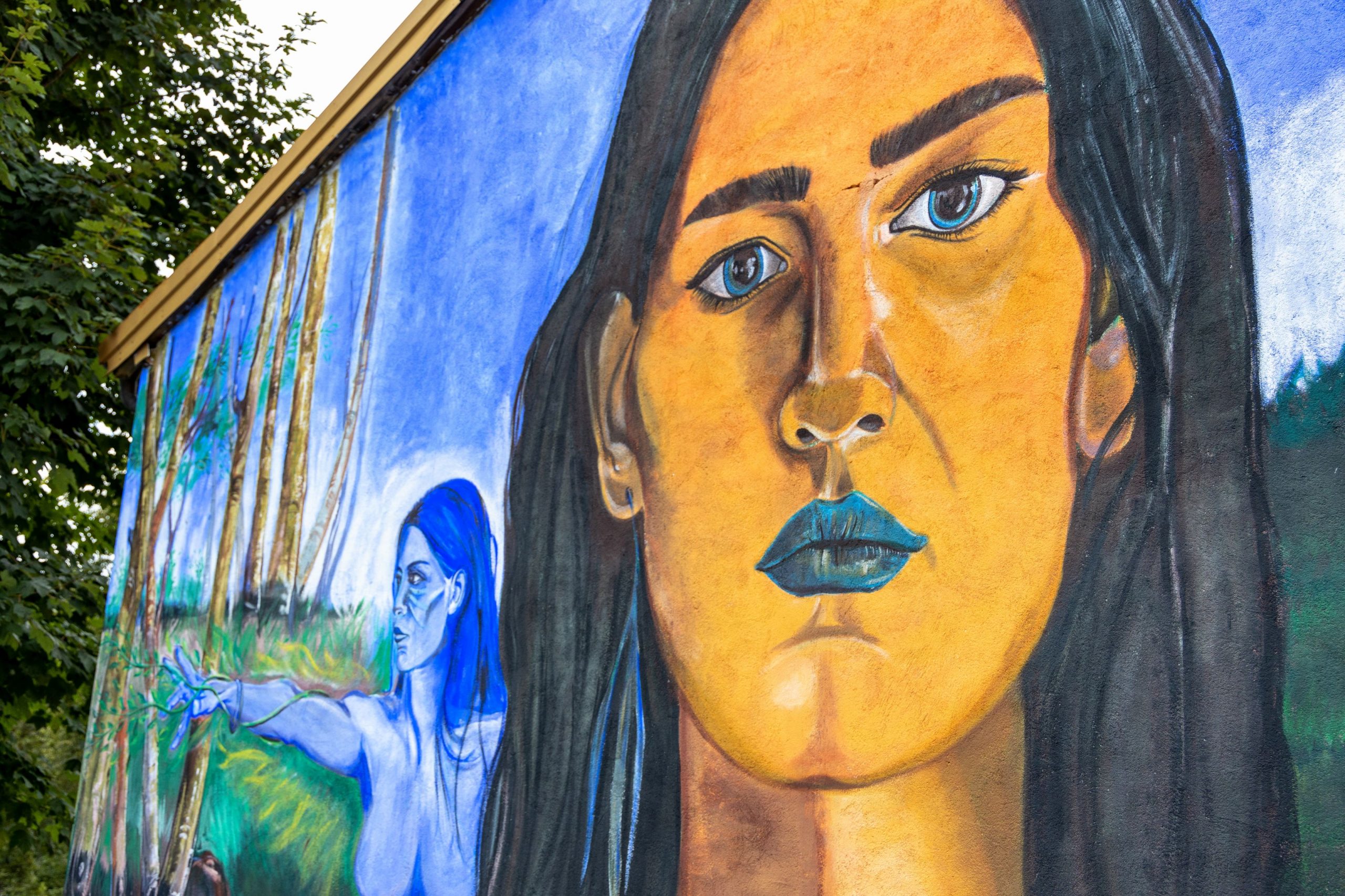
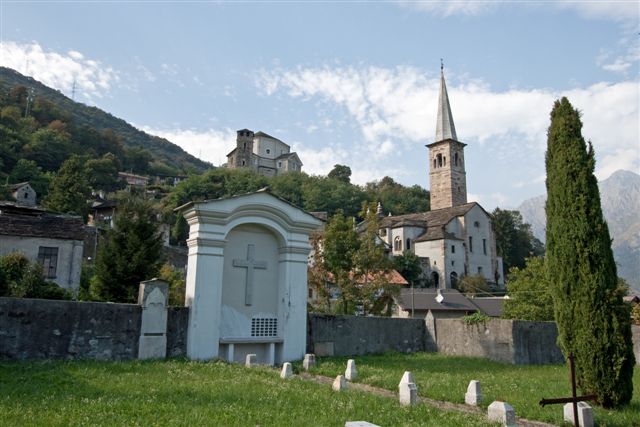
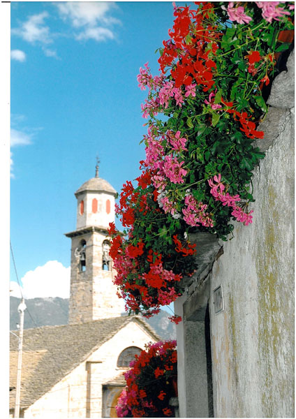
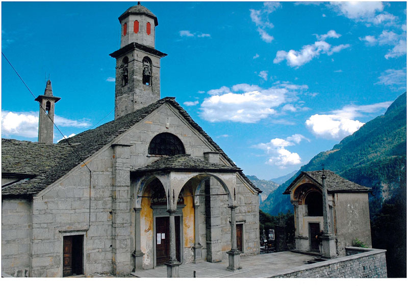
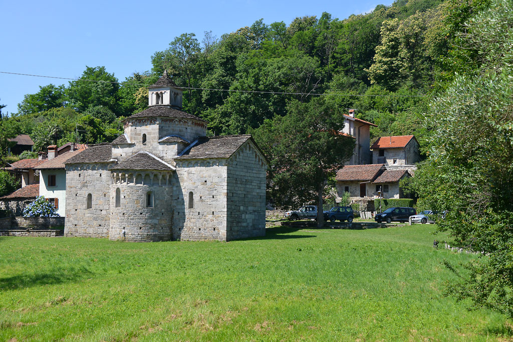
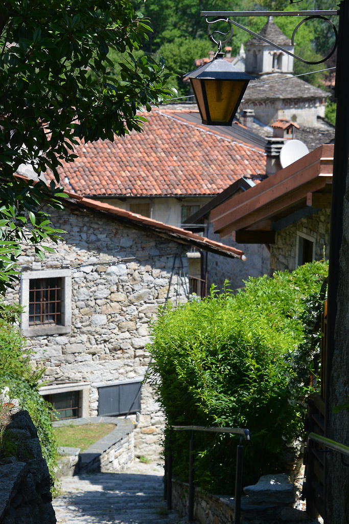
After the well-deserved rest break, go back to the beginning of the lake and take a cobblestone track to the left, near a large beech tree. It is not a real road but rather a water way covered with stone slabs, and you can tell by looking between the holes that can be found along the track. It is very pleasant, fresh and gradual though slightly exposed in certain places (watch livelier children carefully). A sharply climbing path to the left quickly leads to the bridge of the Brolo electrical power plant, and after crossing that bridge, you can continue on the left, initially on cobblestones and then on the staircase that goes around an old building. The climb is now quite steep on a zigzag trail, and you will come out near a small lake used for sport fishing. Continue on past the lake on an asphalt road, and turn left at the crossroads. A short uphill path will bring you to Quarna Sotto (800 m, fountain) characterized by a large square decorated with a curious musical instrument, a horn, and the 18th century church of San Nicolao.
Quarna Sotto is defined as the “land of music” because, in the first half of the 19th century, the production of woodwind instruments developed. The company “Rampone&Cazzani” became world famous, and it is still in business (www.ramponecazzani.com). The Museo Etnografico e dello Stumento musicale a fiato recalls this entrepreneurial success with the presentation of old artisan techniques and an exhibition of over 300 wind instruments (www.museodellequarne.it).
Using the front of the church façade as a reference, go to the left up Via Filippo Beltrami and pass in front of the small museum featuring woodwind instruments.
Alternative: if you want to avoid the main road, even though it is not very busy, do not take Via Beltrami uphill, but instead go downhill on Salita San Giuseppe, to the left, and then take a right and go uphill on Via delle Fontane when you get to a votive pillar. When you get to a wider road, continue on the right, uphill, merging with Via Beltrami more upstream. In this way, however, if you want to see the music museum, you’ll have to go back on Via Beltrami.
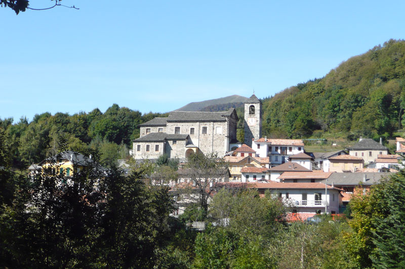
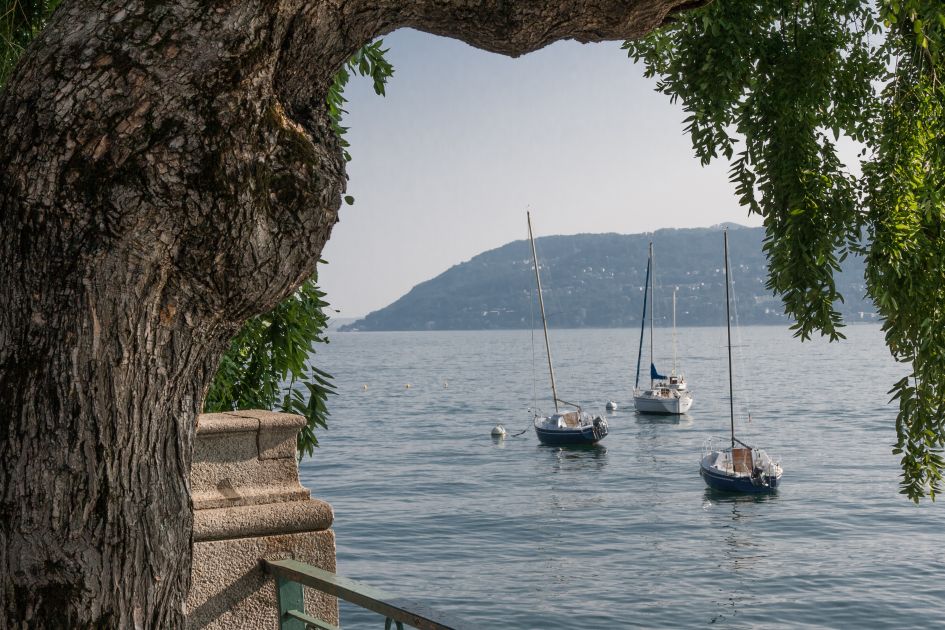
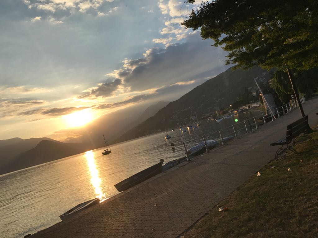
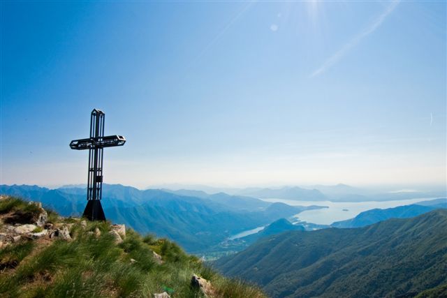
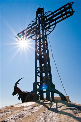
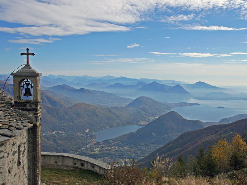
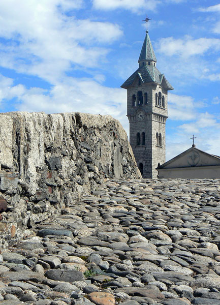
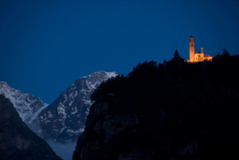
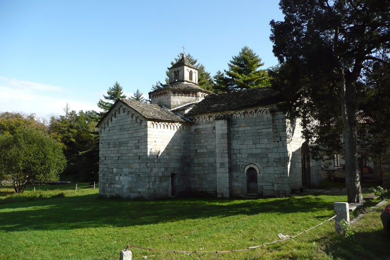
Following the continuously climbing asphalt road, with a slight grade, you come to Quarna Sopra (860 m), passing in front of the Oratory of the Madonna del Pero (1598), with the parish church Saint Stephen (16th century) more on the left. After the municipal building, go on to the left (signs say “Belvedere”) to arrive on Via Circonvallazione/Via Fontegno and continue to go to the left. At the next intersection, and now you are outside the town, go downhill to the right until you get to a barrier beyond which you reach Belvedere (830 m), once a location for clay pigeon shooting and today a quiet lawn with tables and a wide panoramic view of the lake, the towns lower down on the hill side (if you left you car at Cireggio cemetery parking area, you may also see it) and lakes of Nonio: it’s a breathtaking sight! Spend the right amount of time admiring the amazing view, and then go back to the larger crossroads, and go right (sings for “Santuario del Fontegno”). A nice cobblestone track takes you to the Fontegno Sanctuary complex (750 m, fountain), built in the 17th and 19th centuries. It is dedicated to Our Lady of the Snows, and is almost hidden, leaned against the mountain and sheltered by trees. It also has a splendid view. Continue past the church complex and descend on the steep track, which is partly cobblestones and partly dirt path, to reach a staircase that leads to an asphalt road. Continue to the left and you will find the church of Cireggio, whose bell tower can be seen from a great distance.
to learn more
“Quarna, un paese per la musica”
Since 1979 a musical review has been held every summer in the territory, hosting internationally acclaimed artists (www.quarnamusica.it).
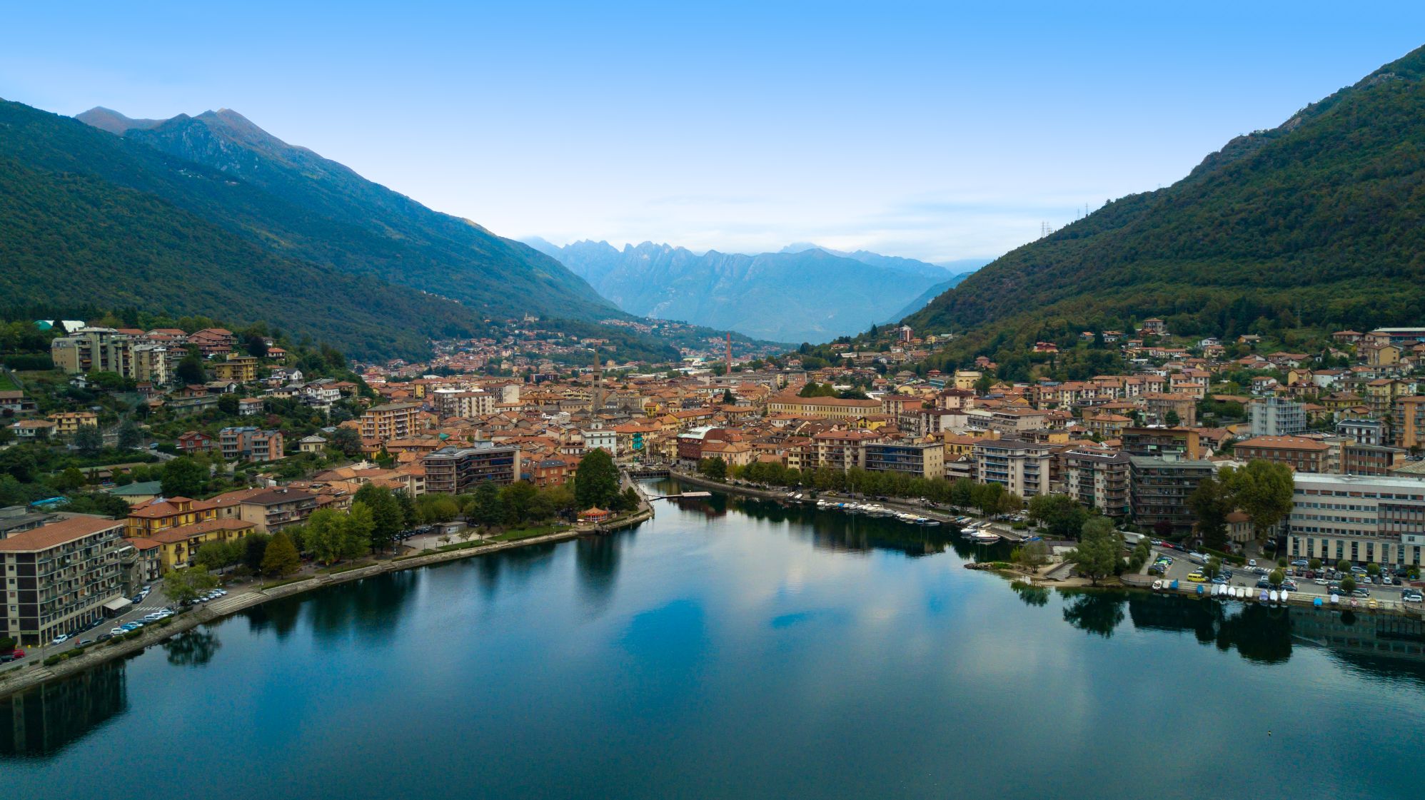
Omegna
A city of crafts and industry, Omegna is known mainly for the products linked to the house and to the kitchen, such as Alessi, Piazza, Girmi, and Lagostina. The “moka express” coffee pot was invented here, and the most famous pressure cookers and pasta makers are produced here. The Forum Museum presents the history of these items (www.forumomegna.it).
tips for young hikers
This itinerary is quite long, and it ends with a descent that is challenging due to its steepness, but of great satisfaction for the panorama and the variety of environments that it goes through. Not suitable for pushchairs. Hikers with baby carrier backpacks will have no difficulty.
Slow trekkers: Franco Voglino, Annalisa Porporato and Nora Voglino
Authors of texts: Franco Voglino and Annalisa Porpora
Back to the list of routes
From Pella to Suna (Verbania)
FROM LAKE ORTA TO LAKE MAGGIORE PASSING THROUGH LAKE MERGOZZO
Lago d’Orta
Route description
Itinerary Description
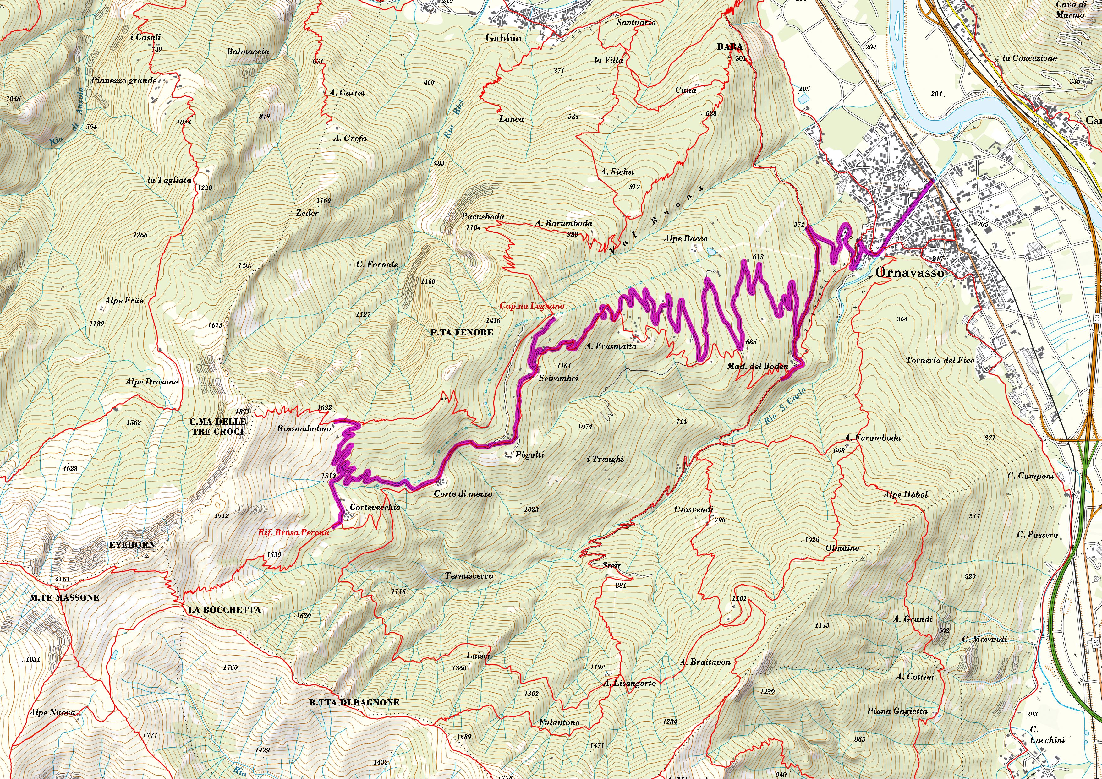
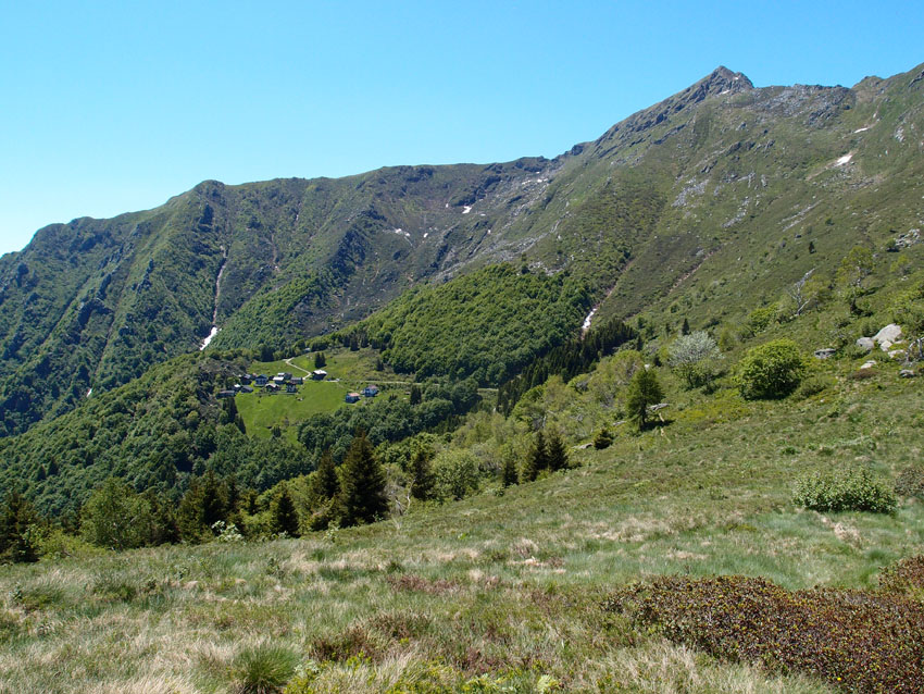
Description of the itinerary: The trail runs along the western shore of Lake Orta from Pella to Omegna, and then continues along the lower part of the Strona valley, about halfway up the mountain far from the industrial buildings at the bottom of the valley. It also goes through several villages that make up the municipality of Casale Court Cerro. The journey reaches the village of Gravellona Toce, where we turn toward Ossola and go in direction of Ornavasso. With a short detour, we can reach the Sanctuary of the Madonna del Boden. From Ornavasso, we cross the river Toce and head toward Lake Maggiore, finally reaching Mergozzo. We continue on the ridges overlooking Lake Mergozzo until we get to Cavandone, and then we go back down to Suna and the shores of the Borromeo Gulf.
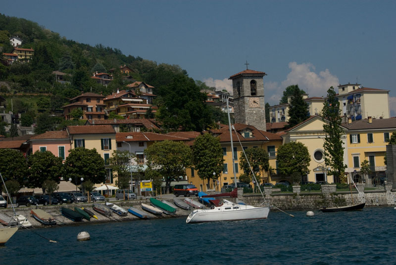
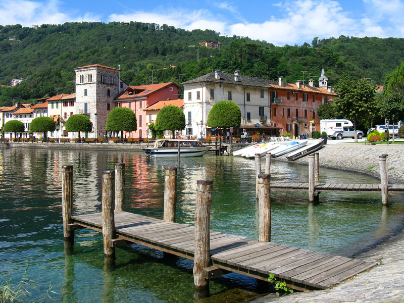
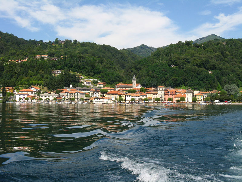
From the lakeside road of Pella, Piazza Motta, we go towards the cemetery to the asphalted road, with a wide view of Lake Orta and Mottarone. When we get to Ronco Inferiore, we find an ancient mule track that goes up to the village of Ronco Superiore, and from there we go north into dense woods on a path that continues at high altitude for a time. Then we come to Oira, a small village on the lake known for its serpentine quarry, a mineral used in various types of fine artwork. The itinerary goes slightly uphill as we walk through the woods towards Brolo. From there, it descends again to the hamlet Bagnella di Omegna on the lakefront path until we get to the town centre near the locks on the lake.
From the Omegna Town Hall, we pass through the historic centre, then cross the bridge on the Strona, and continue through the industrial zone of Crusinallo, always going north. We then leave the bottom of the valley and climb toward the villages of Cranna, Gattugno, Montebuglio and Tanchello and finally reach the main buildings of Casale Corte Cerro. The itinerary continues along the asphalt road toward the localities Crebbia and Ricciano, and then descends on a path to Gravellona Toce, in the locality Pedemonte.
The path skirts the base of the slope, crosses the residential area and leaves the town on the road that leads to Case Camponi, to then continue on dirt road and trail, always at the bottom of the valley, until we get to the cemetery at Ornavasso. From here, we take the street Via Alfredo di Dio to reach the centre and the railway station. We continue toward Ossola. At the bridge over Rio S. Carlo, we can take a detour to the left, and climb to the Sanctuary of Madonna del Boden, along the ancient Via Crucis of Boden. Or we can turn right towards the Toce River, and cross it over a bicycle-pedestrian walkway to reach Candoglia, a place that is famous for its pink marble and its quarries exploited for the construction of the Cathedral of Milan.
We change now direction altogether, turning toward Lake Maggiore, along the bike path Mergozzo-Candoglia, to arrive in a short time at the medieval village and Lake Mergozzo. From there, the path continues on the Sentiero Azzurro (Blue Path), a convenient and easy-to-walk mule track that leads to the hamlet Montorfano and the church of San Giovanni Battista.
Then we descend again to the bottom of the valley on the municipal road and go towards the Natural Reserve of Fondotoce, along the river up to its mouth. Finally, we turn towards the reed bed and the village of Fondotoce. We cross the state road and ascend on a trail in the direction of Cavandone, another characteristic village overlooking the Borromeo Gulf, in order to reach the Church of the Nativity of the Virgin Mary, along its ancient yew tree. A short climb leads to the picturesque village with its architecture in stone.
The trail then descends on a mule track toward Suna, gradually losing elevation to reach the shore of Lake Maggiore.
POINTS OF INTEREST
Pella
Chiesa di San Filiberto
Chiesa parrocchiale di Sant’Albino
Chiesa di San Defendente
Oratorio della Natività di Maria Santissima
Nonio
Oratorio della Madonna della Neve
Cava di Serpentino di Oira
Chiesa di San Silvestro
Brolo
Chiesa Parrocchiale di Sant’Antonio
Omegna
Chiesa di San Bernardino da Siena
Chiesa Parrocchiale di Sant’Ambrogio
Battistero di San Giovanni Battista
Porta Romana o Porta della Valle
Chiesa Parrocchiale di San Gaudenzio
Casale Corte Cerro
Chiesa Parrocchiale di San Tommaso
Chiesa Parrocchiale di San Giorgio Martire
Oratorio di San Giovanni
Oratorio della SS Trinità
Ornavasso
Santuario della Madonna del Boden
Santuario della Guardia
Rotonda del Crocifisso
Torre medioevale
Linea Cadorna
Antica Cava
Museo Parrocchiale di Arte Sacra
Casa Museo del partigiano “A. Di Dio”
Mergozzo
Chiesa di San Graziano
Chiesa di Santa Maria di Prato Scopello
Chiesa Parrocchiale della Beata vergine Assunta
Chiesa di Santa Marta
Museo Archeologico
Chiesa di San Giovanni Battista in Montorfano
Verbania
Riserva Naturale di Fondotoce
Chiesa della Natività di Maria Vergine
Tasso secolare
TECHNICAL NOTES
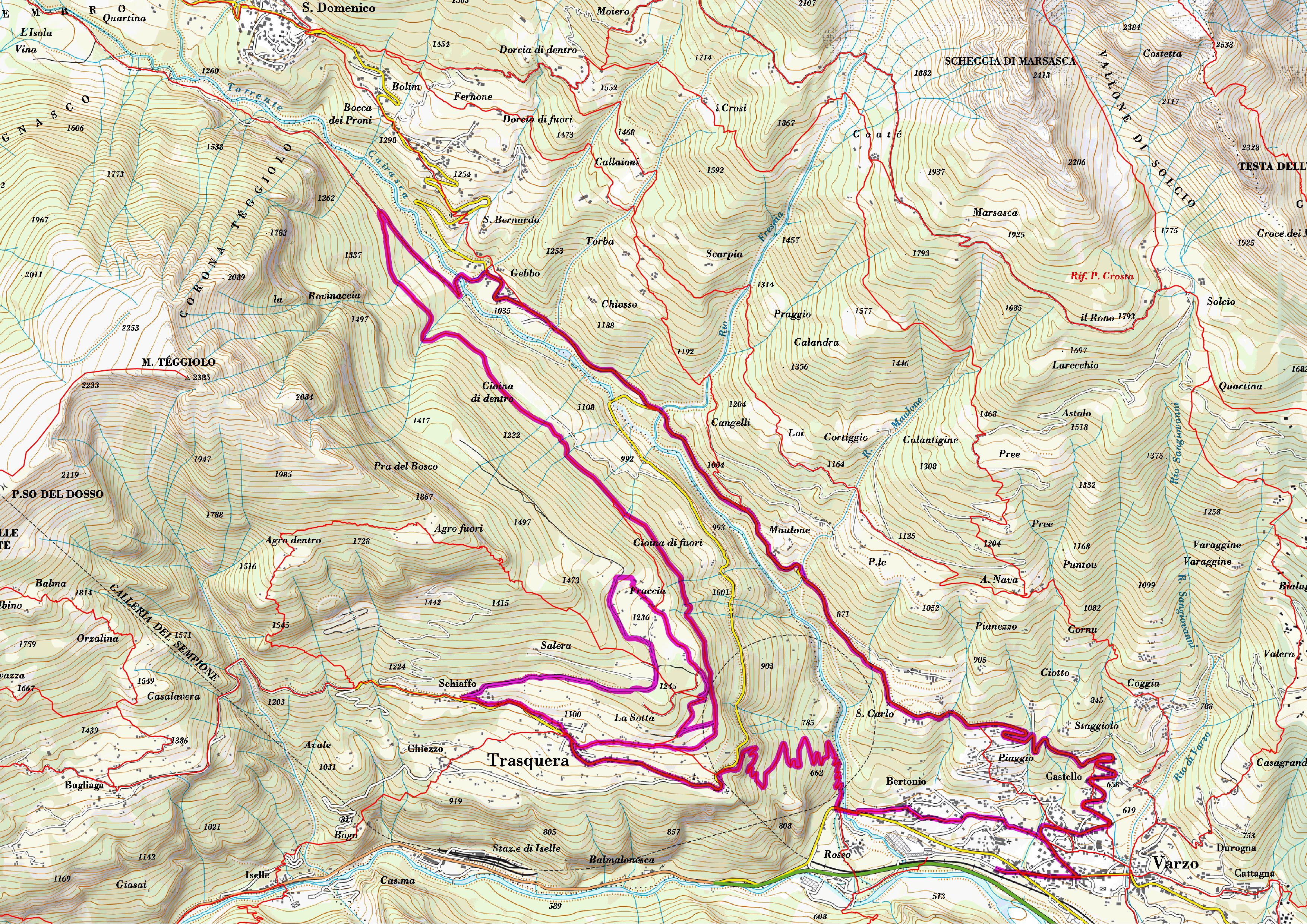
LEGS: the journey is recommended in three legs: from Pella to Omegna (12 km), from Omegna to Mergozzo (16 km), and from Mergozzo to Suna (8 km)
DIFFERENCE IN ELEVATION: lowest altitude of the itinerary, 204 m a.s.l.; highest, 470 m a.s.l. See the map.
DURATION: from 3 to 6 hours for each leg
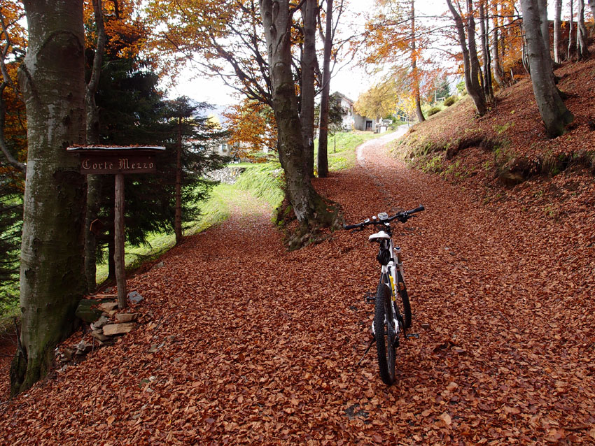
TYPE OF PATH: Excursion – MAINLY DIRT ROADS
FACILITIES
STRUTTURE RICETTIVE
FOR MORE DETAILS
www.lagodorta.net
www.ecomuseogranitomontorfano.it
Back to the list of routes
From Pella to Suna (Verbania)
FROM LAKE ORTA TO LAKE MAGGIORE PASSING THROUGH LAKE MERGOZZO
Valle Divedro
Route description
Itinerary Description
Description of the itinerary: The trail runs along the western shore of Lake Orta from Pella to Omegna, and then continues along the lower part of the Strona valley, about halfway up the mountain far from the industrial buildings at the bottom of the valley. It also goes through several villages that make up the municipality of Casale Court Cerro. The journey reaches the village of Gravellona Toce, where we turn toward Ossola and go in direction of Ornavasso. With a short detour, we can reach the Sanctuary of the Madonna del Boden. From Ornavasso, we cross the river Toce and head toward Lake Maggiore, finally reaching Mergozzo. We continue on the ridges overlooking Lake Mergozzo until we get to Cavandone, and then we go back down to Suna and the shores of the Borromeo Gulf.
From the lakeside road of Pella, Piazza Motta, we go towards the cemetery to the asphalted road, with a wide view of Lake Orta and Mottarone. When we get to Ronco Inferiore, we find an ancient mule track that goes up to the village of Ronco Superiore, and from there we go north into dense woods on a path that continues at high altitude for a time. Then we come to Oira, a small village on the lake known for its serpentine quarry, a mineral used in various types of fine artwork. The itinerary goes slightly uphill as we walk through the woods towards Brolo. From there, it descends again to the hamlet Bagnella di Omegna on the lakefront path until we get to the town centre near the locks on the lake.
From the Omegna Town Hall, we pass through the historic centre, then cross the bridge on the Strona, and continue through the industrial zone of Crusinallo, always going north. We then leave the bottom of the valley and climb toward the villages of Cranna, Gattugno, Montebuglio and Tanchello and finally reach the main buildings of Casale Corte Cerro. The itinerary continues along the asphalt road toward the localities Crebbia and Ricciano, and then descends on a path to Gravellona Toce, in the locality Pedemonte.
The path skirts the base of the slope, crosses the residential area and leaves the town on the road that leads to Case Camponi, to then continue on dirt road and trail, always at the bottom of the valley, until we get to the cemetery at Ornavasso. From here, we take the street Via Alfredo di Dio to reach the centre and the railway station. We continue toward Ossola. At the bridge over Rio S. Carlo, we can take a detour to the left, and climb to the Sanctuary of Madonna del Boden, along the ancient Via Crucis of Boden. Or we can turn right towards the Toce River, and cross it over a bicycle-pedestrian walkway to reach Candoglia, a place that is famous for its pink marble and its quarries exploited for the construction of the Cathedral of Milan.
We change now direction altogether, turning toward Lake Maggiore, along the bike path Mergozzo-Candoglia, to arrive in a short time at the medieval village and Lake Mergozzo. From there, the path continues on the Sentiero Azzurro (Blue Path), a convenient and easy-to-walk mule track that leads to the hamlet Montorfano and the church of San Giovanni Battista.
Then we descend again to the bottom of the valley on the municipal road and go towards the Natural Reserve of Fondotoce, along the river up to its mouth. Finally, we turn towards the reed bed and the village of Fondotoce. We cross the state road and ascend on a trail in the direction of Cavandone, another characteristic village overlooking the Borromeo Gulf, in order to reach the Church of the Nativity of the Virgin Mary, along its ancient yew tree. A short climb leads to the picturesque village with its architecture in stone.
The trail then descends on a mule track toward Suna, gradually losing elevation to reach the shore of Lake Maggiore.
POINTS OF INTEREST
Pella
Chiesa di San Filiberto
Chiesa parrocchiale di Sant’Albino
Chiesa di San Defendente
Oratorio della Natività di Maria Santissima
Nonio
Oratorio della Madonna della Neve
Cava di Serpentino di Oira
Chiesa di San Silvestro
Brolo
Chiesa Parrocchiale di Sant’Antonio
Omegna
Chiesa di San Bernardino da Siena
Chiesa Parrocchiale di Sant’Ambrogio
Battistero di San Giovanni Battista
Porta Romana o Porta della Valle
Chiesa Parrocchiale di San Gaudenzio
Casale Corte Cerro
Chiesa Parrocchiale di San Tommaso
Chiesa Parrocchiale di San Giorgio Martire
Oratorio di San Giovanni
Oratorio della SS Trinità
Ornavasso
Santuario della Madonna del Boden
Santuario della Guardia
Rotonda del Crocifisso
Torre medioevale
Linea Cadorna
Antica Cava
Museo Parrocchiale di Arte Sacra
Casa Museo del partigiano “A. Di Dio”
Mergozzo
Chiesa di San Graziano
Chiesa di Santa Maria di Prato Scopello
Chiesa Parrocchiale della Beata vergine Assunta
Chiesa di Santa Marta
Museo Archeologico
Chiesa di San Giovanni Battista in Montorfano
Verbania
Riserva Naturale di Fondotoce
Chiesa della Natività di Maria Vergine
Tasso secolare
TECHNICAL NOTES
LEGS: the journey is recommended in three legs: from Pella to Omegna (12 km), from Omegna to Mergozzo (16 km), and from Mergozzo to Suna (8 km)
DIFFERENCE IN ELEVATION: lowest altitude of the itinerary, 204 m a.s.l.; highest, 470 m a.s.l. See the map.
DURATION: from 3 to 6 hours for each leg
TYPE OF PATH: Excursion – MAINLY DIRT ROADS
FACILITIES
STRUTTURE RICETTIVE
FOR MORE DETAILS
www.lagodorta.net
www.ecomuseogranitomontorfano.it
Back to the list of routes
From Pella to Suna (Verbania)
FROM LAKE ORTA TO LAKE MAGGIORE PASSING THROUGH LAKE MERGOZZO
Lago di Mergozzo
Route description
Itinerary Description
Description of the itinerary: The trail runs along the western shore of Lake Orta from Pella to Omegna, and then continues along the lower part of the Strona valley, about halfway up the mountain far from the industrial buildings at the bottom of the valley. It also goes through several villages that make up the municipality of Casale Court Cerro. The journey reaches the village of Gravellona Toce, where we turn toward Ossola and go in direction of Ornavasso. With a short detour, we can reach the Sanctuary of the Madonna del Boden. From Ornavasso, we cross the river Toce and head toward Lake Maggiore, finally reaching Mergozzo. We continue on the ridges overlooking Lake Mergozzo until we get to Cavandone, and then we go back down to Suna and the shores of the Borromeo Gulf.
From the lakeside road of Pella, Piazza Motta, we go towards the cemetery to the asphalted road, with a wide view of Lake Orta and Mottarone. When we get to Ronco Inferiore, we find an ancient mule track that goes up to the village of Ronco Superiore, and from there we go north into dense woods on a path that continues at high altitude for a time. Then we come to Oira, a small village on the lake known for its serpentine quarry, a mineral used in various types of fine artwork. The itinerary goes slightly uphill as we walk through the woods towards Brolo. From there, it descends again to the hamlet Bagnella di Omegna on the lakefront path until we get to the town centre near the locks on the lake.
From the Omegna Town Hall, we pass through the historic centre, then cross the bridge on the Strona, and continue through the industrial zone of Crusinallo, always going north. We then leave the bottom of the valley and climb toward the villages of Cranna, Gattugno, Montebuglio and Tanchello and finally reach the main buildings of Casale Corte Cerro. The itinerary continues along the asphalt road toward the localities Crebbia and Ricciano, and then descends on a path to Gravellona Toce, in the locality Pedemonte.
The path skirts the base of the slope, crosses the residential area and leaves the town on the road that leads to Case Camponi, to then continue on dirt road and trail, always at the bottom of the valley, until we get to the cemetery at Ornavasso. From here, we take the street Via Alfredo di Dio to reach the centre and the railway station. We continue toward Ossola. At the bridge over Rio S. Carlo, we can take a detour to the left, and climb to the Sanctuary of Madonna del Boden, along the ancient Via Crucis of Boden. Or we can turn right towards the Toce River, and cross it over a bicycle-pedestrian walkway to reach Candoglia, a place that is famous for its pink marble and its quarries exploited for the construction of the Cathedral of Milan.
We change now direction altogether, turning toward Lake Maggiore, along the bike path Mergozzo-Candoglia, to arrive in a short time at the medieval village and Lake Mergozzo. From there, the path continues on the Sentiero Azzurro (Blue Path), a convenient and easy-to-walk mule track that leads to the hamlet Montorfano and the church of San Giovanni Battista.
Then we descend again to the bottom of the valley on the municipal road and go towards the Natural Reserve of Fondotoce, along the river up to its mouth. Finally, we turn towards the reed bed and the village of Fondotoce. We cross the state road and ascend on a trail in the direction of Cavandone, another characteristic village overlooking the Borromeo Gulf, in order to reach the Church of the Nativity of the Virgin Mary, along its ancient yew tree. A short climb leads to the picturesque village with its architecture in stone.
The trail then descends on a mule track toward Suna, gradually losing elevation to reach the shore of Lake Maggiore.
POINTS OF INTEREST
Pella
Chiesa di San Filiberto
Chiesa parrocchiale di Sant’Albino
Chiesa di San Defendente
Oratorio della Natività di Maria Santissima
Nonio
Oratorio della Madonna della Neve
Cava di Serpentino di Oira
Chiesa di San Silvestro
Brolo
Chiesa Parrocchiale di Sant’Antonio
Omegna
Chiesa di San Bernardino da Siena
Chiesa Parrocchiale di Sant’Ambrogio
Battistero di San Giovanni Battista
Porta Romana o Porta della Valle
Chiesa Parrocchiale di San Gaudenzio
Casale Corte Cerro
Chiesa Parrocchiale di San Tommaso
Chiesa Parrocchiale di San Giorgio Martire
Oratorio di San Giovanni
Oratorio della SS Trinità
Ornavasso
Santuario della Madonna del Boden
Santuario della Guardia
Rotonda del Crocifisso
Torre medioevale
Linea Cadorna
Antica Cava
Museo Parrocchiale di Arte Sacra
Casa Museo del partigiano “A. Di Dio”
Mergozzo
Chiesa di San Graziano
Chiesa di Santa Maria di Prato Scopello
Chiesa Parrocchiale della Beata vergine Assunta
Chiesa di Santa Marta
Museo Archeologico
Chiesa di San Giovanni Battista in Montorfano
Verbania
Riserva Naturale di Fondotoce
Chiesa della Natività di Maria Vergine
Tasso secolare
TECHNICAL NOTES
LEGS: the journey is recommended in three legs: from Pella to Omegna (12 km), from Omegna to Mergozzo (16 km), and from Mergozzo to Suna (8 km)
DIFFERENCE IN ELEVATION: lowest altitude of the itinerary, 204 m a.s.l.; highest, 470 m a.s.l. See the map.
DURATION: from 3 to 6 hours for each leg
TYPE OF PATH: Excursion – MAINLY DIRT ROADS
FACILITIES
STRUTTURE RICETTIVE
FOR MORE DETAILS
www.lagodorta.net
www.ecomuseogranitomontorfano.it
Back to the list of routes


From Pella to Suna (Verbania)
FROM LAKE ORTA TO LAKE MAGGIORE PASSING THROUGH LAKE MERGOZZO
Piana del Toce
Route description
Itinerary Description
Description of the itinerary: The trail runs along the western shore of Lake Orta from Pella to Omegna, and then continues along the lower part of the Strona valley, about halfway up the mountain far from the industrial buildings at the bottom of the valley. It also goes through several villages that make up the municipality of Casale Court Cerro. The journey reaches the village of Gravellona Toce, where we turn toward Ossola and go in direction of Ornavasso. With a short detour, we can reach the Sanctuary of the Madonna del Boden. From Ornavasso, we cross the river Toce and head toward Lake Maggiore, finally reaching Mergozzo. We continue on the ridges overlooking Lake Mergozzo until we get to Cavandone, and then we go back down to Suna and the shores of the Borromeo Gulf.
From the lakeside road of Pella, Piazza Motta, we go towards the cemetery to the asphalted road, with a wide view of Lake Orta and Mottarone. When we get to Ronco Inferiore, we find an ancient mule track that goes up to the village of Ronco Superiore, and from there we go north into dense woods on a path that continues at high altitude for a time. Then we come to Oira, a small village on the lake known for its serpentine quarry, a mineral used in various types of fine artwork. The itinerary goes slightly uphill as we walk through the woods towards Brolo. From there, it descends again to the hamlet Bagnella di Omegna on the lakefront path until we get to the town centre near the locks on the lake.
From the Omegna Town Hall, we pass through the historic centre, then cross the bridge on the Strona, and continue through the industrial zone of Crusinallo, always going north. We then leave the bottom of the valley and climb toward the villages of Cranna, Gattugno, Montebuglio and Tanchello and finally reach the main buildings of Casale Corte Cerro. The itinerary continues along the asphalt road toward the localities Crebbia and Ricciano, and then descends on a path to Gravellona Toce, in the locality Pedemonte.
The path skirts the base of the slope, crosses the residential area and leaves the town on the road that leads to Case Camponi, to then continue on dirt road and trail, always at the bottom of the valley, until we get to the cemetery at Ornavasso. From here, we take the street Via Alfredo di Dio to reach the centre and the railway station. We continue toward Ossola. At the bridge over Rio S. Carlo, we can take a detour to the left, and climb to the Sanctuary of Madonna del Boden, along the ancient Via Crucis of Boden. Or we can turn right towards the Toce River, and cross it over a bicycle-pedestrian walkway to reach Candoglia, a place that is famous for its pink marble and its quarries exploited for the construction of the Cathedral of Milan.
We change now direction altogether, turning toward Lake Maggiore, along the bike path Mergozzo-Candoglia, to arrive in a short time at the medieval village and Lake Mergozzo. From there, the path continues on the Sentiero Azzurro (Blue Path), a convenient and easy-to-walk mule track that leads to the hamlet Montorfano and the church of San Giovanni Battista.
Then we descend again to the bottom of the valley on the municipal road and go towards the Natural Reserve of Fondotoce, along the river up to its mouth. Finally, we turn towards the reed bed and the village of Fondotoce. We cross the state road and ascend on a trail in the direction of Cavandone, another characteristic village overlooking the Borromeo Gulf, in order to reach the Church of the Nativity of the Virgin Mary, along its ancient yew tree. A short climb leads to the picturesque village with its architecture in stone.
The trail then descends on a mule track toward Suna, gradually losing elevation to reach the shore of Lake Maggiore.
POINTS OF INTEREST
Pella
Chiesa di San Filiberto
Chiesa parrocchiale di Sant’Albino
Chiesa di San Defendente
Oratorio della Natività di Maria Santissima
Nonio
Oratorio della Madonna della Neve
Cava di Serpentino di Oira
Chiesa di San Silvestro
Brolo
Chiesa Parrocchiale di Sant’Antonio
Omegna
Chiesa di San Bernardino da Siena
Chiesa Parrocchiale di Sant’Ambrogio
Battistero di San Giovanni Battista
Porta Romana o Porta della Valle
Chiesa Parrocchiale di San Gaudenzio
Casale Corte Cerro
Chiesa Parrocchiale di San Tommaso
Chiesa Parrocchiale di San Giorgio Martire
Oratorio di San Giovanni
Oratorio della SS Trinità
Ornavasso
Santuario della Madonna del Boden
Santuario della Guardia
Rotonda del Crocifisso
Torre medioevale
Linea Cadorna
Antica Cava
Museo Parrocchiale di Arte Sacra
Casa Museo del partigiano “A. Di Dio”
Mergozzo
Chiesa di San Graziano
Chiesa di Santa Maria di Prato Scopello
Chiesa Parrocchiale della Beata vergine Assunta
Chiesa di Santa Marta
Museo Archeologico
Chiesa di San Giovanni Battista in Montorfano
Verbania
Riserva Naturale di Fondotoce
Chiesa della Natività di Maria Vergine
Tasso secolare
TECHNICAL NOTES
LEGS: the journey is recommended in three legs: from Pella to Omegna (12 km), from Omegna to Mergozzo (16 km), and from Mergozzo to Suna (8 km)
DIFFERENCE IN ELEVATION: lowest altitude of the itinerary, 204 m a.s.l.; highest, 470 m a.s.l. See the map.
DURATION: from 3 to 6 hours for each leg
TYPE OF PATH: Excursion – MAINLY DIRT ROADS
FACILITIES
STRUTTURE RICETTIVE
FOR MORE DETAILS
www.lagodorta.net
www.ecomuseogranitomontorfano.it
Back to the list of routes