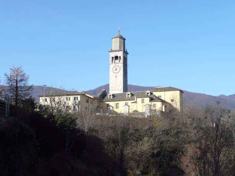
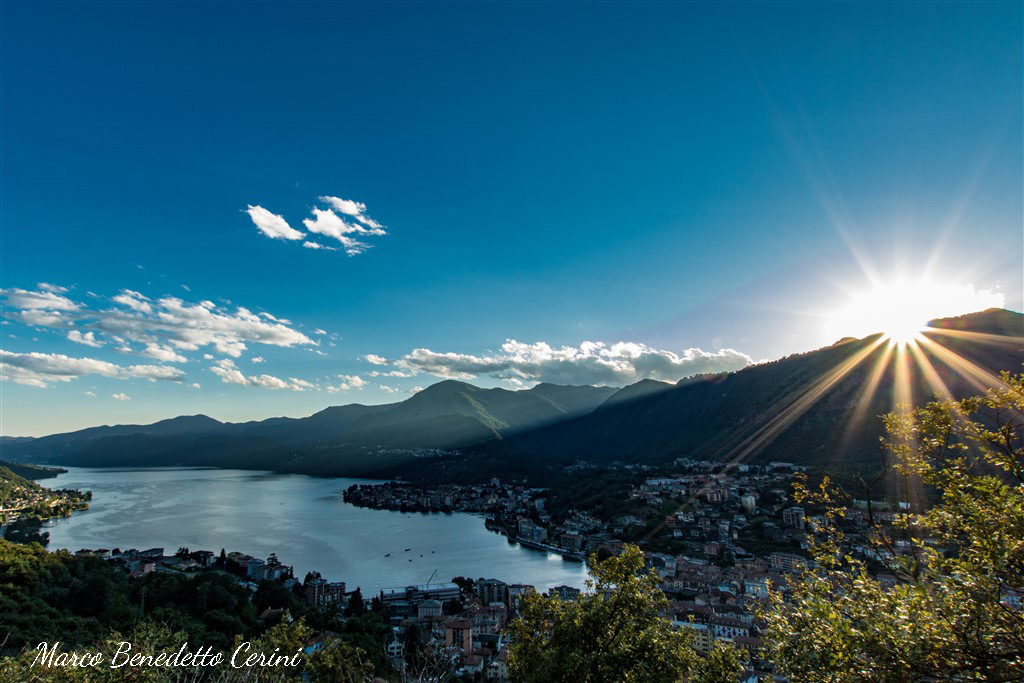
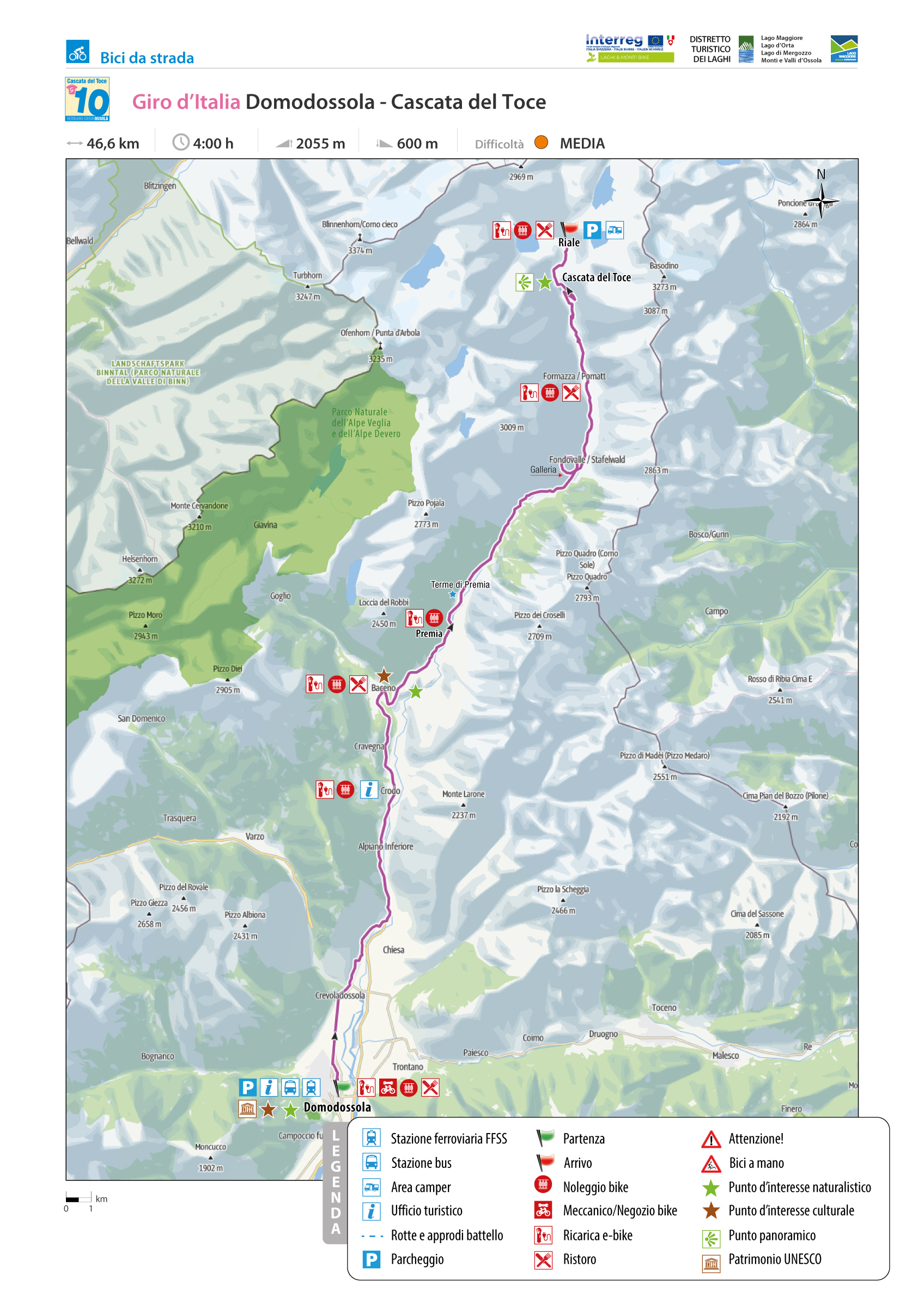
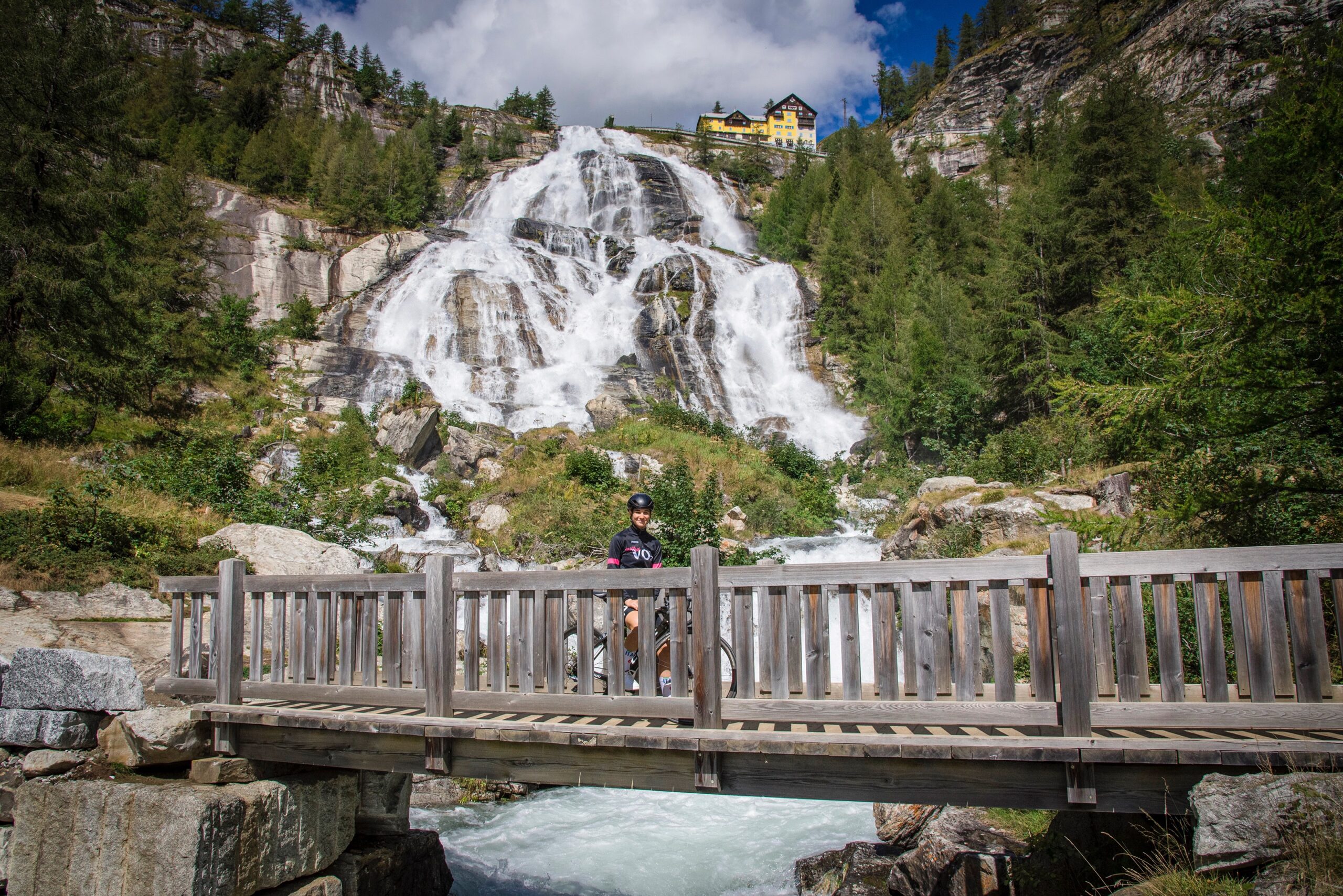
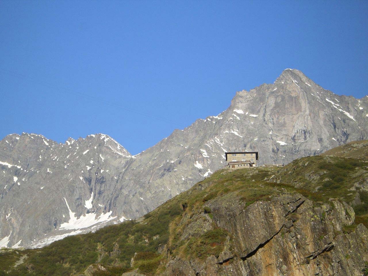
GIRO D’ITALIA: DOMODOSSOLA – CASCATA DEL TOCE
Domodossola e dintorni
Route description
Along this path, thanks to a grand champion like Marco Pantani, unforgettable pages of contemporary cycling have been written. Indeed, who does not remember the last great uphill sprint made by the “Pirate” on Friday, May 30, 2003, during the 19th Canelli-Cascata del Toce stage!!!? How it turned out, then everyone knows, but those moments remain indelible in the memory of the many fans.
Just as they remain in the annals of cycling the granfondo organized by UC Valdossola, first “ex Diablo” and then “De Zan,” with departure from Formazza and arrival at the Cascata, after a 160-kilometer route, which brought the less trained to exhaustion. Other times!
Back to the present day, we start from Domodossola Railway Station to climb to the top of Europe’s highest waterfall.
Back to the list of routes

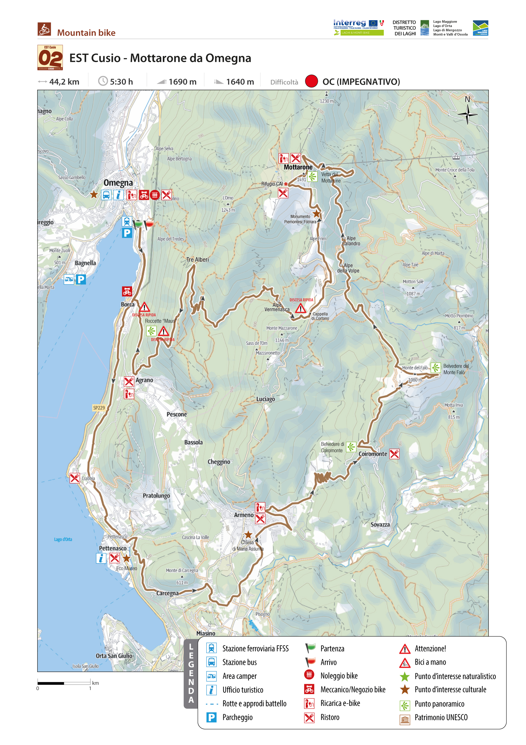
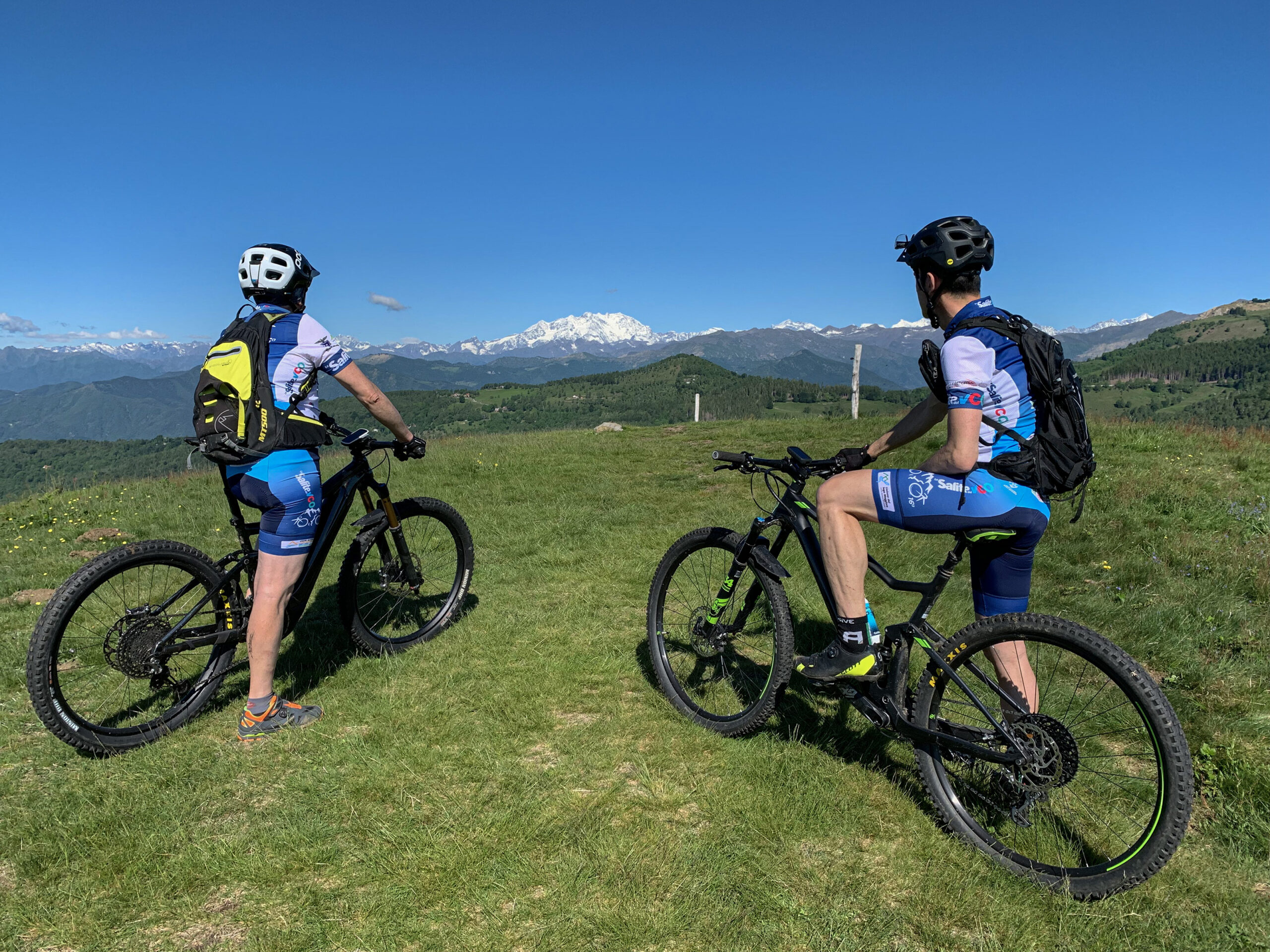
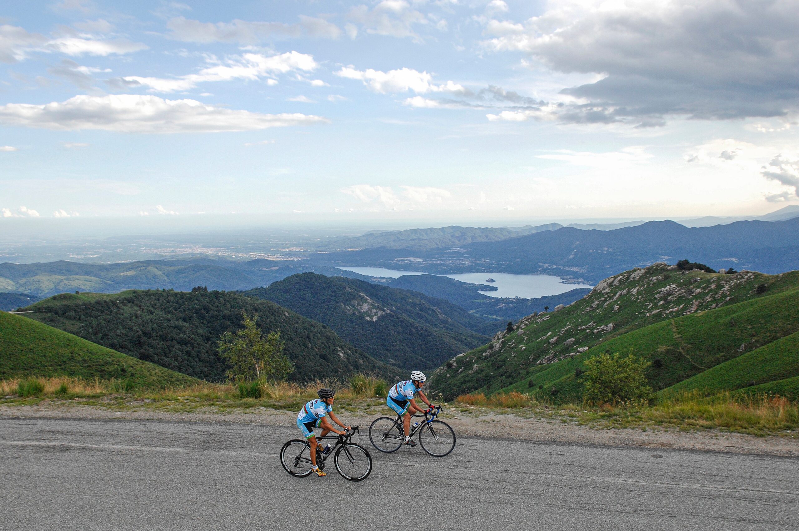
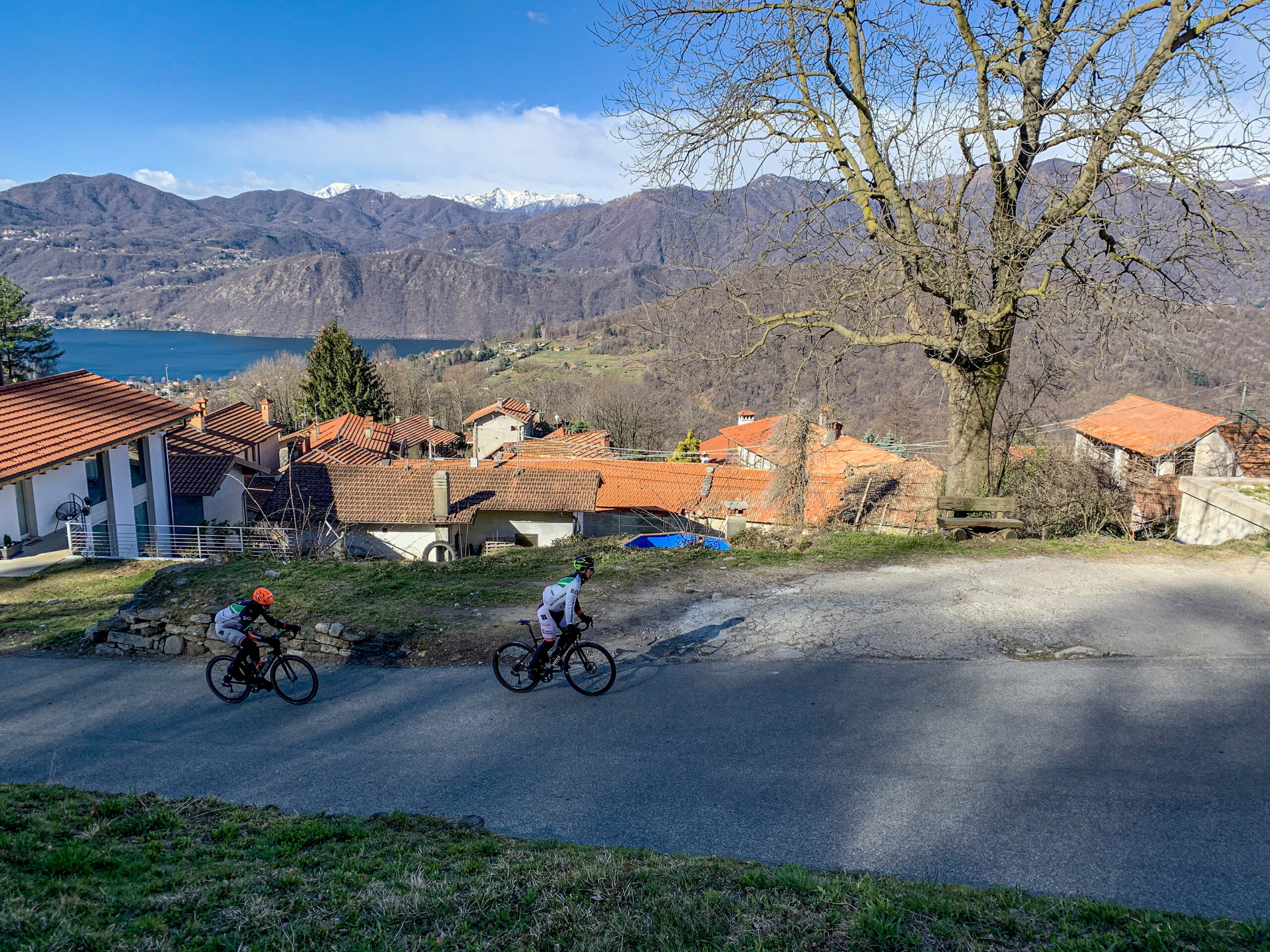
MOTTARONE FROM OMEGNA
EAST CUSIO MTB
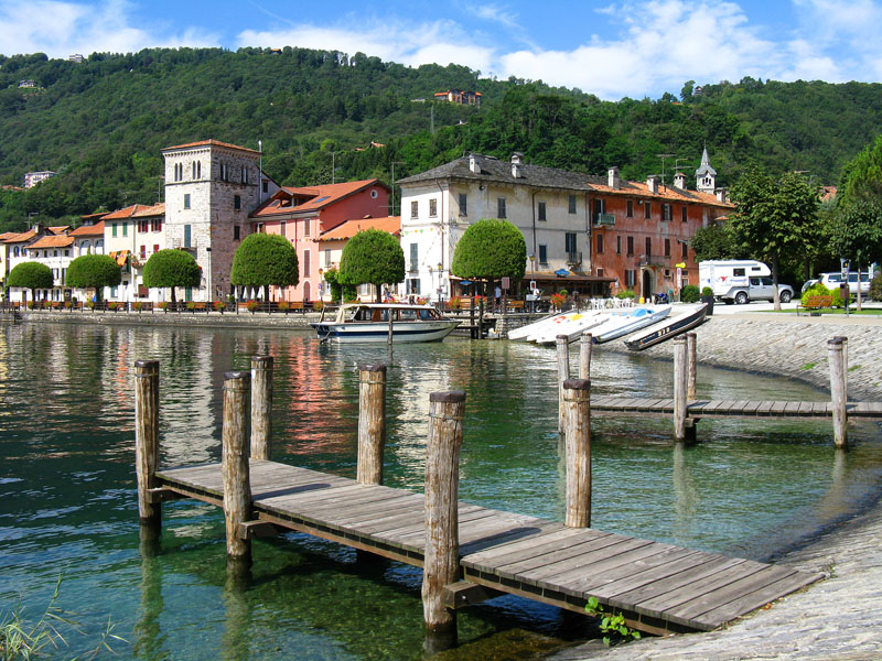
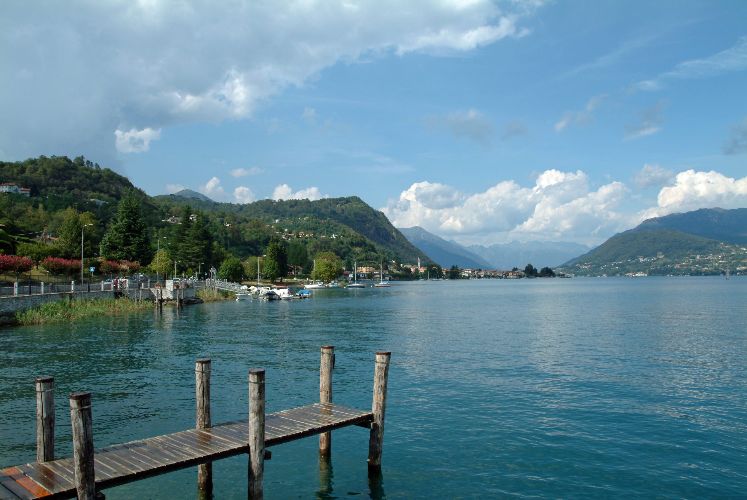
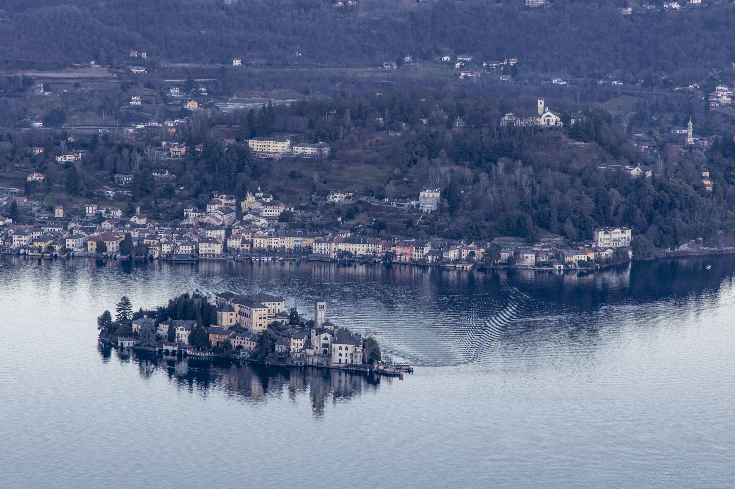
Lago d’Orta
Route description
It is a long and challenging route only for some. Still, one that can become so by opting, when the body or batteries can’t take it anymore, for the escape routes is SP 42 Omegna- Armeno and SP 41 Armeno-Mottarone, which run through the center of this fantastic loop.
We start from the Omegna train station, and along Via Repubblica, we reach Borca. From here, a beautiful path, recently adapted for bikers, leads to Crabbia, Pettenasco hamlet. A short stretch of paved road leads to the main town, skirting the railway and crossing a level crossing. Here, we enjoy a splendid view of Lake Orta and its Sacro Monte, dedicated to St. Francis of Assisi and recognized by UNESCO in 2003 as a “world heritage site.”
Back to the list of routes
One of the most renowned and popular cycling destinations for fans of the “specialissima”
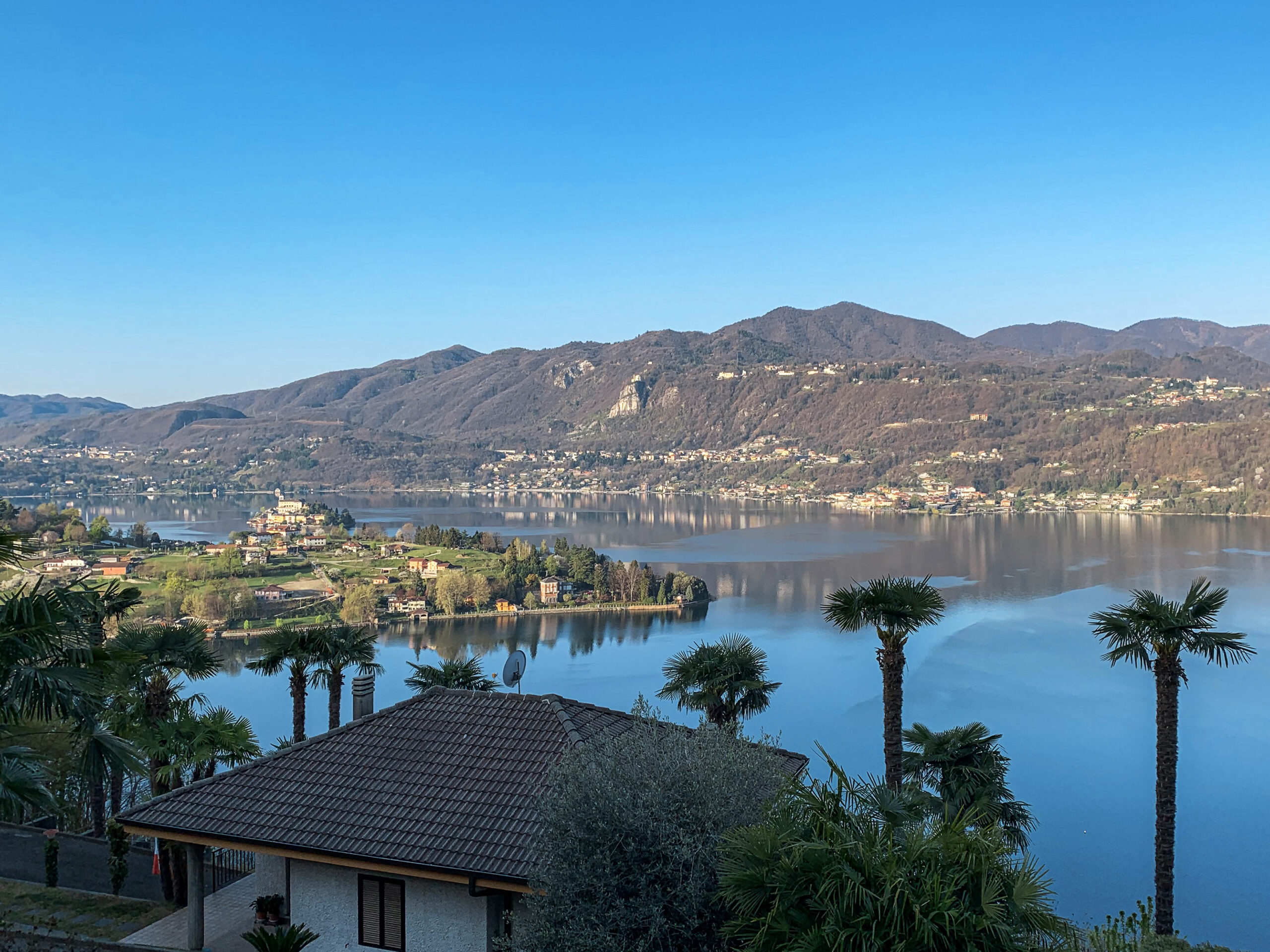
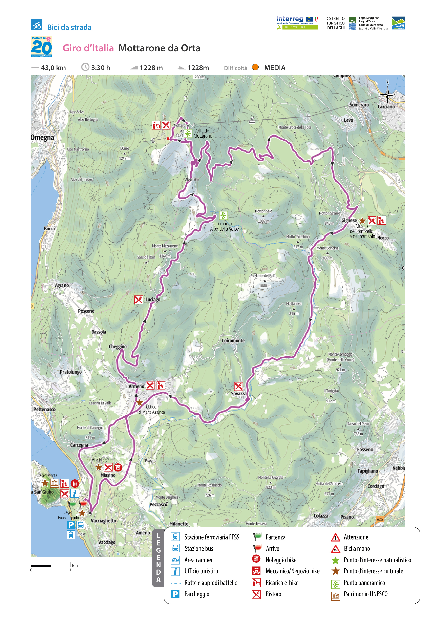
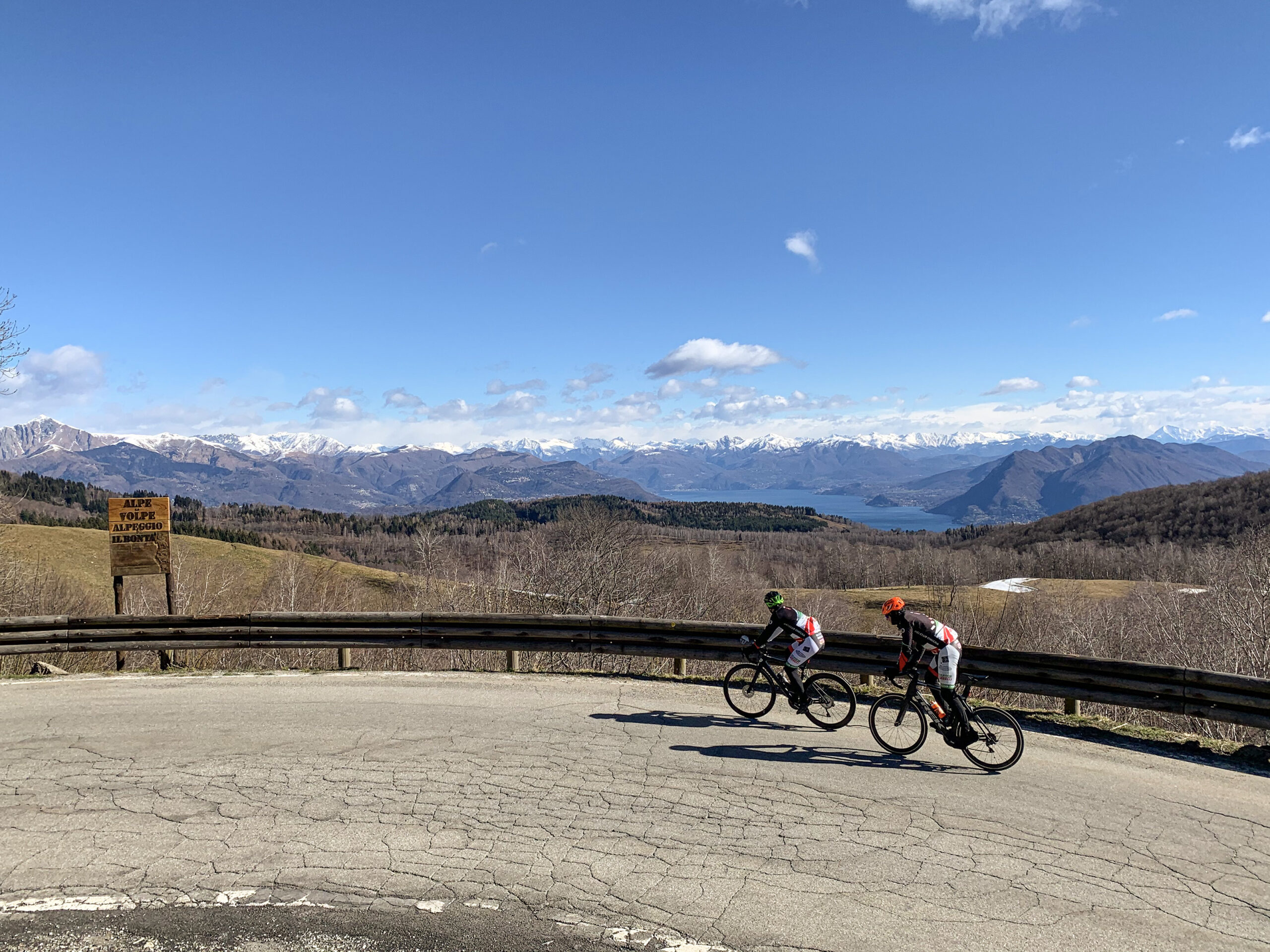
GIRO D’ITALIA: MOTTARONE FROM ORTA SAN GIULIO
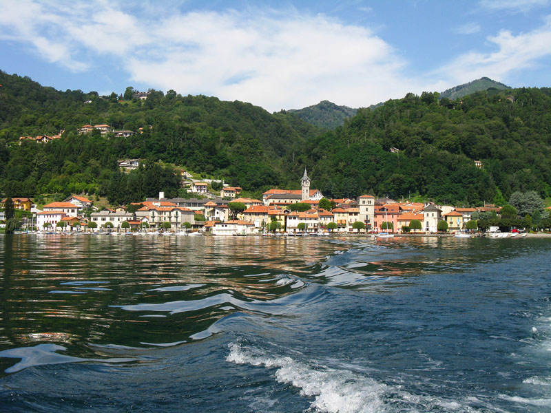
Lago d’Orta
Route description
One of the most renowned and popular cycling destinations for fans of the “specialissima” is Mottarone, either because the Giro d’Italia has passed through it several times or because it is the ideal climb with its rugged, but never prohibitive, gradients and increasingly rewarding surroundings as we climb.
Two roads lead to the summit of Mottarone: the private Borromean road up from Lake Maggiore and the Due Riviere SP 39 up from Lake Orta, and it is this one that we are going to propose.
The starting place is the Orta San Giulio Railway Station in the hamlet of Legro (the famous painted village), which offers both the possibility of getting there by train and ample parking.
Back to the list of routes

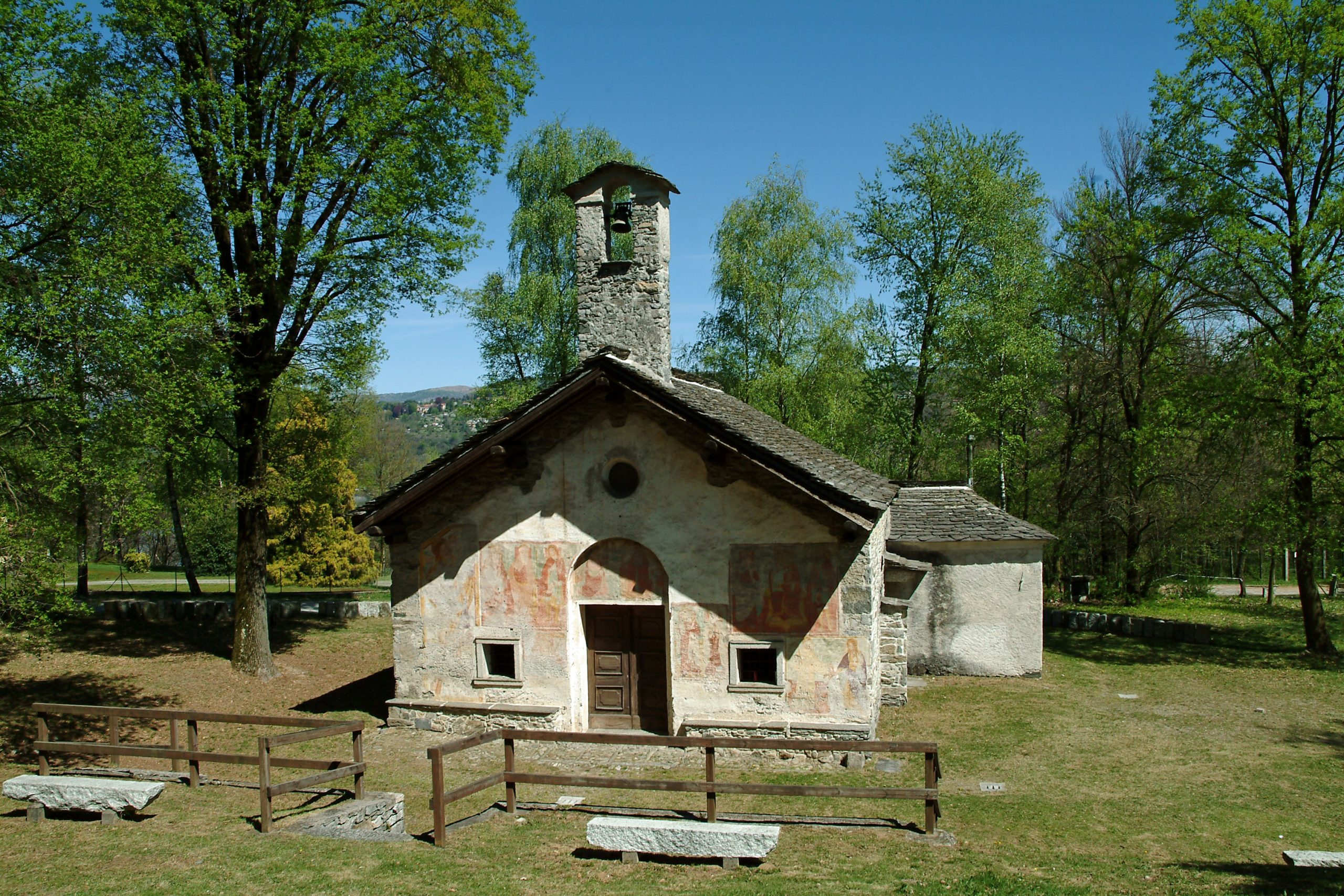
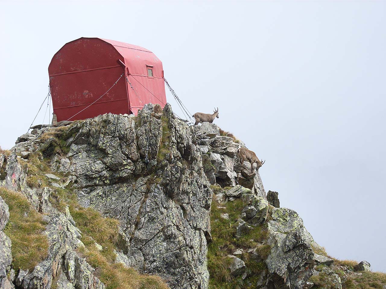
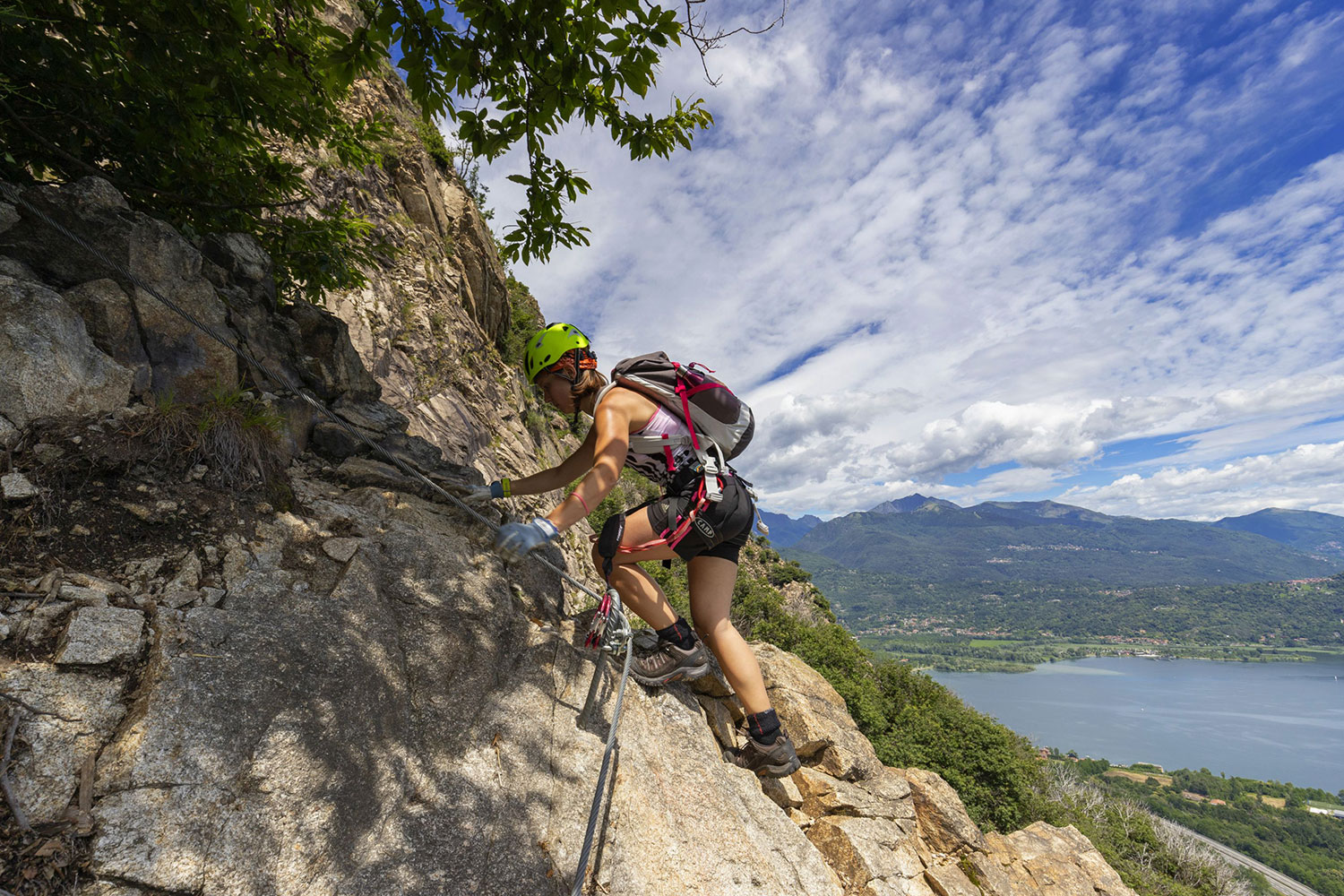
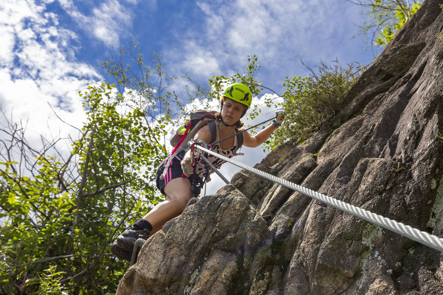
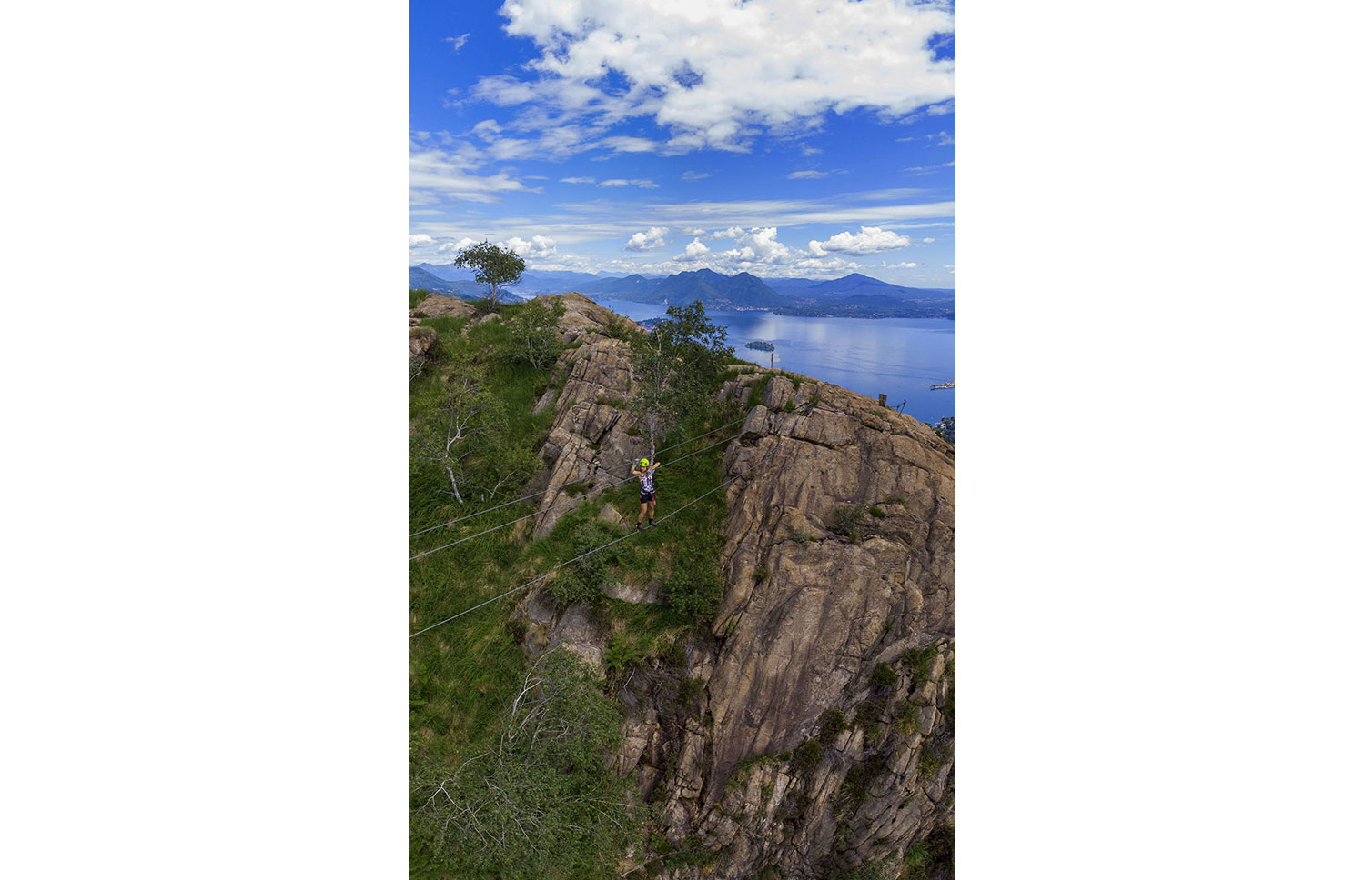
An unforgettable sport and adrenaline climb
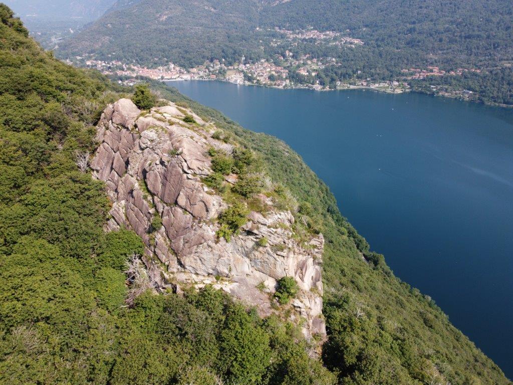
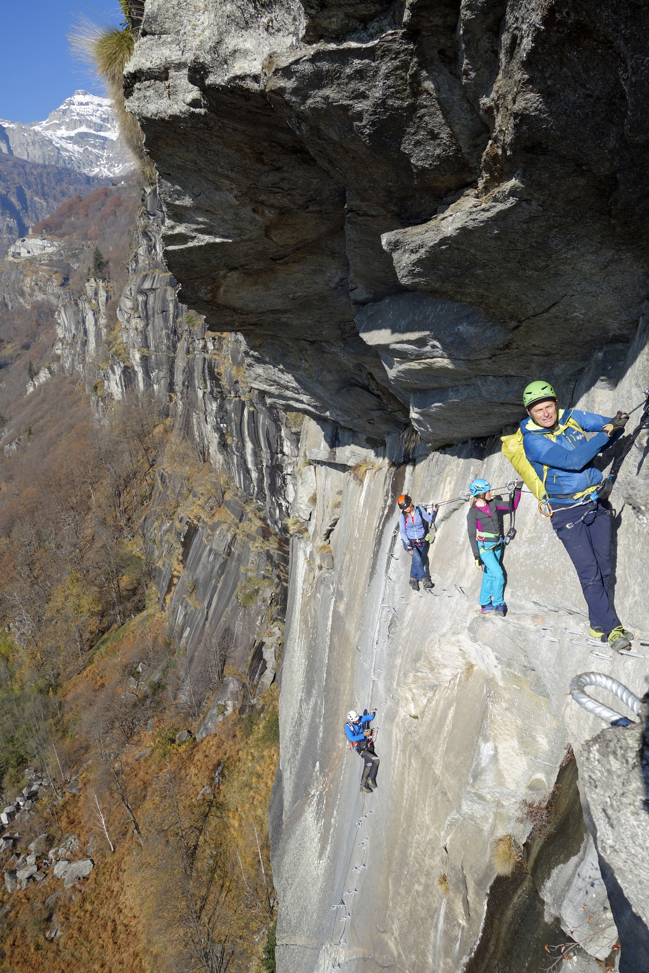
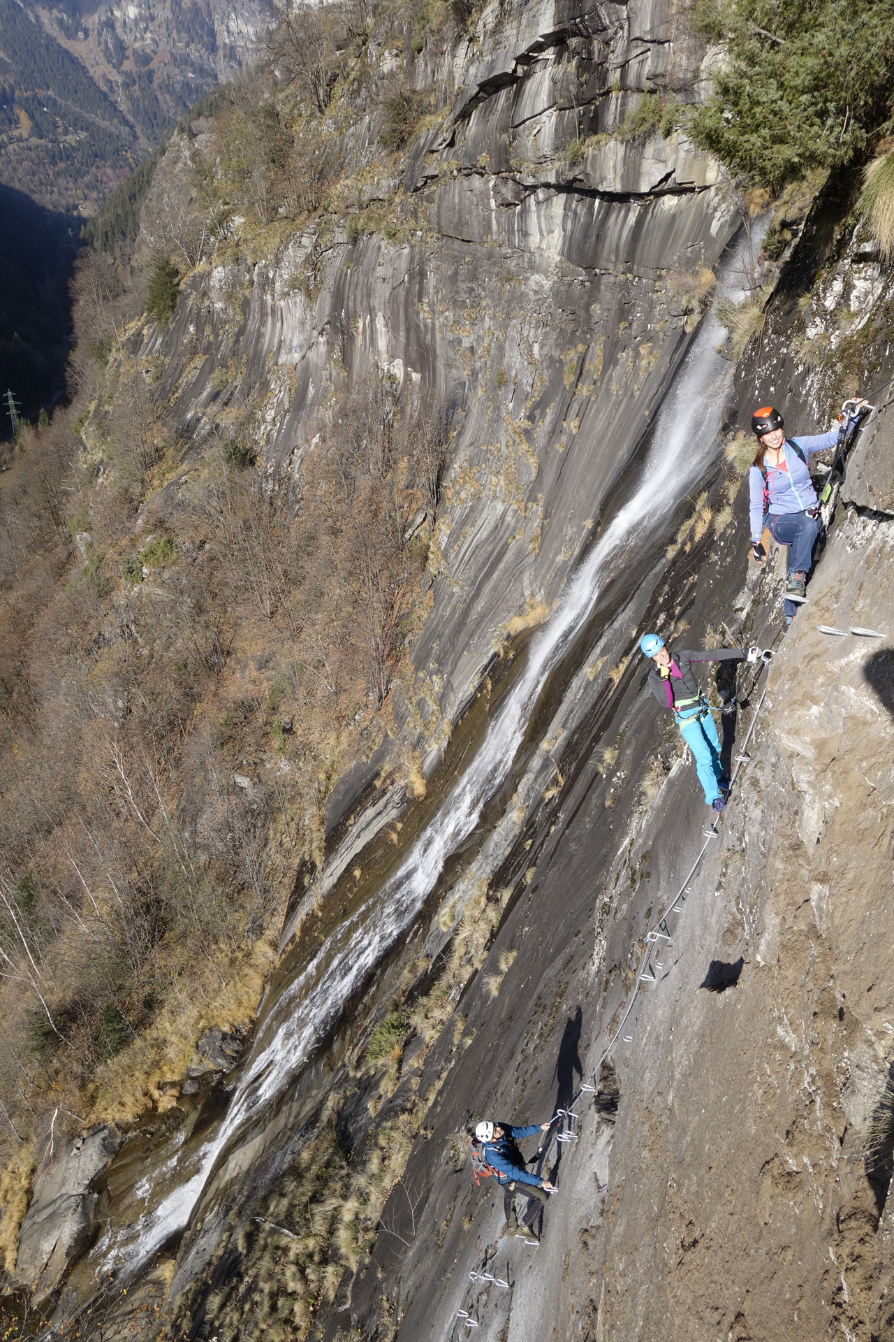
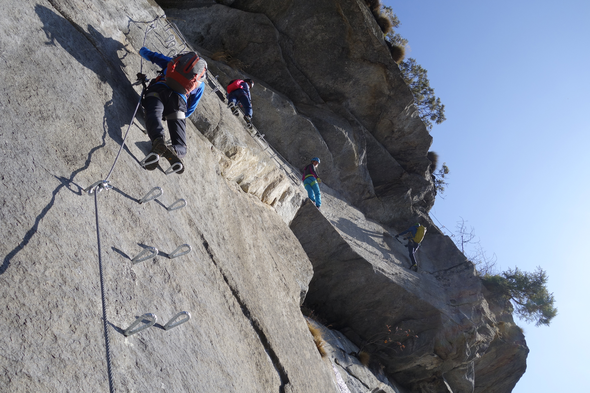
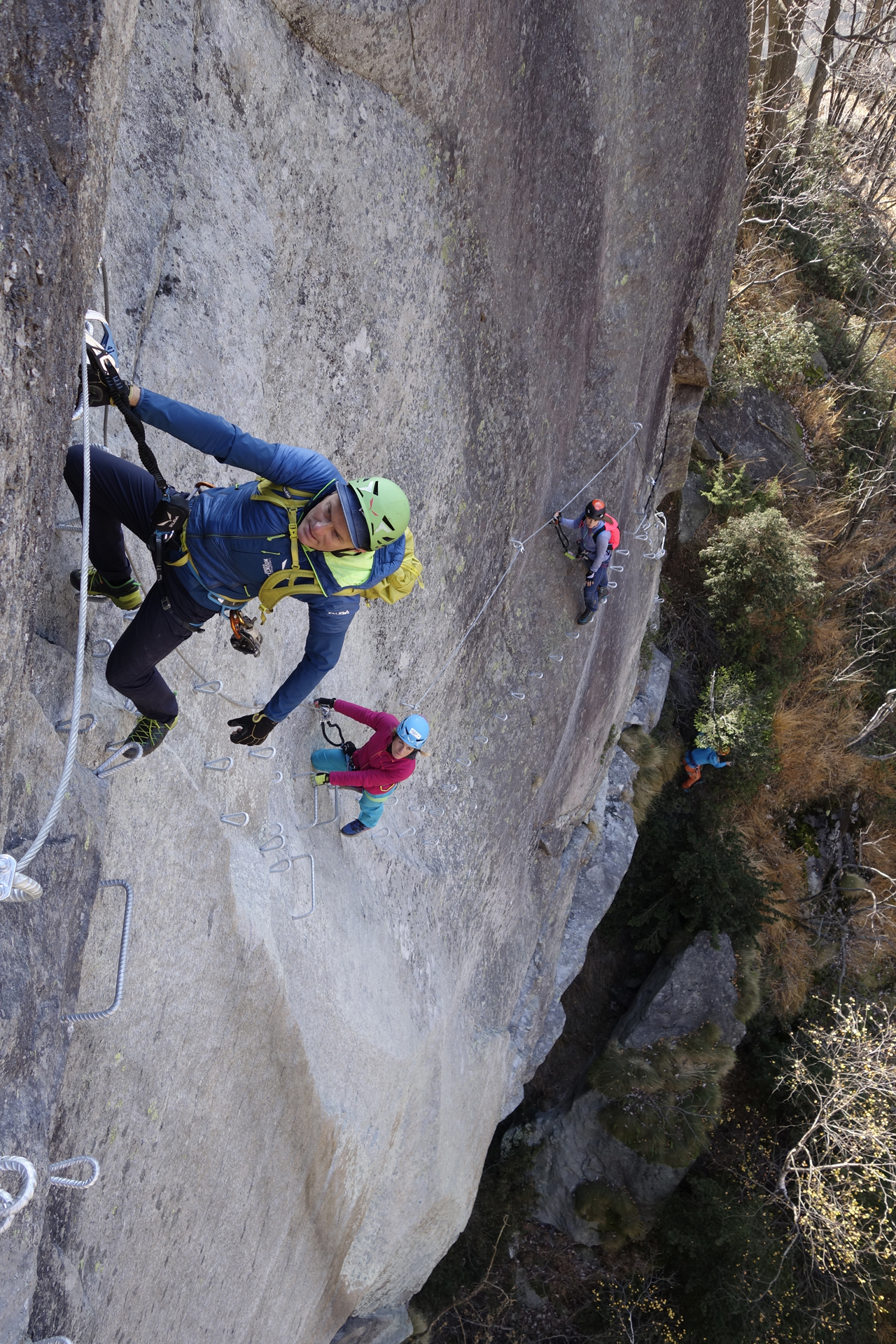
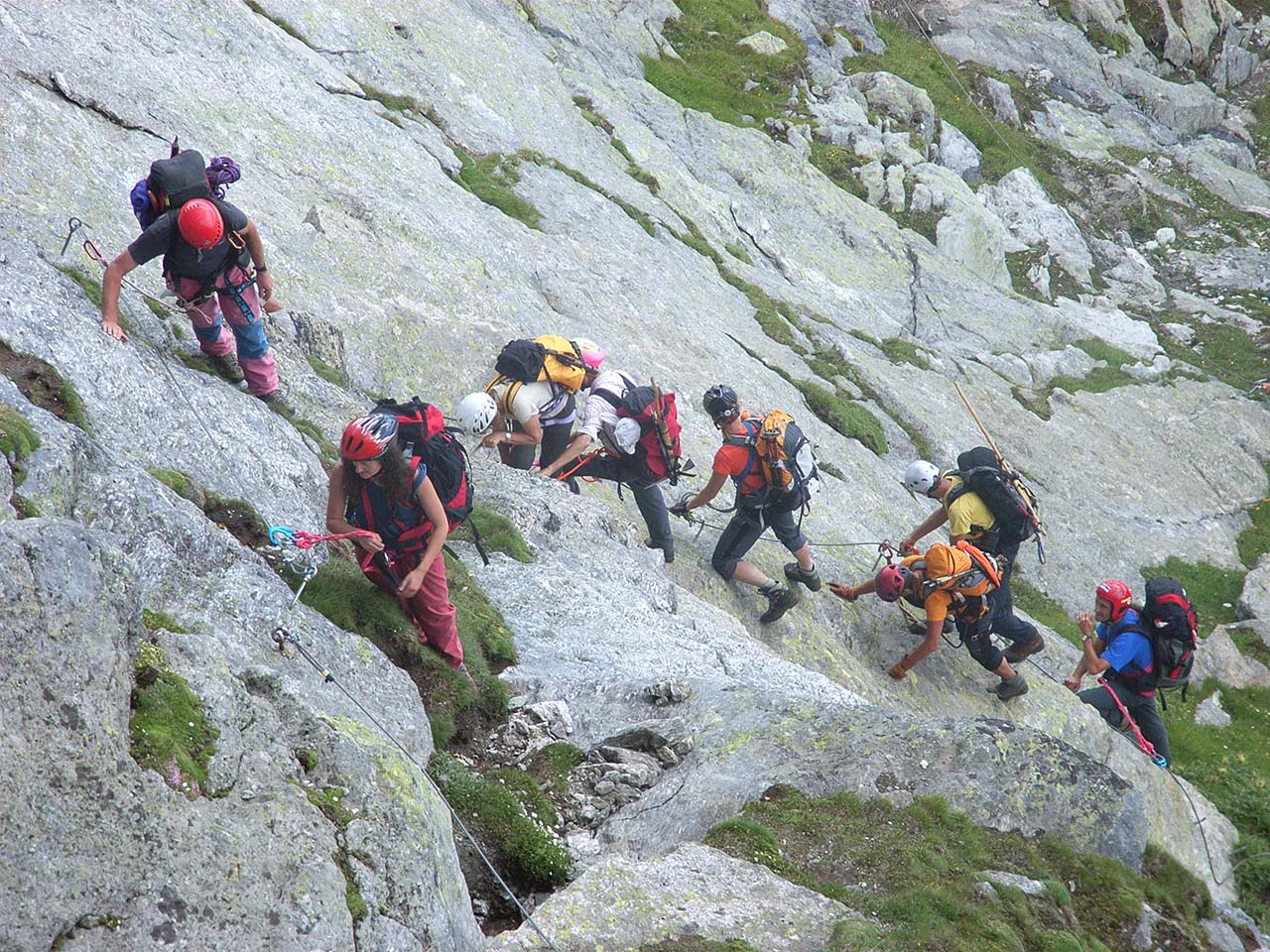
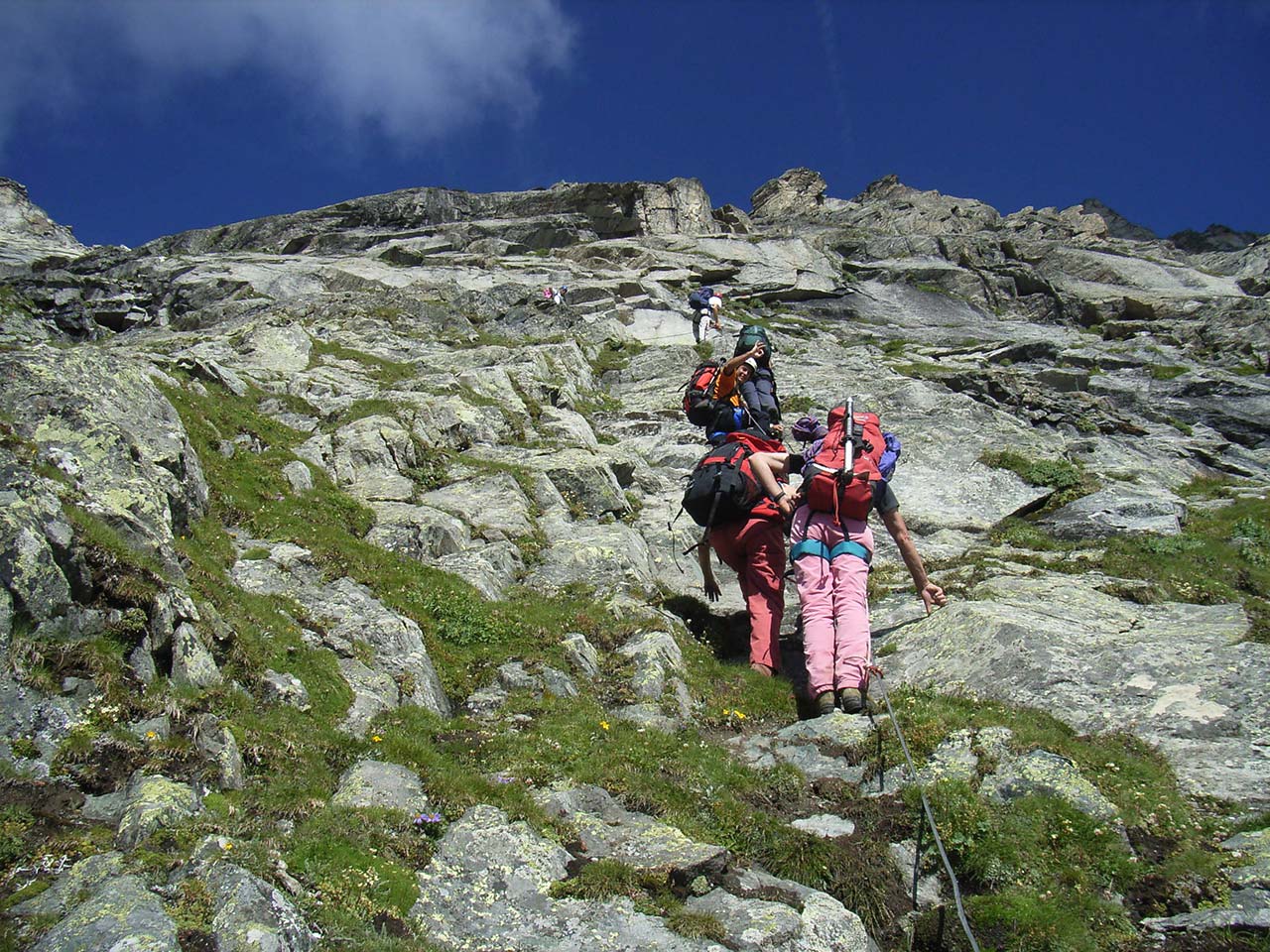
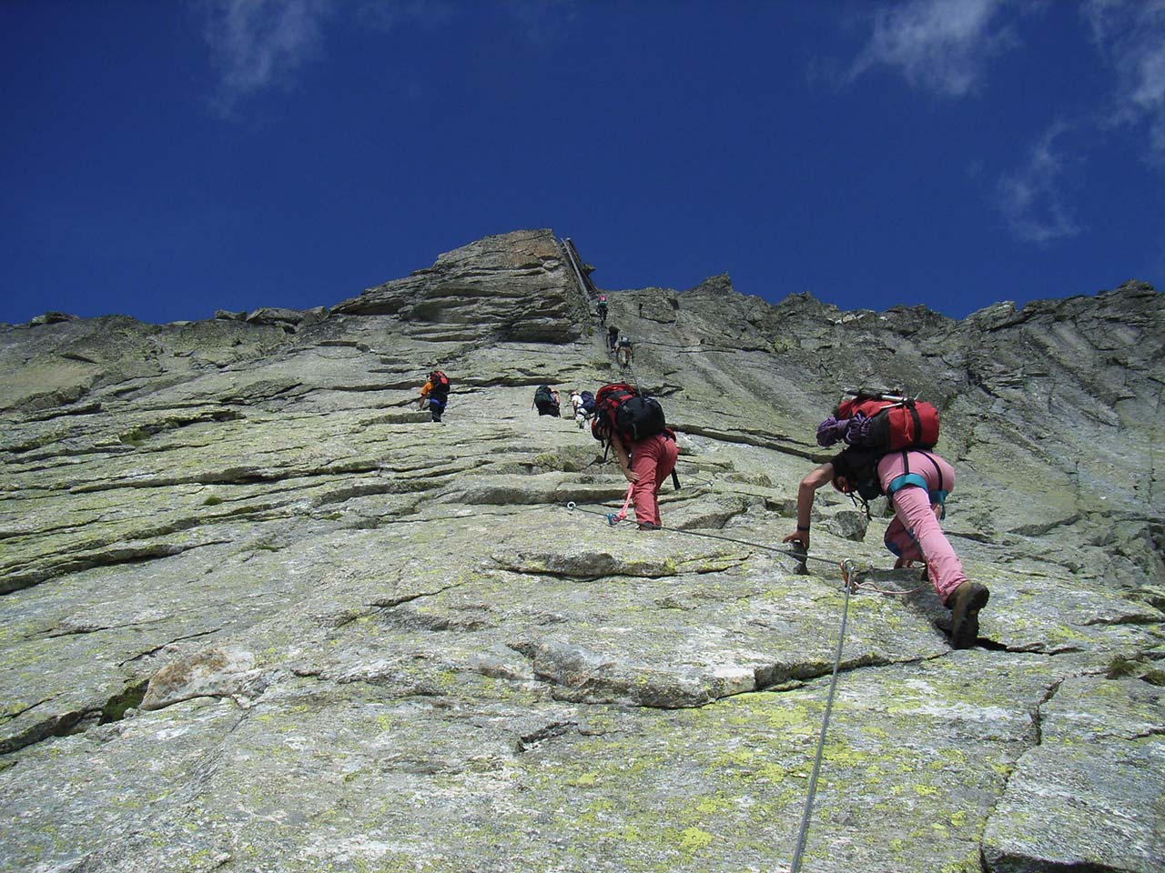
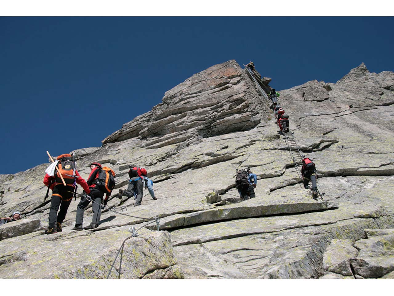
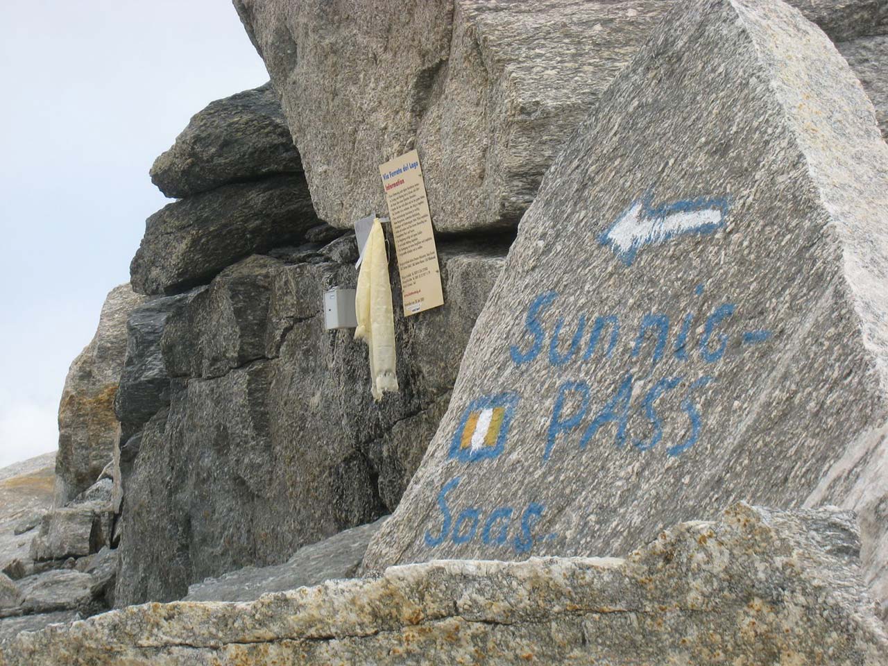
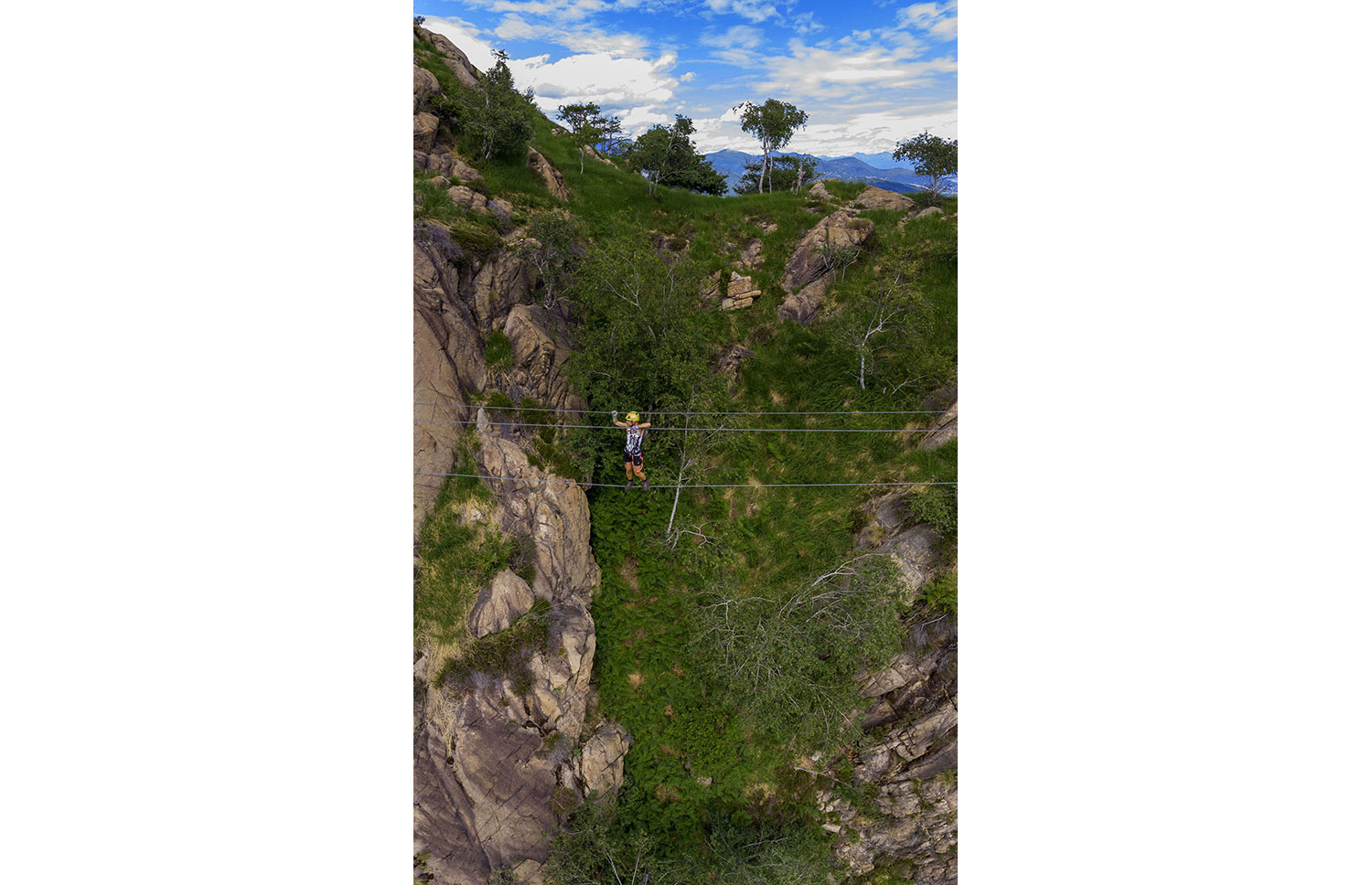
THE MONTORFANO VIA FERRATA: ‘HANDS-ON’ GRANITE
Lago di Mergozzo
Route description
The MONTORFANO is a single block of granite, pure rock, marked by centuries of granite quarrying, embraced by Lake Mergozzo, Lake Maggiore and the River Toce, solitary in the alluvial plain of the Toce.
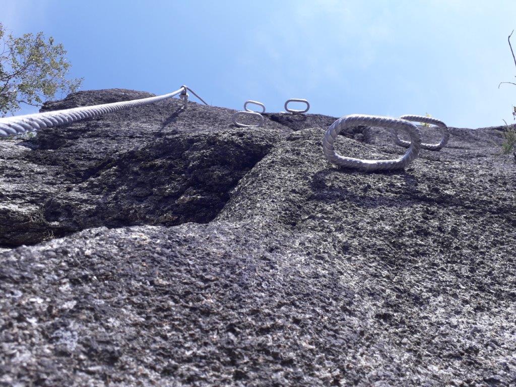
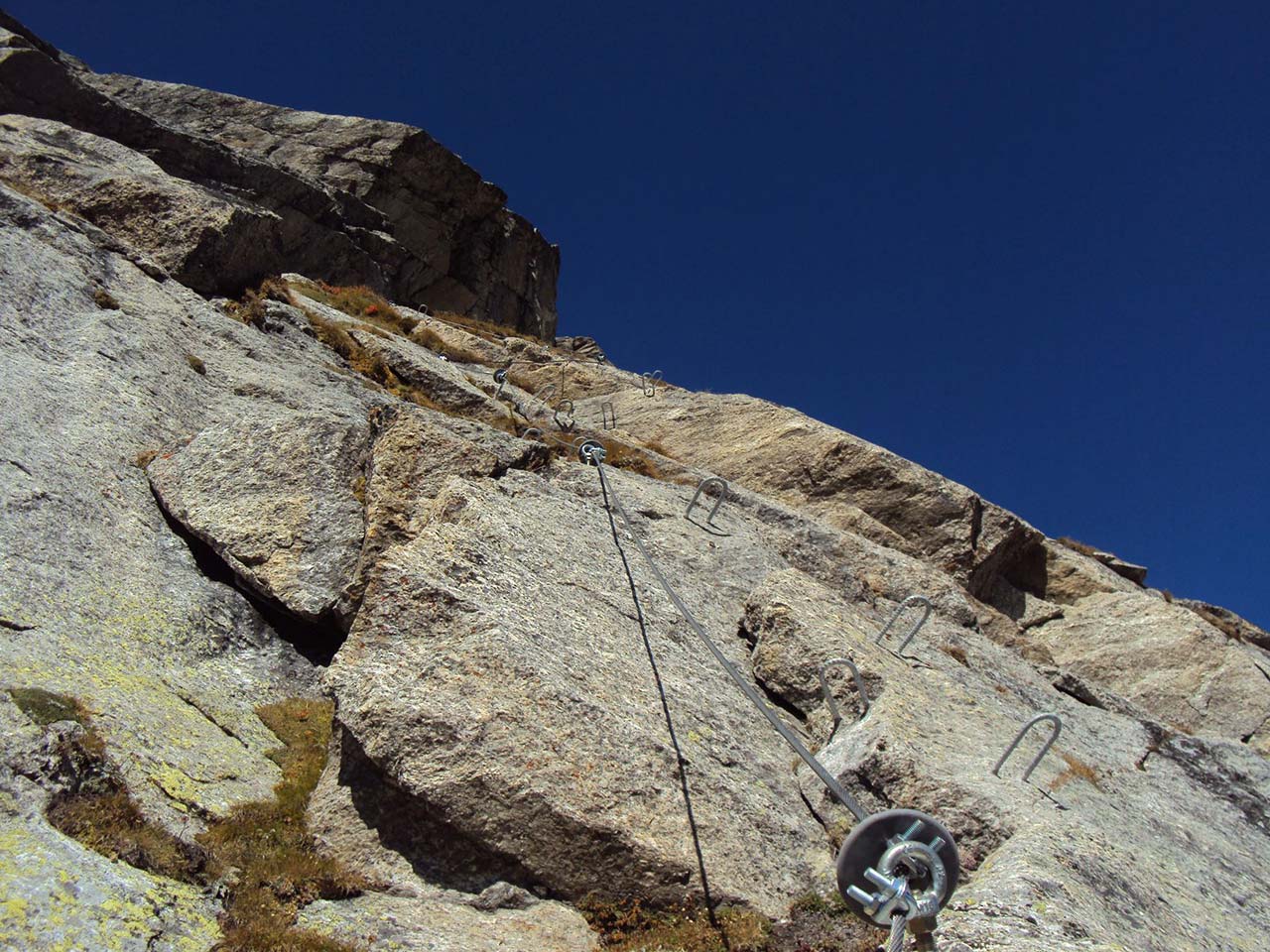
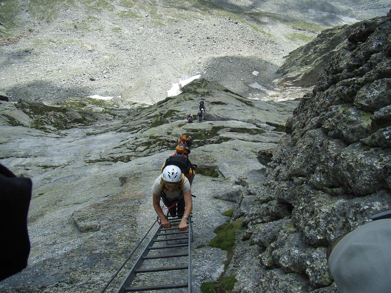
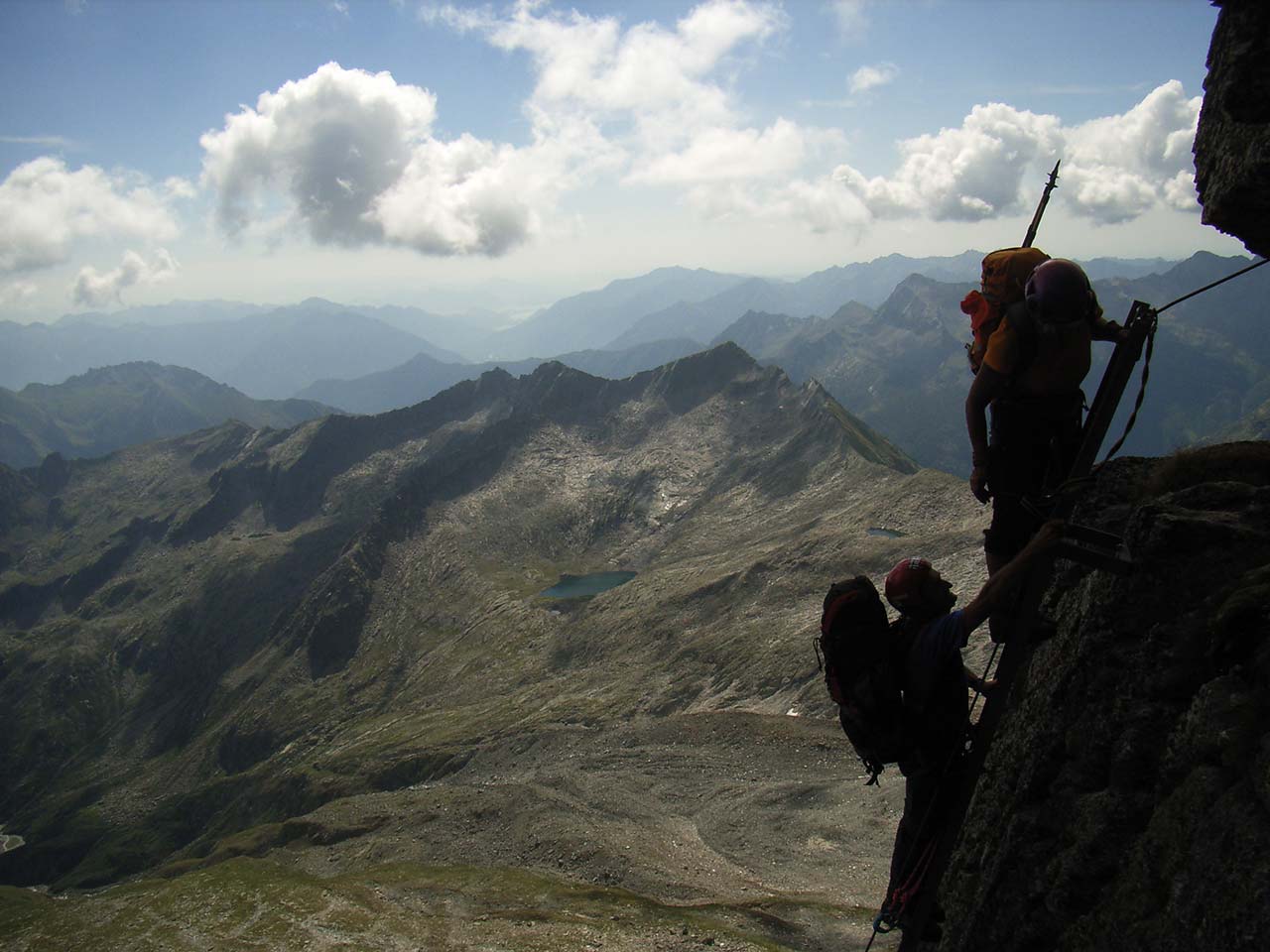
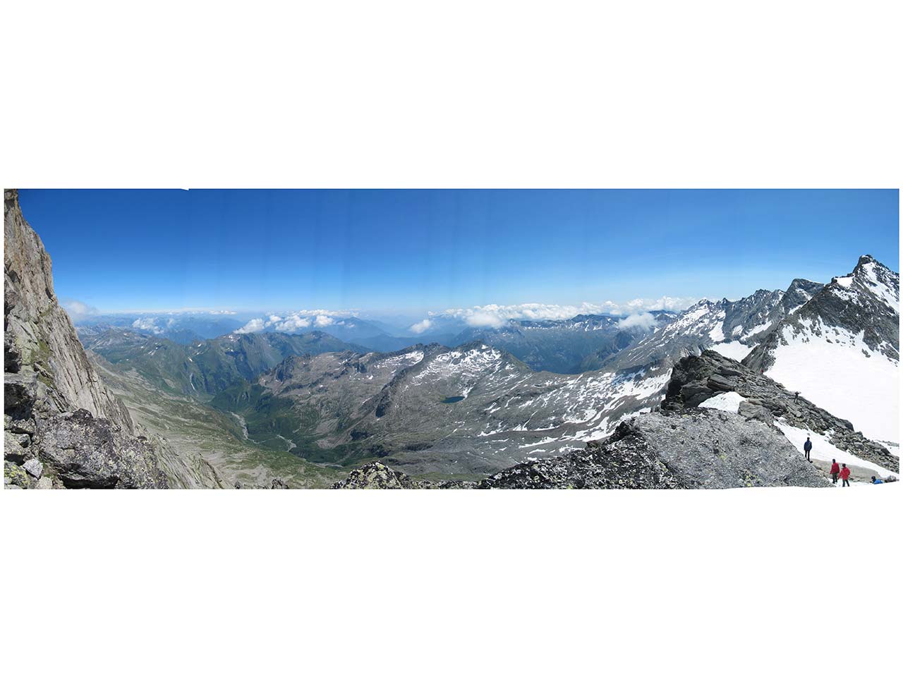
The Montorfano sport climbing itinerary allows you to “touch” this rock, spending an unforgettable day of sport climbing on the adrenaline-filled MONTORFANO VIA FERRATA and on the MONTORFANO CLIMBING CRAG (link to the GPX file available in the attachments).
Along the itinerary you will find detailed explanatory panels, but we advise you to start the itinerary from the lakeside of Mergozzo, following path A58, which takes you in an hour to the via FERRATA MONTORFANO.
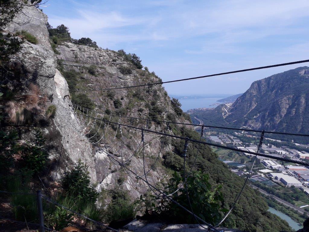
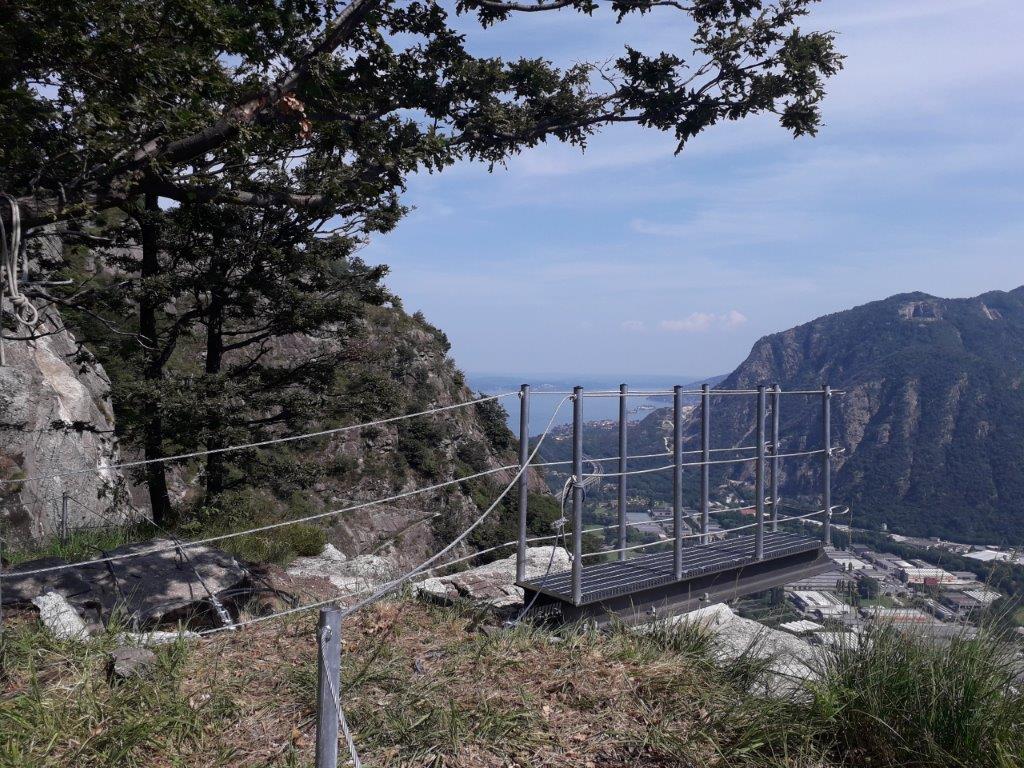
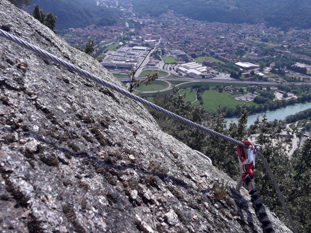
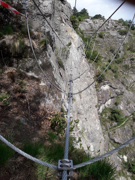
The via FERRATA MONTORFANO is classified as “D:DIFFICULT” and has very exposed sections that require not only a via ferrata set but also a special mastery of the void. Along the route you will find four climbing sectors and two spectacular thirty-metre Tibetan bridges that cross the void.
Once you have completed the via FERRATA MONTORFANO, you can continue the itinerary reaching the summit of Montorfano, and then descend on the opposite side reaching the CLIMBING CRAG MONTORFANO (FALESIA), a granite terrace on Lake Mergozzo, with three climbing sectors of varying difficulty.
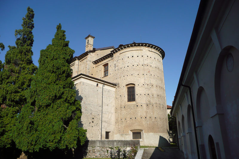
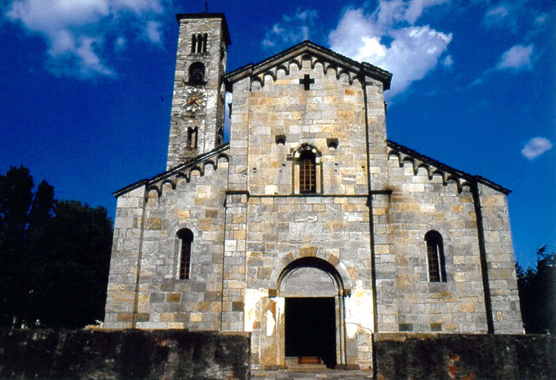
From the climbing crag you go down to the village of Montorfano, where you will find the ancient Romanesque Church of San Giovanni Battista dating from the 11th-12th centuries, which is well worth a visit.
Close the loop by following the Blue Trail along the lake of Mergozzo, discovering suggestive panoramic views and the fresh water source called “del Vescovo”.
On Mergozzo’s lakefront, you can finally enjoy a moment of rest in a restaurant overlooking the lake, concluding an unforgettable day.
ADVICE FROM THE MOUNTAIN GUIDE
The Montorfano sport climbing itinerary is spectacular and fun.
However, it is necessary to pay the utmost attention to safety: on the via ferrata you must have a set (helmet, harness, energy dissipator) and you must be used to the void.
Back to the list of routes
Quick info
Dove: Montorfano (Frazione di Mergozzo)
Telefono: +39 0323 80101
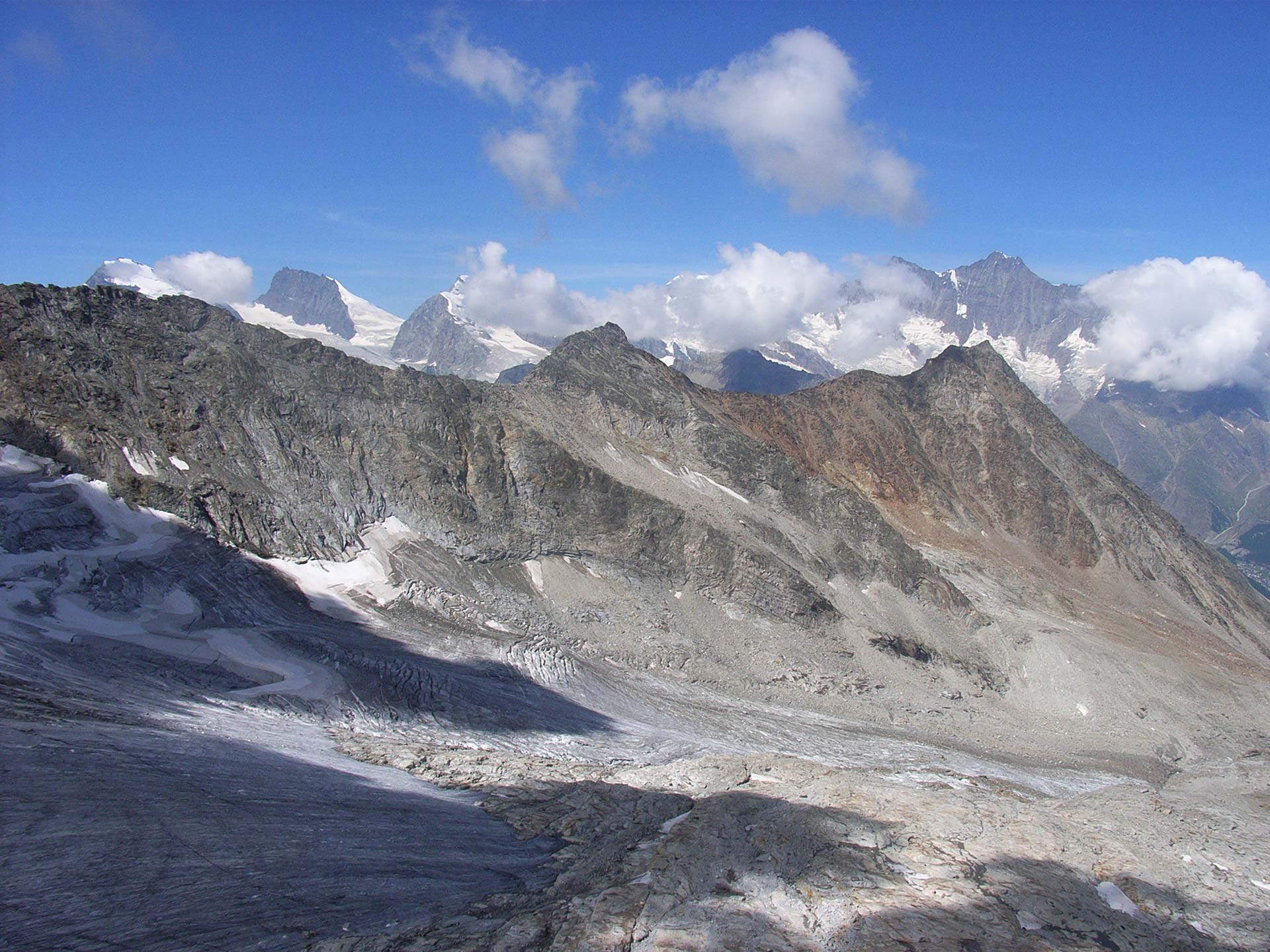
Simplon Road
HISTORIC MOUNTAIN ROADS
Domodossola e dintorni
Route description
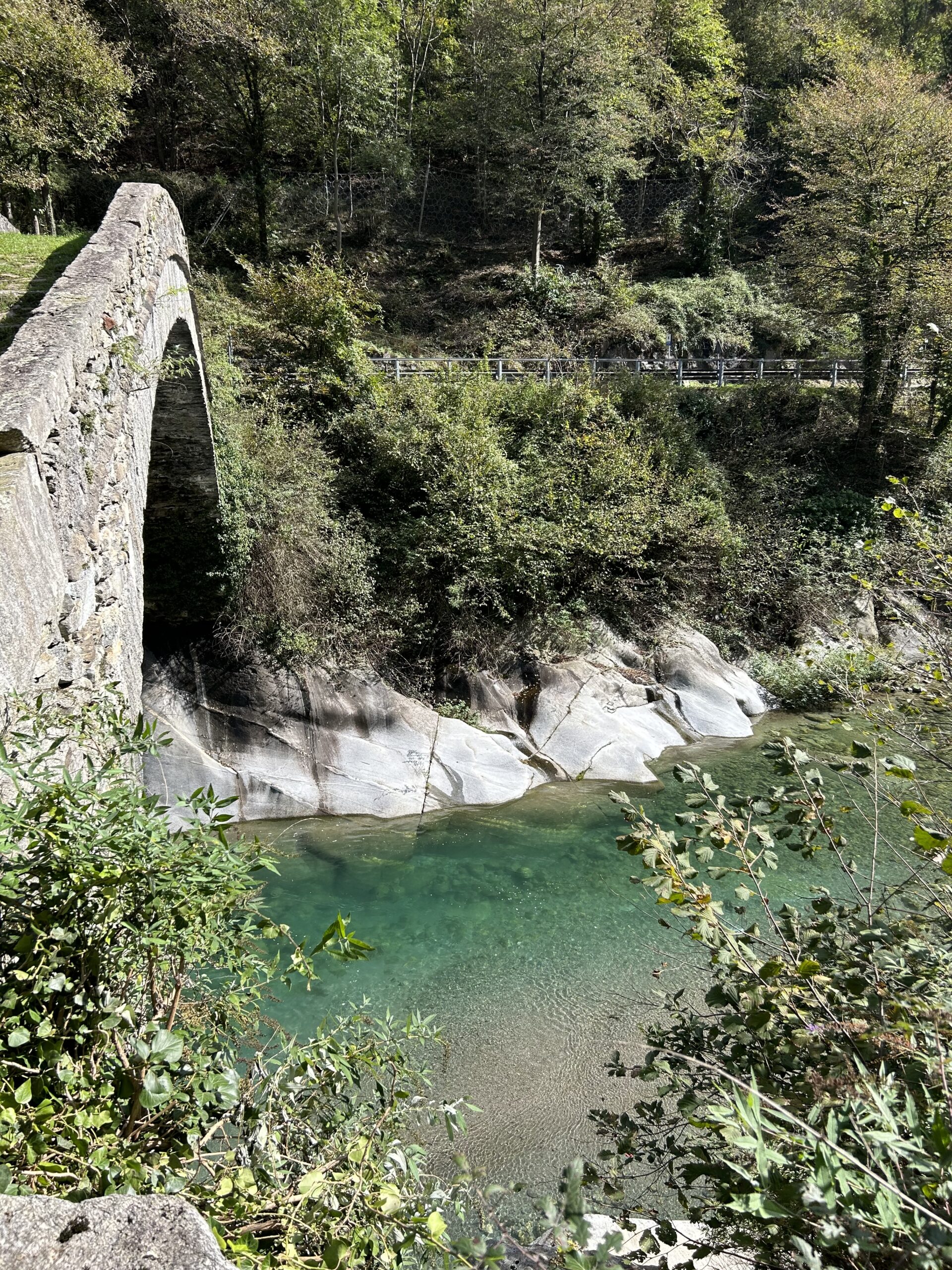
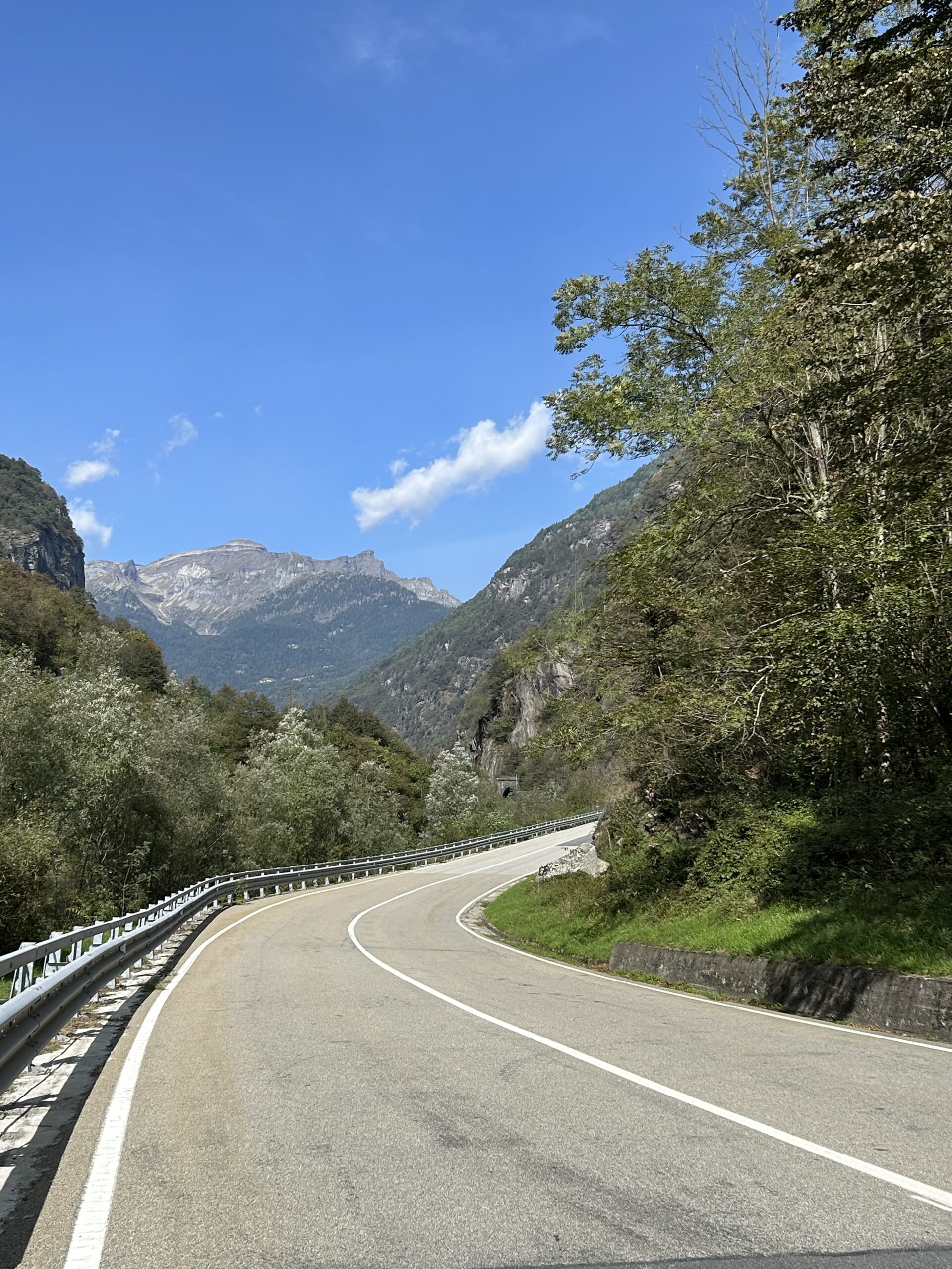
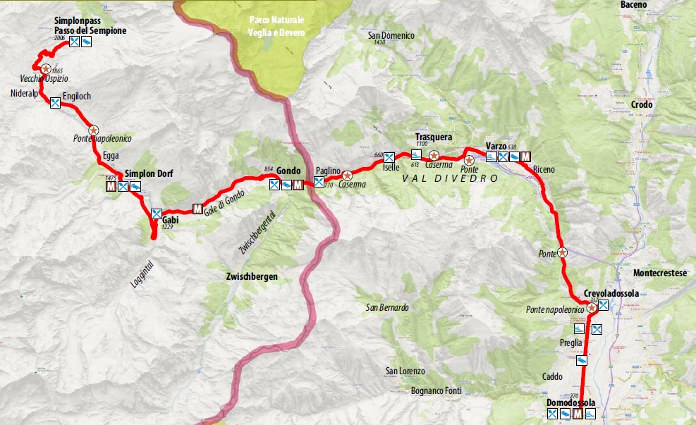
The Sempione Road is the tourist route that leads from Crevoladossola to the Simplon Pass at 2005 metres above sea level in Canton Valais (CH), one of the great Alpine routes of Europe. As proof of its strategic and commercial importance in antiquity it was a path, in the Middle Ages a mule track, in the 17th century a paved road, and in the 19th century a carriage road wanted by Napoleon Bonaparte as a connection between Milan and Paris, uniting Italy with the rest of Europe. In 1906, the Simplon Tunnel was also inaugurated, the 19.8 km railway tunnel that was an extraordinary work of engineering for the time and still represents an important cross-border connection for goods and passengers. In the period between the two world wars, important new defensive works were built along the Simplon Road in caves with numerous cannons, including the two forts of San Giovanni, the Iselle Fort and the Balmoreglio Fort.
CLICK HERE TO EXPLORE VIRTUALLY THE FORTS OF DIVEDRO VALLEY.
The route begins in Crevoladossola, in the locality of Preglia, in front of the imposing Napoleonic Bridge over the Diveria Torrent. Continuing along the carriage road in the direction of the Divedro Valley, one can admire the remains of the San Giovanni Fort and the suggestive Roman bridge over the Diveria, known as Ponte Nuovo, consisting of a perfect round arch. The bridge provides a priceless view of the entire valley. Continuing along the route, you skirt the marvellous Simplon international railway line and reach the sunny municipality of Varzo, where the massive Medieval Tower (14th century) rises in the historic centre. From Varzo, the Cairasca Valley opens up to the hamlet of San Domenico and the splendid Alpe Veglia plain, an enchanting basin of glacial origin, now part of the Veglia-Devero Natural Park. In a dominant position is the municipality of Trasquera, with a breathtaking view of the 4000-metre peaks of Switzerland. The village is the starting point of numerous hiking trails. Continuing the itinerary in the direction of the state border, at Iselle, a hamlet of Trasquera, you encounter numerous remains of military structures dating back to the Napoleonic era (Balmanolesca ruins, Nante hospital ruins, Napoleonic barracks, military garrison) and the famous Simplon Tunnel. Crossing the border, you come across the Gondo fort in the homonymous gorges, until a few years ago still garrisoned by the Swiss military and now converted into a museum.
This route offers a number of interesting features: from the astonishing eight-metre width of the roadway even in the Alpine section to the original adoption of the parabolic arch to draw the curves, from the harmonious altimetrical modelling to the stone barriers. The Simplon Pass, conventionally the border point between the Lepontine Alps and the Pennine Alps, fascinates travellers because of the strong contrast between the steep walls of the Pale di Gondo and the immense vastness of the alpine pastures just beyond, with breathtaking views of the jewels of this corner of the Swiss Valais: the peaks over 4000 m and the Rhone valley that opens up far below, upon reaching the highest level of the route (21 km from the State Border – total height difference approx. 1750 m).
The Simplon Route – which today can be travelled by car, motorbike, road bike, e-bike or on foot along the ancient Via Stockalper Valle Divedro – makes it possible to rediscover at a leisurely pace the many historical, cultural and natural testimonies that this important historic road has to offer.
POINTS OF INTEREST
In Crevoladossola, worth a visit are the Parish Church SS. Peter and Paul and the Ossola Museum of Sacred Architecture www.amossola.it
Varzo is home to the headquarters of the Ente Gestione Aree Protette dell’Ossola (Parco Naturale Veglia-Devero and Parco Naturale Alta Valle Antrona) with the Archeomuseo Multimediale www.areeprotetteossola.it
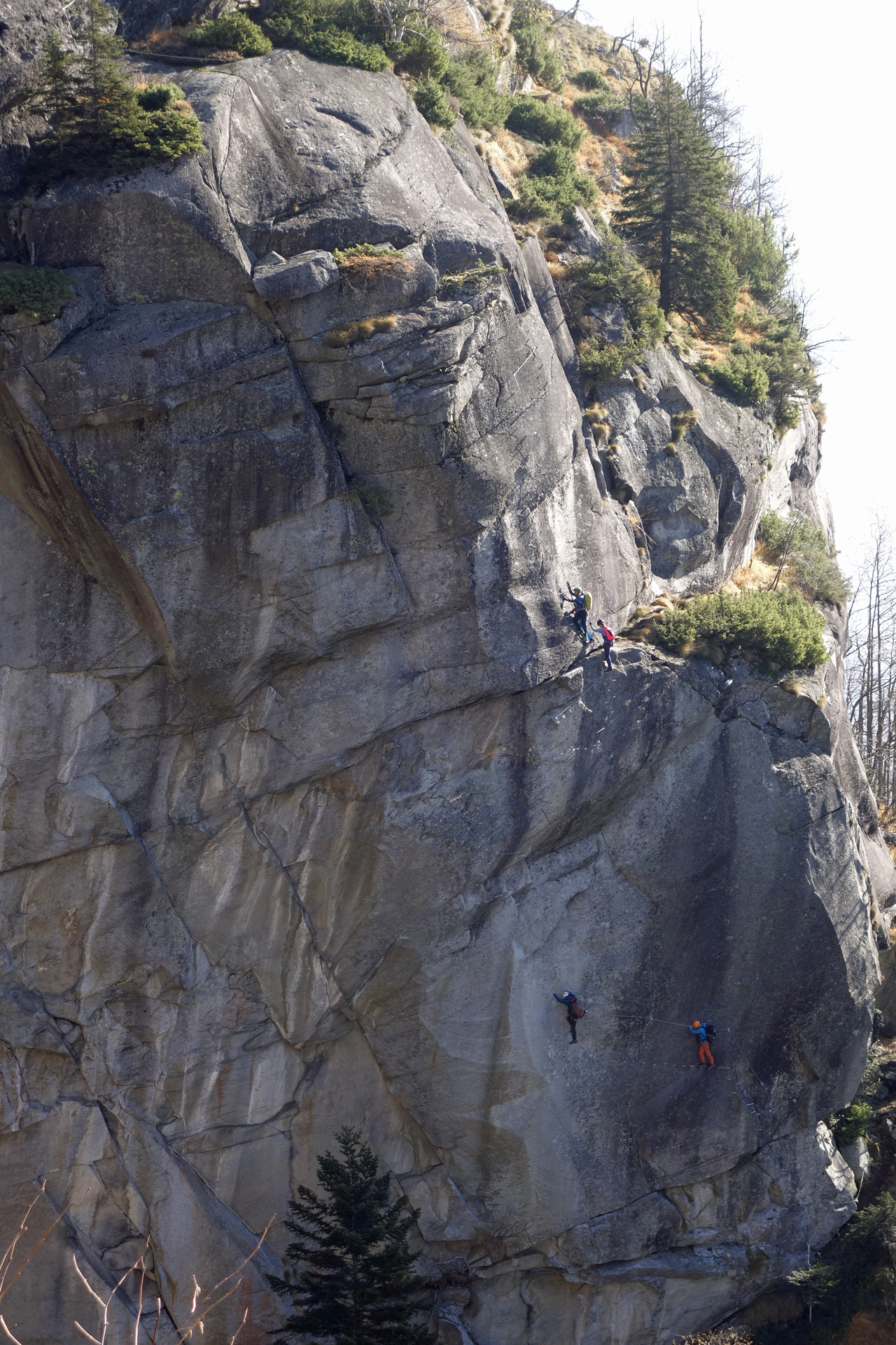
The famous Balmanolesca and Gondo rock faces (in Switzerland) are ideal for climbing enthusiasts.
On Swiss territory, the Simplondorf Ecomuseum in Simplondorf, the Stockalper Castle in Brig, the Alter Gasthof in Simplon Dorf, the Napoleonic Alter Kaserme, the 20th-century Fort and Military Museum in the Gondo Gorge, the Gondo Gold Museum, the Old Hospice and the Simplon Hospice are worth a visit.
Finally, the railway stations of Iselle, Varzo, Preglia and Domodossola are stops along the route of the Trenino Verde delle Alpi TVA (Green Train of the Alps), operated by the Swiss BLS company, which comfortably connects the town of Domodossola to the Bernese Oberland via the Valais in full contact with Alpine nature www.bls.ch
Back to the list of routes
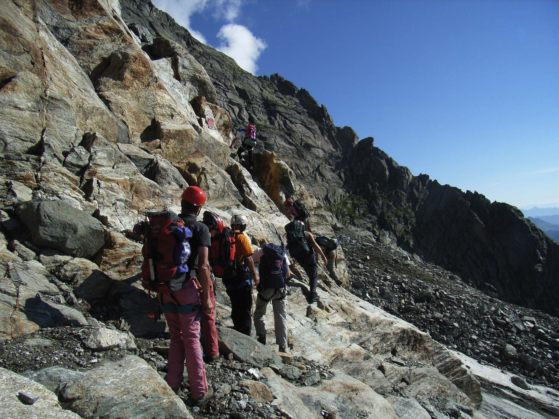
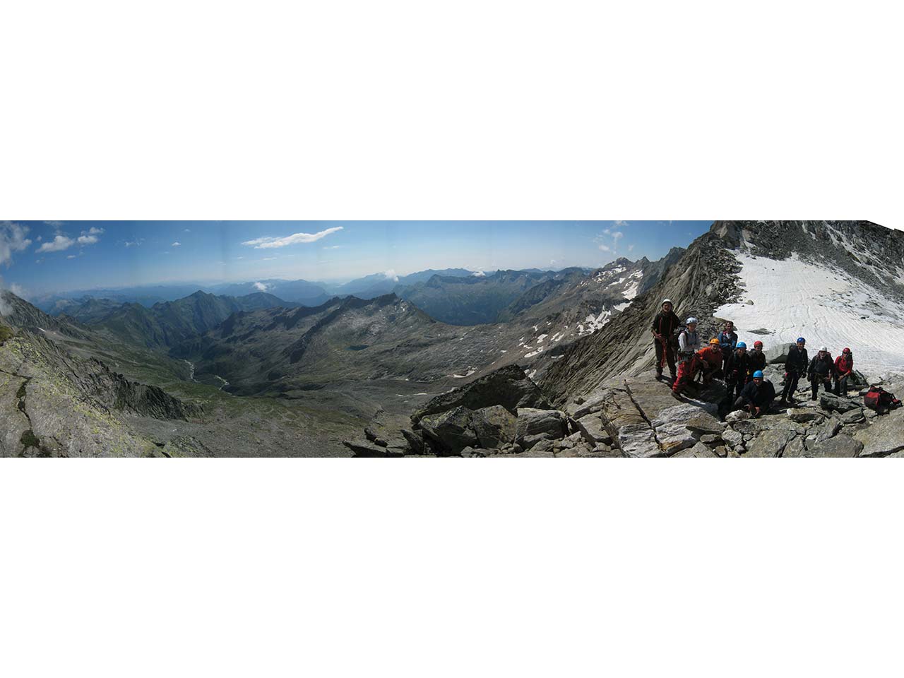
Via Ferrata in Antigorio Valley
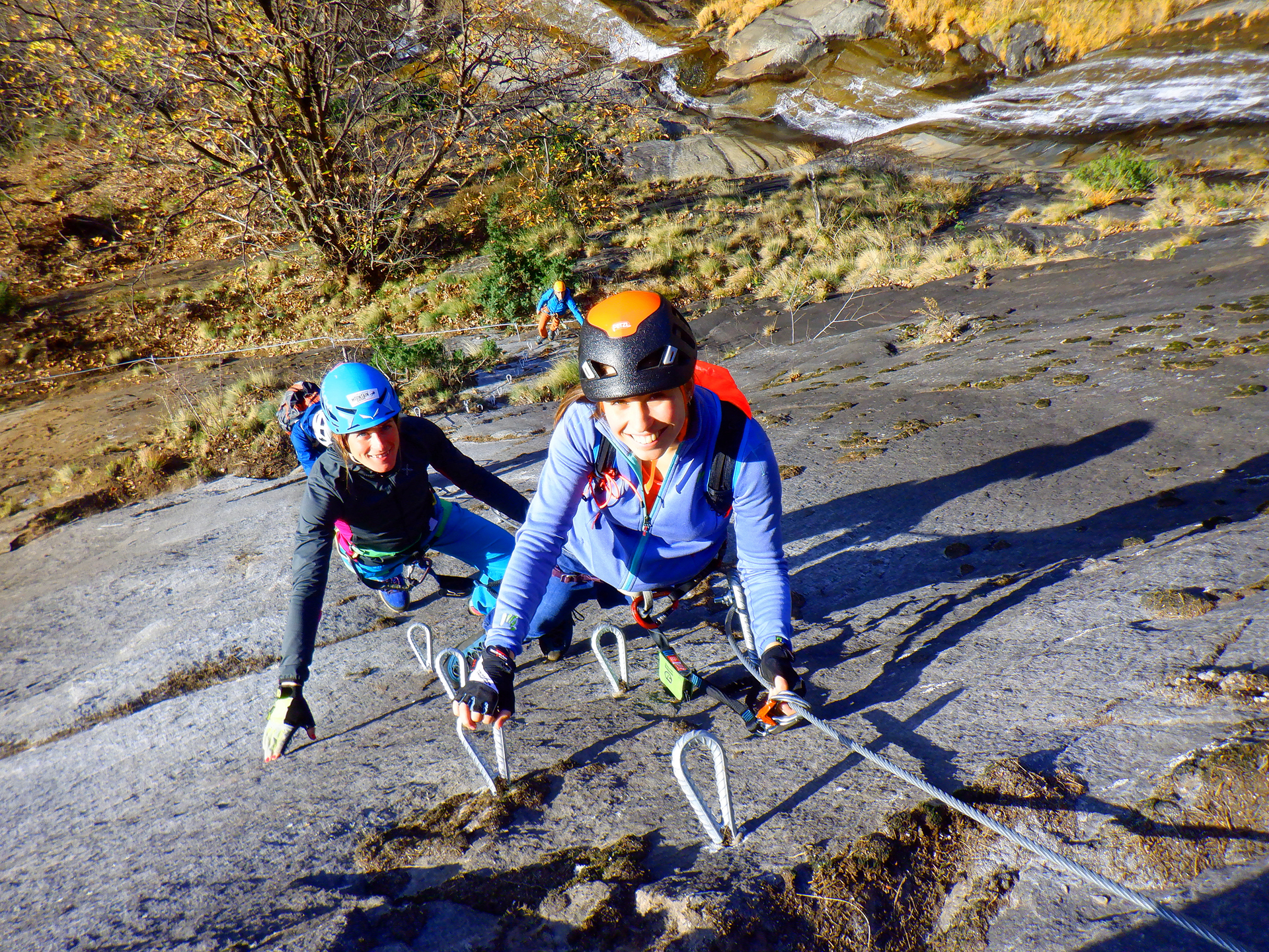
FERRATA WALSERFALL: A TRIBUTE TO THE ANCIENT WALSER PEOPLE AND THE AGÀRO WATERFALL
Valle Antigorio
Route description
Recommended period: MARCH-OCTOBER
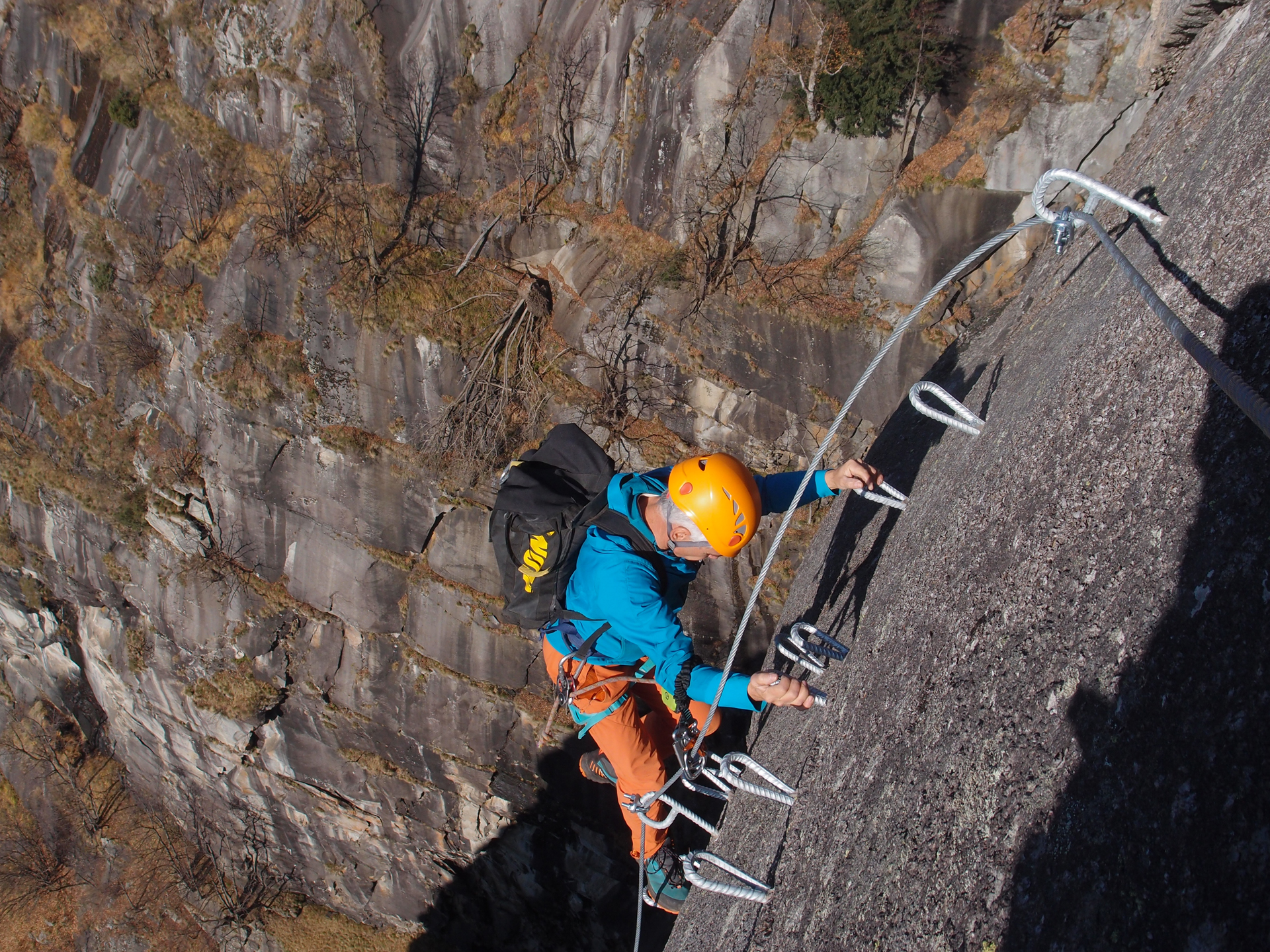
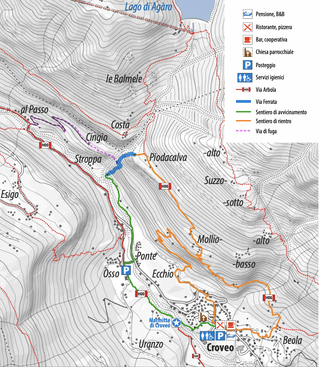
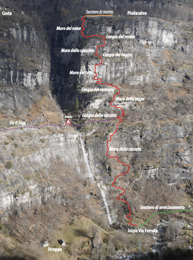
The WALSERFALL Via Ferrata runs along the rocky wall that skirts the Agàro waterfall, downstream of the lake by the same name. It reaches Piodacalva, where a handful of barns and huts stand on a wide and panoramic rocky terrace. This is the Walser region, and as a tribute to these ancient and wise mountain people, the via Ferrata has been named WALSERFALL, combining the terms “Walser” and “Wasserfall” (waterfall).
The access trail (code H00 up to Osso) starts behind the old dairy farm and is marked by specific signs. From the road bridge in Osso, follow a small trail along the river until reaching the Via Ferrata base.
From Piodacalva, the Via Ferrata’s arrival point, head back to Croveo in about 50 minutes following the H06 trail. Alternatively, from Mollio a trail descends to Ecchio and then to the village. These trails have some exposed, unprotected sections that require attention.
Wonderful views along the beautiful waterfall of the Rio di Agaro are awaiting you.
The most difficult sections are on the wall known as “dei tetti”. This wall has a long and aerial traverse. On the final wall that leads to Piodacalva there is a very exposed overhanging passage that requires significant fitness and expertise.
WARNING!
The Via Ferrata is a mostly artificial route that leads the mountaineer on steep walls provided with safety steel ropes and steps anchored to the rock.
It is fundamental to be experienced climbers, physically fit, and technically well trained with full awareness of how to handle void and climbing. Those who have never approached the Vie Ferrate’s climbs are recommended to hire a professional UIAGM Alpine Guide.
It is mandatory to be equipped with specific personal protection equipment suitable for the activity and to be familiar with its correct use:
- Climbing helmet
- Climbing harness fully latched and well-tight in the flanks and thighs plus self-belaying set with energy absorbers
- gloves
- rock climbing shoes
- A double safety longe already fastened to the harness is recommended
Keep in mind that the shocks caused by a fall from the Via Ferrata are extreme. No material can withstand such shocks, and thus the use of energy absorbers is mandatory
Design and Works Supervision Ms. Romina Marani, P.Eng. – Mr. Alessandro Pirocchi, Geologist
Works Coordination: Alpi-Vert di Dalla Gasperina Luca & C. Nusiglie Hamlet 44 10080 Locana (TO)
Final tracking and implementation: Giuseppe Burlone, Alpine Guide; Tazio Ferrari, Alpine Guide; Pietro Garanzini, Alpine Guide; Paolo Pettinaroli, Alpine Guide; Giorgio Sacco, Alpine Guide
For more info: https://www.piemonteoutdoor.it/it/attivita/ferrata/ferrata-walserfall
Back to the list of routes

Via Ferrata in Antigorio Valley
FERRATA WALSERFALL: A TRIBUTE TO THE ANCIENT WALSER PEOPLE AND THE AGÀRO WATERFALL
Valle Antrona
Route description
Recommended period: MARCH-OCTOBER
The WALSERFALL Via Ferrata runs along the rocky wall that skirts the Agàro waterfall, downstream of the lake by the same name. It reaches Piodacalva, where a handful of barns and huts stand on a wide and panoramic rocky terrace. This is the Walser region, and as a tribute to these ancient and wise mountain people, the via Ferrata has been named WALSERFALL, combining the terms “Walser” and “Wasserfall” (waterfall).
The access trail (code H00 up to Osso) starts behind the old dairy farm and is marked by specific signs. From the road bridge in Osso, follow a small trail along the river until reaching the Via Ferrata base.
From Piodacalva, the Via Ferrata’s arrival point, head back to Croveo in about 50 minutes following the H06 trail. Alternatively, from Mollio a trail descends to Ecchio and then to the village. These trails have some exposed, unprotected sections that require attention.
Wonderful views along the beautiful waterfall of the Rio di Agaro are awaiting you.
The most difficult sections are on the wall known as “dei tetti”. This wall has a long and aerial traverse. On the final wall that leads to Piodacalva there is a very exposed overhanging passage that requires significant fitness and expertise.
WARNING!
The Via Ferrata is a mostly artificial route that leads the mountaineer on steep walls provided with safety steel ropes and steps anchored to the rock.
It is fundamental to be experienced climbers, physically fit, and technically well trained with full awareness of how to handle void and climbing. Those who have never approached the Vie Ferrate’s climbs are recommended to hire a professional UIAGM Alpine Guide.
It is mandatory to be equipped with specific personal protection equipment suitable for the activity and to be familiar with its correct use:
- Climbing helmet
- Climbing harness fully latched and well-tight in the flanks and thighs plus self-belaying set with energy absorbers
- gloves
- rock climbing shoes
- A double safety longe already fastened to the harness is recommended
Keep in mind that the shocks caused by a fall from the Via Ferrata are extreme. No material can withstand such shocks, and thus the use of energy absorbers is mandatory
Design and Works Supervision Ms. Romina Marani, P.Eng. – Mr. Alessandro Pirocchi, Geologist
Works Coordination: Alpi-Vert di Dalla Gasperina Luca & C. Nusiglie Hamlet 44 10080 Locana (TO)
Final tracking and implementation: Giuseppe Burlone, Alpine Guide; Tazio Ferrari, Alpine Guide; Pietro Garanzini, Alpine Guide; Paolo Pettinaroli, Alpine Guide; Giorgio Sacco, Alpine Guide
For more info: https://www.piemonteoutdoor.it/it/attivita/ferrata/ferrata-walserfall
Back to the list of routes
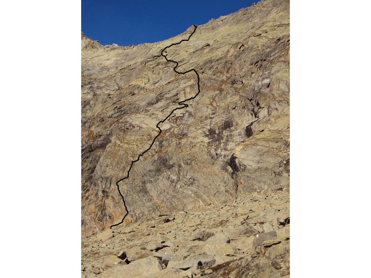
Quick info
Departure altitude: 2850 m
Coordinates UTM/Wgs84:
32 T 045650 5103736Arrival altitude (Bocc.del Bottarello):
3147 mCoordinates UTM/Wgs84:
32 T 0424951 5103615Difference in altitude: m 297
Development: m 400 of which 30 m of ladders
Via Ferrata in Antigorio Valley
FERRATA WALSERFALL: A TRIBUTE TO THE ANCIENT WALSER PEOPLE AND THE AGÀRO WATERFALL
Lago Maggiore
Route description
Recommended period: MARCH-OCTOBER
The WALSERFALL Via Ferrata runs along the rocky wall that skirts the Agàro waterfall, downstream of the lake by the same name. It reaches Piodacalva, where a handful of barns and huts stand on a wide and panoramic rocky terrace. This is the Walser region, and as a tribute to these ancient and wise mountain people, the via Ferrata has been named WALSERFALL, combining the terms “Walser” and “Wasserfall” (waterfall).
The access trail (code H00 up to Osso) starts behind the old dairy farm and is marked by specific signs. From the road bridge in Osso, follow a small trail along the river until reaching the Via Ferrata base.
From Piodacalva, the Via Ferrata’s arrival point, head back to Croveo in about 50 minutes following the H06 trail. Alternatively, from Mollio a trail descends to Ecchio and then to the village. These trails have some exposed, unprotected sections that require attention.
Wonderful views along the beautiful waterfall of the Rio di Agaro are awaiting you.
The most difficult sections are on the wall known as “dei tetti”. This wall has a long and aerial traverse. On the final wall that leads to Piodacalva there is a very exposed overhanging passage that requires significant fitness and expertise.
WARNING!
The Via Ferrata is a mostly artificial route that leads the mountaineer on steep walls provided with safety steel ropes and steps anchored to the rock.
It is fundamental to be experienced climbers, physically fit, and technically well trained with full awareness of how to handle void and climbing. Those who have never approached the Vie Ferrate’s climbs are recommended to hire a professional UIAGM Alpine Guide.
It is mandatory to be equipped with specific personal protection equipment suitable for the activity and to be familiar with its correct use:
- Climbing helmet
- Climbing harness fully latched and well-tight in the flanks and thighs plus self-belaying set with energy absorbers
- gloves
- rock climbing shoes
- A double safety longe already fastened to the harness is recommended
Keep in mind that the shocks caused by a fall from the Via Ferrata are extreme. No material can withstand such shocks, and thus the use of energy absorbers is mandatory
Design and Works Supervision Ms. Romina Marani, P.Eng. – Mr. Alessandro Pirocchi, Geologist
Works Coordination: Alpi-Vert di Dalla Gasperina Luca & C. Nusiglie Hamlet 44 10080 Locana (TO)
Final tracking and implementation: Giuseppe Burlone, Alpine Guide; Tazio Ferrari, Alpine Guide; Pietro Garanzini, Alpine Guide; Paolo Pettinaroli, Alpine Guide; Giorgio Sacco, Alpine Guide
For more info: https://www.piemonteoutdoor.it/it/attivita/ferrata/ferrata-walserfall
Back to the list of routes
Quick info
Departure altitude: 2850 m
Coordinates UTM/Wgs84:
32 T 045650 5103736Arrival altitude (Bocc.del Bottarello):
3147 mCoordinates UTM/Wgs84:
32 T 0424951 5103615Difference in altitude: m 297
Development: m 400 of which 30 m of ladders
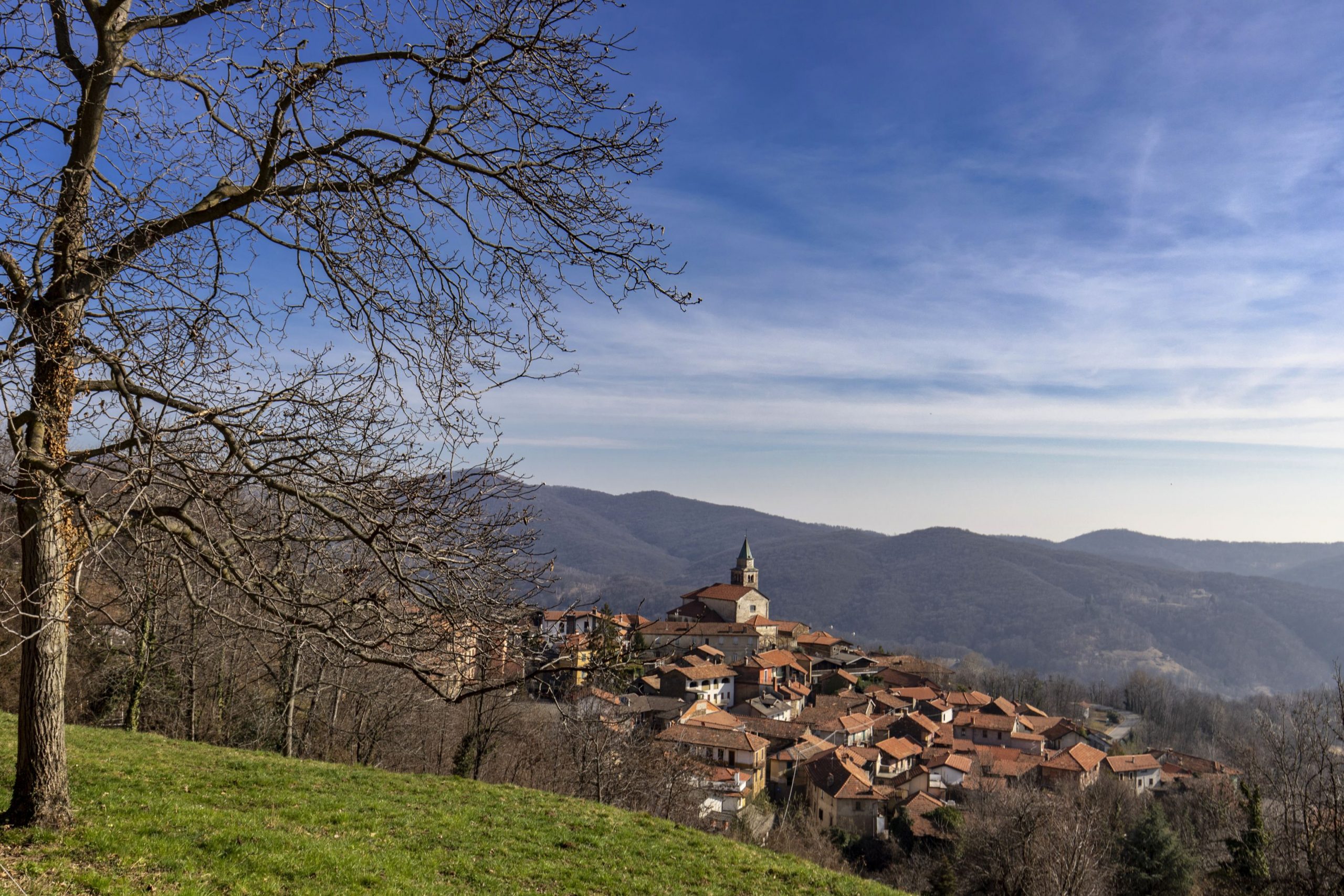
A challenging semi-circular excursion that leads through dense woods and charming abandoned villages
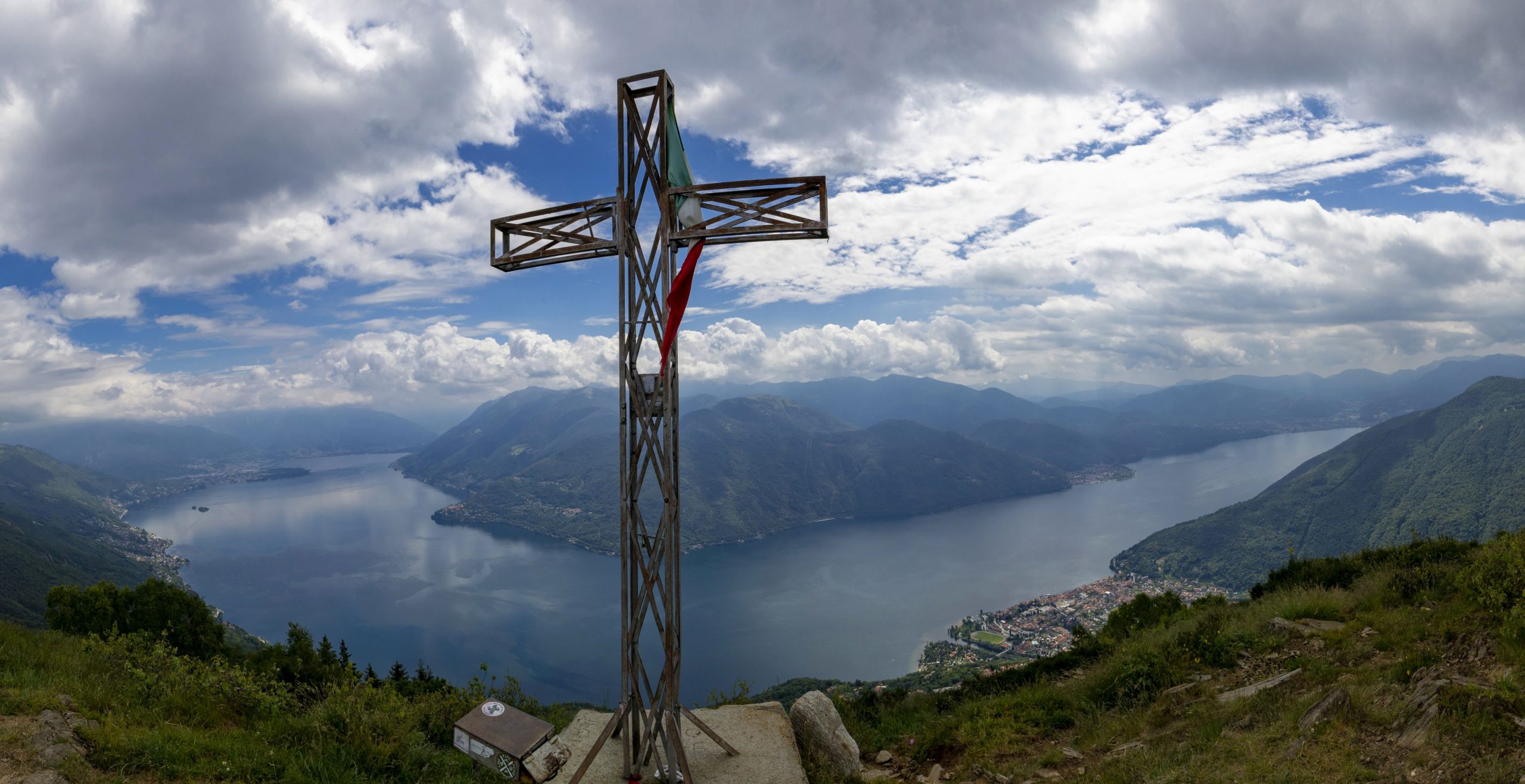
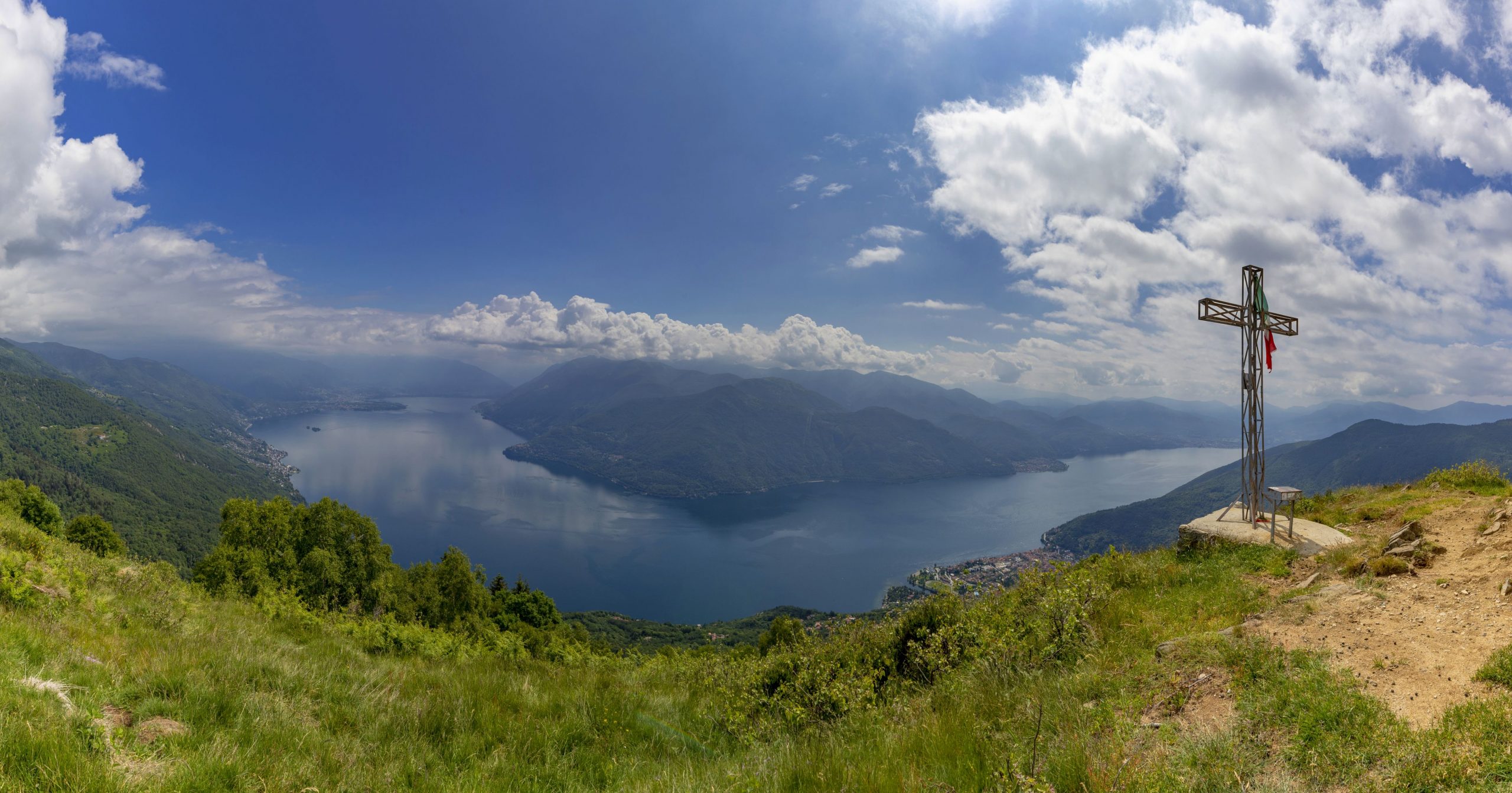
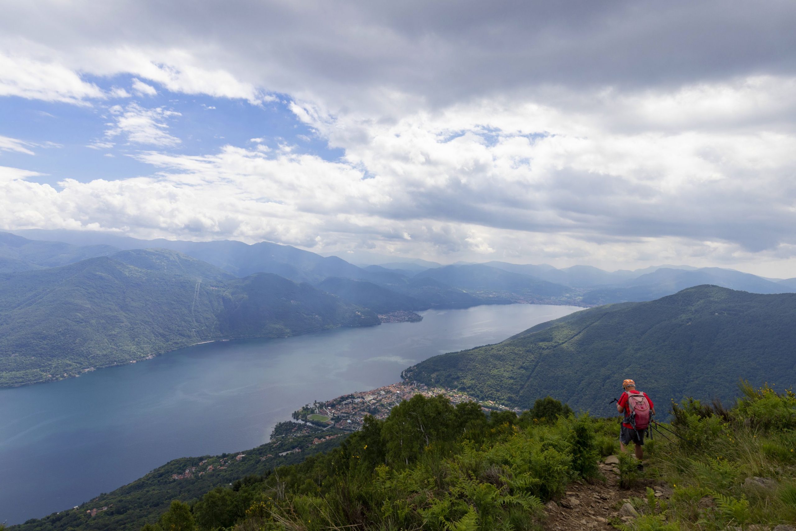
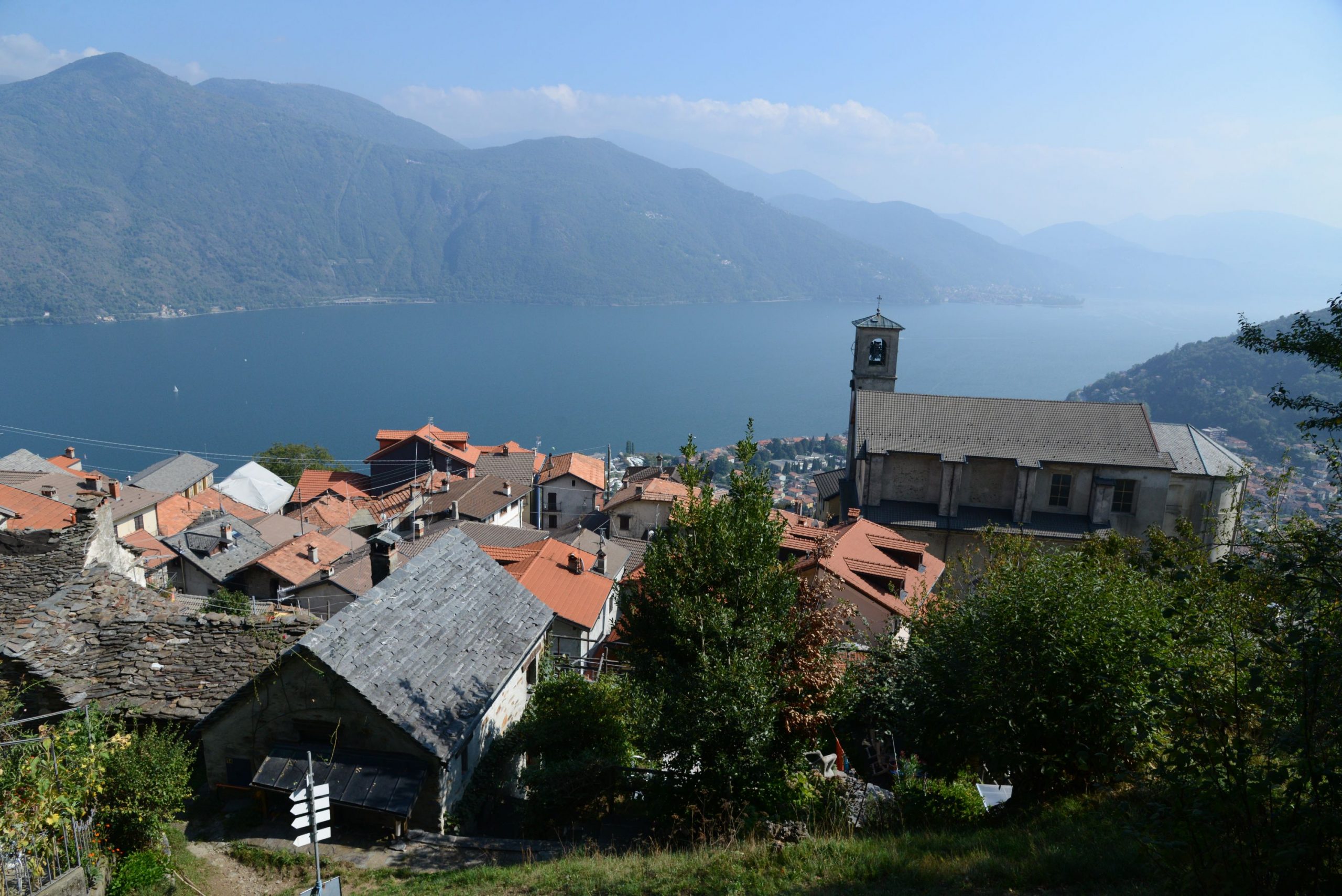
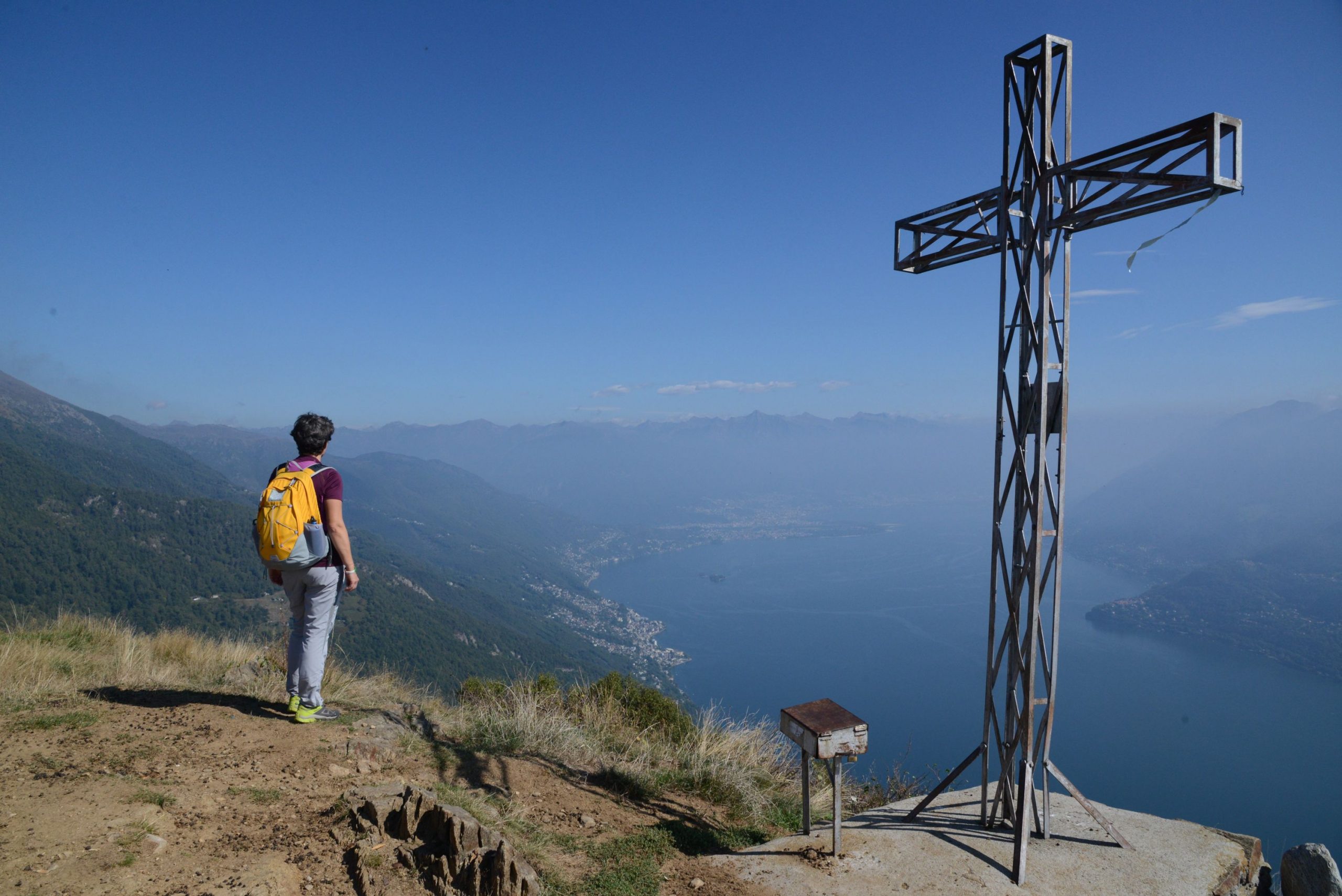
CANNOBIO – MONTE GIOVE
Lago Maggiore
Route description
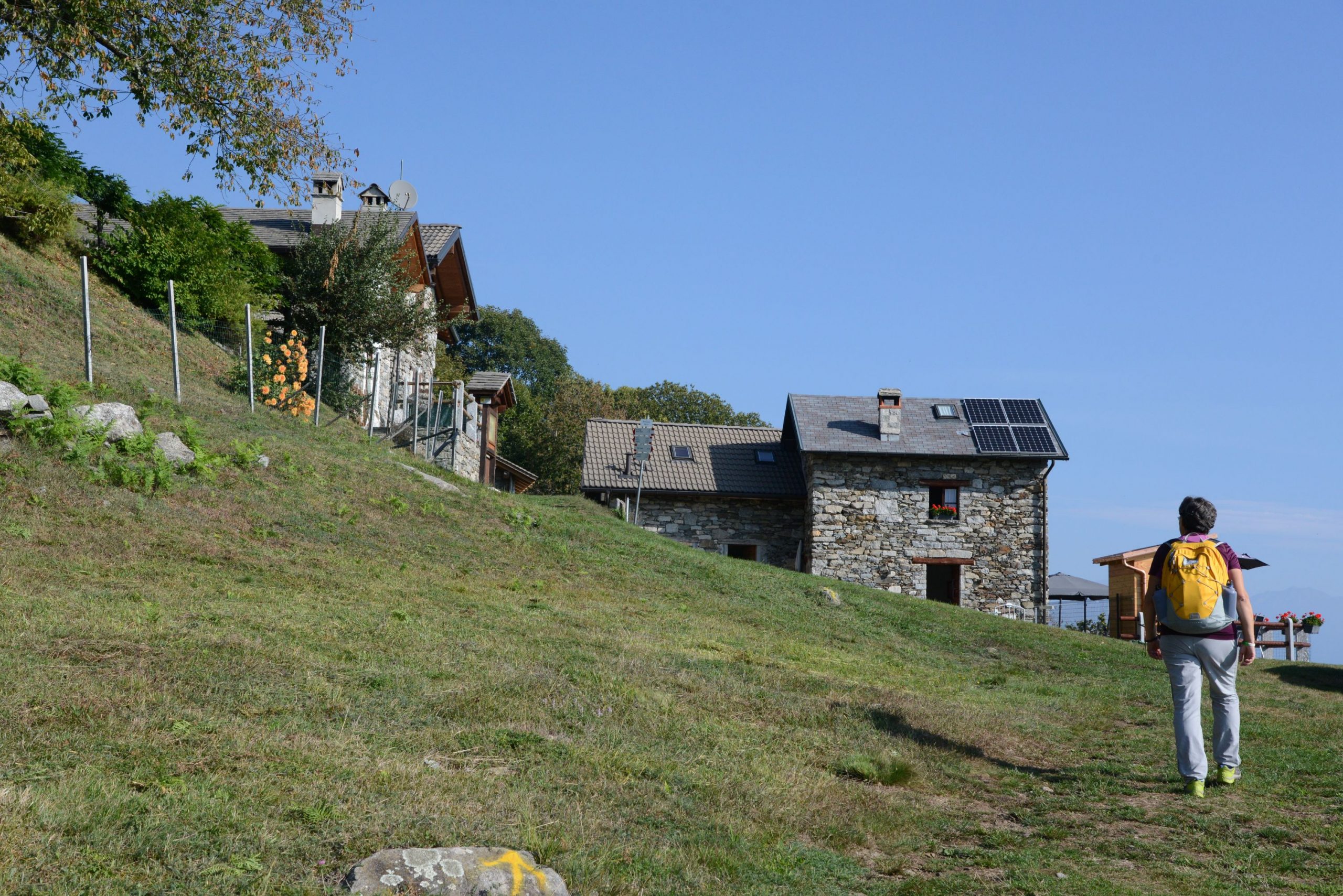
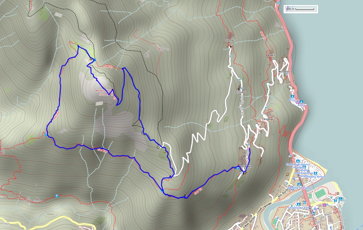
Departure location: Sant’Agata di Cannobio (450 m)
Place of arrival: Monte Giove (1298 m)
Difference in altitude: 850 m total
Distance: 9 km total
Walking time not counting stops: 4 hours and 30 minutes total
Type of route: mixed (trail, asphalt, dirt road)
Signs: red/white “Monte Giove” signs; red/white marks; signs for “Biessen” and “Sant’Agata”; old yellow/red marks
Water: fountains in Sant’Agata
Recommended period: all year round, without snow
How to get there: the trail starting point is in a village located 38 km from Gravellona Toce. SS34 towards Verbania/Locarno. After the village of Cannobio, turn left towards Ronco and Sant’Agata. A large car park is on the left just before the village. By bus: line 17 Cannobio-Sant’Agata (www.vcotrasporti.it).
Information: Distretto Turistico dei Laghi www.distrettolaghi.it; IAT Office – Largo alla Chiesa 3 c/o Palazzo Parasio, Cannobio, www.procannobio.it; Municipality of Cannobio www.comune.cannobio.vb.it
the itinerary
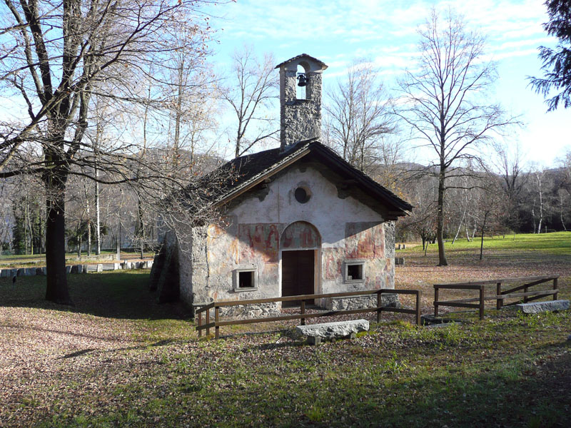
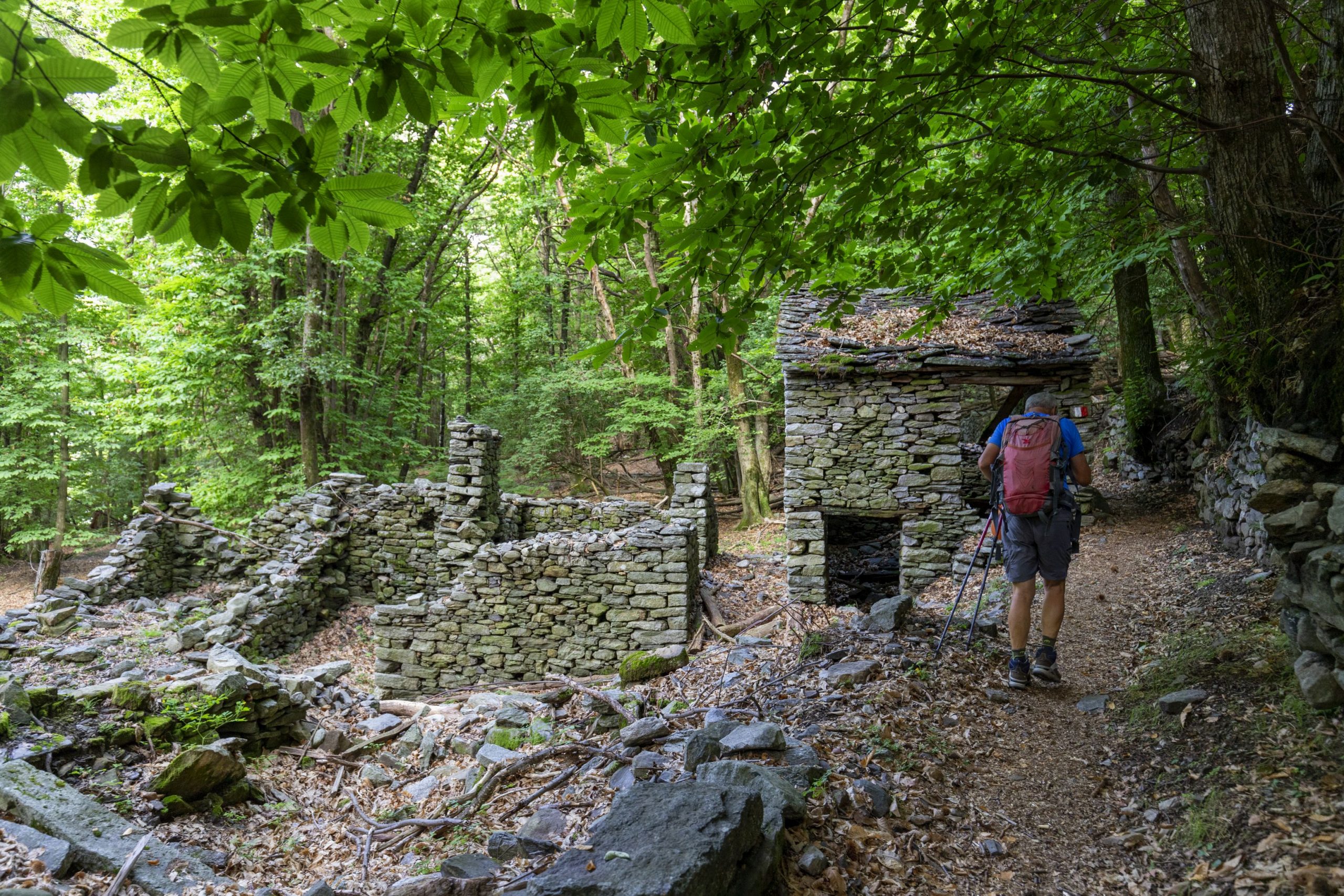
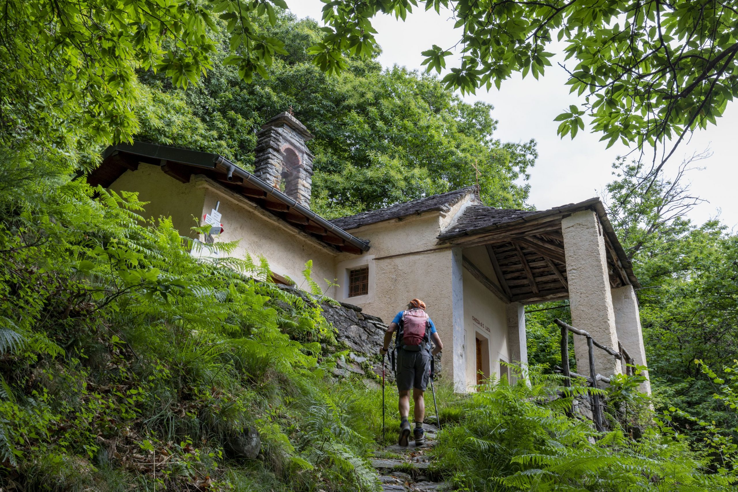
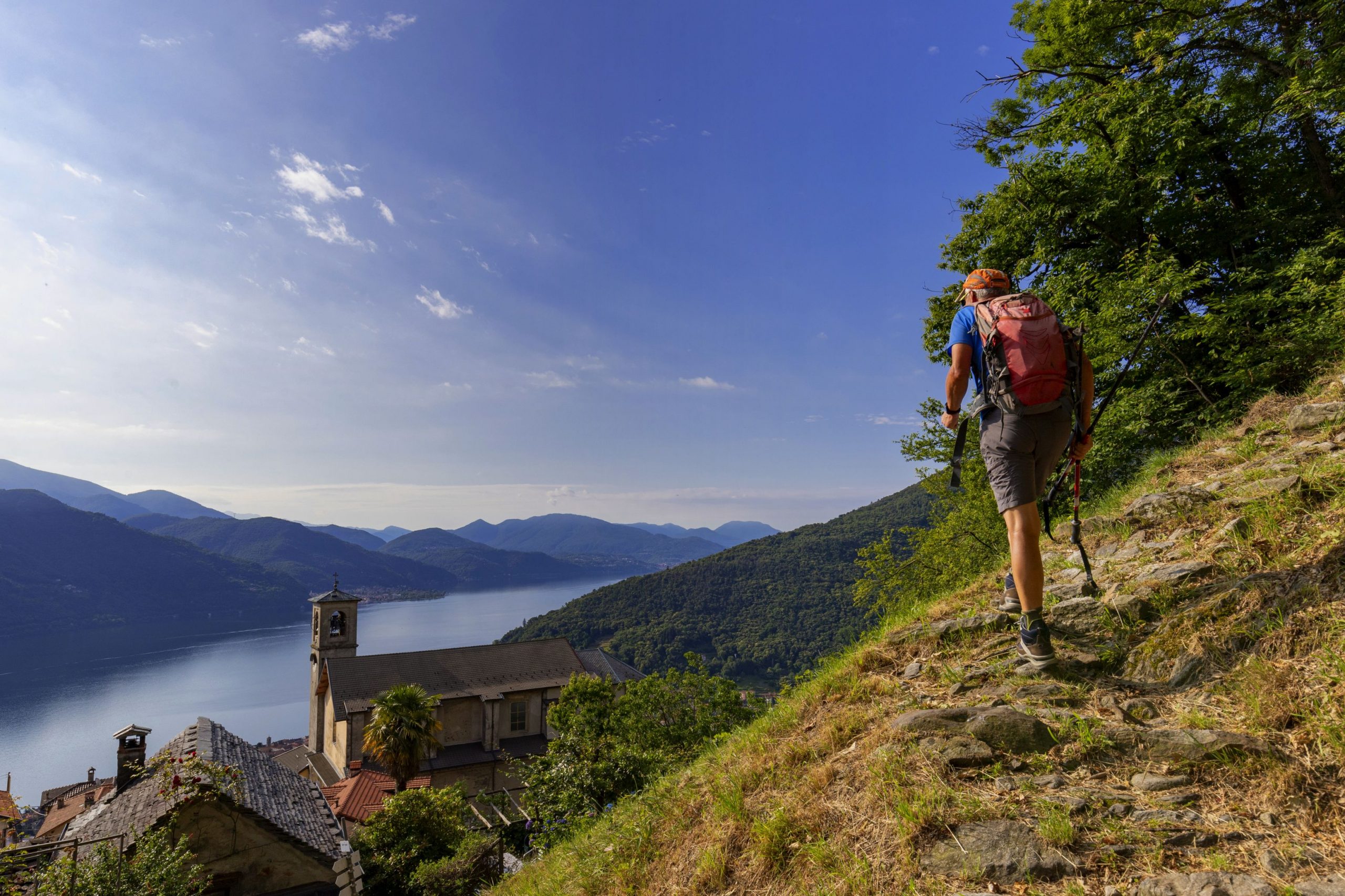
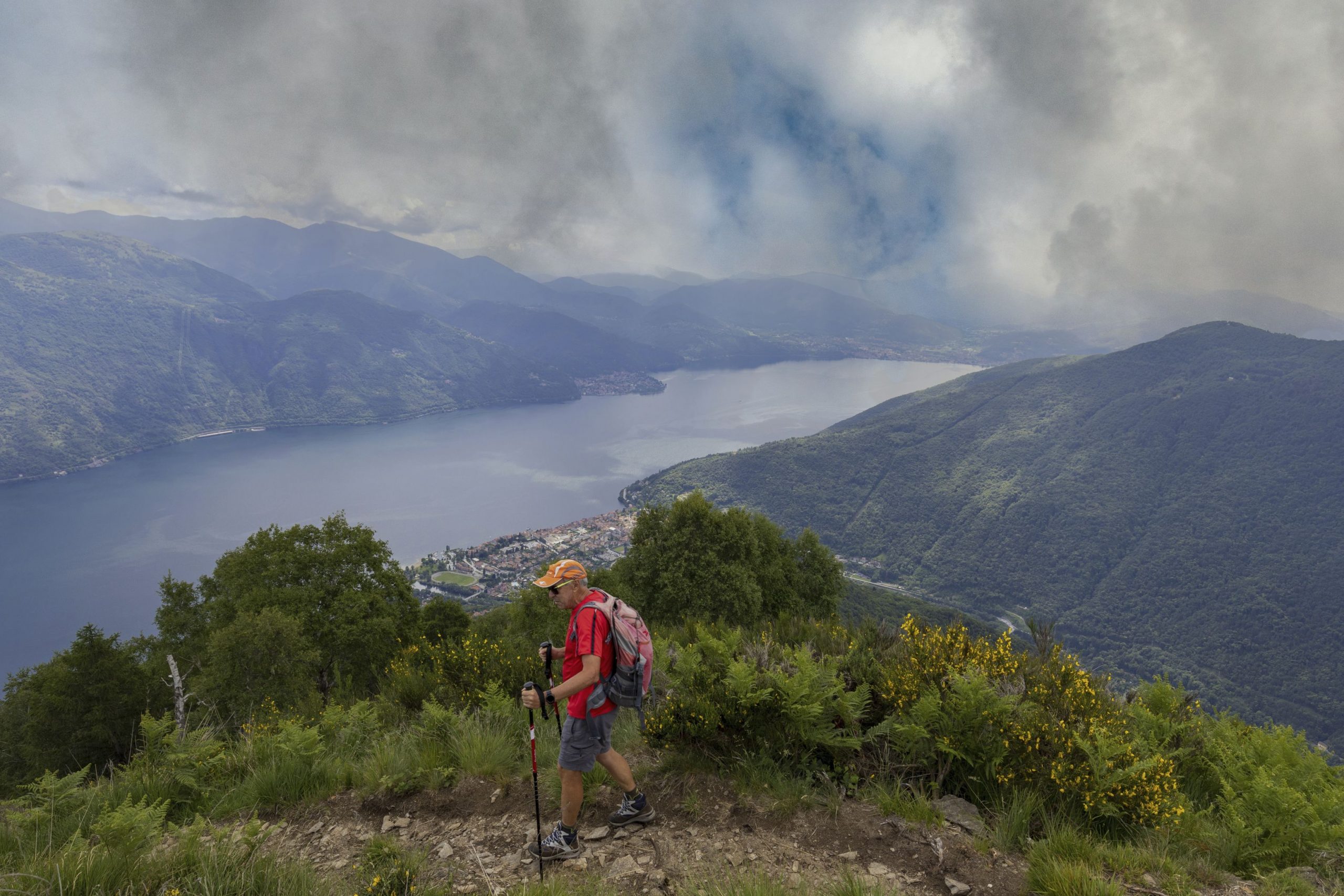
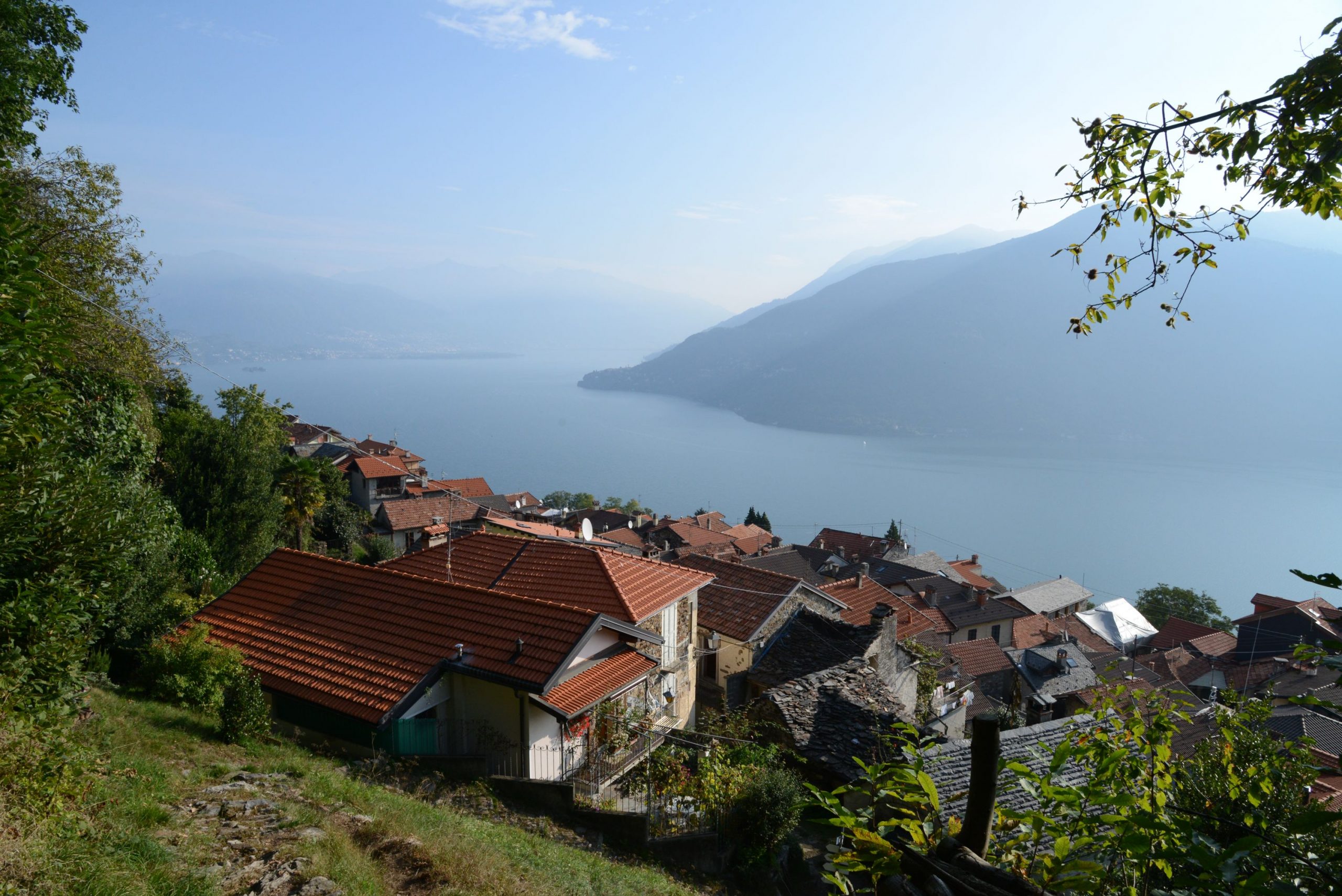
The village of Sant’Agata overlooks the village of Cannobio, and gives excursionists a beautiful view of the lake before they even begin walking. From the car park, take the pedestrian road at the end that is closed by a barrier (a blue pedestrian sign says “strada privata” (private road) and there are red/white marks). It leads towards a grassy track and then a path that passes the elementary school to get to a paved road. Go towards the church, which you will be able to see, and you will come to a magnificent balcony overlooking the lake (with a water fountain, rest rooms and a coffee shop). Pass in front of the church and walk under the arch. Continue through the maze of alleys in the village, following the round red and white marks until you reach the end of the buildings where you’ll take the path uphill on the right (sign for “Monte Giove”). A rather steep climb through chestnut and oak trees takes you quickly to the small chapel of S. Luca (687 m) immersed in the woods. Continue to the left. The path is still climbing, but now a little more gradually, as it leads into a beautiful terraced area where ruins appear at times. Just after the remains of a village, you’ll get to a fork. Bear to the right and follow the sign for “Monte Giove”.
Note: Remember this spot because this is where the circular path ends up on the return trip.
Continue uphill again through the woods until you reach a paved road. Take this road to the left, uphill, but almost immediately you’ll leave the asphalt and take another path on the left that leads to Marcalone (860 m). This village has a marvellous view of the lake, and it can be considered a destination in its own right because it offers meadows where you can play and an agritourism business.
Note: you could also drive up to this location, but keep in mind that the road is quite narrow.
When you reach the houses, take the left staircase (“Monte Giove”) that leads through the entire village. When you get to the asphalt, cross it and take the path (sign for “Monte Giove”). A little further on, there is a fork in the path, with red and white markings on both paths. It’s best to keep right and stay on the widest path with the most recent rectangular signs.
The forest is now made up of thick spruce trees. When you reach the asphalt road, follow it uphill to the right. You’ll come to the first of three paths leading off the road to the right, which makes a short curve (but is not worth following). The second path goes to the left but will not save you much time. Take the third path leading off the asphalt to the right because it shortens the road a lot, even though it takes you up a steep climb through the spruces (pay close attention to the round red and white marks because it is easy to get on the wrong path). When you are back on the asphalt road – which at this point will turn into a dirt road – continue to the right, always uphill, and watch the vegetation change and open up amid the birches. You’ll come to a fork between the dirt road and a path to the right, both with signs for “Monte Giove”.
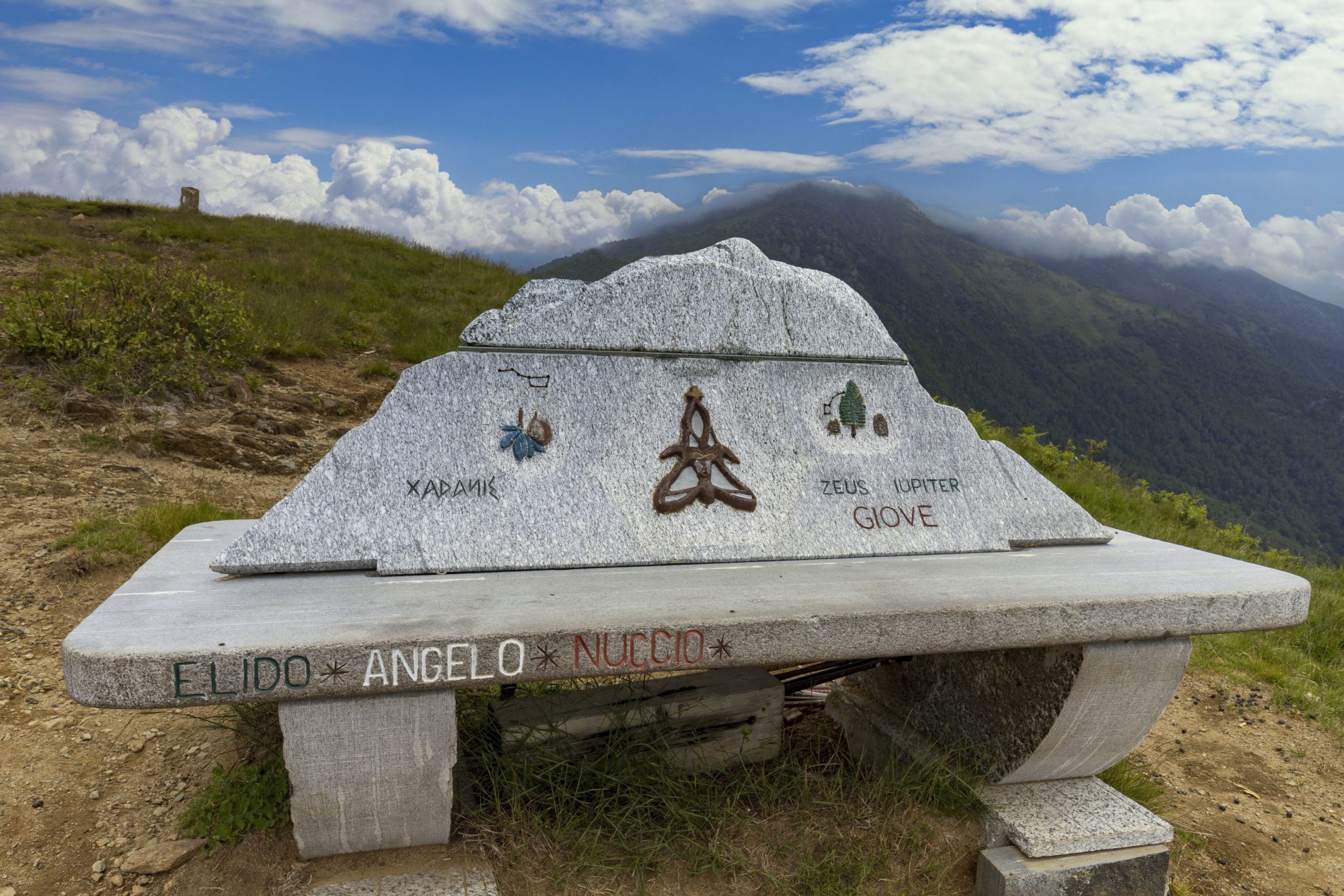
Both directions are correct, but we suggest you stay on the road because – at the time of our inspection – the path was not in very good shape. Also, staying on the road ensures a circular route. The dirt road climbs gradually and then makes a hairpin bend. Take the path on the left (wooden sign) and start up the last climb. Now, you are in an open panoramic environment, on a path that leads to the peak, where you will find a cross and an artistic bench dedicated to variants of the name Jupiter (Giove). After admiring the full 360° view, hikers can start down the wide grassy track on the opposite side of the hill with respect to where they came up. The track soon becomes a rapidly descending path amid short birches that then become increasingly large with beautiful ferns growing underneath. You will come out on a dirt road, and you must go to the left on a light downhill incline until you reach a crossroads. Turn left in the direction of the tables (sign for “Biessen”) along the grassy road that goes to the village of Rombiago (1167 m). Just before getting there, you’ll descend along the path on the left (signs for “Biessen”).
Be careful because this part of the path is hard to see and it is easy to get on the wrong track: do not walk parallel to the village, but instead go down through the birches and then you’ll find the path to the left (old sign for “Biessen”). The descent will be continuous and constant, indicated by old yellow-red marks, first among the birches and then amid the chestnuts and oaks. When you come to a small group of houses, and you will find a fork in the road. Go to the left (sign for “Sant’Agata”). The path winds along gradually. After an isolated votive pillar, it is rather exposed – there is sheer drop over the Cannobina Valley below – but it is not dangerous.
Note: if you look down to the right you can see the seventeenth-century Church of St. Anne positioned on a gorge dug by water, spanned by a small medieval bridge.
The path continues in a gradual descent, and leads to the ruins of the village you saw on your way up. From here, follow the downhill trail to the chapel of S. Luca and then continue the steep descent to return to the starting village, Sant’Agata.
tips for young hikers
A long excursion, this hike is absolutely recommended for its beautiful scenery, but it is only suitable for older children who are already accustomed to walking.
Trail creators: Franco Voglino, Annalisa Porporato and Nora Voglino
Content authors: Franco Voglino and Annalisa Porporato
Back to the list of routes

Departure from Omegna and return
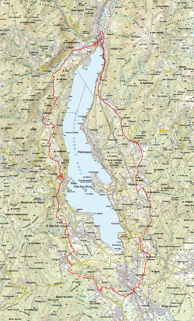
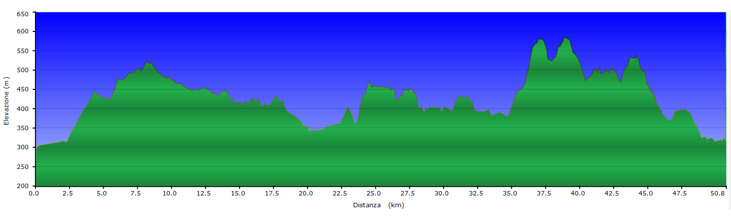
GREEN CIRCLE ROUTE OF LAKE ORTA
Lago d’Orta
Route description
Starting from Omegna, where convenient parking is available near the Forum, set off toward the village of Borca first on via Manzoni and then via Pacinotti. At the end of via Republic turn left following the signs for Armeno-Mottarone, then climb towards the village of Agrano and then Pescone.
Continue climbing through the village of Bassola and when you come to Armeno turn right into via Don Magnone.
At the next junction go straight on along via Abeda to the main square of Armeno, cycle down via Cadorna but shortly after turn left into via Cesare Battisti and then right into via Pariani. You come to the strada delle due Riviere near a supermarket. Cross the road and turn right along an unmade road that will take you to the village of Pisogno a little further on.
Where the tarmac road starts again, turn right and then immediately left passing alongside a place with a swimming pool. After a few hundred metres, near a right bend, turn left into a path which leads to the vicinity of the stables.
When you arrive near a chapel, turn left and cross a bridge over the River Agogna to the village of Pezzasco. Continue on a tarmac road, passing a second bridge and then turning right toward the bridge over the Agogna. Turn immediately left into a path that goes back into the woods and leads to the Reserve of Monte Mesma near the old smithy.
Ford River Membra and turn left following the route signposted as percorso del torrente (river route). On reaching the bottom of via Crucis which climbs to Monte Mesma turn left into the tarmac road to Bolzano Novarese.
Then take via Santa Maria to the town hall of Bolzano, turn left and continue in the direction of Invorio and the cemetery of Bolzano Novarese.
Near the last houses of the town, turn right into an unmade road in the woods. After passing an artificial lake turn right and continue until you reach the church of San Lorenzo in Gozzano. The route now takes you toward Auzate following via Caduti della Libertà and crossing two roundabouts. After reaching the town of Auzate follow the unmade road near the parish church that goes down to the River Grua.
Cross the bridge over the river and climb up again to the the town hall and the parish church of Soriso. Continuing the descent along the tarmac road, take an unmade road that descends toward Pogno. At the junction keep right and pass the bridge over the River Grua. Cycling may not be possible on all parts of this stretch. On reaching Pogno near the sports field continue in the direction of the church and then turn right in direction of Berzonno following via Alzo. Near the church take via Torlaqua and when you come to the church of San Michele turn left and continue along the path to San Maurizio d’Opaglio. Follow via Pianelli to the crossroads with the provincial road 47, turn right and near the left bend going up the cobblestone road that takes you to the village of Briallo.
Cross the village to the chapel of Santa Barbara right at the foot of the rock where the sanctuary of the Madonna del Sasso (Our Lady of the Rock) stands, turn left and follow the fence of the waterworks of San Maurizio and then turn right and follow the path known as the Sentiero degli Scalpellini. A little further on turn right and continue through the woods until you see a gate on the left. Here you turn right and you come to via alle Cave near Alza di Pella. Now turn left and continue on a tarmac road to the stop sign, turn left again along the provincial road 46 and continue uphill and after the village of Ventraggia you come to the bridge over the River Pellino.
Continue climbing to Monte San Giulio, keep going through the houses and take the mule track which climbs to Egro in an area known as the Belvedere. Continue to the cemetery of Egro where you take an unmade road downhill that leads to Grassona near the parish church a little further on.
Continue on a tarmac road near the sign indicating Grassona, turn right into a path to Colma and then go downhill to Cesara. Cross over the road and continue along the streets Cesara, first on via Sant’Isidoro and then you come to the parish church. Shortly after the church continue on an unmade road on the right following the red-white signs to the centre of Nonio and then turn left in direction of Laghetti di Nonio.
After the lakes, turn right sharply going down in the woods to the tarmac road near the area of Ponte Bria. On some sections of this trail cycling may not be possible. Turn right and following a tarmac road you come to the bridge over the River Fiumetta.Turn left along via Varallo to the parish church of Cireggio. Continue along via Leonardo da Vinci to the roundabout in the vicinity of the Church of S. Bernardo and keep right all the way to the sports field. Continue downhill until you reach the ancient Roman door on the left and turn right to the traffic lights.
Turn left and go straight ahead, then turn right along via Ferriere. At the roundabout turn right again to the Forum of Omegna.
To see: the Forum of Omegna, the Church of S. Maria Assunta of Armeno (Our Lady of the Assumption), the Church of San Lorenzo in Gozzano.
AUTHOR: Fabio Valeggia
Back to the list of routes