Sehr netter Spaziergang bis zur ehrwürdigen romanischen Kirche von Montorfano, mit einer einzigartigen Aussicht auf den Lago Maggiore
VON MERGOZZO NACH MONTORFANO
Lago di Mergozzo
Routenbeschreibung
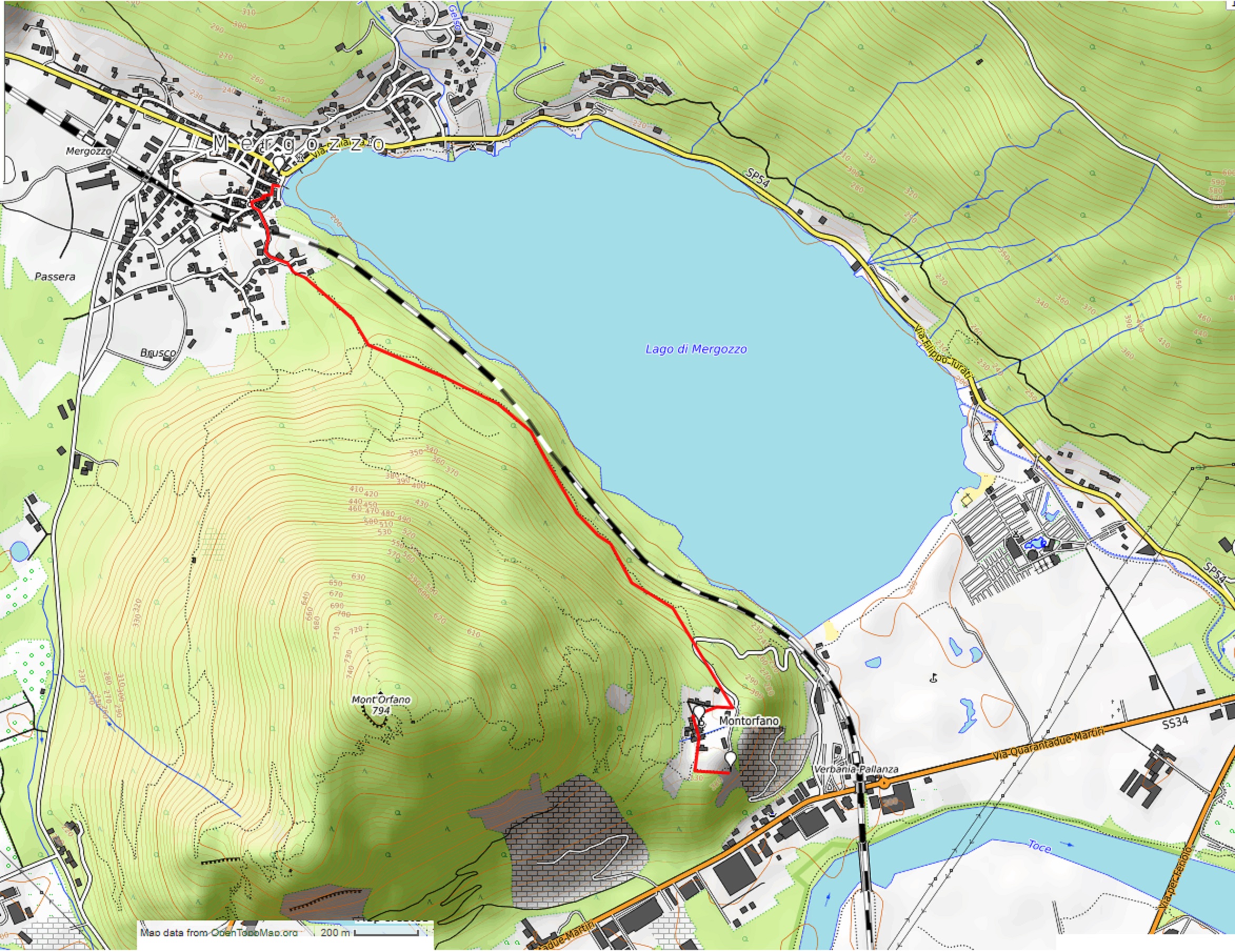
Ausgangsort: Mergozzo Uferpromenade (200 m)
Zielort: Montorfano (335 m)
Höhenunterschied: Etwa 150 m, nur Hinweg
Entfernung: 3 km nur Hinweg
Wanderzeit ohne Pausen: 1 Stunde, nur Hinweg
Art der Pfads: gemischt (Straße, gepflasterter Weg)
Wegweiser: Schilder „Sentiero Azzurro“
Wasser: Brunnen in Mergozzo und in Montorfano
Empfohlene Jahreszeit: ganzjährig.
Hinkommen: 10 km von Gravellona Toce und 21 km von Verbania. In beiden Fällen erst Richtung „Fondotoce“, dann „Mergozzo“. Parkplätze an der Landstraße SP54. – Mit dem Bus Haltestelle Mergozzo der Linie 5 Verbania-Domodossola (www.vcotrasporti.it). Mit dem Zug, Bahnhof Mergozzo auf der Strecke nach Domodossola (www.trenitalia.com).
Informationen: Distretto Turistico dei Laghi – www.distrettolaghi.it; IAT Fremdenverkehrsbüro – Corso Roma 20, Mergozzo – Tel. +39 0323.800935; Gemeinde Mergozzo – www.comune.mergozzo.vb.it
die Tour
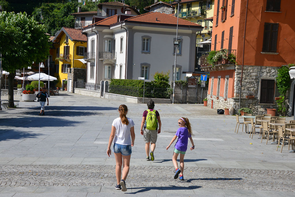
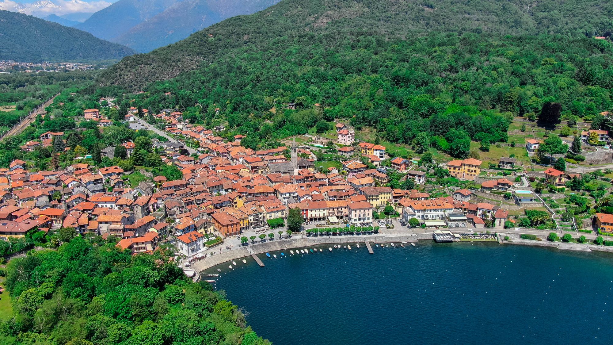
Bevor man den Spaziergang an der Uferpromenade beginnt, sollte man durch die Gassen von Mergozzo wandern, die von der Kirche Assunta aus dem 17. Jh. abgehen. Der große Bau scheint wie eingezwängt in die engen Gassen, eine feierliche Treppe führt hinauf zum Portikus und zu einem von Arkaden geschützten Kreuzweg aus dem 19. Jh. neben der Kirche. Gleich in der Nähe befindet sich die schöne Kirche Santa Marta in rein romanischem Stil aus dem 12. Jh. (Brunnen), ganz in der Nähe der Uferpromenade.
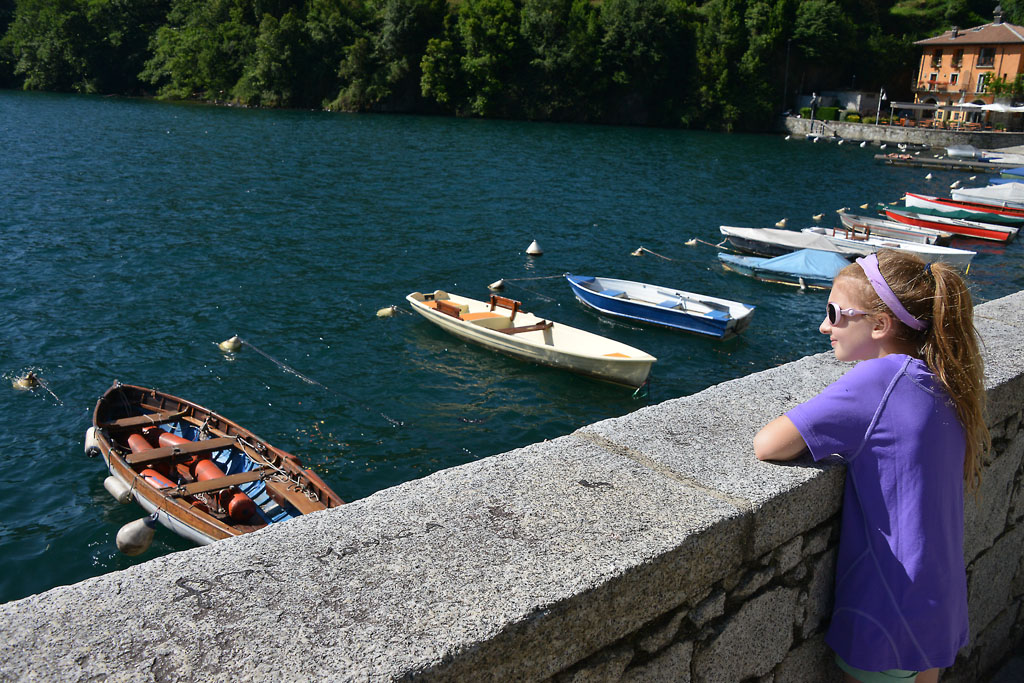
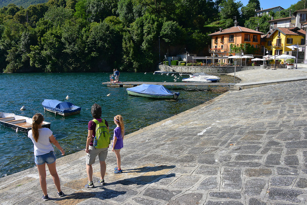
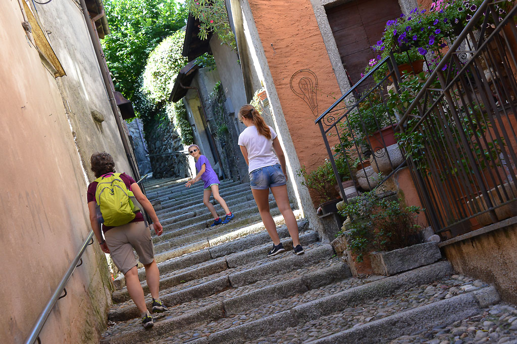
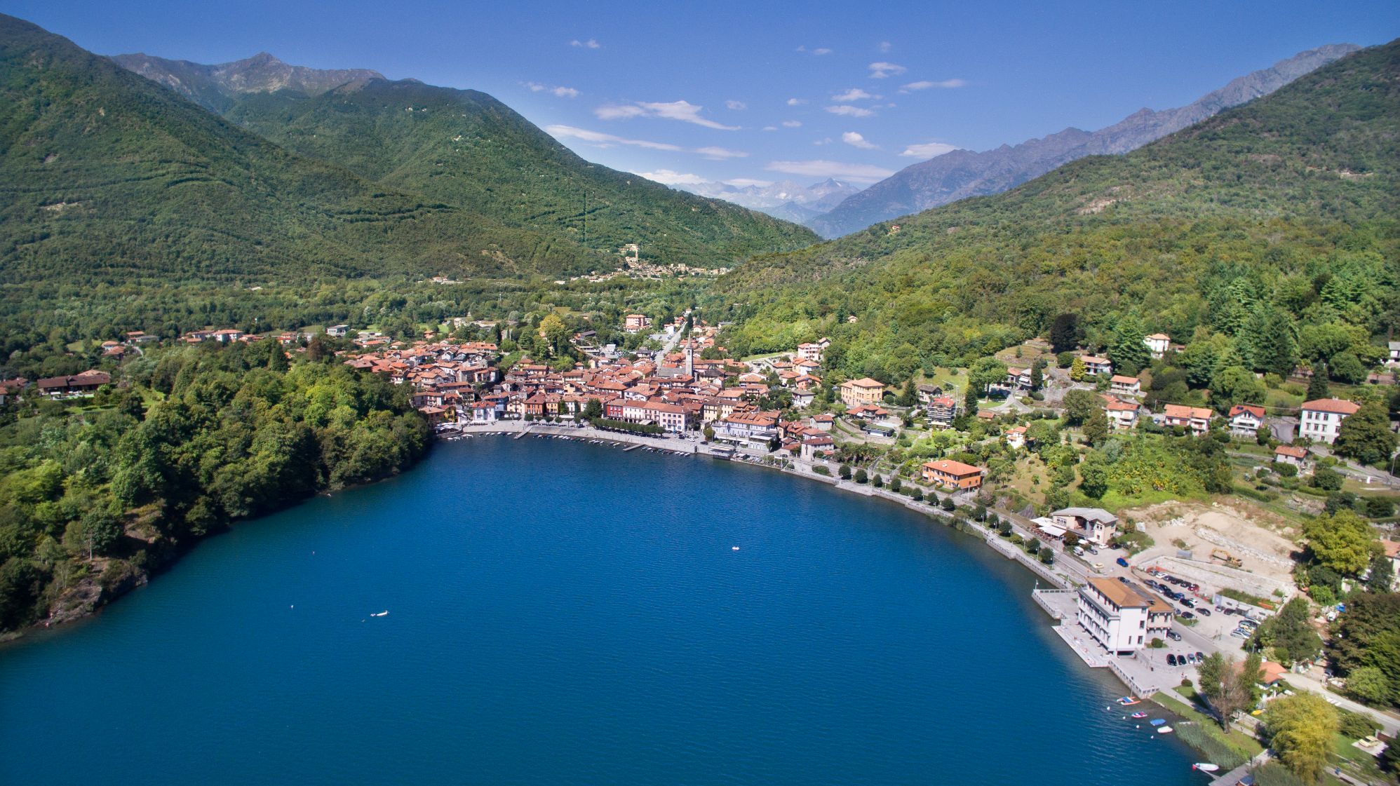
Die Uferpromenade bietet Sitzbänke, ausgedehnte Fußgängerbereiche und eine Ulme, die mindestens fünfhundert Jahre alt zu sein scheint! Am Wasser angekommen, wendet man sich nach rechts bis zur Via Borzoni (braunes Schild „Sentiero Azzurro“) und dann sofort nach links. Nun steigt man auf einer gepflasterten Treppe hinauf. Am Ende der Treppe schlägt man links die Via Maffioli ein und erreicht das Oratorium Santa Elisabetta von 1623 (Brunnen). Hinter dem Oratorium geht es ein kleines Stück nach links, dann in die Via Nostrani und gleich danach rechts in die Via Montorfano. Bergan folgt man über breite und tiefe Stufen den Schildern „Sentiero Azzurro“. Nun geht man weiter bergan auf einer Asphaltstraße, vorbei an Einfamilienhäusern die dann zu einem verwirrend viel markierten Waldweg wird (Schilder, weiß-rote Zeichen, blaue Punkte, gelbe Pfeile). Wenn der Weg endlich zu einem gepflasterten Pfad wird, gibt es keinen Zweifel mehr und man wandert weiter im Schatten zwischen Trockenmauern. Nach dem Anstieg erreicht man eine breitere gepflasterte Straße und folgt den Schildern nach links, gleich danach nochmals nach links, leicht bergab zum Mergozzo-See mit Bänken und Brunnen.
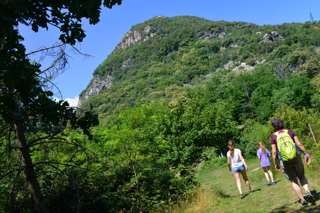
Der Wanderweg führt an der Nordseite des gerade eben 794 Meter hohen Bergs Montorfano entlang. Das Besondere ist aber, dass er aus einem einzigen weißen Granitblock besteht, daher die vielen Steinbrüche, an denen seit Jahrhunderten gearbeitet wird. Aus diesem weißen Granit aus Montorfano wurden die Säulen der Kirche San Paolo Fuori le Mura in Rom gehauen.
Der Pfad verläuft angenehm allmählich ansteigend, immer mit Blick auf den See. Nach einem steileren Anstieg erreicht man eine asphaltierte Straße.
Wenn man mit dem Zug und nicht zu Fuß zurückkehren möchte, muss man hier nach rechts gehen und kommt zum Bahnhof auf der Stecke Verbania-Pallanza.
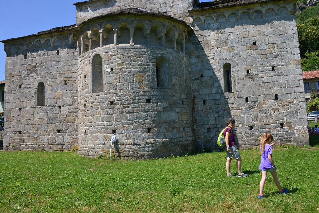
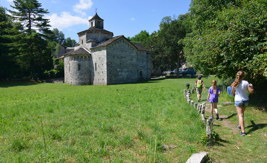
Man geht und auf der Asphaltstraße nach links bergan, vorbei an dem kleinen Friedhof und erreicht einen Parkplatz. Hier nimmt man den Waldweg nach rechts, der zu den Wiesen vor der schönen romanischen Kirche San Giovanni in Montorfano (Brunnen und Tische) führt, die sich isoliert in ihrer architektonischen Reinheit erhebt.
Diese Kirche stammt aus dem 11.-12. Jh. und steht auf den Überresten eines religiösen Gebäudes aus dem 9. Jh. Neuere Grabungen haben sogar die Fundamente einer sehr viel ältere Kirche aus dem 5.-6- Jh. ans Licht gebracht. Die Kirche ist zur Messe geöffnet.
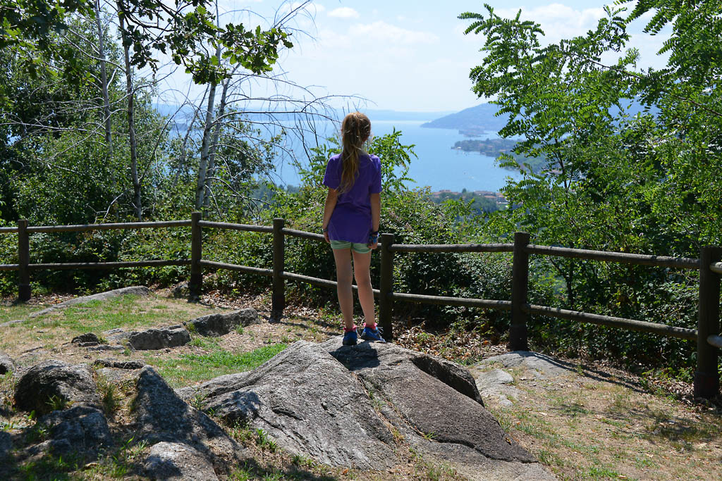
Nach der Besichtigung des eindrucksvollen Gebäudes steigt man weiter bergan bis zu einem von Steinen begrenzten Übergang in Richtung des Feldwegs auf der linken Seite, der zum Belvedere über den Lago Maggiore ansteigt. Der Rückweg erfolgt auf derselben Strecke.
weitere Informationen
See oder Golf?
Die Gegend des Lago Mergozzo ist bereits seit uralten Zeiten bewohnt, die Fundstücke gehen bis 6000 v. Chr. zurück. Doch zu jener Zeit war dies ein Golf des Lago Maggiore. Der See ist entstand erst im 15. Jh, wie es scheint durch „Verschulden“ des Toce-Flusses, der nach und nach so viel Geröll mit sich geführt hatte, dass sich ein Damm bildete, der die beiden Seen heute voneinander trennt.
Archäologisches Museum und Granit-Museum
Es befindet sich in der Via Roma 8 in Mergozzo und verfügt über eine Sammlung über zwei Stockwerke mit Fundstücken von der Urgeschichte bis zur Römerzeit. In einem der Räume dagegen wird die Geschichte des Granits und der entsprechenden Bearbeitungsverfahren erläutert (www.ecomuseogranitomontorfano.it). Ganz in der Nähe liegt Candoglia, der alte Steinbruch, wo man die Marmorverarbeitung nachvollziehen kann. Interessant: Der Marmor wurde zum Bau des Doms von Mailand verwendet.
Ratschläge zum Wandern mit Kindern
Ein einfacher Spaziergang, jedoch wegen des Bodens ungeeignet für Kinderwagen.
Wegmacher: Franco Voglino, Annalisa Porporato und Nora Voglino
Autoren von Texten: Franco Voglino und Annalisa Porporato
Zurück zur Routenliste

Promenade très agréable qui conduit à la précieuse église romane de Montorfano avec son panorama unique sur le Lac Majeur
DE MERGOZZO A MONTORFANO
Lago di Mergozzo
Routenbeschreibung
localité de départ : Mergozzo promenade au lac (200 m)
localité d’arrivée : Montorfano (335 m)
dénivellement : environ 150 m à l’aller seulement
distance : 3 km à l’aller seulement
temps du parcours à l’exclusion des arrêts : 1 heure à l’aller seulement
type de parcours : mixte (asphalte, pavés)
signalétique : panneaux « Sentiero Azzurro »
eau : fontaines à Mergozzo et à Montorfano
période conseillée : toute l’année
comment arriver : à 10 km de Gravellona Toce et à 10 km de Verbania. Dans les deux cas, direction « Fondotoce », puis « Mergozzo ». Parkings sur la route SP54. En autobus : arrêt Mergozzo de la ligne 5 Verbania-Domodossola (www.vcotrasporti.it). En train : gare ferroviaire de Mergozzo sur la ligne pour Domodossola (www.trenitalia.com).
Informations : Distretto Turistico dei Laghi – www.distrettolaghi.it; IAT Bureau Information et Accueil Touristique – Corso Roma 20, Mergozzo – tél. +39 (0)323 800935; Commune de Mergozzo – www.comune.mergozzo.vb.it
l’itinéraire
Avant de commencer la promenade au départ du Lungolago, on conseille de parcourir quelques-unes des ruelles à l’intérieur du village de Mergozzo, qui partent de l’église de l’Assunta du XVIIe siècle, caractérisée par une grande structure pratiquement enchâssée entre les étroites ruelles, avec un escalier solennel qui précède le portique et flanquée d’arcades qui abritent un Chemin de Croix du XIXe siècle. Non loin de là se trouve la belle église Santa Marta, en pur style roman du XIIe siècle (fontaine), à deux pas de l’aire du Lungolago.
La berge est équipée de bancs et de grandes zones piétonnes, et on y découvre un orme qui semble vieux de cinq siècles de vie ! En se tenant devant le lac, on tourne à droite dans la Via Borzoni (panneau marron « Sentiero Azzurro ») puis immédiatement à gauche. Ensuite, on gravit l’escalier pavé. Au sommet de de l’escalier, on tourne à gauche dans la via Maffioli et on continue jusqu’à l’Oratoire Santa Elisabetta qui date de 1623 (fontaine). Derrière l’oratoire, on s’engage à gauche dans la via Nostrani puis immédiatement à droite dans la via Montorfano et on gravit des marches larges et profondes (panneaux « Sentiero Azzurro »). On passe ensuite sur une route goudronnée qui monte entre les pavillons avant de se transformer en un chemin de terre jalonné d’une multitude de balises (panneaux, balises blanches et rouges, vignettes bleues, flèches jaunes). Quand l’itinéraire devient enfin une véritable route pavée, tous les doutes nous abandonnent et on continue à l’ombre, à l’abri de murets construits à sec. Après une montée, on rejoint une route pavée un peu plus large, puis on tourne à gauche (panneaux) puis de nouveau à gauche en descendant légèrement jusqu’au point panoramique sur le lac de Mergozzo, avec des bancs et des fontaines.
Le sentier parcourt le versant nord du mont Montorfano, qui culmine à 794 m à peine ; il s’agit en fait d’un bloc unique de granit blanc, extrait depuis des siècles, ce qui explique la présence de nombreuses carrières. On a également utilisé le granit blanc de Montorfano pour construire les colonnes de l’église San Paolo Fuori le Mura, à Rome.
L’itinéraire est très agréable et progressif, et l’on aperçoit constamment les eaux du lac. Une pente plus nette nous conduit jusqu’à une route goudronnée.
Si l’on a l’intention de revenir en train plutôt qu’à pied, il faut descendre à droite, jusqu’à la gare ferroviaire Verbania-Pallanza.
On remonte la route goudronnée à gauche en passant devant le petit cimetière jusqu’à un parking. On suit le chemin de terre à droite jusqu’aux pelouses qui annoncent la très belle église romane San Giovanni de Montorfano (fontaines et tables) qui se dresse, isolée dans toute sa pureté architecturale.
Elle a été construite entre le XIe et le XIIe siècle, sur les vestiges d’un édifice religieux du neuvième siècle, mais des fouilles récentes ont mis au jour une église bien plus ancienne datant de la période comprise entre le Ve et le VIe siècle. L’église est ouverte à l’heure de la Messe.
Après la visite de cette jolie petite église, on remonte entre les maisons du village jusqu’à un passage délimité par des pierres en prenant la piste herbeuse sur la gauche qui monte jusqu’au point panoramique sur le Lac Majeur. Au retour, on emprunte la même route qu’à l’aller.
pour en savoir plus
Lac ou golfe ?
Le Lac de Mergozzo était déjà habité dans l’Antiquité et les vestiges retrouvés datent d’avant 6000 avant J.-C. Mais à l’époque, c’était un golfe qui faisait partie du Lac Majeur. Ce n’est qu’au XVe siècle il se transforma en lac car la rivière Toce a sans doute déposé un grand nombre de détritus qui créèrent le barrage qui sépare aujourd’hui les deux lacs.
Musée Archéologique et Écomusée du Granit
Situé dans Via Roma 8 à Mergozzo, il abrite une collection de pièces qui illustrent, sur deux niveaux, l’histoire locale, de la Préhistoire à l’époque romaine. Dans une des salles, on décrit en revanche l’histoire du granit et des méthodes de travail (www.ecomuseogranitomontorfano.it). Non loin de là il y a l’ancienne carrière de Candoglia où l’on découvre le travail du marbre utilisé pour la construction de la Cathédrale de Milan.
conseils pour les jeunes randonneurs
Promenade très simple mais inaccessible aux poussettes en raison des caractéristiques du terrain.
Faiseurs du chemin: Franco Voglino, Annalisa Porporato et Nora Voglino
Auteurs des textes: Franco Voglino et Annalisa Porporato
Zurück zur Routenliste
A pleasant stroll until hikers reach the precious small Romanesque church of Montorfano, with a unique panorama of Lake Maggiore
FROM MERGOZZO TO MONTORFANO
Lago di Mergozzo
Routenbeschreibung
Departure location: Mergozzo lake shore (200 m)
Place of arrival: Montorfano (335 m)
Difference in altitude: About 150 m one way
Distance: 3 km one way
Walking time not counting stops: 1 hour one way
Type of route: mixed (asphalt, cobblestones)
Signs: “Sentiero Azzurro” signs
Water: fountains in Mergozzo and Montorfano
Recommended period: all year round
How to get there: 10 km from Gravellona Toce and 10 km from Verbania. In both cases, go in the direction “Fondotoce”, then “Mergozzo”. Parking along the SP54. By bus: line 5 Verbania-Domodossola, stop Mergozzo (www.vcotrasporti.it). By train: railway station of Mergozzo along the line to Domodossola (www.trenitalia.com).
Information: Distretto Turistico dei Laghi – www.distrettolaghi.it; IAT Office – Corso Roma 20, Mergozzo – tel. +39 (0)323.800935; Municipality of Mergozzo – www.comune.mergozzo.vb.it
the itinerary
Before you start along the promenade that starts from the Lakeside, you should walk through some of the internal alleys in Mergozzo that start at the 17th century church of the Assumption. The large church seems to be wedged in between the narrow alleys, with a solemn staircase that anticipates the portico and flanked by another portico which shelters a Via Crucis from the 19th century. The beautiful church of Santa Marta is not far away, in pure Romanesque style from the 12th century (fountain), at a very short walk from the lakeside promenade area (lungolago).
The Lakeside path has benches and ample spaces for pedestrians, and an elm tree that is estimated to about five centuries old! Stand in front of the water, go to the right until you can enter Via Borzoni (brown signs that say “Sentiero Azzurro”) and then immediately go left. Take the cobblestone staircase uphill. At the top of the staircase, go left on Via Maffioli and you will arrive at the Oratory of Saint Elizabeth, built in 1623 (fountain). Behind the oratory, take Via Nostrani on the left for a moment and then go right immediately after Via Montorfano, on a wide uphill trail with deep steps (signs for “Sentiero Azzurro”). Then, go onto asphalt and keep going uphill amid the houses. The road will become a dirt road with many different kinds of signs (road signs, red and white marks, blue bubbles, yellow arrows). When the trail finally becomes a real cobblestone road, you will have no more doubts and proceed in the shade flanked by dry-stone walls. After a hill, you will join on a slightly wider cobblestone path. Go left (follow the signs) and then right away you will go left again, slightly downhill, on a path that leads to a point overlooking Lake Mergozzo, with benches and fountains.
The trail runs along the northern slope of mount Montorfano, just 794 meters in altitude, but this point is a single block of white granite, which explains the presence of several quarries because this stone has been extracted for centuries in this area. White granite of Montorfano was also used for the columns of Saint Paul Outside the Walls in Rome.
The path winds pleasantly with gradual progression, and the lake is almost always visible. With a steeper climb, you will come to an asphalt road.
If you intend to go back with the train instead of walking, you must go right, downhill, to the Verbania-Pallanza railway station.
Take the asphalt road on the left, uphill, passing in front of a small cemetery and arriving at a parking lot. Follow the dirt road to the right that leads to the meadows right before the beautiful Romanesque church of San Giovanni of Montorfano (fountain and tables) that stands isolated in all its architectural purity.
Dating back to the 11th and 12th centuries, the church stands on the remains of a religious building from the 9th century, but recent excavations have brought to light the remains of a much more ancient church, built in the 5th and 6th centuries. You will find it open when it is time for mass.
After visiting the picturesque little church, go uphill in the middle of the houses in the town until you reach a passage delimited by stones that deviates toward the grassy track on the left that climbs up to the panoramic view over Lake Maggiore (Belvedere). You can return by going back the way you came.
to learn more
Lake or gulf?
Lake Mergozzo was already inhabited in ancient times and archaeological finds date back to around 6000 b.C. But at that time, it was a gulf, forming part of Lake Maggiore. Only in the 15th century did it become an independent lake, due to the Toce River slowly bringing in enough that debris to create the barrier that today divides the two lakes.
The Archaeological Museum and the Ecomuseum of Granite
Located in Via Roma 8, in Mergozzo, the museum presents a collection of finds on two floors that offer a brief history of the area from prehistoric times to the Roman era. In one of the rooms, visitors will find descriptions of the history of granite and processing methods (www.ecomuseogranitomontorfano.it). The ancient quarry of Candoglia is a short distance away: the marble taken out of this quarry was used to build the Duomo in Milan and is still used for its maintenance.
tips for young hikers
A very simple walk but, due to the characteristics of the paths, not accessible for strollers.
Slow trekkers: Franco Voglino, Annalisa Porporato and Nora Voglino
Authors of texts: Franco Voglino and Annalisa Porporato
Zurück zur Routenliste
Passeggiata piacevolissima fino alla pregevole chiesa romanica di Montorfano con un panorama unico sul Lago Maggiore
DA MERGOZZO AL MONTORFANO
Lago di Mergozzo
Routenbeschreibung
Passeggiata piacevolissima che dai vicoli medievali di Mergozzo porta al suo magnifico lago, per poi proseguire su una antica mulattiera fino alla pregevole chiesa romanica di Montorfano con un panorama unico sul Lago Maggiore.
località di partenza: Mergozzo lungolago (200 m)
località di arrivo: Montorfano (335 m)
dislivello: 150 m circa solo andata
distanza: 3 km solo andata
tempo di percorrenza al netto delle soste: 1 ora solo andata
tipologia di percorso: misto (asfalto, selciata)
segnaletica: cartelli “Sentiero Azzurro”
acqua: fontane in Mergozzo e in Montorfano
periodo consigliato: tutto l’anno
come arrivare: dista 10 km da Gravellona Toce e 10 km da Verbania. In entrambi i casi direzione “Fondotoce”, quindi “Mergozzo”. Parcheggi lungo la SP54. In autobus: fermata Mergozzo della linea 5 Verbania-Domodossola (www.vcotrasporti.it). In treno: stazione ferroviaria di Mergozzo lungo la linea per Domodossola (www.trenitalia.com).
informazioni: Distretto Turistico dei Laghi – www.distrettolaghi.it; Ufficio IAT – corso Roma 20, Mergozzo – tel. +39 0323.800935; Comune di Mergozzo – www.comune.mergozzo.vb.it
L’itinerario
Prima di avviarsi lungo la passeggiata che parte dal Lungolago si consiglia di percorrere alcuni dei vicoli interni di Mergozzo che dipartono dalla chiesa dell’Assunta del XVII secolo, caratterizzata da un grande impianto quasi incastrato tra gli stretti vicoli, con una solenne scalinata che anticipa il portico ed affiancata da un porticato che ripara una Via Crucis del XIX secolo. Poco distante si trova la bella chiesa di Santa Marta, in un puro romanico del XII secolo (fontana), a due passi dall’area del Lungolago.
Il lungolago offre panchine e ampi spazi pedonali, oltre ad un olmo che sembra avere ben cinque secoli di vita! Ponendosi di fronte all’acqua si va verso destra fino ad imboccare Via Borzoni (cartello marrone “Sentiero Azzurro”) e poi subito a sinistra. Quindi si imbocca la scalinata selciata in salita. In cima alla scalinata si prende a sinistra per via Maffioli arrivando all’Oratorio di Santa Elisabetta del 1623 (fontana). Dietro l’oratorio si prende per un momento a sinistra per via Nostrani per poi imboccare subito dopo via Montorfano a destra, in salita lungo larghi e profondi gradini (cartelli “Sentiero Azzurro”). Si passa quindi su asfalto procedendo in salita in mezzo alle villette per diventare sterrata con un dedalo di segni (cartelli, segni bianco/rossi, bolli blu, frecce gialle). Quando il tracciato diventa finalmente una vera selciata non si hanno più dubbi e si procede in ombra affiancati da muretti a secco. Dopo una salita si raccorda su una selciata un po’ più ampia e si prosegue a sinistra (cartelli) e subito dopo di nuovo a sinistra in leggera discesa che porta all’affaccio sul lago di Mergozzo, con panchine e fontane.
Il sentiero percorre il versante nord del monte Montorfano, alto appena 794 metri ma che ha la peculiarità di essere un unico blocco di granito bianco, cosa che spiega la presenza di diverse cave poiché da secoli esso viene estratto. Granito bianco di Montorfano è stato usato anche per le colonne di San Paolo Fuori le Mura, a Roma.
Il percorso si snoda piacevole con andamento graduale, quasi sempre a vista sulle acque del lago. Con una salita più netta si arriva ad una strada asfaltata.
Se si intende tornare con il treno e non a piedi si deve andare a destra, in discesa, arrivando alla stazione ferroviaria Verbania-Pallanza.
Si prende la strada asfaltata a sinistra, in salita, passando davanti al piccolo cimitero e arrivando ad un parcheggio. Si segue la sterrata a destra che porta ai prati che anticipano la bellissima chiesa romanica di San Giovanni di Montorfano (fontana e tavolini) che sorge isolata in tutta la sua purezza architettonica.
Risalente ai secoli XI-XII, sorge sui resti di un edificio religioso del IX secolo, ma recenti scavi han portato alla luce resti di una chiesa ben più antica dei secoli V-VI. La si trova aperta in orario di Messa.
Dopo la visita della suggestiva chiesetta si sale in mezzo alle abitazioni del paese fino a confluire in un passaggio delimitato da pietre deviando verso la pista erbosa sulla sinistra che sale fino al belvedere sul Lago Maggiore.
Il ritorno avviene sulla medesima via dell’andata.
Per saperne di più:
Lago o golfo?
Il Lago di Mergozzo era già abitato nell’antichità e i reperti ritrovati risalgono fino al 6000 a.C. Ma all’epoca era un golfo facente parte del Lago Maggiore. Solo nel XV secolo è diventato un lago a sé stante e la “colpa” sarebbe del fiume Toce che, poco alla volta, avrebbe portato così tanti detriti da creare lo sbarramento che oggi divide i due laghi.
Museo Archeologico e Ecomuseo del Granito
Situato in via Roma 8, a Mergozzo, presenta una raccolta di reperti offrendo in due piani una carrellata della storia locale che spazia dalla preistoria all’epoca romana. In una delle sale viene invece descritta la storia del granito e dei metodi di lavorazione (www.ecomuseogranitomontorfano.it). Poco distante, nella frazione Candoglia, la cava di marmo utilizzato per la costruzione e la manutenzione del Duomo di Milano.
consigli per i baby escursionisti
Passeggiata molto semplice ma per la caratteristica del fondo non accessibile ai passeggini.
Realizzatori del percorso: Franco Voglino, Annalisa Porporato e Nora Voglino
Autori dei testi: Franco Voglino, Annalisa Porporato
Zurück zur Routenliste

