A cool walk through the woods that leads to a lovely location with a view
VERGANTE HILLS: SASS DEL PIZZ
Lago Maggiore
Route description
A cool walk through the woods that leads to a lovely location with a view suspended above the Lake Maggiore, with interesting benches and trees with a zen personality to play among.
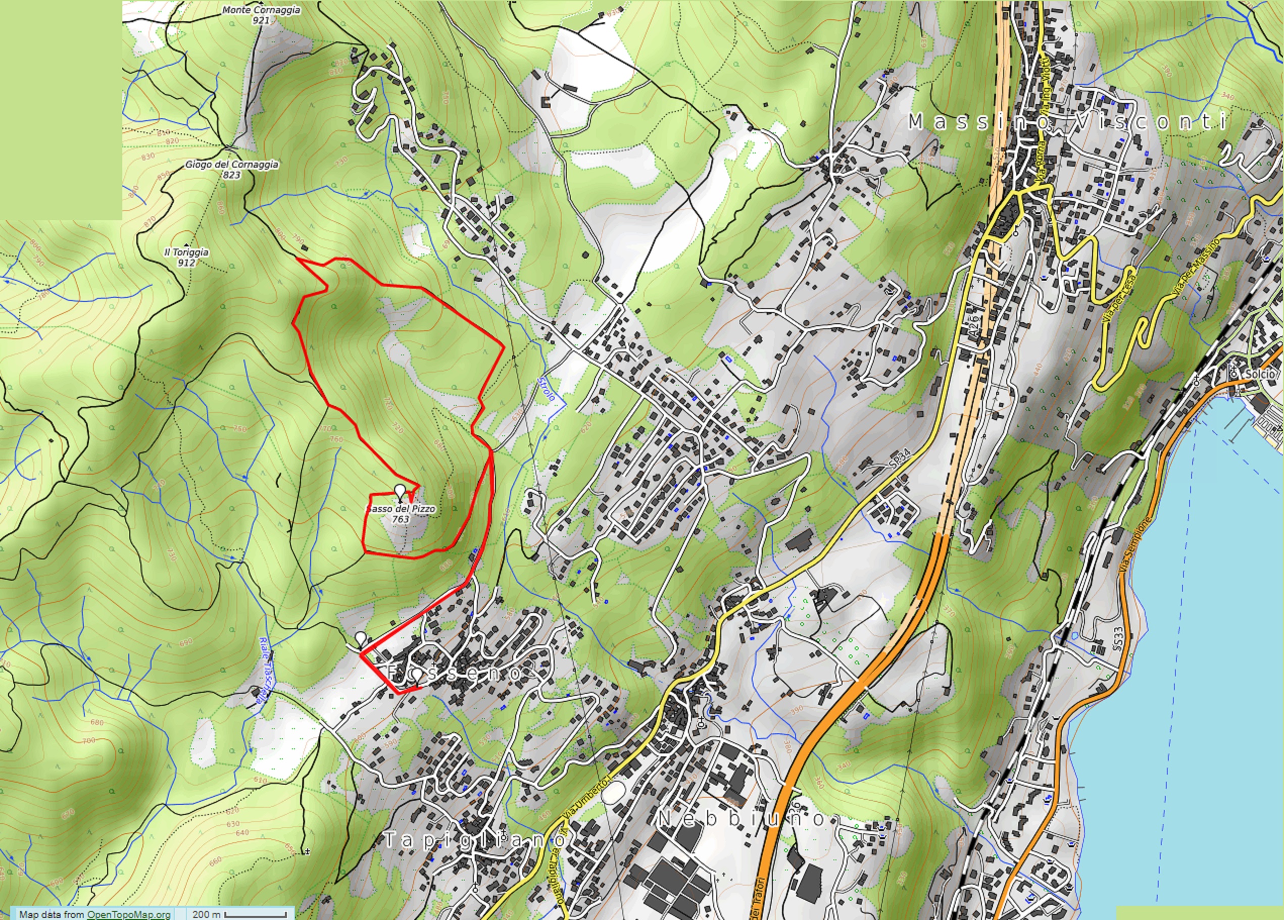
Departure location: Fosseno (600 m)
Place of arrival: Sass del Pizz (763 m)
Maximum altitude: About 800 m
Difference in altitude: About 200 m
Distance: 5 km
Walking time not counting stops: 2 hours
Type of route: mixed (trail, asphalt, dirt road)
Signs: green/white and yellow signs, red/white marks
Water: fountains in Fosseno
Recommended period: all year round, without snow
How to get there: it is 12 km from Arona. From the A26 exit Meina, start out following the blue signs for “Meina”, then follow the blue signs for “Massino Visconti” and “Nebbiuno”. After getting to Nebbiuno, watch to the left for blue signs indicating “Fosseno”. Parking areas in Piazza Sant’Agata and along via Bertoletti. By bus: Arona-Massino Visconti-Gignese line, stop Nebbiuno at about 2 km (www.pirazzi.it).
Information: Distretto Turistico dei Laghi – www.distrettolaghi.it; IAT Office – Piazza Caduti di Nassirya 6, Nebbiuno – tel. +39 (0)322.060202; Municipality of Nebbiuno – www.comune.nebbiuno.no.it
the itinerary
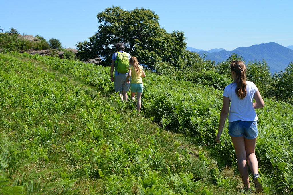
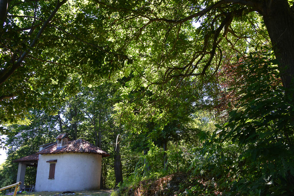
In Piazza Sant’Agata, where you can park, there is an unusual monument dedicated to stone masons and a playground area just behind it. After a well-deserved break, turn your back to the monument and play area, and take the asphalt road to the left uphill (careful: there is no side walk). Always walk uphill on this road, and ignore the different junctions, until you get to the ancient laundry house immersed in the shade of the trees (fountain and stone benches). Continue to the right on the asphalt road (still no side walk) that winds on an almost level grade between the last houses of the hamlet and the first slopes on the wooded mountain. When you begins to descend, you will come to a stop sign, and then continues to the left along the road, which is initially asphalted. Almost immediately, it becomes a dirt road and enters into the shady woods, to come to a clearing.
If you like, you can also park here. It would save you about 1km in distance and 70 meters in altitude, but you would miss stopping at the playground area and the fountains.
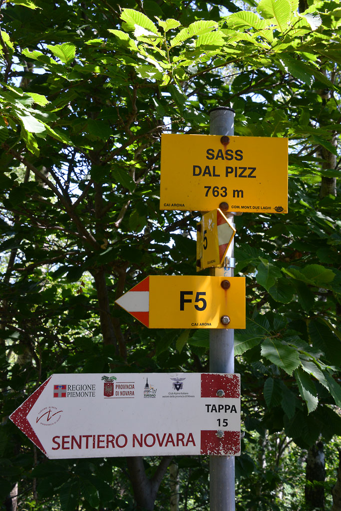
The open space has numerous junctions. You must take the road on the far left (the sign says “Sass del Piz F6”), but keep in mind the dirt road in front of you (“F7” sign), because the proposed ring path ends there. The path climbs gradually in the woods and alternates between a more shaded initial stretch with a more open stretch later on.
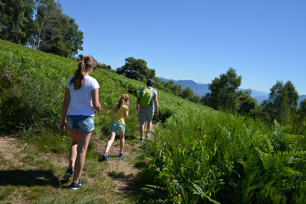
In one of these open stretches, you will find a path on the right through a meadow, and if you look up, you will see a windsock. If you like, it is a short cut to the top, but it is very steep. We suggest that you follow the track, which is longer but much more gradual.
The path drops slightly and you arrive at a fork; take the right path uphill, which is steep at the start and then becomes more gradual, leading up to the summit.
If you like, you can also reach this point from the trail that arrives from the left and starts from the ancient laundry house, but this slope is very steep. You’ll get a taste of that in the final stretch to the summit.
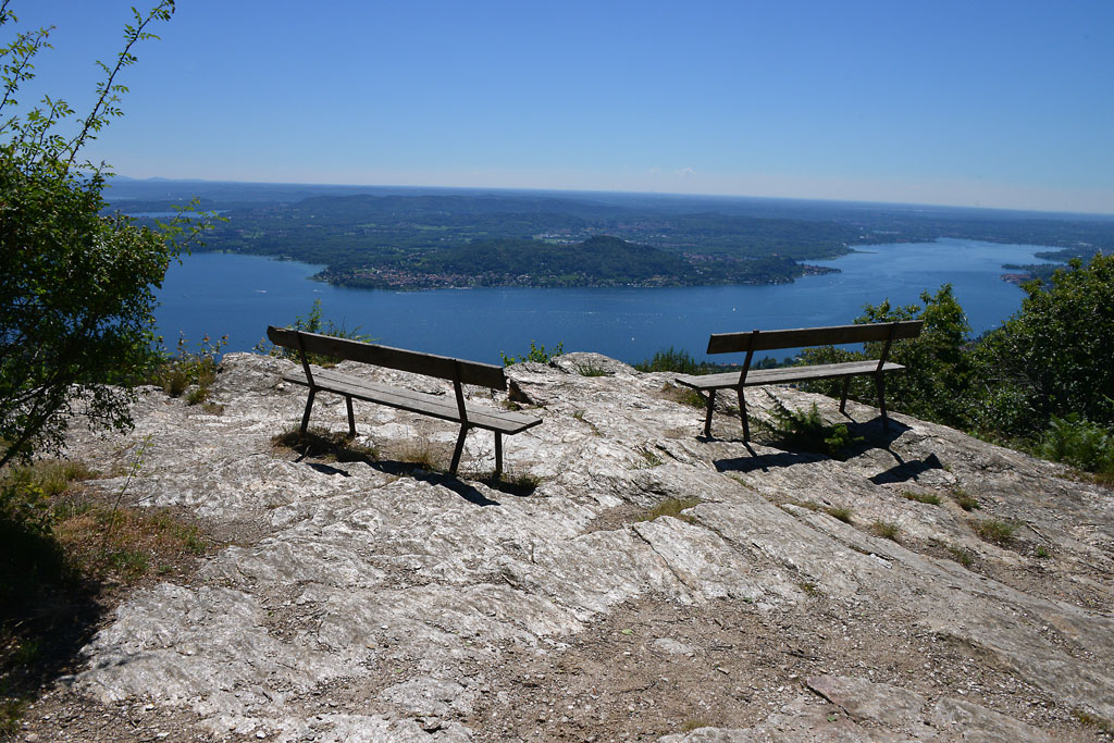
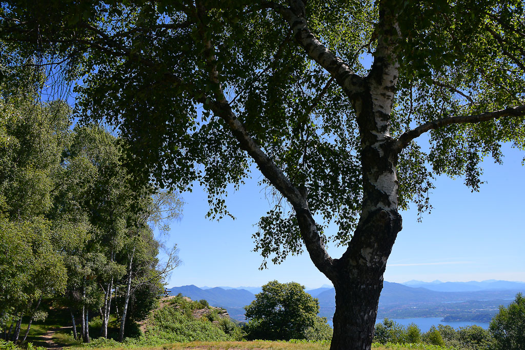
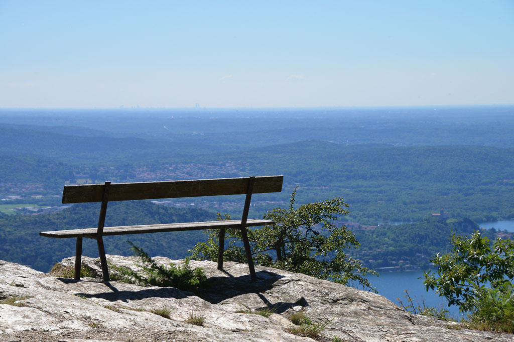
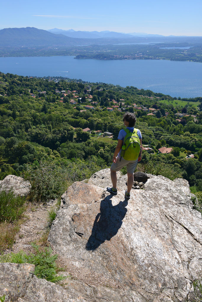
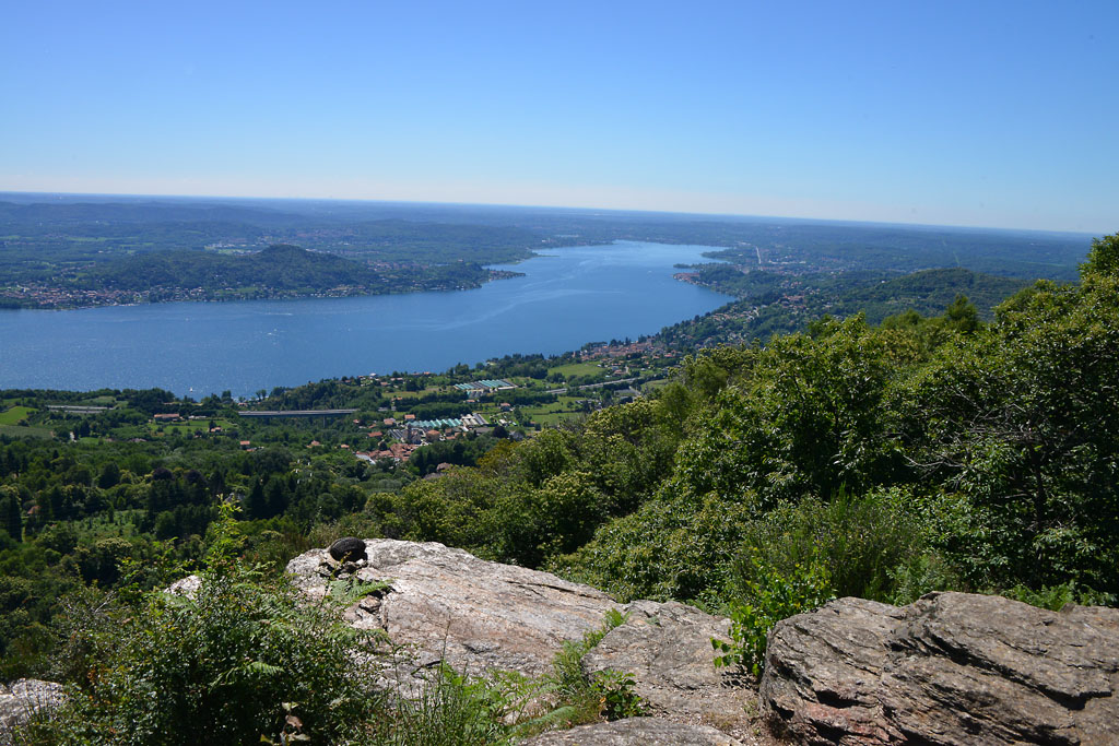
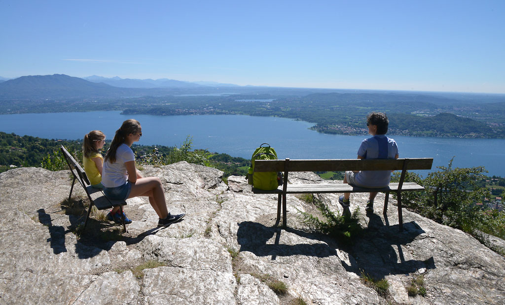
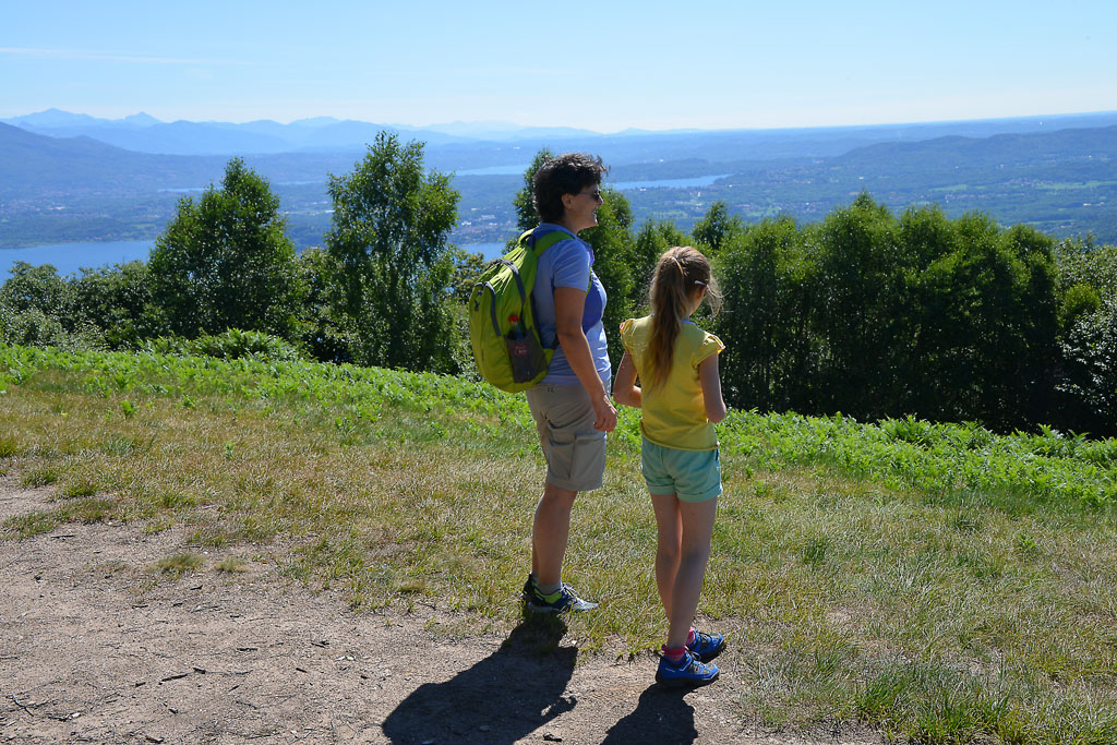
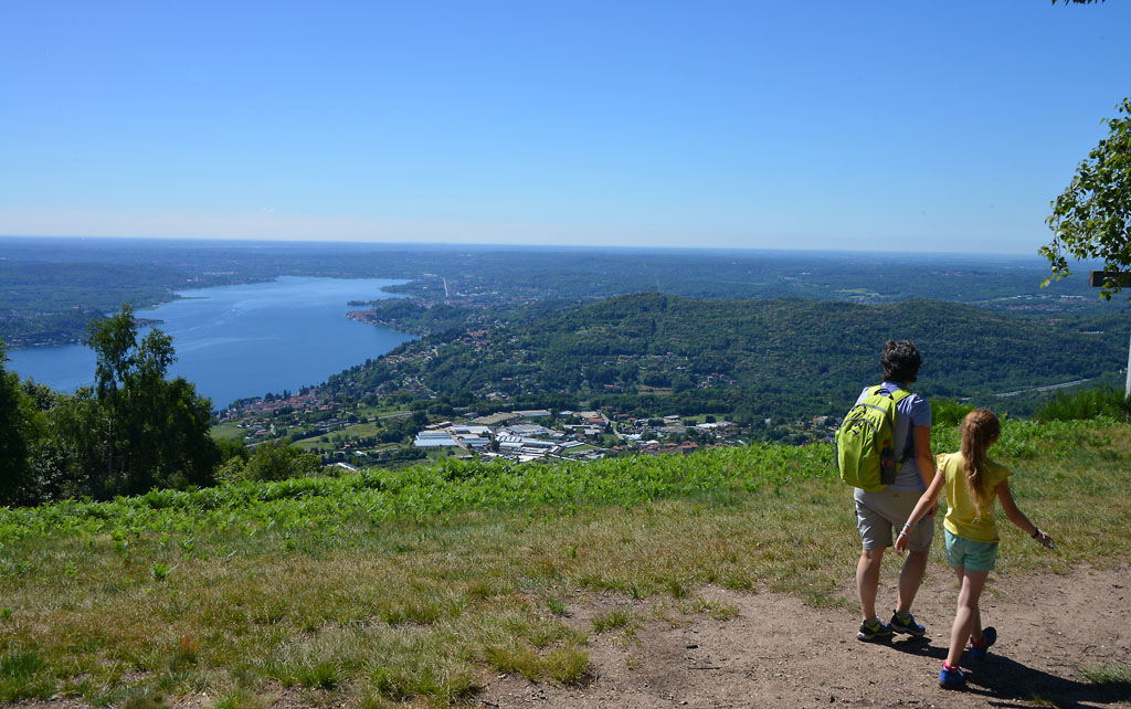
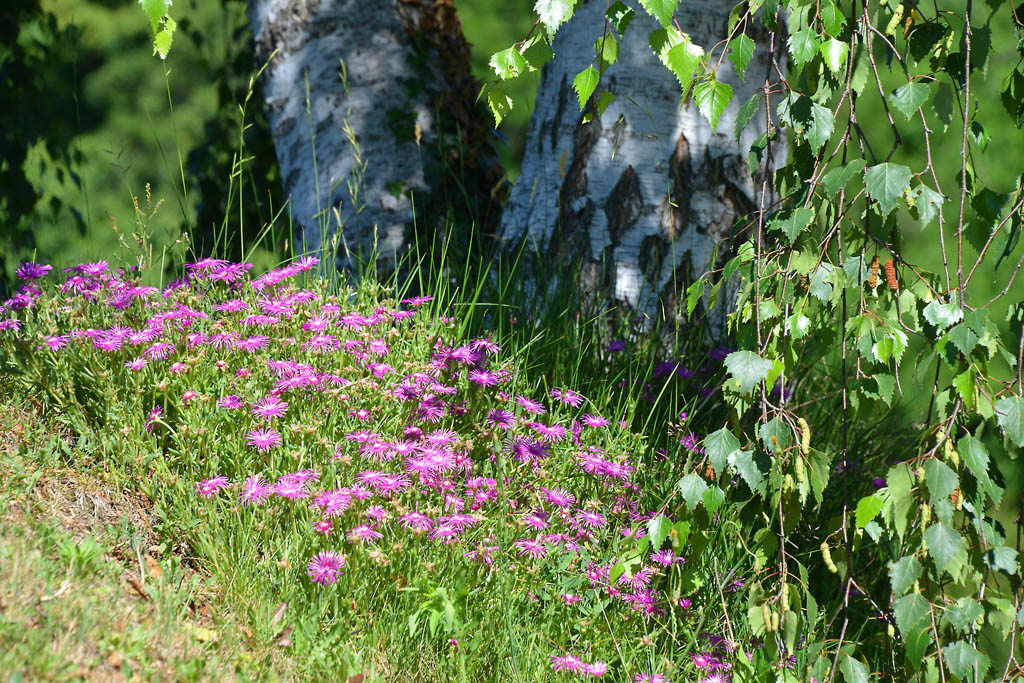
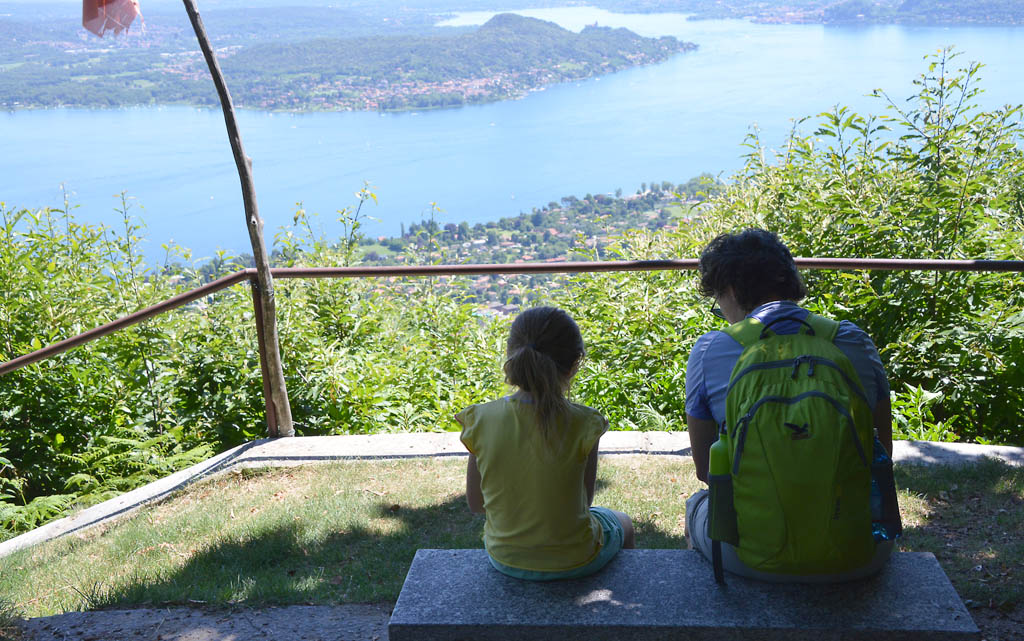
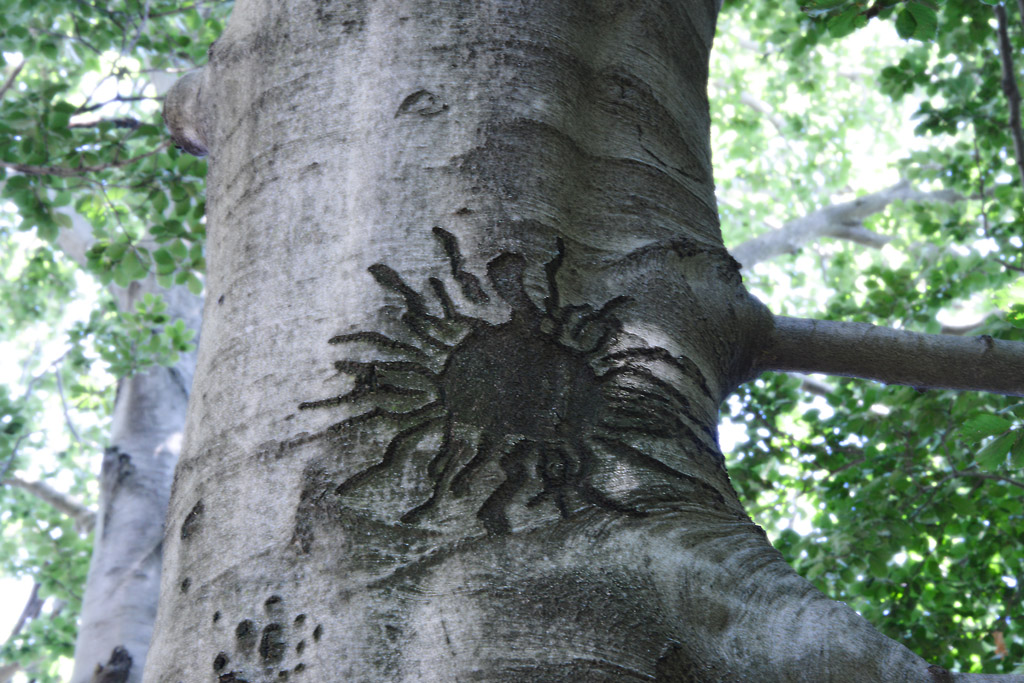
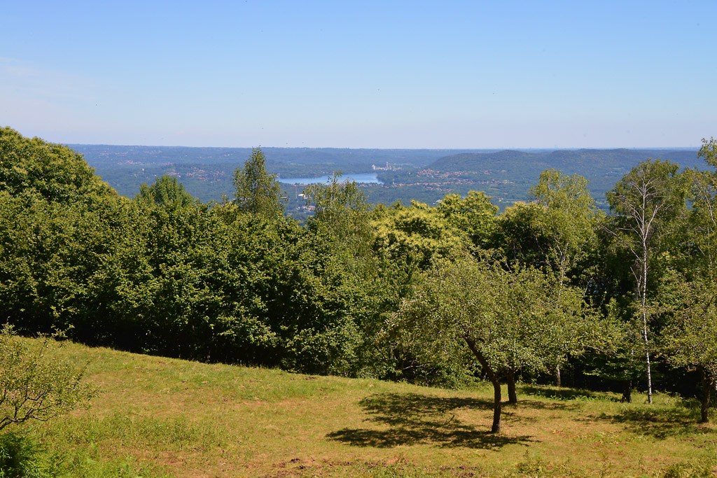
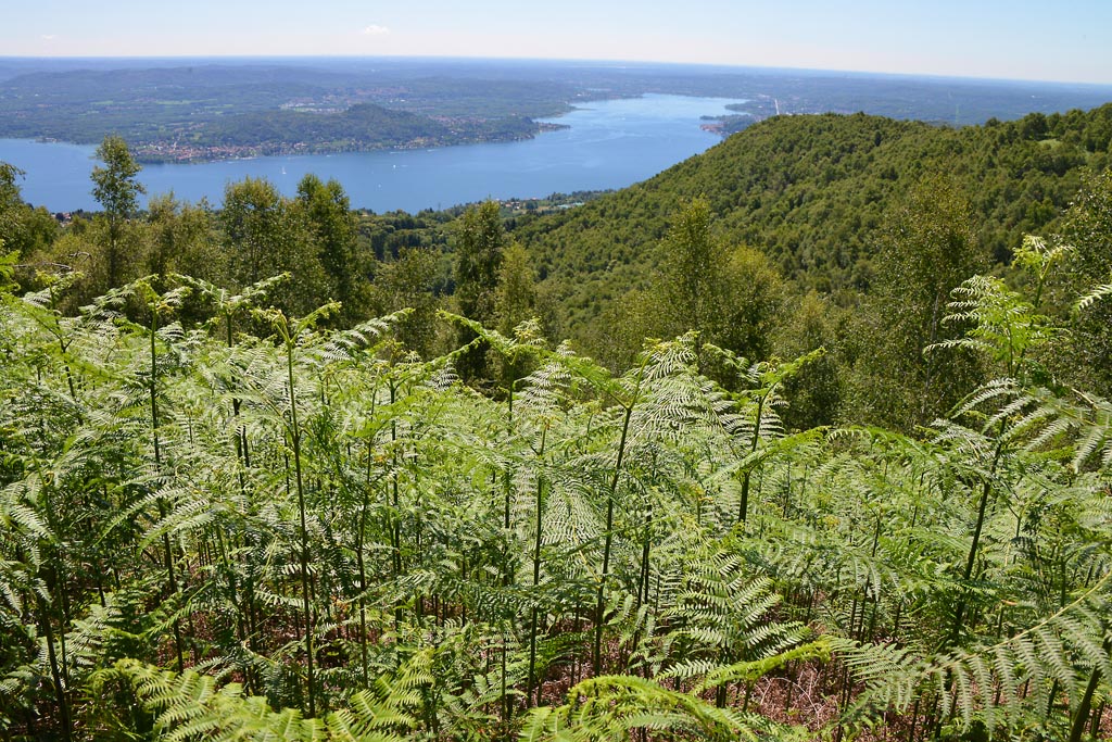
When you get to the summit, you’ll find several wooden tables under the shade trees, mainly birches, and a lovely view of Lake Maggiore. A bit more to the right, you’ll see a large cross, and on the left there is a smooth rock with two relaxing benches, where you can sit and meditate before the majestic panorama that extends over the southern part of Lake Maggiore and the lakes of Monate, Comabbio and Varese.
The trees at the picnic area are perfect for playing hide-and-seek and obstacle races, which make the break pleasant even without “artificial” playground equipment. After having rested for the right amount of time, you can resume your walk to go around the ring. At the altitude of the rock with the benches, take the “F5” trail that proceeds slightly uphill, then flattens out and then goes up again to a junction where you turn right (“F5” sign and then “Sentiero Novara” sign). Proceed along the gently sloping trail, a very pleasant stretch amid ferns and birches where you can see the lake. You will reach another fork where you take a right again (“F5” and “F7” signs). Now, the trail begins to descend constantly along stretches of old cobblestone pavement and enters into an enchanting forest of chestnut trees. The last junction takes you off the “F5” path. Follow the “F7” trail to the right, which is a steep descent, partially on cobblestones, until you close the circle and arrive in the clearing that you started the hike from. At this point, you can retrace the road you took at the beginning of the trip.
to learn more
Nebbiuno
Fosseno, the location from which the excursion starts, is one of the hamlets (frazioni) in the Municipality of Nebbiuno (the others are Tapigliano and Corciago). From the car park, you can see the main church of Fosseno: Sant’Agata. In the early 18th century, there was already a sacred building in this area, but it was “poorly made, obscure, humid and too low. Let the people think of making a new one in a more decent site and in a more venerable form” (4 June 1618, during the visit of the Bishop of Novara Mons. Ferdinando Taverna). They had to wait until 1680 for construction to begin on the new church and, according to the contracts, in addition to the offerings of money, every family also had to provide an unskilled worker to help with the work, and it could be a man or woman.
The Vergante
This name means “that descends downwards”, and it is used to define the hills that separate Verbano (Lake Maggiore) from Cusio (Lake Orta). The highest peak is the Mottarone (1492 m).
The Strawberry Festival
Yes, up until the Sixties, Fosseno produced over fifteen hundred quintals of strawberries per year. Today, production has fallen considerably, but not quality. If you love strawberries, you won’t want to miss the traditional festival that takes place every second Sunday of June with a dedicated market, lunches and dinners, dances and activities.
tips for young hikers
This path is not suitable for prams, but it is very simple and suitable for all small hikers that can walk!
Slow trekkers: Franco Voglino, Annalisa Porporato and Nora Voglino
Authors of texts: Franco Voglino and Annalisa Porporato
Back to the list of routes