This excursion leads to the discovery of the remains of a great landslide of the past
LAKE ANTRONA
Valle Antrona
Route description
This excursion leads to the discovery of the remains of a great landslide of the past and, after a spectacular relaxing lakeside journey, it rewards hikers with an exciting passage “inside” a waterfall, like in classic adventure films!
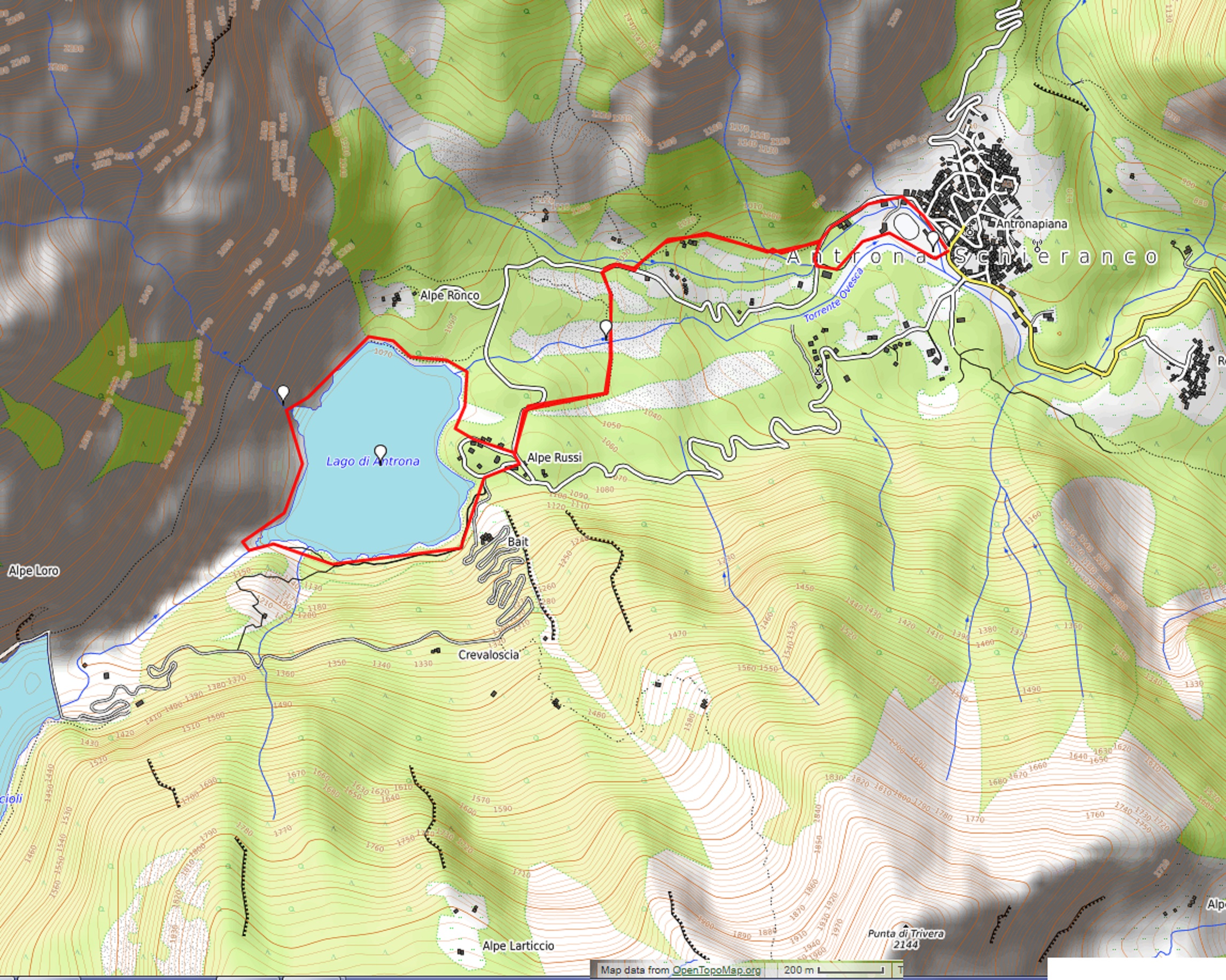
Departure location: Antronapiana (908 m)
Place of arrival: Lake Antrona (1105 m)
Maximum altitude: Sajont waterfall (1145 m approximately)
Difference in altitude: About 250 m
Distance: 6,5 km
Walking time not counting stops: 2 hours and 30 minutes
Type of route: mixed (trail, asphalt, dirt road)
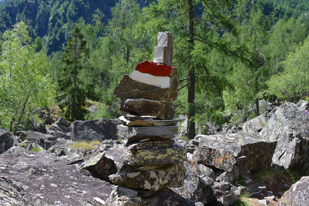
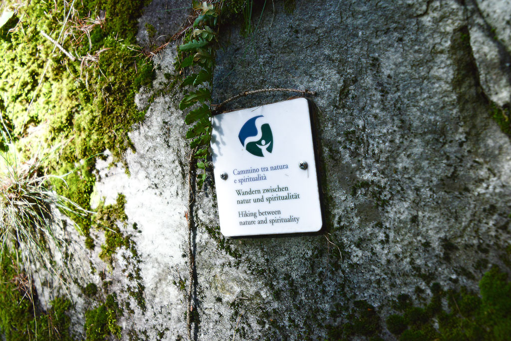
Signs: red/white road signs
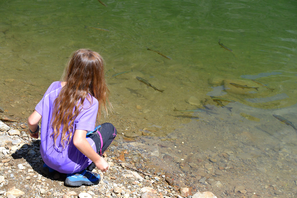
Water: fountains in Antronapiana, at the lake and along the path
Recommended period: from May to October
How to get there: located 22 kilometres from Domodossola. Along the SS33, 6 km south of Domodossola, take the Villadossola exit, then follow the blue signs for “Antrona”. Parking areas along Via Provinciale. By bus: Domodossola-Antrona line, stop Antronapiana (www.comazzibus.com).
Information: Distretto Turistico dei Laghi – www.distrettolaghi.it; Municipality of Antrona Schieranco – www.comune.antronaschieranco.vb.it; Comunità Montana delle Valli dell’Ossola – www.cmvo.it; Parco Naturale Alta Valle Antrona – www.areeprotetteossola.it
the itinerary
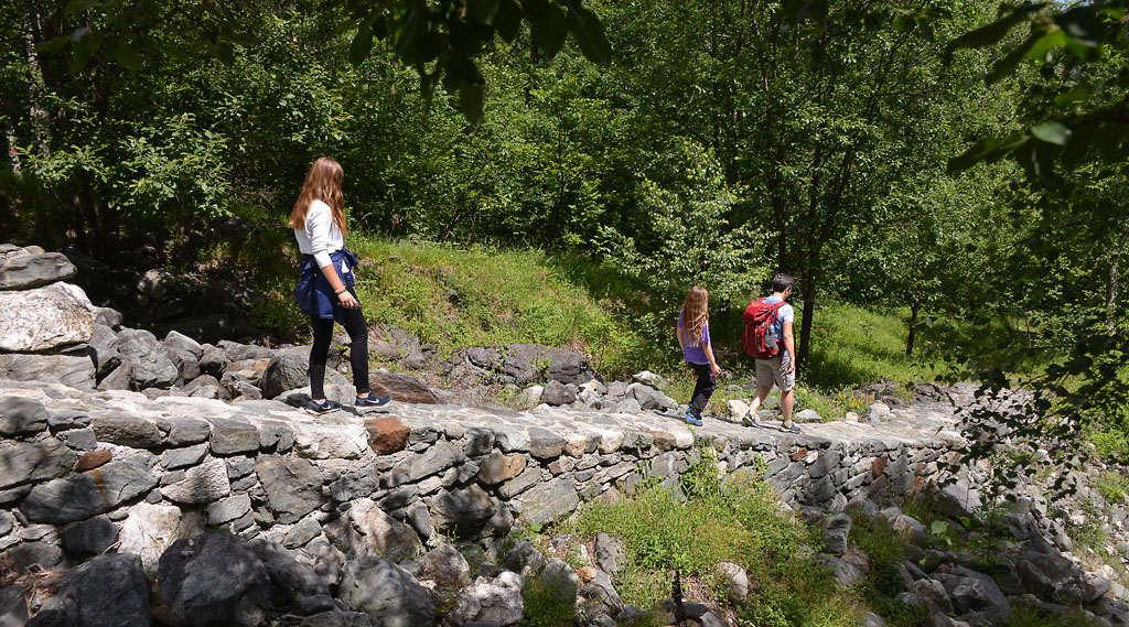
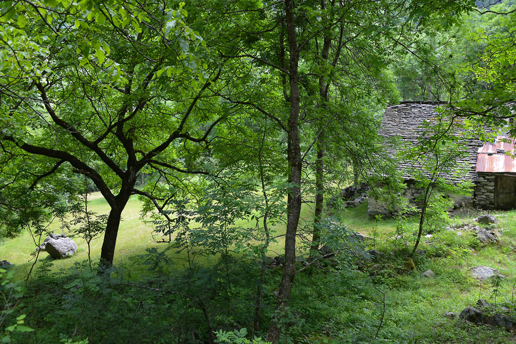
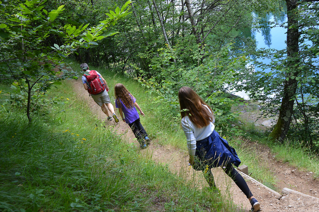
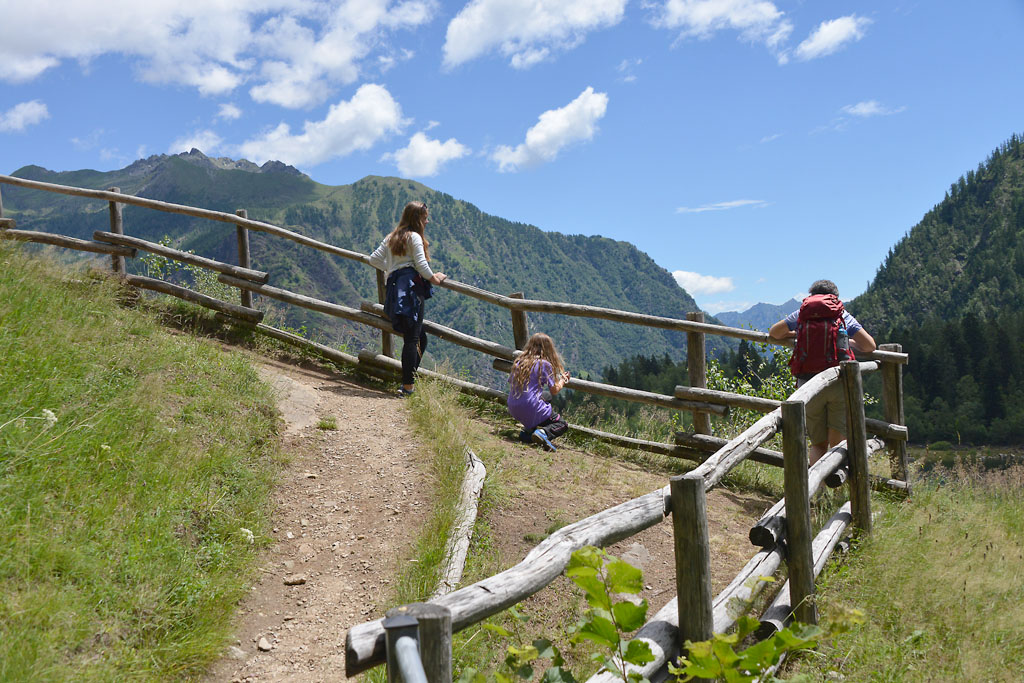
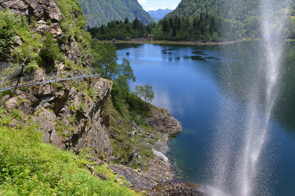
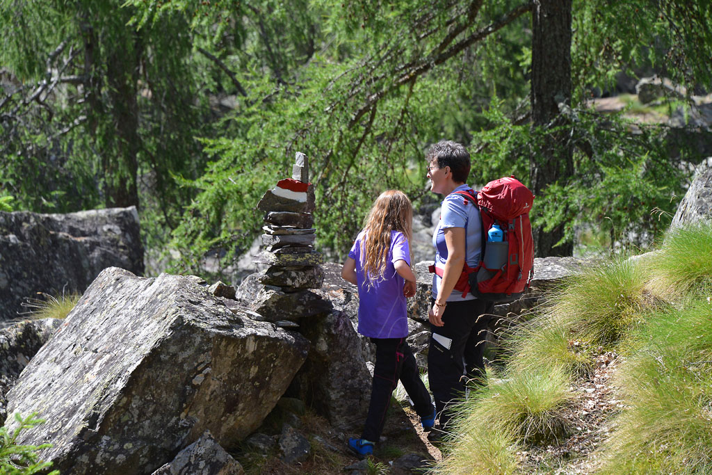
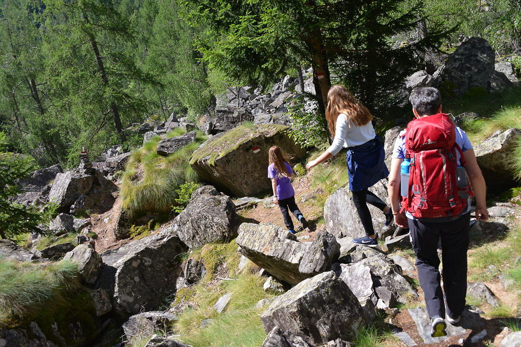
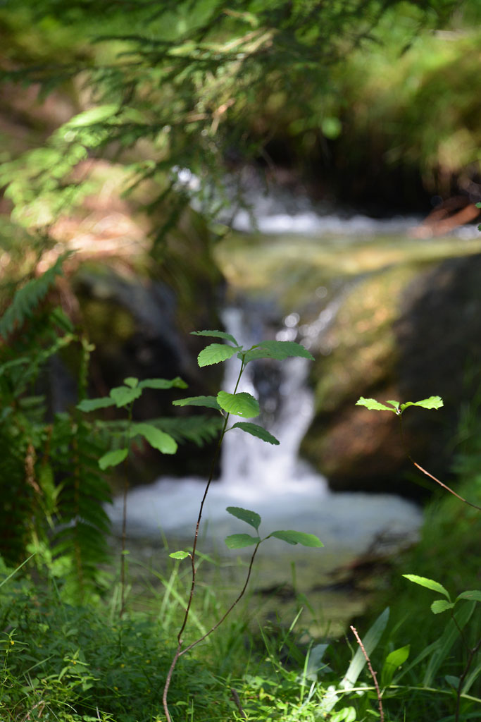
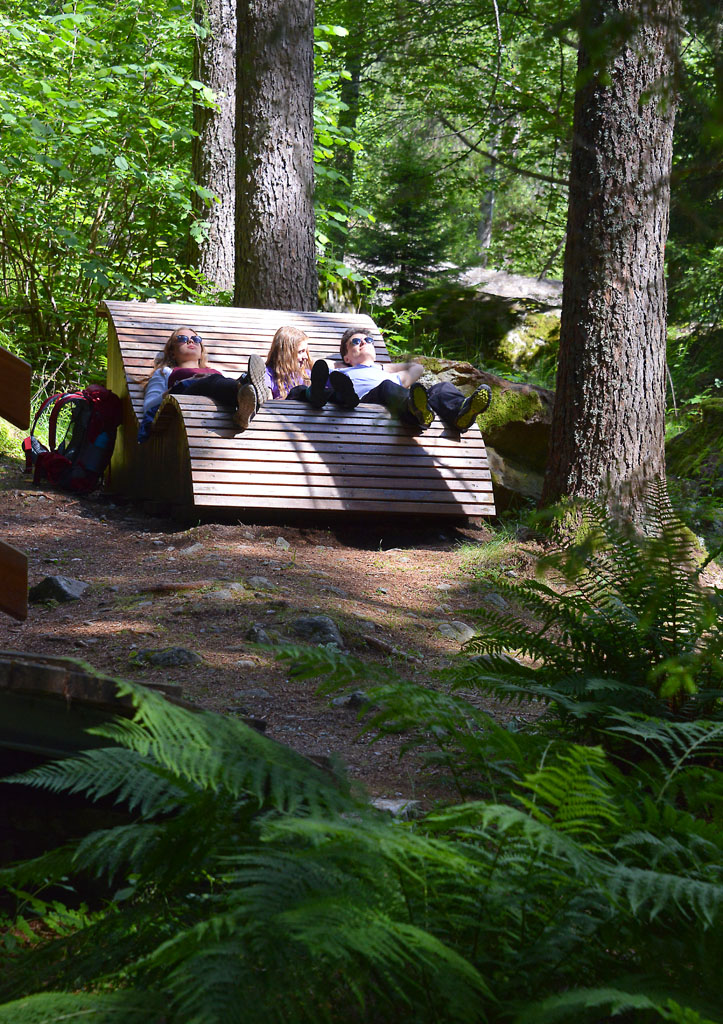
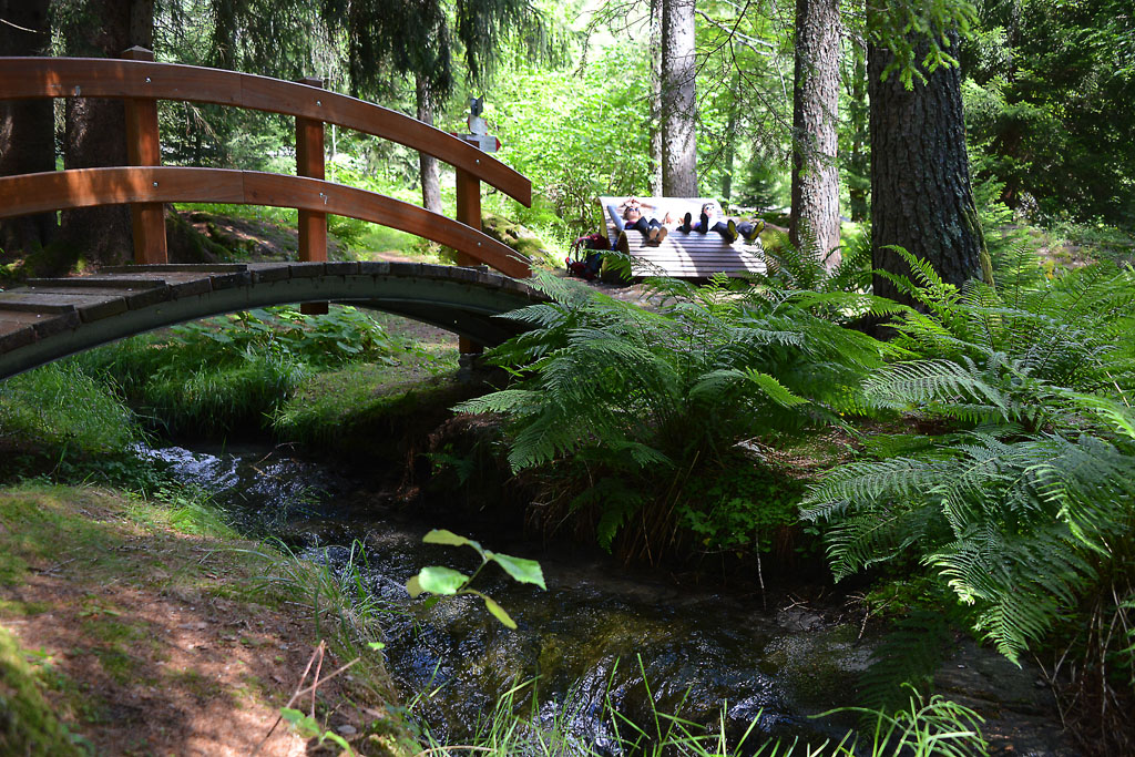
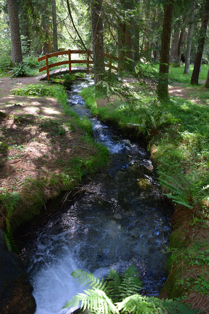
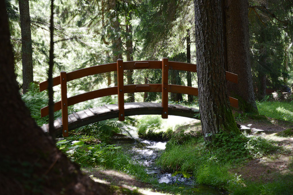
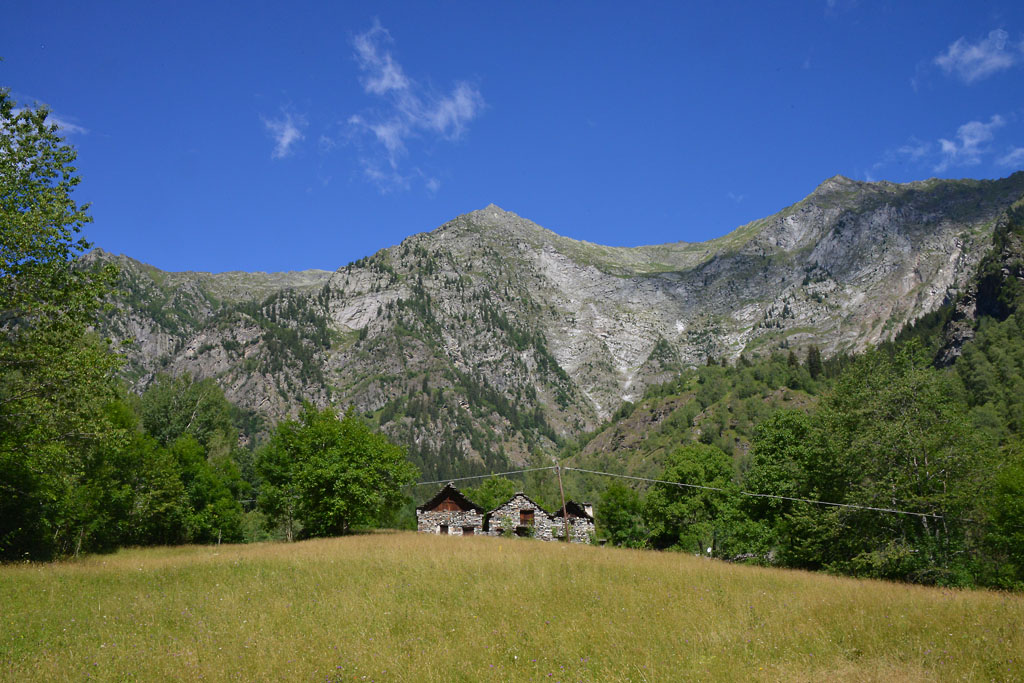
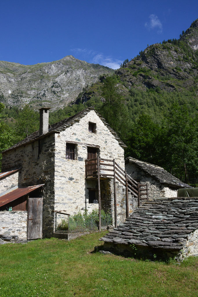
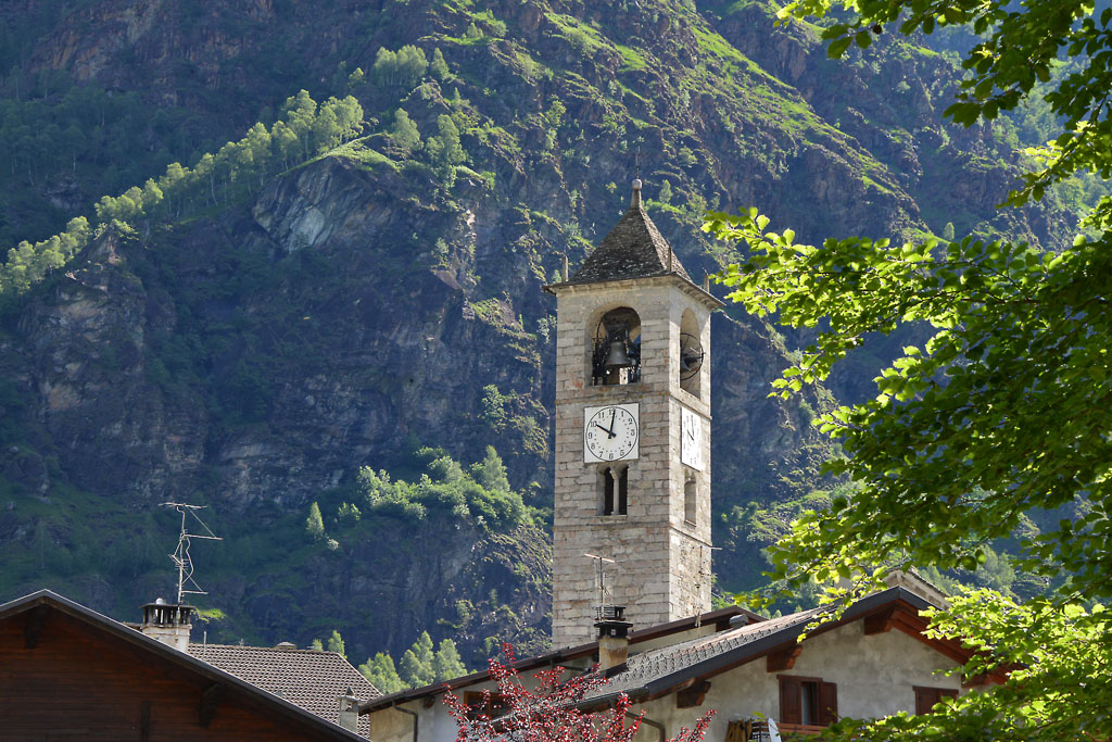
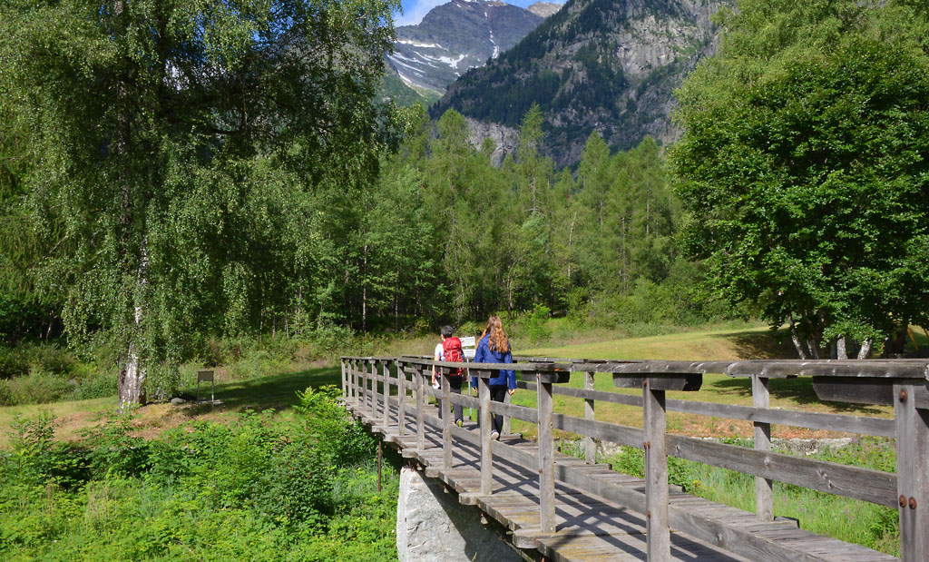
After seeing in the centre of Antronapiana, dominated by the large church of San Lorenzo, built in the 17th century to replace the 13th century parish church was destroyed in the landslide, head towards the provincial road to take the pedestrian walkway that is located right next to the bus stop. You will arrive at an embankment between a canal and the Ovesca torrent, where there is a pleasant picnic area with a play area for children (fountain). After this mandatory stop, take the small path on the roadbed and keep the Ovesca torrent on your left until you get to the skating rink. From here, continue along the dirt road in the direction of a farmhouse, with the village behind you, thus arriving on asphalt. From here, go right for a short stretch, and then take the mule track on the left (road signs for “Antrona Lago 0h40”). The cobblestone path climbs decisively but pleasantly, and always in the shade, until it reaches the small village of Cimallegra (1014 m), formed completely of stone houses immersed in the quiet of the woods. Another short climb leads to another asphalt road where there is a house (and a strange fountain with the head of a monster!). Go along a stretch of asphalt until after the curve, where you need to be careful to find a path on the left that is a bit hidden (sign for “Antrona Lago”). The path descends fairly steeply between the stones (red/white marks), and when it flattens out, you are in the middle of a forest, with an idyllic wooden bridge and a relaxing meditation bench where you can stop and reflect for some time while listening to the pleasant sounds of nature, such as the calm flowing of the bubbling brook. When you resumes your walk, with an irregular course, you will find yourself on an interesting trail among the remains of an ancient landslide (red/white marks and stone statues) until you get back to the asphalt road. Now, continue on the asphalt road to the left coming to the bar-restaurant before Antrona Lake, and then you will walk around the body of water.
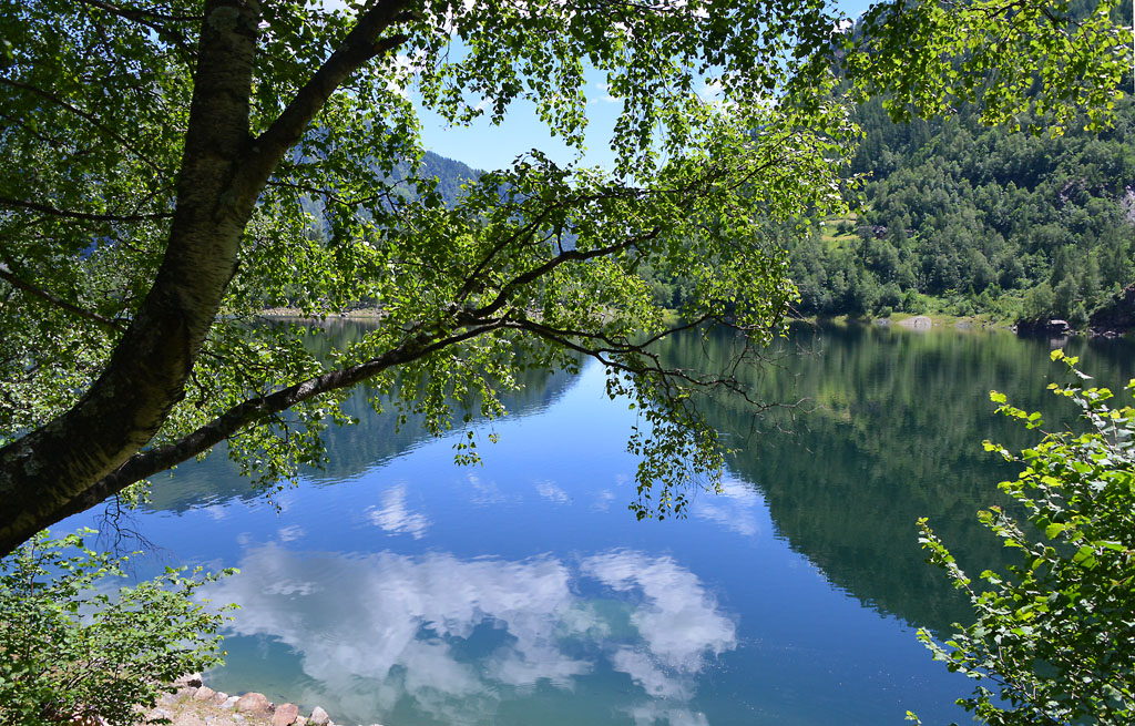
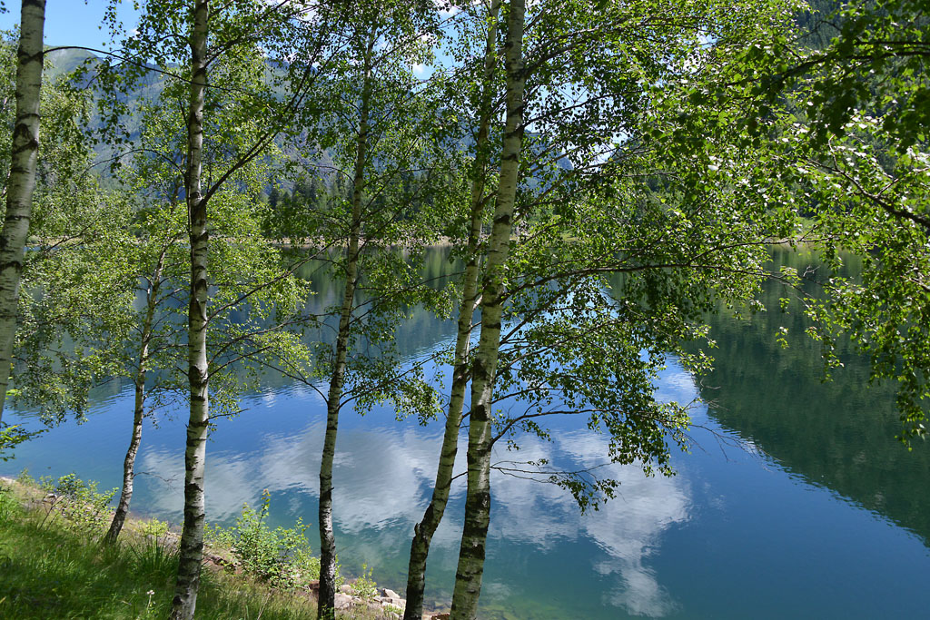
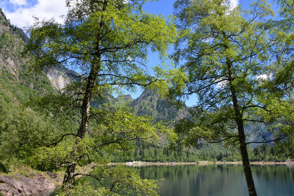
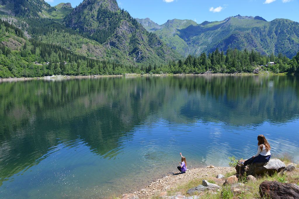
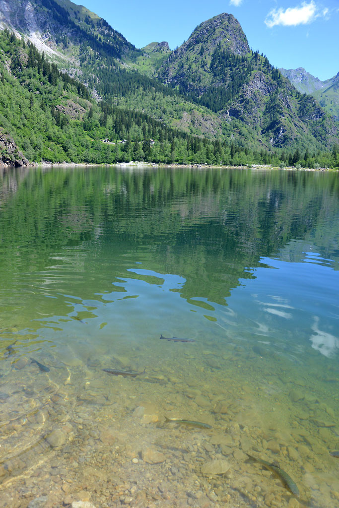
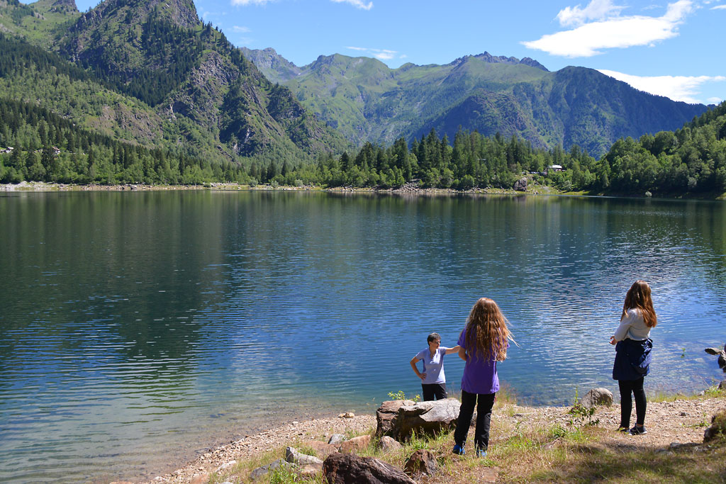
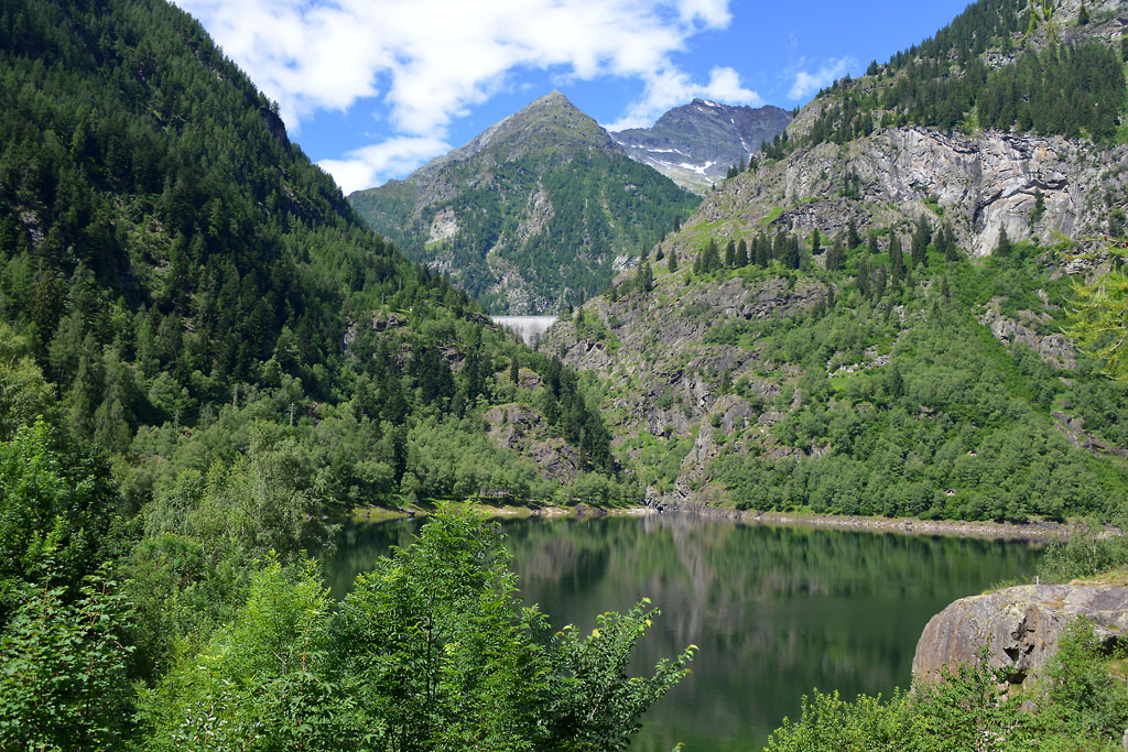
The lake of Antrona is a natural lake, but it was created by a colossal landslide that took place on 27 July 1642. From the top of Pozzuoli, 12 million cubic meters of rocks detached and covered the bottom of the valley for more than 2 kilometres, arriving up to the doors of Antronapiana, and burying some forty houses and unfortunately around a hundred inhabitants.
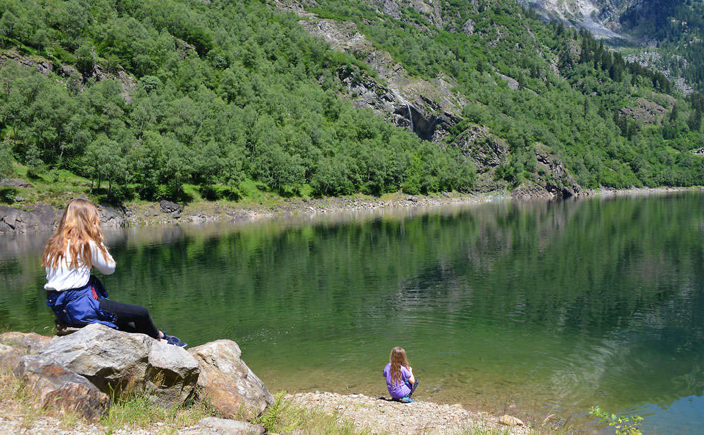
The tour around the lake is possible in both directions but we suggest going clockwise, since the first half is on a quiet dirt road that is wide, flat and easy to travel.
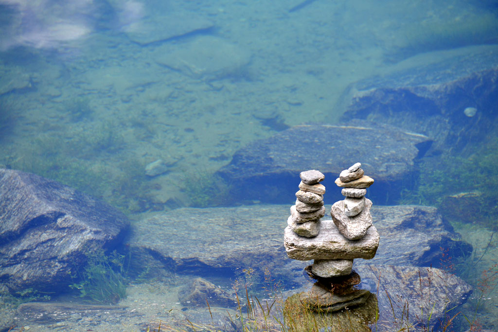
Along the lake, there are also wooden tables but count on them being unoccupied on Sundays when the weather is beautiful. This is a classic summer destination and finding a free one could be rather difficult. It is better to start out with the idea of stopping on stones closest to the water, which you can reach with a very brief deviation from the dirt road.
Pass behind the bar-restaurant and take the road to the left. Then, leave that road and take a dirt road to the right, closer to the shores of lake (signs for “Giro del Lago”).
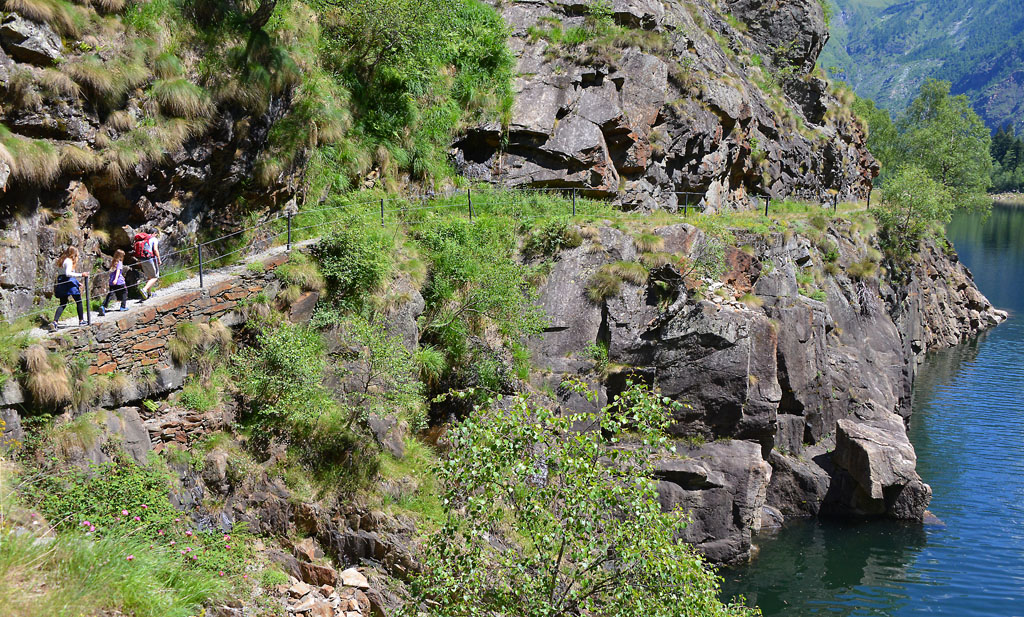
From the bar at the end of the lake, you’ll follow a stretch of the Strada Antronesca, an ancient road that goes through the mountain pass Passo di Saas (also called Antronapasss 2839 m), which connected the Ossola area with Saastal in Switzerland. Used perhaps as early as Roman times, the road was damaged by the landslide which created the lake, and it permanently lost importance when the Napoleonic road of Sempione was built.
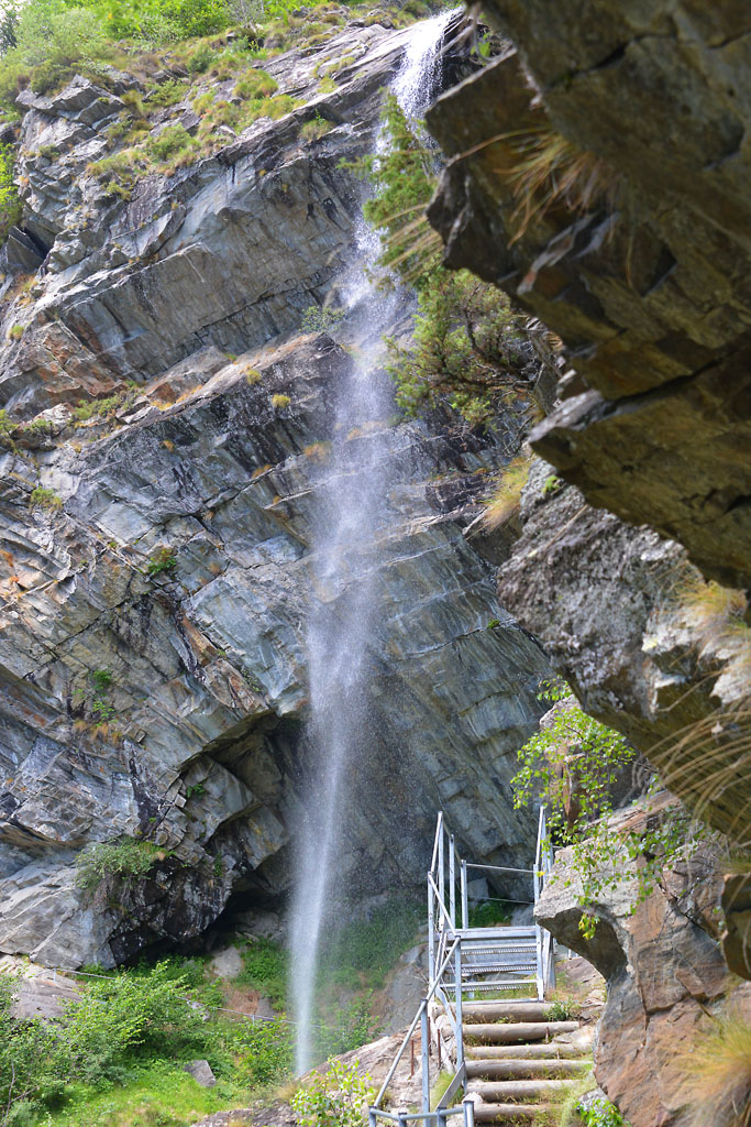
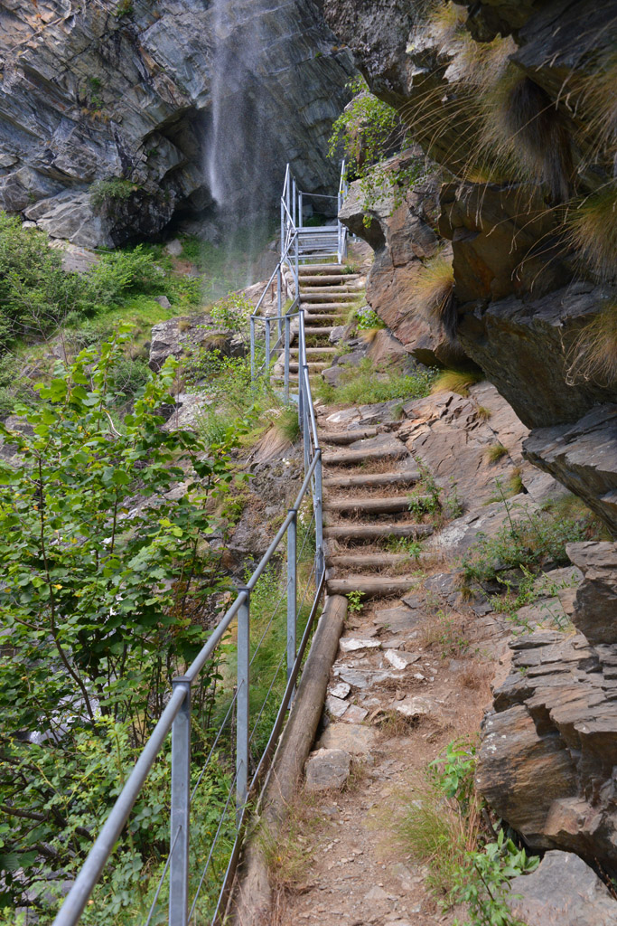
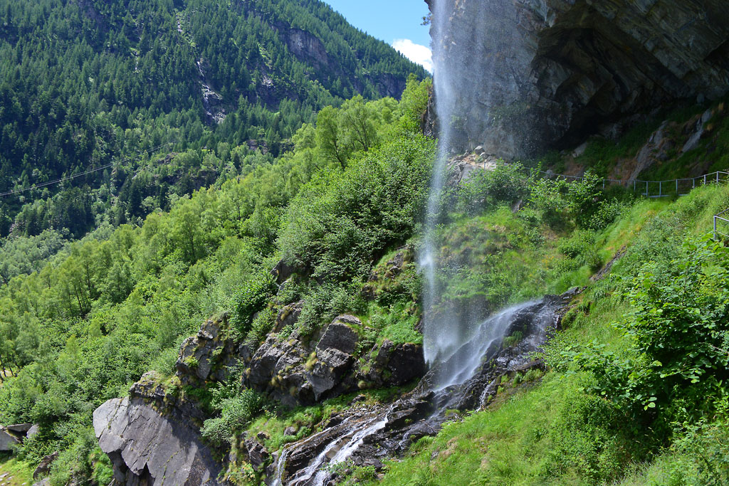
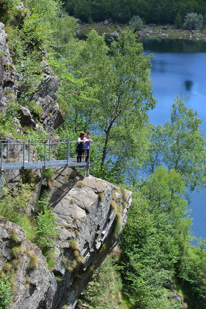
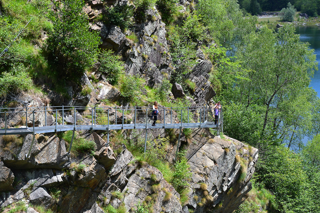
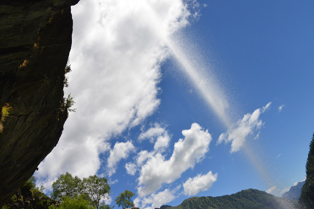
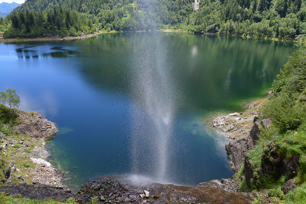
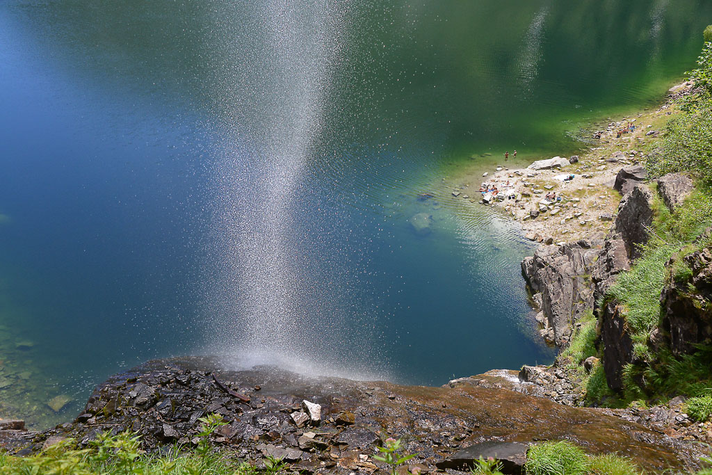
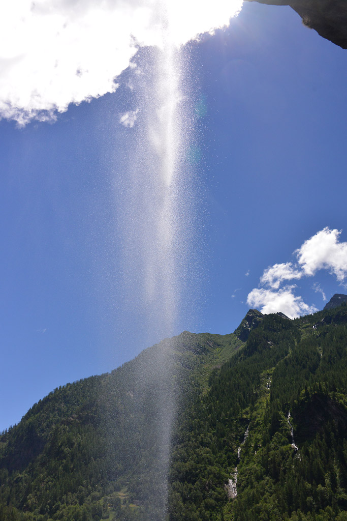
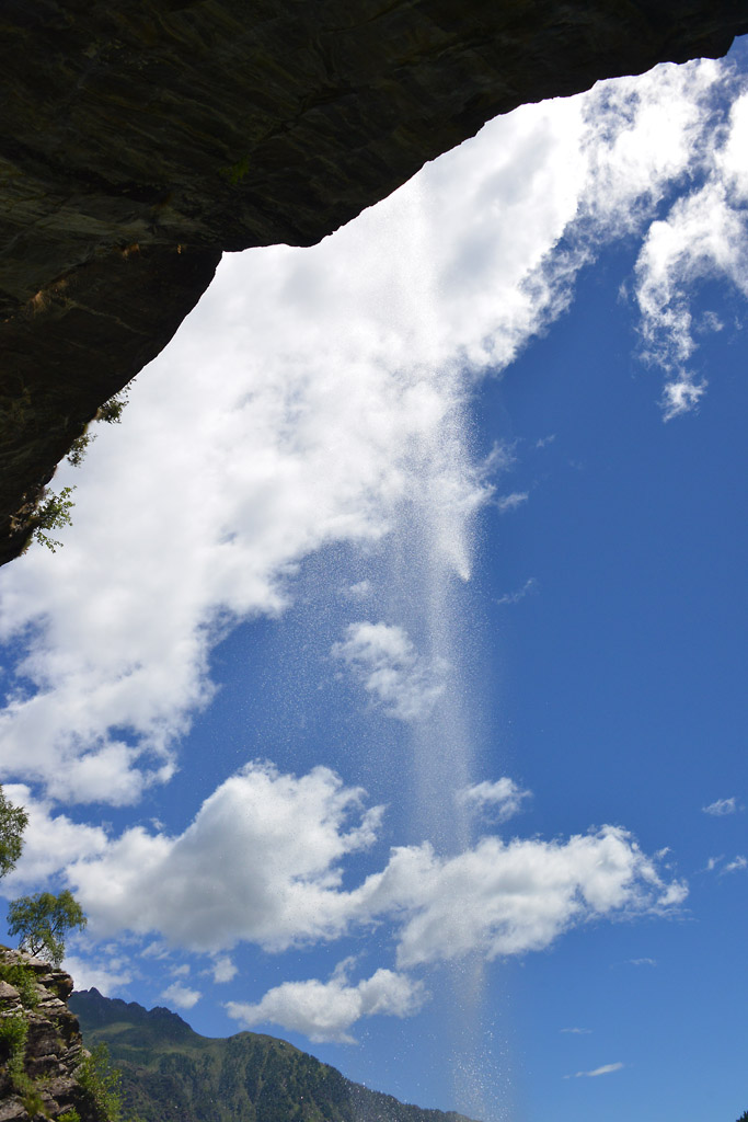
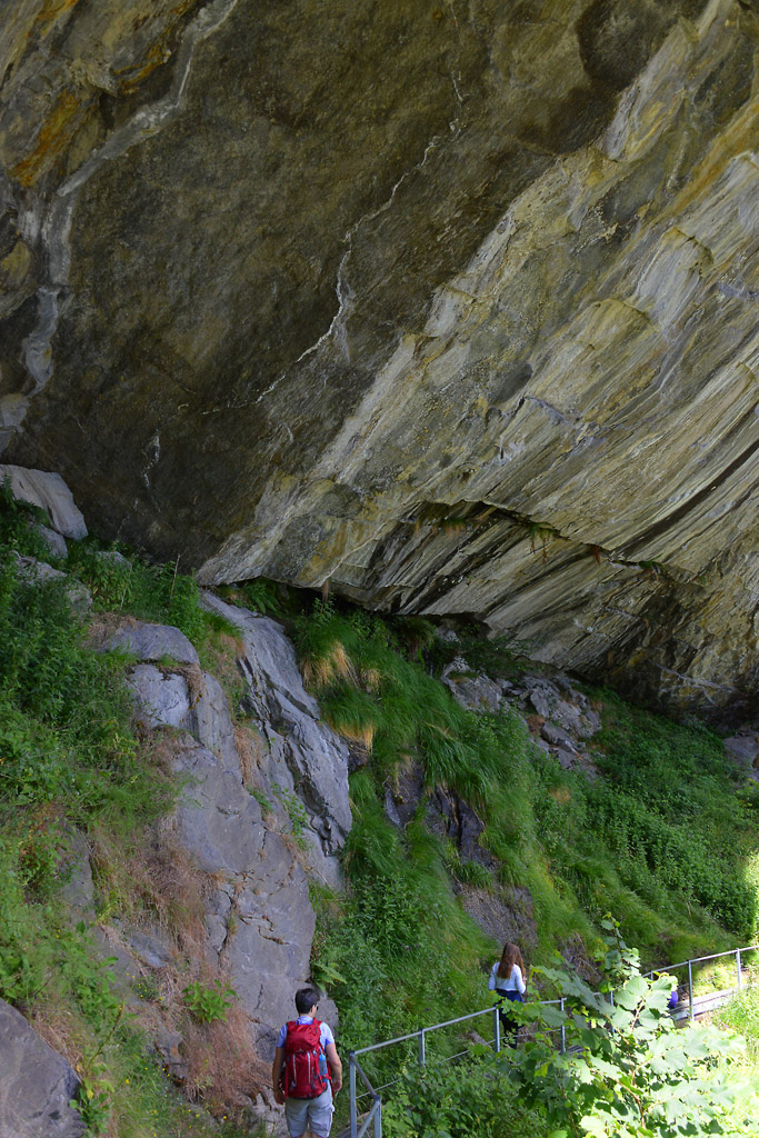
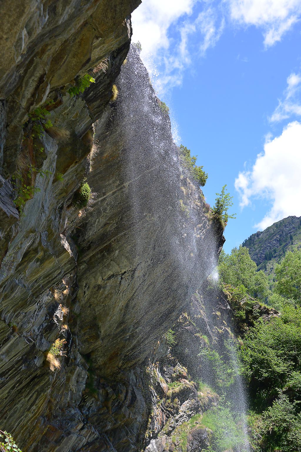
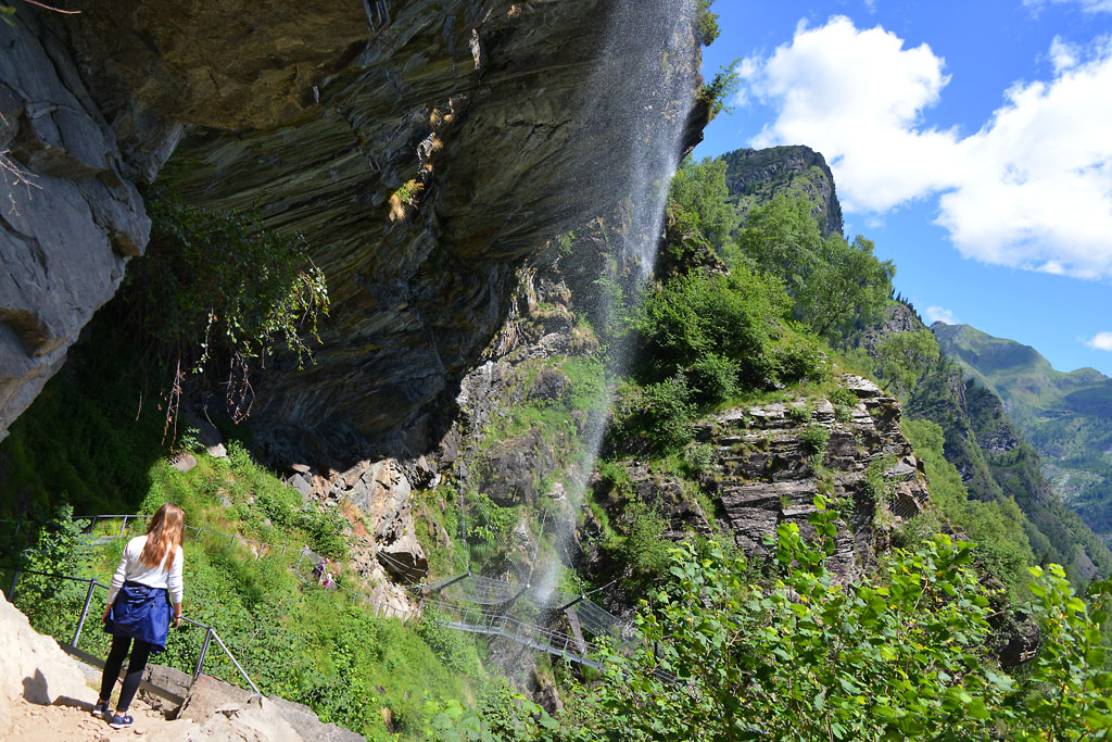
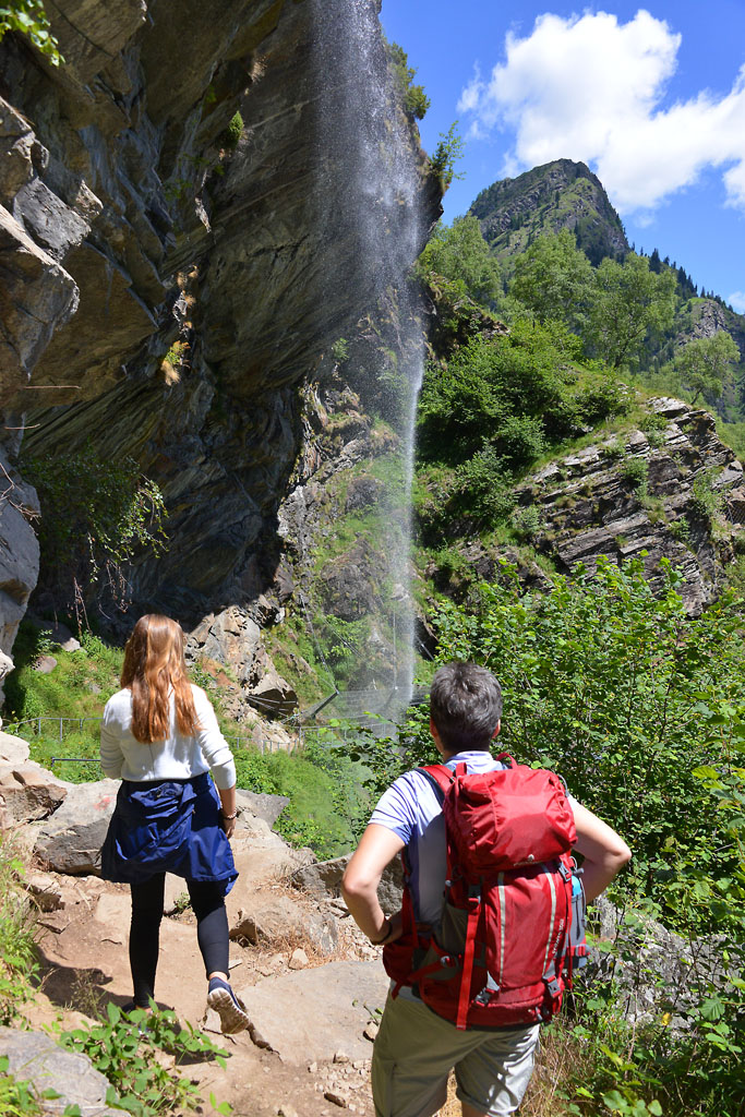
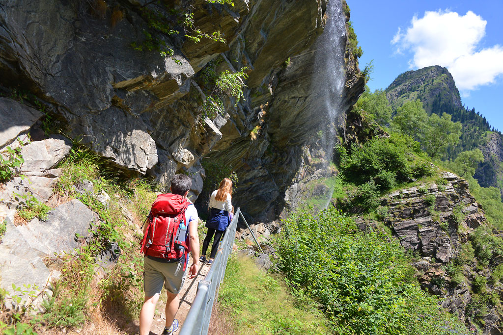
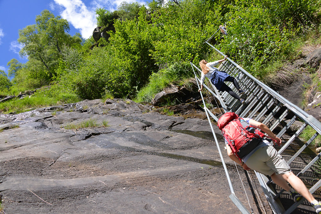
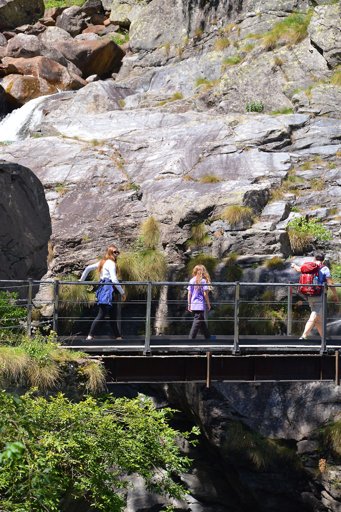
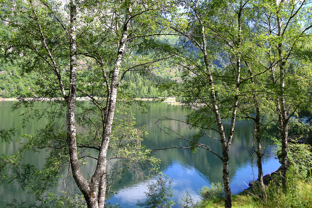
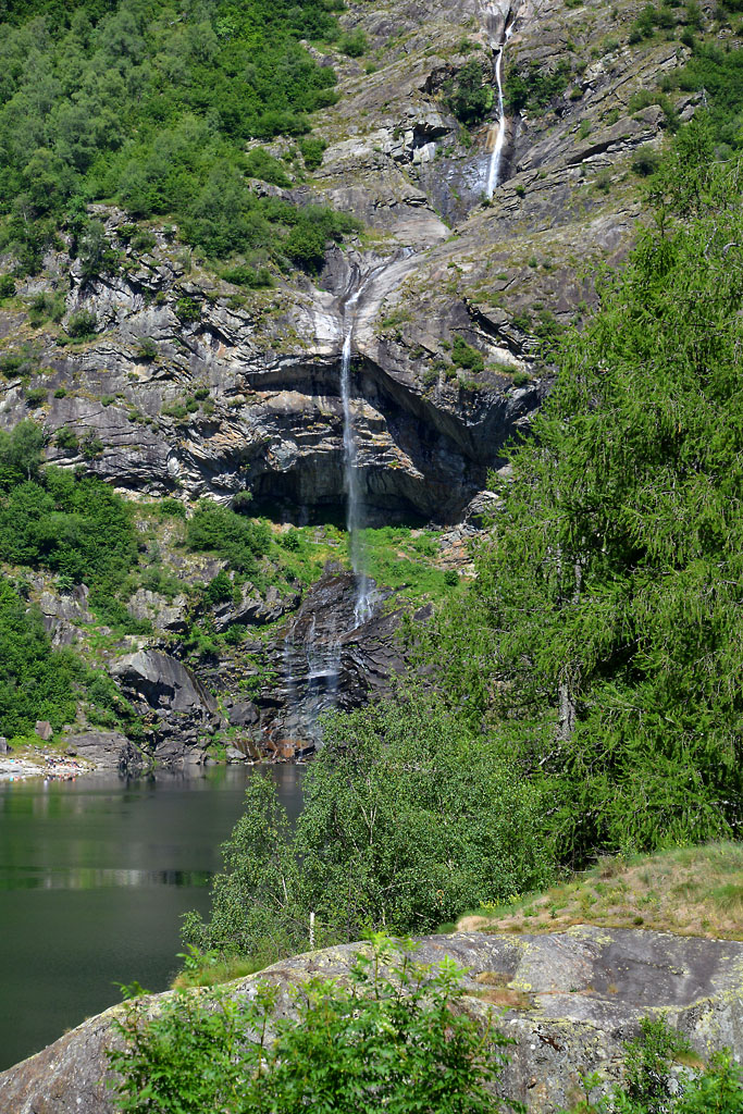
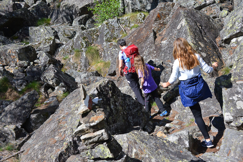
Continue along the lake shore until you get to a bridge that marks the end of the lake and allows you to cross the picturesque Troncone torrent, as it winds through the rocks. The path becomes narrower and soon comes to a steep metal ladder which then becomes a suspended gangway and allows visitors to experience an evocative passage inside the Sajont waterfall, to give them an unusual “point of view”. Don’t miss this adventure!
Warning: it is better not go along this stretch when there are heavy rains and storms that could suddenly swell the waterfall. Also, do not go in winter due to ice.
After getting off the metal footbridge, continue on the trail that fluctuates in regularity. It starts downhill, then slightly uphill and then descends sharply after the first fork, which you should take to the right. The decisive descent leads again to a point near the water, and then continues flat along the shore passing between boulders and arriving behind the bar-restaurant. You can return by going back the way you came.
to learn more
The Municipality
Antrona Schieranco is the name of the municipality where this walk is located. It was formed in 1928 from the merger of two towns, Antrona Piana and Schieranco.
Balancing Ibex
Who has never seen the incredible images of the ibex balanced precariously on the steep walls of a dam? The daring ungulates climb on the steep walls by taking advantage of every ledge, perfectly balanced to lick the saltpetre that they love and need for their well being. Few people know that the dam in question is called Cingino and is located right in the area of Antrona. Dams have been increasing in number since the 1920s in this territory, and are used to produce electricity (long excursion: a difference in altitude of about 1200 meters and 8 km one way from the lake of Antrona).
Viganella
This village is situated along the provincial road that from Villadossola rises toward Antrona. We mention it because of its unique characteristics: tired of not ever seeing the sun for three winter months, the inhabitants built a mirror of 40 square metres on the mountain in front of the town to reflect the sunlight into the village square.
tips for young hikers
With strollers, you can go from Antronapiana up to the lake by only using the asphalt road (to be avoided on Sundays in high season). However, it is not possible to go completely around the lake. You can only reach the bridge over the Troncone torrent. Hikers with baby carrier backpacks will have no difficulties, but front baby carriers are not recommended for the part with the metal walkways.
Slow trekkers: Franco Voglino, Annalisa Porporato and Nora Voglino
Authors of texts: Franco Voglino and Annalisa Porporato
Back to the list of routes